Great Range Traverse Part 1

Vegan.Hiker

Member
Joined
Jul 5, 2014
Messages
2,099
Last weekend I had 3 days to backpack and began the Great Range Traverse. This is a 25 mile hike over rugged terrain summiting 11 different peaks and gaining over 10,000 feet in elevation. This hike was listed by Backpacker as the 3rd hardest dayhike in America in this article http://www.backpacker.com/trips/wyoming/grand-teton-national-park/america-s-hardest-dayhikes/2/. I set out to do this hike over 3 days with a bailout option to do half and come back another weekend for the other half. Unfortunately I took my bailout option as the terrain was much slower that I had anticipated . My slower than expected pacing threw off my planned campsites and water sourcing; finishing in 3 days would have been possible but cutting it close and the clouds began rolling in which factored into my on the fly decision to split it into 2 weekend trips.

In the 2 days I was out there I ended up summiting 6 peaks (Rooster Comb, Hedgehog, Lower Wolf Jaw, Upper Wolf Jaw, Armstrong and Gothics) and climbing 7k in elevation. I was hoping to return this weekend to finish the remaining 5 peaks (Saddleback Basin, Little Haystack, Haystack, and Marcy) but the forecast isn't looking like it will pan out. I have a family vacation the following weekend so I might have to wait until early September.

The red part of the route below is what I need to go back and finish, the yellow is what I did. I'm basically ending up doing the Lower Great Range and Upper Great Range in two separate hikes which is another common way of doing the Great Range.
image2.jpg

It wasn't the 7k feet of elevation gain really that slowed me down, it was the constant, unrelenting steep rock face cliffs. Lots of tossing your pack up and over stuff, lowering your pack with cordage, chucking poles, over and over again. I climbed a good part of a tree to advance up the trail at one point. I have no idea who these maniacs are that can dayhike this kind of stuff. Whoever they are, I'm certainly a cupcake by comparison, because I was totally out of gas just doing half in 2 days.

Here are my Gaia stats for the 2 days. I forgot pause recording when I set up camp so the time profile is off.

image1.jpg

Day 1 turned out to be a beautiful day. I drove up the night before and set my tent up on the outdoor deck of the hiker hostel I stayed at. I was also able to get a shuttle by the hostel since I was starting and ending at different trailheads.

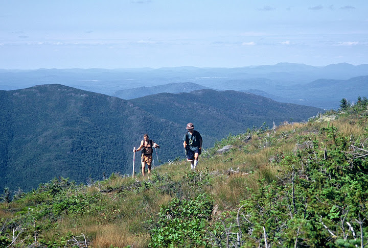
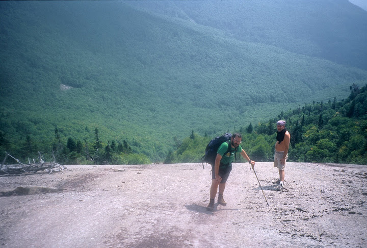
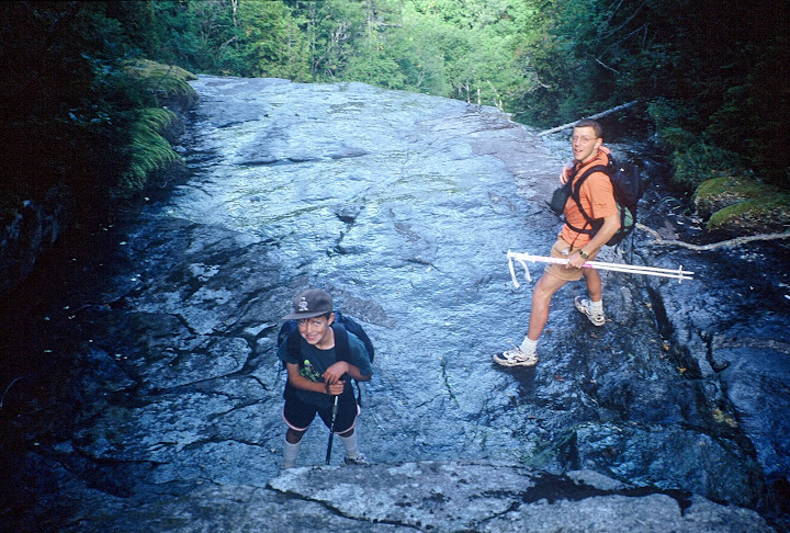
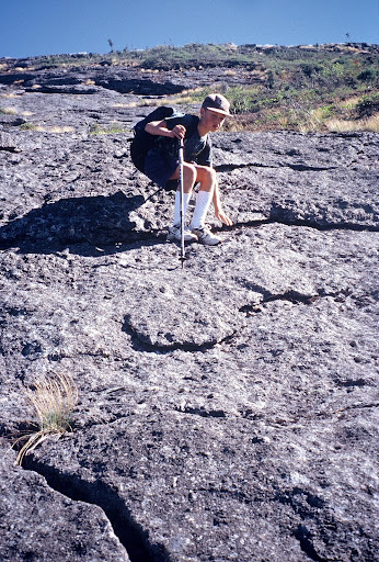
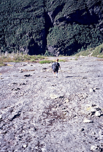
The trail started out with your typical Adirondack scenery.

DSC06303.jpg

DSC06304.jpg

DSC06310.jpg

A few shots from Rooster Comb Mountain

DSC06323.jpg

DSC06331-1.jpg

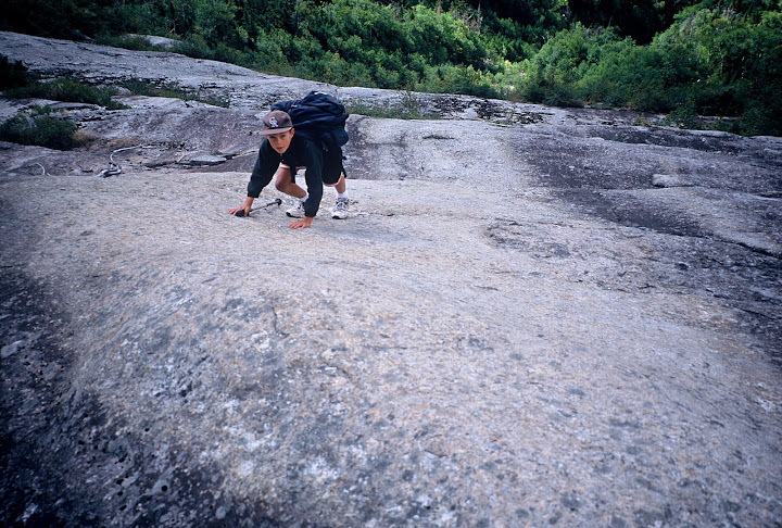
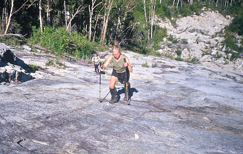
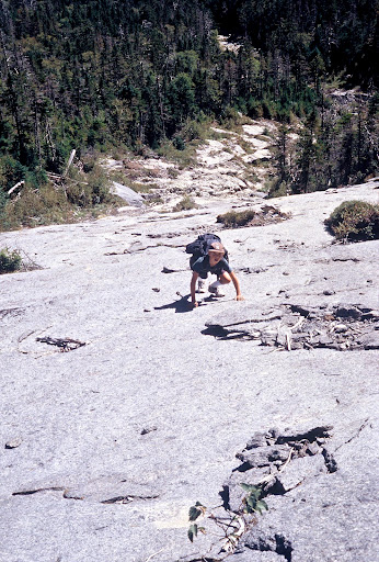
I honestly didn't take any good pictures of the really challenging sections of trail but this show the general rough nature of the trail. Definitely not a trail you could run on.
DSC06332.jpg

I believe this is Upper Wolf Jaw in the back and a false summit of Armstrong in the front
DSC06339.jpg

DSC06344.jpg

I thought this picture below was interesting because it shows how the trails in the northeast sometimes feel like tunnels. That tunnel looking opening on the bottom left is the trail that led to this open rock face.
DSC06358.jpg

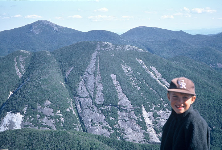
Gothics viewed from Armstrong
DSC06367.jpg

A panorama from Armstrong
DSC06373.jpg

A part of the ridge that the trail follows on the way to Gothics
DSC06395.jpg

DSC06399.jpg

I hated to have to do this, but because of the unexpected pacing and an unexpected late start I had to stealth camp near the summit of Armstrong
DSC06407.jpg

On the bright side there was a nice lookout nearby
DSC06411.jpg

The lookout the next morning. As you can see the clouds were rolling in
DSC06428.jpg

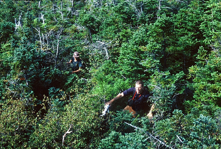
Entering a section of alpine tundra
DSC06453.jpg

Unfortunately it was very cloudy on day 2 which also factored into my decision to come back another weekend for the last 5 peaks
DSC06458.jpg

Despite that the clouds were robbing me of the views, it was pretty cool walking the ridge line in the fog
DSC06462.jpg

DSC06463.jpg

DSC06467.jpg

DSC06470.jpg

DSC06471.jpg

Since us northeasterners don't know how to do anything technical, the descent from Gothics has some cables for repelling a few hundred feet down the rock face.
DSC06476.jpg DSC06481.jpg

After cruising down backwards pretty fast for a bit I was a little spooked to see that the cable was broken in a few spots. Luckily I noticed before unexpectedly running out of line.
DSC06484.jpg

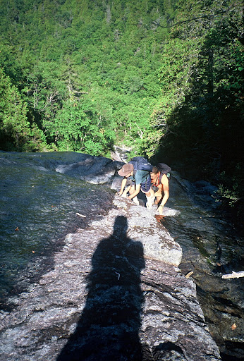
So as I already mentioned I bailed early and ducked down below the clouds on a shortcut back. I hopped along a few pretty boulder strewn brooks.DSC06507.jpg

Now this was quite odd. This girl I ran into about a mile from my car looked to have some pretty unconventional backpacking equipment.
DSC06510.jpg

DSC06511.jpg

Turns out she was one of the teens who worked for the ADK lodge about 3 miles up the trail and was bringing up food supplies.

Featured image for home page:
slide.jpg
 
Last edited:
My first hiking was in the High Peaks of the Adirondacks, starting in 1966. I spent at least 8 weeks up there in 19 of the next 21 years, basing out of Schroon Lake. Have you heard of the Adirondack 46-R's? This TR sparks many memories. Thanks for posting it. The last time I was on Roster Comb was a mid August day solo in 1972. I was 16 years old. I went up, full pack in the afternoon and a storm hit. Just beyond the Rooster Comb, in the col (pass) toward Hedgehog is a boulder , with a place to slide under it, as a primitive shelter. Comfortable aside from that one big root in the middle. The heavens loosed and I spent 17 hours under that boulder eating chocolate and drinking cold duck. Without adult restraint or supervision, I had the opportunity to explore boredom and heartburn.

A couple of other comments, just for fun. While the cable section of Gothics is steep, the backside of Saddleback, while shorter is much steeper. Go light on gear. It helps.

The peak on the right is Giant (of the Valley) and my favorite. The bare patches are rock slides, each having a name and a sporting route up them. The one on the left is The bottle, as one can image. The bigger bare patch on the right side is The Eagle and is a fantastic route
dsc06339-jpg.33335


here is a picture from 2001 of Aaron on the Eagle Slide on giant
FH000015.jpg


In this picture, you can see the peaks for the next part of your traverse. Gothics on the left, Going to the right, the peak way back is Haystack. Next one to the right is Basin, then Saddleback with the fresh rock scars (whiter). These scars were caused by either Sandy or Irene, the two super storms that hiot the range. I understand it is a fine way up the peak. The big peak behind it is Marcy. Colden, then Iroquois and Algonquin rar back to the right
dsc06367-jpg.33338


You took the Orebed trail down off Gothics? Did you take the Southside or main John's brook Lodge trail back to the garden trail head? I hear they may have instituted a shuttle system due to crowds, up to the trail head? Is this true. have not been there since 2001....so many stories... so little time. I await your further adventures in the "Dacks."
 
Last edited:
Looks like a fantastic weekend. Those trails remind me of the Franconia Ridge trail my wife and I did last September. Great views. I also like that hike across the ridge in the clouds. That had to have been cool.
 
You took the Orebed trail down off Gothics? Did you take the Southside or main John's brook Lodge trail back to the garden trail head? I hear they may have instituted a shuttle system due to crowds, up to the trail head? Is this true. have not been there since 2001....so many stories... so little time. I await your further adventures in the "Dacks."

Thanks for all the great insight @ram. You are correct, I took the Ore Bed trail down off of the ridge. When I passed the lodge I took the Johns Brook trail back to the garden lot. Before starting I got a shuttle to rooster comb TH from the nearby hostel that I slept outside of the night before, but I did indeed hear that there is now a town shuttle for the Garden Parking lot although I'm not sure how that works.. I'm guessing all the traffic at the Garden parking lot is from so many hikes starting there (the upper Great Range peaks, Big Slide Mtn, Marcy, and anyone staying/working at the Johns Brook Lodge). Once out on the Range Trail, the crowds seemed to have disappeared though, at least while I was there.

Those rock slides were interesting and forced me to put more faith in the grip from my shoes than I would have preferred at times. Here's another pic looking up and then down to the bottom of one of the slides towards the bottom of Gothics. You mentioned that the cliffs of Saddleback are extremely steep. I have gotten advice that when I return to finish the upper range, that I should go counter clockwise in this order (Marcy, Little Haystack, Haystack, Basin Saddleback) rather than clockwise hitting Saddleback first... do you concur?

Also, the spot in the Rooster Comb col that you got stranded in... I'm pretty sure I know the spot where you hid out, I dropped my pack right in front of an overhang in the col before climbing up Rooster Comb. Crazy story, that must have been rough waiting that out.

looking up from one of the slides, not a great picture as I should have walked out into the middle of it and taken a shot of just how far up the mountain it went.
DSC06497.jpg

The bottom of the slide
DSC06499.jpg

I've got to try the milk crate backpack. I love it!
might work well with some carbon fiber UL milk crates lol. You can even use your Weber BBQ grill cover as a rain cover.

Looks like a fantastic weekend. Those trails remind me of the Franconia Ridge trail my wife and I did last September. Great views. I also like that hike across the ridge in the clouds. That had to have been cool.

Yeah the Whites and ADK's are similar yet at the same time different. I love them both. I'd love to see a report one day from you on your Franconia ridge hike. Did you do the entire section covering liberty and flume all the way to Lafayette? I'm planning on doing the pemi loop as soon as I'm done in the ADK's because I would love to get back on Franconia Ridge. Here's a video I made last year of Franconia Ridge if you're interested in reminiscing.

 
Last edited:
What a fantastic view of the Eastern forests. Those gnarled roots sure do make for a though traverse. Good they were not wet!

Love the spooky climb through the fog and that stealth camp is just super, very cozy too.
 
This totally changed my perception of trails out east. I tend to think of them as well worn paths like that tunnel of trees from one of your previous TRs. Looking forward to seeing more.
 
Thanks for all the great insight @ram.
Those rock slides were interesting and forced me to put more faith in the grip from my shoes than I would have preferred at times. Here's another pic looking up and then down to the bottom of one of the slides towards the bottom of Gothics. You mentioned that the cliffs of Saddleback are extremely steep. I have gotten advice that when I return to finish the upper range, that I should go counter clockwise in this order (Marcy, Little Haystack, Haystack, Basin Saddleback) rather than clockwise hitting Saddleback first... do you concur?

It is not for me to determine the aesthetics of others, but I certainly would not have taken a full pack up on the Range trail. My approach back in the day and we had kids with us (sheesh, I was a kid), would be to hike into the Johns Brook Lodge (JBL) area and camp. Then I would do day trips out of that base. Perhaps a day for the Wolf jaws, Armstrong and Gothics and then a day for Saddleback, Basin and Haystack . Truth be told, with day packs, one could go up to the col between the Wolf Jaws, do Lower or not, go all the way to Haystack and back to JBL in a reasonable day. Or reverse the route and do high to low. I would leave Marcy out of that equation. If set on the peak, I would go up the Hopkins Trail from JBL. If one wanted more, one could take herd path to Gray, down to Lake Tear, up Skylight and back over Marcy...or not.

Yes going up Saddleback is easier than going down it. Another option created by camping in the JBL area is a run up Big Slide. Truth be told, the trail up the Brothers to Big Slide is better though. The lower Brothers has Blueberries in abundance about now and in a month, the forested area of the 3rd Brother is specatualr study in yellow during fall colors. I think it is a birch forest created by the fire of....was it 1923? The 2nd big one anyway, from the 20's. But i digress. It is one of the best day trips around. Up the brothers, down to JBL and out the Southside trail where one can get a swim or so on a hot day. See below. I will address rock slides in a day or so.

Southside slides- WARNING- partial nudity...The date was.....September 10th....2001
FH000083.jpg


FH000086.jpg


FH000100.jpg


FH000102.jpg
 
There is some important distinctions between the Appalachian Mountains and the Adirondacks. The Adirondacks are much older and are made of different stuff, mostly Anorthosite . A bit about it here
http://www.adirondack-park.net/history/geological.html


The result is that the streams in the Adirondacks are not super slick and one can travel on them as aesthetic routes. The rock lacks cracks but has super amazing and sticky surfaces. I recall small micro cuts on my fingers be a common experience. So the Adirondacks have these wonderful rock slides, stable and fun to travel on. The equivalents type features in the Appalachian's are death traps. The slides form when mud slips from saturated soils up high in the old cirques. They strip the thin forest cover down to dome anorthosite rock and travel as a land and rock avalanche down to the nearest drainage and down as are as the 'energy" of the slide lasts. Voila! A new route of quality is born. While some slides last for generations, before being grown over and reclaimed by the forest, many if not most have a 25 year or so life expectancy as quality routes. The good news is new ones form often. The rock hop stream approaches are as much fun as the slabs above. short but epic and thick bushwhacks lead to ridges and in most cases trails. I have only been to my home range twice since 1987, but new sources of info are around

Here is what the storm Irene left behind
http://www.adirondackexplorer.org/stories/new-adirondack-slide-guide

And a more comprehensive guide of options
http://www.adirondackmountaineering.com/46/slideclimbing.html#resume

Vegan Hiker...sorry to hijack the thread. I get carried away when it comes to the "dacks."
What are you thinking for the upper Range Trail plan?

A few stream and slide pictures from 2001

This is the slide that comes down toward the top of Chapel Pond Pass. Its start is visible coming from Keene Valley toward the Northway. It is a gorge of 10 waterfalls to pass through part way up. We call it the Tolley Slide
FH000062.jpg


An obscure slide on the backside of Algonquin
FH000129.jpg


You could not stand on a place like this in the Appalachian's
FH000130.jpg


Epic bushwhack
FH000132.jpg


Colden as it looked then. Look in the first link above to see how it has changed
FH000136.jpg


Slides on Dix
FH000028.jpg


Colden, up one slide down another
FH000050.jpg


FH000052.jpg


FH000053.jpg
 
Last edited:
That bushwack looks comical although I'm sure it wasn't any laughing matter at the time. Sorry I hadn't had a chance to reply to your other post yet. Thanks for all this excellent info. The origins of the slides is interesting. I had no idea they had such a short life span.

The bushwack to the slide on Saddleback and down Ore Bed sounds like an interesting route, and that's the direction I'll be going when I finish the GRT. Perhaps I should leave out Marcy as you recommended and incorporate this instead. I'm not sure when I'll be able to go back and finish. I'll be heading into hurricane Danny next week on a cruise then I'm only home for 2 weeks before heading to the Tetons for an 8 day backpack. Might not get back to the ADK's until late Sept. My wife and I have reservations at the Johns Brook Lodge for the weekend of Oct 2nd for some fall foliage hiking but she won't enjoy anything too strenuous. I was thinking either stopping to do Rooster Comb on the way to the Garden lot before the short hike to the lodge, or dropping the packs at the lodge first then doing Big Slide Mtn. I snowshoed Giant this past winter and wouldn't mind doing that hike in the Fall as well, so that's a possibility although the 3k ft gain in less than 3 miles on Giant might not make the wife all to happy since it's another almost 4 miles to get to the lodge from the garden lot. I've had a route for Algonquin and Wright planned for a while too but I'm just not sure if I'll get to that this year.

I know it's probably a crazy thought to travel from the west to hike in the east, but have you thought of returning to the ADK high peaks for a reunion Ram? If you do ever decide to having a homecoming and want some trail company, let me know.

I'll also leave you with 2 other ADK reports ram in case you hadn't seen them. I'm sure they'll stoke some memories.

http://backcountrypost.com/threads/giant-mountain-wilderness-adirondacks-ny.4192/

http://backcountrypost.com/threads/northern-forest-canoe-trail-section-2.4725/

Also, I'm a little embarrassed to say that I had no idea that the ADK's were not part of the Appalachians. I wonder if that has anything to do with why the AT wasnt routed to go through the ADK's?
 
  • Like
Reactions: ram
Wild! On that first trail pick... I can't see the trail ;)

It's also a very cool pictures of the roots and the woods in general. Those look like real forests!

That broken cable would have killed me.
 
Bushwhacking through spruce is a matter of patience. We had warned the 11 year old of how hard it would be to such a degree, it was easier than he expected. Nothing spells relief like breaking thru to treeline
FH000134.jpg


The tops of rock slides can get dirty and loose and while the Saddleback slide has been around for a bit of time and some herd path passage is likely, it may still not be a happy place. Still the lower slide and the one on Gothics you passed you make a fantastic hike, even if you just go up as far as you are comfortable and return the same way. Here is someone's album. Looks like the first 22 pictures would be easy travel. Beyond a bit trickier. Lets see. No mud. No eroded trails. No people. Lovely pools low down. Constant and unfolding views. Ummmm
https://picasaweb.google.com/104326...BasinEastFaceBasinSEFaceBasinBrookSlides71412

Big slide is a great choice from the lodge. Still, the Brothers route from the garden toward Big Slide is a notch or two up on the "awesome' scale. Your timing for fall colors is perfect if the peak is a week late or so and still likely very good unless it is very early this year. Again, the Brothers begs to be done by you, whether you go the rest of the way from the 3rd one (birch forest) to the summit, or stop at the open landscapes of the first two brothers.

Oh and if I ever do make it back that way, i will contact you ;-) Thanks
Ram
 
My first hiking was in the High Peaks of the Adirondacks, starting in 1966. I spent at least 8 weeks up there in 19 of the next 21 years, basing out of Schroon Lake. Have you heard of the Adirondack 46-R's?."


Whoah nice! I hadn't seen that. I need to find the whole video. The guy at 0:45 is David, owner of T-Max and Topo's Hostel in Keene . I've stayed at his hostel and he shuttled me from the Garden to Rooster comb TH for this trip. Real nice guy and gives lots of great advice. I think his name was David. If it's cool, I'd like to re-post this in the video thread. Might get more views there.
 
Whoah nice! I hadn't seen that. I need to find the whole video. The guy at 0:45 is David, owner of T-Max and Topo's Hostel in Keene . I've stayed at his hostel and he shuttled me from the Garden to Rooster comb TH for this trip. Real nice guy and gives lots of great advice. I think his name was David. If it's cool, I'd like to re-post this in the video thread. Might get more views there.

Sure. A Dack friend from the 70's sent it to me today. Video thread?
 
I just reposted it there. It's called Cinemascapes. I really need to find the full version of this film. When I procure a copy, I'll get your address and mail it to you to check out as well.
 
  • Like
Reactions: ram
I just reposted it there. It's called Cinemascapes. I really need to find the full version of this film. When I procure a copy, I'll get your address and mail it to you to check out as well.

Cool. It said coming out summer of 2015
 
Cool. It said coming out summer of 2015

Ram, I did an online search today to see if it's available yet and it's only being screened at a few scattered places in NY for one night only.
http://www.the46ersfilm.com/screenings/
I picked up 2 tickets to the showing in Brooklyn next month. If I see it become available for sale I'll still pick up a copy and make good on my word to send it your way.
 
  • Like
Reactions: ram
Similar threads
Thread starter Title Forum Replies Date
kwc Great Camp Santanoni Hiking & Camping 1
Bob Technology is great ........... General Discussion 0
Mountain Wanderer Hiking the Idaho Centennial Trail in the Great Burn Backpacking 0
J Great to be here! Heading to White Pocket next month... Noobs: Introduce yourself! 8
chandlerwest Great Basin National Park - Wheeler Peak Hiking & Camping 13
Shrubs Thanks for the great reports! Noobs: Introduce yourself! 12
misSOULa The Great Burn Wilderness: Heart Lake Backpacking 3
Perry Great Packraft Deal Gear 2
scatman Little Cataloochee Trail, Great Smokey Mountains National Park - June 3, 2018 Hiking & Camping 13
scatman Lynn Camp Prong Lollipop Loop, Great Smokey Mountains National Park - May 29, 2018 Hiking & Camping 2
Dreamer Summer 2012: trip 1: a short visit to a small corner of The Great Wasted Forest of Northern Colorado Backpacking 11
Perry Great Deal on Gregory Baltoro Gear 0
Perry Great Deal on Sunto MC2 Compass Gear 0
Wanderlust073 Dayhiking Great Sand Dunes NP Hiking & Camping 4
slc_dan Great Smokey Mountains NP Trip Planning 12
T Pumping the Great Basin on a Handcar General Discussion 14
wsp_scott Clingman's Dome (Great Smoky Mountains NP) Backpacking 0
Nick Desha & Great Bend On The Water 7
TrektheWorld Need to find one great Uintas hike Trip Planning 1
WasatchWill Memorial Day: Another great trip to Torrey Hiking & Camping 11
scatman The Anthony Creek, Russell Field Trails Loop - Great Smoky Mountain National Park, June 10, 2016 Hiking & Camping 13
scatman Gold Mine Loop Trail / Noland Trail - Great Smoky Mountain National Park, June 7, 2016 Hiking & Camping 3
hatchcanyon The Great Traverse Off Road 9
danger02ward Very much enjoy and appreciate all of your great pictures, trip reports, and gear reviews! Noobs: Introduce yourself! 4
dfcooper Great Divide Trail Trip Planning 1
Red Rock Rangers Great Basin National Park Hiking & Camping 10
Dustin Gent great first trek in Utah? Trip Planning 16
Vegan.Hiker Great article about a fellow adventure seeker General Discussion 4
Bob Great Western Trail - Canada Resource Discussions 0
ogg Backpacking Ruby Mtns or Great Basin NP Trip Planning 9
Bob Winchester found in Great Basin NP General Discussion 0
steve Backpacking Great Basin NP Backpacking 18
LarryBoy Utah is great, isn't it? Noobs: Introduce yourself! 6
Lisa Came for some trip beta, stayed for the great community... Noobs: Introduce yourself! 1
mattvogt7 A Great Weekend in July On The Water 10
Jeremy C The Great Bear Photographer General Discussion 5
steve Backpacking Great Basin National Park - June 2014 Backpacking 11
BJett Lower Big Creek - Great Smoky Mountains National Park On The Water 2
Dave Great Basin NP, Aug. 31- Sept. 2 2013 Backpacking 8
Christian Great Basin NP and Crystal Ball Cave, UT Hiking & Camping 16
Dave Kayaking the Great Salt Lake, June 1 2013 On The Water 10
Nick Great Salt Lake 5/9/13 Everything Else 6
Cody Great Western Trail through Utah Backpacking 41
Ericephoto Wheeler Peak, Great Basin National Park Everything Else 7
Nick Great places to live for outdoors lovers General Discussion 51
Nick Last of The Great Unknown now on iTunes General Discussion 0
Ranger Joe 9: The Great Colorado Expedition of 2012, pt9...Epilogue Off Road 4
Ranger Joe 8: The Great Colorado Expedition of 2012, pt8...Mosquito Pass and Webster Pass Off Road 0
Ranger Joe 7: The Great Colorado Expedition of 2012, pt7...hitting the slopes near Aspen Off Road 0
Ranger Joe 6: The Great Colorado Expedition of 2012, pt6...on to Schofield Pass Off Road 0

Similar threads

Back
Top