- Joined
- Jan 4, 2015
- Messages
- 2,886
In August of 2017, I had the opportunity to take the trip of a lifetime - a week and a half in Wyoming's fantastic Absaroka Range. I started at Togwotee Pass and hiked north, ending in Cooke City MT.
Note - this is a more "technical" writeup of my trip, with maps, route considerations, and philosophy. For a more storylike/grandparent-friendly account of my trip, including the day-to-day adventures, many more photos, and a mostly unremarkable story of my bear encounter, please see my blog: http://prettyeasytoremember.blogspot.com/2017/11/in-which-grizzly-shares-my-lunch.html
The problem with pioneering a route in the backcountry is that you're not quite sure if it's going to work. Prior to my trip, I did extensive research, talking with people on BCP, among other places, to try and get some route beta. I'm grateful to each of them for their help in this process, as the trip would not have been possible without them. Still, adjustments in the field are necessary. I deviated from my route in two main places:
Onto the highlights!
Section 1: Buffalo Plateau
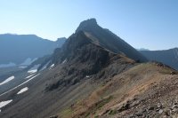
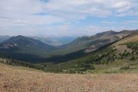
The route started off with a bang - an amazing ridgewalk across a high plateau. Beautiful views were everywhere. I took in the solar eclipse from the top of a remote ridge. Can't be beat! Although entirely off-trail, the terrain was mostly easy, with the occasional short-but-steep climb. I met three dudes in their sixties on this section, who had been hiking the Absarokas for years. They offered helpful tips. If I'm half as cool as they are in my sixties, it'll be an accomplishment.
Section 2: Younts Peak Area
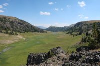
I followed occasional trails through this area, over Marston Pass and the saddle between Younts and Thorofare Peaks. Some trails aren't marked on the maps but definitely exist on the ground. I followed a beautiful side drainage with an entrenched stream, crossed a remote pass, and dropped steeply down a narrow gorge, off-trail, toward the Thorofare.
Section 3: The Thorofare and Woody Pass
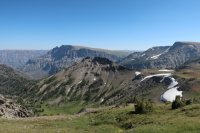
This section was entirely on-trail. I hate to be a downer on an area that everyone likes so much, but I didn't find the Thorofare particularly interesting. It was nice, sure, but very hot/dry/partially burnt and didn't measure up to the fantastic scenery in sections 1-2.
Section 4: Deer Creek Pass
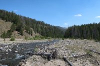
This is where I deviated significantly from my route. A bear got at my food bags overnight in upper Butte Creek, and while he was unsuccesful in obtaining tasty treats (Ursacks are everything they're claimed to be!), he was successful in puncturing my OpSaks and slobbering all over my food, rendering it unedible. The plan was to continue north, off-trail, along the spine of the range. Instead, I bailed down a side trail, did first-aid on a horse, and caught a ride to Cody to get food. For all the mostly-uninteresting details, check out le blog.
Section 5: Grinnell Creek
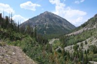
I skipped the northern half of the southern section, as I wouldn't have time to complete the whole route, given my misadventures with the bear. Instead, I resumed my trek north at Grinnell Creek. While there was a trail on the map, it really faded north of an old outfitter camp, forcing a long, mostly horrible bushwhack. Cresting a pass into Silvertip Basin, I encountered a giant burn area.
Section 6: Silvertip and Sunlight Basins
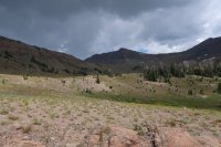
This section was entirely on-trail, which was nice as my Achilles was a-killin' me. More wonderful views abounded in the section, a nice change from the Grinnell Creek section, which was nothing special. I headed up Sunlight Creek and toward the YNP boundary
Section 7: Cruising the Crest
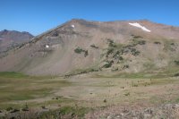
I followed the main crest of the Absarokas north, my left foot in the National Park, and my right foot in the National Forest. The walking was mostly benign until I got within ~10 miles of Republic Pass. There was one sketchy spot that I probably could've done safely, but it exceeded the risk tolerance I have on solo hikes. You're welcome, Mom.
Section 8: Burn Areas and Bushwhack
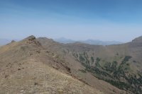
This entire area of the park burned in '88, and if you're below treeline, you're gonna have a bad time. As a result of my bail, I endured a horrendous bushwhack down an unnamed side canyon (with lots of petrified wood!). Once I reached Cache Creek, I cruised along a nicely-maintained trail through more burn areas toward Republic Pass. I crested Republic Pass, now out of the burn area, and returned to my car, parked in Cooke City
Considerations:
Thanks to everyone who participated in this thread. Your advice was invaluable in putting together an ambitious route in a palce I've never been. In particular, a hundred thousand thanks to @Kmatjhwy for her excellent, first-hand, unparalled advice. Next time I'm in Jackson, dinner's one me!

Note - this is a more "technical" writeup of my trip, with maps, route considerations, and philosophy. For a more storylike/grandparent-friendly account of my trip, including the day-to-day adventures, many more photos, and a mostly unremarkable story of my bear encounter, please see my blog: http://prettyeasytoremember.blogspot.com/2017/11/in-which-grizzly-shares-my-lunch.html
The problem with pioneering a route in the backcountry is that you're not quite sure if it's going to work. Prior to my trip, I did extensive research, talking with people on BCP, among other places, to try and get some route beta. I'm grateful to each of them for their help in this process, as the trip would not have been possible without them. Still, adjustments in the field are necessary. I deviated from my route in two main places:
- I bailed at Deer Creek Pass due to a hungry grizzly and ineffective OpSaks. This reduced my total route length by about 45 miles, and forced me to miss some terrain that I was really looking forward to.
- I bailed off the main Absarokas Crest south of Republic Pass due to terrain that was just a little too sketchy to try solo.
Onto the highlights!
Section 1: Buffalo Plateau
The route started off with a bang - an amazing ridgewalk across a high plateau. Beautiful views were everywhere. I took in the solar eclipse from the top of a remote ridge. Can't be beat! Although entirely off-trail, the terrain was mostly easy, with the occasional short-but-steep climb. I met three dudes in their sixties on this section, who had been hiking the Absarokas for years. They offered helpful tips. If I'm half as cool as they are in my sixties, it'll be an accomplishment.

Section 2: Younts Peak Area
I followed occasional trails through this area, over Marston Pass and the saddle between Younts and Thorofare Peaks. Some trails aren't marked on the maps but definitely exist on the ground. I followed a beautiful side drainage with an entrenched stream, crossed a remote pass, and dropped steeply down a narrow gorge, off-trail, toward the Thorofare.

Section 3: The Thorofare and Woody Pass
This section was entirely on-trail. I hate to be a downer on an area that everyone likes so much, but I didn't find the Thorofare particularly interesting. It was nice, sure, but very hot/dry/partially burnt and didn't measure up to the fantastic scenery in sections 1-2.

Section 4: Deer Creek Pass
This is where I deviated significantly from my route. A bear got at my food bags overnight in upper Butte Creek, and while he was unsuccesful in obtaining tasty treats (Ursacks are everything they're claimed to be!), he was successful in puncturing my OpSaks and slobbering all over my food, rendering it unedible. The plan was to continue north, off-trail, along the spine of the range. Instead, I bailed down a side trail, did first-aid on a horse, and caught a ride to Cody to get food. For all the mostly-uninteresting details, check out le blog.

Section 5: Grinnell Creek
I skipped the northern half of the southern section, as I wouldn't have time to complete the whole route, given my misadventures with the bear. Instead, I resumed my trek north at Grinnell Creek. While there was a trail on the map, it really faded north of an old outfitter camp, forcing a long, mostly horrible bushwhack. Cresting a pass into Silvertip Basin, I encountered a giant burn area.

Section 6: Silvertip and Sunlight Basins
This section was entirely on-trail, which was nice as my Achilles was a-killin' me. More wonderful views abounded in the section, a nice change from the Grinnell Creek section, which was nothing special. I headed up Sunlight Creek and toward the YNP boundary

Section 7: Cruising the Crest
I followed the main crest of the Absarokas north, my left foot in the National Park, and my right foot in the National Forest. The walking was mostly benign until I got within ~10 miles of Republic Pass. There was one sketchy spot that I probably could've done safely, but it exceeded the risk tolerance I have on solo hikes. You're welcome, Mom.

Section 8: Burn Areas and Bushwhack
This entire area of the park burned in '88, and if you're below treeline, you're gonna have a bad time. As a result of my bail, I endured a horrendous bushwhack down an unnamed side canyon (with lots of petrified wood!). Once I reached Cache Creek, I cruised along a nicely-maintained trail through more burn areas toward Republic Pass. I crested Republic Pass, now out of the burn area, and returned to my car, parked in Cooke City

Considerations:
- You're gonna have to hitchhike to do this route. No way around it. I got five hitches from Cooke City to Togwotee Pass and it took me about 6 hours on a weekend in August. Not too bad.
- Weather window is fairly small. Before about mid-August, you'll encounter potentially showstopping snow; after Labor Day, you're rolling the dice weather-wise.
- No permits needed - but you probably want to get one anyway. My intended route allowed me to camp outside the Park boundary each night, however I had to bail off the ridge and ended up sleeping in the park. I'd recommend getting the permit, just in case.
- Don't resupply in Cody. I stood on the side of the road for three hours trying to get a ride before someone gave me a pity-hitch back to the trail. Instead, contact on of your friendly neighborhood dude ranches that line Hwy 20 and ask them to hold a package for you.
- Despite everything that went wrong, this is a great little route. I'd like to see someone complete it as planned or as recommended. The Absarokas are a little under-the-radar compared to the Winds, the Tetons, etc, but they're just as wonderful.
Thanks to everyone who participated in this thread. Your advice was invaluable in putting together an ambitious route in a palce I've never been. In particular, a hundred thousand thanks to @Kmatjhwy for her excellent, first-hand, unparalled advice. Next time I'm in Jackson, dinner's one me!

