2019 Highline Planning - Leidy to Mirror Lake

So as I play around with my days & mileages I'm now leaning towards
getting to Painter day 3.

What are your thoughts on the Painter to Oweep Creek?
Any estimates on mileage from Oweep to Ledge Lake?

Painter to Oweep Creek was a hard day. Beautiful, but hard. 3 passes! It's about 15 miles from where we camped in Oweep to Ledge Lake. I don't have it jotted down but if you watch the videos in my Highline TR, I state the mileage each day.

https://backcountrypost.com/threads/unfinished-business-highline-2018.8200/
 
Painter to Oweep would be a tough day...especially Porcupine Pass.
 
For another perspective we did Painter Basin -> Kings -> just short of Tungsten Pass in one day. We originally planned to stay at Tungsten Lake but were too beat. Next day was from Tungsten Pass -> Porcupine Pass -> Lake Fork river.
 
Come on guys! Does Tungsten really qualify as a pass!? ;) But in all seriousness Painter to Oweep would be quite strenuous. Anderson Pass is a whole different animal coming up from down low in Painter Basin than it is via the shortcut off of Gunsight Pass. You'd want to be in extra good shape to keep yourself from regretting from doing such a long day with that one, and that's assuming weather is fair enough through the course of the day. Between the east side of Tungsten and a good ways down Oweep, you'll be out of tree line for a good long while. While @Parma and I ended up with a nice clear night at North Star, I was a bit nervous with a bunch of dark clouds swirling around us as we settled on a camp down amongst some lower lying bushes near North Star. Had there been any lightning or thunder heard, we likely would have sought something further back closer to Tungsten Pass and/or further down in Garfield Basin among a good grove of trees.

Also, I think you're well aware of this, but make sure you have ample battery with a good GPS route on your phone to follow and check it often, especially those first couple of days up until you reach the trail up through Painter Basin because the trail definitely disappears in some of those massive meadows and it's very easy to get off course in those meadows and find yourself making up a bunch of ground to get back on course. Same goes for some other areas like Upper Lake Fork and the like. And don't let the others put down that stretch between Fox Lake and Painter. Yeah...you're stuck in trees for much of that which can make it a mental grind at times, but I still enjoyed some of the creek crossings and views along some of the clearings. Then again, I'm the kind of guy who can find joy in just the fresh air and simple details along the trail knowing I'm on an adventure like that with lots to look forward to as the journey progresses.
 
What are your thoughts on doing Painter to the west side of Porcupine?

Camp high in Painter and do Anderson first thing in the AM, Tungsten,
which has been pointed out isn't much of a pass, and then Porcupine and
camping right after I come down?

The benefit, as I see it, is it sets me then to go Porcupine to base of
Red Knob the next day, setting me up to do Red Knob & Dead Horse.

So the proper question would be, what is the camping on the west
side of Porcupine like?

OR would it be better to go Painter to East side of Porcupine? Then
next day do Porcupine to base of Red Knob?
 
Last edited:
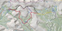
CalTopo shows the following trails from Chepeta to Fox:


Trail to Fox Lake.jpg
Reading trip reports I've been unable to deduce which way people go.

Yellow -> Black? Yellow -> Red -> Green? Yellow -> Red -> Blue -> Black?

The mileages don't seem to be dramatically different, but significantly
different in ups and downs.

Your thoughts?
 
Yellow, Red, Blue, Green. That trail heading north to the Upper Reader Lakes could get you there, but you'd probably be pretty much off trail for a good chunk of it. The other route is the heavily used section.
 
Camping in west Painter Basin and Oweep Basin just after Porcupine Pass is all above the tree line. It's doable, but very exposed.

@WasatchWill and I camped in Painter Basin in the trees right before the jct with trail 043/044...great campsite too.

And I've hiked to Fox Lake multiple times and I don't remember seeing that northern portion you have marked in red. The trail to take is the one you have in green. That's the main trail and the more direct shot to Fox Lake if you go to Queant Lake.
But I'd just stick to the Highline Trail over North Pole Pass and not deal with the elevation down to Queant and back over Fox/Queant Pass.
 
RE: Painter to Oweep drainage (west side Porcupine) I would just play it by weather. If it turns out to be a nasty afternoon, you can seek shelter among the trees southeast of Tungsten among this area here: 40.7414, -110.4275; or you can even continue over Tungsten and seek shelter among some trees below the other side around here: 40.7409, -110.4481. Chances are things'll clear up enough to allow you to get over Porcupine in the evening if it comes to that. Otherwise, it's not that far from Tungsten that you can just get up a little earlier the next morning to get and over it. Either way, it's a good ways on out to Red Knob from Porcupine where chances are good you'll have to take shelter from another afternoon storm in upper Lake Fork or at Dead Horse if you make it that far.

In fact...here's how I'd probably want to approach it all with the days you listed:

Friday: Leidy Peak (Hacking Lake) --> Deadman Lake. ~ 6 miles

Saturday: Deadman Lake --> Reader Lakes. ~ 10.5 miles

Sunday: Reader Lakes --> Kidney Lakes. ~ 10 miles

Monday: Kidney Lakes --> Painter Basin. ~ 7 miles

Tuesday: Painter Basin --> Tungsten Lake/Garfield Basin ~ 9 miles

Wednesday: Tungsten Lake/Garfield Basin --> Edge of tree line at upper Lake Fork (Below western Mt Lovenia) ~13 miles

Thursday : Edge of tree line at upper Lake Fork --> Brinkley Lake ~ 12.5 miles (Make this an extra early start day to get up Dead Horse by mid-morning)

Friday: Brinkley Lake --> Brinkley Lake ~ 10 miles

Saturday: (Contingency 0 Day for storms)

The first day is shorter on miles and allows your body to get a night of acclimation in before really pushing it. Even better is to arrive at Hacking Lake on Thursday evening if you can and camp around there for some extra acclimation. Monday becomes a shorter mileage day with no passes allowing for some good afternoon R&R. I added Saturday at the end as a contingency day which might be wise to allow yourself to have. That is, if you're faced with a day earlier in the week where storms stall you for the better part of a day, you could take a zero day or a "nero" (nearly zero) and finish out the trip on Saturday.
 
@WasatchWill Great info!

My plan is to drive out on that Thursday night and camp at the trail head.

I have never had one elevation sickness symptom, so I'm tempted to push
it a little more on day 1, but I think your advice is sound so I'll go easy day 1
but make up a few of those miles day 2.

The contingency plan is good too.

Seriously, thanks for all the great advice!
 
@Nick @Parma

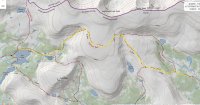
If I've understood you correctly, the path I have
marked in yellow in following image is the path
to take.
Trail to Fox Lake.jpg

I have to say, that all of you BCPers have to be one of the finest collection of
people of the outdoors.

The detailed and nuanced help I've received here can't be valued
in dollars. I'm sure plenty of my questions over the years have
been ignorant. Yet, everything I've asked has been answered with
specific and relevant information without one bit of condescension.

I tend to think of all of you as my insurance policy against self inflicted disaster
when I go into the backcountry.

Thank you!
 
What is the actual length of the Highline?

I always thought it was 83 miles from Leidy to
Mirror Lake Highway. When I measure it at
caltopo, I measure 82.71 miles, but the personal
experience of others says the measurements on
caltopo are too short. So either it's longer than
83 miles or those measurements are closer than
I thought they were.

So what gives?
 
That's accurate enough. Some of the miles feel slower, particularly between fox lake and painter basin, bc of the rocky trail. But add a few, subtract a few, it's mostly right.

I think it also feels longer because the weather often dictates shorter (e.g. more) days so you feel like you've been out there forever.
 
Depends. I clocked 67 doing the Cheat-peta route. I've always figured the full from Leidy is about 85. A lot of the measurements floating around are probably from before it was recorded by GPS devices. I think what matters most is what you actually walk, so I'd favor the actual GPS measurements.
 
I think the distance variation with mapping out routes on services like CalTopo has to do with how accurate you make it. If you trace out your route by using the snap to trail feature on CalTopo or roughly trace out a trail along trails shown on USGS or other topo layers, and then leave it at that, it can end up being off by a few miles for a trip like this one AND you're likely to find that some sections shown on a topo layer is not really there when you get there in person. So after roughing out a route, I then switch to satellite view and zoom in to adjust track points and pin/reposition them to whatever trail is visible in the sat view to more accurately follow curves, switchbacks, etc. Once I've done that, I have found that CalTopo can give accurate enough measurements. Sucks when you hit sections on the sat view where the area you're routing through is covered in snow though.
 
Depends. I clocked 67 doing the Cheat-peta route. I've always figured the full from Leidy is about 85. A lot of the measurements floating around are probably from before it was recorded by GPS devices. I think what matters most is what you actually walk, so I'd favor the actual GPS measurements.

I think you mentioned that when you did Leidy to Chepeta it was 15-16 miles? That comes out about right.
I was mostly concerned that I had under estimated the total distance.

add a few, subtract a few, it's mostly right.
That's the conclusion I've come to.

So after roughing out a route, I then switch to satellite view and zoom in to adjust track points and pin/reposition them to whatever trail is visible in the sat view to more accurately follow curves, switchbacks, etc. Once I've done that, I have found that CalTopo can give accurate enough measurements.
As one who spends way too much time agonizing over maps (but loving every minute of it) that's great advice.
 
I believe it was 8 miles from Leidy to Whiterocks and then 4 miles from Whiterocks to Chepeta according to the Trails Illustrated map I used
 
Back
Top