- Joined
- Dec 2, 2019
- Messages
- 182
-----------------------------------
A trip from one year ago, before the current Coronavirus crisis.
-----------------------------------
"Oh my goodness ... my boots, my boots ... I'm not wearing my boots !"
I shouted at the driver to please not leave, just yet.
I was sitting in the shuttle bus in the parking lot of Tex's Riverways in Moab, whilst the crew loaded the final bags into the trailer. The engine was running, and the driver was ready to pull away, when I looked down and realized that I was still wearing my light running shoes, instead of my hiking boots.
This was not the most auspicious of starts to my adventure. I had spent months at home anticipating the trip; spent weeks planning and making preparations; and spent the past few days finalizing all my arrangements; and yet here I was about to head into one of the most rugged backcountry environments in the US, wearing little more than carpet slippers.
The driver laughed, and told me to be quick, as I raced back to my car to change into my beloved boots.
Finally, I was ready to fulfill a long-held ambition: hike The Maze.
-----
After a short bus ride to Potash, we could finally take to the water, and be sped comfortably by jet-boat along the glorious Colorado River, to the starting point of the hike into the Maze, at Spanish Bottom.
Well, that's the theory !
In practice, the early morning trip along the river is quite an endurance test; being, unfortunately, a very chilly couple of hours. As the speedy craft slices through the ice-cold air of the riverway still in deep shadow, the initial excited chatter of the passengers is soon replaced by quiet mutterings, as each person delves into their packs for additional clothing layers and face coverings. I swear I could hear the faint chattering of teeth before we finally arrived !
Despite the short-lived hardships, the canyon scenery is, of course, utterly magnificent. It is a very unique way of experiencing this enormous expanse of red-rock country.
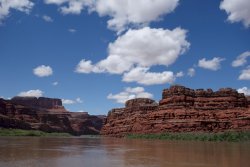
The great advantage of taking this means of transport, is that it is a very quick way of reaching this very remote section of Canyonlands National Park. It is possible to reach the Maze by road, using a high-clearance four-wheel drive vehicle, via a series of very challenging dirt roads. To reach the main section of the Maze would likely take over 8 hours of driving, after leaving the highway. To quote the Park Service advice:
"The road leading into the Land of Standing Rocks is considered very difficult under any conditions and involves considerable risk of vehicle damage. Four-wheel drivers in the Maze should be prepared to make basic road or vehicle repairs and should carry the following items: one or two full-size spare tires, extra gas, extra water, a shovel, a high-lift jack, and from October to April, chains for all four tires."
The remoteness of the Maze area can probably be summarized by the number of visitors to each of the main districts of Canyonlands National Park: Island in the Sky receives around half a million people each year; Needles around 150,000; and the Maze about 10,000. I would hazard a guess that less than 10% of this total are backpackers, staying in the Maze for more than one night.
------------------------------------
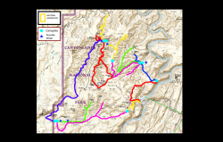
Below is a map of roughly my route over 10 days:
This is the approximate elevation profile (created retrospectively using Gaia GPS):
This is my itinerary:
------------------------------Day 1 : Spanish Bottom -> Colorado River overlooks, via the Dollhouse
------------------------------Day 2 : Colorado River overlooks -> Water Canyon; Day hike in Shot Canyon
------------------------------Day 3 : Day hike to Jasper Ridge
------------------------------Day 4 : Water Canyon -> Pete's Mesa route
------------------------------Day 5 : Pete's Mesa route -> South Fork Horse Canyon, via Pete's Mesa
------------------------------Day 6 : Pictograph Fork Loop Hike, via the Harvest Panel and Maze Overlook
------------------------------Day 7 : South Fork Horse Canyon -> Lou's Spring
------------------------------Day 8 : Day hike to The Fins
------------------------------Day 9 : Lou's Spring -> Ernie's Country, via Sweet Alice Canyon
------------------------------Day 10 : Ernie's Country -> Spanish Bottom
This is the list of camping spots:
---------------Day 1.........Colorado River overlooks
---------------Day 2, 3....Water Canyon
---------------Day 4.........Pete's Mesa route
---------------Day 5, 6....South Fork Horse Canyon
---------------Day 7, 8....Lou's Spring
---------------Day 9.........Ernie's Country
-------------------------------------
All backpackers know what awaits them as they leave Spanish Bottom and hike up to the Dollhouse ... yup, it's a 1,000 ft climb over 1 mile, up a slippery rubble slope ... yikes !!
In truth, although the climb is a real lung-buster, hikers are just so excited to be there, with their adrenaline flowing at a rate of knots, that it is over before you know it. And, from this vantage point, the views across the wide expanse of Spanish Bottom, and along the Colorado River are just superb.
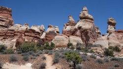
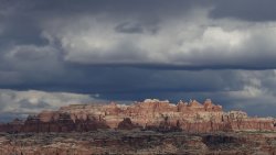
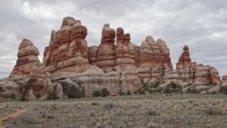
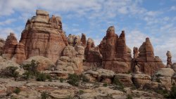
At the top of this steep slope is the famous Dollhouse area. One of the magical things about the Dollhouse is that it really isn't visible until you complete the painful climb, shuffle through a gap in the rocks, and find yourself at a helpful information board. Only at this point, does the full majesty of the numerous sandstone spires begin to display itself, with an array of reds, whites, yellows, and browns on display among the wonderful assortment of huge hoodoos. It is a magnificent sight, certainly matching, and perhaps surpassing, similar groups of rock structures in the Needles district.
My climb up the steep slope was helped by chatting to a German university professor, who was in the midst of a multi-week adventure, of his own design, across Utah. He had previously been to Spanish Bottom, one week before, when he crossed the river by pack-raft, after hiking through the Needles. Unfortunately all of his gear fell into the water as he tried to disembark his boat, and his phone, GPS device, camera, and emergency beacon were all ruined in the process. He had hitched a ride back to Moab on the jet-boat, in order to re-stock all his electronics; so here he was about to continue his trip.
He had also had a miserable time crossing the La Sal Mountains, east of Moab, a couple of weeks previously, when there were some bitterly cold temperatures and waist-deep areas of snow to traverse. His current route would soon take him across the daunting Henry Mountains, and I couldn't help worry about him when there was a full week of unseasonel storms, a few days after my return to Moab. The spring of 2019 was certainly a testing one for any long-distance backpacker in the south-west, as I was to find out myself when I hiked from Moab to Bluff over 3 weeks in late May (https://backcountrypost.com/threads...ss-the-colorado-plateau-may-2019-part-1.8987/).
After the exertions of the previous hour, a few minutes rest in the shade, with tremendous views of the Dollhouse was very welcome indeed.
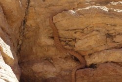
After leaving the Dollhouse, the walking was very pleasant with several small drainages to drop into and climb out of. One such drainage ended abruptly with the obvious exit being a relatively straightforward 10-feet clamber up a rocky incline. As I moved to start the climb, I heard a distinctive noise close by, and instinctively quickly jumped back. I just really hoped I'd be able to see the source of this sound; and, yes, there it was, half-way up the only possible exit route: a rattlesnake, and a rather unhappy one at that. It's neck was arched in preparation to strike, and it's tail was rattling away good-style.
I wasn't in a great hurry, so I decided that I'd just laze a while and keep a close eye on this guy, hoping that he would slither off quietly, once he realized that I was no danger to him. After about 10 minutes, he quietly made his way off into the nearby undergrowth, away from my intended route. With some relief, I clambered up the short slope, and headed off in the direction of my campsite for the night.
Despite a rather confusing 4-way trail junction, I made my way towards a nice spot to pitch my tent for the night. I was only a few minutes scramble from the rim of the Maze plateau, and was able to get some glorious evening views of the mighty Colorado River 1,200 ft below me.
The easy bit at Spanish Bottom, before the 1,000ft climb !
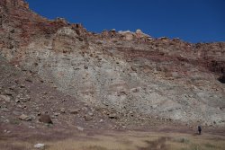
View across Spanish Bottom and the Colorado River from the climb
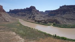
The Dollhouse
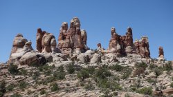
The Dollhouse
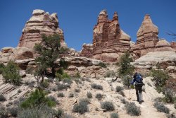
The Dollhouse
A rattlesnake blocks my path !
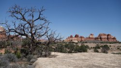
Approaching the Colorado Overlooks
---------------------
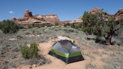
Upon reaching Water Canyon the next morning, I was delighted to see a steady stream of water snaking its way across a lovely open valley. I found a very nice campsite among the trees, which would be an ideal location for the next couple of nights.
My objective for the afternoon was to explore nearby Shot Canyon, and more specifically some of its side drainages. My plan for the following day was to do a day-hike along Jasper Ridge, a high, narrow mesa towering over Jasper and Shot Canyons. My hope was that I could complete it as a loop hike, but this would mean finding a way to drop into a side valley of Shot Canyon from Jasper Ridge. I had read that such a loop was possible, and so today, I wanted to try to determine where this descent from the ridge might be.
I chatted briefly to two brothers and a sister from South Dakota who had arrived with me on the jet-boat yesterday. They were breaking camp at Water Canyon and heading back towards the Dollhouse and Spanish Bottom to return to Moab tomorrow. They were very jealous that I planned to spend 10 days in The Maze, but they were determined to return again some time. As it turned out, these would be the last hikers I would see for the next week !
After a pleasant lunch, I headed off towards Shot Canyon. The hiking was fantastic and the canyon views glorious, but it turned out to be a fruitless search for the spot where I could drop into Shot Canyon from Jasper Ridge. With more time, I may have been able to locate it, but for now, I'd just need to content myself with an out-and-back hike tomorrow.
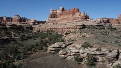
A beautiful descent towards Water Canyon
A lovely campsite
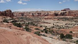
Stunning view into Shot Canyon from the saddle to Water Canyon
---------------------
The following day, I made my way towards Shot Canyon again, and then took the main canyon trail that winds its way up towards the Land of Standing Rocks. The view of the sheer red sandstone cliffs as the canyon narrows are wonderful, although the final half-mile to exit the canyon is a lung-busting 400 ft haul, initially up a steep, loose rubble slope. After a narrow bench walk, the final test lies in store: it's a wide, smooth, slippery white sandstone bowl, atop a huge pour-off, that needs to be traversed. Remarkably, there is a hand-made set of stone steps and thick tree branches placed across the bowl to make the exit possible. It's still a hair-raising crossing, but great fun at the same time. I tried not to think too long about the fact that I'd be repeating this same ascent tomorrow, but this time, with a full pack on my back !
Before reaching the cut-off to Jasper Ridge, I wandered off-trail a little to try to reach the edge of Water Canyon. The views into this wide canyon were undoubtedly among the highlights of my entire trip. It's possible to rim-walk for some distance around the head of this canyon, and gaze along the length of the drainage from wonderful viewpoints several hundred feet above the valley floor. I could just about make out the faint trail far below me which apparently allows a rather steep and sketchy exit from the canyon, directly to the Land of Standing Rocks (thereby allowing the hiker to avoid the exit route that I took, via Shot Canyon).
I had made good progress this morning, and so had plenty of time to explore Jasper Ridge. The junction from the main trail is a little tricky to locate, which is deliberate I guess, since this route isn't an 'official' park trail. The walking along the path is very easy and it would be possible to explore several miles along the ridge. As it turns out, the ridge is actually quite wide so, although the walking is pleasant enough, there aren't non-stop glorious views into a deep, narrow canyon, as I had imagined beforehand. It's possible to easily find such viewpoints, but this means diverting off-trail for a few hundred yards each time to reach the canyon rim. Don't get me wrong, these views into Jasper Canyon are glorious but, since rim-walking isn't really feasible, it's just quite a time-consuming process to reach the rim each time, from the main trail.
The views into Jasper Canyon are so mouth-watering, that it really makes you long to be able to descend into this valley to explore some more. Unfortunately, this canyon is out-of-bounds to the public, since the grasses growing there make it a site of scientific interest. It appears that it is the only valley in the area where cattle didn't roam freely, in the early parts of the last century, and so the flora and fauna of the canyon are pretty much untainted by the hand of modern man.
I had intended to turn back a little sooner, but I couldn't resist looking for the 'fabled' descent from the ridge into Shot Canyon; the one that I had failed to find the previous day, from the opposite direction. Although I felt that I wasn't far away from the spot, again I wasn't able to locate where it was.
Shot Canyon begins to narrow
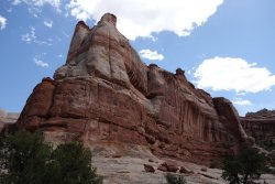
Traversing the sandstone bowl to exit Shot Canyon
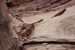
Looking back into Shot Canyon
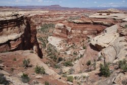
---------------------------------------
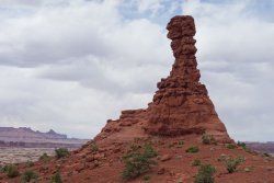
After a leisurely morning exploring the upper reaches of beautiful Water Canyon, I again headed towards Shot Canyon, and followed the main trail; this time all the way to Chimney Rock, a huge thin rock spire. On this plateau, known as The Land of Standing Rocks, there are several other huge dark-red sandstone monoliths close by. This area is, in many ways, the 'center' of The Maze, with three different hiking trails converging at Chimney Rock, and the main jeep road in The Maze passing through.
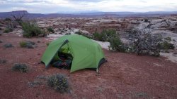
My objective this afternoon was to head along the Pete's Mesa Route, find a nice camping spot off-trail, and then attempt to explore the eponymous mesa. As it turned out, I had spent more time than I had intended around Water Canyon earlier in the day, and so I decided that I would cut the day short and spend a couple of hours lazing around camp, admiring the magnificent distant views of far-away mountains.
An old cowboy camp in Water Canyon
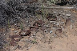
Glorious views of Water Canyon
Chimney Rock in the Land of Standing Rocks
Camping spot off Pete's Mesa Route, with La Sal Mountains in the far distance
------------------------------
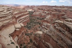
I was up bright and early the following morning to clamber up to Pete's Mesa, a remarkably flat plateau, a couple of hundred feet above the surrounding area. The visual perspective from here of the tortuous twisting, deep, narrow canyons of the entire Maze area was astonishing.
I then descended into one of these canyons by a very circuitous route, the trail twisting and turning around numerous small ravines and drainages, before finally arriving on a sandy valley floor. I was heading through this unnamed canyon towards the South Fork of Horse Canyon, where I hoped there would be a nice flow of water, which would sustain me for the next couple of days.
The tall reeds and damp sand were an early indication of an upcoming water source, and I was glad to see that there was plenty of water up ahead.
After setting up camp, and eating lunch, I headed off to explore the northern section of the South Fork of Horse Canyon (the canyon naming in this area, leaves a little to be desired, I think !).
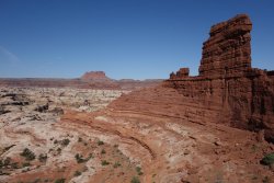
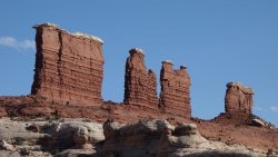
I had one further aim for the day, and that was to scramble up to the famous Chocolate Drops; the huge, thin, and long, sandstone monoliths which tower over the Maze. The route I had researched leaves Pictograph Fork via a small ravine and leads up a couple of hundred feet to these deep-red rock formations. I found the use-trail quite easily, and initially made good progress up the slippery rubble slopes and along some narrow ledges. However, I was then faced with a tricky vertical climb, with a very narrow ledge on top. I really wasn't comfortable with the move required to progress upwards, especially because I was hiking alone, so I decided that discretion was the better part of valor, and abandoned my attempt. The only other access route is via an 8 mile out-and-back trail from the Land of Standing Rocks, so it looked like I wouldn't be getting a close-up view of the Chocolate Drops on this trip, unfortunately.
The 'Red Wall' with The Chocolate Drops and Elaterite Butte in the far distance
Wide perspective of the Maze canyon system from Pete's Mesa
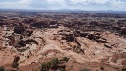
Chocolate Drops and Elaterite Butte from Pete's Mesa
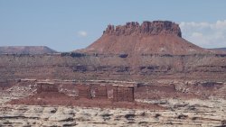
Shot Canyon below Pete's Mesa plateau
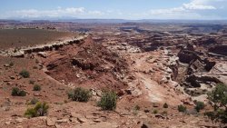
Approaching South Fork of Horse Canyon
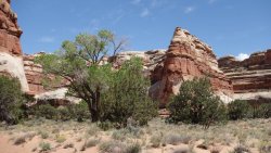
South Fork of Horse Canyon with Chocolate Drops in the distance
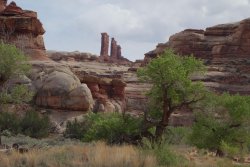
Campsite in South Fork of Horse Canyon
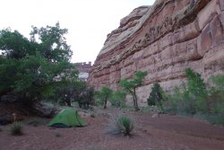
------------------------------
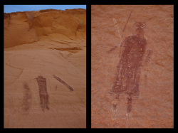
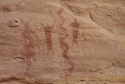
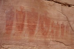
I awoke the following day with a massive feeling of great excitement, since this would be the day where I was able to see the Harvest Scene panel for the first time. Except for the Great Gallery in Horseshoe Canyon, located in a separate section of Canyonlands National Park, the Harvest Scene is regarded as being the most impressive ancient rock-art pictograph panel in the entire country. I couldn't wait to view it for myself.
The panel itself is utterly breathtaking in complexity, detail, and sheer artistry. It was a true privilege to finally see it first-hand, after reading about it for several years. The fact that it is located in such a remote area, and required some tough hiking to get here made the experience all the more special. I spent a magical hour or so, taking in as much of the wonderful spectacle as I could.
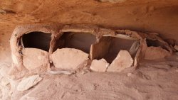
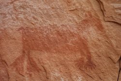
Numerous studies have been done in attempting to age the work, with various scholars estimating dates between several thousand years BC, up to around 1,100 AD. It is certainly known that there was human activity in the area from around 8,0000 BC, with several important periods of occupation in the wider region over the next 9,000 years, up until the 'abandonment' of the area in around 1,300 AD. In the main Maze complex, there is little evidence of habitation sites, suggesting that the Ancient Ones probably didn't live or farm here extensively. However, there are several rock-art panels hidden among the canyons, which suggests that the area would have been traversed, perhaps seasonally, by many ancient peoples. The presence of a panel of the grandeur of the Harvest Scene would probably indicate that this site was of particular importance to these travelers.
If aging the rock art is fraught with difficulty, then interpreting the meaning of the other-worldy figures represented in the pictograph is an almost impossible task for the modern academic. However, undoubtedly one of the reasons why these panels are so incredibly fascinating is that we know so little about what their initial meaning was, and why they chose this specific place to create the rock-art.
As I was admiring The Harvest Scene, I noticed a couple of hikers a hundred yards or so away, across the canyon. I presumed that they were heading towards the famous panel, but they strolled on past, apparently not noticing me or the rock-art. Then, about 10 minutes later, I saw the same guys heading back in the opposite direction, so I was sure that they would now make their way towards where I was standing. But no, again they walked past, and headed out of Pictograph Fork, towards Horse Canyon. This seemed a little odd.
About 30 minutes later, as I headed back to my tent to collect something, I spotted the same two guys sitting in the shade filling up their water bottles. It turns out that they were car-camping in the Land of Standing Rocks and doing a day-hike into the canyons. And, their intention for the day, and lifelong ambition was to visit the Harvest Panel ... the only problem was that they they couldn't find it ... they were quite downcast.
They got quite a shock when I told them that they had twice been within 150 yards of it, about an hour previously. Effectively, when I had seen them earlier, they were on the lookout for the panel, but just didn't spot it. They were delighted when I was able to tell them exactly where to find it.
The day, of course, was only just getting started ! After the excitement of seeing the Harvest Panel, I then hiked a long loop through Pictograph Fork, clambering up to The Land of Standing Rocks at Chimney Rock, and then descended back into the canyon network further along the jeep road, at Lizard Rock. It had been a long, but wonderful hiking day, with glorious canyon scenery to enjoy for many hours.
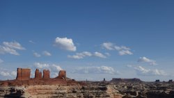
I headed back to Horse Canyon, and decided to see if I could climb up to the Maze Overlook. It was getting a little late in the afternoon, but I thought that the best views might be at this time of day. It was a really fun scramble up to the viewpoint, with some simple 'steps' carved into the smooth sandstone sections. There were a couple of tricky ledges to negotiate and narrow gaps to squeeze through, but progress was relatively straightforward overall. The views over the Maze canyon complex were, of course, absolutely stunning from the overlook, 500 ft above the valley floor. The sight of the Chocolate Drops turning progressively more red, as the sun began to set was magnificent. I could have sat there for hours, but it was getting quite late now, so I had to trot back down the slope quite quickly to get back to camp before dark.
The Harvest Scene pictograph panel
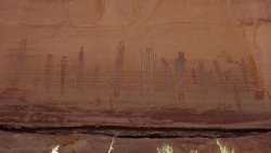
Detail from the Harvest Scene pictograph panel
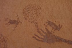
Harvest Scene elements
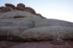
Helpful footholds on the ascent to the Maze Overlook
Chocolate Drops
Chocolate Drops and the Land of Standing Rocks in the far distance from Maze Overlook
Northern section of South Fork of Horse Canyon from the Maze Overlook
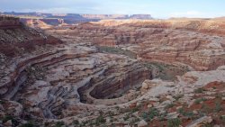
Southern section of South Fork of Horse Canyon from the Maze Overlook
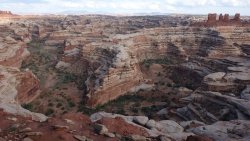
---------------------------------------
The next day would involve my final exit from the main canyon complex of the Maze; the hike would involve a long walk along the southern section of the South Fork of Horse Canyon. After hiking several different canyons in the area over the previous few days, I wasn't really expecting a great deal of anything new this morning but, as it turned out, this was probably my favorite canyon walk of the trip.
This is a delightful canyon, with many groves of gorgeous cottonwoods trees along the way, and long stretches of firm, damp sand to walk over. After endless hours of trudging through soft sand in the past few days, it was really nice to have a more solid surface underfoot for a couple of hours. This really was a beautiful walk, with regular trickles of water along the way, and one surprisingly large plunge-pool. The only downside was the encroaching tamarisk, which appeared to be sprouting in small shoots deep into the damp canyon. I do hope that in 10 years time the valley isn't choked with this voracious vegetation.
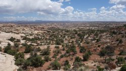
After exiting the canyon close to The Wall, in the Land of Standing Rocks, I headed south-west along the jeep road for a few miles towards the Mother and Child rock monoliths. It was an unexpectedly pleasant walk, with magnificent views across Ernie's Country and glimpses of The Fins, an area of huge long, narrow rock formations, in the southern section of The Maze. In the far distance, towards the east, the distinctive shapes of the tall sandstone spires of the Needles district of Canyonlands National Park could also be clearly seen.
Once at The Mother and Child, I easily found the 'unofficial' route that leaves the jeep road and descends gently towards a vast, open area known as Ernie's Country. The objective of the day was to set up camp close to a reportedly good source of water at Lou's Spring. The spring itself was free-flowing with lovely clear water available in large metal troughs. This would be the ideal home for the next couple of nights.
South Fork of Horse Canyon
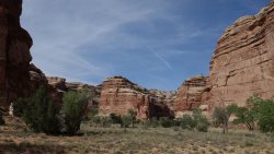
Exiting South Fork of Horse Canyon
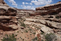
The Fins from the Land of Standing Rocks
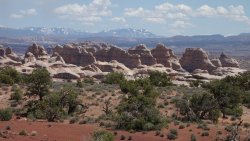
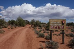
Jeep road through the Land of Standing Rocks
View over Ernie's Country from the Land of Standing Rocks
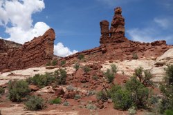
Mother and Child
-----------------------------------
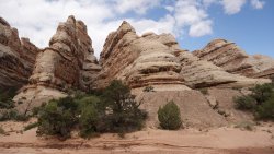
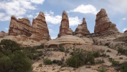
My plan for the following day was an out-and-back hike to the Fins area. I bypassed the second potential water source in this area, known as Clell's Spring, which is tucked in a small alcove just off the main trail. The metal troughs here contain quite a lot of vegetation, and aren't quite as appetizing as the ones at Lou's Spring, but there did seem to be good water available.
I got quite a surprise when I rounded a sharp bend in the trail, and met a fellow hiker. I hadn't seen another backpacker for the past week, so it was very nice to spend a while chatting with him about his plans. He was from California, and was doing a similar loop to me, but in the opposite direction.
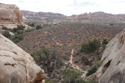
The Fins area made for a really enjoyable couple of hours of exploring. In addition to superb views of these enormous sandstone formations from the valley floor, it was fun to clamber up onto the rock surfaces, and scramble up quite high above the valley.
Looking towards Ernie's Country
The Fins
The Fins
----------------------------
On my final full day in The Maze, I was heading across the main section of Ernie's Country towards the Wide Valley, before ending up close to the Dollhouse for my last night's camping.
After leaving camp close to Lou's Spring, the main trail involves a nasty scramble up the steep rubble slope of a small mesa. Instead, I decided to bypass the mesa entirely and follow Range Canyon a little, before rejoining the trail further ahead.
The walk across Ernie's Country was extremely enjoyable, and very different from the several days which I had spent deep in the canyon system. This area is much more open, with vast, expansive vistas of the surrounding region. The only downside is the long sections of deep sand that make walking much more tiring.
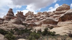
I spent a wonderful couple of hours exploring Sweet Alice canyon, which is filled with many stunning rock formations and arches. It is possible to follow this canyon northwards, and scramble an exit, up towards The Land of Standing Rocks. That particular adventure would have to wait for another day.
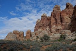
It isn't allowed to wild-camp close to the Dollhouse, so after crossing Wide Valley, I hiked towards the end of Main Flat, where I set up camp for the final time. I then wandered up to the Dollhouse for some evening exploring. The setting sun illuminated the red and white spires and hoodoos magnificently.
Sweet Alice Canyon
Sweet Alice Canyon
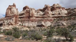
Sweet Alice Canyon
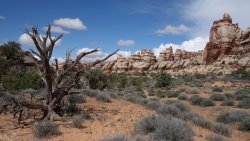
View towards the south of the Needles with Beef Basin in the far distance
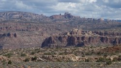
Wide Valley and Main Flat
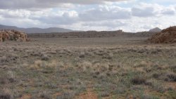
A distant view of The Needles
The Dollhouse
The Dollhouse
The Dollhouse
-------------------------------------------
I then headed back down the steep loose slope towards Spanish Bottom to meet up with the jet-boat, which was due to arrive about 10.30 to 11am.
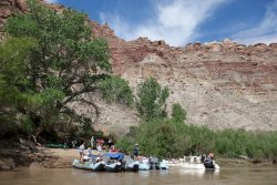
The boat was running a little late today, but I wasn't too concerned, since it was great just to relax beside the river and chat to some of the canoeists who had been paddling on the Colorado for the past few days. There was also a small research party unpacking some gear, alongside some friendly Park Service staff.
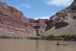
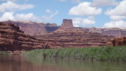
It turned out that the delay in arrival of the jet-boat was due to some technical issues, and it was only able to run at half-speed along the waterway. At first, I was a bit disappointed since this would mean a delayed return to Moab, but then I suddenly realized the huge plus-point of this issue: we wouldn't be half-frozen to death as the boat sped along the river. So, the return trip along the Colorado turned out to be a glorious, warm and sunny trip through some of the most magnificent canyon country of the south-west.
It was a very special way to complete my superb hiking adventure into the Maze.
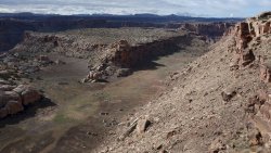
Surprise Valley
Pulling away from Spanish Bottom
Colorado River
Colorado River
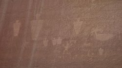
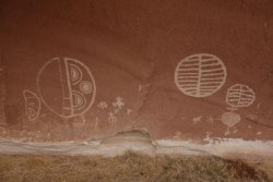
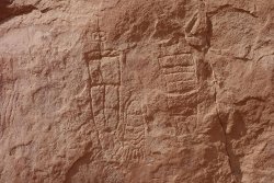
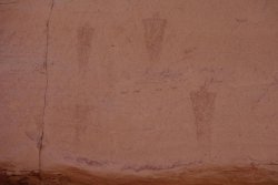
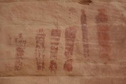
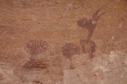
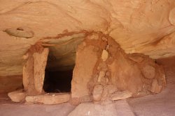
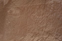
Rock-art and Ruins of The Maze
Last edited:

