Michael
Alien from over the pond...
- Joined
- Sep 5, 2012
- Messages
- 1,042
Wire Pass to Lee's Ferry, we celebrated our jubilee "20 years of traveling in the USA" w/ this trip. This backpacking trip, was the first 4-day-trip, in our life. All my impressions to frame in words, is to hard for me. My English is like a back road, after a flash flood. I hope folks, you understand my kind of writing. 
Day 0: Page/AZ - Lee' s Ferry - Wire Pass
10:00 am, trip from Page Lake Powell Campground & RV Resort, Page/AZ to Lee' s Ferry long term parking lot. At noon should be the pickup by End Of The Trail Shuttles w/Betty Price. After a mandatory stop at the Colorado River, we reached the parking lot.
Navajo Bridges
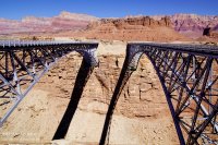
No cellphone reception. Two hiker from Colorado State, they returned straight from their Paria hike, kindly helped us. Thanks again guys. Short phone call with Bettys secretary, hers mother, the truck is in Page/AZ to the repair and the departure retards around 2 hours. Finally, Betty with hers roomy 2004er Chevy Trailblazer came. Luggage load up and: „UP, UP on the way“!
Betty is a very nice elder lady, who operates the shuttle service since over 20 years. She knows about the local roads, geology, flora and fauna and told some stories from the past.
Lee's Ferry long term parking lot
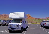
05:00 pm or so, we reach the parking lot at the Wire Pass TH. Now, tent build up and relaxing afterwards.
CS @ Wire Pass
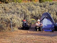
We have a beautiful overview on the parking lot, to observe hikers on their way back from The Wave. Most of them were tired, but with a broad grin in the face. The parking lot empties. We come with a Canadian couple into a very nice discussion. They were in the Buckskin Gulch area, since they did not catch permits for the Wave. Like we, they love this area. Before they leave, they were very friendly and carried out our garbage bag, thus I have on the next day, to bear less.
Shortly after dark, we crawl away into the tent - good night!
Day 1: Wire Pass TH - Paria River, below the Confluence
The night was quiet, until 03:00 o'clock in the morning. A group that we later met again in the gulch, set up her camp. The day begins 05:00 am. Coffee cooking, a few granola bars for the breakfast and pack the backpacks.
07:00 am, start into the Wire Pass. The Buckbrush blooms and waste its sweetness on the desert air. The two known obstacles were, how ever, no problem. The jammed log in the narrows, jammed in the height for years, lies at the ground now.
Blooming Buckbrush in Wire Pass
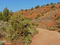
After altogether 1,75 miles, we reach the confluence with the Buckskin Gulch. The sun illuminates the wall at the alcove, on the right side, so that the snake of the petroglyph panel, who extends from the alcove to the end of the wall, is well visible.
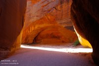
The gulch is bone-dry, only the known pool still has some water. The big alcove is, after 3 miles, to see. Some alcoves are on the way to the first boulder section, however no one is as beautiful as the first one. We reach the section after 4 miles. A few scramble and we leave the first prominent boulders behind ourselves.
Alcove in the Buckskin
Boulder
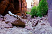
After a short rest, it goes further in direction Middle Route Exit. The path of the gulch here, is changing between pebbly, sandy, and even uphill. It we more narrowly and darker in the gulch.
The walls partly are covered of Desert Varnish. The sandstone shows beautiful structures, according to the light in gray, brown, gold and red shines. It is a continuous direction changing, from the left to the right at the cracks.
Heike @ The Slot
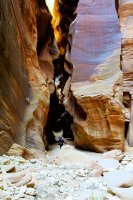
Sandy Trail
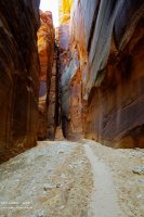
Carved Sandstone
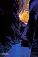
The notorious cesspool, shortly before Middle Route Exit, belongs to the past. The last flash floods "washed away" it. It becomes light. A known crack becomes visible, we reached the Middle Route Exit after almost 8 miles.
Crack @ Middle Route Exit
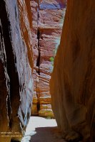
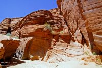
It is 01:00 pm, time for the lunch and the petroglyphs, who I had overlooked 2009. Now I can view them.
Middle Route Exit and Upper Crack (left)
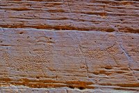
Petroglyph Panel 1 of 4
We hike the next 5.5 miles to the confluence of Paria River, on known terrain. However nothing is, like in 2009. The gulch is really bone-dry and looks like an over cleaned, brightly polished. The reflections of the light are missing in the water, who brings the sandstone of the walls so singularly to the radiance. Circa 04:00 pm and another 4 miles, we reached Boulder Jam. Hey, what's that? Rope Mania.
Boulder Jam
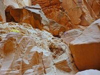
Rabbit Hole
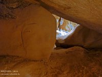
The debris vanished. We rappel into the Rabbit Hole and crawls to the other side. Cool. Time for a rest. Suddenly voices. We meet the 3-o’clock-campers of the Wire Pass. A nice small talk. I made a memory-photo for them, and they continue her hike. It becomes time also for us to hike further. Heya, some things don't change. The old wheel and the wedged barrel, still are there. Shortly before we reach the campsite at the confluence, seeps comes out from the ground of the gulch. This clear water has a leisurely flow to the Paria River. After 13,5 miles on trail, we crossed the confluence. The Paria has very little water. It's very clear.
We hike the river downwards, we need a campsite for the night. The first campsite is busy. A few yards further, on the left side and 0.5 miles below the Confluence, we find our campsite, above the Paria River.
1th Campsite
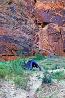
Almost 14 miles and 12 hours of hiking - time for the Dinner: Mountain House’s Chili Mac with Beef - yummy and a coffee as dessert.
With the Katadyn Vario, we refilled our water bottles with the water from the river. It becomes slow dark. A little bit relaxing, a drink, that was it for today.
Day 2: Paria River, below the Confluence - The Hole
After a relaxing night, the day begins about 06:00 am with the accustomed procedure. Cook Coffee, for breakfast few Granola bars and Beef Jerky, later backpacks packing.
08:00 am and 12 °C. It's refreshingly cool. We are again on the trail. The Paria canyon narrows are visible. The muddy riverbed of the Paria will be innumerable times to still cross today. The walls of the Canyons are steep and looks majestically, numerous alcoves and cracks are to see also. Shortly after mile 15, we reach the of far visible Wall Spring, with her green grew.
Paria Canyon Alcove
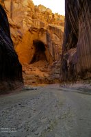
Walls and Portal
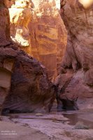
Wall Spring
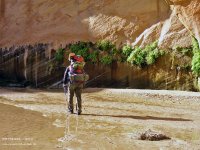
Near mile 17 we pass the Abandoned Meander (Oxbow) and approves us a rest. Big Spring is before the second crack, that we reach, almost 11:00 am. The filling of the water bottles lasts only few seconds, so strongly the water flow is here. Even several populations of fishes are in the water of the Paria River, in the sizes of about 2 to 6 cm of length, to see.
Big Spring
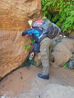
Between the 2. and 3. crack, we hike through the 'Goosenecks' - wonderful. The water of the Paria extends from canyon wall to canyon wall.
Near mile 20 the 4. crack. It's 01:30 pm, time for the Lunch with nuts and Beef Jerky. The hiking boots are swap to the wading boots. The water of the river becomes more and more deeply.
4th Crack
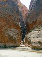
Have a break
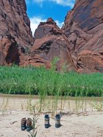
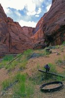
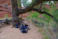
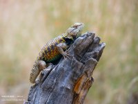
At mile 22, we pass the Boulder-Alley. Gigantic boulders lie in the riverbed, they are good to pass. One little later, we reaches the fragments of the old historic Adam's Water Pump (Judd Hollow Pump). A beautiful place with old Cottonwood trees, that invite formally to a rest. Lizzy welcomes us.
Adam's Water Pump
Rest on a beautiful place
Lizzy
It almost is 04:00 pm. Time to hike again, and to find a campsite. With mile 23, we see a curiosity again. Several springs step out of the ground of the Paria Canyon. The sand around the exit-openings is very fine and deep (like quicksand).
Springs
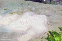
We reach The Hole one mile later, a niche in the western Canyon wall later more, however, to it. The campsite, on opposite, is totally overgrown by shrubs and plants. Here nobody camped more, for a long long time. We find a few yards downriver, almost 05:30 pm, a beautiful site.
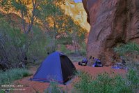
2nd Campsite
The Hole
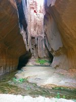
Tent build up and first, cooking a wonderful cup of coffee. What for a relief! Later, we walk up to The Hole, in order to refill our water bottles. Water is running from the canyon wall, which fills a big pool. The walls of The Hole, partially have a luxuriant green plant growing.
We spend the evening, after 10 miles of canyon hiking and 12 hours on the legs, in the soft sand of our campsite - a splendid little spot in the middle of the nature. For dinner, there are Beef Stroganoff with Noodles by Mountain House - delicious. To advanced time, we go into the tent and asleep someday, accompanies from the concert of the frogs.
Day 3: The Hole - South of F.T. Johnson 1912
06:00 am: "And daily, the marmot greets!" Breakfast, backpacks packing. 07:45 am, we are on the Trail. At mile 25, we arrive the Wrather Canyon area. There is also flowing water. The path through the green canyon leads us steeply upward. We set aside our heavy backpacks in the canyon. After plentiful 0.5 miles,
Trail to Wrather Arch
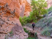
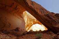
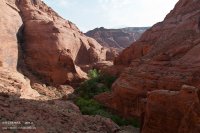
we reaches the arch, that seen of the lower path, looks like an alcove. Wow, what for a colossus! The outlook of here above, is very beautiful.
Wrather Arch from behind
Canyon View
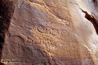
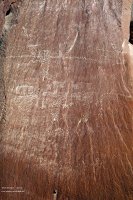
Shortly after 09:00 o'clock, we return into the Paria Canyon. Circa a hour later, between mile 25 & 26, the canyon becomes wider and a petroglyph panel requires a stop.
Petroglyph
Petroglyph
It begins the Kayenta formation and Shower Spring must be somewhere. Deep riparian vegetation and later the splashing water, betrays the source of the location. We stand knee deep in the water and refill the water bottles.
River View
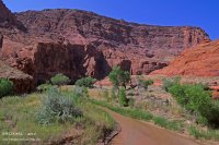
Shower Spring
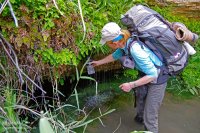
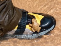
It is 11:00 o'clock and further goes, downwards in the canyon. A native comes together with me and defends his place steadfastly.
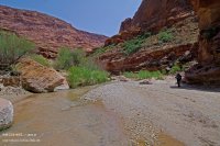
Canyon Downwards
Native
The sun loves us - it is above the 30 °C. After a shortly stop at a beautiful petroglyph panel with Big Horn Sheeps, we find a shady place with a Seep, close to mile 29. Lunchtime! Nuts, Granola bars and Beef Jerky are on the menu.
Big Horn Sheep Panel
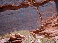
After this strengthener, we hike further through the beautiful Canyon, alternately in the water and through the riparian vegetation.
On Trail
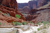
On Trail
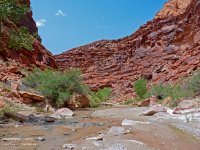
A "signpost" in the riverbed alerts us - the Bush Head Canyon is in the near. We arrived them, shortly before mile 31. The sun burns mercilessly. We enjoy the shadow, one mile further, at a rest.
Bush Head Sign
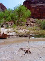
Bush Head Canyon
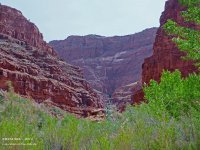
Now it's 04:00 pm. It is no use! We must further go on, that we don't have so many miles, to hike on the tomorrow's day.
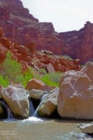
Little Waterfalls
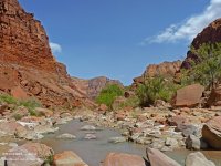
River Scenery
We leave, little time later, via the high-water-route the Paria River bed. Uphill and downhill. This path leads, along the inscription of F.T. Johnson from the year 1912, through a "stone-desert." Here above, is not any beautiful campsite.
High Water Route
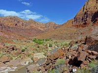
F.T. Johnson 1912
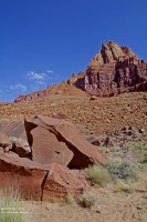
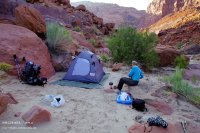
About 1.5 miles later, we leave that area in direction Paria River. Gotcha! A couple of time later a nice spot for camping. It also is enough for today. Our energy-level is nearly at the end, after 11 miles and 10.5 hours of hiking. It is 06:00 pm. Camp built up and first a break. After one strong coffee, we find a shallow position at the river in order to pump off waters for our supplies. Just one bottle, remain at the riparian area, in the water. Later we remove the red-brown mud of the wading boots in the soft flowing river. Time for the dinner. Mountain House Beef Stew is required.
3rd Campsite
Sunset
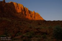
At nightfall, moon and venus are visible - very nice. I grab the well chilled bottle out from the river. We mix ourselves a drink "Pareah Spirit". River water, instant lemon granulate and rum. Cheers! Nice stuff, to let the day fade away.
Day 4: South of F.T. Johnson 1912 - Lee's Ferry
The last day begins about 05:30 am, with the accustomed procedures.
7:00 o'clock, we hike again, in the light of the rising sun, on the high water-route. After half a hour, the Flat Top Rock be to see, with dissimilar petroglyphs. We cross half a mile later the river, whose water is very refreshing.
Flat Top Rock
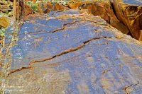
Flat Top Rock - Corner
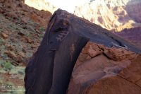
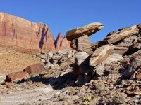
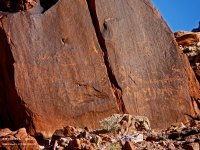
With mile 35 we reach one of the best sites of the Paria Canyon, with the most diverse and most beautiful rock art. Scorpion Rock, Upsidedown Rock and 10 minutes later the 10 Sheep Rock.
Scorpion Rock
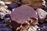
Hoodoo and Upsidedown Rock
10 Sheep Panel
After a river crossing, we happen to see the last and nicest campsite in the Paria Canyon. We still hike 1.5 miles, it is 09:30 o'clock. Time for a second breakfast, with most splendid sunshine. Further it goes. Mighty sand-dunes, are along the way. A bundle of old pipes, flowing water and much green. We hike the to the remnants of the Wilson Ranch site. Other historical markers in the Pariah Canyon will follow further.
Sand Dunes
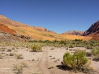
Wilson Ranch Site
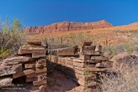
11:00 o'clock or so, we pass the GCNRA-Border-Line. 39 miles after the start at the Wire Pass, we are opposite the Dominguez pass and cross a last time the Paria River.
GCNRA-Border-Line
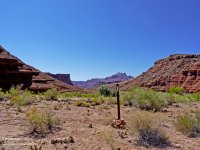
Paria River pano - near Spence Place

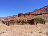
Further historical markers are at the trail to the Lonely Dell Ranch. Spence Place, a corral and an old shack. The Canyon becomes wider and wider.
Spence Place
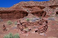
Old Corral
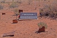
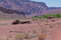
We pass mile 40. A last time goes it upward, in direction of civilization. An old pump, the graveyard of the ranch and old rusting farm equipment, invites to photo stops.
Old Graveyard
Old Farm Equipment
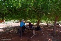
High Noon. We step on the beautiful terrain of the Lonely Dell ranch. Under shady trees, tables and benches stand, that we claim for a time for ourselves. After a short ranch-sightseeing, and a last look to the upper canyon, we say bye, bye you wonderful place of the southwest.
Picknick Area
Bye, Bye
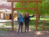
Only a scarce mile. After 4 days of wilderness and 41 miles of adventure, we are again at the RV, on the Long Term Parking Lot at Lee's Ferry. It is 01:00 pm. Garbage and poop-bags removal, boots cleaning and up-up to Lee's Ferry Campground. We let the day there fade away, peaceful and comfortably.
Conclusion:
The trip was strenuous, challenging, but: a unique, unforgettable and wonderful experience in our life.
The weather and trail conditions were outstanding. Temperatures between 12 °C and > 30 °C. The Buckskin Gulch was bone-dry. Wade or swim, through the often described pools, was not necessary. Disadvantage: Thru the past flashfloods, partially the gulch looks like a excessive cleaned floor - IMO.
The out-of-stock water, generated none of the beautiful light reflections, that let the sandstone of the gulch shining so singularly, consequently. The Paria River had low waters and secured consequently a quite rapid making progress, as far as one from fast can talk, with 19 as well as 25 kg of backpack on the back.
Only at the 4. crack, wearing of wading boots were necessary. My boots are canyoneering boots, made by 5.10, with of orthopedic insoles, for me a good election. No sand and sediment in the shoe, the insoles increased comfort and damping. Heike's wading shoes were of Merrell, however they were the purest "sand-gluttons".
Maps and Info. The good preparation was a big plus and we saved much time in the field. The payable one (available at the BLM), "Hiker's Guide to Paria Canyon", we had it first at Lee's Ferry in the hands. The brochure is informative, the maps however puristic. I had created my own printable topo-maps in advance. The mile-statements described by me begin at the Wire Pass and finish at Lee's Ferry. No division into Wire Pass, Buckskin Gulch and Paria Canyon takes place.
Resources of drinking water existed sufficiently. The Paria Canyon offers, numerous springs and seeps. But enough possibilities too, to pump waters at shallow riparian areas of the river.
On the question: Would you do the same again? My answer: Never, say never!
Personally I finds it more pleasantly, to split this trip, into two separated trips: Wire Pass - White House and White House - Lee's Ferry.
Are these 4 days enough? Yes, but's was very short. Depending on his own preferences, physique, weather and trail conditions, 5 - 7 days are a perhaps better choice.
Enjoy, have fun! And maybe see you on trail.
Michael
Featured image for home page:
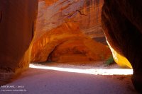
Day 0: Page/AZ - Lee' s Ferry - Wire Pass
10:00 am, trip from Page Lake Powell Campground & RV Resort, Page/AZ to Lee' s Ferry long term parking lot. At noon should be the pickup by End Of The Trail Shuttles w/Betty Price. After a mandatory stop at the Colorado River, we reached the parking lot.
Navajo Bridges

No cellphone reception. Two hiker from Colorado State, they returned straight from their Paria hike, kindly helped us. Thanks again guys. Short phone call with Bettys secretary, hers mother, the truck is in Page/AZ to the repair and the departure retards around 2 hours. Finally, Betty with hers roomy 2004er Chevy Trailblazer came. Luggage load up and: „UP, UP on the way“!
Betty is a very nice elder lady, who operates the shuttle service since over 20 years. She knows about the local roads, geology, flora and fauna and told some stories from the past.
Lee's Ferry long term parking lot

05:00 pm or so, we reach the parking lot at the Wire Pass TH. Now, tent build up and relaxing afterwards.
CS @ Wire Pass

We have a beautiful overview on the parking lot, to observe hikers on their way back from The Wave. Most of them were tired, but with a broad grin in the face. The parking lot empties. We come with a Canadian couple into a very nice discussion. They were in the Buckskin Gulch area, since they did not catch permits for the Wave. Like we, they love this area. Before they leave, they were very friendly and carried out our garbage bag, thus I have on the next day, to bear less.
Shortly after dark, we crawl away into the tent - good night!
Day 1: Wire Pass TH - Paria River, below the Confluence
The night was quiet, until 03:00 o'clock in the morning. A group that we later met again in the gulch, set up her camp. The day begins 05:00 am. Coffee cooking, a few granola bars for the breakfast and pack the backpacks.
07:00 am, start into the Wire Pass. The Buckbrush blooms and waste its sweetness on the desert air. The two known obstacles were, how ever, no problem. The jammed log in the narrows, jammed in the height for years, lies at the ground now.
Blooming Buckbrush in Wire Pass

After altogether 1,75 miles, we reach the confluence with the Buckskin Gulch. The sun illuminates the wall at the alcove, on the right side, so that the snake of the petroglyph panel, who extends from the alcove to the end of the wall, is well visible.
The gulch is bone-dry, only the known pool still has some water. The big alcove is, after 3 miles, to see. Some alcoves are on the way to the first boulder section, however no one is as beautiful as the first one. We reach the section after 4 miles. A few scramble and we leave the first prominent boulders behind ourselves.
Alcove in the Buckskin

Boulder

After a short rest, it goes further in direction Middle Route Exit. The path of the gulch here, is changing between pebbly, sandy, and even uphill. It we more narrowly and darker in the gulch.
The walls partly are covered of Desert Varnish. The sandstone shows beautiful structures, according to the light in gray, brown, gold and red shines. It is a continuous direction changing, from the left to the right at the cracks.
Heike @ The Slot

Sandy Trail

Carved Sandstone

The notorious cesspool, shortly before Middle Route Exit, belongs to the past. The last flash floods "washed away" it. It becomes light. A known crack becomes visible, we reached the Middle Route Exit after almost 8 miles.
Crack @ Middle Route Exit

It is 01:00 pm, time for the lunch and the petroglyphs, who I had overlooked 2009. Now I can view them.
Middle Route Exit and Upper Crack (left)

Petroglyph Panel 1 of 4

We hike the next 5.5 miles to the confluence of Paria River, on known terrain. However nothing is, like in 2009. The gulch is really bone-dry and looks like an over cleaned, brightly polished. The reflections of the light are missing in the water, who brings the sandstone of the walls so singularly to the radiance. Circa 04:00 pm and another 4 miles, we reached Boulder Jam. Hey, what's that? Rope Mania.
Boulder Jam

Rabbit Hole

The debris vanished. We rappel into the Rabbit Hole and crawls to the other side. Cool. Time for a rest. Suddenly voices. We meet the 3-o’clock-campers of the Wire Pass. A nice small talk. I made a memory-photo for them, and they continue her hike. It becomes time also for us to hike further. Heya, some things don't change. The old wheel and the wedged barrel, still are there. Shortly before we reach the campsite at the confluence, seeps comes out from the ground of the gulch. This clear water has a leisurely flow to the Paria River. After 13,5 miles on trail, we crossed the confluence. The Paria has very little water. It's very clear.
We hike the river downwards, we need a campsite for the night. The first campsite is busy. A few yards further, on the left side and 0.5 miles below the Confluence, we find our campsite, above the Paria River.
1th Campsite

Almost 14 miles and 12 hours of hiking - time for the Dinner: Mountain House’s Chili Mac with Beef - yummy and a coffee as dessert.
With the Katadyn Vario, we refilled our water bottles with the water from the river. It becomes slow dark. A little bit relaxing, a drink, that was it for today.
Day 2: Paria River, below the Confluence - The Hole
After a relaxing night, the day begins about 06:00 am with the accustomed procedure. Cook Coffee, for breakfast few Granola bars and Beef Jerky, later backpacks packing.
08:00 am and 12 °C. It's refreshingly cool. We are again on the trail. The Paria canyon narrows are visible. The muddy riverbed of the Paria will be innumerable times to still cross today. The walls of the Canyons are steep and looks majestically, numerous alcoves and cracks are to see also. Shortly after mile 15, we reach the of far visible Wall Spring, with her green grew.
Paria Canyon Alcove

Walls and Portal

Wall Spring

Near mile 17 we pass the Abandoned Meander (Oxbow) and approves us a rest. Big Spring is before the second crack, that we reach, almost 11:00 am. The filling of the water bottles lasts only few seconds, so strongly the water flow is here. Even several populations of fishes are in the water of the Paria River, in the sizes of about 2 to 6 cm of length, to see.
Big Spring

Between the 2. and 3. crack, we hike through the 'Goosenecks' - wonderful. The water of the Paria extends from canyon wall to canyon wall.
Near mile 20 the 4. crack. It's 01:30 pm, time for the Lunch with nuts and Beef Jerky. The hiking boots are swap to the wading boots. The water of the river becomes more and more deeply.
4th Crack

Have a break

At mile 22, we pass the Boulder-Alley. Gigantic boulders lie in the riverbed, they are good to pass. One little later, we reaches the fragments of the old historic Adam's Water Pump (Judd Hollow Pump). A beautiful place with old Cottonwood trees, that invite formally to a rest. Lizzy welcomes us.
Adam's Water Pump

Rest on a beautiful place

Lizzy

It almost is 04:00 pm. Time to hike again, and to find a campsite. With mile 23, we see a curiosity again. Several springs step out of the ground of the Paria Canyon. The sand around the exit-openings is very fine and deep (like quicksand).
Springs

We reach The Hole one mile later, a niche in the western Canyon wall later more, however, to it. The campsite, on opposite, is totally overgrown by shrubs and plants. Here nobody camped more, for a long long time. We find a few yards downriver, almost 05:30 pm, a beautiful site.
2nd Campsite

The Hole

Tent build up and first, cooking a wonderful cup of coffee. What for a relief! Later, we walk up to The Hole, in order to refill our water bottles. Water is running from the canyon wall, which fills a big pool. The walls of The Hole, partially have a luxuriant green plant growing.
We spend the evening, after 10 miles of canyon hiking and 12 hours on the legs, in the soft sand of our campsite - a splendid little spot in the middle of the nature. For dinner, there are Beef Stroganoff with Noodles by Mountain House - delicious. To advanced time, we go into the tent and asleep someday, accompanies from the concert of the frogs.
Day 3: The Hole - South of F.T. Johnson 1912
06:00 am: "And daily, the marmot greets!" Breakfast, backpacks packing. 07:45 am, we are on the Trail. At mile 25, we arrive the Wrather Canyon area. There is also flowing water. The path through the green canyon leads us steeply upward. We set aside our heavy backpacks in the canyon. After plentiful 0.5 miles,
Trail to Wrather Arch

we reaches the arch, that seen of the lower path, looks like an alcove. Wow, what for a colossus! The outlook of here above, is very beautiful.
Wrather Arch from behind

Canyon View

Shortly after 09:00 o'clock, we return into the Paria Canyon. Circa a hour later, between mile 25 & 26, the canyon becomes wider and a petroglyph panel requires a stop.
Petroglyph

Petroglyph

It begins the Kayenta formation and Shower Spring must be somewhere. Deep riparian vegetation and later the splashing water, betrays the source of the location. We stand knee deep in the water and refill the water bottles.
River View

Shower Spring

It is 11:00 o'clock and further goes, downwards in the canyon. A native comes together with me and defends his place steadfastly.
Canyon Downwards

Native

The sun loves us - it is above the 30 °C. After a shortly stop at a beautiful petroglyph panel with Big Horn Sheeps, we find a shady place with a Seep, close to mile 29. Lunchtime! Nuts, Granola bars and Beef Jerky are on the menu.
Big Horn Sheep Panel

After this strengthener, we hike further through the beautiful Canyon, alternately in the water and through the riparian vegetation.
On Trail

On Trail

A "signpost" in the riverbed alerts us - the Bush Head Canyon is in the near. We arrived them, shortly before mile 31. The sun burns mercilessly. We enjoy the shadow, one mile further, at a rest.
Bush Head Sign

Bush Head Canyon

Now it's 04:00 pm. It is no use! We must further go on, that we don't have so many miles, to hike on the tomorrow's day.
Little Waterfalls

River Scenery

We leave, little time later, via the high-water-route the Paria River bed. Uphill and downhill. This path leads, along the inscription of F.T. Johnson from the year 1912, through a "stone-desert." Here above, is not any beautiful campsite.
High Water Route

F.T. Johnson 1912

About 1.5 miles later, we leave that area in direction Paria River. Gotcha! A couple of time later a nice spot for camping. It also is enough for today. Our energy-level is nearly at the end, after 11 miles and 10.5 hours of hiking. It is 06:00 pm. Camp built up and first a break. After one strong coffee, we find a shallow position at the river in order to pump off waters for our supplies. Just one bottle, remain at the riparian area, in the water. Later we remove the red-brown mud of the wading boots in the soft flowing river. Time for the dinner. Mountain House Beef Stew is required.
3rd Campsite

Sunset

At nightfall, moon and venus are visible - very nice. I grab the well chilled bottle out from the river. We mix ourselves a drink "Pareah Spirit". River water, instant lemon granulate and rum. Cheers! Nice stuff, to let the day fade away.
Day 4: South of F.T. Johnson 1912 - Lee's Ferry
The last day begins about 05:30 am, with the accustomed procedures.
7:00 o'clock, we hike again, in the light of the rising sun, on the high water-route. After half a hour, the Flat Top Rock be to see, with dissimilar petroglyphs. We cross half a mile later the river, whose water is very refreshing.
Flat Top Rock

Flat Top Rock - Corner

With mile 35 we reach one of the best sites of the Paria Canyon, with the most diverse and most beautiful rock art. Scorpion Rock, Upsidedown Rock and 10 minutes later the 10 Sheep Rock.
Scorpion Rock

Hoodoo and Upsidedown Rock

10 Sheep Panel

After a river crossing, we happen to see the last and nicest campsite in the Paria Canyon. We still hike 1.5 miles, it is 09:30 o'clock. Time for a second breakfast, with most splendid sunshine. Further it goes. Mighty sand-dunes, are along the way. A bundle of old pipes, flowing water and much green. We hike the to the remnants of the Wilson Ranch site. Other historical markers in the Pariah Canyon will follow further.
Sand Dunes

Wilson Ranch Site

11:00 o'clock or so, we pass the GCNRA-Border-Line. 39 miles after the start at the Wire Pass, we are opposite the Dominguez pass and cross a last time the Paria River.
GCNRA-Border-Line

Paria River pano - near Spence Place

Further historical markers are at the trail to the Lonely Dell Ranch. Spence Place, a corral and an old shack. The Canyon becomes wider and wider.
Spence Place

Old Corral

We pass mile 40. A last time goes it upward, in direction of civilization. An old pump, the graveyard of the ranch and old rusting farm equipment, invites to photo stops.
Old Graveyard

Old Farm Equipment

High Noon. We step on the beautiful terrain of the Lonely Dell ranch. Under shady trees, tables and benches stand, that we claim for a time for ourselves. After a short ranch-sightseeing, and a last look to the upper canyon, we say bye, bye you wonderful place of the southwest.
Picknick Area

Bye, Bye

Only a scarce mile. After 4 days of wilderness and 41 miles of adventure, we are again at the RV, on the Long Term Parking Lot at Lee's Ferry. It is 01:00 pm. Garbage and poop-bags removal, boots cleaning and up-up to Lee's Ferry Campground. We let the day there fade away, peaceful and comfortably.
Conclusion:
The trip was strenuous, challenging, but: a unique, unforgettable and wonderful experience in our life.
The weather and trail conditions were outstanding. Temperatures between 12 °C and > 30 °C. The Buckskin Gulch was bone-dry. Wade or swim, through the often described pools, was not necessary. Disadvantage: Thru the past flashfloods, partially the gulch looks like a excessive cleaned floor - IMO.
The out-of-stock water, generated none of the beautiful light reflections, that let the sandstone of the gulch shining so singularly, consequently. The Paria River had low waters and secured consequently a quite rapid making progress, as far as one from fast can talk, with 19 as well as 25 kg of backpack on the back.
Only at the 4. crack, wearing of wading boots were necessary. My boots are canyoneering boots, made by 5.10, with of orthopedic insoles, for me a good election. No sand and sediment in the shoe, the insoles increased comfort and damping. Heike's wading shoes were of Merrell, however they were the purest "sand-gluttons".
Maps and Info. The good preparation was a big plus and we saved much time in the field. The payable one (available at the BLM), "Hiker's Guide to Paria Canyon", we had it first at Lee's Ferry in the hands. The brochure is informative, the maps however puristic. I had created my own printable topo-maps in advance. The mile-statements described by me begin at the Wire Pass and finish at Lee's Ferry. No division into Wire Pass, Buckskin Gulch and Paria Canyon takes place.
Resources of drinking water existed sufficiently. The Paria Canyon offers, numerous springs and seeps. But enough possibilities too, to pump waters at shallow riparian areas of the river.
On the question: Would you do the same again? My answer: Never, say never!
Personally I finds it more pleasantly, to split this trip, into two separated trips: Wire Pass - White House and White House - Lee's Ferry.
Are these 4 days enough? Yes, but's was very short. Depending on his own preferences, physique, weather and trail conditions, 5 - 7 days are a perhaps better choice.
Enjoy, have fun! And maybe see you on trail.
Michael
Featured image for home page:

