- Joined
- Dec 5, 2017
- Messages
- 1,239
We're working on plans for our Escalante backpacking trip April 17-23. Our goal is to start down Little Death Hollow, spend a few days exploring the other side of the Escalante (Cosmic Ashtray etc), then head back out Wolverine. We'll probably base camp in the Horse Canyon area unless there are reliable water sources on the south/west side of the river.
1) How high might the Escalante water be in the Horse Canyon area? Will we be able to cross safely? (I'm 5'4" and don't think I'm comfortable swimming with my pack to get across.) I've looked at the USGS data and it looks quite low, but I've read that the water level will be higher downstream of Boulder Creek.
2) Are there reliable, sufficient-for-filtering-without-worrying water sources on the south/west side of the Escalante in the Red Breaks/Spencer Flats/Cosmic Ashtray areas? If so, I'd love info if you think a loop is possible. I'm ok with one dry camp but can't carry multiple days' worth of water.
3) What is water like in the slots? How big are pools in LDH? If we dayhike Zebra/Tunnel or Bighorn (or make it there as part of a loop) what conditions might we expect?
4) If we head into the Gulch or Harris Wash, what are those like?
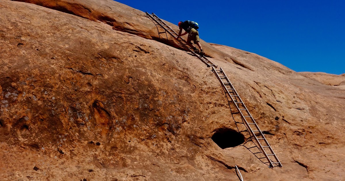
5) I assume we'll exit the river at the sand slide rather than trying the ladders. But have any of you done the ladders recently and think we should step out of our comfort zone and try them? (If so, how well are they bolted into the rock???)
I've studied ideas people shared from my query last Sept. If anyone has additional suggestions, I welcome your help!
Thanks so much.
1) How high might the Escalante water be in the Horse Canyon area? Will we be able to cross safely? (I'm 5'4" and don't think I'm comfortable swimming with my pack to get across.) I've looked at the USGS data and it looks quite low, but I've read that the water level will be higher downstream of Boulder Creek.
2) Are there reliable, sufficient-for-filtering-without-worrying water sources on the south/west side of the Escalante in the Red Breaks/Spencer Flats/Cosmic Ashtray areas? If so, I'd love info if you think a loop is possible. I'm ok with one dry camp but can't carry multiple days' worth of water.
3) What is water like in the slots? How big are pools in LDH? If we dayhike Zebra/Tunnel or Bighorn (or make it there as part of a loop) what conditions might we expect?
4) If we head into the Gulch or Harris Wash, what are those like?
5) I assume we'll exit the river at the sand slide rather than trying the ladders. But have any of you done the ladders recently and think we should step out of our comfort zone and try them? (If so, how well are they bolted into the rock???)
I've studied ideas people shared from my query last Sept. If anyone has additional suggestions, I welcome your help!
Thanks so much.

.jpg")
")