Uintas Conditions 2016

A mini trip report after our overnighter in Amethyst Basin (in Friday 6/17, out Saturday 6/18):

Bugs: none but I am sure they will be there soon
Trail conditions: as expected at this time of the year - a lot dry but also a mix of mud and water, and snow up higher
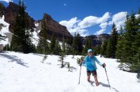
Snow level: we didn't come across any snow patches until 10,000 feet, then pretty much all snow from around 10,500 feet
People: pretty quiet - we saw only a few other groups Friday, most camping is meadows and below it is wet/a lot of snow around lakes still but melt is happening quickly. We saw a few people heading in Saturday but mostly day hikers.

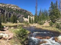
The ice is disappearing on BR24/Emerald Lake
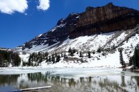
160617 Uintas Amethyst Basin 024 (1280x853).jpg

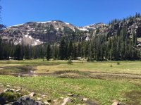
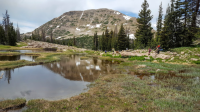
Postholing on the way up to Amethyst Lake
160617 Uintas Amethyst Basin 034 (1280x852).jpg

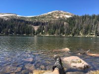
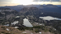
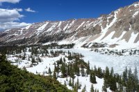
We climbed a rocky section not covered in snow to get this great view down to Amethyst Lake
160617 Uintas Amethyst Basin 044 (1280x852).jpg
 
Thanks for the report. A friend and I stayed at Christmas Meadows campground Friday night. First campsite in. Looking forward to more hiking.
 
Headed up to the eastern uintas on June 26 and we'll be on the highline trail for part of out trip. Anyone have input on what we're gonna run into? We'll be going by chepeta lake, atwood lake, and the chain lakes area I believe
 
Headed up to the eastern uintas on June 26 and we'll be on the highline trail for part of out trip. Anyone have input on what we're gonna run into? We'll be going by chepeta lake, atwood lake, and the chain lakes area I believe
Are you starting at the Ledi Peak eastern trailhead? It is pretty high and may still be in snow. The road to it and the road to Chepeta also may not even be open. Call the ranger station for the eastern Uintas to get that beta.
 
Might be a good weekend to hit up Naturalist Basin before the crowds get there!
 
I needed to get out of the house on Saturday, so I hiked up to Jordan Lake in Naturalist Basin. Snow is pretty much all gone. there were some spots around Jordan Lake. But nothing too big. There were a decent amount of people up there too, not a ton around Jordan Lake. But I didn't really explore how many were camping by the lake.

Here's the stream you cross before Jordan Lake.
Naturalist Stream.jpg


Looking at the waterfall below Blue and Morat Lakes
Naturalist basin.jpg


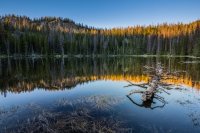
Boots up at Jordan Lake
Jordan Lake.jpg
 
Ruth Lake area is completely clear of snow, lakes are melted out, it's turning green, and there are even some flowers coming in. There were a few mosquitos. I would say the Uintas are officially open for business. Last Saturday.
 
When I got back to my car at the Highline Trailhead, Saturday around 7:30 pm, I saw and talked with a couple college aged guys headed out to do the Highline Trail to Chepeta Lake. They did have ice axes and crampons just in case. One was from Boston and the other just flew in hours before from Minnesota. I told them to be careful of altitude sickness. Hopefully they enjoy their trip...and if you guys happen to come on here and read this, I hope to see a report of your trip!
 
We were in town last weekend and interested in snagging King's Peak. Being that we're from the east coast, we don't get out to the SLC area very often, so we wanted to try and fit it in, however, based on the intell we got it wasn't in the cards without some major snow gear and a little more time. My understanding is there's probably still several feet consistently towards the peak.

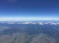
Anyway, I did manage to snag this shot of the Uintas from the plane on the flight home on Sunday. Thought you all might like to see it to get a different perspective on current conditions. I think Kings is the peak in the middle. Zoom in for details.

IMG_4226.JPG ]
 
Last edited:
Taking my family out on the Clyde Lake Loop this week while drenched in repellant. I'm hoping to shoot off before they wake the next morning to bag Mount Watson.

We did the trip Tuesday night.

Let me know how it is. I was planning on doing the same this weekend.

Just a few patches of snow here and there. The trail is clear most of the way, but gets real muddy and is under water in a few spots, requiring some creative bypasses. Mosquitos were abundant, as expected, but we weren't bothered too bad. More buzzing than biting but everyone did get a couple of bites.

Here's a shot approaching Clyde Lake with Mount Watson in the background.
upload_2016-6-30_20-4-50.png

And a shot of the whole basin from Mount Watson. Bald Mountain, the Notch, Hayden Peak, and lots of others can all be seen in the mix.
upload_2016-6-30_20-11-6.png

I'd venture to say everything accessible by trail is safely doable now without any special gear...except for maybe Dead Horse Pass on the Highline?
 
I did the Clyde lake loop with my son this weekend. Big mistake being a holiday weekend!
The hike was great, bugs were bad but manageable. We had a deer come through our campground a couple times and seeing the reaction on my sons face while he watched him was priceless!
Other than that we had people doing fireworks and shooting mortars over the lake. Then a fight broke out among campers that confronted the people shooting them off. 2am people were blowing whistles and screaming.
Other than that it was a memorable outing and I got some great time with my son!
 
Other than that we had people doing fireworks and shooting mortars over the lake. Then a fight broke out among campers that confronted the people shooting them off. 2am people were blowing whistles and screaming.
Other than that it was a memorable outing and I got some great time with my son!

Oh my. Yeah, I stay the heck away from places like that on holiday weekends because you never know what kind of BS you're going to encounter. Glad you all still managed to have a memorable time. What lake did you end up camping at? Where was all the commotion? I'm guessing that was Wall Lake?
 
Back
Top