Navigation
Install the app
How to install the app on iOS
Follow along with the video below to see how to install our site as a web app on your home screen.
Note: This feature may not be available in some browsers.
More options
Style variation
You are using an out of date browser. It may not display this or other websites correctly.
You should upgrade or use an alternative browser.
You should upgrade or use an alternative browser.
Uintas Conditions 2014
- Thread starter Udink
- Start date
- Joined
- Aug 9, 2007
- Messages
- 12,960
Yep, all today. It grew pretty overcast and windy while I was up there.
Same down here. I was out doing work hikes up near Ogden and had to abandon that plan after doing 2 out of 4 hikes that I had planned to do. Nice to see the Uintas will be ready soon.
Ndheiner
Member
- Joined
- Jan 17, 2012
- Messages
- 60
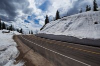
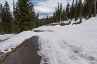
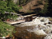
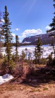
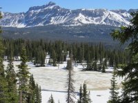
More pics to add to this groovy thread. We are getting close! these pics are from Sunday 6/1/14. The lower trailheads (shingle creek, north fork provo, etc) are definitely open, but beware the river crossings might be impassible due to run-off.
Roughly Trial Lake elevation on up is where the split board and x-country skis need to be utilized for travel.
Hayden Peak Overlook.
Trial Lake Dam.
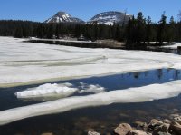
Roughly Trial Lake elevation on up is where the split board and x-country skis need to be utilized for travel.
Hayden Peak Overlook.

Trial Lake Dam.

- Joined
- Aug 9, 2007
- Messages
- 12,960
well that happened in a hurry......I'm assuming I'll be able to go anywhere I want in the Uintas in 25 days?
Some passes and higher elevation stuff may not be clear, but most likely, yes.
Yellowstone 1
Blah!
- Joined
- Jan 23, 2012
- Messages
- 601
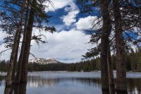
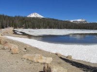
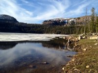
As of yesterday the only lake left holding some ice along the Mirror Lake Highway was Butterfly. However the access to either Moosehorn and Butterfly Campgrounds is probably at least a few weeks away. The road to the Mirror Lake campground looked open. The run off on the Provo has dropped quite a bit from last weekend and the water is no longer muddy.
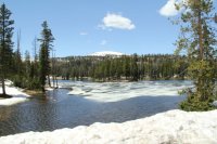
Butterfly Lake 06/07/14

Butterfly Lake 06/07/14
mccrookston
New Member
- Joined
- Apr 1, 2012
- Messages
- 3
Aldaron
Member
- Joined
- Jun 16, 2012
- Messages
- 1,487
Well, it looks like I'm going to be able to fly back to Utah this week for work, so I'm planning on spending the weekend going backpacking. The Uintas are looking good...I'm hoping I can reach West Fork Blacks Fork in a rental car.
It's surprising how sad I get when I look at a map of the Rockies while sitting here in Alabama...
It's surprising how sad I get when I look at a map of the Rockies while sitting here in Alabama...
Don't like ads? Become a BCP Supporting Member and kiss them all goodbye. Click here for more info.

