Uintas Conditions 2014

An interesting illustration of how fast things can change in June....

Google Earth, June 4, 2013 of Cutthroat Lake:
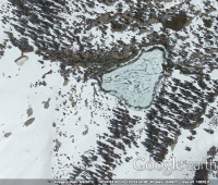
upload_2014-5-19_23-34-6.png

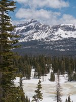
A photo from my trip on June 15, 2013. Just 11 days later:

uintas-hiking-2013-14-jpg.11498
 
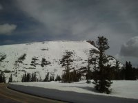
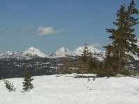
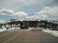
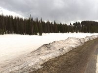
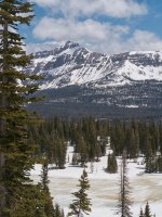
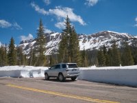
2014-05-20 10.32.14.jpg 1400603569488.jpg 1400603547723.jpg I was just up there today as I had business in Kamas. Drove to where UDOT is clearing the last pass off. There is still snow up high, and some snow on the roads too. Mirror lake is still iced over. I attached some photos I took this morning. These photos are from Bald Mountain Pass, 1st is Bald mountain looking NNW, 2nd is Notch Mountain, and 3rd is Murdock Mountain. No side road open, still a great deal of snow... Sorry for the rookie photos. I know backpacking, not very good at photographing.
 
I was just up there today as I had business in Kamas. Drove to where UDOT is clearing the last pass off. There is still snow up high, and some snow on the roads too. Mirror lake is still iced over. I attached some photos I took this morning.

Was the gate open and you were able to drive as far as you wanted?
 
Of May? Where you heading?
Yep, in about a week and a half. I'll probably just head up there and go wherever looks good, maybe north or west past Trial Lake (like I attempted a little too early last year) or, if I can get to the Bald Mountain trailhead, head northwest toward Clegg or Dean lakes.
 
Hmmmm... I'd bet that your results will be similar to last year, but I am looking forward to seeing the pictures! :)

What date did you try last year when you hit all the snow?
 
Hmmmm... I'd bet that your results will be similar to last year, but I am looking forward to seeing the pictures! :)

What date did you try last year when you hit all the snow?
I agree, but this time I'll stick it out (and hope to have at least one partner to suffer with me!). It was May 24th last year. Compare Dwm's image from above with mine from roughly the same spot last year, and it looks like there is more snow this year.
 
May 25 (Sunday recon.)

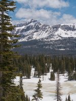
Hayden Peak and a view of the snow cover at the base. PIcture taken from the overlook above Moosehorn Lake near Mirror Lake.
uintahsConditions1.jpg

Long view of Rocky Sea Pass
uintahsConditions2.jpg

Highline Trailhead turnoff at Hayden Pass at 10.347' @Dennis .. the Trial/Crystal lake trailhead turnoff you are yearning to use had about half this snow depth. It was also not plowed.
uintahsConditions3.jpg
 

Attachments

  • uintahsConditions1.jpg
    uintahsConditions1.jpg
    132.4 KB · Views: 14
  • uintahsConditions1.jpg
    uintahsConditions1.jpg
    132.4 KB · Views: 14
Back
Top