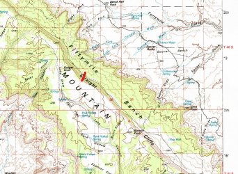
I do not know what is wrong with me. In June of 2020, January of 2021, and June of 2021, I was up on the top of Kaiparowits Plateau and I told myself - Never again! The water was unreliable, the springs were spaced to far apart and the water tasted HORRIBLE. Then you have those little biting flies or gnats that make you want to go screaming off through the sagebrush. Then there is that god awful climb, start at 6,000 feet and in a 1/2 mile crest out at over 7,000 feet. Nope I said, been there, done that, got the bug bites to prove it!
Guess where I was in March of 2022? At the base of the Staight Cliffs and if the 1,000 foot climb wasn't bad enough lets make it 1,500 foot climb this time.
What started this was that one day after work I read a single sentence about a stock trail going through a spot called THE GOLDEN STAIRS. So, with hours and hours of research I was able to expand that single sentence to 4 sentences.
An old pack trail started at or near Coyote Wells and climbed to the summit. It went through a spot called the GOLDEN STAIRS. The GOLDEN STAIRS were made by dynamiting out a sandstone ledge giving stock a way up. Hmmm, that is only three sentences....oh, well I guess that is enough.
After driving from my home in Northern California, across Nevada, through a springtime snowstorm, into Utah, to Escalante, down Hole-in-the-Rock road, down a faint spur road, I am as close as I was going to get to Coyote Wells in a car.
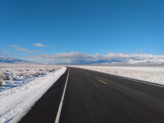
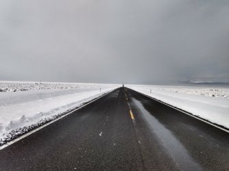
HIGHWAY 50 SOMEWHERE IN NEVADA
Parking at a small turnout, I locked the car, shouldered my pack, and headed west towards the straight cliffs.
I was off, just me and the desert, a 30lb pack and hopefully no bugs! Ten minutes later, I remember I left something at the car. So 15 minutes later I locked the car, shouldered my pack, and headed west towards the straight cliffs.
Soon I was at a spring at the base of Fifty Mile Bench. Unmarked on my maps, perhaps it is Coyote Wells, regardless I am weighed down with 16 lbs of water and certainly do not need any more water, so I start ascending Fifty Mile Bench. I see no sign of a defined trail and there is nothing on any of the maps that show a trail either, as I near the top I follow a short section of what appears to be a trail along a ridge for a couple of hundred yards before it fades out into the sagebrush on the bench.
I keep following what feels like the natural path to the base of the Straight Cliffs. I am veering off to the left somewhat but since I have no idea where the trail is it doesn't really matter which way I go. Suddenly, there appears to be a small cairn, then a little further on, two more. Then, just like that, I am at the trail at the bottom of the Straight Cliffs. I cannot believe my luck!
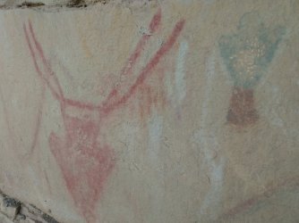
Up I go about 3/4 of the way where you come across some cool rock art and soon afterwards I am climbing up through a notch in the sandstone with some man-made steps and I assume this is the GOLDEN STAIRS (imagine heavenly music if you wish) and after one more steep section I am at the top!
I setup camp nearby and then proceed to spend the next two days in a futile attempt trying to find a trail out of the canyon on to the Plateau. The trail winds it's way southward climbing an arm of the canyon but I lose it under the snow that is covering the head of the canyon.
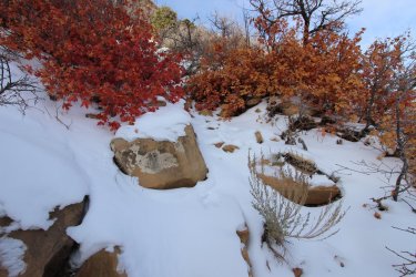
I try a half-dozen different ways each day but am unable to find the trail under all that snow that will take me through the last ledge and to the top. After two days I give up and retrace my route. Going back down the steep section, through the GOLDEN STAIRS, past the rock art, past the cairns, down the ridge with the short trail and I take a break before reaching the spring.
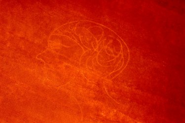
ROCK ART ON THE STRAIGHT CLIFFS
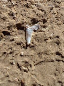
After spending time snacking and hydrating and enjoying the views it is time to head out. After 15 minutes I go to stand up and I use the rock next to me to get my 60 year old butt off the ground when something catches my eye. Well, look at that! Here at over 5,000 feet above sea level, in a desert, is a sharks tooth!
SHARKS TOOTH
What is this? A fetish? An Idol? A cool looking rock? What do you see?
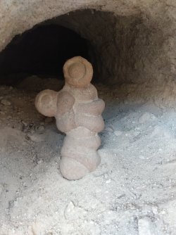
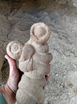
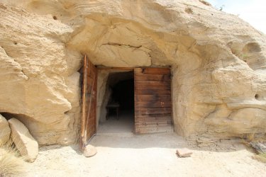
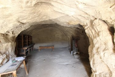
After marveling at it for a little while it is time to head back to the car where I try to salvage the trip by going to check out a couple of sites including the COSMIC NAVEL/ASHTRAY, Chimney Rock, Batty Pass Cave, and such..
BATTY PASS CAVE
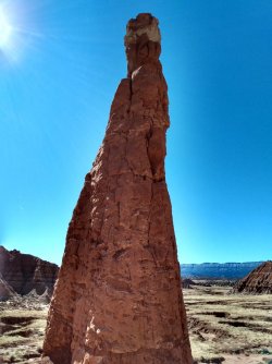
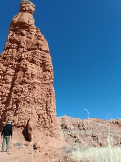
AETSCHI BAETSCHI TOWER (See all the snow on the Straight Cliffs in the background?)
Most people miss out and drive right past Dance Hall Rock and if they even do stop at it is usually just to hear the echo in the Ampitheater area, but if you climb up to top there are giant potholes up there and around on the sides there are historic carvings in the rock.
PIONEER ROCK ART - DANCE HALL ROCK
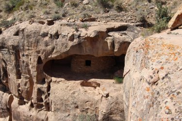
RUINS ON THE STRAIGHT CLIFFS
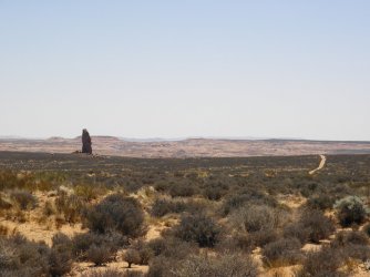
CHIMNEY ROCK
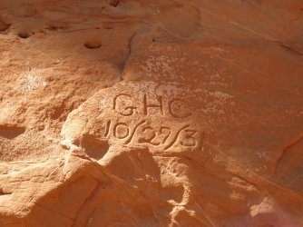
One of the dozens of names scratched into Chimney rock
Then it is back across Nevada, into California, up the driveway to home. I unpack, take a shower, do laundry, go to bed only to wake the next morning just to go back to work.
Guess where I was in March of 2022? At the base of the Staight Cliffs and if the 1,000 foot climb wasn't bad enough lets make it 1,500 foot climb this time.
What started this was that one day after work I read a single sentence about a stock trail going through a spot called THE GOLDEN STAIRS. So, with hours and hours of research I was able to expand that single sentence to 4 sentences.
An old pack trail started at or near Coyote Wells and climbed to the summit. It went through a spot called the GOLDEN STAIRS. The GOLDEN STAIRS were made by dynamiting out a sandstone ledge giving stock a way up. Hmmm, that is only three sentences....oh, well I guess that is enough.
After driving from my home in Northern California, across Nevada, through a springtime snowstorm, into Utah, to Escalante, down Hole-in-the-Rock road, down a faint spur road, I am as close as I was going to get to Coyote Wells in a car.
HIGHWAY 50 SOMEWHERE IN NEVADA


Parking at a small turnout, I locked the car, shouldered my pack, and headed west towards the straight cliffs.
I was off, just me and the desert, a 30lb pack and hopefully no bugs! Ten minutes later, I remember I left something at the car. So 15 minutes later I locked the car, shouldered my pack, and headed west towards the straight cliffs.
Soon I was at a spring at the base of Fifty Mile Bench. Unmarked on my maps, perhaps it is Coyote Wells, regardless I am weighed down with 16 lbs of water and certainly do not need any more water, so I start ascending Fifty Mile Bench. I see no sign of a defined trail and there is nothing on any of the maps that show a trail either, as I near the top I follow a short section of what appears to be a trail along a ridge for a couple of hundred yards before it fades out into the sagebrush on the bench.
I keep following what feels like the natural path to the base of the Straight Cliffs. I am veering off to the left somewhat but since I have no idea where the trail is it doesn't really matter which way I go. Suddenly, there appears to be a small cairn, then a little further on, two more. Then, just like that, I am at the trail at the bottom of the Straight Cliffs. I cannot believe my luck!
Up I go about 3/4 of the way where you come across some cool rock art and soon afterwards I am climbing up through a notch in the sandstone with some man-made steps and I assume this is the GOLDEN STAIRS (imagine heavenly music if you wish) and after one more steep section I am at the top!
I setup camp nearby and then proceed to spend the next two days in a futile attempt trying to find a trail out of the canyon on to the Plateau. The trail winds it's way southward climbing an arm of the canyon but I lose it under the snow that is covering the head of the canyon.

I try a half-dozen different ways each day but am unable to find the trail under all that snow that will take me through the last ledge and to the top. After two days I give up and retrace my route. Going back down the steep section, through the GOLDEN STAIRS, past the rock art, past the cairns, down the ridge with the short trail and I take a break before reaching the spring.
ROCK ART ON THE STRAIGHT CLIFFS

After spending time snacking and hydrating and enjoying the views it is time to head out. After 15 minutes I go to stand up and I use the rock next to me to get my 60 year old butt off the ground when something catches my eye. Well, look at that! Here at over 5,000 feet above sea level, in a desert, is a sharks tooth!
SHARKS TOOTH

What is this? A fetish? An Idol? A cool looking rock? What do you see?


After marveling at it for a little while it is time to head back to the car where I try to salvage the trip by going to check out a couple of sites including the COSMIC NAVEL/ASHTRAY, Chimney Rock, Batty Pass Cave, and such..
BATTY PASS CAVE


AETSCHI BAETSCHI TOWER (See all the snow on the Straight Cliffs in the background?)


Most people miss out and drive right past Dance Hall Rock and if they even do stop at it is usually just to hear the echo in the Ampitheater area, but if you climb up to top there are giant potholes up there and around on the sides there are historic carvings in the rock.
PIONEER ROCK ART - DANCE HALL ROCK

RUINS ON THE STRAIGHT CLIFFS

CHIMNEY ROCK

One of the dozens of names scratched into Chimney rock

Then it is back across Nevada, into California, up the driveway to home. I unpack, take a shower, do laundry, go to bed only to wake the next morning just to go back to work.
Last edited:

