Surreal Sidestep Canyon

Agree, it can be done, we just need lots of time to explore and maybe more experience than Rick and I have..... it's a very unusual and cool surreal looking area. We need to start earlier one day, so we have enough time to explore. Those winter days are so short. :rolleyes:
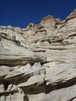
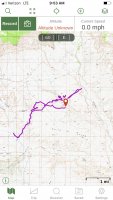
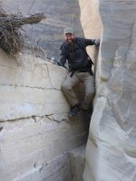
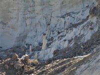
We went back to Sidestep yesterday and I tried to pay attention to how we got in and out. We tend to search around for a way to downclimb in that's reasonable and here's the way we found yesterday. I also marked on our track a "cow path" that we took to get out. I use the quotes as it is really steep but there's no real climbs, you could use it to go in and backtrack into the canyon if you don't like downclimbing. We went overland on the top too to look down into Wahweep for fun. Good luck!P1170467.JPG

Image-1.jpg

P1170493.JPG

P1170486.JPG
 
Last edited:
We went back to Sidestep yesterday and I tried to pay attention to how we got in and out. We tend to search around for a way to downclimb in that's reasonable and here's the way we found yesterday. I also marked on our track a "cow path" that we took to get out. I use the quotes as it is really steep but there's no real climbs, you could use it to go in and backtrack into the canyon if you don't like downclimbing. We went overland on the top too to look down into Wahweep for fun. Good luck!View attachment 74582

View attachment 74583

View attachment 74584

View attachment 74585

Thanks @cmgz ! Very steep 'cow paths' are ok. Great, I'm looking forward to try again. It's also good to see the technique for climbing the dam wall. We figured out how to bypass that, but it's good to know. It's such a cool area. You even went all the way across and got a view down to Wahweap. Awesome!
 
Thanks @cmgz ! Very steep 'cow paths' are ok. Great, I'm looking forward to try again. It's also good to see the technique for climbing the dam wall. We figured out how to bypass that, but it's good to know. It's such a cool area. You even went all the way across and got a view down to Wahweap. Awesome!
I thought you’d get a laugh out of it. My sharing of info has a reason as well. This area has been cut from the Monument and needs a few friends. Careful of the crypto and enjoy
 
I thought you’d get a laugh out of it. My sharing of info has a reason as well. This area has been cut from the Monument and needs a few friends. Careful of the crypto and enjoy

Yes, agree @cmgz ! - That why I wrote the Wahweap Hoodoos TR, see the bottom of the report. We hiked it December 3, 2017- the day before the whole area was cut from the Monument. We will be back to Sidestep and the whole area, it's a very special place.
 
I’ve been to White Rocks and Colorful Canyon several times mostly exploring just below the north rim and photographing from all along the north rim. I’ve read several blogs from people who have hiked up White Canyon to the wall and rather than climbing it, backtracked and found a bypass. I’ve yet to read where the bypass is. Can anyone give me a clue?
 
I’ve been to White Rocks and Colorful Canyon several times mostly exploring just below the north rim and photographing from all along the north rim. I’ve read several blogs from people who have hiked up White Canyon to the wall and rather than climbing it, backtracked and found a bypass. I’ve yet to read where the bypass is. Can anyone give me a clue?

There’s no official or cairned bypass “route”.
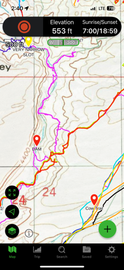
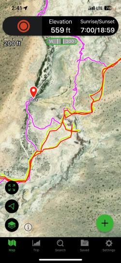
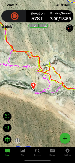
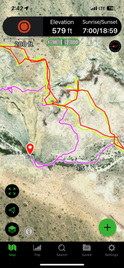
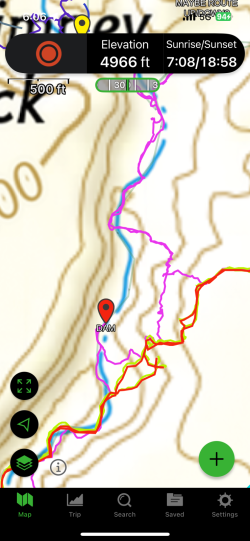
You walk back from the wall, look up towards the rim, left side when you walk away from the dam and find a way up to the rim that you’re comfortable with. Some screenshots of what we did. LMK- if you have questions.

IMG_0009.png


IMG_0010.png

spun the map sideways, note N arrow .
Looks like we were also searching (red/neon green ) for something comfortable once we were really close to the rim.
IMG_0011.png

IMG_0012.png
 
Interesting that this thread should resurface, as I was recently wondering about revisiting this area when looking at options for a potential desert trip in a couple of weeks. In 2021 we parked at the spot that everyone used, and first walked up the main wash into the side canyon with "good hoodoos" as in @regehr 's first image. Then back down a bit, and up a little side canyon and over to the "white valley hoodoos" area. After traversing though that area we ended up looking down into Sidestep, but by then the afternoon shadows were falling fast (late morning start and it was November) so we turned around there and slogged it home across the seemingly endless cow flats. Eventually we got tired of that, veered west and dropped into the lower "white valley" by a somewhat sketchy route. Which must have been below the dam because I don't recall that. Might be worth checking out again...
 
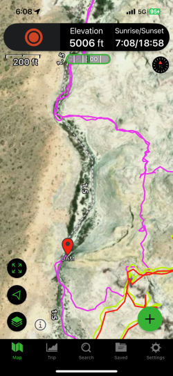
Here’s a better satellite view of the dam bypass “route” - color pink:

IMG_0075.png


IMG_0073.png
 

Don't like ads? Become a BCP Supporting Member and kiss them all goodbye. Click here for more info.

Back
Top