Navigation
Install the app
How to install the app on iOS
Follow along with the video below to see how to install our site as a web app on your home screen.
Note: This feature may not be available in some browsers.
More options
Style variation
You are using an out of date browser. It may not display this or other websites correctly.
You should upgrade or use an alternative browser.
You should upgrade or use an alternative browser.
Album Summit Shots
- Thread starter WasatchWill
- Start date
danger02ward
Love the Mountains!
- Joined
- Mar 1, 2016
- Messages
- 402
danger02ward
Love the Mountains!
- Joined
- Mar 1, 2016
- Messages
- 402
danger02ward
Love the Mountains!
- Joined
- Mar 1, 2016
- Messages
- 402
- Joined
- Oct 12, 2015
- Messages
- 363
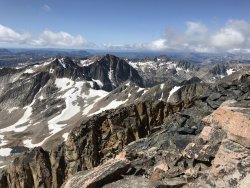
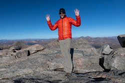
August 16, 2019 I had the great pleasure of climbing granite peak in Montana up the southwest ramp and enjoying the spectacular views.
Nice work! How was the snowpack? We were going to attempt the NE ridge back in July, but there was still a lot of snow so we opted to climb Tempest instead. Unfortunately, I don't think I'll make it over there again this season, so hoping for another attempt next year.
danger02ward
Love the Mountains!
- Joined
- Mar 1, 2016
- Messages
- 402
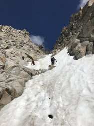
Thanks! There is still quite a bit of snow in the southwest ramp/couloir. We had to use ice axes and crampons to ascend then to be safe due to the steep snow repelled down.Nice work! How was the snowpack? We were going to attempt the NE ridge back in July, but there was still a lot of snow so we opted to climb Tempest instead. Unfortunately, I don't think I'll make it over there again this season, so hoping for another attempt next year.
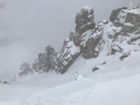
Looking up from the bottom of the snow in the southwest ramp/couloir on the ascent.
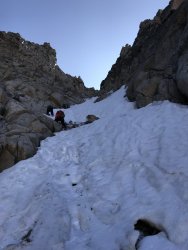
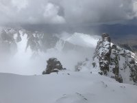
Looking down from the top of the snow after the ascent.
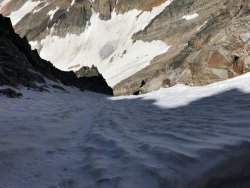
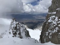
Looking down from the top of the snow before the descent.
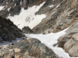
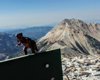
Looking up from the bottom of the snow after the descent
- Joined
- Jun 25, 2012
- Messages
- 4,430
Well done, Danger!Thanks! There is still quite a bit of snow in the southwest ramp/couloir. We had to use ice axes and crampons to ascend then to be safe due to the steep snow repelled down.
Looking up from the bottom of the snow in the southwest ramp/couloir on the ascent.
View attachment 80813
Looking down from the top of the snow after the ascent.
View attachment 80814
Looking down from the top of the snow before the descent.
View attachment 80815
Looking up from the bottom of the snow after the descent
View attachment 80816
Is that the normal summer ascent route when it is snow free, too? Often on many routes it is too loose and scary without some snow. Like the north ridge of the Pfeifferhorn.
danger02ward
Love the Mountains!
- Joined
- Mar 1, 2016
- Messages
- 402
Thanks Artemus! Good point. The standard route comes from the south east side is technical and involves ropes. The southwest ramp couloir according to summit post is gaining popularity. It warns that the guides don’t like it due to the rockfall danger. But yes people go hit the southwest ramp in the summer when there’s is less snow. There are a couple of tricky spots according to reports where people have put in fixed ropes.Well done, Danger!
Is that the normal summer ascent route when it is snow free, too? Often on many routes it is too loose and scary without some snow. Like the north ridge of the Pfeifferhorn.
danger02ward
Love the Mountains!
- Joined
- Mar 1, 2016
- Messages
- 402
- Joined
- Jun 25, 2012
- Messages
- 4,430
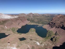
Nice, Danger! What day were you on Powell? I walked past all three Red Castle Lakes and went over the past into Oweep on Sunday.September I had the great pleasure of visiting two Uinta thirteeners Wilson peak and mt Powell.
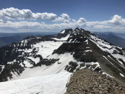
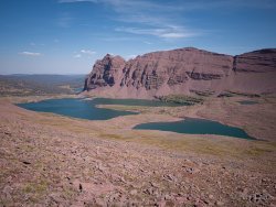
View of Beautiful red castle lake from Wilson peak.
View attachment 81925
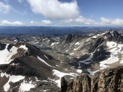
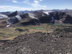
View of Wilson peak, smiths fork lake and east red castle from mt Powell.
View attachment 81927
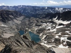
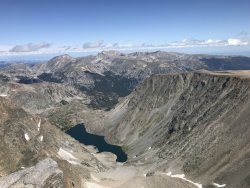
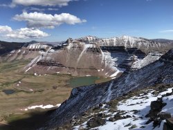
View of cliff lake in the Henry’s fork basin and Kings peak from mt Powell.
View attachment 81928
danger02ward
Love the Mountains!
- Joined
- Mar 1, 2016
- Messages
- 402
Friday the 13th. I can’t believe I came so close to meeting the great Artemus. Did you do a loop?Nice, Danger! What day were you on Powell? I walked past all three Red Castle Lakes and went over the past into Oweep on Sunday.
- Joined
- Jun 25, 2012
- Messages
- 4,430
Yes I did a loop solo. FIrst good overnight since my shoulder surgery. I should probably right up a mini-TR but it is a very similar route to what @Nick did and posted here. You?Friday the 13th. I can’t believe I came so close to meeting the great Artemus. Did you do a loop?
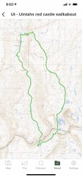
Red Castle & Little East Fork Blacks Fork, Uintas
September 2011 As I've whittled away at my bucket list of destination in the Uintas over the years, there have been two that always seemed to get pushed back; Red Castle and Little East Fork Black's Fork. I always envisioned Red Castle as being too busy, meanwhile Little East Fork as being so...
backcountrypost.com
- Joined
- Jun 25, 2012
- Messages
- 4,430
I just learned that Red Castle Lake is the largest natural lake in the Uintas.September I had the great pleasure of visiting two Uinta thirteeners Wilson peak and mt Powell.
View of Beautiful red castle lake from Wilson peak.
View attachment 81925
View of Wilson peak, smiths fork lake and east red castle from mt Powell.
View attachment 81927
View of cliff lake in the Henry’s fork basin and Kings peak from mt Powell.
View attachment 81928
danger02ward
Love the Mountains!
- Joined
- Mar 1, 2016
- Messages
- 402
- Joined
- Jun 25, 2012
- Messages
- 4,430
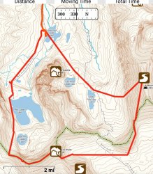
I'll go find my reference about Red Castle lake - I think it was summitpost.org or mountainproject.com. Not necessarily definitive. And we can probably find the exact acreage of both with a little research.I thought that granddaddy lake was the largest natural lake. Looks like a nice loop! How many miles is that? We just backpacked into lower red castle then did a day hike loop to hit Wilson and Powell View attachment 81951 lo
My hike was 27 miles and 4,500' of vert. I'll bet very much the same distance as yours but less vert.
I walked by Lower Red Castle lake at about 5pm on Saturday. Were you still there? I saw several parties but wouldn't recognize you to stop and shake your hand if I saw you. But I would like to some time as long as you don't use any unwarranted descriptive adjectives such as great when you see me.
There were three or more sheep just downstream of the lake likely stranded to perish in the winter. Hundreds or thousands were near my trailhead and the high country was hammered again - especially in Oweep - but they had moved them out for the winter.
danger02ward
Love the Mountains!
- Joined
- Mar 1, 2016
- Messages
- 402
We were back at the car by 2pm on Saturday.I walked by Lower Red Castle lake at about 5pm on Saturday. Were you still there? I saw several parties but wouldn't recognize you to stop and shake your hand if I saw you. But I would like to some time as long as you don't use any unwarranted descriptive adjectives such as great when you see me.
I would be happy to meet you one of these days Artemus. When that day happens I will try not to use any of those unwanted descriptive adjectives like great but it will be very hard for me not to.
According to Hikesandlakes.com granddaddy is 170 acres and red castle is 21acres. However I thought granddaddy was natural but maybe it has been dammed.
- Joined
- Oct 30, 2016
- Messages
- 991
Don't like ads? Become a BCP Supporting Member and kiss them all goodbye. Click here for more info.


