- Joined
- Dec 23, 2013
- Messages
- 4,114
Last week, I completed a six day, approximately 44 mile backpacking trip through the south central portion of Yellowstone National Park. This trip included my wife and daughter, along with @Artemus, and my friend Quin, who joined us on our second day of the trip.
The route was a lollipop loop that began and ended at the South Boundary Trailhead, located just north of the South Entrance Ranger Station. We did the loop in a clockwise direction, and stayed at our second campsite for two nights in order to do a day hike north, up to the southern shore of Heart Lake.
The first two days were quite comfortable with temps in the high sixties and low seventies, but on day three and beyond it began to warm up, and our last three days were a bit on the hot side. Also, might mention that the first day was smoky, days two through five were clear before smoke settled in again on our way out on the last day.

Overview map of our lollipop loop
Day 1 - South Boundary Trailhead to Campsite 8C6
We had stayed at the Grant Village Campground the night before, and after driving south to the trailhead, we managed to hit the trail a little after eleven in the morning.
First up on this trail is a ford of the Snake River, which was pretty straight forward for everyone, being only calf to mid-calf deep and not too swift at the crossing.
After the crossing, we made our way through some meadows to some hot springs that were located on the east side of the trail. We made a short detour to check them out before heading into the forest where we would spend a good portion of the day before breaking out to the Snake River once again near the Snake River Hot Springs and campsite 8C1. Along the way, we enjoyed currants, raspberries, and some huckleberries.
About two hours in, we stopped to eat lunch, and while finishing up, a solo backpacker passed by and told us that he'd just seen a grizzly about ten to fifteen minutes up the trail and it had stood up to get a better look at him. Of course, we never saw the bear once we were back on the trail.
When we reached the Snake River Hot Springs, I told Art that where the creek that flows out of the springs enters the river you can sit and soak. So Art went to check this out as we continued on past campsite 8C1 and on towards our second ford of the Snake just before our campsite for the night.
Arriving at the river, we ran into a group that was headed for 8C1 for the night, and they told us that they had seen two grizzlies and one black bear today coming from Heart Lake. And of course once again, we didn't see any of the bears.
We forded the river again; reached our campsite; Art caught back up to us; and we set up our tents and settled in to eat dinner.
Just as we were finishing our meals, we heard a shout from back across the river, and soon a gentleman showed up at our site, asking if we had this site for the night. After we told him "Yes, we do." He asked to see our permit. I showed him the official permit emailed to me from the backcountry office. We then asked to see his permit. He then stated that it was on his wife's cellphone and she didn't have cell coverage in the backcountry, and that he was with her and his son, and his sister-in-law who was three months pregnant, but they were still on the other side of the Snake, because they didn't want to ford the river again. He said that his wife told him they were in our campsite for the night.
"Hmm," I thought to myself. If you really thought that this was your campsite, then why didn't your whole group come across the river to start setting up camp? It made no sense to me.
I might add at this point that the gentleman was carrying a sidearm, and kept fidgeting with the pistol as he spoke to us. Art eventually asked him to stop fondling his gun because it was beginning to make him feel uncomfortable. I then asked if his group had run into any wildlife on their hike in, and he said that they had just run into a sow with three cubs before he forded the river. He said that he shouted at the bear which made them take off. So that was the shouts that we had heard previously. And once again, we never saw the bears. He then wandered back across the river to join his family and they headed back the way they had come.
We came to believe they were trying to poach a site for the night and really didn't have an official permit.

Information board at the trailhead

The ladies fording the Snake

The hot springs just before we entered the forest

I passed along this footbridge when they were building it back in 2012. I stopped and watched them for a bit before continuing on

Plenty of berries along this stretch of the trail

Breaking out of the trees near the Snake River Hot Springs

The Snake River near campsite 8C1

Fording for the second time today. Our campsite for the night is located in the group of trees to the left.

The Taj Mahal

A dinner guest while we were eating
Day 2 - Campsite 8C6 to Campsite 8B2 near Basin Creek Lake
Day two was an easy day, at less than five miles to our next campsite and the temperature remained pleasant.
We started off by climbing up above the Snake River right out of camp, and then continuing on up the Red Creek Drainage. Eventually, we ran into a large, gorgeous meadow where we took some time to enjoy the views and watch a goshawk hunt for prey.
On our way to the meadow, we ran into a group of three heading south that saw a grizzly on Red Creek just ahead of us, but alas, no such luck for us.
After taking in the meadow, we reached Basin Creek Lake and just beyond our campsite. Since we reached camp fairly early in the day, Art and I did a hike up onto the ridge to see if we could get a glance of Mount Sheridan, which is located on the west side of Heart Lake.
At around eight in the evening, Quin showed up to join our merry band of scallywags, and you'll never guess what he saw on the way in. That's right a grizzly bear - just above our previous night's campsite! No bear sighting for the rest of us though.
I thought that 8B2 was a much better campsite than our previous night's 8C6.

Getting set up to put my knee brace on for day number two

Climbing up above the Snake

The Snake River

The confluence of Red Creek with the Snake River

Forest hiking during the first part of the day up the Red Creek Drainage

Red Creek

Time for a drink

Breaking out into the large meadow

A frog in a tributary of Red Creek

Meadow view

More meadow - looking north

@Artemus, taking it all in - watching the goshawks hunt

Arriving at Basin Creek Lake

Signpost for campsite 8B2

This guy hung out by our tent


View from our day hike after reaching campsite 8B2 in the afternoon - Chicken Ridge in the distance. Also, a look down onto the
meadows where we would be day hiking up to Heart Lake on Day 3

A glimpse of Mount Sheridan

More views to the northeast from the ridge towards Channel Mountain

Back at Basin Creek Lake - about twenty ducks are calling the lake home
Day 3 - Day Hike from Campsite 8B2 to Heart Lake
Day three found us staying at the same campsite which afforded us a nice hike up to Heart Lake and back at around 9.5 miles roundtrip.
On our way up to the lake, we realized that the Park Service had moved the official trail further to the east, up into the dog's hair pine and out of the lowlands. On our way back to camp, we would remedy this and take the original trail.
Along the way, Mount Sheridan would dominate our view, and we stopped at Sheridan Lake for some lunch, and once we reached Heart Lake, we took a prolonged break at the lake to enjoying a beautiful afternoon, though by this time it was beginning to get warmer.
Art, Sheila and Katie all enjoyed getting into the water at the lake, and all emerged with leaches! I also pointed out to Art the game trail that follows the southern shore of the lake to the Heart River.
On our way back to camp, the guys decided to take the old trail through the lowland along Basin Creek. This turned out to be a fun jaunt through some marsh, allowing us to pass by a couple of beaver dams, and sniff our the old campsite that used to be used before the NPS moved it.

Day hike overview map to Heart Lake. The official trail green, while the old trail purple.

On our way to Heart Lake and Mount Sheridan

Consultation along the trail

Where we first realized the old trail was not the official trail anymore. The downed marker says "Main Trail." This caused us some
confusion at first.

Lily pad filled pond

A look up at Mount Sheridan

Coming up on the northern end of the old trail - where it intersects with the current trail

Sheridan Lake - our lunch stop

Southwest corner of Heart Lake

Heart Lake

Heading back to camp through old growth

The old trail. Trail Crew!

Beaver dam along the old trail

Following Basin Creek on the old trail

Trail Crew! @chandlerwest

Old trail trail marker with a bullet hole in it

Right this way - into the willows we go

@Artemus at the old campsite 8B1 location. Notice the downed bear pole behind him.

The southern intersection of the old trail with the current one

Our water source for campsite 8B2 The trickle that filled this pool would dry up as the day warmed up
Day 4 - Campsite 8B2 to Campsite 8C4 on the Snake River
Day four turned out to be a hoot. First, we had to cover some of the same ground that we had on the previous day in order to get to the Basin Creek Cutoff Trail. Again, a section of this trail had been moved up into the new growth, so of course we took the old route instead. Second, when we stopped for lunch at campsite 8B4, we soon were joined by a llama train! Turns out, this was a guided trip and they were going to stay at 8B4 for the night. Of course, I had to pet some of the llamas while we were there. How cool is that. Also, campsite 8B4 has one of the best views of any campsite in the Park, but shh...... don't tell Art that I told you that. It can just be our little secret.
Mount Sheridan once again dominated the landscape on this day, and Basin Creek would have to be forded many times on our way to 8C4.
After our llama surprise, the afternoon really heated up for us on our way to 8C4. When we arrived at camp, everyone headed to the river to enjoy the cool water.

Back north again today

Can you make out the old cutoff trail?

Mount Sheridan, from the old cutoff trail

On the old cutoff trail

Basin Creek below

Bear scat of the trail

Dual bear poles at campsite 8B3

Chicken Ridge to the northeast

The llama train is rolling into town!

Scatman heaven!

A llama whisperer too?

Another crossing of Basin Creek

Shoulder high grass at the beginning of this meadow. It was really heating up at this point.

Willows!

Back on the Snake again, near the confluence with Basin Creek seen below

Bear pole and food bag at 8C4

Giving the feet a rest.

Alpenglow on Mount Hancock along Big Game Ridge

Dusk on the Snake River and Mount Sheridan

Dusk at campsite 8C4
Day 5 - Campsite 8C4 to Campsite 8C2 on the Snake River
On day five, we had almost an immediate ford of the Snake River as we used the Harebell Cutoff Trail in order to reach the Harebell Patrol Cabin, located near the southern boundary of the Park. The Harebell Cutoff turned out to be the biggest hill climb of the trip, and I slipped into mosey mode as I mad my way up the trail.
When we reached the patrol cabin, we stopped for a lengthy break. The cabin itself was not being occupied at the moment, and we noticed several grizzly bear claw marks all around the structure, even a muddy paw print on the back wall.
From the patrol cabin, after one small hill, it was essentially down hill all the way to the crossing of Coulter Creek. And after the fording of Coulter, a flat meadows hike to our last campsite 8C2.

Looking north along the Snake River

Fording again


Heading up the Harebell Cutoff Trail

Harebell Patrol Cabin

Paw print?

Group shot at the cabin

Patrol cabin outhouse

Looking back at Mount Hancock and Big Game Ridge

View to the west

Harebell Creek below

Coulter Creek - good grizzly country

Confluence of Coulter Creek and the Snake River

Arriving at campsite 8C2

Campsite 8C2

Bear boxes instead of a bear pole(s) at 8C2

Sunset at 8C2
Day 6 - Campsite 8C2 to the South Boundary Trailhead
We were up early for today's hike out. It would be our longest day and we wanted to beat the heat and get as many miles out of the way before it turned hot. Quin left extra early in order to get back to the trailhead and drive back to Salt Lake, before heading on to Great Basin National Park the following day.
Heading out, we saw our first bear tracks on the trail, and we also ran into a family of grouse. Also, it was nice to see some small aspens taking hold along the South Boundary Trail. When I was through here about thirty years ago there were no aspen to speak of.
As we approached campsite 8C1 again, we ran into a family of marmots that showed off for us.
We made good time on our way out, and after our final ford of the Snake, we reached the trailhead in the early afternoon.

Heading out from campsite 8C2

Bear print on the South Boundary Trail

Grouse along the trail

A patch of Goldenrod along the trail

Back on the Snake

Marmots put on a show

Soaking up some sun

Thistles on our way out

Creek from the Snake River Hot Springs

There is a Pika in this shot.

The final ford

Last hill to the trailhead.
Great trip! The last three days were a little warmer than I like, but I drank plenty of water to stay hydrated.
This was not a big animal type of trip though. We did see four deer, including one along the old Heart Lake Trail. We saw many sandhill cranes, ducks, geese, and birds or prey, which include six bald eagles. Small animals included chipmunks, squirrels, marmots, pikas, mice, and a long tailed weasel. I was disappointed that we didn't see a bear at some point along our route, but sometimes that is just the way it goes.
As for our campsites, I thought only our first night's site, 8C6, was subpar with really no view to speak of other than one hill and some trees.
The End.
The route was a lollipop loop that began and ended at the South Boundary Trailhead, located just north of the South Entrance Ranger Station. We did the loop in a clockwise direction, and stayed at our second campsite for two nights in order to do a day hike north, up to the southern shore of Heart Lake.
The first two days were quite comfortable with temps in the high sixties and low seventies, but on day three and beyond it began to warm up, and our last three days were a bit on the hot side. Also, might mention that the first day was smoky, days two through five were clear before smoke settled in again on our way out on the last day.
Overview map of our lollipop loop
Day 1 - South Boundary Trailhead to Campsite 8C6
We had stayed at the Grant Village Campground the night before, and after driving south to the trailhead, we managed to hit the trail a little after eleven in the morning.
First up on this trail is a ford of the Snake River, which was pretty straight forward for everyone, being only calf to mid-calf deep and not too swift at the crossing.
After the crossing, we made our way through some meadows to some hot springs that were located on the east side of the trail. We made a short detour to check them out before heading into the forest where we would spend a good portion of the day before breaking out to the Snake River once again near the Snake River Hot Springs and campsite 8C1. Along the way, we enjoyed currants, raspberries, and some huckleberries.
About two hours in, we stopped to eat lunch, and while finishing up, a solo backpacker passed by and told us that he'd just seen a grizzly about ten to fifteen minutes up the trail and it had stood up to get a better look at him. Of course, we never saw the bear once we were back on the trail.
When we reached the Snake River Hot Springs, I told Art that where the creek that flows out of the springs enters the river you can sit and soak. So Art went to check this out as we continued on past campsite 8C1 and on towards our second ford of the Snake just before our campsite for the night.
Arriving at the river, we ran into a group that was headed for 8C1 for the night, and they told us that they had seen two grizzlies and one black bear today coming from Heart Lake. And of course once again, we didn't see any of the bears.
We forded the river again; reached our campsite; Art caught back up to us; and we set up our tents and settled in to eat dinner.
Just as we were finishing our meals, we heard a shout from back across the river, and soon a gentleman showed up at our site, asking if we had this site for the night. After we told him "Yes, we do." He asked to see our permit. I showed him the official permit emailed to me from the backcountry office. We then asked to see his permit. He then stated that it was on his wife's cellphone and she didn't have cell coverage in the backcountry, and that he was with her and his son, and his sister-in-law who was three months pregnant, but they were still on the other side of the Snake, because they didn't want to ford the river again. He said that his wife told him they were in our campsite for the night.
"Hmm," I thought to myself. If you really thought that this was your campsite, then why didn't your whole group come across the river to start setting up camp? It made no sense to me.
I might add at this point that the gentleman was carrying a sidearm, and kept fidgeting with the pistol as he spoke to us. Art eventually asked him to stop fondling his gun because it was beginning to make him feel uncomfortable. I then asked if his group had run into any wildlife on their hike in, and he said that they had just run into a sow with three cubs before he forded the river. He said that he shouted at the bear which made them take off. So that was the shouts that we had heard previously. And once again, we never saw the bears.
He then wandered back across the river to join his family and they headed back the way they had come.We came to believe they were trying to poach a site for the night and really didn't have an official permit.
Information board at the trailhead
The ladies fording the Snake
The hot springs just before we entered the forest
I passed along this footbridge when they were building it back in 2012. I stopped and watched them for a bit before continuing on
Plenty of berries along this stretch of the trail
Breaking out of the trees near the Snake River Hot Springs
The Snake River near campsite 8C1
Fording for the second time today. Our campsite for the night is located in the group of trees to the left.
The Taj Mahal
A dinner guest while we were eating
Day 2 - Campsite 8C6 to Campsite 8B2 near Basin Creek Lake
Day two was an easy day, at less than five miles to our next campsite and the temperature remained pleasant.
We started off by climbing up above the Snake River right out of camp, and then continuing on up the Red Creek Drainage. Eventually, we ran into a large, gorgeous meadow where we took some time to enjoy the views and watch a goshawk hunt for prey.
On our way to the meadow, we ran into a group of three heading south that saw a grizzly on Red Creek just ahead of us, but alas, no such luck for us.
After taking in the meadow, we reached Basin Creek Lake and just beyond our campsite. Since we reached camp fairly early in the day, Art and I did a hike up onto the ridge to see if we could get a glance of Mount Sheridan, which is located on the west side of Heart Lake.
At around eight in the evening, Quin showed up to join our merry band of scallywags, and you'll never guess what he saw on the way in. That's right a grizzly bear - just above our previous night's campsite! No bear sighting for the rest of us though.
I thought that 8B2 was a much better campsite than our previous night's 8C6.
Getting set up to put my knee brace on for day number two
Climbing up above the Snake
The Snake River
The confluence of Red Creek with the Snake River
Forest hiking during the first part of the day up the Red Creek Drainage
Red Creek
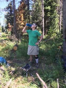
Time for a drink
Breaking out into the large meadow
A frog in a tributary of Red Creek
Meadow view
More meadow - looking north
@Artemus, taking it all in - watching the goshawks hunt
Arriving at Basin Creek Lake
Signpost for campsite 8B2
This guy hung out by our tent
View from our day hike after reaching campsite 8B2 in the afternoon - Chicken Ridge in the distance. Also, a look down onto the
meadows where we would be day hiking up to Heart Lake on Day 3
A glimpse of Mount Sheridan
More views to the northeast from the ridge towards Channel Mountain
Back at Basin Creek Lake - about twenty ducks are calling the lake home
Day 3 - Day Hike from Campsite 8B2 to Heart Lake
Day three found us staying at the same campsite which afforded us a nice hike up to Heart Lake and back at around 9.5 miles roundtrip.
On our way up to the lake, we realized that the Park Service had moved the official trail further to the east, up into the dog's hair pine and out of the lowlands. On our way back to camp, we would remedy this and take the original trail.
Along the way, Mount Sheridan would dominate our view, and we stopped at Sheridan Lake for some lunch, and once we reached Heart Lake, we took a prolonged break at the lake to enjoying a beautiful afternoon, though by this time it was beginning to get warmer.
Art, Sheila and Katie all enjoyed getting into the water at the lake, and all emerged with leaches! I also pointed out to Art the game trail that follows the southern shore of the lake to the Heart River.
On our way back to camp, the guys decided to take the old trail through the lowland along Basin Creek. This turned out to be a fun jaunt through some marsh, allowing us to pass by a couple of beaver dams, and sniff our the old campsite that used to be used before the NPS moved it.
Day hike overview map to Heart Lake. The official trail green, while the old trail purple.
On our way to Heart Lake and Mount Sheridan
Consultation along the trail
Where we first realized the old trail was not the official trail anymore. The downed marker says "Main Trail." This caused us some
confusion at first.
Lily pad filled pond
A look up at Mount Sheridan
Coming up on the northern end of the old trail - where it intersects with the current trail
Sheridan Lake - our lunch stop
Southwest corner of Heart Lake
Heart Lake
Heading back to camp through old growth
The old trail. Trail Crew!
Beaver dam along the old trail
Following Basin Creek on the old trail
Trail Crew! @chandlerwest
Old trail trail marker with a bullet hole in it
Right this way - into the willows we go
@Artemus at the old campsite 8B1 location. Notice the downed bear pole behind him.
The southern intersection of the old trail with the current one
Our water source for campsite 8B2 The trickle that filled this pool would dry up as the day warmed up
Day 4 - Campsite 8B2 to Campsite 8C4 on the Snake River
Day four turned out to be a hoot. First, we had to cover some of the same ground that we had on the previous day in order to get to the Basin Creek Cutoff Trail. Again, a section of this trail had been moved up into the new growth, so of course we took the old route instead.
Second, when we stopped for lunch at campsite 8B4, we soon were joined by a llama train! Turns out, this was a guided trip and they were going to stay at 8B4 for the night. Of course, I had to pet some of the llamas while we were there. How cool is that. Also, campsite 8B4 has one of the best views of any campsite in the Park, but shh...... don't tell Art that I told you that. It can just be our little secret. Mount Sheridan once again dominated the landscape on this day, and Basin Creek would have to be forded many times on our way to 8C4.
After our llama surprise, the afternoon really heated up for us on our way to 8C4. When we arrived at camp, everyone headed to the river to enjoy the cool water.
Back north again today
Can you make out the old cutoff trail?
Mount Sheridan, from the old cutoff trail
On the old cutoff trail
Basin Creek below
Bear scat of the trail
Dual bear poles at campsite 8B3
Chicken Ridge to the northeast
The llama train is rolling into town!
Scatman heaven!
A llama whisperer too?
Another crossing of Basin Creek
Shoulder high grass at the beginning of this meadow. It was really heating up at this point.
Willows!
Back on the Snake again, near the confluence with Basin Creek seen below
Bear pole and food bag at 8C4
Giving the feet a rest.
Alpenglow on Mount Hancock along Big Game Ridge
Dusk on the Snake River and Mount Sheridan
Dusk at campsite 8C4
Day 5 - Campsite 8C4 to Campsite 8C2 on the Snake River
On day five, we had almost an immediate ford of the Snake River as we used the Harebell Cutoff Trail in order to reach the Harebell Patrol Cabin, located near the southern boundary of the Park. The Harebell Cutoff turned out to be the biggest hill climb of the trip, and I slipped into mosey mode as I mad my way up the trail.
When we reached the patrol cabin, we stopped for a lengthy break. The cabin itself was not being occupied at the moment, and we noticed several grizzly bear claw marks all around the structure, even a muddy paw print on the back wall.
From the patrol cabin, after one small hill, it was essentially down hill all the way to the crossing of Coulter Creek. And after the fording of Coulter, a flat meadows hike to our last campsite 8C2.
Looking north along the Snake River
Fording again
Heading up the Harebell Cutoff Trail
Harebell Patrol Cabin
Paw print?
Group shot at the cabin
Patrol cabin outhouse
Looking back at Mount Hancock and Big Game Ridge
View to the west
Harebell Creek below
Coulter Creek - good grizzly country
Confluence of Coulter Creek and the Snake River
Arriving at campsite 8C2
Campsite 8C2
Bear boxes instead of a bear pole(s) at 8C2
Sunset at 8C2
Day 6 - Campsite 8C2 to the South Boundary Trailhead
We were up early for today's hike out. It would be our longest day and we wanted to beat the heat and get as many miles out of the way before it turned hot. Quin left extra early in order to get back to the trailhead and drive back to Salt Lake, before heading on to Great Basin National Park the following day.
Heading out, we saw our first bear tracks on the trail, and we also ran into a family of grouse. Also, it was nice to see some small aspens taking hold along the South Boundary Trail. When I was through here about thirty years ago there were no aspen to speak of.
As we approached campsite 8C1 again, we ran into a family of marmots that showed off for us.
We made good time on our way out, and after our final ford of the Snake, we reached the trailhead in the early afternoon.
Heading out from campsite 8C2
Bear print on the South Boundary Trail
Grouse along the trail
A patch of Goldenrod along the trail
Back on the Snake
Marmots put on a show
Soaking up some sun
Thistles on our way out
Creek from the Snake River Hot Springs
There is a Pika in this shot.
The final ford
Last hill to the trailhead.
Great trip! The last three days were a little warmer than I like, but I drank plenty of water to stay hydrated.
This was not a big animal type of trip though. We did see four deer, including one along the old Heart Lake Trail. We saw many sandhill cranes, ducks, geese, and birds or prey, which include six bald eagles. Small animals included chipmunks, squirrels, marmots, pikas, mice, and a long tailed weasel. I was disappointed that we didn't see a bear at some point along our route, but sometimes that is just the way it goes.
As for our campsites, I thought only our first night's site, 8C6, was subpar with really no view to speak of other than one hill and some trees.
The End.