- Joined
- Dec 2, 2019
- Messages
- 196
Part 1 of the trip report here
Part 2 of the trip report here
Part 3 of the trip report here
I had, so far, covered 188 miles over 15 days (13 hiking days).
I woke up on a lovely, sunny morning to an incredible panoramic vista of the Cedar Mesa canyon network spread out before me, from my camping site below Bear Ears. As I was packing up my gear, I got quite a start when I heard a loud voice: "Good morning. I like your camping spot ". To say that I had gotten quite used to solitude over the past week or so was putting it mildly; this was literally the first person that I had seen in the 9 days since I had left Needles Outpost !
The passing jogger was interested to hear about my trip. However, I was soon to feel rather embarrassed, as I tried to impress him with descriptions of my adventures. It turns out that he was actually amongst the top-10 finishers of the 2,650 mile Pacific Crest Trail (PCT) last year (83 days), after which he became one of the few people to have completed the 7,900 mile triple-crown of PCT, Continental Divide Trail, and Appalachian Trail in a single calendar year ! Of all the people I could have met this morning, and attempted to impress, one of the country's top thru-hikers was probably not the ideal candidate. A very nice guy, and an amazing athlete. As he jogged back down the road, I felt that my recent exploits were the equivalent of an afternoon stroll around the boating lake in New York’s Central Park, in comparison to his incredible feats.
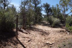
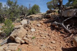
My route today would take me towards Cedar Mesa, via a short section of The Emigrant Trail. I would be following the path of the intrepid Hole-in-the-Rock pioneers who first traversed the tortuous 200 mile route from Escalante to Bluff, across the Colorado Plateau, almost 140 years ago. Their travails in traversing Cedar Mesa involved clearing a trail through the pinyon and juniper woodland, before constructing a remarkable stone stairway across the slickrock to help their 80 wagons cross Grand Gulch, the deepest canyon on the mesa. Their ingenuity and determination throughout the journey was incredible. On a warm spring day, it was difficult to imagine the deep mud and snow that the 250 settlers had to battle through to cross Cedar Mesa, as they made their way south-west, in February 1880.
Cedar Mesa is a vast 400 square-mile plateau which contains a huge network of canyons that are home to an incredible trove of ancient wonders (it is estimated that there are over 100,000 individual archaeological sites within the canyon system). The area was extensively inhabited by the Ancestral Puebloans between 2,500 and 700 years ago, before the final abandonment in 1290. It isn’t known precisely why the people left, but drought, dwindling resources, local warfare, and over-farming have all been suggested as possible contributory factors. The area continues to play an important role in the cultural life of several local tribes.
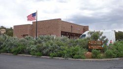
After leaving the Emigrant Trail, I stopped off for a few minutes to pick up an overnight permit and say hello to the fantastic folks at the Kane Gulch Ranger Station. Their incredible knowledge, enthusiasm, and passion for Cedar Mesa is truly inspirational, and I always enjoy chatting with them, whenever I pass through the area.
After a few days on reduced rations, due to my unexpected ankle- and weather-related delays, I felt like a child on Christmas morning, as I headed through the pinyon and juniper woodland of Cedar Mesa, and picked up my next food cache. It was a lovely balmy afternoon as I set up camp on the slickrock at the Owl Creek trailhead. I had deliberately packed an extra day’s rations in my cache, so I was able to laze in the afternoon sun, and enjoy an extra lunch and a bonus Snickers bar !
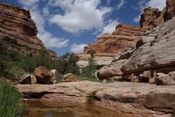
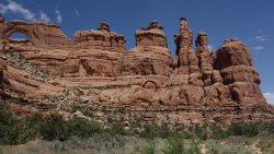
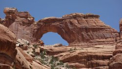
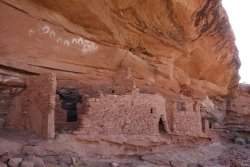
Owl Creek is undoubtedly one of the scenic highlights of the Cedar Mesa area, with dramatic red sandstone buttes, knobs, and spires towering over a beautiful wide valley, filled with an array of stunning wildflowers. Although the rain was falling steadily again, the incredible sight of Neville’s Arch piercing the high cliff walls was a joy to behold. As with many of the canyons in this incredible area, there are many signs of the ancient inhabitants, with 1,000 year-old granaries, habitation structures, look-out towers, and rock-art much in evidence. It was truly a privilege to spend time in such a wondrous part of the South-West.
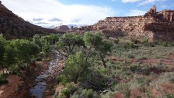
As one heads east, Owl Creek merges firstly into Fish Creek, and then ends dramatically several miles later, as the huge sandstone cliffs of Comb Ridge rise dramatically from Comb Wash. As the Hole-In-The-Rock pioneers found, further easterly progress is then only possible via a considerable detour around the southern end of this ridge, which reaches heights of over 700’, and is over 80 miles in length. Further evidence of their route (and of the original 1930s highway) through Comb Ridge can be found, as one hikes from the modern highway up onto the ridge-top.
I woke up early, and opened my tent to the sight of sparkling blue skies and bright sunshine. I had found a lovely little camping spot within a 5 minute walk of the top of Comb Ridge. I took my stove and breakfast goodies and sat atop the ridge at a stunning viewpoint; an incredible vista that is easily among the most dramatic in the South-West. The long sweeping, sinuous curve of the ridge reached northwards in the direction from which I had traveled, over the past two and a half weeks.
It seemed difficult to believe that this was the 19th and final day of my adventure. I spent several minutes mentally replaying the route in my head, laughing and shuddering in equal measure at some of the events that had occurred along the way. From my spectacular viewpoint, I could see the La Sal mountains, east of Moab, and also Bear Ears, towards the north of Cedar Mesa. Both of these South-West icons had formed the background to many of my days on the trail, and although I was very familiar with them, they looked particularly beautiful this morning. There were several times before, and during, my hike that I had had considerable doubts about whether I could complete it, but barring another sprained ankle, or severe snowstorm, I was only a few miles from completion.
As I descended from the ridge, I was heading towards Butler Wash. This eastern section of Comb Ridge is a fascinating area for ancient ruins and rock art, and one could spend weeks exploring the extensive nooks and crannies of the numerous side canyons, that slice into the ridge.
From Butler Wash, it is possible to scramble up a little-known rubble chute onto Tank Mesa. The panoramic vistas from this mesa are magnificent, with Comb Ridge, Bear Ears, the La Sals, Navajo Mountain, Sleeping Ute Mountain, and even Monument Valley all visible from the top. Also, from satellite imaging, archaeologists have found evidence of an ancient ‘road’, perhaps 1,000 years old, running across the mesa, apparently linking two large habitation sites, either side of the Tank Mesa. These sites appear to be ‘Chaco outliers’, indicating their archaeological similarity to the large complex ancient structures found at Chaco Canyon in northern New Mexico.
It was fascinating to see cowboy inscriptions on the rock from the 1920s, as I descended the well-constructed old cattle trail from Tank Mesa, and made my way towards my final destination of Bluff. The marvelous Bluff Fort was constructed in 1880 by the original Hole-in-the-Rock settlers, who had finally reached their destination, after 6 long months of arduous travel.
I spent some time chatting to the group of wonderfully enthusiastic volunteers at the fort, regaling them with my adventures over the previous few weeks. They were delighted that I had popped in to say hello, having just walked all the way from Moab. Sitting in the late afternoon shade, with some of the direct descendants of the original 1880 pioneers felt like a very appropriate way to finish off my hike across the Colorado Plateau.
As T.S. Eliot said: "The journey, not the arrival, matters ". And my goodness, what an incredible journey from Moab to Bluff it turned out to be. Despite torrential rain, heavy snow, freezing cold, dozens of stream-crossings, a badly sprained ankle, a dog attack, and an incorrect map, I had arrived in Bluff on schedule and (largely) in one piece. In total, I had covered almost 255 miles, over 19 days (17 hiking days) and ascended/descended more than 30,000’ in elevation. (Note, the core route of the trail is 189 miles, but due to additional exploring and the occasional wrong-turn, I ended up hiking much further).
It may be that this route forever remains a purely personal achievement, but perhaps other people might consider following this trail in future. I hope they do, since it passes through some of the most incredible scenery, not only of the South-West, but in my opinion, in the world. The fascinating history of the region resonates through every canyon and across every mesa. It was a joy to walk it.
Postscript: For some fun, I thought I'd have a go at creating a website (my first !) for this route (this will likely only work on a desktop, at the moment). So, if anyone would like some more detailed information on the trail, then here is the link. Apologies for my rather amateurish attempts
https://www.mabelinetrail.com/
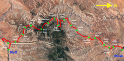
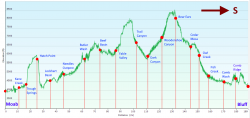
Trail map and elevation profile
.
.
.
.
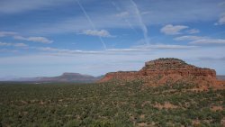
Descending from Bears Ears, looking west over Natural Bridges National Monument
.
.
.
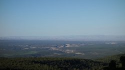
Distant view over Cedar Mesa and the Grand Gulch canyon system
.
.
.
Marker on the Emigrant Trail
.
.
.
Stone stairway in Grand Gulch, constructed by the 1880 pioneers
.
.
.
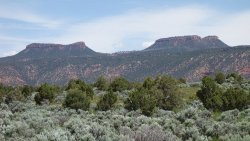
Distant view of Bears Ears
.
.
.
Kane Gulch Ranger Station
.
.
.
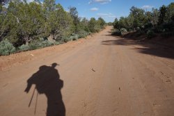
Road walking across Cedar Mesa
.
.
.
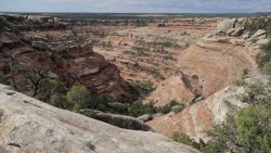
Looking down into Owl Creek Canyon
.
.
.
Owl Creek
.
.
.
Owl Creek and Neville's Arch
.
.
.
Neville's Arch
.
.
.
Fish Creek
.
.
.
Ancient habitation structure and rock-art
.
.
.
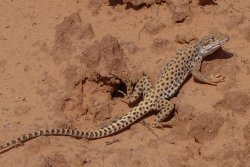
A fellow traveler
.
.
.
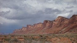
Comb Ridge, looking north from Comb Wash
.
.
.
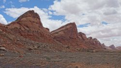
Comb Ridge, looking south from Comb Wash
.
.
.
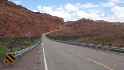
Modern highway through Comb Ridge
.
.
.
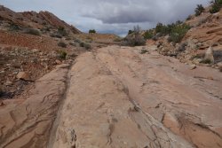
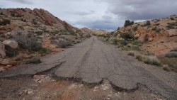
Wagon ruts in 1880 Emigrant Trail through Comb Ridge
.
.
.
1930s highway through Comb Ridge
.
.
.
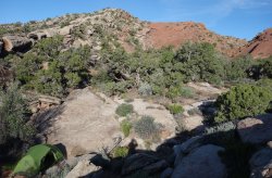
A cosy camping spot, close to the top of Comb Ridge
.
.
.
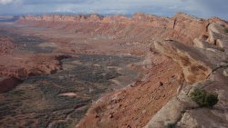
View from Comb Ridge, towards the La Sal Mountains
.
.
.
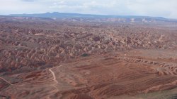
View from Comb Ridge, across Comb Wash and Cedar Mesa towards Bear Ears
.
.
.
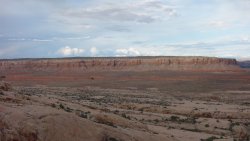
Tank Mesa and Butler Wash from Comb Ridge
.
.
.
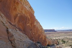
Petroglyph on descent from Comb Ridge towards Butler Wash and Tank Mesa
.
.
.
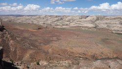
Comb Ridge and Butler Wash from Tank Mesa
.
.
.
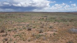
Tank Mesa
.
.
.
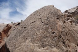
1920s cowboy inscriptions on the descent from Tank Mesa
.
.
.
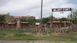
Bluff Fort
Part 2 of the trip report here
Part 3 of the trip report here
I had, so far, covered 188 miles over 15 days (13 hiking days).
-----
I woke up on a lovely, sunny morning to an incredible panoramic vista of the Cedar Mesa canyon network spread out before me, from my camping site below Bear Ears. As I was packing up my gear, I got quite a start when I heard a loud voice: "Good morning. I like your camping spot ". To say that I had gotten quite used to solitude over the past week or so was putting it mildly; this was literally the first person that I had seen in the 9 days since I had left Needles Outpost !
The passing jogger was interested to hear about my trip. However, I was soon to feel rather embarrassed, as I tried to impress him with descriptions of my adventures. It turns out that he was actually amongst the top-10 finishers of the 2,650 mile Pacific Crest Trail (PCT) last year (83 days), after which he became one of the few people to have completed the 7,900 mile triple-crown of PCT, Continental Divide Trail, and Appalachian Trail in a single calendar year ! Of all the people I could have met this morning, and attempted to impress, one of the country's top thru-hikers was probably not the ideal candidate. A very nice guy, and an amazing athlete. As he jogged back down the road, I felt that my recent exploits were the equivalent of an afternoon stroll around the boating lake in New York’s Central Park, in comparison to his incredible feats.
My route today would take me towards Cedar Mesa, via a short section of The Emigrant Trail. I would be following the path of the intrepid Hole-in-the-Rock pioneers who first traversed the tortuous 200 mile route from Escalante to Bluff, across the Colorado Plateau, almost 140 years ago. Their travails in traversing Cedar Mesa involved clearing a trail through the pinyon and juniper woodland, before constructing a remarkable stone stairway across the slickrock to help their 80 wagons cross Grand Gulch, the deepest canyon on the mesa. Their ingenuity and determination throughout the journey was incredible. On a warm spring day, it was difficult to imagine the deep mud and snow that the 250 settlers had to battle through to cross Cedar Mesa, as they made their way south-west, in February 1880.
Cedar Mesa is a vast 400 square-mile plateau which contains a huge network of canyons that are home to an incredible trove of ancient wonders (it is estimated that there are over 100,000 individual archaeological sites within the canyon system). The area was extensively inhabited by the Ancestral Puebloans between 2,500 and 700 years ago, before the final abandonment in 1290. It isn’t known precisely why the people left, but drought, dwindling resources, local warfare, and over-farming have all been suggested as possible contributory factors. The area continues to play an important role in the cultural life of several local tribes.
After leaving the Emigrant Trail, I stopped off for a few minutes to pick up an overnight permit and say hello to the fantastic folks at the Kane Gulch Ranger Station. Their incredible knowledge, enthusiasm, and passion for Cedar Mesa is truly inspirational, and I always enjoy chatting with them, whenever I pass through the area.
After a few days on reduced rations, due to my unexpected ankle- and weather-related delays, I felt like a child on Christmas morning, as I headed through the pinyon and juniper woodland of Cedar Mesa, and picked up my next food cache. It was a lovely balmy afternoon as I set up camp on the slickrock at the Owl Creek trailhead. I had deliberately packed an extra day’s rations in my cache, so I was able to laze in the afternoon sun, and enjoy an extra lunch and a bonus Snickers bar !
-----
The gaping chasm of Owl Creek Canyon opened before me, as I stood on the canyon rim the next morning. It was a stunning sight, with 500' of magnificent sandstone gorge below. It was slow work, picking my way down the circuitous path to the canyon floor, but the views were superb. A small rattlesnake darted under a nearby rock, as I descended the trail, and let me know he was keeping a close eye on me, via his distinctive rattle.
Owl Creek is undoubtedly one of the scenic highlights of the Cedar Mesa area, with dramatic red sandstone buttes, knobs, and spires towering over a beautiful wide valley, filled with an array of stunning wildflowers. Although the rain was falling steadily again, the incredible sight of Neville’s Arch piercing the high cliff walls was a joy to behold. As with many of the canyons in this incredible area, there are many signs of the ancient inhabitants, with 1,000 year-old granaries, habitation structures, look-out towers, and rock-art much in evidence. It was truly a privilege to spend time in such a wondrous part of the South-West.
-----
As one heads east, Owl Creek merges firstly into Fish Creek, and then ends dramatically several miles later, as the huge sandstone cliffs of Comb Ridge rise dramatically from Comb Wash. As the Hole-In-The-Rock pioneers found, further easterly progress is then only possible via a considerable detour around the southern end of this ridge, which reaches heights of over 700’, and is over 80 miles in length. Further evidence of their route (and of the original 1930s highway) through Comb Ridge can be found, as one hikes from the modern highway up onto the ridge-top.
-----
I woke up early, and opened my tent to the sight of sparkling blue skies and bright sunshine. I had found a lovely little camping spot within a 5 minute walk of the top of Comb Ridge. I took my stove and breakfast goodies and sat atop the ridge at a stunning viewpoint; an incredible vista that is easily among the most dramatic in the South-West. The long sweeping, sinuous curve of the ridge reached northwards in the direction from which I had traveled, over the past two and a half weeks.
It seemed difficult to believe that this was the 19th and final day of my adventure. I spent several minutes mentally replaying the route in my head, laughing and shuddering in equal measure at some of the events that had occurred along the way. From my spectacular viewpoint, I could see the La Sal mountains, east of Moab, and also Bear Ears, towards the north of Cedar Mesa. Both of these South-West icons had formed the background to many of my days on the trail, and although I was very familiar with them, they looked particularly beautiful this morning. There were several times before, and during, my hike that I had had considerable doubts about whether I could complete it, but barring another sprained ankle, or severe snowstorm, I was only a few miles from completion.
As I descended from the ridge, I was heading towards Butler Wash. This eastern section of Comb Ridge is a fascinating area for ancient ruins and rock art, and one could spend weeks exploring the extensive nooks and crannies of the numerous side canyons, that slice into the ridge.
From Butler Wash, it is possible to scramble up a little-known rubble chute onto Tank Mesa. The panoramic vistas from this mesa are magnificent, with Comb Ridge, Bear Ears, the La Sals, Navajo Mountain, Sleeping Ute Mountain, and even Monument Valley all visible from the top. Also, from satellite imaging, archaeologists have found evidence of an ancient ‘road’, perhaps 1,000 years old, running across the mesa, apparently linking two large habitation sites, either side of the Tank Mesa. These sites appear to be ‘Chaco outliers’, indicating their archaeological similarity to the large complex ancient structures found at Chaco Canyon in northern New Mexico.
It was fascinating to see cowboy inscriptions on the rock from the 1920s, as I descended the well-constructed old cattle trail from Tank Mesa, and made my way towards my final destination of Bluff. The marvelous Bluff Fort was constructed in 1880 by the original Hole-in-the-Rock settlers, who had finally reached their destination, after 6 long months of arduous travel.
I spent some time chatting to the group of wonderfully enthusiastic volunteers at the fort, regaling them with my adventures over the previous few weeks. They were delighted that I had popped in to say hello, having just walked all the way from Moab. Sitting in the late afternoon shade, with some of the direct descendants of the original 1880 pioneers felt like a very appropriate way to finish off my hike across the Colorado Plateau.
-----
As T.S. Eliot said: "The journey, not the arrival, matters ". And my goodness, what an incredible journey from Moab to Bluff it turned out to be. Despite torrential rain, heavy snow, freezing cold, dozens of stream-crossings, a badly sprained ankle, a dog attack, and an incorrect map, I had arrived in Bluff on schedule and (largely) in one piece. In total, I had covered almost 255 miles, over 19 days (17 hiking days) and ascended/descended more than 30,000’ in elevation. (Note, the core route of the trail is 189 miles, but due to additional exploring and the occasional wrong-turn, I ended up hiking much further).
It may be that this route forever remains a purely personal achievement, but perhaps other people might consider following this trail in future. I hope they do, since it passes through some of the most incredible scenery, not only of the South-West, but in my opinion, in the world. The fascinating history of the region resonates through every canyon and across every mesa. It was a joy to walk it.
-----
Postscript: For some fun, I thought I'd have a go at creating a website (my first !) for this route (this will likely only work on a desktop, at the moment). So, if anyone would like some more detailed information on the trail, then here is the link. Apologies for my rather amateurish attempts
https://www.mabelinetrail.com/
-----
Trail map and elevation profile

.

.
.
.
Descending from Bears Ears, looking west over Natural Bridges National Monument

.
.
.
Distant view over Cedar Mesa and the Grand Gulch canyon system

.
.
.
Marker on the Emigrant Trail

.
.
.
Stone stairway in Grand Gulch, constructed by the 1880 pioneers

.
.
.
Distant view of Bears Ears

.
.
.
Kane Gulch Ranger Station

.
.
.
Road walking across Cedar Mesa

.
.
.
Looking down into Owl Creek Canyon

.
.
.
Owl Creek

.
.
.
Owl Creek and Neville's Arch

.
.
.
Neville's Arch

.
.
.
Fish Creek

.
.
.
Ancient habitation structure and rock-art

.
.
.
A fellow traveler

.
.
.
Comb Ridge, looking north from Comb Wash

.
.
.
Comb Ridge, looking south from Comb Wash

.
.
.
Modern highway through Comb Ridge

.
.
.
Wagon ruts in 1880 Emigrant Trail through Comb Ridge

.
.
.
1930s highway through Comb Ridge

.
.
.
A cosy camping spot, close to the top of Comb Ridge

.
.
.
View from Comb Ridge, towards the La Sal Mountains

.
.
.
View from Comb Ridge, across Comb Wash and Cedar Mesa towards Bear Ears

.
.
.
Tank Mesa and Butler Wash from Comb Ridge

.
.
.
Petroglyph on descent from Comb Ridge towards Butler Wash and Tank Mesa

.
.
.
Comb Ridge and Butler Wash from Tank Mesa

.
.
.
Tank Mesa

.
.
.
1920s cowboy inscriptions on the descent from Tank Mesa

.
.
.
Bluff Fort

Last edited:
