- Joined
- Dec 23, 2013
- Messages
- 4,169
I headed up to the Teton Wilderness for my last backpacking trip of the year over the Columbus Day weekend. Our route took us up Pilgrim Creek where we established a base camp and then the following two days completed day hikes up what I call the West Fork of Pilgrim Creek (unnamed on map) on the first and one to the headwaters of Pilgrim Creek for the second. @Georgia Yankee , this one is for you. 
As we approached the trailhead on Pilgrim Creek, we saw off to our right (south) a grizzly bear foraging in the sage brush meadow. We took some shots out of the window and continued on to the trailhead. It took us a few minutes to get everything together and get a group picture before heading on up the trail. The weather was overcast, temps in the low forties, fairly good breeze blowing and it had obviously been snowing the last couple of days. This made the trail extremely muddy along our route.
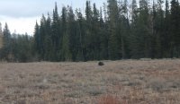
Grizzly bear near trailhead
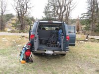
Our escape vehicle
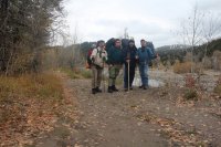
No sadder group of four individuals will you ever see
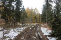
Sloppy going
Our first day would take us approximately 5.5 miles upstream where we would locate a camp along Pilgrim Creek. The trail initially starts out as a dirt road before eventually turning into a regular trail. Along this road, we ran into an outfitters camp that at first seemed unoccupied. I was drawn to the corral where there were a number of horses and mules. I love mules! If ever there were an animal that said "Scatman", it would be a mule. After taking a couple of pictures, a woman began calling out from within the camp. She needed help getting a five gallon gas tank off of a platform fifteen feet in the air. She needed the gas to fire up a generator in order to electrify the electric fence to keep grizzlies out of the camp. The car battery just wasn't doing the trick. After helping her get it down, she asked if there was anything she could do for us. I told her that she could lend us a mule to carry our packs to our camp! She didn't seem to like that idea too much though, so we were off again without a pack animal.
Now on our way to camp, you have to cross Pilgrim Creek twenty one times! Of course looking at the map, it appeared we would only be crossing it thirteen times. Must be the Scatman Coefficient at work again. The mud never ended on our way up the creek and because of the slop, it took us four hours to reach camp.
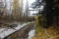
Slop and more slop
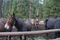
Mules! Love 'em.
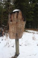
Wilderness boundary
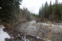
Pilgrim Creek
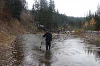
Crossing Pilgrim Creek
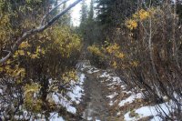
Trail through willows
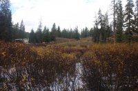
More willows
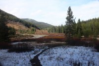
View up Pilgrim Creek
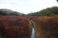
Standing water in the trail
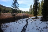
Some snow too - thought the skies are starting to clear
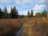
Nearing camp
Once at camp we set up quickly due to not much day light left. For the three nights we were there the lowest it got was 19 degrees. The first night though, it only got down to 25 and the sun would not hit our campsite until 9:52 in the morning.
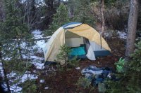
My tent
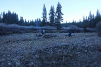
Beginning of day two on Pilgrim Creek
Our first day hike on day two would take us up the West Pilgrim Trail which is no longer maintained. The trail intersects with the Pilgrim Creek Trail in a meadow just across the creek from our campsite. The intersection is marked with a pole but the old trail cannot be detected in the meadow. It took a little searching just within the tree line for us to pick it up and begin following it. Once we were on the trail, it was easy to follow though it does have some downfall across it in places, not a discouraging amount though. The trail follows what I term the West Fork of Pilgrim Creek for a good portion of its length. Unfortunately for us, the trail conditions were worse than the day before with large clumps of mud sticking to our boots as we made our way up the drainage. After about 3.5 miles up, we had had enough and made our way down to the creek for lunch. After lunch, we decided to bushwhack down the creek instead of returning on the trail. This turned out to be a gorgeous hike along the creek until the canyon narrowed and we could not make our way around a small waterfall. So we backtracked a bit and climbed the hill until we reached the trail again and headed back to camp.
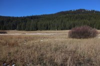
The post where the West Pilgrim Trail intersects with the Pilgrim Creek Trail
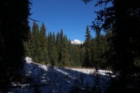
First glimpse of Wildcat Ridge
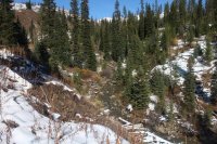
Unnamed creek - I called it the West Fork of Pilgrim Creek
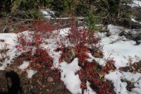
Fall colors along the trail. Does anyone know what this plant is?
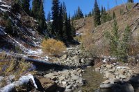
Crossing West Fork of Pilgrim Creek
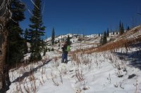
Snow is now covering the trail at this point
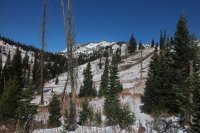
Wildcat Ridge and Wildcat Peak
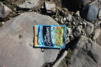
Lunch time! This is for @Joey , there must be an elk carcass around here somewhere.
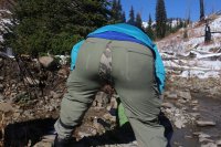
Obviously the better half of Scatman! On the first night at camp, I bent over to get a pullover out of my tent when I ripped the seam in the seat of my pants. It didn't bother me too much, but those unfortunate enough to hike behind me for the rest of the trip might have a different opinion than me.
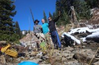
A group shot after lunch
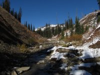
Hiking off trail down the creek, looking back at Wildcat Ridge
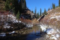
Still hiking down the creek
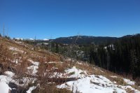
Heading back to camp after returning to the trail
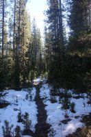
West Pilgrim Trail - no longer maintained
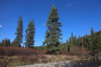
View to the northeast from our campsite
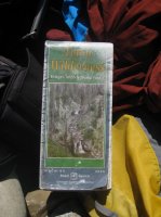
Tool of the trade
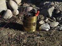
One of my backpacking partner's antique stove
On day three, our second day hike, took two of us to the headwaters of Pilgrim Creek. The first part of the trail took us through willows but soon it became more wooded and the steepness began to increase. The trail conditions in the morning were good, as in frozen, which helped us along. The conditions would turn to mud in the afternoon as we made our way back. As we reached the headwaters, we climbed a small ridge to get an excellent view of the Tetons and the whole Pilgrim Creek Drainage in one direction and Bobcat Ridge in the other. We decided this is where we would eat our lunches. We stayed up top for an hour before heading back down and on to camp. The trail at this point was a mess again. Besides the views from the upper trail, the neat part about this hike was that after the Middle Fork of the Pilgrim we were following grizzly tracks all the way up.
When we got back to camp , our camp mates had been busy making some rock art along the creek.
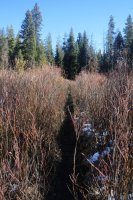
Heading through the willows at the beginning of our second day hike
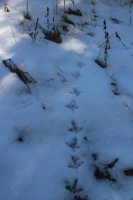
Grouse track
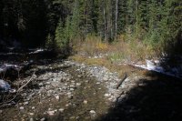
A smaller Pilgrim Creek
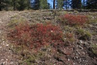
More fall colors
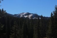
Whetstone Mountain
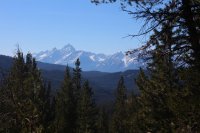
View of the Tetons and the Pilgrim Creek Drainage
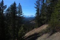
Another view of the Tetons in the distance
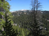
Bobcat Ridge
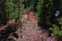
Yep - more fall colors
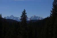
Tetons again
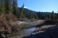
Pilgrim Creek
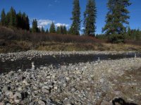
Rock art along Pilgrim Creek
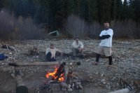
Chilin' around the campfire before calling it a night
The last day we woke up a little earlier, packed up and headed back for the trailhead. The trail out was much easier to hike than when we came in. Enough stretches had dried to the point that you could avoid the slop for the most part. On our way out we met the outfitter who own had the mules. He was headed in to break down his camp that we passed but somehow never saw. Fortunately he left a couple of mules and a couple of horses at his camp back near the trailhead and I got to pet one of the horses and a mule on the way out.
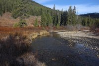
Pilgrim Creek on the way out
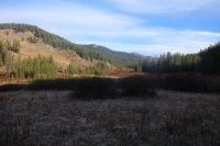
View again up Pilgrim Creek - still frosty in the shade
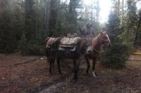
The outfitter and one of his mules. This guy and the woman we helped at the start of our trip were the only two people that we encountered on the trip.
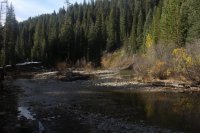
Pilgrim Creek
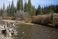
Pilgrim Creek at a crossing
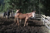
Mules again
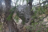
Nice hornets nest about one mile form the trailhead
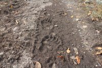
Grizzly tracks along the trail
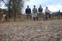
We made it! Remember, the road is closed!
Overall, a nice little trip. Other than the first day, the weather was excellent for hiking even if the trails weren't in good condition. I thought there would be an opportunity to see some bears along the drainage but the only one we saw was near the parking lot of the trailhead on our way in. The Pilgrim Creek Drainage certainly has a wild feel to it with the first half making your way through willows and the second half through lodgepole. Our scariest encounters turned out to be with grouse on numerous occasions. They can sure make your heart stop for a moment. If you're contemplating this route, bring some good boots and gaiters for all the creek crossings you'll do. It would take a lot of time to change into sandals if that is your preference.
Before I end this long winded report, I wanted to give props to a pair of boots. The night before I left on this trip, I tried to try on my old boots and I could not get my feet in them anymore. Panicked, I pulled out a brand new pair of boots that I had bought last year and stored under my bed. The are Lowa Tibet GTX boots and they preformed splendidly. Having never been worn before, they not only kept the water out after all the creek crossings, but I also did not get a single blister from them and I found them to be quite comfortable on my feet to boot. So if you are in the market for a new pair of boots be sure and give them a look.
As we approached the trailhead on Pilgrim Creek, we saw off to our right (south) a grizzly bear foraging in the sage brush meadow. We took some shots out of the window and continued on to the trailhead. It took us a few minutes to get everything together and get a group picture before heading on up the trail. The weather was overcast, temps in the low forties, fairly good breeze blowing and it had obviously been snowing the last couple of days. This made the trail extremely muddy along our route.

Grizzly bear near trailhead

Our escape vehicle

No sadder group of four individuals will you ever see

Sloppy going
Our first day would take us approximately 5.5 miles upstream where we would locate a camp along Pilgrim Creek. The trail initially starts out as a dirt road before eventually turning into a regular trail. Along this road, we ran into an outfitters camp that at first seemed unoccupied. I was drawn to the corral where there were a number of horses and mules. I love mules! If ever there were an animal that said "Scatman", it would be a mule. After taking a couple of pictures, a woman began calling out from within the camp. She needed help getting a five gallon gas tank off of a platform fifteen feet in the air. She needed the gas to fire up a generator in order to electrify the electric fence to keep grizzlies out of the camp. The car battery just wasn't doing the trick. After helping her get it down, she asked if there was anything she could do for us. I told her that she could lend us a mule to carry our packs to our camp! She didn't seem to like that idea too much though, so we were off again without a pack animal.
Now on our way to camp, you have to cross Pilgrim Creek twenty one times! Of course looking at the map, it appeared we would only be crossing it thirteen times. Must be the Scatman Coefficient at work again. The mud never ended on our way up the creek and because of the slop, it took us four hours to reach camp.

Slop and more slop

Mules! Love 'em.

Wilderness boundary

Pilgrim Creek

Crossing Pilgrim Creek

Trail through willows

More willows

View up Pilgrim Creek

Standing water in the trail

Some snow too - thought the skies are starting to clear

Nearing camp
Once at camp we set up quickly due to not much day light left. For the three nights we were there the lowest it got was 19 degrees. The first night though, it only got down to 25 and the sun would not hit our campsite until 9:52 in the morning.

My tent

Beginning of day two on Pilgrim Creek
Our first day hike on day two would take us up the West Pilgrim Trail which is no longer maintained. The trail intersects with the Pilgrim Creek Trail in a meadow just across the creek from our campsite. The intersection is marked with a pole but the old trail cannot be detected in the meadow. It took a little searching just within the tree line for us to pick it up and begin following it. Once we were on the trail, it was easy to follow though it does have some downfall across it in places, not a discouraging amount though. The trail follows what I term the West Fork of Pilgrim Creek for a good portion of its length. Unfortunately for us, the trail conditions were worse than the day before with large clumps of mud sticking to our boots as we made our way up the drainage. After about 3.5 miles up, we had had enough and made our way down to the creek for lunch. After lunch, we decided to bushwhack down the creek instead of returning on the trail. This turned out to be a gorgeous hike along the creek until the canyon narrowed and we could not make our way around a small waterfall. So we backtracked a bit and climbed the hill until we reached the trail again and headed back to camp.

The post where the West Pilgrim Trail intersects with the Pilgrim Creek Trail

First glimpse of Wildcat Ridge

Unnamed creek - I called it the West Fork of Pilgrim Creek

Fall colors along the trail. Does anyone know what this plant is?

Crossing West Fork of Pilgrim Creek

Snow is now covering the trail at this point

Wildcat Ridge and Wildcat Peak

Lunch time! This is for @Joey , there must be an elk carcass around here somewhere.

Obviously the better half of Scatman!

A group shot after lunch

Hiking off trail down the creek, looking back at Wildcat Ridge

Still hiking down the creek

Heading back to camp after returning to the trail

West Pilgrim Trail - no longer maintained

View to the northeast from our campsite

Tool of the trade

One of my backpacking partner's antique stove
On day three, our second day hike, took two of us to the headwaters of Pilgrim Creek. The first part of the trail took us through willows but soon it became more wooded and the steepness began to increase. The trail conditions in the morning were good, as in frozen, which helped us along. The conditions would turn to mud in the afternoon as we made our way back. As we reached the headwaters, we climbed a small ridge to get an excellent view of the Tetons and the whole Pilgrim Creek Drainage in one direction and Bobcat Ridge in the other. We decided this is where we would eat our lunches. We stayed up top for an hour before heading back down and on to camp. The trail at this point was a mess again. Besides the views from the upper trail, the neat part about this hike was that after the Middle Fork of the Pilgrim we were following grizzly tracks all the way up.
When we got back to camp , our camp mates had been busy making some rock art along the creek.

Heading through the willows at the beginning of our second day hike

Grouse track

A smaller Pilgrim Creek

More fall colors

Whetstone Mountain

View of the Tetons and the Pilgrim Creek Drainage

Another view of the Tetons in the distance

Bobcat Ridge

Yep - more fall colors

Tetons again

Pilgrim Creek

Rock art along Pilgrim Creek

Chilin' around the campfire before calling it a night
The last day we woke up a little earlier, packed up and headed back for the trailhead. The trail out was much easier to hike than when we came in. Enough stretches had dried to the point that you could avoid the slop for the most part. On our way out we met the outfitter who own had the mules. He was headed in to break down his camp that we passed but somehow never saw. Fortunately he left a couple of mules and a couple of horses at his camp back near the trailhead and I got to pet one of the horses and a mule on the way out.

Pilgrim Creek on the way out

View again up Pilgrim Creek - still frosty in the shade

The outfitter and one of his mules. This guy and the woman we helped at the start of our trip were the only two people that we encountered on the trip.

Pilgrim Creek

Pilgrim Creek at a crossing

Mules again

Nice hornets nest about one mile form the trailhead

Grizzly tracks along the trail

We made it! Remember, the road is closed!
Overall, a nice little trip. Other than the first day, the weather was excellent for hiking even if the trails weren't in good condition. I thought there would be an opportunity to see some bears along the drainage but the only one we saw was near the parking lot of the trailhead on our way in. The Pilgrim Creek Drainage certainly has a wild feel to it with the first half making your way through willows and the second half through lodgepole. Our scariest encounters turned out to be with grouse on numerous occasions. They can sure make your heart stop for a moment. If you're contemplating this route, bring some good boots and gaiters for all the creek crossings you'll do. It would take a lot of time to change into sandals if that is your preference.
Before I end this long winded report, I wanted to give props to a pair of boots. The night before I left on this trip, I tried to try on my old boots and I could not get my feet in them anymore. Panicked, I pulled out a brand new pair of boots that I had bought last year and stored under my bed. The are Lowa Tibet GTX boots and they preformed splendidly. Having never been worn before, they not only kept the water out after all the creek crossings, but I also did not get a single blister from them and I found them to be quite comfortable on my feet to boot. So if you are in the market for a new pair of boots be sure and give them a look.
Last edited:

