Pandemic? What pandemic?

Here in W. Colorado, there are people out everywhere, many in brand new campers and huge fifth-wheelers towing ATVs and every motor toy imaginable. OTOH, I was out in a remote area nobody knows about (except maybe Randy L., @gnwatts, @Udink and a few others - PM me if you want to know where), and there was nobody, not one vehicle around. It was hot, but wonderful.

It's very depressing driving through some of my favorite places in western Colorado this summer... There are so many people out who just don't give a damn.
 
It's very depressing driving through some of my favorite places in western Colorado this summer... There are so many people out who just don't give a damn.
I'm currently staying in a house along the road to three state parks (Rifle Gap. Harvey Gap, and Rifle Falls, as well as the national forest, and I have to close my front patio doors every day now because of all the traffic. I've never seen so many huge trailers, a lot of which look brand new.

Will be moving soon. This all started a couple of months ago. Before that, it was very quiet.

People who would normally be spending their time and money travelling the world are now buying RVs and trailers and visiting public lands because they can't go elsewhere right now...
 
With a site like this, you still have to be able to search and find the information you are looking for. It requires a little effort to figure things out, and that does weed out a lot of people. I find that apps like Alltrails are much worse as there is not much effort needed to find places using that kind of app, which really brings out the crowds.
Agreed all around. After thinking a bit more about it, message boards probably don't contribute much at all to the problem when compared with social media and Alltrails. And the trip report format on this site usually doesn't really provide tons of route information like trailheads and distances. You have to read every word of the report to get a sense of a place. It's not neatly packaged, formatted info like a geotag or Alltrails page.
 
People who would normally be spending their time and money travelling the world are now buying RVs and trailers and visiting public lands because they can't go elsewhere right now...

Everywhere is overrun. National parks, State parks, national forests, open spaces, local ponds - everywhere crowded to the max. Saw 4 people while hiking up Huron. Passed at least 400 hiking down.

Can't find kayaks, bikes, campers, Bass Pro/Cabelas fishing and camping sections routinely look looted.

We see more 20-30 somethings out than anything, and I suspect for many it's more a matter of not having a job and/or money to do much else other than get outside and enjoy what's free or nearly so.
 
Agreed all around. After thinking a bit more about it, message boards probably don't contribute much at all to the problem when compared with social media and Alltrails. And the trip report format on this site usually doesn't really provide tons of route information like trailheads and distances. You have to read every word of the report to get a sense of a place. It's not neatly packaged, formatted info like a geotag or Alltrails page.
There are other websites where you can pay some money to get all the GPS coordinates you need. Won't name any names but I'm sure you can guess which ones I'm talking about.
 
I'll be heading up to Yellowstone next week for a backpacking trip. @Bob, do you think you can clear a lane for me at the west entrance station? :)
Lol... Come mid week.
 
It's very depressing driving through some of my favorite places in western Colorado this summer... There are so many people out who just don't give a damn.
And you can't change them... They are the same people who don't give a damn in life
 
Just talked to a friend who has his son up in Yankee Boy Basin (above Ouray, CO), and he said it's packed out. We used to go there as kids and were the only ones there. (Wow, that was just a few years ago. j/k)
 
Just talked to a friend who has his son up in Yankee Boy Basin (above Ouray, CO), and he said it's packed out. We used to go there as kids and were the only ones there. (Wow, that was just a few years ago. j/k)
Just looked it up on the map. That blows my mind that you can just drive up to the top of a basin like that.
 
There's just one small problem..

The last paragraph "Photos later from the cleared road calmed the outcry. Much of the overhang still exists, Six Basins told The Gazette: “Only about 30% of the overhang was actually affected, so most of that iconic structure is still intact.”"

I was up there a few weeks ago, road is open and isn't much different than before.

Needless to say, it is an amazing basin. Too bad it is overrun with ATVs.

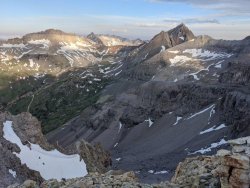
Gilpin, Dallas, Sneffels, Kismet, Cirque.jpg
 
The last paragraph "Photos later from the cleared road calmed the outcry. Much of the overhang still exists, Six Basins told The Gazette: “Only about 30% of the overhang was actually affected, so most of that iconic structure is still intact.”"

I was up there a few weeks ago, road is open and isn't much different than before.

Needless to say, it is an amazing basin. Too bad it is overrun with ATVs.

View attachment 90473
Used to be great 4 wheeling... Any still do that or just the atv horde now?
 
Kind of an aside, but your comment brought back some memories:

My brother and I "borrowed" our dad's pickup when he was out of town and took it up there one nice summer day to climb Mt. Sneffels. I was driving, and I managed to get it up the second hill in the basin, where one starts to need 4-wheel drive. Problem was, it wasn't a 4X4. I managed to take out the manifold turning around, then almost burned out the brakes going back to Ouray (didn't know to shift down, was just a kid barely old enough to drive, and we'd just moved down there from NW Colo.). We took the truck to a local garage where they replaced the manifold. We didn't want our dad to know, as we weren't supposed to drive it (he knew us well). When I told him about it some 10 years later, he just shook his head, not a bit surprised. LOL
 
Last edited:
Agreed all around. After thinking a bit more about it, message boards probably don't contribute much at all to the problem when compared with social media and Alltrails. And the trip report format on this site usually doesn't really provide tons of route information like trailheads and distances. You have to read every word of the report to get a sense of a place. It's not neatly packaged, formatted info like a geotag or Alltrails page.

I would still practice caution. All it takes is one person with a few social media followers to put things together, post an image on instagram, which then gets found out by others who post their images and before long it's Horseshoe Bend.
 
I would still practice caution. All it takes is one person with a few social media followers to put things together, post an image on instagram, which then gets found out by others who post their images and before long it's Horseshoe Bend.
For sure. I follow my procedure for only naming well known places regardless of the platform. Just saying that overall, message boards like BCP have a much smaller impact than social media and other sites.
 
With a site like this, you still have to be able to search and find the information you are looking for. It requires a little effort to figure things out, and that does weed out a lot of people. I find that apps like Alltrails are much worse as there is not much effort needed to find places using that kind of app, which really brings out the crowds.

I saw someone post on the wildernessbackpacking subreddit, asking if someone could draw out a gpx track for them using a written description from Backpacker with trails and landmarks easily identifiable on a topo map. So many people are lazy, and incapable of routefinding without a GPS. I once ran into a couple in Lee Vining (E of the easternmost entrance to Yosemite) near dusk. They asked me where San Jose was, and I said 5-6 hours in the other direction. I asked if they knew in which direction the sun set, and they shrugged. They blindly drove east instead of west for hours b/c they didn't have a data connection for their mobile mapping app.
 
Back
Top