Mystery "trail" Above Cuberant Basin?

Hoobie

Member
Joined
Jan 28, 2013
Messages
9
I was just checking out google earth researching for a trip up to the Cuberant Basin of the Uinta Mountains and I noticed this distinct looking "trail" up where it just seems odd for a trail to be. Also adding to the mystery (at least for me) is it just seems to cross this meadow from one rocky place to another rocky place, dissapearing at both ends. It's not marked on any map I've looked at and seems real tricky to get to for it do be so distinct. Also a measurement on google earth reads about 4 - 5 ft wide (maybe a canal? but an odd place for one). I found it most visible using the historic imagery from 8/27/2009 but it is visible on all imagery dates. Does anyone know what it is? Or has anyone been up there in person?Screenshot 2016-09-01 19.37.57.jpg
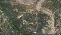
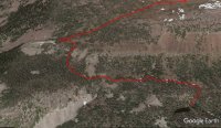
The trail is at the yellow pin stating "Mystery Trail", on the somewhat flat meadow above & NorthWest of Cuberant Basin. Screenshot 2016-09-01 19.38.17.jpg
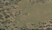
It just crosses the meadow, disappearing in the rocky areas on both ends. Screenshot 2016-09-01 19.39.08.jpg
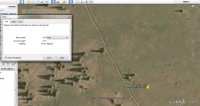
Google earth measurement of "trail", of coarse that's a wide "trail" but I'm stumped.
 
Very interesting, I've got a couple things similar to this that I've found on Google Earth that I want to go see what it is.
 
Yeah I'm going to have to add it to my adventure list. I am curious if it is connected with some of the mysteries in the Cuberant Basin, maybe it's a bigfoot highway. I'd be happy with an elk or deer highway though.
 
Curious if anyone ever checked this out?

I'm taking a few days off next week and this is one of the
places I'm considering.

Thanks
 
Last edited:
I was just thinking about this the other day. Can't wait to hear about it.


Sent from my iPhone using Tapatalk
 
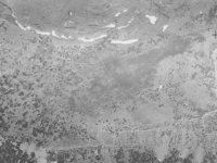
Looking at some 1939 aerial imagery (found here), this "trail" is visible back then.

View attachment 57307

It's got to be a man-made ditch or trench, but I can't figure out the purpose. Intriguing. Maybe I'll have to plan one more backpacking trip this year...
Intriguing indeed, especially if it's that old. That suggests to me it must have some depth to it. I gotta find out what it is.

I'm looking at satellite imagery and there doesn't seem to be a clear, best way up. Anybody have experience?
Here's a rough line of what seems to be the best way up:

Cuberant Meadow.jpgAny thoughts?

Thanks
 
Seems to me if it's that old it has to be an animal trail. We've all seen tons of those, in fact, there are grizz/animal trails in Alaska that go way back and are so deep they've become rivulets.
 
Seems to me if it's that old it has to be an animal trail. We've all seen tons of those, in fact, there are grizz/animal trails in Alaska that go way back and are so deep they've become rivulets.
I'm completely ready to accept that explanation, except that it ends so abruptly at the south end in a small
group of tree and on the north, it goes to the cliff edge.

I'll let you know next week.
 
It really seems like something the CCC would have done. They built the dam at Fish Lake (a mile northwest) in the 1930s. Maybe this was a ditch to funnel a little bit of snowmelt into the Dry Fork basin?
 
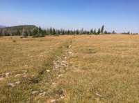
So here are the results of my Hike today:
IMG_3671.JPG

I was kinda crunched for time so I didn't walk the whole length of it.

At first glance it looks like the earth just dropped in along a straight line.

As old as it is it's impossible to tell whether it was man made, my first guess would be no.

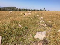
The contour of the land there would not produce water flow towards the Fish Lake side, as mentioned above, even though when the snow melts I'm sure it fills with water.

IMG_3667.JPG
If it were any where other than a wide open meadow, it never be noticed.

I'll post a TR of the whole Hike later.
 

Don't like ads? Become a BCP Supporting Member and kiss them all goodbye. Click here for more info.

Back
Top