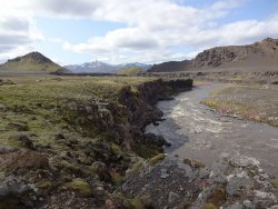
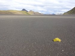
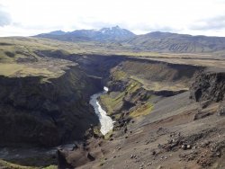
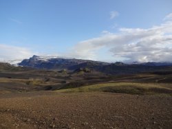
Laugavegur-Fimmvorduhals, Iceland

Joined
Sep 16, 2018
Messages
18
August 7-13, 2019

The Laugavegur trail is easily the most popular backpacking trail in Iceland. I paired it with the Fimmvorduhals trail, which is also a popular option, and hiked the combination over the course of 7 days/6 nights. There is plenty of information out there on these trails, so I'll try to present a concise report and some basic logistics and trail notes.

Logistics: I got a nonstop flight from Boston to Reykjavik for $450 on Iceland Air, and since I booked through Jet Blue there were no bag fees. On either end of the hike I booked a night at the same Airbnb spot in Reykjavik, and got them to agree to store my non-hiking stuff during the hike. To get to the Airbnb, I took the Flybus shuttle to the BSI bus terminal in Reykjavik, and then a city but to the apartment (easy with a little research and planning). To get to and from the trailheads, I used the Trex hiker shuttle.

Stove fuel: I found a small (100-110 g) Primus fuel canister at a store called Fjallraven in Reykjavik which fit my Snowpeak LiteMax stove. I visited a few other stores that sold larger Coleman and Jetboil canisters. For alcohol burning stoves you can find a product called Raudspritt at most gas stations and some gear stores, from what I have read it burns fine. That said, you could also find used canisters or bottles of Raudspritt at many if not all of the campsites/huts along the way.

Basic route description: I started at the northern end of the Laugevur trail at Landmannalaugar, and hiked south to the other trailhead in Thorsmork. From there I continued south on the Fimmvorduhals trail to Skogar, which passes between two glacier-capped volcanoes. Along this hike, you are required to either stay in huts, or camp outside of those huts. I camped each night except the last night. The fee per night was 2000 ISK which is about $16. I paid cash but the huts also seemed equipped for credit cards.

Weather: Based on other reports I gather that I was quite fortunate. 6 of the 7 days had mostly clear skies, it never got below freezing, highs around 50, and little wind. Practically no precipitation other than a brief sleet on day 6.

The down side of this hike is that it is crowded. You might see 100 people per day out on the trail. I'm one who really enjoys solitude, but I still have no regrets about this trip as the scenery was outstanding and it also gave me the experience for a return trip to Iceland.
 
Last edited:
Day 1

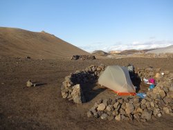
Leaving Reykjavik at 7:30 I arrived at Landmannalaugar around 11. They charge 500 ISK to use the restroom here but if you tell them you're hiking the Laugavegur they'll let you in at no charge. I hit the trail shortly before noon and made it to the first hut at Hrafntinnusker by 4pm, about 7 miles away. This site is often quite windy so there are several rock walls to shelter your tent. After making camp I climbed a nearby peak (with an obvious trail from the camp) which had a 360 panoramic view. The campsite was not packed that night as a few rock walls remained unclaimed.

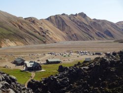
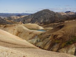
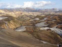
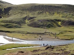
Looking back on Landmannalaugar

DSC02681.JPG

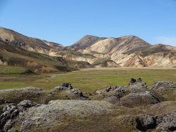
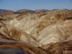
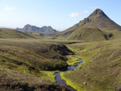
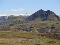
Plenty of postcard views along this first stretch.

DSC02691.JPG
DSC02694.JPGDSC02708.JPGDSC02711.JPG

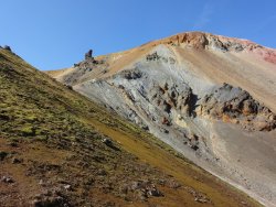
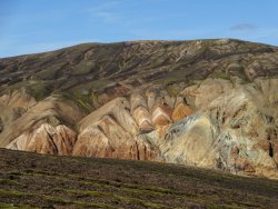
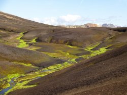
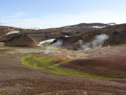
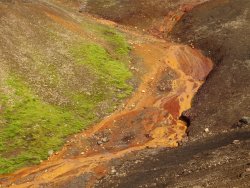
Lots of geothermal activity which colors the creekbeds a rainbow of colors.

DSC02731.JPGDSC02732.JPG

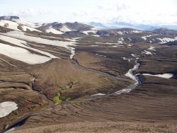
Views from the peak near the hut

DSC02745.JPGDSC02746.JPG

My Big Agnes Copper Spur was never tested.

DSC02750.JPG
 
Last edited:
I did that same route last summer. We'd intended a leisurely hike like yours, but due to the weather and on the advice of the wardens, we cut it to 3 hiking days. We did do a layover day for some dayhiking around Thorsmork, though. And we only had one day with "mostly clear skies." Had wind in the 40+ mph range on Fimmvorduhals, plus rain. Still crowded, still beautiful. I look forward to your days 2-7.
 
That is quite the wall around your tent.

I want to see more :)
 
Day 2

Today took me to the second hut/campsite at Alftavatn which is a large lake. The first half of the walk was similar scenery to Day 1. About midway you reach a divide and from there you get a huge view to the south with the volcanoes/glaciers in the distance. The landscape changes as there is less geothermal activity, more volcanic sand, and expansive flats interspersed with isolated, green-sloped mountains. The first river crossing (mid shin) occurs a couple of miles before Alftavatn. I made camp around 3 pm and spent a couple hours exploring a neighboring valley.

There is a "restaurant" at Aftavatn but all they sell is freeze dried food as far as I could tell.

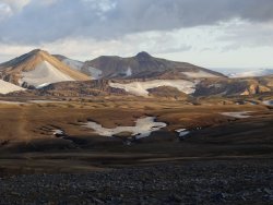
The view leaving the first hut heading south:

DSC02752.JPG

Looking back from the divide, the Hrafntinnusker hut is visible in the distance.

DSC02766.JPG

View to the west from the same spot

DSC02768.JPG

Last of the crazy colors

DSC02771.JPG

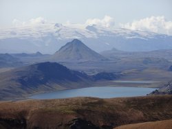
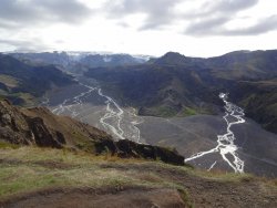
Start of the descent down toward Alftavatn. The Eyafjallajokull glacier/volcano is visible in the background.

DSC02774.JPG

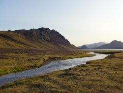
Alftavatn inlet stream

DSC02795.JPG
 
Last edited:
I did that same route last summer. We'd intended a leisurely hike like yours, but due to the weather and on the advice of the wardens, we cut it to 3 hiking days. We did do a layover day for some dayhiking around Thorsmork, though. And we only had one day with "mostly clear skies." Had wind in the 40+ mph range on Fimmvorduhals, plus rain. Still crowded, still beautiful. I look forward to your days 2-7.

It's a good idea to plan this trip with a couple of slack days just in case the weather is like you experienced. The forecast the week before I left called for clouds and rain every day, but I lucked out.
 
Day 3

The second river crossing occurs shortly after leaving Alftavatn. The trail then pass by the Hvanngil hut and quickly hits the third river crossing which was the deepest (knee) and swiftest of the four crossings that required wading. Then the terrain really opens up with vast flats punctuated by impressive green-sloped mountains. The trail crosses a bridge over a much larger river, the Innri-Emstrua. Here I left the trail for a few miles and followed a parallel road one valley over to the west. This was a nice break from all the people although there were a couple of cars. My off-trail wanderings took me to the Markarfljot which is a major river with an impressive canyon. Clouds began to collect overhead and there was a sprinkle lasting less that a minute. I was taking my time and arrived late in the day to the Emstrur hut/camp.

The first river crossing of the day, second overall. I waded through in my trail runners and blew past the boot-wearing crowd.

DSC02800.JPG

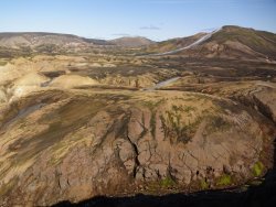
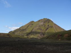
This was my favorite mountain for while.

DSC02803.JPGDSC02806.JPG

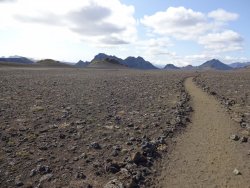
Entering the volcanic flats

DSC02810.JPG

The Innri-Emstrua

DSC02816.JPG

Airfield

DSC02821.JPG

The Markarfljot

DSC02833.JPG

View toward Thorsmork and the big glaciers to the south

DSC02838.JPG
 
Last edited:
Day 4

This was my final day on the Laugavegur as the big glaciers came closer in to view. The scenery was a bit less dramatic but still impressive. Camped at Langidalur where I paid 500 ISK for a 5 min. shower. There is a small store where I purchased a small map of hiking trails in Thorsmork, and some candy bars. They also had some chips and fuel for sale but not much else.

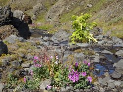
Some of the local flora:

DSC02856.JPG

Best view of the day with the Myrdalsjokull glacier (covering the volcano Katla) in the background.

DSC02863.JPG
 
Day 5

I had planned to spend today doing a big day hike in the Thorsmork area, but I was feeling lethargic and slept in. I think I was behind on my calories, so I headed over to the restaurant at Hasadalur where they had an all you can eat buffet featuring some delicious chicken soup. The restaurant seems to be open all day except for closures 10-11 and 5-6. On the way there I climbed Valahnukur which offers a panaramic view of Thorsmork. After lunch I moved my camp just a couple of miles over to the Basar hut which would give me a head start the next day. I made camp around 2 and spent the rest of the day just lounging.

View from atop Valahnukur:

DSC02875.JPG
 
Day 6

I got up at 7am and by 8am was at the start of the Fimmvorduhals trail which is 15 miles long, climbs 3000 feet to a pass between the two volcanoes, and descends down to Skogar on the south coast. The sky was overcast all day, and after an hour, there was some sleet combined with a strong wind from the North which was thankfully at my back. The wind ramped up throughout the day and I was glad I had gotten an early start. I planned to spend the night in Baldvinnskali, a hut near the middle of the trail. I had never slept in one of these huts before, and did not particularly think I would enjoy it, but did not want to risk camping outside in case of inclement weather.

I arrived at the hut at 1 pm. The wind was already strong enough that it was affecting my balance. As the day wore on, people hoping to make it to Thorsmork began trickling in, asking if there was room for them. The warden was discouraging them from continuing down to Thorsmork and rightfully so. People arriving from Thorsmork after me reported sand storms with very poor visibility such that it was difficult to see the next trail marker. The warden did her best to accommodate as many people as possible. Toward the end of the day, people arriving were looking very haggard and had blackened faces from the volcanic sand, and some were at the end of their rope. At some point the hut became full and yet another large group arrived. They had left Skogar at 4 pm, hoping to make it all the way to Thorsmork, and I don't think the warden had any sympathy for them because of their poor planning. She told them
they would either have to head back to Skogar or to camp outside. The previous night some people had tried in vain to pitch a tent in the wind for an hour before giving up. This night, however, the people were able to build some rock walls and pitch their tents which were still there in the morning. We asked the warden if this was particularly bad weather she no, not really.

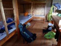
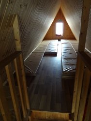
I was glad to be in the hut, but it was not a pleasant experience. I felt like a sardine and the air was stagnant. I woke up at 3 am and had to go outside just to get some fresh air as I could hardly breath. I almost packed up then and there but decided to ride it out until 5 am when there would be better daylight. So I laid on my mattress until 5 am and then packed up, the first to leave the hut.

As a side note, the hut does not have running water, but they were selling water from a large reservoir to hikers passing through for 500 ISK per liter. People staying there could have some water at no charge but were encouraged to conserve.

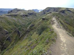
On the climb up there is a brief ridge with a steep drop on both sides.

DSC02878.JPG

Looking back north after the last big climb.

DSC02886.JPG

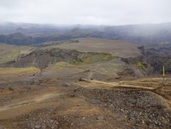
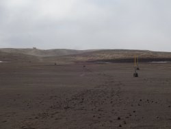
Near the middle of the trail, a dusty plain. The other hut is visible in the distance. It seemed a bit more out of the way.

DSC02894.JPG

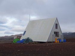
People with reservations slept upstairs in the triangular Baldvinnskali, shown here. I got there early enough that I got a single mattress by the stairs.

DSC02897.JPG
 
Last edited:
Day 7

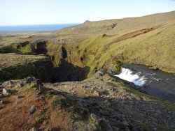
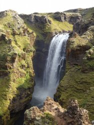
Hitting the trail before 6 am, the skies to the south were clearing and the Atlantic Ocean came in to view. After about 3 miles of walking on a road, you come to a bridge. After crossing the bridge, the trail follows a river for 4 miles down to Skogar. There is literally a different waterfall about every 5 minutes culminating in the magestic Skogafoss. This really helped me forget the hellish night before and was a great way to cap off the trip. There is a restaurant in Skogar where I had some delicious lamb stew while waiting for my bus back to Reykjavik.

The hut in the morning.

DSC02898.JPG

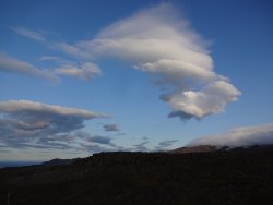
Clearing skies

DSC02904.JPG

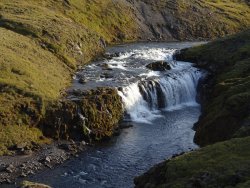
A sampling of waterfalls

DSC02917.JPGDSC02923.JPGDSC02935.JPG

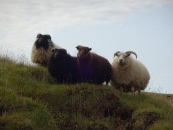
Some dayhiker's dog was messing with a lamb and these sheep were nonplussed.

DSC02945.JPG

Cheers,

DRS
 
Last edited:
Looks like interesting terrain to hike through, but lots of people. Do you have to camp near the huts? Or can you camp anywhere and avoid some of the crowds? That photo of the inside of the hut looks like my idea of hell :)

thanks for the report
 
Looks like interesting terrain to hike through, but lots of people. Do you have to camp near the huts? Or can you camp anywhere and avoid some of the crowds? That photo of the inside of the hut looks like my idea of hell :)
Most places you can set up a tent near or just outside the huts. I personally don't recommend camping on Fimmvorduhals...too barren, rocky, and exposed. Just do that one in one day. Of course, the winds were brutal the day I did it, so that colors my perception a bit. And not all the huts are quite as spartan as the one shown. We hutted in Thorsmork:
80885
 
Last edited:
Similar threads
Thread starter Title Forum Replies Date
TrektheWorld Iceland - June 2018 Everything Else 3
powderglut 2018 Iceland Campervan Trip Everything Else 11
Aldaron Iceland Aurora Photography 14

Similar threads

Back
Top