- Joined
- May 5, 2012
- Messages
- 1,732
(Fair warning: this trip report is long and a bit pretentious)

Quivering, the calf muscles strained. Toes groped, making the muscle fibers contract and release. The sticky rubber-wrapped toe caps on the shoes surrounding those feet scraped along, seeking any little edge or knob upon which to rest. Each leg reached full extension without finding purchase.
"Not good. This is really not good," I said, my voice shaking. "I can't get grip. My feet are just sliding."
The rock felt damp and cold. It leeched heat. My body flattened against the sandstone, maximizing friction and reducing, by some small measure, the likelihood that all five feet and eleven inches of me would slip like a wet bar of soap.
"How far below is the next groove?"
Jeff craned his neck out with caution from above me.
"About half a foot or so."
"Shit. That's too far."
"If you just slide down a bit, you can get it."
A frustrated grunt slipped past my lips.
"Problem is, I'm pretty sure that once I start sliding I won't stop. I'll just tumble. Or at least I will until I hit the bottom. That's like two hundred feet down though."
Again my toes scraped the rock with the same result.
"Do you want me to come down?"
"No," I said, emphasizing the syllable to keep him from moving. Already he had begun to creep over from his safe perch.
"Are you sure? I can give you a hand assist."
My head shook, jostling the beads of sweat on my forehead.
"I need you to stay where you are. If you come down we might both be stuck. And I want at least one of us to be able to go back for help if this goes bad."
Let me rephrase, I thought. It's already gone bad.
Light snow flurries swirled in the space between us. They wet the dull orange rock, one continuous piece of sandstone quilted by horizontal and vertical grooves, like rows and columns on a spreadsheet. Each tile, or cell to extend the metaphor, measured anywhere from six to ten feet per a side. Most were squarish, but the lines were not perfect, like those drawn by a grade schooler. (I didn't get any shots of this, but you can see the type of terrain I'm talking about in this Ronnie Coldbowl photo on panoramio.)
Jeff and I were perched on the west face of the ridge, about three quarters of the way up from the base. We had started down from the crest, intending to zig-zag our way along the grooves to the desert floor. Before beginning down I had scouted ahead, aware that sight can deceive and that the slope could in fact be more steep than it first appeared. The path had seemed doable as long as we stair-stepped the quilt lines.
It wasn't doable. Now, my forearms were crammed into one of those quilt lines. They held the entirety of my weight over a slope that had proved too steep to descend. The small cleft had a soft edge that made it difficult to gain much purchase. Higher up the grooves were six or eight inches deep but as the slope had become more sheer they also became more shallow. This groove dug only an inch or so deep into the rock. Fine wet sand filled its recess. Both of my hands, balled into fists, were tucked against my chest. I exhaled against the gritty stone, feeling the heat of it reflect back into my flushed face. My hair, wetted by sweat and snow, matted against my forehead. The pack tugging at my shoulders conspired to pull those arms off the little ledge.
"Shit. This is dumb. This is really dumb," I said under my breath.
With eyes clenched I eased the contracted muscles of my left arm and in a jerking motion inched it away from the trunk of my body. Useless feet dangled as the right arm followed. Images of the stomach-churning fall that would surely follow a mis-move flashed across my mind. I tried to block them out as I again moved the left arm, followed by the right. In this way I shuffled along, inch by inch along the red rock.
"Keep going. Just a few more feet and you've got it," Jeff said as I crept along on wobbly arms.
The mountain threatened to shrug off my little body. I felt its indifference, bordering on disdain.
There is no one to save you. One wrong move, one twitch, and you're mine.
***
This trip had not started in such a dramatic fashion. My friend Jeff had moved from Salt Lake City to St. George about a year prior and in that time I'd not been south to visit. I'd been longing to head into the desert and so I told him I'd be heading down and suggested we plan an outing.
A trip down Parunuweap topped my to-do list. Still, I knew that Jeff would probably like to take his wife and two kids along for at least one day, so Parunuweap was out. Water Canyon seemed interesting but would probably be too snowy in early November. So as a easy warm-up I selected the Middle Fork of Taylor Creek in Zion National Park's Kolob Canyons section for our first hike. The trail is kid-suitable, scenic and relatively short.
Jeff had bought a kid-carrier for his youngest at a yard sale. He tossed this, some bottles of water and snacks in his Durango and we all headed toward Cedar. As we climbed northward on I-15 we saw a good deal of snow on the Pine Valley Mountains and Kolob Terrace. It even bounded the Kolob Canyon Road right off the freeway.
Conditions along the trail were soggy but pristine. A coating of untouched powder covered the trees and undergrowth.

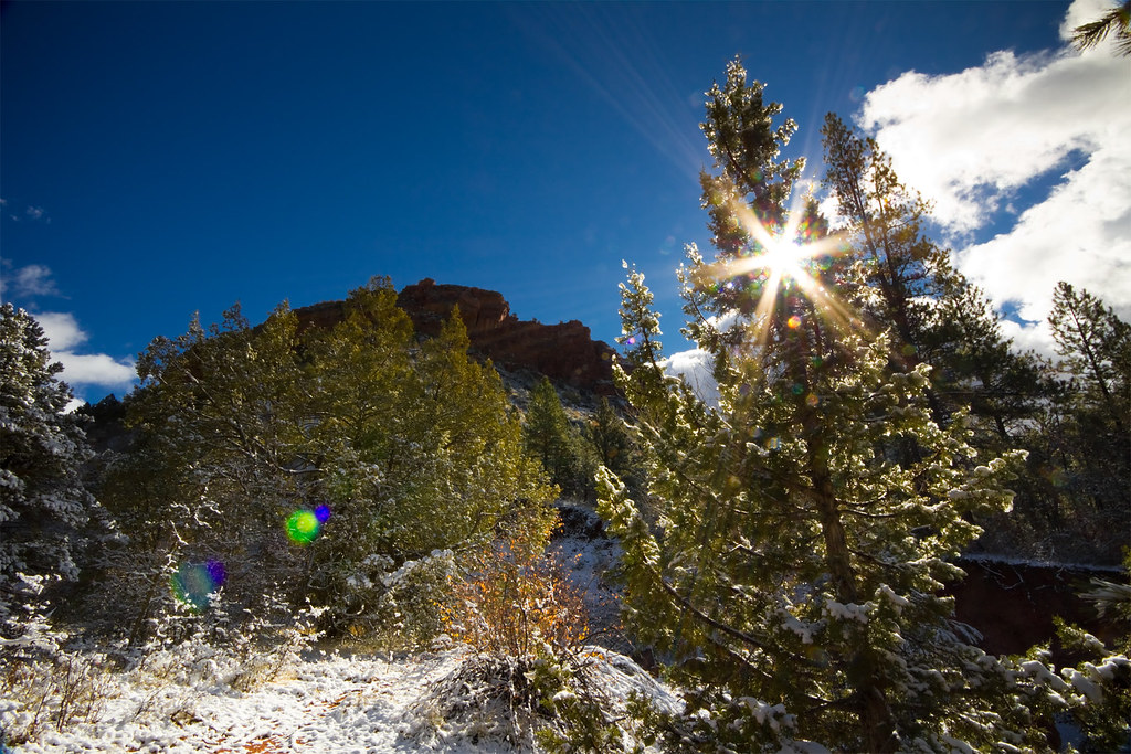
Snow in the Kolob Canyons by ashergrey, on Flickr
We picked our way down muddy steps to the creekside and began following the waterway up into the finger canyon. Jeff's boy thought the frequent stream crossings were a blast, right up until the point he fell into the frigid water and soaked his shoes.

The red walls ascended and narrowed, made all the more stunning by the contrast of the white snow covering the canyon's bottom. The boy's cheery disposition soured as we continued past the Larsen and Fife cabins. By the time we'd reached the trail's terminus at Double Arch Alcove he'd turned downright sour. We hooted at the hole and listened to the echoes, hoping he'd take notice of the sound and brighten his mood. Instead he climbed into his sister's backpack carrier and fell asleep.

I took some shots and we started back down the trail.
Glimpse of the Sky by ashergrey, on Flickr
Jeff shouldered his boy in the kid carrier, putting his son's now bare feet into his sweatshirt pockets to warm them. But his younger daughter, unhappy at being usurped from the easy chair, started to fuss. Jeff's wife carried her in her arms but she soon grew tired. Before long she had zipped her daughter up inside her hoodie. The little girl stretched the garment so tight that it held her in place against her mother's torso like a cocoon. She fell asleep there, making her mother appear as if she were pregnant with a gigantic baby. Later the girl started awake and, not understanding where she was or why she was so constricted, started to wail.

GPS track via Google Maps.
On Sunday Jeff and I set out, sans children, for the Paria Contact Station. The hope was that at this late season we'd stand a decent chance of scoring lottery permits for North Coyote Buttes. Because the permits are awarded on a day-before-trip basis, we'd planned to spend Sunday exploring Wire Pass and Buckskin Gulch. If we won the lottery, we'd make other plans. Otherwise we'd head back to St. George Sunday evening.
We left St. George before dawn, driving the north route to Kanab through the Zion-Mt. Caramel tunnel. Along the way, we were treated to an amazing sunrise.
Fence by ashergrey, on Flickr
A group of about 12 people had already reached the little BLM outpost by the time we arrived. Still, it seemed the odds were in our favor. As we waited more hopefuls arrived, swelling the number to about 20. In the meantime I perused the USGS quad maps available at the ranger station, showing Jeff the lay of the land around Buckskin Gulch, Wire Pass and The Wave. I also demonstrated how I could pull up the same map tiles on my iPhone using Phil Endecott's Topo Maps App, overlaying GPS data and waypoints.
One of the Bureau of Land Management staffers couldn't resist the opportunity to bash the tech.
"GPS? That's as good as worthless out here. Most people that get lost are too reliant on those things."
Then came the lottery.
We scored! It came close, with Jeff and I taking the seven and eight spots of the 10 available. Encouraged, we set off down House Rock Valley Road to explore Buckskin.
It took longer than expected to reach the Wire Pass trailhead, as we became stuck behind a snail-pace driver in an SUV on the backcountry road. He slowed to a crawl each time washboards rattled his vehicle, making me grit my teeth. Worse yet, he drove down the center of the path, refusing to move over or swerve much around rough patches.
"This guy has no clue about rural road etiquette," I vented as my beater Subaru wagon bounced over the rocks and ruts. "We've been tailing his butt for five miles. You think he would let us pass."
By the time we both arrived at the trailhead, the sky had turned overcast. The clouds were low but flat, light gray in color and non-threatening. We started on the path to Wire Pass, Mr. Slow Driver and his female companion now on our heels. Before long we came upon another group, obviously confused as to where they were going. They stood in the wash, trying to decide if they were supposed to continue up it or turn toward North Coyote Buttes. We stopped and helped them navigate, making snide comments under our breath that if they were lost at this point, their situation would soon be worse. I pulled up the USGS quad on my iPhone, overlaid our position on the map and showed this to the group.
This pause allowed the slow driver and his wife to catch up to us. They were an older couple, late middle-aged. The man stood tall and somewhat broad, with piercing eyes and a dark beard flecked with gray. The woman had scraggly hair and cragged features, but not in a haggard way. As we waved goodbye to the confused party and wished them well, the wife took an interest in my iPhone.
"Oh, does that gyee pee ess?"
A thick accent marred her English. It sounded Russian. As in, comic book-movie-villain Russian.
"I'm sorry?"
"Your phone, does it gyee pee ess?"
"Oh, you mean is it a GPS receiver."
"Yes, yes."
And so began our conversation. In several years of using a smartphone as a handheld GPS on the trail, I'd never had so many people show interest in it as on this trip. It was a reminder that a large portion of the population (the majority?) have no idea how global positioning actually works and still view the tech as a high-cost luxury.
As the woman, Mila, and I talked it dawned on me that the reason her husband Glenn did not understand rural road etiquette was that they were not from the neighborhood. Their SUV with Utah plates was a rental.
Glenn and Mila hailed from Kiev, by way of Chicago. They'd come to the U.S. about 20 years prior and took up residence in Illinois. Glenn didn't talk much at first but Mila couldn't stop chatting. We heard about her job working with a firm that codes hospital management software, her lazy 20-something son, her views on Russian politics… it all came pouring out. Still, it was worth it to see their dumbfounded reaction when we entered the little Wire Pass slot.
Wire Pass by ashergrey, on Flickr
They accepted our help getting over the little boulders. Once we reached Buckskin, Glenn and Mila opted to depart our company and head north. Jeff and I went west deeper into the narrows.
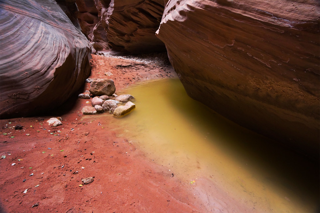
Murk by ashergrey, on Flickr
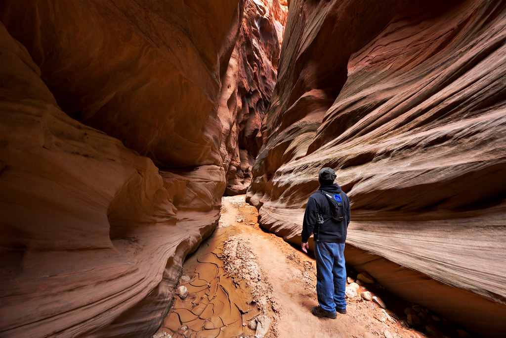
Marvel by ashergrey, on Flickr
By my estimation we made it about half to three quarters of the way to the Middle Trail exit before turning back. Conditions were quite dry and we escaped much of the mud I've heard can be such a problem for hikers in Buckskin.
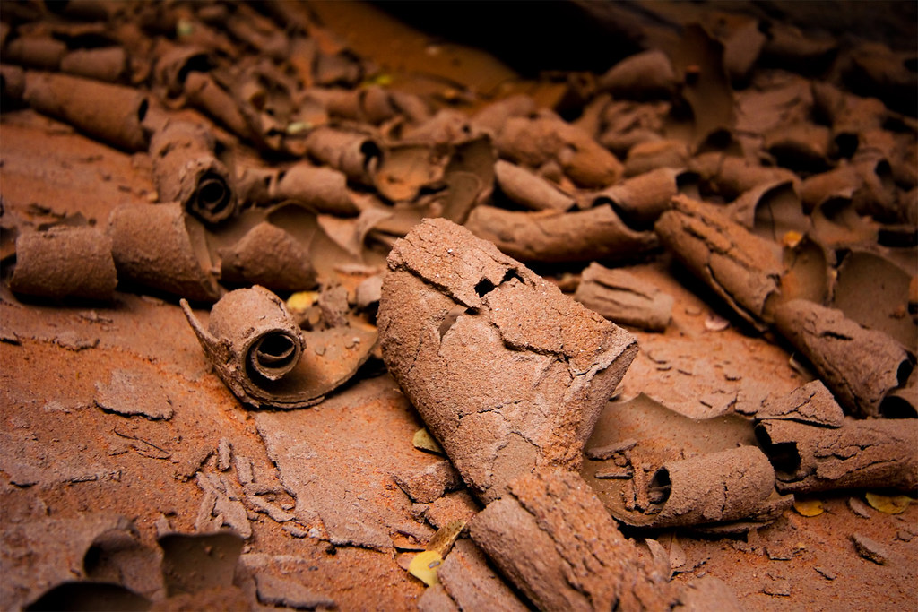
Shaved Chocolate by ashergrey, on Flickr
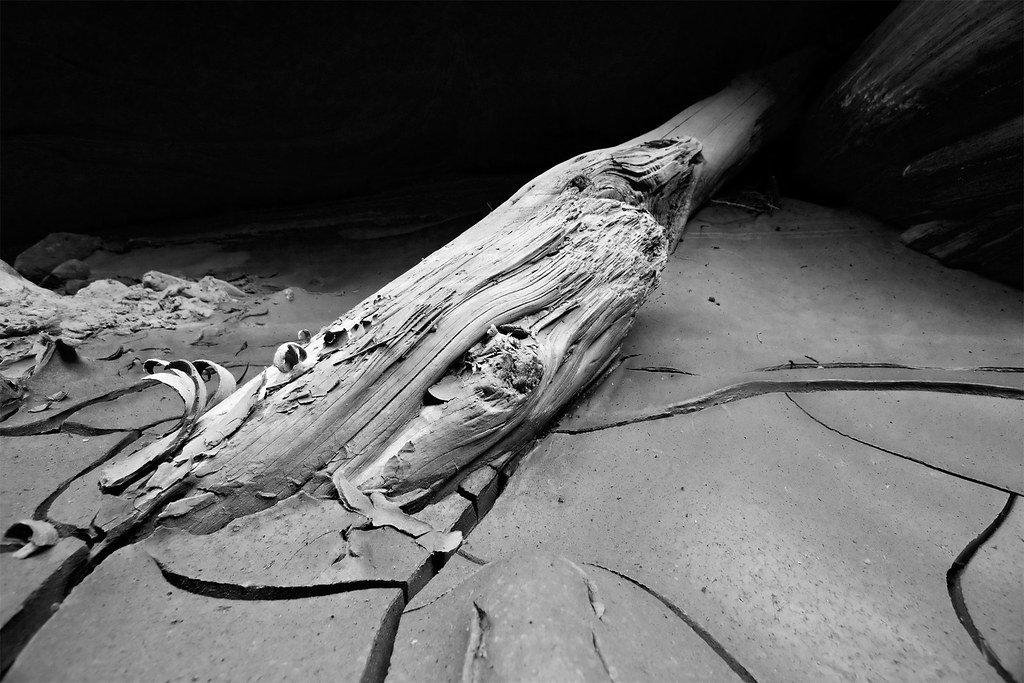
Creationism by ashergrey, on Flickr
Upon returning to the Wire Pass trailhead, we encountered another of the winners from that day's North Coyote Buttes permit lottery. He'd set up a little pup tent at the trailhead parking lot, unfazed by the darkening of the clouds and the chilling wind that started to blow across the desert. Biking across Siberia and most of the rest of the world will give a man that perspective. Mila made him some Cup Noodles.

Given the worsening weather and our lack of winter camping gear, Jeff and I opted to drive to Page for the night. We crashed out at the motel soon after arrival. I woke early the next morning, eager to get to the trailhead by dawn at the latest. It had poured rain in Page overnight… but that fell as snow just a slight bit higher in elevation. Like at the turn-off for the House Rock Valley Road. We faced a decision: risk it or bag it. We risked it.
House Rock Road by ashergrey, on Flickr
It seemed a bad decision at first, as fat wet flakes danced on the wind at the trailhead.

Still we bundled up and started off again up toward Wire Pass. The weather made the hike to North Coyote Buttes a real slog. Once we arrived, we encountered very flat light and a chilly breeze that made photography a real drag.
Hiking the Surface of Mars (Explored) by ashergrey, on Flickr
Winter at The Wave by ashergrey, on Flickr
Most of my shots required a ton of post work to make them at all interesting (including total sky replacements). I ended up overbaking them as a result.
Eroded (Explored) by ashergrey, on Flickr
Stratum by ashergrey, on Flickr
Wave vertorama by ashergrey, on Flickr
We hiked up above the main Wave formation then circled around to the east side of the rock "island". I'd hoped to find some interesting formations or an easy access to the top of the outcropping. Instead only depressing, snowbound desert greeted me.


Sharpness by ashergrey, on Flickr
Wet, cold and somewhat miserable, Jeff and I decided to cut our losses and begin the hike back to the car. I faced a full drive home to Salt Lake City (having to be to work the next day). In retracing our steps we did our best to follow the landmarks. I'd done enough research to know that the most common mistake people make returning from the Wave is turning west too early. The reason why is there are a set of twin domes used as a reference point that are very similar to a second set of twin domes. When headed north, the approaches to each of these sets of domes is very similar.

We made this mistake. In our defense, we recognized the error early. However, in my curiosity I insisted that we continue on to the top of the ridge so I could see what the big fuss was about. Upon reaching it, a hiker is granted a tantalizing view of the overland route back toward Wire Pass. It seems, from that view, that making a descent from the spot would grant a nice short cut. With this in mind I told Jeff to stay put while I scouted my way down the opposite side of the ridge a bit.

He seemed hesitant but trusted my judgement when I told him I could see a way down by following the grooves in the rock as they stepped down the slope. For a time, this actually worked. We zig-zagged along, each picking our own path. He ended up in front of me and the first sign of danger came when he made an abrupt stop.
"What's wrong?" I could tell from his body language that it wasn't a simple matter of his pausing to select the best of several paths.
"I can't see a way down any more."
I stopped as well and surveyed our options. The slope had steepened in its incline with such a gradual roll that I had not at first recognized the precariousness of our perch.
"Hmm. Maybe this wasn't such a good idea. Let's go back."
We both turned, only to find that our descent had already placed the crest 50 to 100 feet above us. The grooves that had provided such an easy path to that point now seemed nothing more than sidewalk cracks. I tried to scramble up the face of the rock but found my feet sliding beneath me. The light snow had made the normally dry, crumbly crustose lichen adhering to the sandstone feel more like greased peach skin.
With great caution we each picked our way to spots along the wall where we could settle without exhausting ourselves. Jeff, being shorter and more nimble than I, ascended to a spot higher up the wall. I meanwhile fumbled with my backpack and DSLR camera bag. I'd strapped the camera bag to my hip and now that I'd turned from descending to ascending, it flopped between my body and the rock. Once in these safe spots, we each took a chance to breathe and consider the options.
"We're cliffed out. I can't believe I did this to us. Total rookie mistake." Jeff didn't say much in response. I continued on, letting the interior monologue in my head spill out and talking myself through the situation. "The way I see it, we have two choices… we can keep trying to go up, or we can stay here and wait for help… problem is, we're in a wilderness area where they only allow 20 people access a day." Pauses punctuated the clauses coming out of my mouth. Each thought led to the next, with the spaces between giving me time to consider the gravity of problem before us. "And with the weather as it is now, it's unlikely we're going to see many people… and even if we do spot someone, they'll have to go to the Paria Contact Station… then the BLM will have to come down here and either get us with ropes or call in a helicopter… and with the weather being what it is, they might not even be able to get a helicopter in here today."
"I don't really want to spend a night here."
"Yeah, me neither. Especially if it snows again."
"And I'm getting cold."
"That's another good point. We've stopped moving. We're going to cool off real fast. At some point hunger and hypothermia become considerations."
"Can you get up to where I am?"
I looked up to where he half stood, half sat on a ledge about 15 feet up slope. The shaking of my legs after three days of hiking and the adrenaline flooding my bloodstream combined to cause a vertiginous sensation. The shift in my center of gravity caused by both wearing a backpack and having a camera sitting lopsided on one hip made it feel as if I were being pulled backward, away from the safety of the rock.
"I don't know. Probably not with my pack on. It's seriously throwing off my balance."
Jeff pointed out a few possible routes between us that I could try, but each time I started up my feet made precipitous slips and I ended up back on my perch. Part of my strategy in talking through the situation involved keeping panic in check by treating the problem with a thorough, sober and rational process. Now though, I felt a sense of dread brewing.
"I'm seriously considering just dropping my pack."
"Yeah?"
"Yeah. I'm pretty sure I can make it up without it. I mean, if I let it go from here it will probably slide most the way down. My camera would be toast, but that's better than falling to my death."
While mulling this move, I spied another potential route up the slope. However, in order to reach it I would need to traverse about 15 feet to the left from my perch. No safe hand or footholds spanned the distance, only one of the narrow grooves and sheer rock. So nervous and terrified, I pressed my body flat to the stone, inched my toes out over the precipice and crammed my forearms into the depression.
***
Upon spanning the distance, Jeff and I reunited and picked our way up the rest of the mountain. As the cliff rolled out into a hilltop our mad scramble became a cautious tiptoe, then longer strides and at last elated skips and hops. We stopped again at the crest to look back on the specious slope. Laughter erupted from our lungs at escaping the scrape. Our limbs trembled from the agitating rush of endorphins brought on by the near-death experience.
"That was nuts."
"It doesn't even look that bad from up here."
"I know, right? I can totally see the path down again from up here but it just doesn't exist when you get down there. It's deceiving."
We felt elated in that moment. Still, I recognized then that the error in my judgement had brought us very near to disaster. A wrong step or a crumbing bit of stone and the story would have been inked in the headlines. Had we gone back to the prescribed path the moment we acknowledged turning too early, the view from the crest would not have presented its tantalizing vista. And had I heeded my hiking partner's hesitation at trailblazing, my own hubris could have been diluted.
The hike out (the right way) took us back around to the desert floor north-west of the troubling slope. We turned back to look at where we'd been stuck and wondered how in the hell it had seemed like an okay idea before. I regret now not photographing it, but anyone who has hiked to the Wave by way of the Wire Pass trailhead has seen the spot. And I would not begrudge anyone for, upon seeing a hiker stranded there, calling that person an idiot.
GPS track via Google Maps.
Featured image for home page:

Quivering, the calf muscles strained. Toes groped, making the muscle fibers contract and release. The sticky rubber-wrapped toe caps on the shoes surrounding those feet scraped along, seeking any little edge or knob upon which to rest. Each leg reached full extension without finding purchase.
"Not good. This is really not good," I said, my voice shaking. "I can't get grip. My feet are just sliding."
The rock felt damp and cold. It leeched heat. My body flattened against the sandstone, maximizing friction and reducing, by some small measure, the likelihood that all five feet and eleven inches of me would slip like a wet bar of soap.
"How far below is the next groove?"
Jeff craned his neck out with caution from above me.
"About half a foot or so."
"Shit. That's too far."
"If you just slide down a bit, you can get it."
A frustrated grunt slipped past my lips.
"Problem is, I'm pretty sure that once I start sliding I won't stop. I'll just tumble. Or at least I will until I hit the bottom. That's like two hundred feet down though."
Again my toes scraped the rock with the same result.
"Do you want me to come down?"
"No," I said, emphasizing the syllable to keep him from moving. Already he had begun to creep over from his safe perch.
"Are you sure? I can give you a hand assist."
My head shook, jostling the beads of sweat on my forehead.
"I need you to stay where you are. If you come down we might both be stuck. And I want at least one of us to be able to go back for help if this goes bad."
Let me rephrase, I thought. It's already gone bad.
Light snow flurries swirled in the space between us. They wet the dull orange rock, one continuous piece of sandstone quilted by horizontal and vertical grooves, like rows and columns on a spreadsheet. Each tile, or cell to extend the metaphor, measured anywhere from six to ten feet per a side. Most were squarish, but the lines were not perfect, like those drawn by a grade schooler. (I didn't get any shots of this, but you can see the type of terrain I'm talking about in this Ronnie Coldbowl photo on panoramio.)
Jeff and I were perched on the west face of the ridge, about three quarters of the way up from the base. We had started down from the crest, intending to zig-zag our way along the grooves to the desert floor. Before beginning down I had scouted ahead, aware that sight can deceive and that the slope could in fact be more steep than it first appeared. The path had seemed doable as long as we stair-stepped the quilt lines.
It wasn't doable. Now, my forearms were crammed into one of those quilt lines. They held the entirety of my weight over a slope that had proved too steep to descend. The small cleft had a soft edge that made it difficult to gain much purchase. Higher up the grooves were six or eight inches deep but as the slope had become more sheer they also became more shallow. This groove dug only an inch or so deep into the rock. Fine wet sand filled its recess. Both of my hands, balled into fists, were tucked against my chest. I exhaled against the gritty stone, feeling the heat of it reflect back into my flushed face. My hair, wetted by sweat and snow, matted against my forehead. The pack tugging at my shoulders conspired to pull those arms off the little ledge.
"Shit. This is dumb. This is really dumb," I said under my breath.
With eyes clenched I eased the contracted muscles of my left arm and in a jerking motion inched it away from the trunk of my body. Useless feet dangled as the right arm followed. Images of the stomach-churning fall that would surely follow a mis-move flashed across my mind. I tried to block them out as I again moved the left arm, followed by the right. In this way I shuffled along, inch by inch along the red rock.
"Keep going. Just a few more feet and you've got it," Jeff said as I crept along on wobbly arms.
The mountain threatened to shrug off my little body. I felt its indifference, bordering on disdain.
There is no one to save you. One wrong move, one twitch, and you're mine.
***
This trip had not started in such a dramatic fashion. My friend Jeff had moved from Salt Lake City to St. George about a year prior and in that time I'd not been south to visit. I'd been longing to head into the desert and so I told him I'd be heading down and suggested we plan an outing.
A trip down Parunuweap topped my to-do list. Still, I knew that Jeff would probably like to take his wife and two kids along for at least one day, so Parunuweap was out. Water Canyon seemed interesting but would probably be too snowy in early November. So as a easy warm-up I selected the Middle Fork of Taylor Creek in Zion National Park's Kolob Canyons section for our first hike. The trail is kid-suitable, scenic and relatively short.
Jeff had bought a kid-carrier for his youngest at a yard sale. He tossed this, some bottles of water and snacks in his Durango and we all headed toward Cedar. As we climbed northward on I-15 we saw a good deal of snow on the Pine Valley Mountains and Kolob Terrace. It even bounded the Kolob Canyon Road right off the freeway.
Conditions along the trail were soggy but pristine. A coating of untouched powder covered the trees and undergrowth.
Snow in the Kolob Canyons by ashergrey, on Flickr
We picked our way down muddy steps to the creekside and began following the waterway up into the finger canyon. Jeff's boy thought the frequent stream crossings were a blast, right up until the point he fell into the frigid water and soaked his shoes.
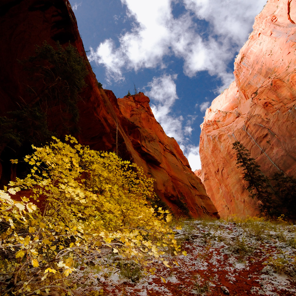
The red walls ascended and narrowed, made all the more stunning by the contrast of the white snow covering the canyon's bottom. The boy's cheery disposition soured as we continued past the Larsen and Fife cabins. By the time we'd reached the trail's terminus at Double Arch Alcove he'd turned downright sour. We hooted at the hole and listened to the echoes, hoping he'd take notice of the sound and brighten his mood. Instead he climbed into his sister's backpack carrier and fell asleep.
I took some shots and we started back down the trail.
Glimpse of the Sky by ashergrey, on Flickr
Jeff shouldered his boy in the kid carrier, putting his son's now bare feet into his sweatshirt pockets to warm them. But his younger daughter, unhappy at being usurped from the easy chair, started to fuss. Jeff's wife carried her in her arms but she soon grew tired. Before long she had zipped her daughter up inside her hoodie. The little girl stretched the garment so tight that it held her in place against her mother's torso like a cocoon. She fell asleep there, making her mother appear as if she were pregnant with a gigantic baby. Later the girl started awake and, not understanding where she was or why she was so constricted, started to wail.
GPS track via Google Maps.
On Sunday Jeff and I set out, sans children, for the Paria Contact Station. The hope was that at this late season we'd stand a decent chance of scoring lottery permits for North Coyote Buttes. Because the permits are awarded on a day-before-trip basis, we'd planned to spend Sunday exploring Wire Pass and Buckskin Gulch. If we won the lottery, we'd make other plans. Otherwise we'd head back to St. George Sunday evening.
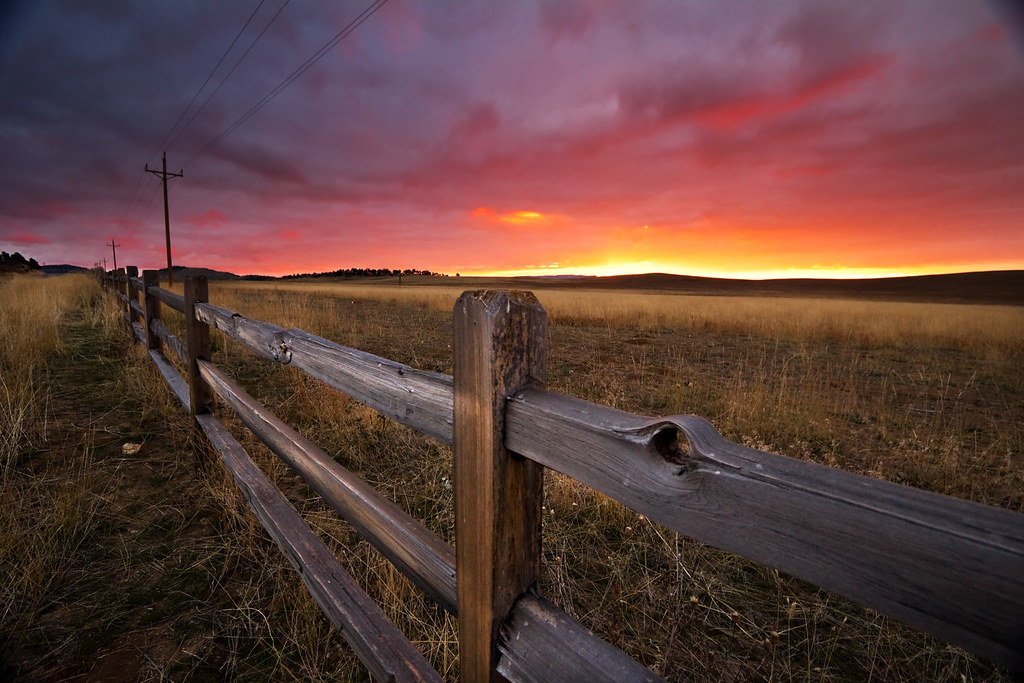
We left St. George before dawn, driving the north route to Kanab through the Zion-Mt. Caramel tunnel. Along the way, we were treated to an amazing sunrise.
Fence by ashergrey, on Flickr
A group of about 12 people had already reached the little BLM outpost by the time we arrived. Still, it seemed the odds were in our favor. As we waited more hopefuls arrived, swelling the number to about 20. In the meantime I perused the USGS quad maps available at the ranger station, showing Jeff the lay of the land around Buckskin Gulch, Wire Pass and The Wave. I also demonstrated how I could pull up the same map tiles on my iPhone using Phil Endecott's Topo Maps App, overlaying GPS data and waypoints.
One of the Bureau of Land Management staffers couldn't resist the opportunity to bash the tech.
"GPS? That's as good as worthless out here. Most people that get lost are too reliant on those things."
Then came the lottery.
We scored! It came close, with Jeff and I taking the seven and eight spots of the 10 available. Encouraged, we set off down House Rock Valley Road to explore Buckskin.
It took longer than expected to reach the Wire Pass trailhead, as we became stuck behind a snail-pace driver in an SUV on the backcountry road. He slowed to a crawl each time washboards rattled his vehicle, making me grit my teeth. Worse yet, he drove down the center of the path, refusing to move over or swerve much around rough patches.
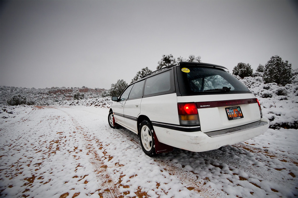
"This guy has no clue about rural road etiquette," I vented as my beater Subaru wagon bounced over the rocks and ruts. "We've been tailing his butt for five miles. You think he would let us pass."
By the time we both arrived at the trailhead, the sky had turned overcast. The clouds were low but flat, light gray in color and non-threatening. We started on the path to Wire Pass, Mr. Slow Driver and his female companion now on our heels. Before long we came upon another group, obviously confused as to where they were going. They stood in the wash, trying to decide if they were supposed to continue up it or turn toward North Coyote Buttes. We stopped and helped them navigate, making snide comments under our breath that if they were lost at this point, their situation would soon be worse. I pulled up the USGS quad on my iPhone, overlaid our position on the map and showed this to the group.
This pause allowed the slow driver and his wife to catch up to us. They were an older couple, late middle-aged. The man stood tall and somewhat broad, with piercing eyes and a dark beard flecked with gray. The woman had scraggly hair and cragged features, but not in a haggard way. As we waved goodbye to the confused party and wished them well, the wife took an interest in my iPhone.
"Oh, does that gyee pee ess?"
A thick accent marred her English. It sounded Russian. As in, comic book-movie-villain Russian.
"I'm sorry?"
"Your phone, does it gyee pee ess?"
"Oh, you mean is it a GPS receiver."
"Yes, yes."
And so began our conversation. In several years of using a smartphone as a handheld GPS on the trail, I'd never had so many people show interest in it as on this trip. It was a reminder that a large portion of the population (the majority?) have no idea how global positioning actually works and still view the tech as a high-cost luxury.
As the woman, Mila, and I talked it dawned on me that the reason her husband Glenn did not understand rural road etiquette was that they were not from the neighborhood. Their SUV with Utah plates was a rental.
Glenn and Mila hailed from Kiev, by way of Chicago. They'd come to the U.S. about 20 years prior and took up residence in Illinois. Glenn didn't talk much at first but Mila couldn't stop chatting. We heard about her job working with a firm that codes hospital management software, her lazy 20-something son, her views on Russian politics… it all came pouring out. Still, it was worth it to see their dumbfounded reaction when we entered the little Wire Pass slot.
Wire Pass by ashergrey, on Flickr
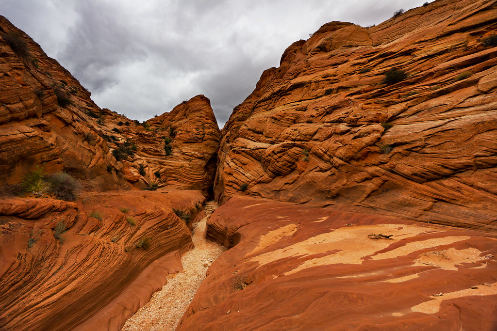
They accepted our help getting over the little boulders. Once we reached Buckskin, Glenn and Mila opted to depart our company and head north. Jeff and I went west deeper into the narrows.
Murk by ashergrey, on Flickr
Marvel by ashergrey, on Flickr
By my estimation we made it about half to three quarters of the way to the Middle Trail exit before turning back. Conditions were quite dry and we escaped much of the mud I've heard can be such a problem for hikers in Buckskin.
Shaved Chocolate by ashergrey, on Flickr
Creationism by ashergrey, on Flickr
Upon returning to the Wire Pass trailhead, we encountered another of the winners from that day's North Coyote Buttes permit lottery. He'd set up a little pup tent at the trailhead parking lot, unfazed by the darkening of the clouds and the chilling wind that started to blow across the desert. Biking across Siberia and most of the rest of the world will give a man that perspective. Mila made him some Cup Noodles.
Given the worsening weather and our lack of winter camping gear, Jeff and I opted to drive to Page for the night. We crashed out at the motel soon after arrival. I woke early the next morning, eager to get to the trailhead by dawn at the latest. It had poured rain in Page overnight… but that fell as snow just a slight bit higher in elevation. Like at the turn-off for the House Rock Valley Road. We faced a decision: risk it or bag it. We risked it.
House Rock Road by ashergrey, on Flickr
It seemed a bad decision at first, as fat wet flakes danced on the wind at the trailhead.
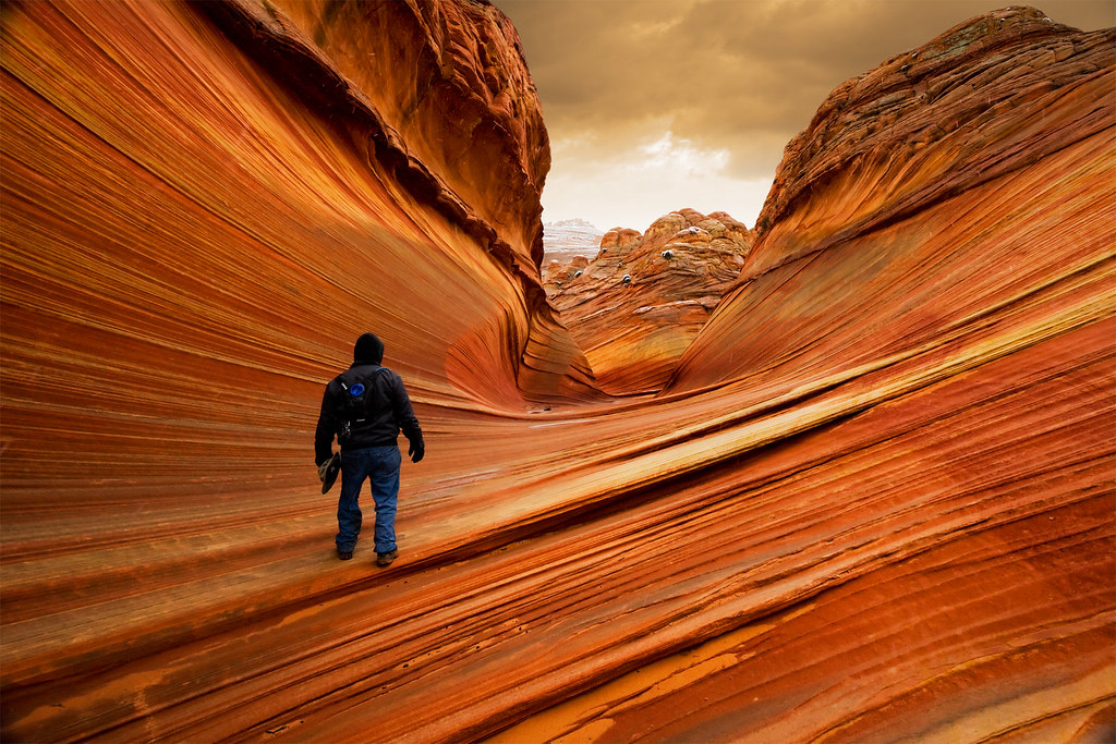
Still we bundled up and started off again up toward Wire Pass. The weather made the hike to North Coyote Buttes a real slog. Once we arrived, we encountered very flat light and a chilly breeze that made photography a real drag.
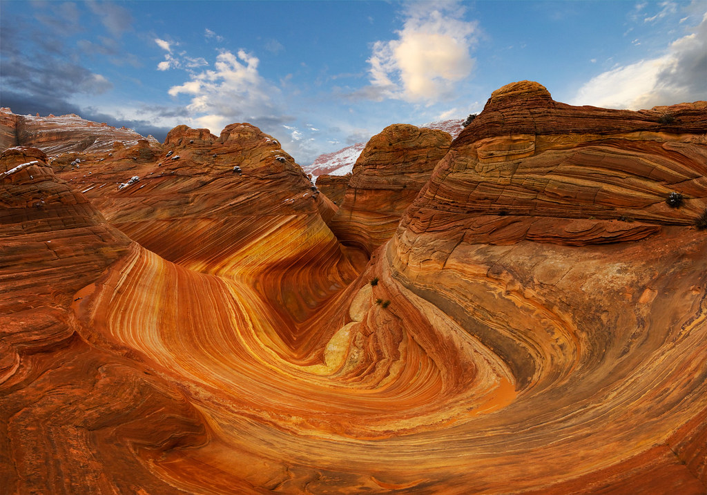
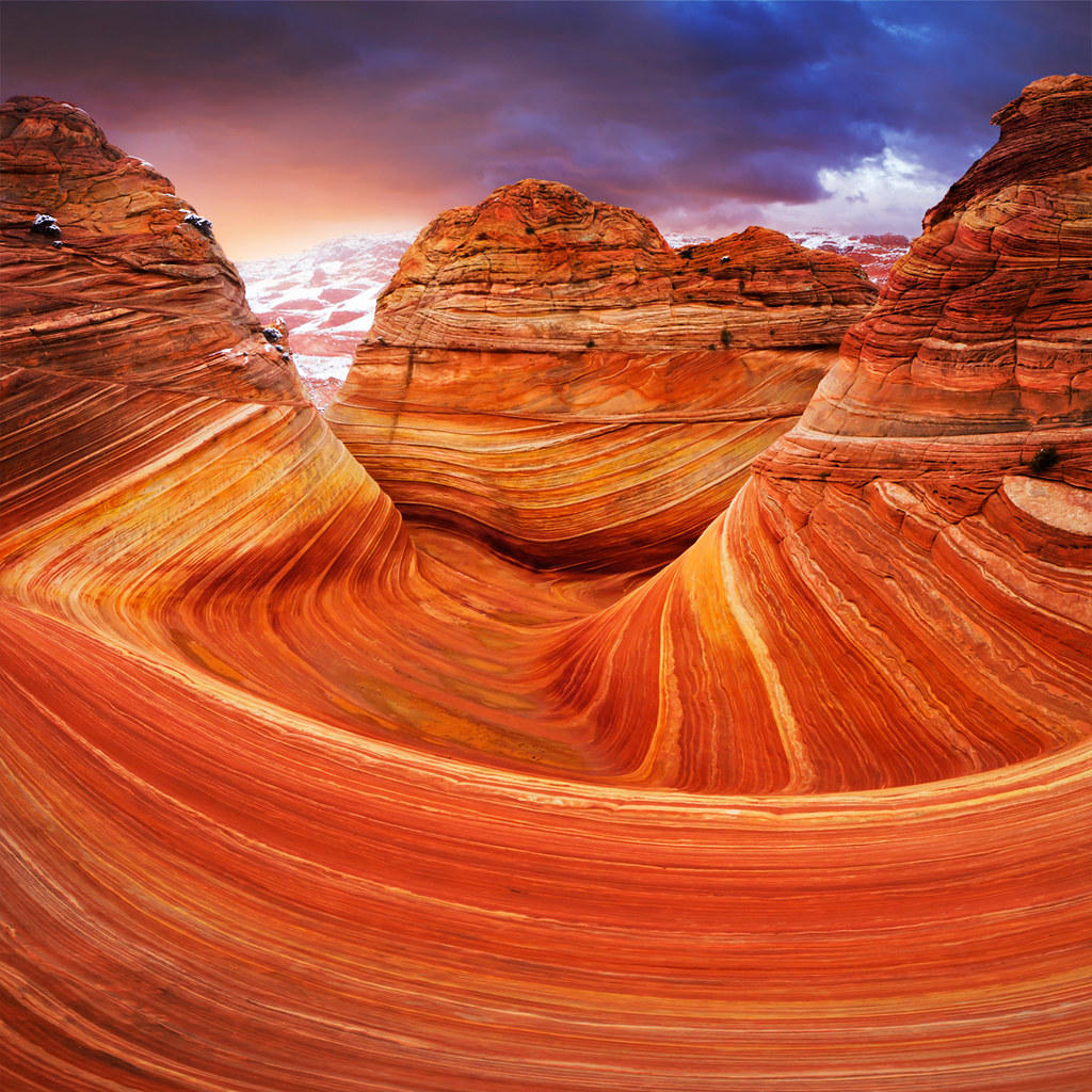
Hiking the Surface of Mars (Explored) by ashergrey, on Flickr
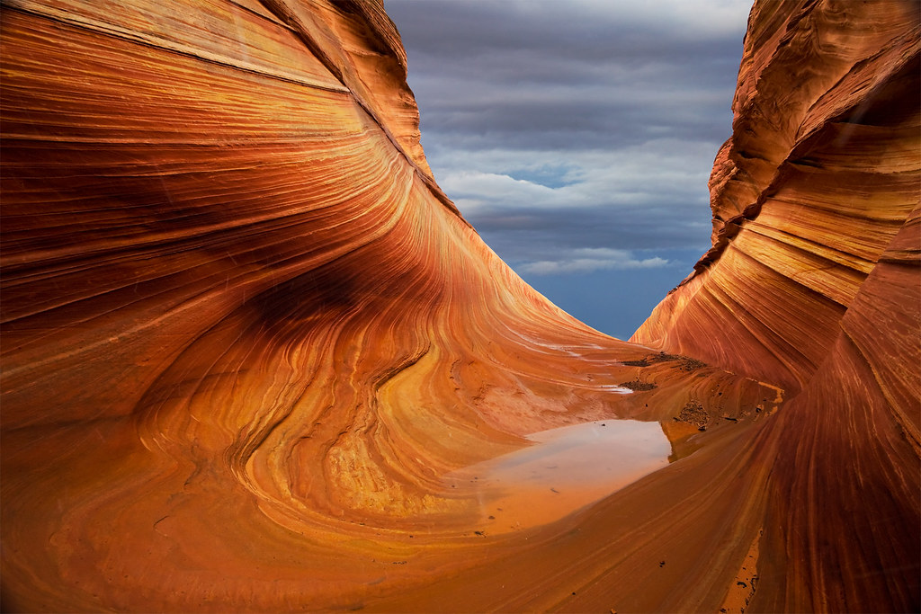
Winter at The Wave by ashergrey, on Flickr
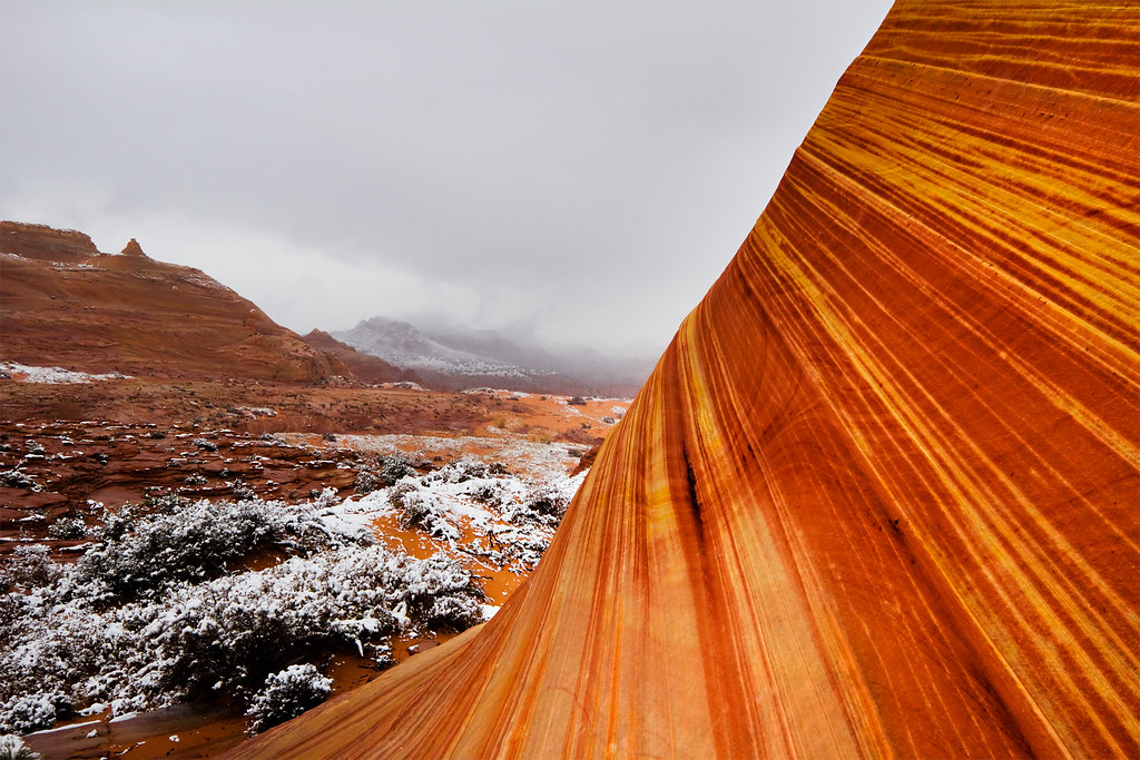
Most of my shots required a ton of post work to make them at all interesting (including total sky replacements). I ended up overbaking them as a result.
Eroded (Explored) by ashergrey, on Flickr
Stratum by ashergrey, on Flickr
Wave vertorama by ashergrey, on Flickr
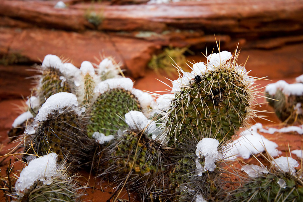
We hiked up above the main Wave formation then circled around to the east side of the rock "island". I'd hoped to find some interesting formations or an easy access to the top of the outcropping. Instead only depressing, snowbound desert greeted me.
Sharpness by ashergrey, on Flickr
Wet, cold and somewhat miserable, Jeff and I decided to cut our losses and begin the hike back to the car. I faced a full drive home to Salt Lake City (having to be to work the next day). In retracing our steps we did our best to follow the landmarks. I'd done enough research to know that the most common mistake people make returning from the Wave is turning west too early. The reason why is there are a set of twin domes used as a reference point that are very similar to a second set of twin domes. When headed north, the approaches to each of these sets of domes is very similar.
We made this mistake. In our defense, we recognized the error early. However, in my curiosity I insisted that we continue on to the top of the ridge so I could see what the big fuss was about. Upon reaching it, a hiker is granted a tantalizing view of the overland route back toward Wire Pass. It seems, from that view, that making a descent from the spot would grant a nice short cut. With this in mind I told Jeff to stay put while I scouted my way down the opposite side of the ridge a bit.
He seemed hesitant but trusted my judgement when I told him I could see a way down by following the grooves in the rock as they stepped down the slope. For a time, this actually worked. We zig-zagged along, each picking our own path. He ended up in front of me and the first sign of danger came when he made an abrupt stop.
"What's wrong?" I could tell from his body language that it wasn't a simple matter of his pausing to select the best of several paths.
"I can't see a way down any more."
I stopped as well and surveyed our options. The slope had steepened in its incline with such a gradual roll that I had not at first recognized the precariousness of our perch.
"Hmm. Maybe this wasn't such a good idea. Let's go back."
We both turned, only to find that our descent had already placed the crest 50 to 100 feet above us. The grooves that had provided such an easy path to that point now seemed nothing more than sidewalk cracks. I tried to scramble up the face of the rock but found my feet sliding beneath me. The light snow had made the normally dry, crumbly crustose lichen adhering to the sandstone feel more like greased peach skin.
With great caution we each picked our way to spots along the wall where we could settle without exhausting ourselves. Jeff, being shorter and more nimble than I, ascended to a spot higher up the wall. I meanwhile fumbled with my backpack and DSLR camera bag. I'd strapped the camera bag to my hip and now that I'd turned from descending to ascending, it flopped between my body and the rock. Once in these safe spots, we each took a chance to breathe and consider the options.
"We're cliffed out. I can't believe I did this to us. Total rookie mistake." Jeff didn't say much in response. I continued on, letting the interior monologue in my head spill out and talking myself through the situation. "The way I see it, we have two choices… we can keep trying to go up, or we can stay here and wait for help… problem is, we're in a wilderness area where they only allow 20 people access a day." Pauses punctuated the clauses coming out of my mouth. Each thought led to the next, with the spaces between giving me time to consider the gravity of problem before us. "And with the weather as it is now, it's unlikely we're going to see many people… and even if we do spot someone, they'll have to go to the Paria Contact Station… then the BLM will have to come down here and either get us with ropes or call in a helicopter… and with the weather being what it is, they might not even be able to get a helicopter in here today."
"I don't really want to spend a night here."
"Yeah, me neither. Especially if it snows again."
"And I'm getting cold."
"That's another good point. We've stopped moving. We're going to cool off real fast. At some point hunger and hypothermia become considerations."
"Can you get up to where I am?"
I looked up to where he half stood, half sat on a ledge about 15 feet up slope. The shaking of my legs after three days of hiking and the adrenaline flooding my bloodstream combined to cause a vertiginous sensation. The shift in my center of gravity caused by both wearing a backpack and having a camera sitting lopsided on one hip made it feel as if I were being pulled backward, away from the safety of the rock.
"I don't know. Probably not with my pack on. It's seriously throwing off my balance."
Jeff pointed out a few possible routes between us that I could try, but each time I started up my feet made precipitous slips and I ended up back on my perch. Part of my strategy in talking through the situation involved keeping panic in check by treating the problem with a thorough, sober and rational process. Now though, I felt a sense of dread brewing.
"I'm seriously considering just dropping my pack."
"Yeah?"
"Yeah. I'm pretty sure I can make it up without it. I mean, if I let it go from here it will probably slide most the way down. My camera would be toast, but that's better than falling to my death."
While mulling this move, I spied another potential route up the slope. However, in order to reach it I would need to traverse about 15 feet to the left from my perch. No safe hand or footholds spanned the distance, only one of the narrow grooves and sheer rock. So nervous and terrified, I pressed my body flat to the stone, inched my toes out over the precipice and crammed my forearms into the depression.
***
Upon spanning the distance, Jeff and I reunited and picked our way up the rest of the mountain. As the cliff rolled out into a hilltop our mad scramble became a cautious tiptoe, then longer strides and at last elated skips and hops. We stopped again at the crest to look back on the specious slope. Laughter erupted from our lungs at escaping the scrape. Our limbs trembled from the agitating rush of endorphins brought on by the near-death experience.
"That was nuts."
"It doesn't even look that bad from up here."
"I know, right? I can totally see the path down again from up here but it just doesn't exist when you get down there. It's deceiving."
We felt elated in that moment. Still, I recognized then that the error in my judgement had brought us very near to disaster. A wrong step or a crumbing bit of stone and the story would have been inked in the headlines. Had we gone back to the prescribed path the moment we acknowledged turning too early, the view from the crest would not have presented its tantalizing vista. And had I heeded my hiking partner's hesitation at trailblazing, my own hubris could have been diluted.
The hike out (the right way) took us back around to the desert floor north-west of the troubling slope. We turned back to look at where we'd been stuck and wondered how in the hell it had seemed like an okay idea before. I regret now not photographing it, but anyone who has hiked to the Wave by way of the Wire Pass trailhead has seen the spot. And I would not begrudge anyone for, upon seeing a hiker stranded there, calling that person an idiot.
GPS track via Google Maps.
Featured image for home page: