- Joined
- Feb 15, 2020
- Messages
- 624
Pretty arbitrary name for a trip report, but this one is all over the place with plenty of highs and lows - of both the literal and metaphorical varieties. I've had a few versions of this trip drawn up for a while now, but it finally came together. Some places I've wanted to see for a while now (or see from a new perspective), a bit of inspiration from last year's (in)famous BCP Hidden Creek Expedition, and a general love of the Greater Yellowstone finally saw it happen.
The initial plan was to hike up Deer Creek Pass, hopefully find the route up the Hidden Creek falls, traverse to and across the Thorofare Plateau, then exit via Eagle Pass - with a summit of Eagle Peak (highest point in Yellowstone NP) to cap things off. I'd also strongly considered traversing 'The Trident' on this one, but after a couple days up high getting blasted with wind and sun I'm glad I decided to hike through the Yellowstone River valley instead. Can't do everything on every trip after all.
I had one friend accompanying me - but unfortunately we were only together a couple days before he had to make a less than ideal exit due to injury, but we'll get to that. As a result, I was alone beyond the Hidden Creek meadows.
Day 1: Deer Creek TH to Upper Butte Creek [11.20 mi; +4,470'/-1,087']
Things kicked off in conventional fashion - a good, long climb up to the good stuff. Deer Creek itself is very nice, but quite a long approach to the most exciting parts. Might have seen more bear sign here than any other section of the trip though - even if the bears themselves remained elusive. Not much good camping to be found, but I do love the upper bowl below Kingfisher Peak. Upper Butte Creek - as @wsp_scott recommended - made for an absolutely excellent camp for the night.
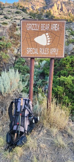
Obligatory 'Bear Country' sign at the trailhead. Ready to go!
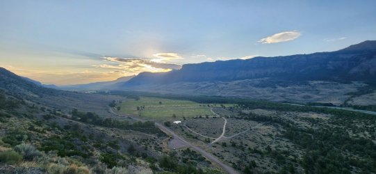
We got a fairly early start - hoping to avoid too much direct sun on the lower, steeper section. I think this was a pretty good call. No other cars at the trailhead.
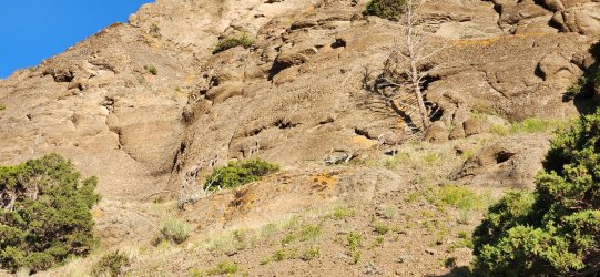
And less than 10 minutes into our hike, we already have some bighorns. Two bighorn ewes and two small lambs.
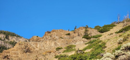
They were not very skittish and mostly watched calmly as we passed by.
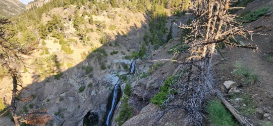
Cool multi-tier waterfall on the way up.
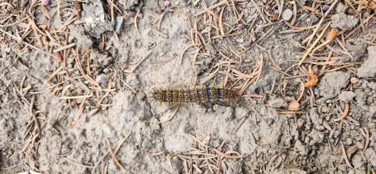
Cute little Tent Caterpillar crossing the trail.
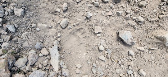
There were bear tracks pretty much all the way up. Mostly small-ish in size.
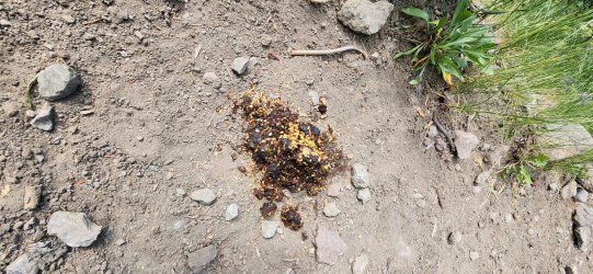
Plenty of scat to be found, as well.
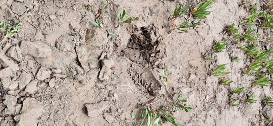
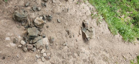
Even some nice digs to get at the juicy insects below. Pushed this rock right onto the trail.
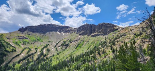
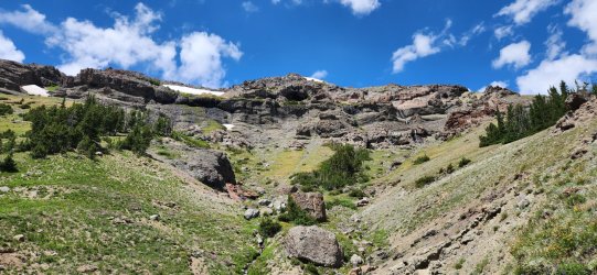
The upper basin and Kingfisher Peak were spectacular as we approached the pass.
Cozy looking cave. And the water coming down here was divine.
This little marmot had the best seat in the house - and he seemed to know it.
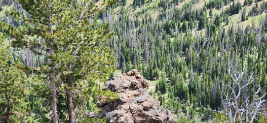
360° from Deer Creek Pass.
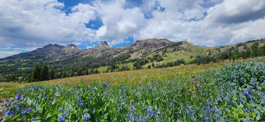
Wildflowers were going crazy below the pass at upper Butte Creek.
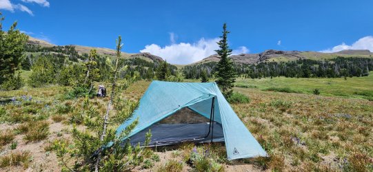
Made for a very nice place to set up camp.
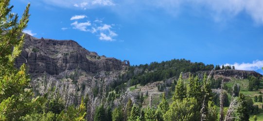
I recognized this arch from some of last year's trip reports. I was tempted to go up and get a closer look, but contented myself with just observing it as I ate dinner.
Day 2: Upper Butte Creek to Hidden Creek Meadows [19.23 mi; +1,407'/-2,353']
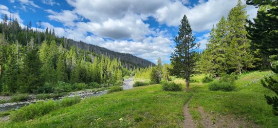
Today would start with a long, gentle drop to Thorofare Creek before climbing up to the Hidden Creek meadows. Mostly on nicely manicured trail, though it would fade in/out beyond the Hidden Creek outfitters' camp. The early parts of the day were very pretty, but nothing of particular note - Hidden Creek on the other hand lived up to the hype as an absolutely spectacular canyon to explore.
The morning brought beautiful conditions and just enough clouds to keep things cool
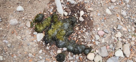
Some pretty fresh scat to start the day.
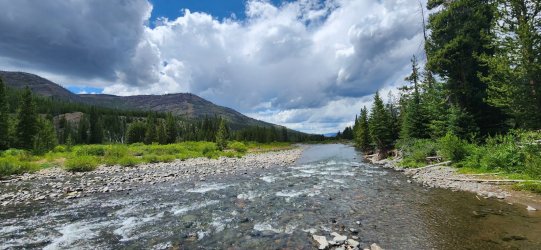
Down to Thorofare Creek and ready to head up towards Hidden Creek.
It was a bit rainy on the first half of our hike up towards Hidden Creek, but things opened up right as we found the Hidden Creek meadows.
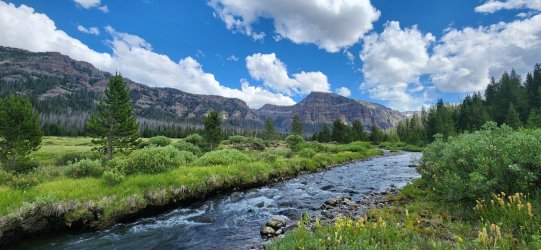
Incredible views and sheer rock faces.
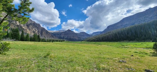
Our first, distant look at the Hidden Creek falls.
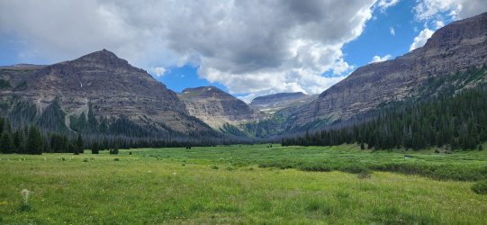
Wonderful camp for the night, even if it did rain off-and-on for the duration.
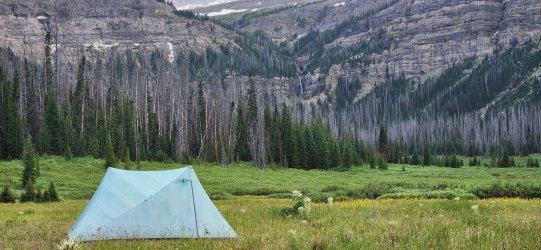
In between showers I found myself looking right at tomorrow's first objective.
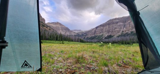
Day 3: Hidden Creek Meadows to Thorofare Plateau [10.01 mi; +4,248'/-2,412']
The long anticipated day was here - could @TheMountainRabbit find the way up above the Hidden Creek falls? My buddy and I had spent the evening discussing our options and felt pretty good about our plan, but you never quite know until you get there. I'd hoped to explore closer to the falls the prior evening, but the rain kept me back at camp.
Unfortunately the rain also kept us awake for much of the night, so neither of us woke up feeling the most rested. My hiking partner decided he wanted to stick to the low route and we would meet up again along Thorofare Creek after I (hopefully) crossed Thorofare Plateau. Not out of the ordinary on our trips, so we said our "good-bye"s and "good luck"s and split up for the day. (Though it would turn out to be much longer.)
Morning brought a beautiful sunrise and high spirits.
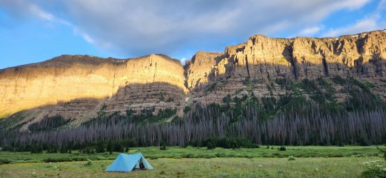
Thanks to all of the prior evening's rain, it was a very damp walk up to the cliffs.
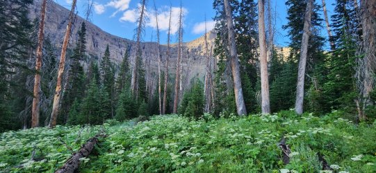
With the proper route relatively unknown, my plan for the AM was to swing out wide left (east) of the Hidden Creek falls and try to find a suitable 'break' in the cliffs. On both the topos and a picture @TractorDoc shared with me from his trip last year, I thought this gully looked promising. There was a large slide path that led right to it, so after breaking out from the trees it was right in front of me.
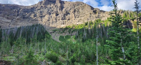
Turns out I wasn't alone in this thinking. As I approached - planning on going straight up the gully - I noticed this slight trail off to the left-hand side.
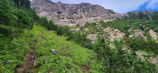
It was fairly steep, but had secure footing and took me right above the problematic cliff band.
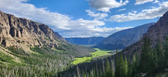
The traverse turned out to be straight-forward, as the trail continued - more or less - all the way to the top of the Hidden Creek falls.
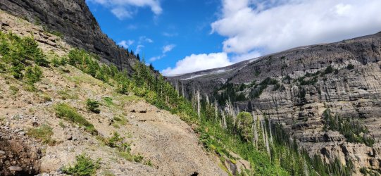
Into the trees.
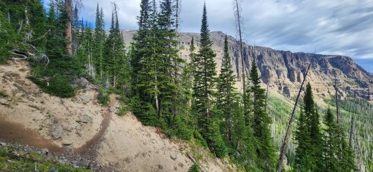
The top of what I now realize is just the lower falls of Hidden Creek. (Though possibly the most spectacular and you don't get a great view on this route. Might want to check out @scatman's report from last year if you want a close-up look.)
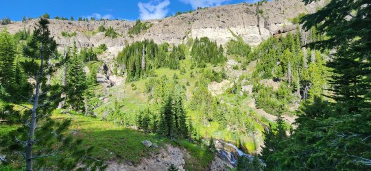
I guess I'd call this the middle basin of Hidden Creek. Another wonderful set of falls coming over the upper edge and a real 'Shangri-La' vibe. I stopped for a bit to enjoy before heading up towards the next set of falls.
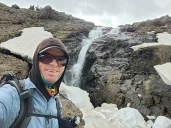
Yours truly enjoying a bit of the spray.
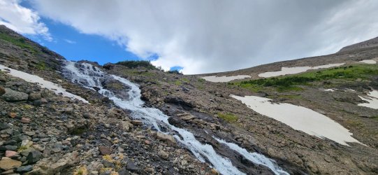
The falls here were more of a cascade than the sheer drop below, but beautiful nonetheless.
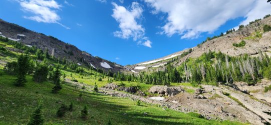
Looking down at the middle basin.
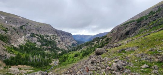
And on to the upper basin! This section was beautiful walking along a gentle stream, before climbing up towards unnamed Peak 11797 (or 11801, depending on the source).
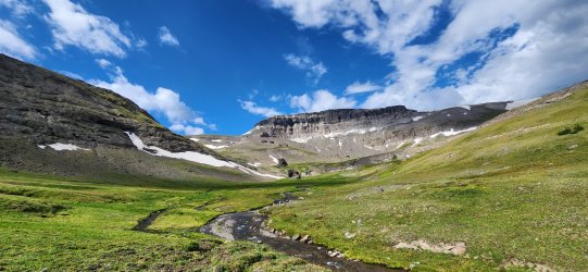
Can you spot the elk? I spotted 3 or 4 before they darted over the ridgeline.
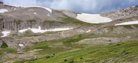
The weather was getting a little bit moody, giving the unnamed peak an ominous vibe. And is that another waterfall?
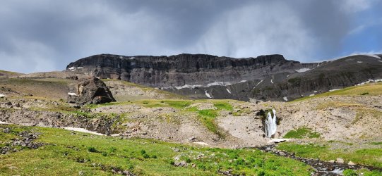
A nice little tarn. And I'll be damned if this isn't one of the more impressive unnamed peaks I've had the pleasure of encountering.
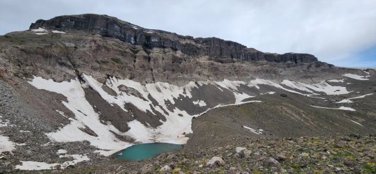
A look back at the Hidden Creek meadows from the eastern flank of unnamed Peak 11797.
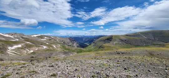
Thorofare Mountain and Younts Peak in the distance. I think Younts is the parent peak to this one.
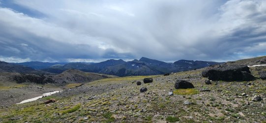
And the Pinnacle Buttes, too!
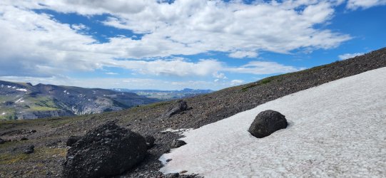
Looking NW along the cliffs of the unnamed peak.
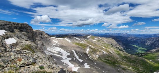
And now the Tetons are in the mix!
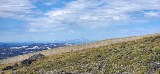
My BCP bottle made the journey as well. Incredible views abound - the Hidden Creek meadows almost 3,000' down below.
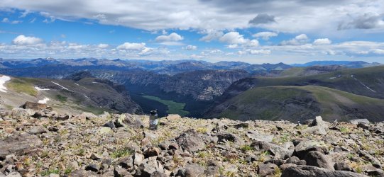
360° from the high point. I think you can see almost every significant peak of the GYE from here. Incredible. One of my favorite summits ever.
But the show must go on. Looking towards the rest of the day's route to the Thorofare Plateau.
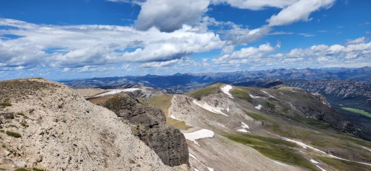
One last look SE along the unnamed peak's northern face.
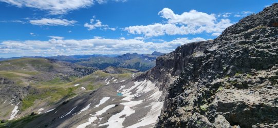
This wonderful unnamed drainage leads down to the Yellowstone River. Thunder Mountain in the distance. At one point I'd considered going out to Thunder Mountain instead of the Thorofare Plateau, but I'm not sure that last section of ridgeline 'goes'. I might need to approach from the west next time.
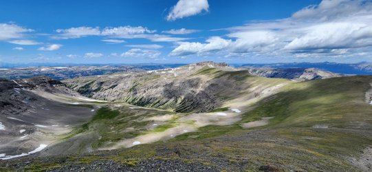
Headwaters of Castle Creek. The ridgeline leading to the Thorofare Plateau on the right.
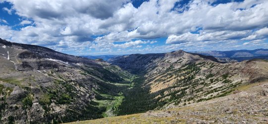
Another cool arch as I approach the Thorofare Plateau. This is also about where I started getting concerned about the final climb up the the Thorofare Plateau - I hadn't thought it looked bad on the topo; just a bit steep. That rock was not looking friendly though. Nothing to do but walk on over and find out, I guess.
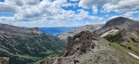
But before I got there, I found a nice little snowfield and decided to grab a bit more water. It had been very sparse since the final climb up to unnamed Peak 11797. And this is where I got some unfortunate and surprising news on my inReach: my hiking partner, whom I'd envisioned walking casually down to Thorofare Creek, was still stranded in upper Hidden Creek with what he believed to be a ruptured Achilles tendon and said he could no longer move. He reassured me that he had 4+ days of food and was otherwise fine and urged me to continue on w/o him. I was torn, but also knew that there was going to be little for me to do that he couldn't do himself. We exchanged GPS messages for quite some time and decided I would continue on. His trip was over and SAR got him back to Cody - maybe he even saw the same doctor as @scatman did last year. I took a bit to collect myself - now distracted by my friend's predicament and concerned about the upcoming climb onto the Thorofare Plateau that wasn't looking any friendlier as I approached.
But finally some good news - what had looked increasingly unfriendly became suddenly clear as I got near. The rock was as nasty as it looked, but there was a wonderful little shelf below the lowest band of cliffs that was actually quite nice.
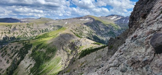
And soon I found myself at the highest point of the Thorofare Plateau.
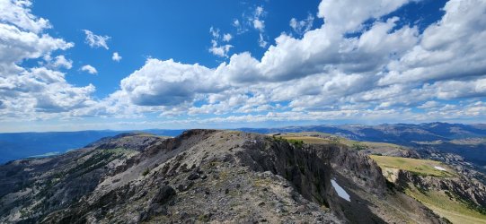
360° from the high point of the Thorofare Plateau.
It was very windy, but I managed to find a little pocket of protection to set up camp w/o dropping down too far. Lucky for me there was still a prominent snowfield for water, but I don't think it was long for this world. (Thankfully I topped off before going to sleep, because it was barely even a trickle in the morning.)
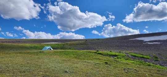
I heard from my buddy that he was safely back in Cody, 'boot'ed up, and headed to sleep in a nice climate-controlled hotel - and I wasn't sure which of us should be jealous of the other. All a matter of perspective, I guess.
Day 4: Hidden Creek Meadows to Bridger Lake via Hawk's Rest [11.99 mi; +1,800'/-4,641']
On paper, this was going to be a pretty chill day. Mostly downhill along the Thorofare Plateau w/ a bit of a climb up Hawk's Rest before finishing the day down by Thorofare Creek. Easy-peasy. Well, me being me - and left completely to my own devices - I managed to totally mess that up and turn relaxation into (ill-advised) adventure.
Wonderful, bright skies to start the day.
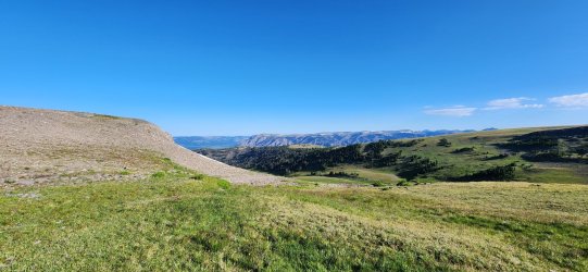
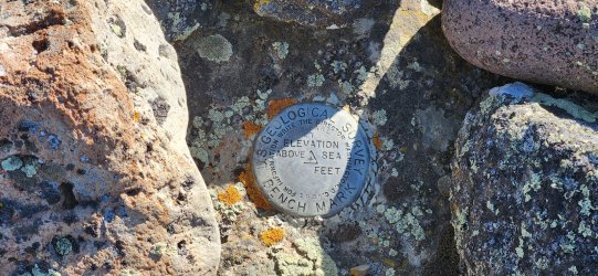
Quick visit to the Thorofare Plateau benchmark.
360° from the Thorofare Plateau benchmark.
Views down the plateau - Hawk's Rest in the distance.
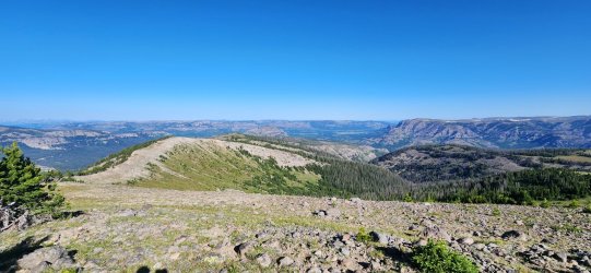
Pretty nice little trail from near the benchmark.
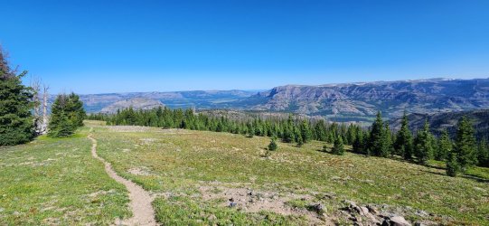
Castle Creek meets the Yellowstone River.
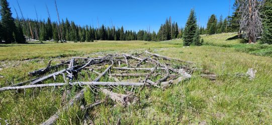
Interesting little 'ruin' in a meadow along the trail. Not sure what it was, but it seemed to have been arranged intentionally (at some point, at least).
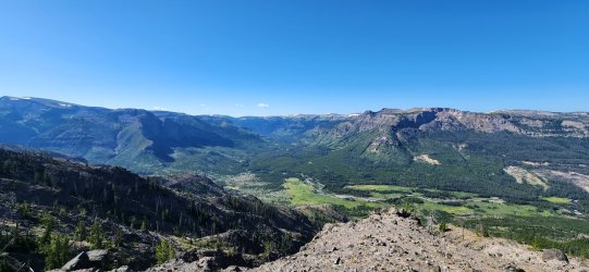
Looking out towards Yellowstone Point. Glad I wouldn't be doing that particular bushwhack again. (Joke's on me, if you read on. )
)
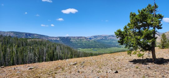
Confluence of Thorofare Creek and the Yellowstone River - and a little bit of Bridger Lake - from near Point 9246 below Hawk's Rest.
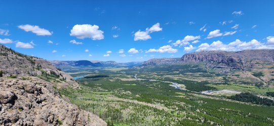
Looking back on the day's route as I head up Hawk's Rest.
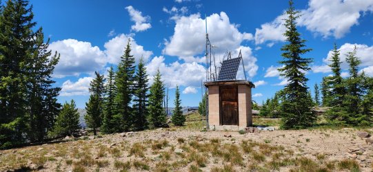
Forest Service radio repeater up on Hawk's Rest. The views from the 'peak' of Hawk's Rest are a little underwhelming due to its broad nature. Guess that's why the trail only continued up to Point 9246 and then dropped down to Thorofare Creek - as I probably should have...
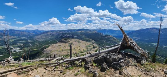
But I didn't - and was rewarded with some fantastic views!
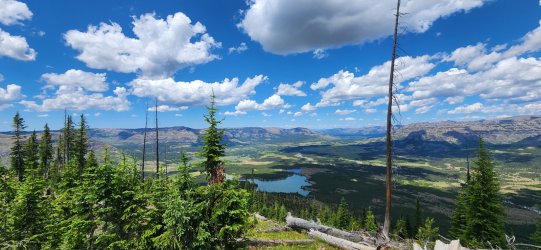
Just incredible views really.
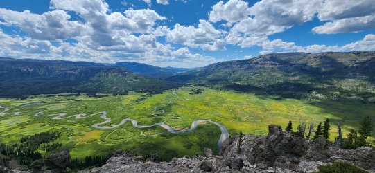
But do not ever drop off the west side of Hawk's Rest. Just don't - it is a terrible idea.
Sure is pretty though. Fancy bridge down there.
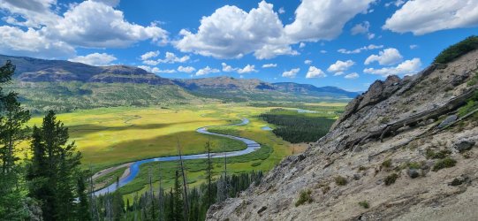
Rarely have I been so happy to be at the bottom of something.
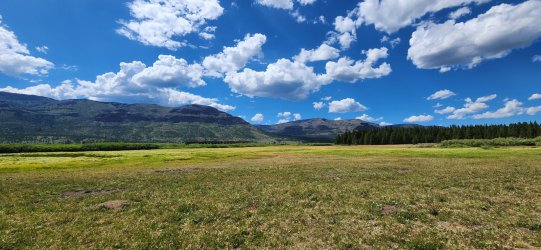
I took a little nap at the Hawk's Rest cabin. Saw a single mule train off in the distance - first human I'd seen on this trip, other than my now-hobbled hiking buddy two days ago.
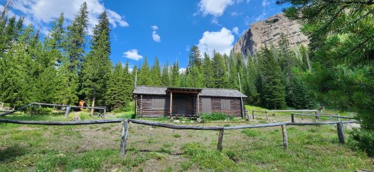
First look at Bridger Lake. It looked so pretty from up high, I couldn't help but want to camp there.
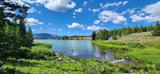
Found a really nice spot on the north side. And a well-positioned tree that might even give me a chance to go to bed early.
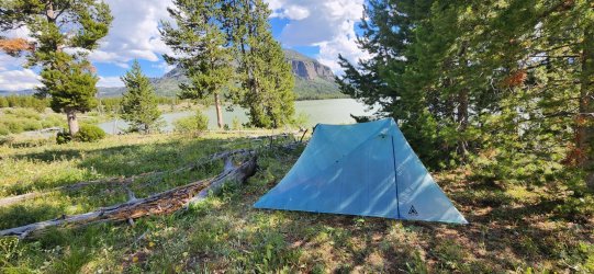
Wonderful dinner spot to sit and consider the day's choices.
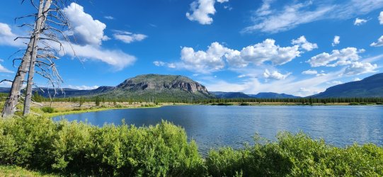
After dinner I strolled over to the park boundary. Nothing of particular note, but lots of little garter snakes in the meadow and then an otter crossing Bridger Lake upon my return. (I tried for a picture, but no luck.) Beautiful evening.
360° from the park boundary north of Bridger Lake.
Day 5: Bridger Lake to Upper Howell Creek [17.88 mi; +1,316'/-612']
On Day 5 I would actually get the relaxing day that Day 4 had promised. At one point I'd thought I might traverse 'The Trident' today, but after multiple days up high and my sketchy downclimb of Hawk's Rest a walk in the park is exactly what the doctor ordered. Plus, I was excited to revisit some of my favorite parts of my 2019 Thorofare trip and the Thorofare Patrol Cabin. (Actually the first trip report I ever posted on BCP: Southeast Yellowstone Loop (Yellowstone NP) - mid-September 2019.)
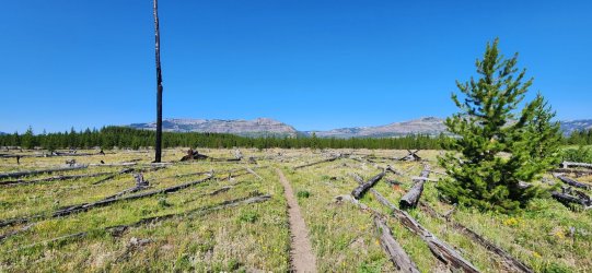
Walked through the meadow over to the Thorofare Creek spur trail. Quite a luxurious trail!
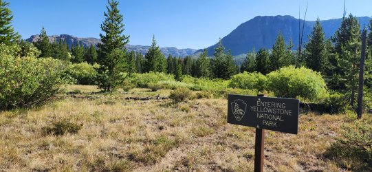
And entered the park proper shortly after.
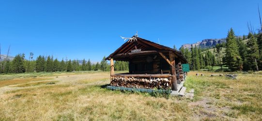
This cabin is a special place. There were actually a few NPS folks out here this time - they were busy, so we only chatted briefly.
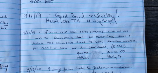
Cool to see our logbook entry from 2019. The current log goes back to 2012.
Hard to find wide open spaces like these anywhere else.
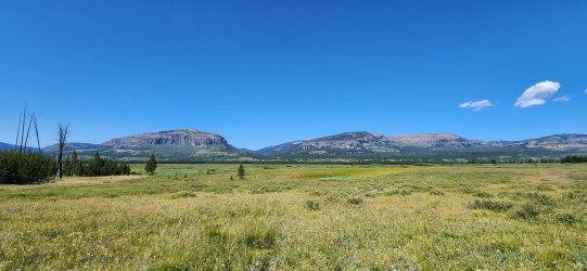
I remember this campsite! Surprisingly disappointing actually. But it's only 11a, so it's not on today's agenda anyway.
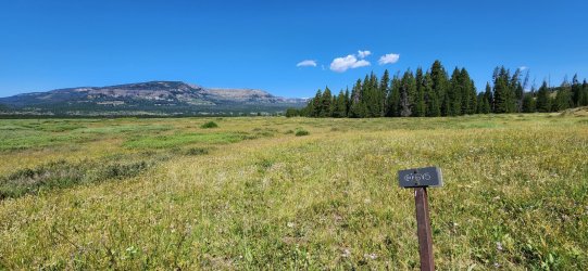
Today I'd be heading up Mountain Creek. I actually had a reservation for 6D5, but I could already tell I'd be getting there too early.
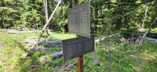
Much of the trail was heavily treed - nice for shade, less so for views. Smelled really good though.
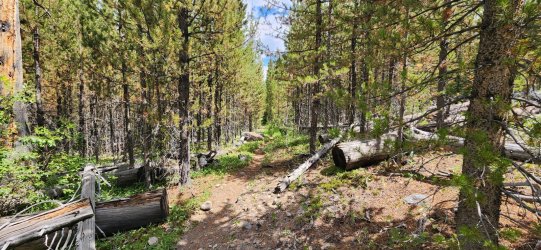
Some pretty cool spots along the creek though - even when the weather started turning a bit moody. It 'spit' on me for 20-30 minutes and then brightened back up.
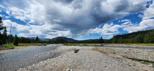
Spotted this brave little Dusky Grouse leading me away from her chicks.
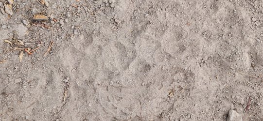
Wolves? Tracks only lasted for about 100 yards or so. The fresh bear tracks on the other hand I followed for miles - but somehow never took a picture? Go figure.
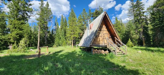
Love these A-frame cabins. Nobody home at this one.
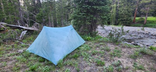
Ended up camping on upper Howell Creek - just outside of the park, not in the designated site. Could've stayed wherever I wanted - still hadn't seen anyone else out here.
Day 6: Upper Howell Creek to Eagle Creek TH via Eagle Peak [22.66 mi; +3,692'/-5,799']
I was looking forward to this one! Eagle Peak has been on my list for a few years and it's always looked like a really fun climb. There was a poster for the missing Austin King at the Howell Creek cabin - and another one would be found at Eagle Pass - reminding me not to take it for granted. I couldn't help thinking about him a bit as I camped near his campsite and climbed up towards his last known location. (More details here: Eagle Peak - Yellowstone - Missing Hiker.)
My original plan was to camp at Eagle Creek Meadows for the evening, but I got there at 3p and decided to push the extra 10 miles in the name of pizza. (Worth it.)
Got some good looks at the morning's goal as soon as I started hiking.
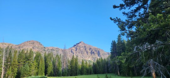
Getting closer. Those cliff bands look intimidating.
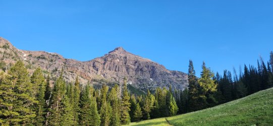
Little break at the Eagle Pass park boundary.
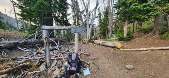
Not much of a view from Eagle Pass - even if you're not climbing Eagle Peak, I strongly recommend a little 20'-30' climb to get the better view.
Eagle Peak looking quite impressive this morning.
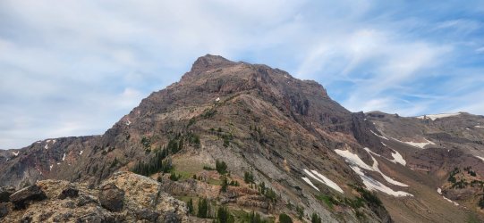
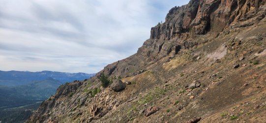
The crux of the journey. You should be on the grass - not the rock - for this traverse. Trust me. Also a good time to say: I like to approach a lot of climbs with minimal beta for the sake of adventure, but I don't think Eagle Peak is one to approach this way. There is absolutely a 'right way' to do this one and I'd suggest looking it up before you go.
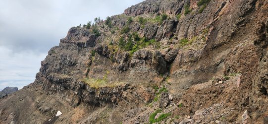
The lava tube might be a problem for the claustrophobic. I just had to make sure my pack didn't roll down the mountain, since there's no way I was going to fit w/ it on.
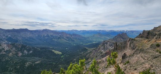
On top of the lava tube! Just a little easy Class 3 and a simple ridge walk to go.
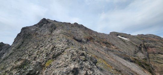
Almost there!
Is that the summit register I see?
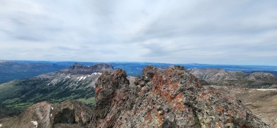
360° from the summit of Eagle Peak. Stunning, but well-earned.
Remember what I said about claustrophobia? Back into the tube!
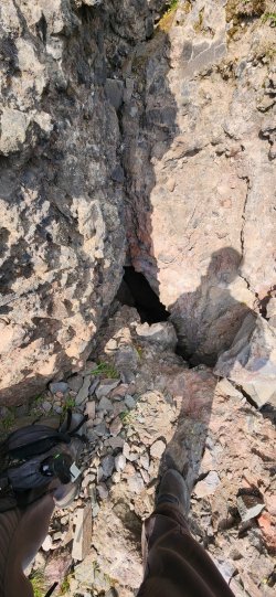
Funny enough, I saw my first hikers of the entire trip just as I emerged from the tube. Must have looked like the mountain was giving birth to me. They were park employees (fisheries, I believe) giving Eagle Peak an attempt with a few days off - I think they were camped at Eagle Creek Meadows so they'd already had a long day. I gave them a little beta on the remaining route - reassuring them they were past the worst of it - and we went our separate ways.
Spotted this interesting little benchmark on my way down.
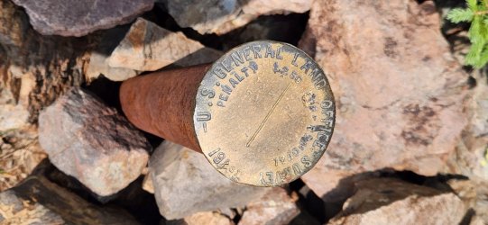
Honestly, the Eagle Creek trail is a little underwhelming compared to the places I'd just been - so not that many pictures. Plus, once I realized I'd be hitting Eagle Creek Meadows early, I was fairly resolved to get all the way to my truck and I started moving a bit quicker.
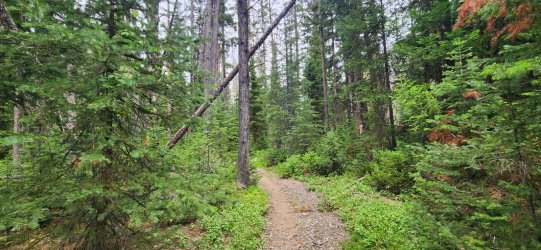
Eagle Creek Meadows was more than worth a stop though. There's a nice little outfitters camp here that appeared to be occupied, but I didn't actually see anyone.
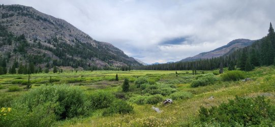
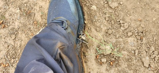
This little guy tried to hitch a ride for a bit.
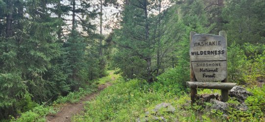
Exiting the wilderness. Don't worry, I'll be back.
Spent a glorious night in Cody where I ate a burger and fries while I waited for my large pepperoni and mushroom pizza. Slept like a baby and got up to have a huge pancake breakfast. Maybe I didn't bring enough food on this one?
I spent a fair bit of time worried about my decision to separate from my buddy, but after debriefing with him as I drove back towards home those concerns dissipated. He was excited to hear all about the trip and I was thrilled to hear that his spirits were high and his Achilles on the mend. All's well that ends well, I guess.
The trip itself was wonderful. It felt like a tour of places I'd been thinking about for years, but hadn't yet visited. The valley that contains Hidden Creek really is a special place and I felt very privileged to visit - not to mention the awe-inspiring basins up above the falls. The unnamed Peak 11797 (or 11801) is absolutely one of my favorites of all-time. I wouldn't do it the same way next time, but it was really cool to be on top of Hawk's Rest - a view most only see from below. You can't go wrong with a walk through the upper Yellowstone River valley. And to tie it all up with Eagle Peak - the highest point in Yellowstone NP - was incredible.
Actual distances/elevations of the trip. Total distance ended up at 92.99 mi; total elevation gain/loss at +16,930/-16,899 - per CalTopo. I found it interesting that my start at Deer Creek (6,422') and finish at Eagle Creek (6,423') only measured off by a single foot. Guess I should've stood on a rock before I got started.


I still need to write up the Brooks Range trip from earlier in the year, but I figured I'd get this one down while it was still fresh in my mind and dominating my thoughts.
The initial plan was to hike up Deer Creek Pass, hopefully find the route up the Hidden Creek falls, traverse to and across the Thorofare Plateau, then exit via Eagle Pass - with a summit of Eagle Peak (highest point in Yellowstone NP) to cap things off. I'd also strongly considered traversing 'The Trident' on this one, but after a couple days up high getting blasted with wind and sun I'm glad I decided to hike through the Yellowstone River valley instead. Can't do everything on every trip after all.
I had one friend accompanying me - but unfortunately we were only together a couple days before he had to make a less than ideal exit due to injury, but we'll get to that. As a result, I was alone beyond the Hidden Creek meadows.
Day 1: Deer Creek TH to Upper Butte Creek [11.20 mi; +4,470'/-1,087']
Things kicked off in conventional fashion - a good, long climb up to the good stuff. Deer Creek itself is very nice, but quite a long approach to the most exciting parts. Might have seen more bear sign here than any other section of the trip though - even if the bears themselves remained elusive. Not much good camping to be found, but I do love the upper bowl below Kingfisher Peak. Upper Butte Creek - as @wsp_scott recommended - made for an absolutely excellent camp for the night.
Obligatory 'Bear Country' sign at the trailhead. Ready to go!

We got a fairly early start - hoping to avoid too much direct sun on the lower, steeper section. I think this was a pretty good call. No other cars at the trailhead.

And less than 10 minutes into our hike, we already have some bighorns. Two bighorn ewes and two small lambs.

They were not very skittish and mostly watched calmly as we passed by.

Cool multi-tier waterfall on the way up.

Cute little Tent Caterpillar crossing the trail.

There were bear tracks pretty much all the way up. Mostly small-ish in size.

Plenty of scat to be found, as well.

Even some nice digs to get at the juicy insects below. Pushed this rock right onto the trail.


The upper basin and Kingfisher Peak were spectacular as we approached the pass.

Cozy looking cave. And the water coming down here was divine.

This little marmot had the best seat in the house - and he seemed to know it.

360° from Deer Creek Pass.
Wildflowers were going crazy below the pass at upper Butte Creek.

Made for a very nice place to set up camp.

I recognized this arch from some of last year's trip reports. I was tempted to go up and get a closer look, but contented myself with just observing it as I ate dinner.

Day 2: Upper Butte Creek to Hidden Creek Meadows [19.23 mi; +1,407'/-2,353']
Today would start with a long, gentle drop to Thorofare Creek before climbing up to the Hidden Creek meadows. Mostly on nicely manicured trail, though it would fade in/out beyond the Hidden Creek outfitters' camp. The early parts of the day were very pretty, but nothing of particular note - Hidden Creek on the other hand lived up to the hype as an absolutely spectacular canyon to explore.
The morning brought beautiful conditions and just enough clouds to keep things cool

Some pretty fresh scat to start the day.

Down to Thorofare Creek and ready to head up towards Hidden Creek.

It was a bit rainy on the first half of our hike up towards Hidden Creek, but things opened up right as we found the Hidden Creek meadows.

Incredible views and sheer rock faces.

Our first, distant look at the Hidden Creek falls.

Wonderful camp for the night, even if it did rain off-and-on for the duration.

In between showers I found myself looking right at tomorrow's first objective.

Day 3: Hidden Creek Meadows to Thorofare Plateau [10.01 mi; +4,248'/-2,412']
The long anticipated day was here - could @TheMountainRabbit find the way up above the Hidden Creek falls? My buddy and I had spent the evening discussing our options and felt pretty good about our plan, but you never quite know until you get there. I'd hoped to explore closer to the falls the prior evening, but the rain kept me back at camp.
Unfortunately the rain also kept us awake for much of the night, so neither of us woke up feeling the most rested. My hiking partner decided he wanted to stick to the low route and we would meet up again along Thorofare Creek after I (hopefully) crossed Thorofare Plateau. Not out of the ordinary on our trips, so we said our "good-bye"s and "good luck"s and split up for the day. (Though it would turn out to be much longer.)
Morning brought a beautiful sunrise and high spirits.

Thanks to all of the prior evening's rain, it was a very damp walk up to the cliffs.

With the proper route relatively unknown, my plan for the AM was to swing out wide left (east) of the Hidden Creek falls and try to find a suitable 'break' in the cliffs. On both the topos and a picture @TractorDoc shared with me from his trip last year, I thought this gully looked promising. There was a large slide path that led right to it, so after breaking out from the trees it was right in front of me.

Turns out I wasn't alone in this thinking. As I approached - planning on going straight up the gully - I noticed this slight trail off to the left-hand side.

It was fairly steep, but had secure footing and took me right above the problematic cliff band.

The traverse turned out to be straight-forward, as the trail continued - more or less - all the way to the top of the Hidden Creek falls.

Into the trees.

The top of what I now realize is just the lower falls of Hidden Creek. (Though possibly the most spectacular and you don't get a great view on this route. Might want to check out @scatman's report from last year if you want a close-up look.)

I guess I'd call this the middle basin of Hidden Creek. Another wonderful set of falls coming over the upper edge and a real 'Shangri-La' vibe. I stopped for a bit to enjoy before heading up towards the next set of falls.

Yours truly enjoying a bit of the spray.

The falls here were more of a cascade than the sheer drop below, but beautiful nonetheless.

Looking down at the middle basin.

And on to the upper basin! This section was beautiful walking along a gentle stream, before climbing up towards unnamed Peak 11797 (or 11801, depending on the source).

Can you spot the elk? I spotted 3 or 4 before they darted over the ridgeline.

The weather was getting a little bit moody, giving the unnamed peak an ominous vibe. And is that another waterfall?

A nice little tarn. And I'll be damned if this isn't one of the more impressive unnamed peaks I've had the pleasure of encountering.

A look back at the Hidden Creek meadows from the eastern flank of unnamed Peak 11797.

Thorofare Mountain and Younts Peak in the distance. I think Younts is the parent peak to this one.

And the Pinnacle Buttes, too!

Looking NW along the cliffs of the unnamed peak.

And now the Tetons are in the mix!

My BCP bottle made the journey as well. Incredible views abound - the Hidden Creek meadows almost 3,000' down below.

360° from the high point. I think you can see almost every significant peak of the GYE from here. Incredible. One of my favorite summits ever.
But the show must go on. Looking towards the rest of the day's route to the Thorofare Plateau.

One last look SE along the unnamed peak's northern face.

This wonderful unnamed drainage leads down to the Yellowstone River. Thunder Mountain in the distance. At one point I'd considered going out to Thunder Mountain instead of the Thorofare Plateau, but I'm not sure that last section of ridgeline 'goes'. I might need to approach from the west next time.

Headwaters of Castle Creek. The ridgeline leading to the Thorofare Plateau on the right.

Another cool arch as I approach the Thorofare Plateau. This is also about where I started getting concerned about the final climb up the the Thorofare Plateau - I hadn't thought it looked bad on the topo; just a bit steep. That rock was not looking friendly though. Nothing to do but walk on over and find out, I guess.

But before I got there, I found a nice little snowfield and decided to grab a bit more water. It had been very sparse since the final climb up to unnamed Peak 11797. And this is where I got some unfortunate and surprising news on my inReach: my hiking partner, whom I'd envisioned walking casually down to Thorofare Creek, was still stranded in upper Hidden Creek with what he believed to be a ruptured Achilles tendon and said he could no longer move. He reassured me that he had 4+ days of food and was otherwise fine and urged me to continue on w/o him. I was torn, but also knew that there was going to be little for me to do that he couldn't do himself. We exchanged GPS messages for quite some time and decided I would continue on. His trip was over and SAR got him back to Cody - maybe he even saw the same doctor as @scatman did last year. I took a bit to collect myself - now distracted by my friend's predicament and concerned about the upcoming climb onto the Thorofare Plateau that wasn't looking any friendlier as I approached.
But finally some good news - what had looked increasingly unfriendly became suddenly clear as I got near. The rock was as nasty as it looked, but there was a wonderful little shelf below the lowest band of cliffs that was actually quite nice.

And soon I found myself at the highest point of the Thorofare Plateau.

360° from the high point of the Thorofare Plateau.
It was very windy, but I managed to find a little pocket of protection to set up camp w/o dropping down too far. Lucky for me there was still a prominent snowfield for water, but I don't think it was long for this world. (Thankfully I topped off before going to sleep, because it was barely even a trickle in the morning.)

I heard from my buddy that he was safely back in Cody, 'boot'ed up, and headed to sleep in a nice climate-controlled hotel - and I wasn't sure which of us should be jealous of the other. All a matter of perspective, I guess.
Day 4: Hidden Creek Meadows to Bridger Lake via Hawk's Rest [11.99 mi; +1,800'/-4,641']
On paper, this was going to be a pretty chill day. Mostly downhill along the Thorofare Plateau w/ a bit of a climb up Hawk's Rest before finishing the day down by Thorofare Creek. Easy-peasy. Well, me being me - and left completely to my own devices - I managed to totally mess that up and turn relaxation into (ill-advised) adventure.
Wonderful, bright skies to start the day.

Quick visit to the Thorofare Plateau benchmark.

360° from the Thorofare Plateau benchmark.
Views down the plateau - Hawk's Rest in the distance.

Pretty nice little trail from near the benchmark.

Castle Creek meets the Yellowstone River.

Interesting little 'ruin' in a meadow along the trail. Not sure what it was, but it seemed to have been arranged intentionally (at some point, at least).

Looking out towards Yellowstone Point. Glad I wouldn't be doing that particular bushwhack again. (Joke's on me, if you read on.

Confluence of Thorofare Creek and the Yellowstone River - and a little bit of Bridger Lake - from near Point 9246 below Hawk's Rest.

Looking back on the day's route as I head up Hawk's Rest.

Forest Service radio repeater up on Hawk's Rest. The views from the 'peak' of Hawk's Rest are a little underwhelming due to its broad nature. Guess that's why the trail only continued up to Point 9246 and then dropped down to Thorofare Creek - as I probably should have...

But I didn't - and was rewarded with some fantastic views!

Just incredible views really.

But do not ever drop off the west side of Hawk's Rest. Just don't - it is a terrible idea.
Step 1) The worst downhill bushwhack you've experienced in the GYE.
Step 2) Throw your backpack off a cliff and think, "Well, I guess now I have to downclimb this."
Step 3) A bushwhack that makes you yearn for Step 1 with all of your heart.
Sure is pretty though. Fancy bridge down there.

Rarely have I been so happy to be at the bottom of something.

I took a little nap at the Hawk's Rest cabin. Saw a single mule train off in the distance - first human I'd seen on this trip, other than my now-hobbled hiking buddy two days ago.

First look at Bridger Lake. It looked so pretty from up high, I couldn't help but want to camp there.

Found a really nice spot on the north side. And a well-positioned tree that might even give me a chance to go to bed early.

Wonderful dinner spot to sit and consider the day's choices.

After dinner I strolled over to the park boundary. Nothing of particular note, but lots of little garter snakes in the meadow and then an otter crossing Bridger Lake upon my return. (I tried for a picture, but no luck.) Beautiful evening.
360° from the park boundary north of Bridger Lake.
Day 5: Bridger Lake to Upper Howell Creek [17.88 mi; +1,316'/-612']
On Day 5 I would actually get the relaxing day that Day 4 had promised. At one point I'd thought I might traverse 'The Trident' today, but after multiple days up high and my sketchy downclimb of Hawk's Rest a walk in the park is exactly what the doctor ordered. Plus, I was excited to revisit some of my favorite parts of my 2019 Thorofare trip and the Thorofare Patrol Cabin. (Actually the first trip report I ever posted on BCP: Southeast Yellowstone Loop (Yellowstone NP) - mid-September 2019.)
Walked through the meadow over to the Thorofare Creek spur trail. Quite a luxurious trail!

And entered the park proper shortly after.

This cabin is a special place. There were actually a few NPS folks out here this time - they were busy, so we only chatted briefly.

Cool to see our logbook entry from 2019. The current log goes back to 2012.

Hard to find wide open spaces like these anywhere else.

I remember this campsite! Surprisingly disappointing actually. But it's only 11a, so it's not on today's agenda anyway.

Today I'd be heading up Mountain Creek. I actually had a reservation for 6D5, but I could already tell I'd be getting there too early.

Much of the trail was heavily treed - nice for shade, less so for views. Smelled really good though.

Some pretty cool spots along the creek though - even when the weather started turning a bit moody. It 'spit' on me for 20-30 minutes and then brightened back up.

Spotted this brave little Dusky Grouse leading me away from her chicks.
Wolves? Tracks only lasted for about 100 yards or so. The fresh bear tracks on the other hand I followed for miles - but somehow never took a picture? Go figure.

Love these A-frame cabins. Nobody home at this one.

Ended up camping on upper Howell Creek - just outside of the park, not in the designated site. Could've stayed wherever I wanted - still hadn't seen anyone else out here.

Day 6: Upper Howell Creek to Eagle Creek TH via Eagle Peak [22.66 mi; +3,692'/-5,799']
I was looking forward to this one! Eagle Peak has been on my list for a few years and it's always looked like a really fun climb. There was a poster for the missing Austin King at the Howell Creek cabin - and another one would be found at Eagle Pass - reminding me not to take it for granted. I couldn't help thinking about him a bit as I camped near his campsite and climbed up towards his last known location. (More details here: Eagle Peak - Yellowstone - Missing Hiker.)
My original plan was to camp at Eagle Creek Meadows for the evening, but I got there at 3p and decided to push the extra 10 miles in the name of pizza. (Worth it.)
Got some good looks at the morning's goal as soon as I started hiking.

Getting closer. Those cliff bands look intimidating.

Little break at the Eagle Pass park boundary.

Not much of a view from Eagle Pass - even if you're not climbing Eagle Peak, I strongly recommend a little 20'-30' climb to get the better view.
Eagle Peak looking quite impressive this morning.

The crux of the journey. You should be on the grass - not the rock - for this traverse. Trust me. Also a good time to say: I like to approach a lot of climbs with minimal beta for the sake of adventure, but I don't think Eagle Peak is one to approach this way. There is absolutely a 'right way' to do this one and I'd suggest looking it up before you go.

The lava tube might be a problem for the claustrophobic. I just had to make sure my pack didn't roll down the mountain, since there's no way I was going to fit w/ it on.

On top of the lava tube! Just a little easy Class 3 and a simple ridge walk to go.

Almost there!

Is that the summit register I see?

360° from the summit of Eagle Peak. Stunning, but well-earned.
Remember what I said about claustrophobia? Back into the tube!

Funny enough, I saw my first hikers of the entire trip just as I emerged from the tube. Must have looked like the mountain was giving birth to me. They were park employees (fisheries, I believe) giving Eagle Peak an attempt with a few days off - I think they were camped at Eagle Creek Meadows so they'd already had a long day. I gave them a little beta on the remaining route - reassuring them they were past the worst of it - and we went our separate ways.
Spotted this interesting little benchmark on my way down.

Honestly, the Eagle Creek trail is a little underwhelming compared to the places I'd just been - so not that many pictures. Plus, once I realized I'd be hitting Eagle Creek Meadows early, I was fairly resolved to get all the way to my truck and I started moving a bit quicker.

Eagle Creek Meadows was more than worth a stop though. There's a nice little outfitters camp here that appeared to be occupied, but I didn't actually see anyone.

This little guy tried to hitch a ride for a bit.

Exiting the wilderness. Don't worry, I'll be back.

Spent a glorious night in Cody where I ate a burger and fries while I waited for my large pepperoni and mushroom pizza. Slept like a baby and got up to have a huge pancake breakfast. Maybe I didn't bring enough food on this one?
I spent a fair bit of time worried about my decision to separate from my buddy, but after debriefing with him as I drove back towards home those concerns dissipated. He was excited to hear all about the trip and I was thrilled to hear that his spirits were high and his Achilles on the mend. All's well that ends well, I guess.
The trip itself was wonderful. It felt like a tour of places I'd been thinking about for years, but hadn't yet visited. The valley that contains Hidden Creek really is a special place and I felt very privileged to visit - not to mention the awe-inspiring basins up above the falls. The unnamed Peak 11797 (or 11801) is absolutely one of my favorites of all-time. I wouldn't do it the same way next time, but it was really cool to be on top of Hawk's Rest - a view most only see from below. You can't go wrong with a walk through the upper Yellowstone River valley. And to tie it all up with Eagle Peak - the highest point in Yellowstone NP - was incredible.
Actual distances/elevations of the trip. Total distance ended up at 92.99 mi; total elevation gain/loss at +16,930/-16,899 - per CalTopo. I found it interesting that my start at Deer Creek (6,422') and finish at Eagle Creek (6,423') only measured off by a single foot. Guess I should've stood on a rock before I got started.


I still need to write up the Brooks Range trip from earlier in the year, but I figured I'd get this one down while it was still fresh in my mind and dominating my thoughts.
