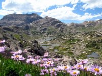
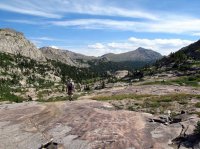
Help! First Trip to the Winds.

Blake Merrell

Life Elevated - Rising Higher
Joined
Feb 25, 2013
Messages
600
This August I have a trip to the Wind Rivers planned. We are looking to visit the Titcomb basin and surrounding area. I think we will have about 4, possibly, 5 nights to spend in the area.

I am looking for suggestions.

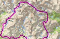
Here is the link to a map that shows what I think my buddy and I might try: http://caltopo.com/m/6R19

The red line is our preferred route (at the moment). The yellow line is our 2nd options, and our third is to just basecamp in the basin and day hike all over the place.

What say ye, BCP? Can ya help me out? what are the must see places in this area, and how should I get to them?

Thanks!

Blake

 
Last edited:
Wish I could say I've been all around that area to be able to help you out, but the closest I've been is New Fork Lakes for a couple scout camps.

Anyways, tough decisions ahead of you. That red route looks great and I've heard/read great things about Indian Basin. I've read that Knapsack Col can be quite the adventure. Some have made it up and over just fine while others have had close calls with slips and falls on the descent down Twins Glacier into Titcomb so perhaps some microspikes would be good to have on hand if you go that route.
 
Oh yeah, I have a friend from high school that went up that area years ago. He was able to bag Fremont Peak up there and had fantastic views down into Titcomb Basin, Indian Basin, and the Fitzpatrick Wilderness to the East so if you can catch that on a good weather day, that might be worth it. I think he went northwesterly from his camp in Indian Basin up to a saddle and then scrambled the ridge going northeast to reach the peak.
 
Freemont Peak is on the to-do list, for sure! If we decide to do our loop hike (red line) then we might not be able to summit Freemont. but if we opt to basecamp Titcomb or do another short loop hike, I for sure want to summit Freemont!
 
Back in 2013 part of our trip went back into the Camp Lake, Snowbridge Lake, Alpine Lakes, Alpine Pass, Knifepoint Glacier, Indian Pass area and it was some tough sledding through there. Here's a little info about Alpine and Knifepoint.

Here are some excerpts from my personal write-up from that trip. You may find it helpful for this section of you trip. It's not polished, so excuse that. =)

-Regarding a section of trail from Camp Lake to Snowbridge Lake: "It was tough going getting there. Lots of boulder hopping and a nasty nasty section of bushwhacking that left us both wiped out."

-From Day 4 (Snowbridge Lake all the way to Indian Basin which took us over Alpine Lake Pass and Indian Pass): "One of my toughest backpacking days ever. We knew we were going to be trail-less again. And the thru hiker we talked to had told us that he talked to a guy that said he only made 4 miles in one day in this area. We boulder hopped...It was tough tough going. Up and down. Huge boulders to navigate. So tiring. Being at such a high elevation didn't help. It was hard for me to enjoy the spectacular scenery. I snapped as many pictures as I could muster and kept plugging away trying to keep Dave in sight...a nearly impossible task with his pace and in the tough terrain. We made it up to the lower (south) end of the upper lake and took a quick break. The next mile or so around the west wide of the lake was killer. We were already sapped and tired and the boulder hopping just kept coming. At times we'd have to hike several hundred feet above the lake to move forward. We finally made it to the upper end of the lake and to the base of Alpine Lakes Pass. We ate...but neither of us had an appetite. We forced ourselves to eat and drink. Ahead of us we still had 2 passes and were were already super tired and gassed. We worked our way up the pass, navigated a 100 foot section or snow and made it to the top and finally looked down into the glaciated valley. [For Knifepoint Glacier/Indian Pass]...we donned our crampons, and we headed up the glacier with relative ease. It wasn't that steep...but it was quite hard and icy. At the top of the hard ice we made our way up loose soil/footing and up Indian pass at which point were safely out of no mans land and back onto the other side of the divide."

Note, we had pretty heavy packs (mine started at 40 lbs) and were go go go every single day. I'm sure that added to the fatigue. Plus I had broken my collar bone 2 months earlier so I wasn't in the best of shape. =)

Another note, we went via Fall Creek Lake and Pass (above Timico) and via Dennis Lake to get to the Golden Lakes area. I'm unfamiliar with the Wall Lake route that you have outlined.
 
Thanks for that Mike K, Very helpful. That section looks crazy rough. I have begun a training program to get my butt in better shape, so hopefully that terrain won't be so butt-kicking bad, but we shall see...

I kinda knew that this sections would be crazy hard, but I really don't know what to expect. If we go this route, would you recommend 2 camping days through that area (Alpine Lakes to Golden Lake)

You're welcome. It was fun to revisit some of my pictures and remember the trip. Would I recommend 2 camping days through that area? Hmm. Not sure. I will say that the route looks pretty ambitious for 4 or 5 nights. If you're lightweight and like to go go go, you could do it. Our trip was approx 45 miles in 4 nights. It was too much. Our route was similar to yours but we didn't do the loop through Titcomb. We were pretty spent after the 5 days/4 nights. I'd say we bit off more than we could chew. I'm sure you're younger and fitter though! =) At the end of my log I wrote: "Looking at the pictures, I'm in awe of what we did and what we saw. Would I do that same route again? Not sure! Maybe if I had 8 or 9 days and had a 35 pound pack. Whew. Love the Winds..." I may have been exaggerating a bit on the 8 or 9 days. But a 6 or 7 night trip would have been more chill and given us more time to explore and relax. And a 20 or 25 lb pack sounds better than the 35 lbs.

Here's a screen shot of our very approximate route:

2013 Winds Loop.jpg
 
@Mike K What sections of that hike were your favorite? Why were they your favorite?

Thanks for sharing that screen shot of your route.
 
We went counter clockwise...and day one (to Cook Lakes) is sort of ho hum - although you're in the Winds...so it's hard to complain. Pole Creek, Cook Lakes, Wall Lake, Angel Pass area are all nice. Seems like Cook Lakes had decent fishing. (I'd been to these areas on another trip). Dennis Lake dropping into Lousie and Golden Lakes was probably my favorite area...it was really nice - more trees, grass, green, etc.. Camp Lake area was decent too. After that getting to Alpine Lakes Pass was pretty remote, rocky, treeless, but still pretty cool. Tough going though. The view down into the north side of Alpine Lakes Pass is awesome! And Indian Basin is so so. I hear Titcomb is awesome but I've surprisingly never been through there! Oh, and Island Lake is gorgeous but there's usually a ton of people around here (and Titcomb)...not a huge deal I guess. Hope that helps a bit. =)
 
Years ago, a friend and I planned a pretty similar trip to the one in the original post, except our route used Angel Pass instead of going up from Wall Lake. A couple years ago we kind of decided "last minute" to do a trip, and ended up modifying that route. Instead of doing 5 days, we did 7, still going over Angel Pass, but bypassing the Alpine Lakes and Pass area and doing Bloody Hell pass instead (because we thought it would be easier!). Angel Pass is very cool, it's challenging but mostly just a lot of bouldering to get both up and down. At the top, it is the coolest pass I have been to so far. I thought the hike from the Golden Lakes to Camp Lake was very fun, there is a pretty fair trail all the way and though it's sometimes steep it is pretty straightforward.

Bloody Hell pass lived up to its name. We vowed never to do it again, but we're not smart enough to remember something like that so we'll probably do it again eventually. Almost got walled out near the Northern end by a large sheet of ice (we didn't have crampons). It is a spectacular hike, though. Do want to do the Alpine Lakes someday, too. After our experience with the ice in Bloody Hell, we decided to skip climbing Knife Point Glacier and took an all-rock route up Indian Pass. It was challenging but not nearly as bad as we had thought. The rock were we went up was very unstable though, it was very recently deposited glacial garbage. In some places there was still ice underneath the rock which was in the process of collapsing, but we were able to hike around any spots that seemed dangerous. The West side of Indian Pass is pretty straightforward. Indian Basin is cool, but you will want to go into the Titcomb as well.
 
Where is Bloody Hell Pass?

We ran into that loose and unstable rock right around Knife Point as well (we ran into it directly above it). It was more annoying than anything. Although I think I remember having to be careful not to knock rocks loose onto others in the group below.
 
Is wall lake worth seeing? I have toyed with using the Angel Pass route, but the route outlined in red seems to be shorter in miles... and seems to maybe be more scenic thought there.... is that true?
 
Since I just wrote up another TR and I'm in the uploading mood...

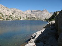
Here are the few pics I have of a day hike up to Wall Lake:

236393102_39a667e552_o (1).jpg

236393093_c0798c747a_o.jpg


A view of Angel Pass from above Cook Lakes:

9656678722_9364f835a9_k.jpg


Angel Pass from the other side...

9656597524_108d86ec8d_k.jpg


Dropping down to Dennis Lake from (Fall Lakes?) Pass:

9653354335_e12230bf86_k.jpg


Dropping into Louise/Golden

9653793965_67944b7d48_k.jpg
 
Bloody Hell Pass is the canyon from Lake 10,980 or so (it's just North of Snowbridge Lake) to the Shangri La area (the end is basically at Lake 10,834).

Would love to see Wall Lake, but we figured on Angel Pass being more straightforward. Don't think you will have any regrets about the scenery going over from Wall Lake.
 
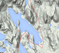
I marked some good campsites (X1, X2) at the Upper Cook Lakes. Where your campsite logo is, is thick trees and not level. PS. Great fishing out on the drumstick peninsula.
CookCamp1.jpg

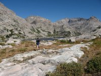
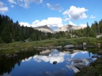
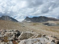
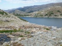
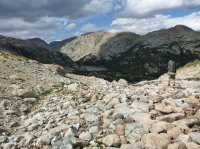
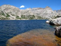
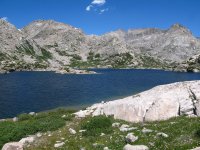
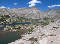
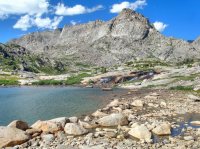
Here are a few photos of the Wall Lake area.
wall1.JPG

wall2.JPG

Wall3.jpg

wall4.jpg
High up in the Wall Lake drainage looking West.
wall5.jpg

Heading back down from Wall Lake looking south. Mount Baldy is the pointy peak on the right.
wall6.jpg
 
Sweet! thanks for the camping suggestions. I am thinking that I really like the pictures of Wall lake! Hopefully getting over Tiny Glacier Pass is doable.
 
Do a search I have two posts on the Winds covering most of where you want to go. Also my routes are in the resource section here on BCP. Bloody Hell Pass is by the Brown Cliffs, I'd say it's easier than the Alpine Pass. I've tried for Upper Alpine and Pass twice aand been weathered out both times. Indian Pass (by Titcomb) is time consuming on the East side. Fremont is a hard scramble.....and exposed.. I'll dig up some more info ..

You can get over by Tiny Glacier...
 
Do a search I have two posts on the Winds covering most of where you want to go. Also my routes are in the resource section here on BCP.

Thanks Bob :) I used your beta extensively as I have attempted to plan my own route. Thanks for working with me and answering some of my emails and things. I love all of this route planning and very much appreciate all your guys help and beta!

Glad to hear that Tiny is passable.
 
Similar threads
Thread starter Title Forum Replies Date
Stephanie Help! Looking for a 1-2 day trip Backpacking 9
B 1-2 Night Sierra Trip Help Trip Planning 3
TrektheWorld Need help with Uintas trip - camping Trip Planning 8
MurrMan81 Help Planning Utah Backpacking Trip Trip Planning 9
B Trip Selection Help: Tumble Creek or Sanford-Dadina Plateau (WStE AK) Trip Planning 12
DrNed Help With Float Trip Planning Trip Planning 3
stu heilsberg Help planning Uintas trip Trip Planning 1
Nick Help me win a float trip down Cataract Canyon General Discussion 19
Michael Help, tips, suggestions 4 our upcoming 2015 trip Trip Planning 17
A Help me with a Trip to Grandaddy and Highline trail Trip Planning 5
jrh Help me plan my trip (while I'm on it!) Trip Planning 8
Laura Help me decide my next trip! General Discussion 5
jdgibney Help Me Plan Our Trip! Trip Planning 40
U Help with a Winds itinerary Trip Planning 19
wsp_scott Redwoods planning help Trip Planning 6
balzaccom The Beatles were right: Help! Trip Planning 0
balzaccom A little help, please? Backpacking 0
regehr Help identifying stone tool? General Discussion 6
balzaccom Help on the trail--literally General Discussion 7
Miya Down Gear Odor Help Gear 31
Duketogo13 Questions about packrafting the Escalante/Lake Powell in September. Need help! Trip Planning 5
The Trout Whisperer HELP w/ lightweight chair recommendations!!!!! Gear 3
J Yikes, I need help deciding.... Trip Planning 5
Titans Paw prints, help pls! General Discussion 32
J Need Park City area Hiking help Trip Planning 2
Matt Van Natta HELP: Wind River Range, Baker Lake to Green River Lakes Trip Planning 7
pstm13 HELP NEEDED- Idaho in Early June for 2-3 Days Trip Planning 6
JBPHXAZ Dark Canyon Backpacking Help Trip Planning 9
DrNed Need Help With Mosquitoes? General Discussion 2
wsp_scott Help me buy a bike Gear 10
N Avenza IOS app help with Caltopo Resource Discussions 4
o2bav8 10/12/18 - help? General Discussion 12
Jimmy Glacier Route Help Trip Planning 0
marquiri Help with Bridger-Teton National Forest Trip Planning 2
Cburton Teton Crest Trail Permit Issues - Help! Trip Planning 15
LoneWolfOutdoors Help choosing between two tents Gear 8
Devin Ashby Southern Utah Backpacking Loop Help Trip Planning 9
N Help choosing trekking footwear General Discussion 3
uintahiker App building help General Discussion 10
AKay09 Teton Shuttle Help 8/18 or 8/19 Trip Planning 0
CCoC Yellowstone Itineraries Help Trip Planning 3
genez Teton shuttle help 7/10 ? Trip Planning 23
Artemus Help Requested - Conserving the San Rafael Swell Wilderness - Interested? General Discussion 16
DrNed Help With Water On White Rim Trip Planning 11
AKay09 Yellowstone/Tetons Help Trip Planning 40
WasatchWill Seeking a little help for Fall Break with family in GSENM Trip Planning 4
Outdoors24 Tent help Gear 10
Noun Sequitur Sunglasses Help Gear 15
Ross Water Canyon to White Wave (help & invite) Trip Planning 8
Ross Help/Invite:Cape Solitude at rim of Colorado & Little Colorado confluence Trip Planning 0

Similar threads

Back
Top