Help! First Trip to the Winds.

What is the prettier section? (I know, i know. such a subjective question)

Dennis Lake to Upper Golden Lake,
or
Upper Golden Lake to Camp?

Just trying to figure out if it would be worth it to drop down and do the Angle Pass Trail instead of come over Tiny Glaicer.

Thanks!
 
I was originally going to say Upper Golden to Camp...but the view from high above Golden (Lower) looking north is pretty cool, too. =) What's the approx difference in mileage and elevation gain/loss ... Angel vs Tiny?

It's all good through that area. =)
 
Camp to Upper Golden....
 
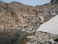
My answer is "yes." Our hike took us down from Angel Pass down to Upper Golden, but that was an excellent hike. I really enjoyed Upper Golden to Camp Lake too. Thought Camp Lake was very nice with Douglas Peak being right beside you for a good chunk of that hike.

You're really not going to be disappointed either way. In planning our route I actually considered Tiny Glaceir pass heavily, and really wanted to spend some time up on the high plateau up there if possible, but that's just not the way we went. A little extra hiking would give you an amazing view of the Alpine Lakes area from up high.

What is the prettier section? (I know, i know. such a subjective question)

Dennis Lake to Upper Golden Lake,
or
Upper Golden Lake to Camp?

Just trying to figure out if it would be worth it to drop down and do the Angle Pass Trail instead of come over Tiny Glaicer.

Thanks!
 
Thanks a ton for your advise and pics! Just makes me even more excited to get out there this summer.

So, seems like a lot of you head to Angel Pass and do the loop that way. any particularly reason why? I was planning on heading to Island Lake/ Titcomb basin and doing the loop that way.
 
Last edited:
Blake, Blake, Blake...don't worry, anywhere you go is gorgeous. You're going to the winds!!! I'll admit I haven't read all the posts to this thread carefully but the just of it all seems to be that you're not going to go wrong anywhere.

From what I gather you are wanting to maximize your time to see the most country possible. I'm a mountain goat mile cruncher as well. I've done big trips like you're planning through that section of the winds. On our first trip up there we amended our plans and decided to attempt Fremonte by scoping out the potential route from Island lake at 11pm by the full moon light. We didn't have any beta on the peak just what we could see as a best potential route from a long way away. Needless to say, we woke up at 5, hiked up through the Indian lakes basin, picked our route and summited. The mountain is a good, steep, talus ridden, scramble with views that are unparalleled. If you do it on a clear day you can see the teton range in the distance. It is tough and totally worth it. After reading a bunch of your TRs on Canyon Collective I would assume you're in good physical condition to be able to do it.

Anyway, that's my recommendation. Head towards Titcomb basin first, summit Fremonte, then return by passing Wall lake. Now that I'm thinking about it, if my summer wasn't already planned I'd beg you to let me come with you.

Salud!
 
don't worry, anywhere you go is gorgeous. You're going to the winds!!!

haha :) Good point. Very true!

I like the idea of summiting Fremont. I think it might be worth it to take it easy and enjoy the Titcomb basin for a day or so, and take the time to summit Freemont and such. AHH! Is it August yet?????
 
haha :) Good point. Very true!

I like the idea of summiting Fremont. I think it might be worth it to take it easy and enjoy the Titcomb basin for a day or so, and take the time to summit Freemont and such. AHH! Is it August yet?????
What time in August are you going to be there?
We will be hiking into Titcomb Basin around the 24th.
Cheers
IRG
 
If you are exiting at Elkhart we might meet on the trail. We will be entering there on the 23rd.
We will be doing some sort of dog - leg loop. Into Titcomb, Island Lake, Upper Jean.
Knapsack Col would be awesome. Fremont Peak would be incredible.
We missed our chance last year to do it, due to 6+ inch of fresh snow a couple days before we started.
Sounds like have a pretty challenging trip planned.
Hope to hear about if we meet on trail.
Good luck planning.
Cheers
IRG
 
They are both awesome and you can't really go wrong either way, but if you made me choose, I'd have to go with Camp to Upper Golden. The fishing up there wasn't as good, but the views were better, IMO. Awesome area, either way.
 
I had a trip a while back where I went into the Cook Lakes area, then went over Lester Pass to Island, Summited Fremont, then back out to Elkhart Park. I did the Elkhart Park to Cook Lakes in a day and Island Lake back to Elkhart Park in a day. There are some serious ups and downs from Photographers point into Island Lake - it is a very tough trail to quickly put the miles past. Total trip was 4 days - not anywhere near enough time. If I summit Fremont peak again, I would take the extra time to just go up to Titcomb and summit Fremont - spend some time exploring the Indian Lakes and Upper Titcomb a bit. It seemed that I was always in a hurry. The only bad thing about the area is the people and the pesky marmots - they will get into anything and everything if left out. The Winds are huge and solitude is easy to be found, but in this area you have to work a little for it.

I found this area to be very different than hiking in the Uintas, or even Big Sandy openings in that the terrain is rough and the ups and downs are relentless. I can usually pound the miles out, but this area absolutely wore me out. I will never do Elkhart Park to Island Lake in a day again.
 
I've done Island Lake to Elkhart Park in a day twice. Seems to end up around 7.5ish hours for me. The ups and downs from Island Lake to Big Seneca don't bother me that much, the scenery is nice and it's usually not too crowded at that point. Seems once you hit Big Seneca you hit the crowd. From Big Seneca to about Eklund still has plenty of ups and downs, not as bad, but you get down into the trees without much for views. It's not the most boring trail ever, but it's not my favorite.

The stretch of trail from Photographer's Point to Elkhart Park is what I have dubbed my most hated stretch of trail ever. Not because it's the worst trail to hike, but because it is SO BORING compared to the scenery you are coming from or headed to, and on the way back in it's about 6 miles of bland, boring trail between you and your car. It seems no matter what, my Winds trips always involve this trail and I've hiked that stretch many times and it just never fails to cause some kind of anguish in me. I even wrote a song about it:

This is the trail that never ends
it just goes on and on my friends
you know we started hiking it not knowing what it was
and we just kept on hiking it forever just because
this is the trail that never ends
(and so on)
 
The stretch of trail from Photographer's Point to Elkhart Park is what I have dubbed my most hated stretch of trail ever. Not because it's the worst trail to hike, but because it is SO BORING compared to the scenery you are coming from or headed to, and on the way back in it's about 6 miles of bland, boring trail between you and your car.

I'd have to agree that it's a mentally tough section of trail! And generally when you hike it you've already put in some miles that day and have turned your thoughts toward a celebratory post-hike burger and keep wondering if the parking lot is around the next bend. Or the next. Or the next. The lack of landmarks just makes the miles go by slowly.
 
I've done Island Lake to Elkhart Park in a day twice. Seems to end up around 7.5ish hours for me. The ups and downs from Island Lake to Big Seneca don't bother me that much, the scenery is nice and it's usually not too crowded at that point. Seems once you hit Big Seneca you hit the crowd. From Big Seneca to about Eklund still has plenty of ups and downs, not as bad, but you get down into the trees without much for views. It's not the most boring trail ever, but it's not my favorite.

The stretch of trail from Photographer's Point to Elkhart Park is what I have dubbed my most hated stretch of trail ever. Not because it's the worst trail to hike, but because it is SO BORING compared to the scenery you are coming from or headed to, and on the way back in it's about 6 miles of bland, boring trail between you and your car. It seems no matter what, my Winds trips always involve this trail and I've hiked that stretch many times and it just never fails to cause some kind of anguish in me. I even wrote a song about it:

This is the trail that never ends
it just goes on and on my friends
you know we started hiking it not knowing what it was
and we just kept on hiking it forever just because
this is the trail that never ends
(and so on)

Good to know! we are hoping to get at least as far as Island Lake on day one... I'm afraid that might be the easiest section of our trip though....eek what have I gotten myself into?! lol SO EXCITED!
 
Good to know! we are hoping to get at least as far as Island Lake on day one... I'm afraid that might be the easiest section of our trip though....eek what have I gotten myself into?! lol SO EXCITED!

Just make sure you're in shape before you go! On my first backpacking trip ever, we tackled the Winds out of Elkhart park. Our route, of course, was to take the perfectly reasonable trail which goes down to a beautiful camp at Fremont Lake the first night, and the next day to climb up out of Pine Creek canyon to Trapper Lake via an "unmaintained" trail. I'm not sure I've ever felt so bad as I did that afternoon at Trapper Lake, but turning back didn't seem like a reasonable option... There's much more physical training involved before trips now!
 
Similar threads
Thread starter Title Forum Replies Date
Stephanie Help! Looking for a 1-2 day trip Backpacking 9
B 1-2 Night Sierra Trip Help Trip Planning 3
TrektheWorld Need help with Uintas trip - camping Trip Planning 8
MurrMan81 Help Planning Utah Backpacking Trip Trip Planning 9
B Trip Selection Help: Tumble Creek or Sanford-Dadina Plateau (WStE AK) Trip Planning 12
DrNed Help With Float Trip Planning Trip Planning 3
stu heilsberg Help planning Uintas trip Trip Planning 1
Nick Help me win a float trip down Cataract Canyon General Discussion 19
Michael Help, tips, suggestions 4 our upcoming 2015 trip Trip Planning 17
A Help me with a Trip to Grandaddy and Highline trail Trip Planning 5
jrh Help me plan my trip (while I'm on it!) Trip Planning 8
Laura Help me decide my next trip! General Discussion 5
jdgibney Help Me Plan Our Trip! Trip Planning 40
U Help with a Winds itinerary Trip Planning 19
wsp_scott Redwoods planning help Trip Planning 6
balzaccom The Beatles were right: Help! Trip Planning 0
balzaccom A little help, please? Backpacking 0
regehr Help identifying stone tool? General Discussion 6
balzaccom Help on the trail--literally General Discussion 7
Miya Down Gear Odor Help Gear 31
Duketogo13 Questions about packrafting the Escalante/Lake Powell in September. Need help! Trip Planning 5
The Trout Whisperer HELP w/ lightweight chair recommendations!!!!! Gear 3
J Yikes, I need help deciding.... Trip Planning 5
Titans Paw prints, help pls! General Discussion 32
J Need Park City area Hiking help Trip Planning 2
Matt Van Natta HELP: Wind River Range, Baker Lake to Green River Lakes Trip Planning 7
pstm13 HELP NEEDED- Idaho in Early June for 2-3 Days Trip Planning 6
JBPHXAZ Dark Canyon Backpacking Help Trip Planning 9
DrNed Need Help With Mosquitoes? General Discussion 2
wsp_scott Help me buy a bike Gear 10
N Avenza IOS app help with Caltopo Resource Discussions 4
o2bav8 10/12/18 - help? General Discussion 12
Jimmy Glacier Route Help Trip Planning 0
marquiri Help with Bridger-Teton National Forest Trip Planning 2
Cburton Teton Crest Trail Permit Issues - Help! Trip Planning 15
LoneWolfOutdoors Help choosing between two tents Gear 8
Devin Ashby Southern Utah Backpacking Loop Help Trip Planning 9
N Help choosing trekking footwear General Discussion 3
uintahiker App building help General Discussion 10
AKay09 Teton Shuttle Help 8/18 or 8/19 Trip Planning 0
CCoC Yellowstone Itineraries Help Trip Planning 3
genez Teton shuttle help 7/10 ? Trip Planning 23
Artemus Help Requested - Conserving the San Rafael Swell Wilderness - Interested? General Discussion 16
DrNed Help With Water On White Rim Trip Planning 11
AKay09 Yellowstone/Tetons Help Trip Planning 40
WasatchWill Seeking a little help for Fall Break with family in GSENM Trip Planning 4
Outdoors24 Tent help Gear 10
Noun Sequitur Sunglasses Help Gear 15
Ross Water Canyon to White Wave (help & invite) Trip Planning 8
Ross Help/Invite:Cape Solitude at rim of Colorado & Little Colorado confluence Trip Planning 0

Similar threads

Back
Top