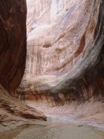
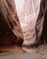
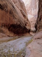
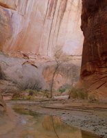
Halls Creek Loop via Lower Muley and Red Slide

Cody

Member
Joined
Mar 4, 2012
Messages
100
34-PB260365.JPG

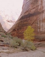
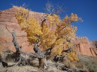
Here's a trip I took through Halls Creek, using Lower Muley and the Red Slide to poke a little deeper into the Waterpocket Fold on a three-night outing last fall. Capped it off with a twilight run (splash) through the HC Narrows on the last evening. A couple of other nice BCP reports have come out of the area recently, so I'll add this to the collection.

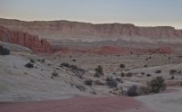
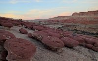
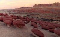
I pulled a permit late in the day and drove down to the Halls Creek Overlook and started down the trail hoping to at least get to the Hamburger Rocks in time for a few photos and perhaps even getting through the lower east-west leg of Lower Muley to camp there where it opens up. I made it to the Hamburgers with some light, but after lingering there for a while I ended up just setting up camp at the junction of Muley and Halls.01-PB230069.JPG02-PB230073.JPG03-PB230080.JPG

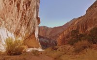
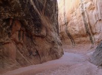
Day 2, I woke up and headed right up Lower Muley from the bottom. This is the slottly section of Muley that cuts east-west across the Waterpocket Fold.
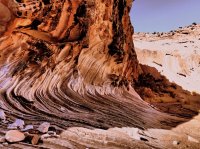
04-PB240153.JPG05-PB240171.JPG06-PB240179.JPG

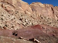
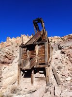
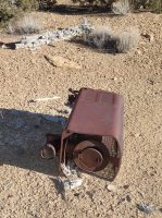
Where Lower Muley cuts north, I exited up a drainage to the west right near the elbow. The watercourse eventually made for fairly rough travel and I climbed up to hike along the cliffs to the south. May or may not have saved me time, but it was rough, slow travel all morning either way. I had previously found some map evidence for an old road or trail in this side canyon. Certianly seems possible towards the bottom, but it eventually becomes pummeled with large rockfall and whatever route used to exist is hard to pick out. I had hoped to connect into this old pre-Park/Monument system of roads to navigate down towards Deer Point and beyond. Took some work, but I eventually found it when I stumbled on old road grades and relics of uranium operations.
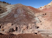
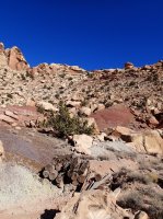
07-PB240189.JPG08-PB240190.JPG09-PB240191.JPG10-PB240196.JPG11-PB240198.JPG12-PB240201.JPG13-PB240207.JPG14-PB240209.JPG

I was mostly able to use that old road system to navigate south toward the Circle Cliffs and Red Slide. Just over the ridge to my west were the heads of the Moody Canyons of Escalante. From the Halls Creek side, there appeared to be a few good route options down into the Moodys. My only chance for water up there were some "tanks" indicated up on Deer Point, or making it down the Red Slide into Halls Creek that night. I decided to just be conservative on water and spend the night up in the Fold, hopefully getting to water in Halls the next day before I was too dried up.
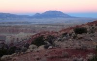
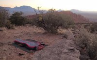
15-PB240214.JPG16-PB250237.JPG

I got an early start on Day 3 anticipating needing some time for routefinding through below the Circle Cliffs and down the Red Slide. If I could get down in time I was hoping to get through the Halls Creek Narrows that night but I had miles of Halls Creek ahead of me to get there even once I get down Red Slide. Turns out, it was slow going once again, with a few issues finding a good route. More interesting relics along the way.
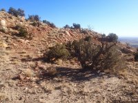
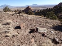
17-PB250260.JPG18-PB250275.JPG19-PB250277.JPG20-PB250285.JPG21-PB250290.JPG22-PB250291.JPG

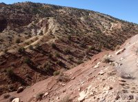
Once past the area below the Circle Cliffs, a route down the Red Slide is fairly well worn with an old road grade and recent foot traffic. Probably makes for a good entry into GSENM canyons. This is the only section since leaving Muley where there was any evidence of recent visitation since the miners left their mark. From there I descended the Red Slide into Halls Creek.

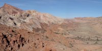
23-PB250297.JPG24-PB250301.JPG

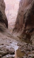
Once down, my water had dried up and I was glad to find water (although iced over) in the Fountain Tanks. I filled up and headed down to the narrows. Above the narrows, I had to decide if I wanted to get wet that night and possibly hike back over the divide in the dark, or hit the narrows first thing on Day 4. I opted to run through the narrows that night. I dropped my camping gear in a small grove of Cottonwoods near the top of the narrows and took along a dry bag and extra insulation in case of any swimming involved. Kind of a shame to have to hurry through such nice narrows, but I wanted to get on the road a little earlier the following day.
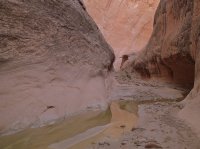
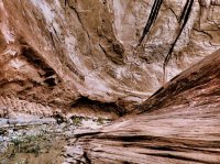
25-PB250321.JPG26-PB250329.JPG27-PB250337.JPG28-PB250346.JPG29-PB250349.JPG30-PB250351.JPG31-PB250354.JPG32-PB250356.JPG

33-PB250359.JPG

I did end up encountering two sections towards the end that required swims. I dry bagged my clothes and got through it. Didn't end up stopping to get dressed again until the Halls Creek Divide, because I wanted at least a little daylight to get started on that route. Once I knew I was on route, I put the dry clothes on along with some extra insulation to kill the chill and headed north to make camp and cook dinner. I ate well and went to bed dry and warm, but woke up about 3:30 to amazing clear air and bright stars. On a whim, I decided it was time to pack up and hike out since I couldn't get back to sleep. In a few minutes I was packed and hiking back up Halls Creek in the dark. Eventually I did get tired and took several naps (slept 'till cold, then got up and hiked 'till tired, then repeat). Even with a few naps, I was climbing up to the Halls Creek Overlook by sunrise and I ate breakfast at my truck. Later, of course, lunch at the Sunglow Cafe in Bicknell, where all of my CRNP adventures end. Great long weekend hike; fueled the imagination for more routes down there in the future. Love that place.

Here's the route with 10-minute fixes from my Spot:

https://mapsengine.google.com/map/edit?mid=zbgpWqwR40vA.kxg8Fkoe1WWU

Featured image for home page:
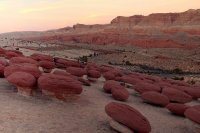
slide.jpg
 
Awesome trip, man! It's amazing all the mining relics and old roads still there. I was at Hall's Creek Overlook last month and I usually make it a point to look for familiar names in the visitor register. Saw yours there and wondered what kinda trip you'd done.
 
Really cool trip report, Cody! Very inspiring! When exactly did you do this? I know last fall but when? Just curious on the timing of the leaves. Looks like maybe late November?
 
WOW!

This is a very creative approach to an amazing chunk of desert. Way to set a bunch of cool spots into one trip.
 
Really cool trip report, Cody! Very inspiring! When exactly did you do this? I know last fall but when? Just curious on the timing of the leaves. Looks like maybe late November?

It was 23-26 Nov. Cottonwoods down by the narrows were hanging on to their gold, but further up they'd mostly dropped.

704555_10200173606527490_1912455535_o.jpg

Incidentally, I did Spring Canyon in CRNP a few weeks ahead of this trip and the leaves were all gone up there. I'm going to have to repeat that route when there is some more color, but is was great nonetheless (in the snow). Spring Canyon also has good loop options too if you don't mind crossing a little frontcountry mid-route. I should write up that trip too...

Awesome report! It's amazing how many mining relics you found.

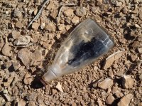
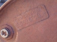
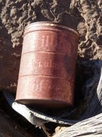
An old mine camp I stumbled into up in the fold was especially "decorated" (littered). Old punch top beer cans galore, whisky bottles, etc. It's the same site where I found the old heater pictured in the TR above. Must have been quite a life hauling ore out of that country. Here's a can of Shilling Regular Coffee:

135283_10200173604967451_1665780244_o.jpg
 
Very cool hike.

I came down that gully to enter LMT a few years ago. I was looking for the old road myself, but I didn't see any sign of it. Now looking at your route I see that I was too far north. Very cool stuff -- I hate it that I missed out, but glad you shared the report.

Thanks,
- Jamal
 
Hamburger Rocks looks like a good family hike with funky scenery to wow the kids. Put it on my list for next time to CRNP.
 
Hamburger Rocks looks like a good family hike with funky scenery to wow the kids. Put it on my list for next time to CRNP.

The Rangers once told me that less than 50 people a year see them. The wear pattern of them looks amazing, and the contrast of purple and white is very unique.
 
The Rangers once told me that less than 50 people a year see them. The wear pattern of them looks amazing, and the contrast of purple and white is very unique.

Very few people use the CRNP backcountry. When getting a permit I've peeked over the permit desk at the binder and more than once I have seen my last permit entry on the same page a month or so later with only a few entries in between. I bet they only issue a few hundred permits a year.
 
It certainly seems like that from my limited experience too. We didn't see any other people in 3 days on our Halls Creek trip on a prime spring weekend.
 
Similar threads
Thread starter Title Forum Replies Date
Mikjik86 Halls Creek Loop. 2 Days, or 3? General Discussion 6
sierrasummits Halls Creek, Moody canyon, Stevens canyon loop ? Trip Planning 5
RyanP Coyote Gulch to Halls Creek via Steven's Canyon and the Baker Route (car/key swap) Meet Up (Members Only) 8
WasatchWill Halls Creek: Version 2.0 Backpacking 9
RyanP Coyote Gulch to Halls Creek via Stevens Canyon Trip Planning 28
Mikjik86 Backpacking Halls Creek Narrows. Backpacking 4
Mikjik86 Halls Creek Narrows Short Video Backpacking 0
WasatchWill Halls Creek...It was time. Backpacking 14
Ross Halls Creek and Muley Twist Hiking & Camping 35
Ross Invite Cathedral Valley,Halls Creek.Happy canyon,Bisti,Caineville Mesa + more Meet Up (Members Only) 4
Jammer Flash Floods in May? (Halls Creek Narrows Video) Backpacking 20
Ross Invite Halls Creek Narrows.....(& perhaps Needles/Behind The Rocks) Meet Up (Members Only) 12
Clint_N Halls Creek Narrows - May 2013 Backpacking 13
Nick Halls Creek Bay On The Water 22
Nick Halls Creek Narrows Backpacking 37
lostlandscapes Halls Creek Narrows, 4/6/13 Backpacking 23
pixie1339 Invite Halls Creek Narrows May 10th - 12th Meet Up (Members Only) 42
NateGeesaman Halls Creek Narrows of Capitol Reef July 2012 Backpacking 20
WasatchWill WRHR: Day 4 - Halls Lake to Camp Lake Backpacking 17
WasatchWill WRHR: Day 3 - 'Desolation Valley' to Halls Lake Backpacking 15
W 9 Days Solo Escalante Loop in October (water advice) - Stevens Canyon, Baker Route over Waterpocket fold, Halls Narrows to Moody Canyons Trip Planning 11
piper01 Escalante, Part 4: Dance Halls and Dinosaurs Hiking & Camping 3
rinats Canyonlands/Needles: Salt Creek to Chesler Park Trip Planning 6
shredhiker Slough Creek mid June? Trip Planning 11
Spud Salt Creek Canyon question Trip Planning 11
BobFink Mirror Plateau via Pelican Valley and Pelican Creek, July / August 2023 Backpacking 12
Janice Such a GRAND Canyon - Deer Creek / Tapeats / Thunder River Backpacking 21
Jackson Little Rock Creek Backpacking 5
scatman Yellowstone's Thorofare, Headwaters of Thorofare Creek, Majo Pass, Younts Peak, Bob's Canyon, and Cub Creek - August 9, 2023 - Days 7 through 10 Backpacking 34
scatman Yellowstone's Thorofare, Headwaters of Thorofare Creek, Majo Pass, Younts Peak, Bob's Canyon, and Cub Creek - August 9, 2023 - Days 1 through 6 Backpacking 56
J South Crandall Creek and the Hoodoos Wyoming and Yellowstone? Trip Planning 3
CodyL Maple Creek or Duck Creek Drainages-YNP Trip Planning 0
J Pacific Creek or North Buffalo Fork? Teton Wilderness, Thorofare ,etc. Trip Planning 10
I Rescue Creek - Yellowstone National Park - June 3, 2023 Backpacking 15
Dreamer Slough Creek - YNP - 6/5-7/23 Backpacking 3
shredhiker Blacktail Creek June 2023 Backpacking 4
Dreamer Rescue Creek -YNP - 6/3-5/23 Backpacking 3
shredhiker Slough Creek May 2023 Backpacking 11
scatman Rescue Creek - Yellowstone National Park - June 3, 2023 Backpacking 56
Gretchen Millward Trachyte Creek via Woodruff Canyon, April 2023 Backpacking 9
I Slough Creek - Yellowstone June 5 & 6 Meet Up (Members Only) 19
scatman City Creek Loop - April 23, 2023 Hiking & Camping 8
F Thorofare/South Boundary/Wolverine Creek Trip Planning 2
scatman Rescue Creek - Yellowstone National Park Meet Up (Members Only) 19
Janice When might road to Salt Creek TH be ok? Trip Planning 23
BobFink Yellowstone South Entrance to Fox Creek via Basin Creek Cutoff - Labor Day 2022 Trip Reports 4
Janice Professor Creek / Mary Jane Canyon - mid April? Trip Planning 0
scatman North Ridge of City Creek Canyon - February 4, 2023 Hiking & Camping 17
MikeP Exploring/Calf Creek Trip Planning 28
scatman South Ridge of City Creek Canyon - January 28, 2023 Hiking & Camping 4

Similar threads

Back
Top