GYE resources

Seems to be the going rate for the very few copies I've seen online... makes it pretty tempting to "lose" the library copy. But then @Pringles might be forced to hunt me down. :lol:

My sister is a librarian, I'm pretty sure they all carry large guns and love to hunt down people who "lose" a book :)
 
Just copy it....
 
No hunting you down, TheMountainRabbit. Once you get the item through Interlibary Loan, make photocopies or take pictures of the pages you care about. So maybe it’s all of them… it’s the information you want, right? But no, don’t be selling the copy of the folks who lent it to you. :) We did have a patron who requested two or three rare items, and then didn’t bring them back. We did our best to get them back, and finally paid the bill the lending library sent us. It was $1200, if I remember right. We eventually sent that to collections, and the collections people worked out something where he could pay half, and get his borrowing privilege back (silly us, when you swipe our stuff, we don’t lend things to you any more). We screamed no to the collections agency, and that patron left our lives. He was a shifty guy. He is now serving a prison sentence, I’m not exactly sure what the charges were, but he had 5 pounds of cyanide. I’m really glad to not be dealing with him any more. But, back to the topic… inter library loan things! You can find amazing things! Oh, and I have that Yellowstone Atlas. I look at it periodically, but don’t find it particularly helpful.
 
I ended up getting a copy of "Greater Yellowstone & Grand Teton Recreation Atlas" https://www.amazon.com/Greater-Yellowstone-Grand-Teton-Recreation/dp/0929591305 that was $5 (including shipping). Not worth it. It is a good idea in theory, but the implementation is lacking.

Basically, it has 1:100,000 maps of Yellowstone and 1:600,000 maps of the surrounding area. So, on 2 normal size pages you get a map that stretches from Jackson to the bottom of the Winds. It shows some campground locations, but doesn't have names.

Even the Yellowstone maps aren't super useful because all of the colors are very muted and the trails marking are too faint and are almost impossible to follow with my old eyes. And the fonts are too small (again old eyes) to easily read.

It turns out I bought a Yosemite map from the same company a couple years ago. The formatting choices seemed familiar and I went digging through my maps. I had the same issues with Yosemite map, muted colors, small fonts, hard to follow trails.

Based on these two products, I would not recommend Benchmark Maps in the future. Or at least I would want to see one in person before I bought it.
 
Now sorry for my absence. Have been retired and just living on my bike. Left Jackson Hole on Sept 5th, and right now in the Tucson area. Maybe next over to Ajo and Organ Pipe with staying warm. Lots of empty places in the desert.

But since this is about GYE and Absaroka Mountain Resources including for the Teton Wilderness, then will chime in. Now it seems one book overlooked by Everyone is the book by the Bonney's. Do think there names were Orin And Lorraine Bonney. They later had a book on all of Wyoming's Mountains. They had various editions in the 60s and early 70s with lots lots of very valuable information tucked into the book. Then if you can find one ... Ralph Maughan wrote a book on the Teton Wilderness entitled 'Beyond The Tetons' back in like 1982. It only sold a few copies. But a great resource. Have copies of both.

But the thing is that not much has appeared in print recently. Actually do think this is a good thing. There is much country back in both the South and North Absarokas as wild as it has ever been. There is also all the old topo maps. The only real way to really get to know is to Go! Put aside your jobs, grab your backpack and just spend all summer back in there. Then go the next summer, then the next, then the next ... then you soon will be the expert. Take a look at it .... from South Pass to Livingston Montana there is only 4 ... again 4 roads to cross. They are the Union Pass Gravel Road, Togwotee Pass, East Entrance YNP road, NE entrance to YNP road. Much wilderness in here ... NW Wyoming and Southern Montana that one can get lost in on purpose and still live the mountain man life if that is what one wants. This is what I have done ... just gone into those wilds. There is still sooooooo much, sooooooo much that I still have not seen. Gosh, wish I was still young. But seriously considering of doing a prolonged walkabout all over this country again next summer. Anybody care to come along all spring to fall?

But put all the resources together. ... the falcon guidebook, Tom Turianos book (which do have), the Bonneys old guidebook, all the topo maps, and more. Go to a library near YNP and in NW Wyoming with browsing the historical section and old maps .... this will even simply more info longgg since buried and forgotten. But the important thing is GO Go Go GO Go!!!!!!

Do think that the people who have known this country ... the South Absarokas, the North Absarokas, back deep Yellowstone Park parts, and more ... they could not even fill a room? Many have passed away now, but some are still around. Many don't talk of what they have experienced for many in the outside world just simply would not understand. The wilds make a mark on the person when one truly experiences the deep wilds. That person then will never be the same. True for myself!

How many people think or dream of the mountain men of days gone by. The country is still there. Get out of the matrix and Go!

Now remember onetime years ago, like 15 to 20 years ago when I was heading up the Upper Yellowstone River. I was somewhere above where Castle Creek came on down and joined the Yellowstone. Here coming down the trail was a lone horseman. He was a middle aged plus. He said he was the son of an outfitter and grew up in this country in the. 60s when as a kid with his father. He said those trails were covered with people then coming and going. Then when we met it was only us two. And we talked. In some ways those mountain wilds is wilder now then back then. I remember when first going in 40 plus years ago, people were everywhere. The last time when in saw old abandoned trails with the grass growing up. Old campsites now all grass covered, and not many people.


Guess will say this to end ... do the research, look at the maps till you know them by heart and more, find every scrap of material you can on the country during the longgg winter ... and then come spring Go Go Go!

Sorry if preached to much but just my thoughts and such.

Wishing Everyone The Very Very Best!
 
Last edited:
As for the book 'Select Peaks' ... Good Book! But left out a lot also of other areas just nearby. The old old Bonneys book was better do think. Maybe just a snippet of info but something.
 
Last edited:
As for the book 'Select Peaks' ... Good Book! But left out a lot also of other areas just nearby. The old oldBonneys book was better do think. Maybe just a snippet of info but something.
Do you have any info getting out the head of hidden canyon... Looks like can get up the east side then cross over at the top of trees?
 
Now Bob have gone out to the top of the mountains from the western fork of Hidden Creek. This is fork that branches off at the old outfitter site and not the branch with the big meadows. I went up this branch, west fork, to the head. Old hunters - outfitters trail up the drainage for a good good ways. Then from here went to the top of the high ridge on the left side, and then to the high mountain basin at the very top. Loved it up there. Climbed the peaks all around nearby. Them when descending, went down to the North Fork of the Yellowstone. About as wild as it gets. Stupendous Country Bigtime!

Also there is an old outfitters trail linking the Upper North Fork of the Yellowstone to the Very upper Thorofare Creek / River Area that have done at times. Many old outfitter routes in the Absarokas but fading as the years go by.

Time to go set up camp now among the Saguaros out in the desert.

Best to Everyone!
 
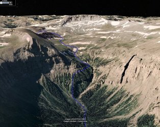
Ok, I looked at you description. It's decent .. want to explore the main canyon... Here is what I was looking at....

a hidden.jpg
 
Last edited:
Now Bob as to your route above, have never explored that route. But many a time have I gone up to those Upper Hidden Creek Meadows and stayed some days with wandering about. Hidden Creek is a special special gem in this country.

But for the information, many years ago back in the very early 80s, a guide that operated in this country drew on my topo maps back off beaten routes here in the South Absarokas. And he did draw a route that was similar to what you have here. But have never explored if true or not. For myself it looks mighty steep. Take this for whatever it might be worth.

Also for the info., one can go up the west fork and over the ridge at the end and down into the head of Castle Creek also.
what do you use as a trailhead for this vicinity? Turpin Meadow? looks like a long approach in any case
 
Regehr, Yes maybe Turpin Meadows but also Pacific Creek or the trailheads off of the South Fork of the Shoshone. Yes a big trek in. But would be a good place to stay a few days in a Jackson (Turpin Mdws.) to Cody (Sth Fk of the Shoshone) trips. But when I have gone in, do take a whole load of supplies, take my time with usually staying like a month in at a time before resupplying. Many a time would go into the wilds by late May, and come out in early September. Then in the summer maybe only several times for a resupply, with being in there a month at a time. Would live off the land also. This would give me time to really see, enjoy, and experience this country. But the Upper Hidden Creek Meadows is simply Stupendous!
 
Bob, Deer Creek is a steep trail in but completely doable. Sometimes quite abit of horse use on Deer Creek. I usually use the Ishawooa Drainage for less steep but longer going in. And Upper Pass Creek with it's meadows is gorgeous!
 
Bob, Deer Creek is a steep trail in but completely doable. Sometimes quite abit of horse use on Deer Creek. I usually use the Ishawooa Drainage for less steep but longer going in. And Upper Pass Creek with it's meadows is gorgeous!
Have looked at Ishawooa but it is longer.... Made a loop going up there then off trail north to rampart and down and around thru Open Creek and back around Lapalii Creek..... at least looks doable on Goggle Earth. On the ground ?? Upper Open Creek looks very nice.

Chose Deer creek because its the shorter route, but you're correct it is the steeper choice. I can only get others to join me by keeping trips under a week and longer than a week strains me anymore.
 
Hello all! do any of you know if there is a path around or under Overlook Mtn to connect the Open Creek trail to the Mountain Creek trail that takes you down into Yellowstone? Thanks in advance!
 
No trails. I have a couple of prospective routes plotted though. Dont know how much experience youve had but its tough country. Around Overlook is steep and unstable tuff... PITA to find a way around high that is not a interesting traverse. There is a old trail up Open Creek and over into Rampart Creek.

Ill send you a PM thru BP
 
Last edited:
Hello all! do any of you know if there is a path around or under Overlook Mtn to connect the Open Creek trail to the Mountain Creek trail that takes you down into Yellowstone? Thanks in advance!
I have a buddy who's done it, though he's half mountain goat so take that with a grain of salt. Twice I've intended to to it myself but had to cut the trips short die to bear emergencies.
 
Now as far as I know there are no routes or paths from the Open Creek Drainage over to the Mountain Creek Drainage. The high peak ridge here between the two is really quite something. This ridge connects the high alpine Trident Plateau with the Absaroka Crest at Overlook Mountain. One would have to be like half a mountain goat to do so. There are routes - old trails that connect Upper Open Creek to Upper Rampart Creek. And there is a route -old trail which have been on which connects Upper Mountain Creek to Upper Fishhawk Creek. This is just spectacular and love it in there. This route goes over a remote pass in here called Glacier Pass because of the Fishhawk Glacier nearby. Now Tom Turiano describes a route to the top of Overlook Peak in his book. I have looked all over the topo maps of the region and there is some really remote and wild wild country in here. Wild untrailed ridges, Wild untrained and remote high mountain basins, Wild nooks and crannies ... Just Great Great Great! Some of these back drainages off the main routes probably have old routes up them, like the Siggins Fork. The reason is the outfitter presence back in here in the fall. There are outfitter camps up in the Mountain Creek Drainage outside YNP, up Open Creek, and up along the Thorofare River. Heard of and know of about a certain outlook place up on a ridge of the Trident Plateau that overlooks the whole area that the YNP rangers use to see if the outfitters go poaching into YNP.

Now have stood at the base of a cliff of Overlook Mountain in the very very head of Mountain Creek. Great memories! There was a nice little flat place for a camp also right nearby. Bighorn Sheep were around. Glacier Pass was nearby and had spent time there earlier in the day. Just pure wilderness all around. Then looking down the Mountain Creek Drainage was Mount Sheridan near Heart Lake in the far distance. It was also a nice warm day in late summer and what a day it was. Life in the wilderness is Great!

PS: Just some info for everyone. Reason that little fork off of Open Creek is called the Siggins Fork ... It is for the Siggins Brothers who were back in this country in the 30s - depression days fur trapping Pine Martin's back in here.
 
Last edited:

Similar threads

Back
Top