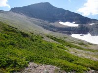
Guess the spot

wow, awesome info @Jackson!
I used the same description and had no problems. I think it's a liiiiiiiittle confusing as written - basically you go straight up the snow tongue (very steep and unstable), cross from right to left below the Slab. Once you've crossed below the slab, take a hard right and climb from seven o'clock to two o-clock. IMPORTANT: once you get near the top of the chute, the chute gets ultra-steep and gets into the class IV range. Stop climbing the chute right below this point and you'll notice an escape to your right (south). Head that way for just a tiny bit (couple dozen yards) and you'll soon reach the Gash. From there simply scramble up on good rock, loop below the summit, and you're there. Your main problem will be rocks tumbling down the chute. I was on the snow tongue when a bit one came rocketing out of the bottom of the Chute. If I were there I would have been killed. Also the snow tongue is no fun if there's no snow.
 
I used the same description and had no problems. I think it's a liiiiiiiittle confusing as written - basically you go straight up the snow tongue (very steep and unstable), cross from right to left below the Slab. Once you've crossed below the slab, take a hard right and climb from seven o'clock to two o-clock. IMPORTANT: once you get near the top of the chute, the chute gets ultra-steep and gets into the class IV range. Stop climbing the chute right below this point and you'll notice an escape to your right (south). Head that way for just a tiny bit (couple dozen yards) and you'll soon reach the Gash. From there simply scramble up on good rock, loop below the summit, and you're there. Your main problem will be rocks tumbling down the chute. I was on the snow tongue when a bit one came rocketing out of the bottom of the Chute. If I were there I would have been killed. Also the snow tongue is no fun if there's no snow.
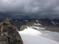
Awesome info! And the loose rocks sound pretty nuts. I hope you had a helmet!
 
Fremont peak lol, aparently anything that looks like the wind rivers is fremont peak to me lol
 
13909125_1744650819108276_6094484922387359499_o.jpg
 
Fremont Peak (j/k). Kind of reminds me of that country around Logan Pass. (BTW, the Going to the Sun Road is still closed).
 
Last edited:
It looks so familiar...like a Uintas peak I've seen or done. (I've been comparing to pics of Hayden, Agassiz, Yard, stuff around Deadhorse Lake,etc)...but nothing seems to quite match!
 
its in GNP, might be difficult because people dont commonly go here
 
I've seen a grizzly bear heading down the outfitters' trail towards me before I crossed the pass on the left of the image.
Really? That could be crazy!
 
A little nerve wracking, I had my bear spray out and ready. He broke off the trail to my left and went around along the lower slope of a peak that shall remain nameless less it gives your spot away.

Yeah any peak names will give an area away and in no time people will get it because this spot, while not popular is interesting to say the least lol
 
Back
Top