Navigation
Install the app
How to install the app on iOS
Follow along with the video below to see how to install our site as a web app on your home screen.
Note: This feature may not be available in some browsers.
More options
Style variation
You are using an out of date browser. It may not display this or other websites correctly.
You should upgrade or use an alternative browser.
You should upgrade or use an alternative browser.
Guess the spot
- Thread starter Backcountry Post
- Start date
- Joined
- Dec 11, 2015
- Messages
- 2,094
mike_offerman
Member
- Joined
- Feb 8, 2012
- Messages
- 566
mike_offerman
Member
- Joined
- Feb 8, 2012
- Messages
- 566
You are correct, great spot up there!
Langdon Greene
Member
- Joined
- Dec 27, 2015
- Messages
- 243
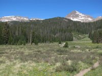
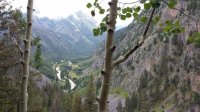
Looks a bit like Snowmass Creek (Colorado) near the junction of the 2 forks, but this valley seems to be a lot narrower.
It also reminds me of a spot looking down Cascade Canyon [main fork] in Grand Tetons. Actually, the more I look at it the more I think that's it! ETA: Yep, that's my guess. The rocks look right for it too. We spent about an hour on the rockslide above that river bend meadow watching a big bull moose feed, wading through the river down there. I'm pretty sure that's it. I guess I could go look at my photos to see if it's a match....
It also reminds me of a spot looking down Cascade Canyon [main fork] in Grand Tetons. Actually, the more I look at it the more I think that's it! ETA: Yep, that's my guess. The rocks look right for it too. We spent about an hour on the rockslide above that river bend meadow watching a big bull moose feed, wading through the river down there. I'm pretty sure that's it. I guess I could go look at my photos to see if it's a match....
mike_offerman
Member
- Joined
- Feb 8, 2012
- Messages
- 566
I am thinking San Juans, but not sure where....
mike_offerman
Member
- Joined
- Feb 8, 2012
- Messages
- 566
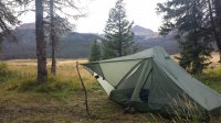
Took me a minute, but I have a feeling those are train tracks and not a road. How about Elk Park?
mike_offerman
Member
- Joined
- Feb 8, 2012
- Messages
- 566
Seldom Seen Anderson
Member
- Joined
- Jan 19, 2012
- Messages
- 739
Pine Valley?
Langdon Greene
Member
- Joined
- Dec 27, 2015
- Messages
- 243
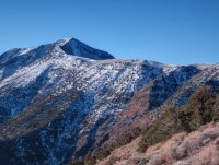
Mauna Loa? 

mike_offerman
Member
- Joined
- Feb 8, 2012
- Messages
- 566
None of those 3 are in the correct state (Utah or Hawaii), though I am not quite sure I know where Pine Valley is.
- Joined
- Jun 25, 2012
- Messages
- 4,430
Pine Valley Mtns are towering above St. George. Do I win?None of those 3 are in the correct state (Utah or Hawaii), though I am not quite sure I know where Pine Valley is.
mike_offerman
Member
- Joined
- Feb 8, 2012
- Messages
- 566
You win my thanks for expanding my geographic knowledge!
Don't like ads? Become a BCP Supporting Member and kiss them all goodbye. Click here for more info.


