Navigation
Install the app
How to install the app on iOS
Follow along with the video below to see how to install our site as a web app on your home screen.
Note: This feature may not be available in some browsers.
More options
Style variation
You are using an out of date browser. It may not display this or other websites correctly.
You should upgrade or use an alternative browser.
You should upgrade or use an alternative browser.
Guess the spot
- Thread starter Backcountry Post
- Start date
Ben
Member
- Joined
- Sep 12, 2014
- Messages
- 1,873
- Joined
- Jun 25, 2012
- Messages
- 4,430
It is really cool wherever it is. Geoposition please?You got it @River . I'm impressed. Do you know he name of the place?
Ben
Member
- Joined
- Sep 12, 2014
- Messages
- 1,873
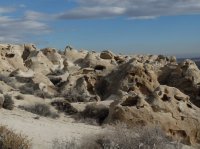
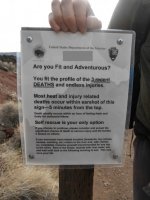
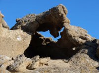
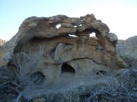
Some very limited BLM info names it the Shoofly Oolite.
http://www.blm.gov/pgdata/etc/media...ntry.Par.58571.File.dat/ShooflyOolite_web.pdf
Formed from the shores of prehistoric Lake Idaho.
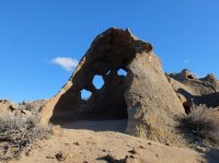
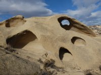
Univeral Transverse Mercator 11T 0571761E 4743099N zone 11T, 0571761 east by 4743099 north
US National Grid 11T NH 71761 43099 11TNH 7176143099
Decimal Degrees 42.8371, -116.1219 42 point 8371 degrees north by 116 point 1219 degrees west
Degrees Decimal Minutes 42°50.23', -116°07.31' 42 degrees 50 point 23 minutes north by 116 degrees 07 point 31 minutes west
Degrees Minutes Seconds 42°50'14", -116°07'19" 42 degrees 50 minutes 14 seconds north by 116 degrees 07 minutes 19 seconds west
http://www.blm.gov/pgdata/etc/media...ntry.Par.58571.File.dat/ShooflyOolite_web.pdf
Formed from the shores of prehistoric Lake Idaho.


Univeral Transverse Mercator 11T 0571761E 4743099N zone 11T, 0571761 east by 4743099 north
US National Grid 11T NH 71761 43099 11TNH 7176143099
Decimal Degrees 42.8371, -116.1219 42 point 8371 degrees north by 116 point 1219 degrees west
Degrees Decimal Minutes 42°50.23', -116°07.31' 42 degrees 50 point 23 minutes north by 116 degrees 07 point 31 minutes west
Degrees Minutes Seconds 42°50'14", -116°07'19" 42 degrees 50 minutes 14 seconds north by 116 degrees 07 minutes 19 seconds west
- Joined
- Jun 25, 2012
- Messages
- 4,430
Great! I'm going there. Idaho always surprises me.Some very limited BLM info names it the Shoofly Oolite.
http://www.blm.gov/pgdata/etc/media...ntry.Par.58571.File.dat/ShooflyOolite_web.pdf
Formed from the shores of prehistoric Lake Idaho.
View attachment 39866 View attachment 39867 View attachment 39868 View attachment 39869
Univeral Transverse Mercator 11T 0571761E 4743099N zone 11T, 0571761 east by 4743099 north
US National Grid 11T NH 71761 43099 11TNH 7176143099
Decimal Degrees 42.8371, -116.1219 42 point 8371 degrees north by 116 point 1219 degrees west
Degrees Decimal Minutes 42°50.23', -116°07.31' 42 degrees 50 point 23 minutes north by 116 degrees 07 point 31 minutes west
Degrees Minutes Seconds 42°50'14", -116°07'19" 42 degrees 50 minutes 14 seconds north by 116 degrees 07 minutes 19 seconds west
Don't like ads? Become a BCP Supporting Member and kiss them all goodbye. Click here for more info.

