John Morrow
Member
- Joined
- May 22, 2015
- Messages
- 1,119
Pretty sure I am wrong, can't line it up on GE. But it begs the question: How/why are you up so high on the Navajo?
Follow along with the video below to see how to install our site as a web app on your home screen.
Note: This feature may not be available in some browsers.
The butte is not in a tributary to Fold - @regehr was warmer, not so much in distance but drainageA northern fork of Fold? It joins main Fold on the left, with main Fold heading to the River towards upper right? If so, is there a route from the River into Fold from the bottom?
The second pic, from another trip, is near a high point that is part of a known route - starts with 'C'Pretty sure I am wrong, can't line it up on GE. But it begs the question: How/why are you up so high on the Navajo?
Gotcha, that was a big hint. Haven't confirmed on GE but has to be. I'll let someone else ID it. Three to Five miles E/NE of where I first guessed, I believe. Practically impossible miles!The second pic, from another trip, is near a high point that is part of a known route - starts with 'C'
You can walk Fold up from the river. There’s one short sloping dryfall in the middle, above a pothole, that can be done with a partner assist or pack toss (not very hard). I did it top down from the gully by the sandslide some 20 or so years ago. It’s fun bouldery terrain down the bottom there.A northern fork of Fold? It joins main Fold on the left, with main Fold heading to the River towards upper right? If so, is there a route from the River into Fold from the bottom?
Correct!6361T in Upper Stevens.
BumpView attachment 141355
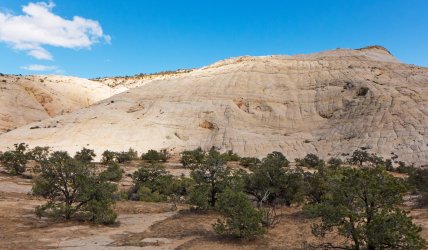
Here is another lovely spot
As a Canuck - said with great affection - you know Utah better than some of us who have lived there for years.@Pukwudgie My first thought was "somewhere around Phipps Arch" and sure enough, a quick look on GE shows that it is in fact on the "backside" of Phipps.

Yep this is on top of the exit route Allen describes in his Phipps hike up and over couple steep slickrock domes. Pretty fun@Pukwudgie My first thought was "somewhere around Phipps Arch" and sure enough, a quick look on GE shows that it is in fact on the "backside" of Phipps.
Somewhere in the San Rafael Swell is my guess!
It is somewhere in the San Rafael Swell. I can give a hint as to where in the swell. It is north of I70Somewhere in the San Rafael Swell is my guess!
Don't like ads? Become a BCP Supporting Member and kiss them all goodbye. Click here for more info.
