Navigation
Install the app
How to install the app on iOS
Follow along with the video below to see how to install our site as a web app on your home screen.
Note: This feature may not be available in some browsers.
More options
Style variation
You are using an out of date browser. It may not display this or other websites correctly.
You should upgrade or use an alternative browser.
You should upgrade or use an alternative browser.
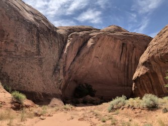
Guess the spot: Utah Edition
- Thread starter Ben
- Start date

SteveR
Member
- Joined
- Sep 22, 2016
- Messages
- 1,046
Actually @regehr, what I meant by "pick one", was to choose one or the other of those two drainages. In my mind, upper Zebra would be more precise, but it doesn't matter, you were really close. As for your submission- with the way that Utah peak names go, that center one is probably known as "Someone's Nipple" .
Pukwudgie
Member
- Joined
- Jun 18, 2021
- Messages
- 208
Definitely looks like a "Nipple" or a "Knob"Actually @regehr, what I meant by "pick one", was to choose one or the other of those two drainages. In my mind, upper Zebra would be more precise, but it doesn't matter, you were really close. As for your submission- with the way that Utah peak names go, that center one is probably known as "Someone's Nipple" .
regehr
Member
- Joined
- Mar 28, 2012
- Messages
- 2,482
It is a Knob for sure.Definitely looks like a "Nipple" or a "Knob"
Pukwudgie
Member
- Joined
- Jun 18, 2021
- Messages
- 208
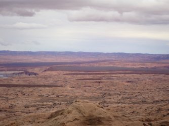
Ok I'll guess it, Red Knob Pass? USGS map labels Red Knob as the one on the left tho. Wasatch (left) and Lovenia (right) visible in the background.It is a Knob for sure.
regehr
Member
- Joined
- Mar 28, 2012
- Messages
- 2,482
got it, you're up. the other "visible" feature is the uinta highline trailOk I'll guess it, Red Knob Pass? USGS map labels Red Knob as the one on the left tho. Wasatch (left) and Lovenia (right) visible in the background.
")
Pukwudgie
Member
- Joined
- Jun 18, 2021
- Messages
- 208
Looks very enticing, minus the weather.got it, you're up. the other "visible" feature is the uinta highline trail
regehr
Member
- Joined
- Mar 28, 2012
- Messages
- 2,482
It was actually great, last September I think, the forecast was sort of dire but it mostly rained while we weren’t trying to eat or hang out. We had the entire w fork blacks fork to ourselves.Looks very enticing, minus the weather.

Pukwudgie
Member
- Joined
- Jun 18, 2021
- Messages
- 208
That's a BINGO. You're up @Brendan SIron Top Mesa looks like from topish of the fold east of Long.
Pukwudgie
Member
- Joined
- Jun 18, 2021
- Messages
- 208
@Brendan S Bump

Brendan S
Member
- Joined
- Mar 19, 2016
- Messages
- 434
Nice, nailed it.Is it the pass between Middle Moody and Red Slide, Circle Cliffs?
Similar look but it's Swap Mesa/Tarantula Mesa east of the Fold in the background.Is that the ridge above Castle Valley? Looks like Book Cliffs in the background, pretty far away.