Navigation
Install the app
How to install the app on iOS
Follow along with the video below to see how to install our site as a web app on your home screen.
Note: This feature may not be available in some browsers.
More options
Style variation
You are using an out of date browser. It may not display this or other websites correctly.
You should upgrade or use an alternative browser.
You should upgrade or use an alternative browser.
Guess the spot: Utah Edition
- Thread starter Ben
- Start date
- Joined
- May 31, 2015
- Messages
- 3,329
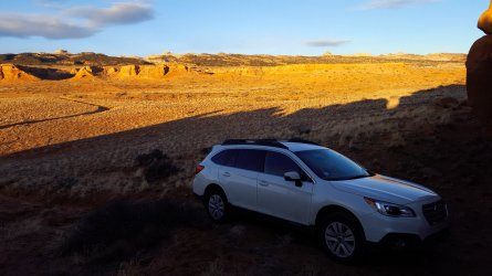
Yep! Just a mile or two north of the trail to Sheets Gulch. So I guess maybe the road wasn't paved directly below us, but we were pretty close to where it transitions.Along the Notom road?
Have at it!
SteveR
Member
- Joined
- Sep 22, 2016
- Messages
- 1,028
SteveR
Member
- Joined
- Sep 22, 2016
- Messages
- 1,028
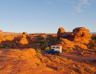
That's the spot!Is it that area along the Lockhart Basin road just south of Indian Creek, and about two miles north of UT-211?
priz1234
Member
- Joined
- Jun 10, 2020
- Messages
- 314
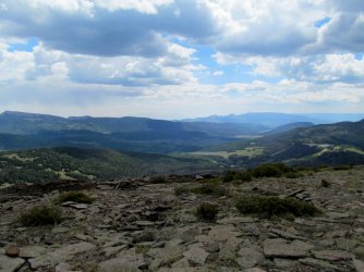
Mount Terrill?Slight departure from the recent theme. Although my camp spot is visible near the center of the image, this was taken from a nearby peak.
Udink
Still right here.
- Joined
- Jan 17, 2012
- Messages
- 1,742
Yep! Looking down the Left Fork of UM Creek.Mount Terrill?
regehr
Member
- Joined
- Mar 28, 2012
- Messages
- 2,458
ack how did I miss this I was on that mountain less than one week ago??Yep! Looking down the Left Fork of UM Creek.
John Morrow
Member
- Joined
- May 22, 2015
- Messages
- 1,119
I know I've been here....but where was it?
priz1234
Member
- Joined
- Jun 10, 2020
- Messages
- 314
I'm pretty sure you posted one on guess the spot that was pretty close to here so I bet you have been. Another hint is that there is a good trail through this canyon.I know I've been here....but where was it?
priz1234
Member
- Joined
- Jun 10, 2020
- Messages
- 314
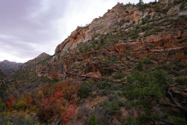
Not Rock Canyon. If we are thinking about the same Rock Canyon, this one is further south and is a non technical canyonIs this Rock Canyon?
- Joined
- Jul 24, 2021
- Messages
- 166
I was thinking of a Rock Canyon up near Provo, though I've never been.Not Rock Canyon. If we are thinking about the same Rock Canyon, this one is further south and is a non technical canyon
So if that is the Rock Canyon you were thinking that I was thinking of ( ), and this is south of that, what about The Box/Pine creek. The fall colors and the desert varnish are now giving me this higher elevation Colorado plateau vibe.
Don't like ads? Become a BCP Supporting Member and kiss them all goodbye. Click here for more info.


