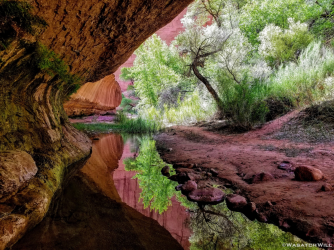
Guess the spot: Utah Edition

We had actually camped down on the White Rim and hiked it from over by Monument Basin. We had another friend do it from the Govt trail the next weekend. The route goes up kind of the NW side. We had a rope and some people used it (mostly just for a hand line), I was able to up and down climb everything without it.
 
You got it @SteveR !

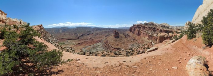
A beautiful trail with incredible views over Capitol Reef.
I was inspired by the report of @WasatchWill : Hiking Capitol Reef's Navajo Knobs | Backcountry Post

The Navajo Knobs hike is regarded streneous because, apart from the total gain in height, a major part of the trail is along the edge of tilted layers which means repeatedly loosing and again gaining height, also on the way back!

DSCN6363_stitchsmall.jpg
 
You got it @SteveR !

A beautiful trail with incredible views over Capitol Reef.
I was inspired by the report of @WasatchWill : Hiking Capitol Reef's Navajo Knobs | Backcountry Post

The Navajo Knobs hike is regarded streneous because, apart from the total gain in height, a major part of the trail is along the edge of tilted layers which means repeatedly loosing and again gaining height, also on the way back!

View attachment 97199
I've driven and ridden on that stretch of highway under The Castle countless times now, so it felt really weird when I finally did that hike and found myself standing above and overlooking The Castle like you have in this shot. Great pano!
 
Sorry @WasatchWill, that is obviously the way up from Tower House :)
You are up!
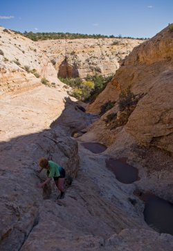
Hahaha! I was thinking I should have phrased it that way for that is what it appears to have been in the moment that photo was taken. Ok...I'm still going to assume I now have to throw something up here....Can't pick anything too recent as that might be too obvious...but don't want to make it too hard either, so I'm going with this one...

1617934851717.png
 
That's not the trail I took to get to Tower House! Wish I had taken that way though.
The new picture looks Golden Cathedral-ish.... as on the way IN or OUT.

What did you do, go all the way up Butler Wash or whatever fork of it goes up from the south? I've looked at that before but figured there may be some potentially impassable pour-offs based on the imagery. Anyway...it's not Neon Canyon or all that close to it but it's kind of in that ball park...that is, same monument and part of same drainage system.
 
Willow Gulch. :)


Gesendet von iPad mit Tapatalk
 

Don't like ads? Become a BCP Supporting Member and kiss them all goodbye. Click here for more info.

Back
Top