Navigation
Install the app
How to install the app on iOS
Follow along with the video below to see how to install our site as a web app on your home screen.
Note: This feature may not be available in some browsers.
More options
Style variation
You are using an out of date browser. It may not display this or other websites correctly.
You should upgrade or use an alternative browser.
You should upgrade or use an alternative browser.
Guess the spot: Utah Edition
- Thread starter Ben
- Start date
Udink
Still right here.
- Joined
- Jan 17, 2012
- Messages
- 1,742
It was just steep, boring scenery, and exposed to the afternoon sun. In comparison the trail from Mud Lake was mostly through pine and aspen groves, with occasional nice views of the canyon and peaks, and crossed by several streams of running water.What was the problem with the closed road? Overgrown?
- Joined
- Jan 4, 2015
- Messages
- 2,897
Indeed. This is a well-known canyon in the park.CRNP
Gesendet von iPhone mit Tapatalk
- Joined
- Jun 11, 2017
- Messages
- 4,595
Spring Cyn
- Joined
- Jan 4, 2015
- Messages
- 2,897
You're up!Spring Cyn
- Joined
- Jun 11, 2017
- Messages
- 4,595
Reef&Ruins
Colorado Plateau is calling...
- Joined
- Feb 3, 2017
- Messages
- 926
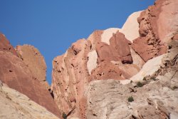
Looks like chocolate ice cream. Although it'd probably break my teeth.
SteveR
Member
- Joined
- Sep 22, 2016
- Messages
- 1,017
Looks more like rocky road ice cream to me. Is this in the big rock candy mountain area?Looks like chocolate ice cream. Although it'd probably break my teeth.
- Joined
- Jun 11, 2017
- Messages
- 4,595
It should be, but no, it's in the Swell.
- Joined
- Jun 11, 2017
- Messages
- 4,595
Nopester. Look further east, my friend, and a bit north. Think of the geology. Where do you see such beauty?
- Joined
- Jun 11, 2017
- Messages
- 4,595
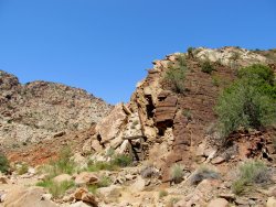
OK, I think this is too hard, especially since I can't find it myself and I took it. I was on the road just below Three Fingers Canyon, but can't locate it exactly on Google Earth, maybe because the angle's not right. But it's the top of the Reef from somewhere near Three Fingers.
So, on that note of defeat, whoever reads this first and wants to post another, have at it. I'm going to head out and drive down there and see if I can find it before this incoming storm hits, and I may be awhile.
(If anyone wants to come along, I should be at the Squeeze in about 7 hours. Bring some Evolution Ale so my memory can evolve.))
ETA: Paging @LarryBoy
Last edited:
Udink
Still right here.
- Joined
- Jan 17, 2012
- Messages
- 1,742
I would've guessed somewhere near Hurst Bridge. But fine, I'll throw out another photo:OK, I think this is too hard, especially since I can't find it myself and I took it. I was on the road just below Three Fingers Canyon, but can't locate it exactly on Google Earth, maybe because the angle's not right. But it's the top of the Reef from somewhere near Three Fingers.
So, on that note of defeat, whoever reads this first and wants to post another, have at it. I'm going to head out and drive down there and see if I can find it before this incoming storm hits, and I may be awhile.
(If anyone wants to come along, I should be at the Squeeze in about 7 hours. Bring some Evolution Ale so my memory can evolve.))
ETA: Paging @LarryBoy

- Joined
- Jun 11, 2017
- Messages
- 4,595
Looks like an old mine adit in the Swell somewhere, maybe Hondu country or near the WIckiup?
Last edited:
Udink
Still right here.
- Joined
- Jan 17, 2012
- Messages
- 1,742
It is a mine in the Swell, but within easy hiking distance of the place in your last photo.Looks like an old mine adit in the Swell somewhere, maybe Hondu country or near the WIckiup?
- Joined
- Jun 11, 2017
- Messages
- 4,595
Uneva Mine
Udink
Still right here.
- Joined
- Jan 17, 2012
- Messages
- 1,742
That's it! And now it's back to you.Uneva Mine
- Joined
- Jun 11, 2017
- Messages
- 4,595
Don't like ads? Become a BCP Supporting Member and kiss them all goodbye. Click here for more info.


