- Joined
- Jun 25, 2012
- Messages
- 4,430
Now you are closer, than Ohio.I've been to that one too.
Mojave?
Follow along with the video below to see how to install our site as a web app on your home screen.
Note: This feature may not be available in some browsers.
Now you are closer, than Ohio.I've been to that one too.
Mojave?
Nope, your other guess was closer but not specific enough.There's one in Utah too.
Maybe Devils Playground.
Haha! A satellite is basically like a really, really high drone... err quadcopter! I like it!
I.e. Devils Playground
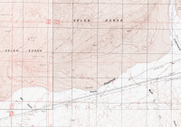
I don't know where your map snippet came from. The feature is called Kelso Dunes on the USGS quad AFAIK. Famous as the Booming Dunes.I.e. Devils Playground
Just giving you a hard time. Liked the idea of a drone video.

Bob, observing your private life is pretty far down in my recon queue. @scatman on the other hand.....ha ....... Art it's still a drone ...... Did you go dark and buy one to bug all of us?
Don't like ads? Become a BCP Supporting Member and kiss them all goodbye. Click here for more info.
