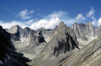
Guess the spot: Maps Edition

Whatever you do... do not drive Poison Spring at night. In the day proceed with caution.
I don't even remember this conversation or why I was looking for Posion Spring. Since I am in Idaho probably a slim to zero chance of me attempting to drive this road let alone at night or in a rain storm.

Sent from my SM-G935V using Tapatalk
 
Bugaboos?
Of course it is the Bugs! One of the 50 of the "50 Classic Climbs of North America" is here, on the Bugaboo Spire, and I have had the honor of climbing it, successfully. The 10 teams behind us overnighted on the route, the poor buggers. We watched them from our tents and empathized with their headlamps up high on skinny ledges with little bivy gear. Classic.

You, Liz, are on deck.
 
Last edited:
I've read that TR before and didn't make the connection. Pretty wild!

I've seen the Bugs and am awed by anyone who would climb them. Just getting up under them was a bit hair-raising in itself, as I don't like exposure.

OK, that inspires me to post up a bit different map of a similar place, though much less frequented. Also in Canada, but not BC. Hint: lots of colorful names in these peaks. The main access to them is by plane.

map smal.jpg
 
I've read that TR before and didn't make the connection. Pretty wild!

I've seen the Bugs and am awed by anyone who would climb them. Just getting up under them was a bit hair-raising in itself, as I don't like exposure.

OK, that inspires me to post up a bit different map of a similar place, though much less frequented. Also in Canada, but not BC. Hint: lots of colorful names in these peaks. The main access to them is by plane.

View attachment 57468

Rock,
You need to embrace that exposure. I too am awed by it but climbing made me less scared of it. :)

Anyway could you be teasing us with a really cool map view of the northeast view of Kluane Provincial Park, Yukon?
 
I embrace the fear, and it embraces me back a little too tight and squeezy.

Wrong province but I do love the Kluane.

Hint: the river on the right of the map is rather famous. I'm sure you know these peaks, you may have even climbed there. It's a climber's paradise, though hard to get to.

NOTE: @Artemus I updated this - it's NOT in Yukon T (nor BC).
 
Last edited:
Another hint: At least one of these climbs is in the book Fifty Classic Climbs Of North America and may be on your bucket list, if you have one.
 
Another hint: At least one of these climbs is in the book Fifty Classic Climbs Of North America and may be on your bucket list, if you have one.
Well, then it is in the Northwest Territories and it is in on my bucket list and I will be super-impressed if you have been there too!

Hint us what kind of map it is, please, please, please.
 
Last edited:
I would love to go there, but no such luck so far. Yes, it's in NWT. Not sure what kind of map it is, maybe just someone's hand sketch.

BIG hint: look at the peaks near the top of the map. They're in a ________. (one word, glaciation-related).

I will add that, even though they may be on your bucket list, I believe they're unclimbable.
Tomorrow, when I am maybe rested, I will respond to your choice of the adjective "unclimbable". That has turned out to be an inadequate description of a particular feature to climbers. In fact, it is a lure. When named such a certain glacial cirque of particular importance and distinction was promptly climbed. It is called the Cirque of the Unclimbables. Unclimbable? Fat chance. Those namers knew they were throwing down the gauntlet.

People like Alex Honnold and Uli Steck responded. Their predecessors had already climbed many of those Unclimbables. Respect.
 
Last edited:
A bit of mis-perception by the man who first named them. ;) Lots of cool names later, like the Lotus Flower Tower.

Lol you're up, @Artemus

499686.jpg

bolyards map smal.jpg
 
Last edited:
Similar threads
Thread starter Title Forum Replies Date
Outdoor_Fool The value of the various Guess the Spot threads General Discussion 6
wsp_scott NYTimes article: Guess the spot saves someone's life General Discussion 1
C Guess the Spot: somewhere in Southern Utah General Discussion 4
JDWalters Guess the Spot: Eastern US Edition General Discussion 515
LarryBoy Guess the Spot: Trip Reports Edition Hiking & Camping 5
balzaccom Guess the Spot--DIY version General Discussion 33
Ben Guess the spot: Utah Edition General Discussion 6324
Artemus Guess the Spot: International Edition General Discussion 283
Jammer Guess the Spot (not where you think) General Discussion 10
Backcountry Post Guess the spot General Discussion 7683
Perry Can You Guess Where The Uintas Are? General Discussion 5
J Identify the spot Utah: I don't know where it is General Discussion 2
Happyidiot Looking for camping spot close to Denver. General Discussion 2
Jammer Havasu Falls Extra Spot General Discussion 3
Nick Spot X Gear 27
SKLund Sticking with SPOT Gear 0
Ross Unofficial Where’s The Spot General Discussion 0
Perry Good Deal on a Spot Gen 3 Gear 5
Jammer Spot/InReach for May? Trip Planning 7
Bridgette Good camping spot in the Uintas with 4WD Trip Planning 0
jonmessina Spot Tracker Rental? Trip Planning 1
uintahiker The bloodiest spot in Arizona Hiking & Camping 0
Jammer InReach vs Spot Messenger 2013 Gear 32
wnorton Do you use Spot Connect or DeLorme InReach? Gear 6
Nurrgle Good car camping spot in the Uintas General Discussion 9
Nick SPOT Connect Gear 2
F Maps for the Bob Marshall Wilderness Resource Discussions 3
U Funny experience with Maps on iPad Everything Else 1
westy NW Wyoming Maps Trip Planning 13
T Findings while searching Google maps General Discussion 9
TrektheWorld Gazetteer Maps Gear 4
Mike Jones Who uses paper maps? General Discussion 42
Wanderlust073 Black Ridge Canyons Wilderness / Rattlesnake Canyon maps Trip Planning 6
Jackson Google Maps 3D Detail General Discussion 4
isleroyaleguy White Clouds maps? Trip Planning 4
Mike Jones Built a Custom Map Board for protecting my maps while hiking Gear 9
Bob Create Maps/Routes for Android Resource Discussions 1
Backcountry Post Embedding CalTopo Maps Questions, Suggestions & Support 23
andyjaggy Printing Maps General Discussion 13
Mike K Maps on your phone (cheap or free) General Discussion 25
Absarokanaut NOAA June, July, and August Seasonal Outlook Maps General Discussion 16
steve Google Maps Engine Question on windows 8.1 laptop with USB gps General Discussion 0
uintahiker Google Maps vs KML file embed General Discussion 2
Nick New Google Maps Engine SUCKS General Discussion 12
baltocharlie Maps for Spring trip Trip Planning 17
Waynee-ack Maps? General Discussion 4
Backcountry Post Embedding Maps Questions, Suggestions & Support 32
Nick Embedding Google Maps Questions, Suggestions & Support 0

Similar threads

Back
Top