BeardoMcGrath
Member
- Joined
- Jan 31, 2022
- Messages
- 55
Background
After finishing our three day exploration of lower Willow Gulch we had lunch in the shade at Sooner Rocks and then drove the steep 4WD road up Sooner Slide to Fiftymile Bench. The road definitely requires a HC vehicle but isn’t anything difficult and wasn’t too washed out from winter melt or the previous summer’s monsoon season. The purpose of driving up to this lonely area was to explore Fiftymile Mountain the following day. We found a great spot not too far from the Lower TH amongst the junipers to car camp and settled in for a comfortable night after our short backpacking trip.
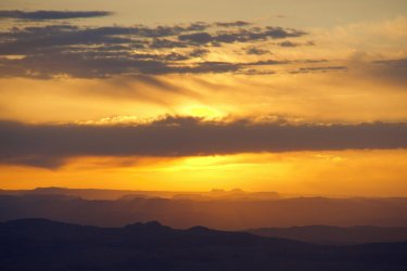
Sunrise from camp, looking out towards the Bears Ears
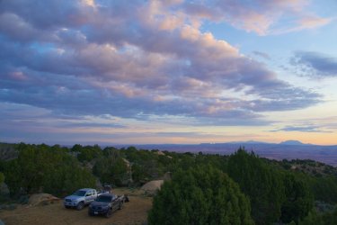
Beautiful campsite
Hike
Mostly cloudy to partly cloudy, then mostly cloudy with passing thunder late; 50s-60s
After a nice sunrise we packed our daypacks and made the short drive to the Lower TH. There was a good spot to park here that could also serve as a campsite, but with less of a view. Leaving the Tacoma at 9:40 under mostly cloudy skies, we walked up the old closed off road to the edge of the Straight Cliffs. The Lower Trail is certainly in a remote setting, but in good shape, well blasted into the hillside. After our trip along the relatively flat canyon bottoms, our hearts were pumping before long on the climb up. We saw a few wildflowers on the way, and before long reached the top of the cliffs, where the trail peters out next to a handful of huge cairns.
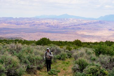
Brian along the closed section of road below the bigger climb
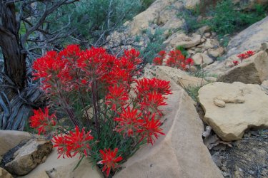
Wildflowers on the climb up
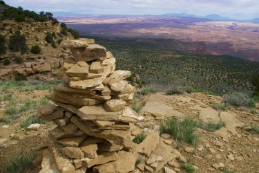
One of the massive cairns at the top of the trail
It was rather blustery at the rim, and combined with the low clouds and occasional rain drops it felt a bit more like winter than mid-May. The plan was to follow the supposed cattle trail north to find the “Rim Ruins” noted in Kelsey’s Guide, which are located below Point 7586 on the USGS topo. Initially we didn’t have much luck locating the trail, and so engaged in some light bushwhacking to gain the ridge NW of the upper end of the Lower Trail. Along the way we passed a few snowbanks hanging on from the record winter.
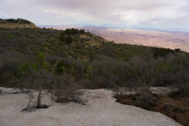
Lingering snowbank
After a snack break in view of the summit of Navajo Mtn (and thus a good spot for the members of our party who are self-employed to check some work emails) we continued down the other side under clearing skies and warming conditions. The going was much more open, and before long we stumbled on the old stock trail marked on the map. While following the trail is mostly easy, it definitely was faint in places but the open juniper forest up on this mountain made for easy walking. The contrast of green trees with the desolate red rock desert far below was enjoyable. Before long we reached the west side of Point 7586, and broke off the trail, rounding the slope until we reached a col between this summit and the rocky domes just to the north. Along the way we passed a snake and were able to snap a photo.
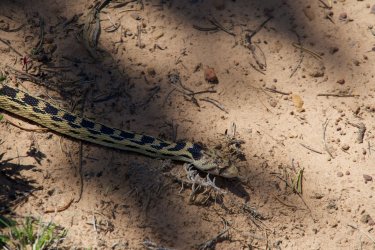
After taking in the grand views from the rim over Escalante country, we peered over the edge to the SE to investigate the final section of the route. The guidebook states one must drop below the uppermost cliffs and contour around to find the ruins. From our vantage it was not possible to see the ledge they were on, but I suspected they were around the little ridge we could see in front of us. The upper slopes were somewhat choked with brush and oak, so we had to move slowly along the steep slope and backtracked a couple times when we came to spots that were too steep. We learned the best and least steep route is to stay as high as possible contouring around.
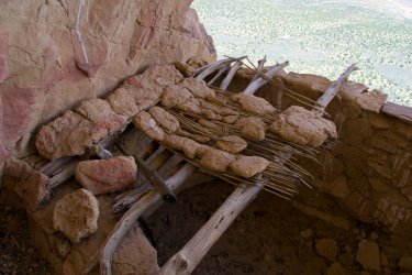
Once around the little ridge we could see the flat spot right before the ledge crawl to ruins. Looking at it we weren’t sure about it at first; I’m not particularly brave when it comes to exposure. However, once on my hands and knees I found it not too bad to shimmy across, with only one especially narrow spot to give pause. Soon we were next to the old granaries, perched with an unmatched view over all the red rock between us and the Henry Mountains.
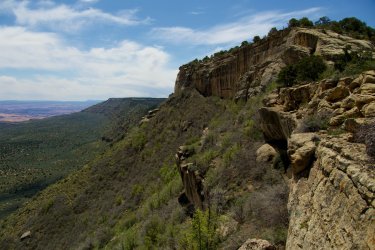
Final approach to the Rim Ruins below Point 7586. The ruins are out of view from here, around the little ridge photo center
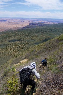
Descending through the brush to contour to the ruins
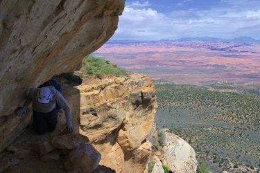
Ledge crawl to reach the ruins. This wasn't toooo scary but you definitely want to take it easy to get across
It was about 12:10 when we got to the ruins ledge and we spent about 15 mins poking around; these ruins are pretty intact but this is definitely not a secret spot as evidenced by the recent graffiti from 2021 and 2022. We decided the best location to take lunch would be on the top of the little peak right above us, where we could sit in the sun and not have to contemplate crawling back across the narrow ledge. And so we traversed the airy ledge a second time back to our packs, and then back along the steep slopes to more level ground. It was a straightforward climb through some boulders to the top of Point 7586, where we were able to sit in the sun and enjoy the expansive views along with lunch.
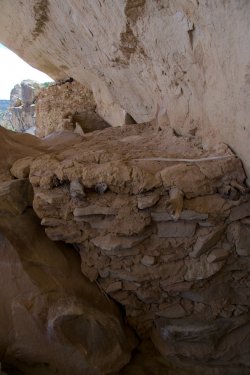
Granary with intact roof
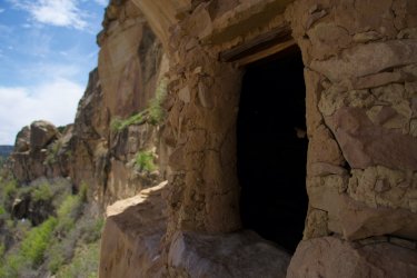
Storage with a view
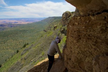
The ledge is somewhat narrow but we were able to poke around effectively
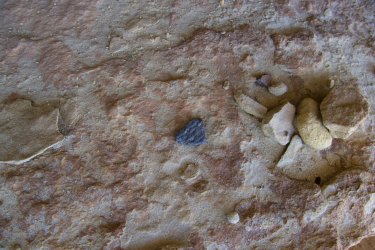
Only a couple pottery shards here
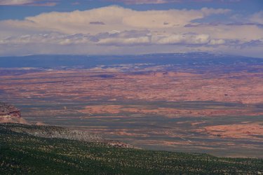
View north from our lunch spot. Still plenty of snow on Boulder Mtn! The long snaking route of the Hole-in-the-Rock Road is also visible
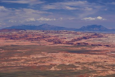
View across the Escalante Canyons to the Henry Mtns
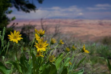
This looked like a kind of balsamroot one could see in E WA but I'm not sure if it grows this far south
After about 45 mins we were done with lunch and it was time to head back south, this time along the rim. While there isn’t a trail along this route, it is the best way to travel up here, with continuous views off the cliffs and only the occasional rim to negotiate. South of Point 7586 we dropped down past a pretty impressive Piñon Pine; during our visit on top of the mountain we saw quite a few old specimens of both Piñon Pine and Juniper. Not quite NW old growth but still impressive!
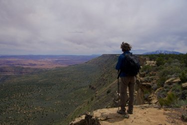
Joe takes in the view. The point to his left is where we were headed next
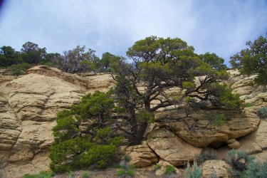
Large Piñon Pine
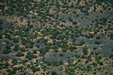
View down to our campsite. Upon our return we realized we could actually make out the Rim Ruins through the binoculars
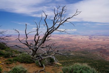
A number of tree skeletons on the rim made for interesting photos
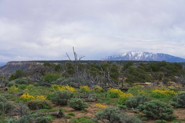
Lots of the dead trees up here were all blown over in the same direction. Looks like there can be some pretty strong NW winds at times
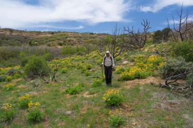
Flowers everywhere
Descending towards the top of the Lower Trail we actually crossed a small stream, so it seems there is water available up here in wetter years or the springtime (we had carried all our water up from the car for the day). Arriving back near the big cairns at 2:30, we decided there was enough time to explore a few other potential ridgetop ruins on the way to the survey point at the east end of Bull Ridge (Bull Ridge Point?), where I expected we would have a great view down Twilight Canyon to Lake Powell and across to Navajo Mountain. So we continued south away from the rim, through intermittent forest and then crisscrossing through sagebrush. Once again the pack trail on the map was hard to find, but climbing out of Trail Hollow and onto Corral Ridge we did find a couple of ruins in poor shape, not much more than stone circles on the ground.
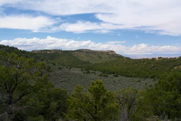
Looking back north over upper Trail Hollow back to the area around the top of the Lower Trail. We stayed in the trees to the right on our return as it was easier than weaving through the sagebrush
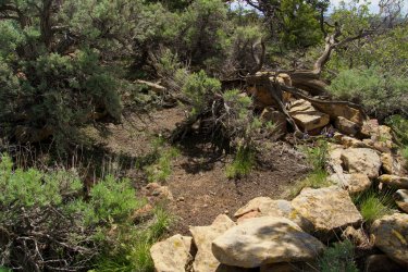
One of the pretty degraded ruins climbing onto Corral Ridge
Once on the ridgetop we decided to angle back towards the rim, in order to have the best views. Portions of this area have been burned by fire–possibly the Lake Canyon Fire in 1996–but there were lots of wildflowers to brighten the scene and of course the continuous views over the rim. Walking the edge was quite easy, with only a handful of cliff bands to negotiate dropping between Corral Ridge and Bull Ridge. As we approached Bull Ridge Point we got great views back to the north along the surprisingly green slopes of the Straight Cliffs.
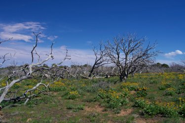
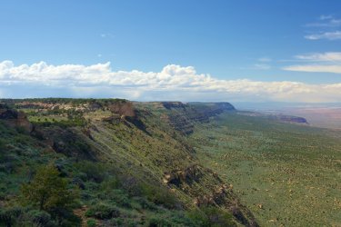
Looking north along the Straight Cliffs with the sun coming back out. Corral Ridge is at center-left
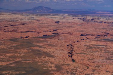
Canyons of the lower Escalante. I believe this is looking straight into Davis Gulch
We reached unassuming Bull Ridge Point right around 4 PM, with partly sunny skies. While the point was unassuming, the views were not, with a 270˚ panorama from Navajo Mountain to Boulder Mountain. The point sits right above Fiftymile Point, which I recall looking massive from the end of the Hole-in-the-Rock Road a few years prior but looked somewhat small down below. We spent over an hour here in the sun and calm conditions, and I took plenty of time to look through the binoculars, particularly the interesting Entrada cliffs in upper Twilight Canyon and the massive deep canyons on the north side of Navajo Mountain. This spot may have some of the best views in all of Utah.
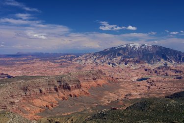
Our reward: a five star view down Twilight Canyon to Lake Powell and Navajo Mtn
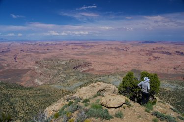
Looking straight off the point. The top of Fiftymile Point is at center-left with Davis Gulch behind it to the left and Llewellyn Gulch above Brian.
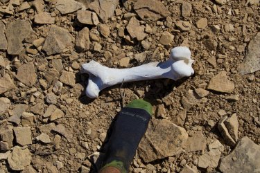
Assuming this came from a cow, if so it came to a scenic place to die
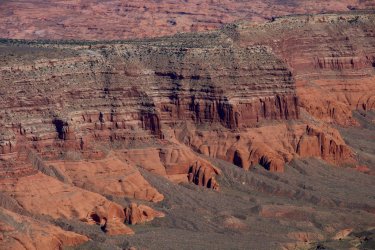
The cliffs above Twilight Canyon were very impressive
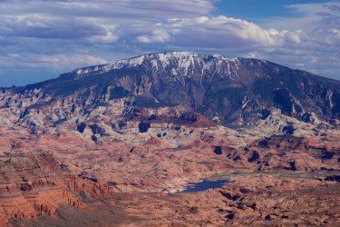
Though perhaps not as impressive as the vertical relief from Lake Powell to the top of Navajo Mtn. Still a few ski runs there on the north slopes...
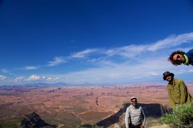
Happy hikers
Eventually it was time to depart, if we wanted to return to camp before sunset. Walking back NW into the sun was actually a little hot, a surprise after the cool and showery morning. Fortunately some clouds had begun to build again later into the afternoon, and so we were shaded as we continued along the rim off Bull Ridge and up and over Corral Ridge. On the north side of Corral Ridge, at the base of a small cliff band, we ran across an interesting old cowboy camp.
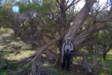
Brian and an impressive old growth juniper
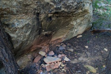
Old fire pit at the cowboy camp
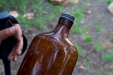
Old bottle at the cowboy camp
Descending back into upper Trail Hollow we contoured around the hill right along the rim, staying a bit higher than our trip south to remain in the woods and avoid dancing around all the sagebrush. It was about 6:40 when we reached the top of the Lower Trail again, with the skies dark and threatening and occasional rumbles of thunder rolling our way. Not wanting to get caught out in anything unpleasant, we hiked back down the cattle trail pretty efficiently, although I did have to stop at some nice dappled light on Fiftymile Bench, as well as a rainbow appearing just before we returned to the pickup.
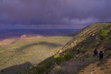
Descending the Lower Trail under threatening skies
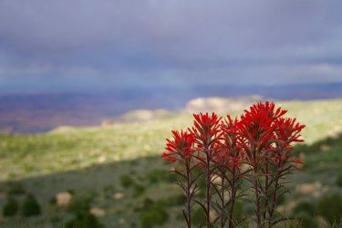
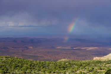
Rainbow just before the TH
Overall this was an excellent dayhike that provided some of the best views I’ve had in the state. For anyone headed up this way I would definitely recommend sticking to the rim rather than attempting to locate the old pack trail on top, although it may be more visible in some places rather than others. While we didn’t make it all the way south to Navajo Point, the view from Bull Ridge Point was exceptional and involved quite a bit less hiking. Bull Ridge Point would make an excellent campsite if you were willing to haul water up there. After camping another night on the bench we drove back down to the Hole-in-the-Rock Road, and back out to Escalante to continue our trip.
After finishing our three day exploration of lower Willow Gulch we had lunch in the shade at Sooner Rocks and then drove the steep 4WD road up Sooner Slide to Fiftymile Bench. The road definitely requires a HC vehicle but isn’t anything difficult and wasn’t too washed out from winter melt or the previous summer’s monsoon season. The purpose of driving up to this lonely area was to explore Fiftymile Mountain the following day. We found a great spot not too far from the Lower TH amongst the junipers to car camp and settled in for a comfortable night after our short backpacking trip.

Sunrise from camp, looking out towards the Bears Ears

Beautiful campsite
Hike
Mostly cloudy to partly cloudy, then mostly cloudy with passing thunder late; 50s-60s
After a nice sunrise we packed our daypacks and made the short drive to the Lower TH. There was a good spot to park here that could also serve as a campsite, but with less of a view. Leaving the Tacoma at 9:40 under mostly cloudy skies, we walked up the old closed off road to the edge of the Straight Cliffs. The Lower Trail is certainly in a remote setting, but in good shape, well blasted into the hillside. After our trip along the relatively flat canyon bottoms, our hearts were pumping before long on the climb up. We saw a few wildflowers on the way, and before long reached the top of the cliffs, where the trail peters out next to a handful of huge cairns.

Brian along the closed section of road below the bigger climb

Wildflowers on the climb up

One of the massive cairns at the top of the trail
It was rather blustery at the rim, and combined with the low clouds and occasional rain drops it felt a bit more like winter than mid-May. The plan was to follow the supposed cattle trail north to find the “Rim Ruins” noted in Kelsey’s Guide, which are located below Point 7586 on the USGS topo. Initially we didn’t have much luck locating the trail, and so engaged in some light bushwhacking to gain the ridge NW of the upper end of the Lower Trail. Along the way we passed a few snowbanks hanging on from the record winter.

Lingering snowbank
After a snack break in view of the summit of Navajo Mtn (and thus a good spot for the members of our party who are self-employed to check some work emails) we continued down the other side under clearing skies and warming conditions. The going was much more open, and before long we stumbled on the old stock trail marked on the map. While following the trail is mostly easy, it definitely was faint in places but the open juniper forest up on this mountain made for easy walking. The contrast of green trees with the desolate red rock desert far below was enjoyable. Before long we reached the west side of Point 7586, and broke off the trail, rounding the slope until we reached a col between this summit and the rocky domes just to the north. Along the way we passed a snake and were able to snap a photo.

After taking in the grand views from the rim over Escalante country, we peered over the edge to the SE to investigate the final section of the route. The guidebook states one must drop below the uppermost cliffs and contour around to find the ruins. From our vantage it was not possible to see the ledge they were on, but I suspected they were around the little ridge we could see in front of us. The upper slopes were somewhat choked with brush and oak, so we had to move slowly along the steep slope and backtracked a couple times when we came to spots that were too steep. We learned the best and least steep route is to stay as high as possible contouring around.
Once around the little ridge we could see the flat spot right before the ledge crawl to ruins. Looking at it we weren’t sure about it at first; I’m not particularly brave when it comes to exposure. However, once on my hands and knees I found it not too bad to shimmy across, with only one especially narrow spot to give pause. Soon we were next to the old granaries, perched with an unmatched view over all the red rock between us and the Henry Mountains.

Final approach to the Rim Ruins below Point 7586. The ruins are out of view from here, around the little ridge photo center

Descending through the brush to contour to the ruins

Ledge crawl to reach the ruins. This wasn't toooo scary but you definitely want to take it easy to get across
It was about 12:10 when we got to the ruins ledge and we spent about 15 mins poking around; these ruins are pretty intact but this is definitely not a secret spot as evidenced by the recent graffiti from 2021 and 2022. We decided the best location to take lunch would be on the top of the little peak right above us, where we could sit in the sun and not have to contemplate crawling back across the narrow ledge. And so we traversed the airy ledge a second time back to our packs, and then back along the steep slopes to more level ground. It was a straightforward climb through some boulders to the top of Point 7586, where we were able to sit in the sun and enjoy the expansive views along with lunch.

Granary with intact roof

Storage with a view

The ledge is somewhat narrow but we were able to poke around effectively


Only a couple pottery shards here

View north from our lunch spot. Still plenty of snow on Boulder Mtn! The long snaking route of the Hole-in-the-Rock Road is also visible

View across the Escalante Canyons to the Henry Mtns

This looked like a kind of balsamroot one could see in E WA but I'm not sure if it grows this far south
After about 45 mins we were done with lunch and it was time to head back south, this time along the rim. While there isn’t a trail along this route, it is the best way to travel up here, with continuous views off the cliffs and only the occasional rim to negotiate. South of Point 7586 we dropped down past a pretty impressive Piñon Pine; during our visit on top of the mountain we saw quite a few old specimens of both Piñon Pine and Juniper. Not quite NW old growth but still impressive!

Joe takes in the view. The point to his left is where we were headed next

Large Piñon Pine

View down to our campsite. Upon our return we realized we could actually make out the Rim Ruins through the binoculars

A number of tree skeletons on the rim made for interesting photos

Lots of the dead trees up here were all blown over in the same direction. Looks like there can be some pretty strong NW winds at times

Flowers everywhere
Descending towards the top of the Lower Trail we actually crossed a small stream, so it seems there is water available up here in wetter years or the springtime (we had carried all our water up from the car for the day). Arriving back near the big cairns at 2:30, we decided there was enough time to explore a few other potential ridgetop ruins on the way to the survey point at the east end of Bull Ridge (Bull Ridge Point?), where I expected we would have a great view down Twilight Canyon to Lake Powell and across to Navajo Mountain. So we continued south away from the rim, through intermittent forest and then crisscrossing through sagebrush. Once again the pack trail on the map was hard to find, but climbing out of Trail Hollow and onto Corral Ridge we did find a couple of ruins in poor shape, not much more than stone circles on the ground.

Looking back north over upper Trail Hollow back to the area around the top of the Lower Trail. We stayed in the trees to the right on our return as it was easier than weaving through the sagebrush

One of the pretty degraded ruins climbing onto Corral Ridge
Once on the ridgetop we decided to angle back towards the rim, in order to have the best views. Portions of this area have been burned by fire–possibly the Lake Canyon Fire in 1996–but there were lots of wildflowers to brighten the scene and of course the continuous views over the rim. Walking the edge was quite easy, with only a handful of cliff bands to negotiate dropping between Corral Ridge and Bull Ridge. As we approached Bull Ridge Point we got great views back to the north along the surprisingly green slopes of the Straight Cliffs.


Looking north along the Straight Cliffs with the sun coming back out. Corral Ridge is at center-left

Canyons of the lower Escalante. I believe this is looking straight into Davis Gulch
We reached unassuming Bull Ridge Point right around 4 PM, with partly sunny skies. While the point was unassuming, the views were not, with a 270˚ panorama from Navajo Mountain to Boulder Mountain. The point sits right above Fiftymile Point, which I recall looking massive from the end of the Hole-in-the-Rock Road a few years prior but looked somewhat small down below. We spent over an hour here in the sun and calm conditions, and I took plenty of time to look through the binoculars, particularly the interesting Entrada cliffs in upper Twilight Canyon and the massive deep canyons on the north side of Navajo Mountain. This spot may have some of the best views in all of Utah.

Our reward: a five star view down Twilight Canyon to Lake Powell and Navajo Mtn

Looking straight off the point. The top of Fiftymile Point is at center-left with Davis Gulch behind it to the left and Llewellyn Gulch above Brian.

Assuming this came from a cow, if so it came to a scenic place to die

The cliffs above Twilight Canyon were very impressive

Though perhaps not as impressive as the vertical relief from Lake Powell to the top of Navajo Mtn. Still a few ski runs there on the north slopes...

Happy hikers
Eventually it was time to depart, if we wanted to return to camp before sunset. Walking back NW into the sun was actually a little hot, a surprise after the cool and showery morning. Fortunately some clouds had begun to build again later into the afternoon, and so we were shaded as we continued along the rim off Bull Ridge and up and over Corral Ridge. On the north side of Corral Ridge, at the base of a small cliff band, we ran across an interesting old cowboy camp.

Brian and an impressive old growth juniper

Old fire pit at the cowboy camp

Old bottle at the cowboy camp
Descending back into upper Trail Hollow we contoured around the hill right along the rim, staying a bit higher than our trip south to remain in the woods and avoid dancing around all the sagebrush. It was about 6:40 when we reached the top of the Lower Trail again, with the skies dark and threatening and occasional rumbles of thunder rolling our way. Not wanting to get caught out in anything unpleasant, we hiked back down the cattle trail pretty efficiently, although I did have to stop at some nice dappled light on Fiftymile Bench, as well as a rainbow appearing just before we returned to the pickup.

Descending the Lower Trail under threatening skies


Rainbow just before the TH
Overall this was an excellent dayhike that provided some of the best views I’ve had in the state. For anyone headed up this way I would definitely recommend sticking to the rim rather than attempting to locate the old pack trail on top, although it may be more visible in some places rather than others. While we didn’t make it all the way south to Navajo Point, the view from Bull Ridge Point was exceptional and involved quite a bit less hiking. Bull Ridge Point would make an excellent campsite if you were willing to haul water up there. After camping another night on the bench we drove back down to the Hole-in-the-Rock Road, and back out to Escalante to continue our trip.
Last edited:
