Deer Creek out-and-back (Grand Canyon NP)

fossana

Member
Joined
Jan 11, 2018
Messages
872
DSC00951crop.jpg
Well, third time is a charm. After an exhausting week in NYC for work (time difference + inability to sleep through city noise), I took Bert's advice from the weekend prior and attempted to take the winter route to Monument Point and Bill Hall trailhead. Indeed the roads were in fairly good condition, and the trip was uneventful.

Logistics
Start/end: Monument Point/Bill Hall trailhead
Mileage: ~20 miles
Elevation gain: 5250 ft +
Difficulty: class 3 (a few spots)
Navigation: Map is useful. Some junctions are marked.
Filterable water: reliable water at Deer Creek; may be some water on the esplanade after rains
Designation: Grand Canyon National Park
Fees: none
Nearest town/gas: Fredonia, AZ
Date hiked: 21 Apr 2019
Approach notes: All online directions I found reference FSR 425, but this holds snow late into the spring. There is an alternate lower elevation winter route leaving FSR22 at FSR447 (as if approaching Kanab Creek Wilderness), then joining FSR 425 at a lower elevation. Recommend BLM's Arizona Strip Map for navigation given the maze of Forest Service roads.


Approximate Route
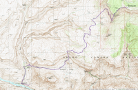
map.png

Trip Report
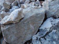
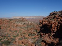
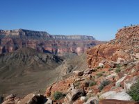
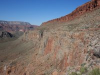
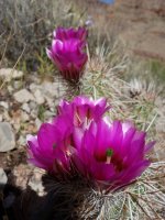
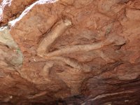
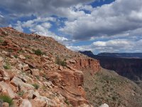
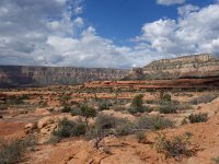
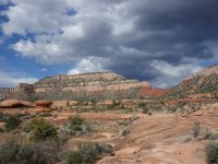
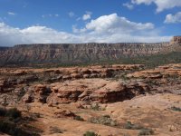
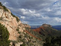
My plan was to hike to Deer Creek and maybe traverse over to Thunder River. I wasn't sure if I had lost my acclimatization or how rugged the linkup was (or exactly where it was), so I left myself the option of an out-and-back. I started up the trail from Bill Hall, which first climbs to Monument Point before descending many hundred feet to the esplanade. You'll get to make up that extra elevation on the way back. The views were immediately spectacular, with wildflowers and juniper-topped red and white banded mesas. Bill Hall trail weaves its way through a cliff band below Monument Point, then contours NW to zigzag down a gentler slope. Along the way I stopped to admire the marine fossils in the limestone talus chute through which the trail passed. Hard to imagine much of this was under the ocean at one point in time.
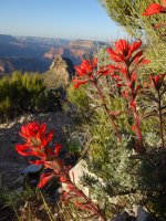
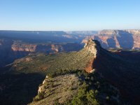
DSC00797.jpg DSC00800.jpg DSC00802.jpg

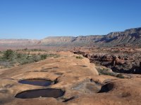
I passed the junction to Indian Hollow (the longer, but less steep option), then the trail flattened out on the esplanade. Despite the past few weeks of toasty (for spring) temps, there was still standing water in some of the potholes. I passed several parties of backpackers on their way out of the Big Ditch. After a few miles of esplanade the trail dropped through another cliff band into Surprise Valley.
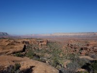
DSC00808.jpg DSC00814.jpg DSC00818.jpg DSC00821.jpg DSC00825.jpg

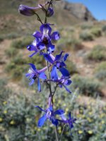
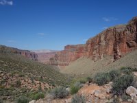
I passed the Deer Creek/Thunder River junction and dropped down the drainage toward Deer Spring. As I walked along the dry creek bed the cliff walls grew taller and more Grand Canyonesque in appearance. Soon, however, my solitude would come to an end.
DSC00837.jpg DSC00840.jpg DSC00847.jpg

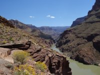
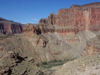
At the first dramatic fall, the rafting crowds started to appear. Most people were courteous, but a number made little effort to move aside as they slowly shuffled down the trail. I headed toward the river where I thought the traverse to Thunder River was (there wasn't much information online about exactly where it was from the Deer Creek side, nor was it on my USGS-based maps).
DSC00856.jpg DSC00867.jpg DSC00871.jpg DSC00874.jpg


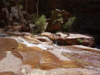
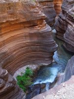
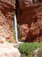
I passed the lovely Deer Creek patio/narrows and fall, and saw that there were ~10 rafts tied up along the shoreline (which explained the hordes of people). I spotted a few cairns heading SE, but there wasn't an obvious trail and the going was slow with the steep rugged terrain. At this point it was getting warm and I decided it was more than I wanted to undertake, having to drive home that night and work the next day. So I turned around, filtered water, and mentally prepared for the crowds.
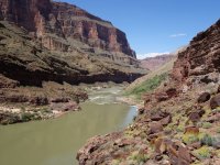
DSC00885.jpg DSC00889.jpg DSC00891.jpg

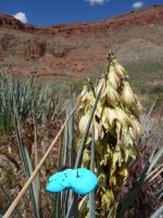
I thought I would be more tired than I was on the long ascent. At Surprise Valley I passed the last and the most clueless of the rafting parties (Peeps homage to them below). One guy thought I might be lost since I was "heading in the wrong direction". As I climbed through the red wall, the clouds started to roll in and the wind picked up, which took the edge off of the afternoon heat.
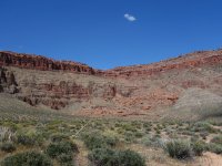
DSC00908.jpg DSC00910.jpg DSC00916.jpg


Back at the esplanade it looked like it might rain, despite no precipitation in the forecast. I was hoping that meant light rain (if any) since the roads are notoriously sketchy in muddy conditions. I passed a few friendly backpacking groups on their way in.
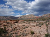
DSC00919.jpg DSC00932.jpg DSC00933.jpg DSC00939.jpg


When I hit the Indian Hollow trail junction, I knew it was the final push to Monument Point. From here, the first part of the climb was the most relentless, with almost no switchbacks, but then the grade eased. Despite my recent work trip I was feeling reasonably energetic, and made decent time back to my car. The rain remained light, fortunately, on my drive home.
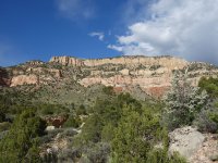
DSC00942.jpg DSC00951.jpg


Epilogue
When I got home I did more digging into where the traverse to Thunder River is. The only place I found it was on CalTopo Map Builder, where it appears ~0.5M up from the Colorado River. Another time.
 
Nice. I am impressed with what you conquer in a day. Even with what had to be a pretty early start to drive there too.

Murdered blue peep, and all those yellow flowers in bloom. Plus you caught pics of fossils and a great one of Monument point, all while eating up over 20 miles... Nice.

Sad that you missed Thunder gushing out of the redwall, it is impressive.
 
nice!!! I've never really been to Grand Canyon and love all the hikes you do. I love doing long day hikes so this is something I might do one day.

Thanks, Yvonne! You should check it out; you're even closer to the N Rim than me. It's only a few hours drive to the trailheads.
 
Wow! I am really happy to see all that water!
Poor little peep...
 
Similar threads
Thread starter Title Forum Replies Date
Janice Such a GRAND Canyon - Deer Creek / Tapeats / Thunder River Backpacking 21
cmgz Grand Canyon-Bill Hall Trail to Thunder River and Deer Creek Backpacking 6
TIMP Grand Canyon Bill Hall Trailhead to Deer Creek Falls and Thunder Spring General Discussion 3
B Thorofare loop from Deer Creek Trip Planning 20
S Deer Creek into the Thorofare Trip Planning 6
Eugene Monument Point to Thunder River and Deer Creek Backpacking 9
Jackson Question about Deer Creek Trip Planning 2
Mr. Me Deer Creek to Dry Creek Trail #43 Everything Else 3
Nick Deer Creek Ice-Off On The Water 12
TrektheWorld Red Deer Lake & Beyond Backpacking 10
J Grand Canyon NP Backpack Pt. 2 Deer Cyn explore-->Esplanade-->Indian Hollow Tr. April 18-23, 2021 Backpacking 10
J Grand Canyon NP Backpack Pt. 1 Thunder River Tr.-->Esplanade-->Tapeats-->Deer. April 18-23, 2021 Backpacking 13
NorthwestWanderer Washington - 4x4 to Bear Lake & Little Deer Pass Off Road 0
Ugly Snowy Dawn Traverse on Deer Ridge Hiking & Camping 6
J Dayhikes GSENM, Cap Reef, Behind the Rocks: Deer Cr, Tanks, Sheets Gulch, Moab Rim Apr. 4 to 8, 2018 Hiking & Camping 0
natylka Bald Mountain at Deer Park-July 2014 Hiking & Camping 0
Howells Outdoors XC Ski at Southern Utah's Deer Valley Winter Sports 3
Howells Outdoors Cross-country Ski at Deer Valley Hiking & Camping 8
gnwatts Deer Canyon, Cedar Mesa Hiking & Camping 2
rinats Canyonlands/Needles: Salt Creek to Chesler Park Trip Planning 6
shredhiker Slough Creek mid June? Trip Planning 11
Spud Salt Creek Canyon question Trip Planning 11
BobFink Mirror Plateau via Pelican Valley and Pelican Creek, July / August 2023 Backpacking 12
Jackson Little Rock Creek Backpacking 5
scatman Yellowstone's Thorofare, Headwaters of Thorofare Creek, Majo Pass, Younts Peak, Bob's Canyon, and Cub Creek - August 9, 2023 - Days 7 through 10 Backpacking 34
scatman Yellowstone's Thorofare, Headwaters of Thorofare Creek, Majo Pass, Younts Peak, Bob's Canyon, and Cub Creek - August 9, 2023 - Days 1 through 6 Backpacking 56
J South Crandall Creek and the Hoodoos Wyoming and Yellowstone? Trip Planning 3
CodyL Maple Creek or Duck Creek Drainages-YNP Trip Planning 0
J Pacific Creek or North Buffalo Fork? Teton Wilderness, Thorofare ,etc. Trip Planning 10
I Rescue Creek - Yellowstone National Park - June 3, 2023 Backpacking 15
Dreamer Slough Creek - YNP - 6/5-7/23 Backpacking 3
shredhiker Blacktail Creek June 2023 Backpacking 4
Dreamer Rescue Creek -YNP - 6/3-5/23 Backpacking 3
shredhiker Slough Creek May 2023 Backpacking 11
scatman Rescue Creek - Yellowstone National Park - June 3, 2023 Backpacking 56
Gretchen Millward Trachyte Creek via Woodruff Canyon, April 2023 Backpacking 9
I Slough Creek - Yellowstone June 5 & 6 Meet Up (Members Only) 19
scatman City Creek Loop - April 23, 2023 Hiking & Camping 8
F Thorofare/South Boundary/Wolverine Creek Trip Planning 2
scatman Rescue Creek - Yellowstone National Park Meet Up (Members Only) 19
Janice When might road to Salt Creek TH be ok? Trip Planning 23
BobFink Yellowstone South Entrance to Fox Creek via Basin Creek Cutoff - Labor Day 2022 Trip Reports 4
Janice Professor Creek / Mary Jane Canyon - mid April? Trip Planning 0
scatman North Ridge of City Creek Canyon - February 4, 2023 Hiking & Camping 17
MikeP Exploring/Calf Creek Trip Planning 28
scatman South Ridge of City Creek Canyon - January 28, 2023 Hiking & Camping 4
travel2walk Gros Ventre Wilderness: Granite Creek, West Fork Crystal Creek, Crystal Creek, & Swift Creek - June 2021 Backpacking 8
slieb Lower Muddy Creek in Winter? Trip Planning 7
scatman A Yellowstone Love Story (Bog Creek Euphoria) - September 12, 2022 Backpacking 28
NorthwestWanderer Backpacking Grand Teton National Park : Fossil Pass,Fox Creek Pass,Indian Lake,Alaska Basin,Hurricane Pass,Ice Floe Lake,& Snowdrift Lake Backpacking 19

Similar threads

Back
Top