- Joined
- May 5, 2012
- Messages
- 1,732
My last attempt at an Escalante trip in late March had been met with abject failure. When I asked the time off work this time around I held out hope that conditions would be improved. As the day neared, the forecast did not provide encouragement. Salt Lake City expected snow. A cold front moving south and east brought the potential for precipitation.
Recalcitrant, I proceeded anyway.
The trip actually started Thursday night with a visit to Russ at Skycall. He's a Salt Lake City local who runs a business out of his home outfitting people with sat phones and GPS trackers. I picked up a Globalstar unit from him with the intention of using it to call into the KSL Outdoors show on Saturday morning from the bottom of Coyote Gulch. I'd never carried a sat phone before, but it ended up playing a very important role on this outing. More on that in a bit.

With the wagon loaded and ready to go, I went down for a few hours sleep. Rising at about 3:30 a.m. on Friday, I started south. The early wake meant I needed to stop a couple of times to stave off drowsiness. Shortly after sunrise I pulled off Utah SR 20 and napped a bit. Outside of Escalante I pulled off SR 12 to doze a bit more. During this second stop, an odd sound roused me. I opened my eyes to see smoke pouring out the front grill of the car.
At once wide awake, I stepped outside with curses under my breath. I popped the hood and peered inside. Coolant splattered the engine, still dripping from the overflow reservoir's drain tube. The green fluid dribbled onto the dirt below, running off the side of the engine skid plate. On the opposite side of the engine bay I could hear a boiling sound from near the turbo. Not good.
I went back to the cabin and turned the key in the ignition far enough to start the radiator and HVAC fans. Then I checked my phone. No service. At least I have the sat phone, I thought. Twenty minutes or so more passed before I dared start the engine and finish the drive into Escalante.
Along the way, the engine behaved itself. I kept hawk eyes trained on the coolant temp gauge. It didn't budge. The smoking dissipated as the leaked coolant burned off the block, though I could still smell it.
Once in Escalante I hit the interagency visitor center, more for the nice lavatory than anything. The road condition report said Hole in the Rock was in pretty good shape with mild washboarding returning. No trouble for the wagon, if it didn't overheat on the way. As extra insurance, I stopped and purchased some ridiculously overpriced antifreeze from the only open gas station in town.

The good news is the wagon performed admirably. It made it down to the 40 Mile Ridge road in no time. Since my last visit I'd equipped it with larger all-terrain tires and taller struts. The extra cushion made for a pleasant cruise. Running through the soft sand between the water tank and Forty Mile Ridge TH at speed was especially fun.
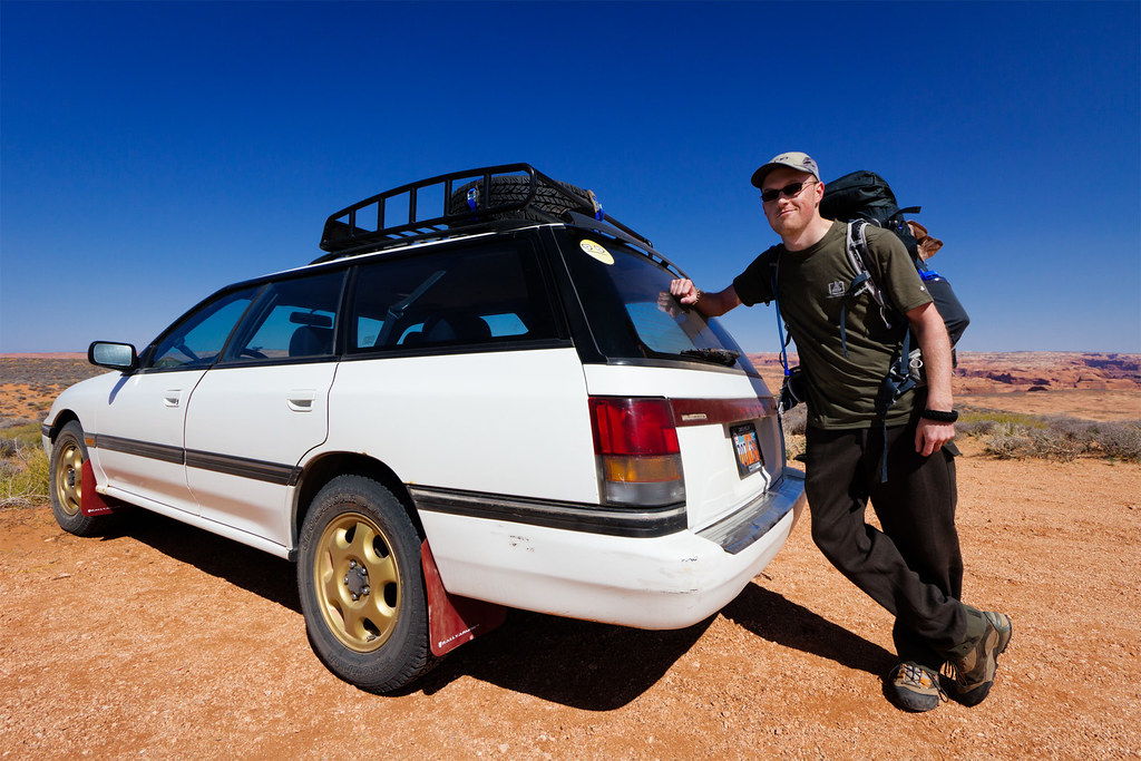
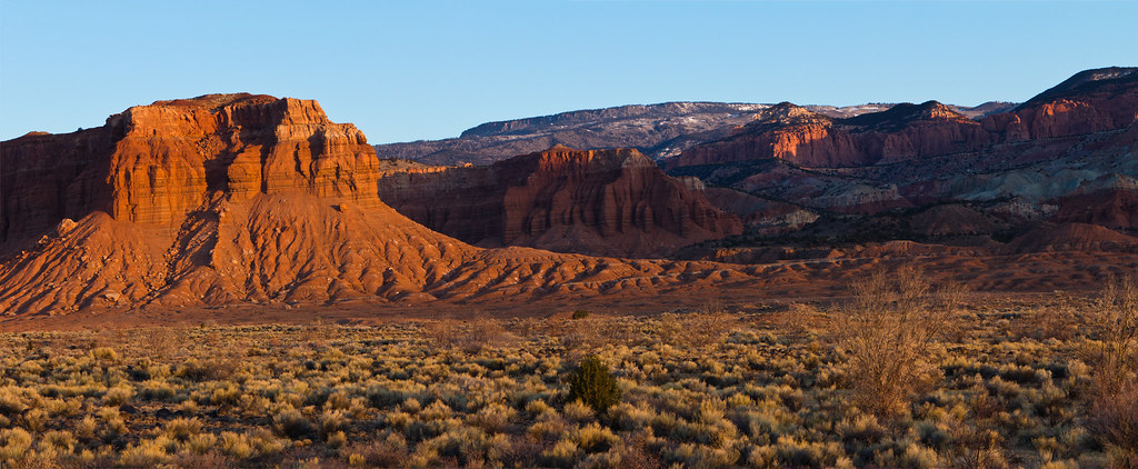
At 40 Mile Ridge by ashergrey, on Flickr
I hit the Forty Mile Ridge trailhead at about 1 p.m. There were a few other vehicles but no signs of any other humans.
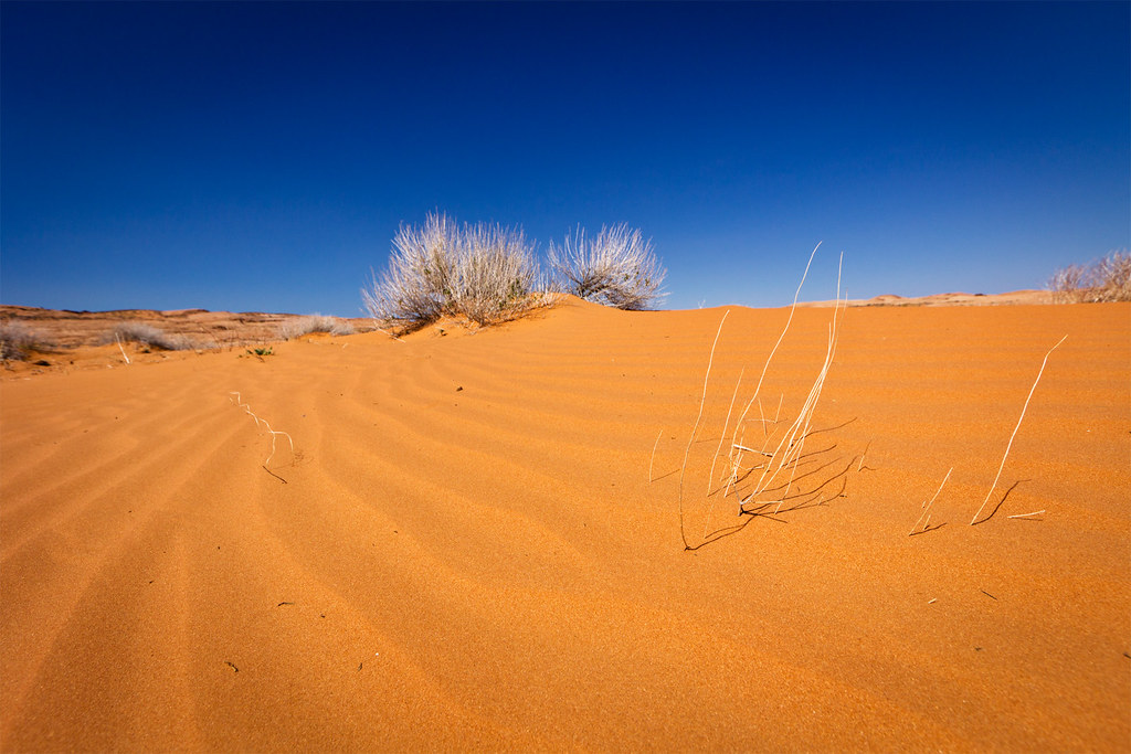
Sand by ashergrey, on Flickr
That stayed true the whole way out to and through Crack in the Wall. I spent a decent amount of time screwing around with photos and video at the crack.
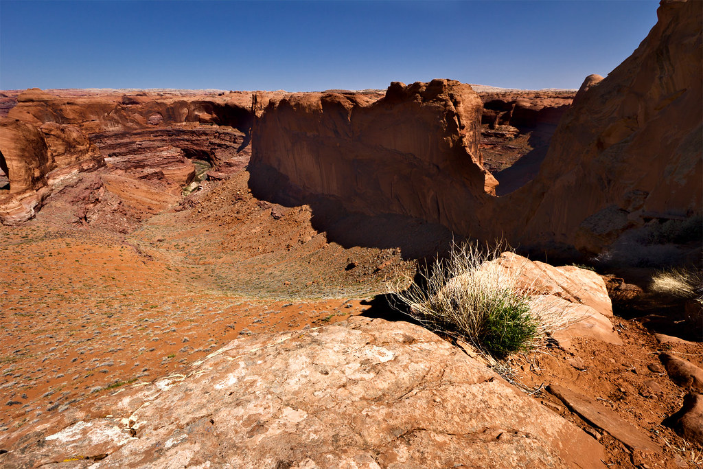
Above the Escalante by ashergrey, on Flickr
Once through the crack, it was on down the dune. About halfway to the bottom I came across a couple lugging their paddle gear the opposite direction. We chatted a few minutes. They'd just finished running the Escalante, having encountered decent flows most of the way. They complained of a large school group from Arizona in the Coyote Gulch vicinity and some mosquitos but praised the weather. I looked around. Skies were still bright and clear. The air was cool but the direct sunshine made up the difference. It appeared I'd escaped the gloomy forecast.
At that moment someone up on top of the crack hollered. The three of us looked that direction, seeing a small silhouette at the rim. The paddlers asked if that was someone from my group. I responded in the negative, telling them I was solo. A flash of what seemed respect moved over the paddler's face. I appreciated that.
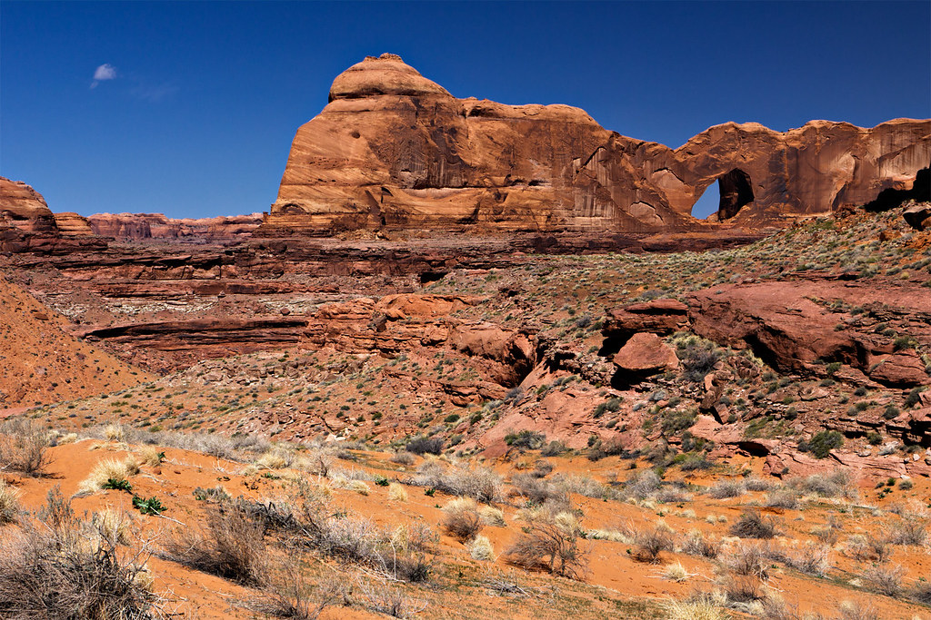
Stevens Arch by ashergrey, on Flickr
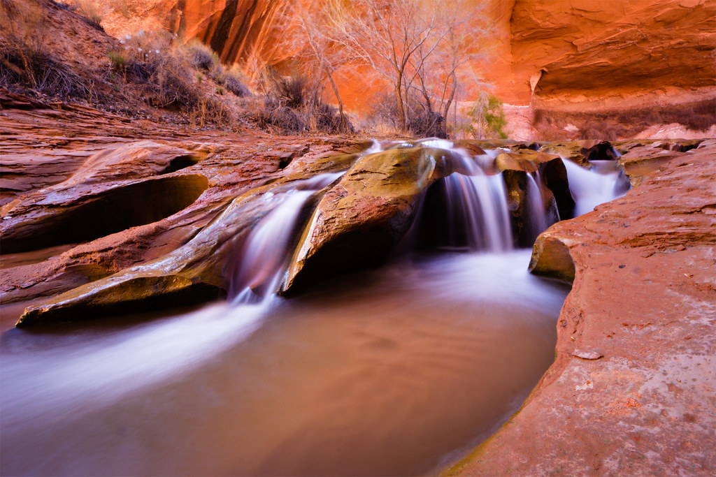
Upon reaching the gulch I turned upstream, stopping for photos when the mood struck.
Signs of Spring by ashergrey, on Flickr
Little Log by ashergrey, on Flickr

At around 4 p.m. I ran into two more guys coming downstream from above the lower outhouse. They'd been in the canyon several days. One asked how much farther I planned to hike that day. I shrugged. I'll stop when I feel like stopping.
That feeling came upon arrival at Coyote Natural Bridge, in part because some idiots were camped right up against the bridge at the edge of the creek. I smelled their fire before I saw them, but when they saw me they rushed to subdue it. Their lack of respect and courtesy irked me enough that I stopped and pitched camp on the opposite side of the bridge, off the creek bed but within sight of their spot. Normally I'd have tried to find a spot away from others but I figured I'd repay discourtesy in kind.
About this point, I realized I'd left both matches and by backup fire starter out of my pack. Leaving things at home is a bad habit of mine and while this wasn't as bad as the time I left my hiking shoes behind, it was pretty grim. Dehydrated meals with ice-cold water… not appetizing in the least.
Then I remembered the Friendly Swede paracord bracelet around my wrist, a Christmas gift from a friend. With a few strikes from my knife against the bracelet's fire starter, my little propane stove roared to life. Always have a back-up to your back-up.
Coyote Bridge by ashergrey, on Flickr
[PARSEHTML]<iframe src="http://www.mappingsupport.com/p/gmap4.php?q=http://dl.dropbox.com/u/3847512/GPS/Coyote_Gulch_1.kml&t=t4" frameborder="0" marginheight="0" scrolling="no" width="800" height="800"></iframe><br><br>[/PARSEHTML]
Temperatures dropped into the mid-to-lower 20sºF overnight. My phone alarm went off at 6 a.m., the early rise necessary because I had an appointment on the radio. After some trial and error I managed to establish a signal and connect with Tim and Russ on the KSL Outdoors show back in Salt Lake City.
[PARSEHTML]<audio controls><source src="http://dl.dropbox.com/u/3847512/Coyote_Gulch_interview.mp3">Your browser does not support HTML5.</audio>[/PARSEHTML]
Cold gusts of wind raked the canyon bottom, blowing sand. The fickle breezes would switch directions on a whim, making it difficult to find shelter. Frigid and frustrated, I broke camp and started on toward Jacob Hamblin Arch. I wanted to catch the next section of the canyon with some nice morning light.
Narrow Meander by ashergrey, on Flickr
Carving by ashergrey, on Flickr
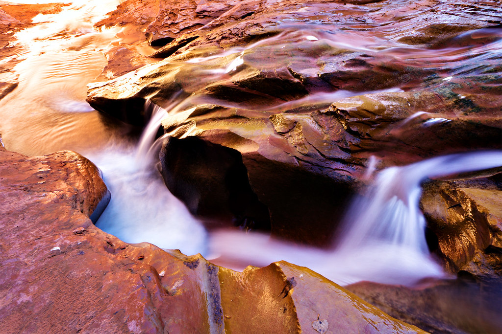
Alchemy by ashergrey, on Flickr
I passed a few bivvies along the way and took care to move quietly around them. Unfortunately, as I approached Jacob Hamblin I could hear a bunch of kids hooting and hollering from the far side. In the confined space voices really carry and this group obviously didn't care. It really dampened my enthusiasm. Soon after, a stream of probably 25 to 30 people started coming around the curve under the giant alcove. I had the sense they were not all one group, but had become clumped together while hiking downstream (something I consider horrible trail manners, for the record).
The crowd splashed down the waterway like a herd of cattle, blathering on in their conversations without pausing a moment to take in the scene or listen to the sounds of the canyon. The only advantage to seeing them there was the sense of scale they provided.
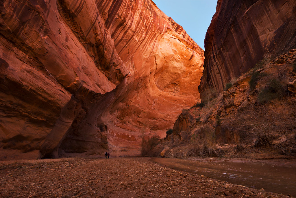
Overhang by ashergrey, on Flickr
Feeling sour, I faced a decision. I'd moved upstream past the best bits of the canyon. It was still early in the day and I had plenty of time to find a prime spot for my second night, working my way back down for more photos. Now though I feared the experience would be tarnished by another big crowd plowing through my camp. Add to that the knowledge that my sister had flown in from New York for the weekend and the insecurity about the state of my vehicle… time to hoof it out of the Gulch.

The next question became how to exit. I'd eyeballed a potential escape route from the upper reaches of Hurricane Wash, but had no beta as to whether or not it would be viable. I followed cattle tracks out of the main wash at a 37.406545,-111.086754. This meant slogging through deep sand devoid of any other human tracks. The cattle tracks died out as I entered a short slot at 37.402099,-111.086368. Not a good sign. I turned a corner and ran into this.

Crap. That's a 20 foot dryfall. Backtracking, I found a spot with a low enough angle on the wall to allow a scramble up and out of the drainage. From there I followed the path of least resistance uphill. Another fork of the drainage just to the west had an interesting section of potholes and could probably be ascended easily enough.

[PARSEHTML]<iframe src="http://www.mappingsupport.com/p/gmap4.php?q=http://dl.dropbox.com/u/3847512/GPS/HurricaneWashalternateexit.kml&t=t4" frameborder="0" marginheight="0" scrolling="no" width="600" height="600"></iframe><br><br>[/PARSEHTML]
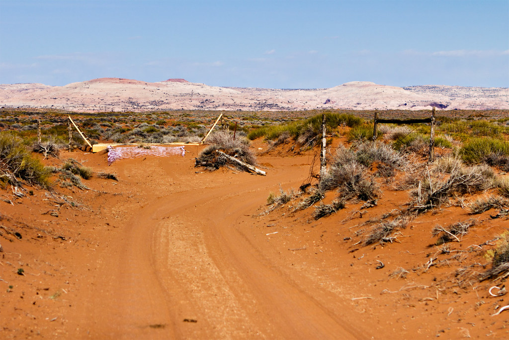
Next came a long walk over cattle-ravaged desert toward the road. I dodged cow patties, mostly sticking to the watercourse to avoid too many ups and downs. I hoped to hit the road and hitch a ride with a passing motorist back to Forty Mile Ridge. At 37.387804,-111.074816 I came across a defined cattle track. It ran at a tangent with the road, meaning less likelihood of catching an immediate ride, but I took it anyway.
The path eventually met up with the road a bit short of the water tank. The walk along the road felt even more soul-crushing than had traversing the open desert in full sunlight. By now the pack weighed down on me and my snacks were running short. I played some music to keep focused.
Cattle Guard by ashergrey, on Flickr

On the death march I passed one Jeep headed the opposite direction. In an ironic twist, the only vehicle to come up the Forty Mile Ridge road did so just as I was arriving at my own car. I chatted with the two guys there for a few minutes. They offered me a beer which I politely declined and I told them about Backcountrypost.com. The duo told me they planned to enter Coyote Gulch at the crack on Sunday, then hike up and climb out at Jacob Hamblin.
With the sun starting to slide toward the western horizon, I packed up and headed for Escalante.

[PARSEHTML]<iframe src="http://www.mappingsupport.com/p/gmap4.php?q=http://dl.dropbox.com/u/3847512/GPS/Coyote_Gulch_2.kml&t=t4" frameborder="0" marginheight="0" scrolling="no" width="800" height="800"></iframe><br><br>[/PARSEHTML]
Perhaps the most interesting part of the trip came on the ride home. I stopped in for food and a souvenir for my sister at Escalante Outfitters. Dusk was falling by the time I'd fueled up and started north on SR 12. The twilight deepened to blackness by the time I crossed the Escalante River.
Climbing up from Calf Creek I came across three vehicles stopped with their emergency flashers on right in the middle of the road. I couldn't tell as I rolled by them exactly what had happened, if it was a wreck or something else. Up the road a hundred feet or so, a woman stood waving a flashlight. I pulled up to where she stood and asked what happened.
In a voice flush with anxiety she told me they'd had a tire go flat on their Suburban coming down from the Hogsback. Now the vehicle sat stranded, stuck right in the lane of travel. They'd almost been hit by others coming around the blind curve.
In this Google street view shot, the red truck is right where their Suburban was stranded. Anyone who has driven this section of road knows what a precarious place that is for a breakdown.

I found a safe place to pull off up the road a bit farther up the road then walked down to rejoin the woman. We chatted a bit more. She and her husband, along with three kids, were headed from their home in Castle Rock, Colorado to Kanab. They'd already had troubles on their trip, having gone through a car wash with their sunroof stuck in the open position. They'd started hearing noises from their brakes while on the Hogsback. Then their rear passenger tire blew.
With the sun gone, the air turned icy. I ran back to my car, grabbed my headlamp and a coat then went back to take over for the woman at the blind corner. She returned to the Suburban where two other guys were working to get the spare loose.
Problem is, the fitting had broken on the underslung spare tire and there was no way to get it to drop. They tried several approaches. The husband and wife kept their cool but it was obvious their frustration was mounting. They tried to limp the Suburban down the hill but the troubled wheel wouldn't even turn.
One of the good samaritans took off to find cell coverage and call a tow. Then it dawned on me. I had the sat phone. I dialed Russ at Skycall. He in turn called the Utah Highway Patrol, who dispatched a Garfield County Sheriff's deputy. The deputy arrived from Boulder about 30 minutes later driving a smaller Chevy SUV.

In an amazing stroke of luck, the deputy was able to fit his spare to the broken-down family's Suburban. They wheeled the Suburban down to a safe pull-out, then figured out exactly what had gone wrong.
As it turns out, the top bolt had either come loose or not been reinstalled on the Suburban's passenger rear brake caliper during a pre-trip service visit. This caused the caliper to flip off the rotor and run along the inside edge of the wheel. This friction wore holes on the inside of the wheel. The tire deflated and the wheel tore it to shreds, making it appear as though the tire had blown.

The deputy took his spare back, making apologies for not being able to donate it to the cause. The runner who had left to find cell service returned with the news that he'd contacted AAA for a tow. They'd dispatched a truck — out of Loa.
Two hours had past since my arrival on scene. I, along with the deputy, packed up and offered the stranded family the best. As I headed north, I saw the tow driver coming off Boulder Mountain, still 20 minutes away from the site of the breakdown.
Exhausted, I made it as far as Torrey before deciding I should call it a day. I had provisions to sleep in the car but needed a warm shower. This meant stopping at the Best Western outside of Capitol Reef on SR 24. I had to ring the after-hours bell (as it was now about 11:30 p.m.), bothering the attendant. I didn't care.
Once in the room, I started the shower going and undressed. I stepped one foot into the steaming shower, then slipped. Pitching backward, my flailing arms grabbed for any purchase. All they could find was the tangled mess of the shower curtain. My body weight hit it but instead of tearing away as it should, the curtain pulled the rod off the wall. My rear hit the cold tile floor with a thud, the metal bar clattering down behind it in a cloud of drywall dust.
The exhaustion and adrenaline and emotion of the moment mixed into a weird stew inside me. Then I started to laugh, still buried under a mound of wet plastic.
In the morning I awoke sore and stiff to this.
Best Western by ashergrey, on Flickr
As I cruised through Loa on Sunday morning on my way back to Salt Lake City, I spotted the broken-down Suburban sitting outside the one tow lot/mechanic shop in the county. I felt a pang of guilt for not doing more to help the family. I also made a mental note to myself -- do not break down in southern Utah.

Featured image for home page:

Recalcitrant, I proceeded anyway.
The trip actually started Thursday night with a visit to Russ at Skycall. He's a Salt Lake City local who runs a business out of his home outfitting people with sat phones and GPS trackers. I picked up a Globalstar unit from him with the intention of using it to call into the KSL Outdoors show on Saturday morning from the bottom of Coyote Gulch. I'd never carried a sat phone before, but it ended up playing a very important role on this outing. More on that in a bit.
With the wagon loaded and ready to go, I went down for a few hours sleep. Rising at about 3:30 a.m. on Friday, I started south. The early wake meant I needed to stop a couple of times to stave off drowsiness. Shortly after sunrise I pulled off Utah SR 20 and napped a bit. Outside of Escalante I pulled off SR 12 to doze a bit more. During this second stop, an odd sound roused me. I opened my eyes to see smoke pouring out the front grill of the car.
At once wide awake, I stepped outside with curses under my breath. I popped the hood and peered inside. Coolant splattered the engine, still dripping from the overflow reservoir's drain tube. The green fluid dribbled onto the dirt below, running off the side of the engine skid plate. On the opposite side of the engine bay I could hear a boiling sound from near the turbo. Not good.
I went back to the cabin and turned the key in the ignition far enough to start the radiator and HVAC fans. Then I checked my phone. No service. At least I have the sat phone, I thought. Twenty minutes or so more passed before I dared start the engine and finish the drive into Escalante.
Along the way, the engine behaved itself. I kept hawk eyes trained on the coolant temp gauge. It didn't budge. The smoking dissipated as the leaked coolant burned off the block, though I could still smell it.
Once in Escalante I hit the interagency visitor center, more for the nice lavatory than anything. The road condition report said Hole in the Rock was in pretty good shape with mild washboarding returning. No trouble for the wagon, if it didn't overheat on the way. As extra insurance, I stopped and purchased some ridiculously overpriced antifreeze from the only open gas station in town.
The good news is the wagon performed admirably. It made it down to the 40 Mile Ridge road in no time. Since my last visit I'd equipped it with larger all-terrain tires and taller struts. The extra cushion made for a pleasant cruise. Running through the soft sand between the water tank and Forty Mile Ridge TH at speed was especially fun.
At 40 Mile Ridge by ashergrey, on Flickr
I hit the Forty Mile Ridge trailhead at about 1 p.m. There were a few other vehicles but no signs of any other humans.
Sand by ashergrey, on Flickr
That stayed true the whole way out to and through Crack in the Wall. I spent a decent amount of time screwing around with photos and video at the crack.
Above the Escalante by ashergrey, on Flickr
Once through the crack, it was on down the dune. About halfway to the bottom I came across a couple lugging their paddle gear the opposite direction. We chatted a few minutes. They'd just finished running the Escalante, having encountered decent flows most of the way. They complained of a large school group from Arizona in the Coyote Gulch vicinity and some mosquitos but praised the weather. I looked around. Skies were still bright and clear. The air was cool but the direct sunshine made up the difference. It appeared I'd escaped the gloomy forecast.
At that moment someone up on top of the crack hollered. The three of us looked that direction, seeing a small silhouette at the rim. The paddlers asked if that was someone from my group. I responded in the negative, telling them I was solo. A flash of what seemed respect moved over the paddler's face. I appreciated that.
Stevens Arch by ashergrey, on Flickr
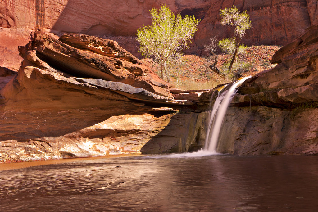
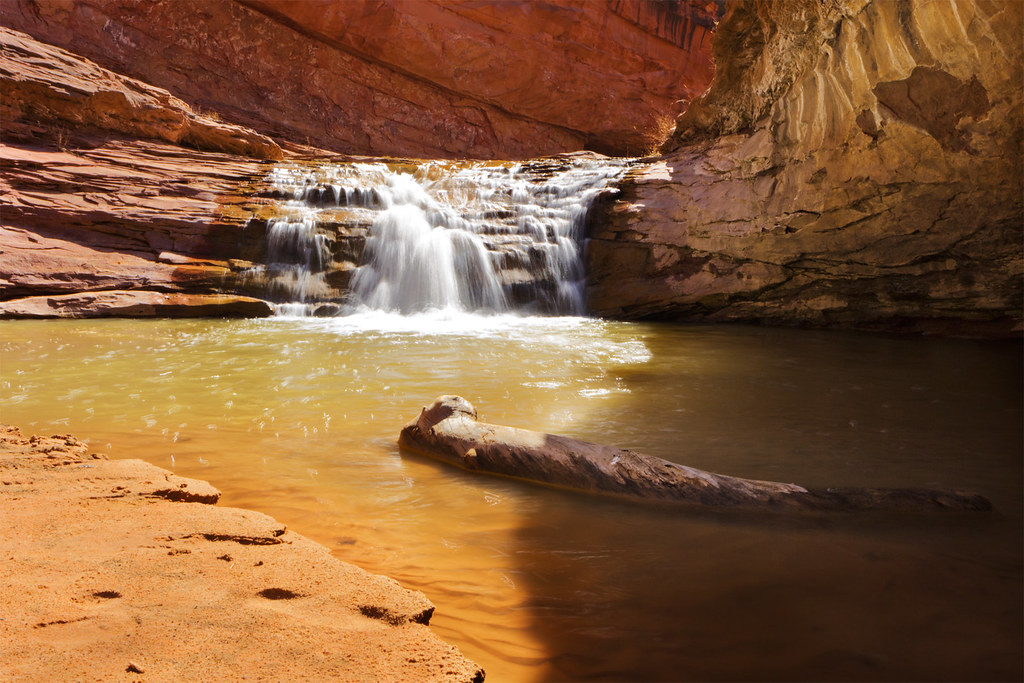
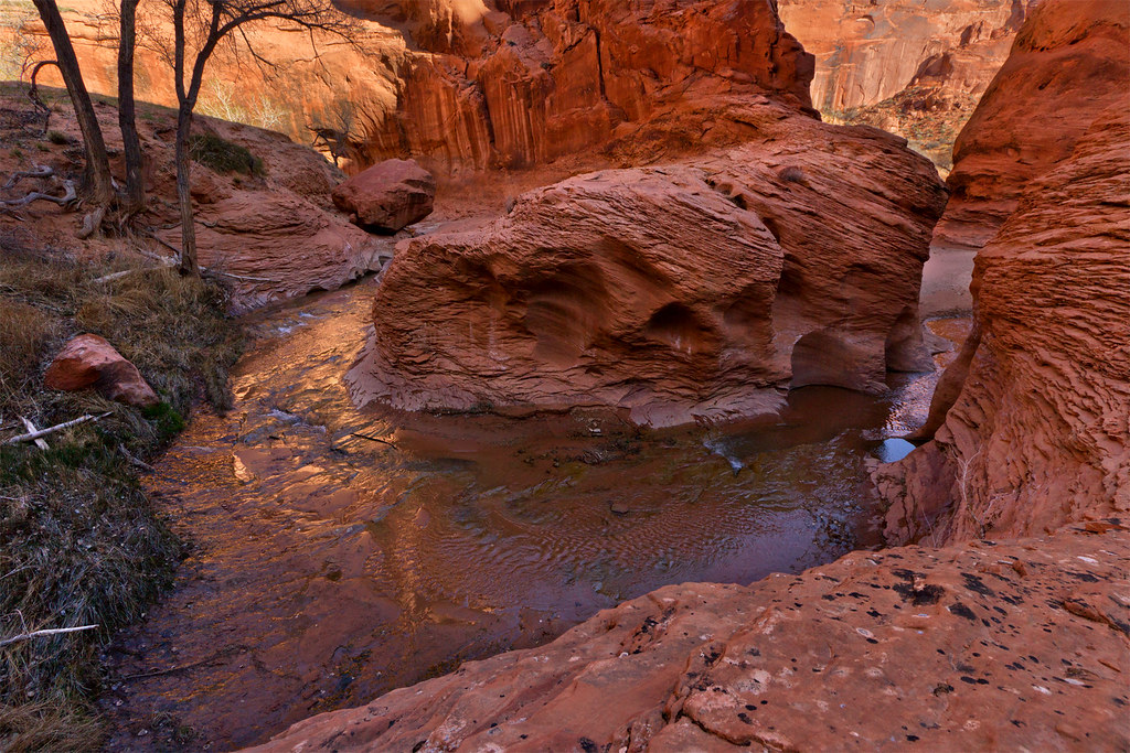
Upon reaching the gulch I turned upstream, stopping for photos when the mood struck.
Signs of Spring by ashergrey, on Flickr
Little Log by ashergrey, on Flickr
At around 4 p.m. I ran into two more guys coming downstream from above the lower outhouse. They'd been in the canyon several days. One asked how much farther I planned to hike that day. I shrugged. I'll stop when I feel like stopping.
That feeling came upon arrival at Coyote Natural Bridge, in part because some idiots were camped right up against the bridge at the edge of the creek. I smelled their fire before I saw them, but when they saw me they rushed to subdue it. Their lack of respect and courtesy irked me enough that I stopped and pitched camp on the opposite side of the bridge, off the creek bed but within sight of their spot. Normally I'd have tried to find a spot away from others but I figured I'd repay discourtesy in kind.
About this point, I realized I'd left both matches and by backup fire starter out of my pack. Leaving things at home is a bad habit of mine and while this wasn't as bad as the time I left my hiking shoes behind, it was pretty grim. Dehydrated meals with ice-cold water… not appetizing in the least.
Then I remembered the Friendly Swede paracord bracelet around my wrist, a Christmas gift from a friend. With a few strikes from my knife against the bracelet's fire starter, my little propane stove roared to life. Always have a back-up to your back-up.
Coyote Bridge by ashergrey, on Flickr
[PARSEHTML]<iframe src="http://www.mappingsupport.com/p/gmap4.php?q=http://dl.dropbox.com/u/3847512/GPS/Coyote_Gulch_1.kml&t=t4" frameborder="0" marginheight="0" scrolling="no" width="800" height="800"></iframe><br><br>[/PARSEHTML]
Temperatures dropped into the mid-to-lower 20sºF overnight. My phone alarm went off at 6 a.m., the early rise necessary because I had an appointment on the radio. After some trial and error I managed to establish a signal and connect with Tim and Russ on the KSL Outdoors show back in Salt Lake City.
[PARSEHTML]<audio controls><source src="http://dl.dropbox.com/u/3847512/Coyote_Gulch_interview.mp3">Your browser does not support HTML5.</audio>[/PARSEHTML]
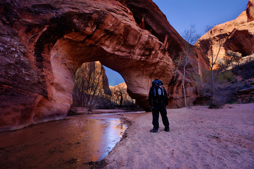
Cold gusts of wind raked the canyon bottom, blowing sand. The fickle breezes would switch directions on a whim, making it difficult to find shelter. Frigid and frustrated, I broke camp and started on toward Jacob Hamblin Arch. I wanted to catch the next section of the canyon with some nice morning light.
Narrow Meander by ashergrey, on Flickr
Carving by ashergrey, on Flickr
Alchemy by ashergrey, on Flickr
I passed a few bivvies along the way and took care to move quietly around them. Unfortunately, as I approached Jacob Hamblin I could hear a bunch of kids hooting and hollering from the far side. In the confined space voices really carry and this group obviously didn't care. It really dampened my enthusiasm. Soon after, a stream of probably 25 to 30 people started coming around the curve under the giant alcove. I had the sense they were not all one group, but had become clumped together while hiking downstream (something I consider horrible trail manners, for the record).
The crowd splashed down the waterway like a herd of cattle, blathering on in their conversations without pausing a moment to take in the scene or listen to the sounds of the canyon. The only advantage to seeing them there was the sense of scale they provided.
Overhang by ashergrey, on Flickr
Feeling sour, I faced a decision. I'd moved upstream past the best bits of the canyon. It was still early in the day and I had plenty of time to find a prime spot for my second night, working my way back down for more photos. Now though I feared the experience would be tarnished by another big crowd plowing through my camp. Add to that the knowledge that my sister had flown in from New York for the weekend and the insecurity about the state of my vehicle… time to hoof it out of the Gulch.
The next question became how to exit. I'd eyeballed a potential escape route from the upper reaches of Hurricane Wash, but had no beta as to whether or not it would be viable. I followed cattle tracks out of the main wash at a 37.406545,-111.086754. This meant slogging through deep sand devoid of any other human tracks. The cattle tracks died out as I entered a short slot at 37.402099,-111.086368. Not a good sign. I turned a corner and ran into this.
Crap. That's a 20 foot dryfall. Backtracking, I found a spot with a low enough angle on the wall to allow a scramble up and out of the drainage. From there I followed the path of least resistance uphill. Another fork of the drainage just to the west had an interesting section of potholes and could probably be ascended easily enough.
[PARSEHTML]<iframe src="http://www.mappingsupport.com/p/gmap4.php?q=http://dl.dropbox.com/u/3847512/GPS/HurricaneWashalternateexit.kml&t=t4" frameborder="0" marginheight="0" scrolling="no" width="600" height="600"></iframe><br><br>[/PARSEHTML]
Next came a long walk over cattle-ravaged desert toward the road. I dodged cow patties, mostly sticking to the watercourse to avoid too many ups and downs. I hoped to hit the road and hitch a ride with a passing motorist back to Forty Mile Ridge. At 37.387804,-111.074816 I came across a defined cattle track. It ran at a tangent with the road, meaning less likelihood of catching an immediate ride, but I took it anyway.
The path eventually met up with the road a bit short of the water tank. The walk along the road felt even more soul-crushing than had traversing the open desert in full sunlight. By now the pack weighed down on me and my snacks were running short. I played some music to keep focused.
Cattle Guard by ashergrey, on Flickr
On the death march I passed one Jeep headed the opposite direction. In an ironic twist, the only vehicle to come up the Forty Mile Ridge road did so just as I was arriving at my own car. I chatted with the two guys there for a few minutes. They offered me a beer which I politely declined and I told them about Backcountrypost.com. The duo told me they planned to enter Coyote Gulch at the crack on Sunday, then hike up and climb out at Jacob Hamblin.
With the sun starting to slide toward the western horizon, I packed up and headed for Escalante.
[PARSEHTML]<iframe src="http://www.mappingsupport.com/p/gmap4.php?q=http://dl.dropbox.com/u/3847512/GPS/Coyote_Gulch_2.kml&t=t4" frameborder="0" marginheight="0" scrolling="no" width="800" height="800"></iframe><br><br>[/PARSEHTML]
Perhaps the most interesting part of the trip came on the ride home. I stopped in for food and a souvenir for my sister at Escalante Outfitters. Dusk was falling by the time I'd fueled up and started north on SR 12. The twilight deepened to blackness by the time I crossed the Escalante River.
Climbing up from Calf Creek I came across three vehicles stopped with their emergency flashers on right in the middle of the road. I couldn't tell as I rolled by them exactly what had happened, if it was a wreck or something else. Up the road a hundred feet or so, a woman stood waving a flashlight. I pulled up to where she stood and asked what happened.
In a voice flush with anxiety she told me they'd had a tire go flat on their Suburban coming down from the Hogsback. Now the vehicle sat stranded, stuck right in the lane of travel. They'd almost been hit by others coming around the blind curve.
In this Google street view shot, the red truck is right where their Suburban was stranded. Anyone who has driven this section of road knows what a precarious place that is for a breakdown.
I found a safe place to pull off up the road a bit farther up the road then walked down to rejoin the woman. We chatted a bit more. She and her husband, along with three kids, were headed from their home in Castle Rock, Colorado to Kanab. They'd already had troubles on their trip, having gone through a car wash with their sunroof stuck in the open position. They'd started hearing noises from their brakes while on the Hogsback. Then their rear passenger tire blew.
With the sun gone, the air turned icy. I ran back to my car, grabbed my headlamp and a coat then went back to take over for the woman at the blind corner. She returned to the Suburban where two other guys were working to get the spare loose.
Problem is, the fitting had broken on the underslung spare tire and there was no way to get it to drop. They tried several approaches. The husband and wife kept their cool but it was obvious their frustration was mounting. They tried to limp the Suburban down the hill but the troubled wheel wouldn't even turn.
One of the good samaritans took off to find cell coverage and call a tow. Then it dawned on me. I had the sat phone. I dialed Russ at Skycall. He in turn called the Utah Highway Patrol, who dispatched a Garfield County Sheriff's deputy. The deputy arrived from Boulder about 30 minutes later driving a smaller Chevy SUV.
In an amazing stroke of luck, the deputy was able to fit his spare to the broken-down family's Suburban. They wheeled the Suburban down to a safe pull-out, then figured out exactly what had gone wrong.
As it turns out, the top bolt had either come loose or not been reinstalled on the Suburban's passenger rear brake caliper during a pre-trip service visit. This caused the caliper to flip off the rotor and run along the inside edge of the wheel. This friction wore holes on the inside of the wheel. The tire deflated and the wheel tore it to shreds, making it appear as though the tire had blown.
The deputy took his spare back, making apologies for not being able to donate it to the cause. The runner who had left to find cell service returned with the news that he'd contacted AAA for a tow. They'd dispatched a truck — out of Loa.
Two hours had past since my arrival on scene. I, along with the deputy, packed up and offered the stranded family the best. As I headed north, I saw the tow driver coming off Boulder Mountain, still 20 minutes away from the site of the breakdown.
Exhausted, I made it as far as Torrey before deciding I should call it a day. I had provisions to sleep in the car but needed a warm shower. This meant stopping at the Best Western outside of Capitol Reef on SR 24. I had to ring the after-hours bell (as it was now about 11:30 p.m.), bothering the attendant. I didn't care.
Once in the room, I started the shower going and undressed. I stepped one foot into the steaming shower, then slipped. Pitching backward, my flailing arms grabbed for any purchase. All they could find was the tangled mess of the shower curtain. My body weight hit it but instead of tearing away as it should, the curtain pulled the rod off the wall. My rear hit the cold tile floor with a thud, the metal bar clattering down behind it in a cloud of drywall dust.
The exhaustion and adrenaline and emotion of the moment mixed into a weird stew inside me. Then I started to laugh, still buried under a mound of wet plastic.
In the morning I awoke sore and stiff to this.
Best Western by ashergrey, on Flickr
As I cruised through Loa on Sunday morning on my way back to Salt Lake City, I spotted the broken-down Suburban sitting outside the one tow lot/mechanic shop in the county. I felt a pang of guilt for not doing more to help the family. I also made a mental note to myself -- do not break down in southern Utah.
Featured image for home page:
