Vegan.Hiker
Member
- Joined
- Jul 5, 2014
- Messages
- 2,099
I had 8 days off this Fourth of July so I took a road trip from my home in New Jersey to Nova Scotia, Canada. This report is about the 4 day backpacking trip on Cape Chignecto. This was a long 14 hour drive so I also wrote a short trip report of some of the stuff I checked out on the drive up which you can check out here.
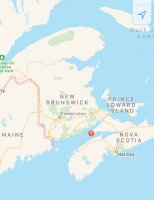
Cape Chignecto juts out into the middle of the Bay of Fundy in between Nova Scotia and New Brunswick, Canada. In the map below, the red pin marks it's location.
When I arrived I went to the Ranger Station to pick up my permits and then set up my tent in a nearby field. The field was about a 10 minute walk from the Ranger Station up on cliff overlooking the coast. Unfortunately, it was cloudy and the fog obstructed most of the view. There was heavy rain in the forecast for later that night but the weather was supposed to clear up the next morning and stay nice for the remainder of my trip.
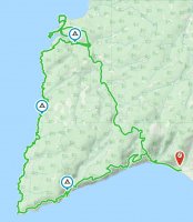
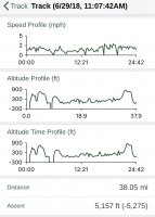
I attached my Gaia tracks below in case anyone is interested. The route I took was a tad over 38 miles with a little over 5,000' cumulative elevation gain. All of the hike, except for the 10 mile connector trail back to the ranger station on my last day, followed the coast line. The hike was a little more rugged than I expected with some tricky fords, and stream crossings, but compared to the Pemi Loop trip that I did a few weeks prior (report HERE), this wasn't nearly as challenging. It was definitely more of a quiet, peaceful, and serene vibe. There was more variation than I expected as well. There were alpine forests, areas of mixed hardwoods, grassy fields, river banks filled with ferns and moss, and of course a coast that varied from sea level beaches to rugged cliffs towering 900' over the sea below. One thing that there was definitely no shortage of, was water sources. It felt as though you crossed a freshwater river or stream that was flowing towards the ocean every half hour or so. There was never a reason to carry more than a liter at a time.
Gaia tracks (you can click on image to enlarge)
Starting out on day 1, the clouds and fog were still lingering. To start and end the loop, there is a section of beach that runs about 1.5 miles that is passable at all times except for betwen 1 hour before high tide to one hour after high tide. The rangers warn you to double-check the tide tables before you head out there or you'll get stuck clinging to the cliffs in a precarious spot.
Where the mountains meet the sea.
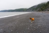
At the end of the beach walk there are some wooden stairs marking the beginning of the trail. The trail heads up steeply to about 900' before you start looking way down at the ocean.
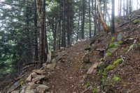
At first, I thought "hey there's the tip of the cape", but I quickly learned that the cape is actually made of dozens of smaller capes with coves in between them. Some big, some small. I liken them to false summits. This was just one of dozens of capes I encountered.
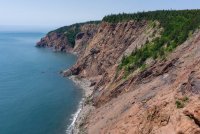
Once up on the cliff, the trail went back and forth between meandering through the woods and the edge of the cliff line. I learned after a while that when the trail headed away from the coast and into the woods, it was usually to descend down to a river or stream crossing.
Clouds slowly started to lift
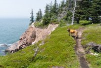
Some of the tributaries descended down to the ocean gradually and some fell off of cliffs in waterfalls.
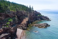
After about 10 or 11 miles the trail descended down to a nice cove with a beach and a river flowing out from the woods into the ocean. This is where my first campsite was. The name of this cove was Refugee Cove.
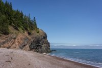
Right side of Refugee Cove. On the right side of this pic is where the water flows into the ocean.
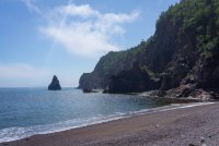
Left side of Refugee Cove. I later heard that there are cool caves to explore right around this corner that you can access at low tide. Unfortunately, I spent the whole evening on this beach but had no idea.
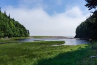
The campsites were behind the cove tucked in the woods along the stream. This is looking out towards the beach from near the campsites. The water pools into a pond and flows out towards the right side down the beach and into the ocean.
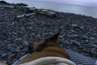
After setting up camp, I spent the next few hours sitting on the beach using a large log as a back rest. Lucy napped on her half a z-lite while I ate dinner and watched the sun go down with my earbuds in. It was the times of peace and serenity like this that made the drive sooo worthwhile.
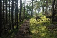
The trail the next morning ascending out of Refugee Cove
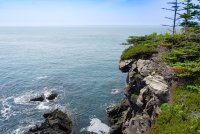
We decided to break for lunch here on day 2
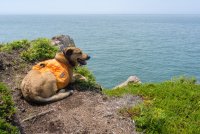
Most coves were innaccessible and had a beach. Unless you were to kayak in I suppose.
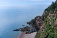
This beach was looking really nice in the heat of the day. I looked for a route down but there was none.
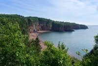
Once I passed the tip of the cape, the trail was much more open and grassy. There were open fields along the tops of the cliffs on this side and a little less of the dense forest.
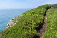
Looking out over the ocean from about 800' above
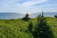
Another cove with a beach and waterfall
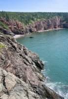
I’ve always noticed that unlike my other dog Joey, Lucy actually looks at views. I'm curious to know why that is. I wonder if it's a difference in their vision or in their cognition.
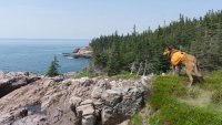
A glimpse of what the trail looked like when it tucked into the forest a little.
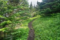
I learned that this is called a "raised beach". I'm not exactly sure how this happens but I'm guessing it has to do with erosion and the passing of millions of years. What I don't understand is whether the water level was ever up that high. I'll have to look into this more.
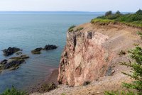
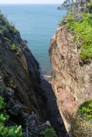
There were occasionally some fissures like this one that looks almost like slot canyons that leading to a tiny beach. My guess is that these were formed from tectonics though, not water erosion.
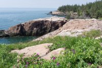
Some wildflowers and alpine forest on the north end of the cape. The cliffs weren't as high on the northern end.
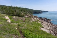
Another cove with water flowing out to the ocean
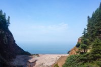
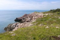
Low tide
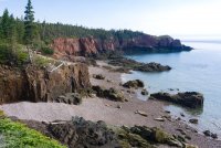
Almost walked right into this guy hanging out right on the trail. I'm glad that Lucy was hiking behind me when we came across it.
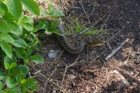
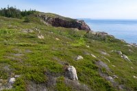
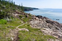
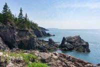
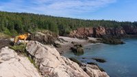
On day 3, I only had about a 5 mile hike to my campsite, so I set up camp and slackpacked another 7 miles on a loop that went further up the coast. Here are a few pics from day 3.
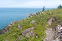
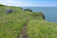
On day 4, I got up early and was on the trail by 5:30 am. Almost all of day 4 was inland through forest and following various rivers and streams. I eventually reached the beach where I started the loop. When I got there I almost didn't recognize it. Not so much because the fog was gone, but because of how much of the sea floor becomes exposed at low tide.
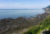
By the time I descended down onto the beach the tide had come up a little and looked more like when I had started my trip here. I walked the mile and half back to the ranger station to check out and begin my trip back to New Jersey.
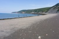
A few final thoughts.. This trip was much nicer than I expected but the campsites were pretty awful. There were so many views and vistas along the way, yet most of the campsites were tucked hundreds of feet into the woods in a 4' spot between a tree and a boulder. I don't get it. In retrospect, I wish I had made kayak beach camping reservations (which they will give to backpackers) where you can just camp wherever on the beach.
I had a pretty funny incident in the ranger station where I thought my gaia route was wrong and that my campsites were all marked in the wrong spot when I was talking to the Ranger before the trip. If I thought something was 7 miles away he'd say no that's about 11.5 and this went on and on for over 5 minutes until I realized I was talking in miles and he was talking in kilometers. It was straight up Abbot and Costello. I felt like a real American idiot. I also got really good at multiplying by .6 as all of the signs on the trail were in km.
All in all, I really enjoyed this trip and it inspired me to want to want to take 3 other trips... 1) I'm bumping the Pacific Northwest up my list as I just really love coastal hiking. I really think it should be considered up there with the Mountains and the Desert. 2) I'd like to backpack the Fundy Footpath in New Brunswick. I heard from a few other hikers on the trail that the Fundy Footpath is much more difficult than the Chignecto Loop but just as scenic and with much nicer campsites. It's also a few hours closer to where I live. And finally, 3) I'd like to backpack the 40 mile length of Pictured Rocks National Lakeshore in Michigan. Perhaps my buddy @Chuck the Mauler will show me the ropes up there one day.
Thanks for checking this out.
Cape Chignecto juts out into the middle of the Bay of Fundy in between Nova Scotia and New Brunswick, Canada. In the map below, the red pin marks it's location.

When I arrived I went to the Ranger Station to pick up my permits and then set up my tent in a nearby field. The field was about a 10 minute walk from the Ranger Station up on cliff overlooking the coast. Unfortunately, it was cloudy and the fog obstructed most of the view. There was heavy rain in the forecast for later that night but the weather was supposed to clear up the next morning and stay nice for the remainder of my trip.
I attached my Gaia tracks below in case anyone is interested. The route I took was a tad over 38 miles with a little over 5,000' cumulative elevation gain. All of the hike, except for the 10 mile connector trail back to the ranger station on my last day, followed the coast line. The hike was a little more rugged than I expected with some tricky fords, and stream crossings, but compared to the Pemi Loop trip that I did a few weeks prior (report HERE), this wasn't nearly as challenging. It was definitely more of a quiet, peaceful, and serene vibe. There was more variation than I expected as well. There were alpine forests, areas of mixed hardwoods, grassy fields, river banks filled with ferns and moss, and of course a coast that varied from sea level beaches to rugged cliffs towering 900' over the sea below. One thing that there was definitely no shortage of, was water sources. It felt as though you crossed a freshwater river or stream that was flowing towards the ocean every half hour or so. There was never a reason to carry more than a liter at a time.
Gaia tracks (you can click on image to enlarge)


Starting out on day 1, the clouds and fog were still lingering. To start and end the loop, there is a section of beach that runs about 1.5 miles that is passable at all times except for betwen 1 hour before high tide to one hour after high tide. The rangers warn you to double-check the tide tables before you head out there or you'll get stuck clinging to the cliffs in a precarious spot.
Where the mountains meet the sea.

At the end of the beach walk there are some wooden stairs marking the beginning of the trail. The trail heads up steeply to about 900' before you start looking way down at the ocean.

At first, I thought "hey there's the tip of the cape", but I quickly learned that the cape is actually made of dozens of smaller capes with coves in between them. Some big, some small. I liken them to false summits. This was just one of dozens of capes I encountered.

Once up on the cliff, the trail went back and forth between meandering through the woods and the edge of the cliff line. I learned after a while that when the trail headed away from the coast and into the woods, it was usually to descend down to a river or stream crossing.
Clouds slowly started to lift

Some of the tributaries descended down to the ocean gradually and some fell off of cliffs in waterfalls.

After about 10 or 11 miles the trail descended down to a nice cove with a beach and a river flowing out from the woods into the ocean. This is where my first campsite was. The name of this cove was Refugee Cove.
Right side of Refugee Cove. On the right side of this pic is where the water flows into the ocean.

Left side of Refugee Cove. I later heard that there are cool caves to explore right around this corner that you can access at low tide. Unfortunately, I spent the whole evening on this beach but had no idea.

The campsites were behind the cove tucked in the woods along the stream. This is looking out towards the beach from near the campsites. The water pools into a pond and flows out towards the right side down the beach and into the ocean.

After setting up camp, I spent the next few hours sitting on the beach using a large log as a back rest. Lucy napped on her half a z-lite while I ate dinner and watched the sun go down with my earbuds in. It was the times of peace and serenity like this that made the drive sooo worthwhile.

The trail the next morning ascending out of Refugee Cove


We decided to break for lunch here on day 2

Most coves were innaccessible and had a beach. Unless you were to kayak in I suppose.

This beach was looking really nice in the heat of the day. I looked for a route down but there was none.

Once I passed the tip of the cape, the trail was much more open and grassy. There were open fields along the tops of the cliffs on this side and a little less of the dense forest.

Looking out over the ocean from about 800' above

Another cove with a beach and waterfall

I’ve always noticed that unlike my other dog Joey, Lucy actually looks at views. I'm curious to know why that is. I wonder if it's a difference in their vision or in their cognition.

A glimpse of what the trail looked like when it tucked into the forest a little.

I learned that this is called a "raised beach". I'm not exactly sure how this happens but I'm guessing it has to do with erosion and the passing of millions of years. What I don't understand is whether the water level was ever up that high. I'll have to look into this more.

There were occasionally some fissures like this one that looks almost like slot canyons that leading to a tiny beach. My guess is that these were formed from tectonics though, not water erosion.

Some wildflowers and alpine forest on the north end of the cape. The cliffs weren't as high on the northern end.


Another cove with water flowing out to the ocean


Low tide

Almost walked right into this guy hanging out right on the trail. I'm glad that Lucy was hiking behind me when we came across it.

On day 3, I only had about a 5 mile hike to my campsite, so I set up camp and slackpacked another 7 miles on a loop that went further up the coast. Here are a few pics from day 3.


On day 4, I got up early and was on the trail by 5:30 am. Almost all of day 4 was inland through forest and following various rivers and streams. I eventually reached the beach where I started the loop. When I got there I almost didn't recognize it. Not so much because the fog was gone, but because of how much of the sea floor becomes exposed at low tide.

By the time I descended down onto the beach the tide had come up a little and looked more like when I had started my trip here. I walked the mile and half back to the ranger station to check out and begin my trip back to New Jersey.

A few final thoughts.. This trip was much nicer than I expected but the campsites were pretty awful. There were so many views and vistas along the way, yet most of the campsites were tucked hundreds of feet into the woods in a 4' spot between a tree and a boulder. I don't get it. In retrospect, I wish I had made kayak beach camping reservations (which they will give to backpackers) where you can just camp wherever on the beach.
I had a pretty funny incident in the ranger station where I thought my gaia route was wrong and that my campsites were all marked in the wrong spot when I was talking to the Ranger before the trip. If I thought something was 7 miles away he'd say no that's about 11.5 and this went on and on for over 5 minutes until I realized I was talking in miles and he was talking in kilometers. It was straight up Abbot and Costello. I felt like a real American idiot. I also got really good at multiplying by .6 as all of the signs on the trail were in km.
All in all, I really enjoyed this trip and it inspired me to want to want to take 3 other trips... 1) I'm bumping the Pacific Northwest up my list as I just really love coastal hiking. I really think it should be considered up there with the Mountains and the Desert. 2) I'd like to backpack the Fundy Footpath in New Brunswick. I heard from a few other hikers on the trail that the Fundy Footpath is much more difficult than the Chignecto Loop but just as scenic and with much nicer campsites. It's also a few hours closer to where I live. And finally, 3) I'd like to backpack the 40 mile length of Pictured Rocks National Lakeshore in Michigan. Perhaps my buddy @Chuck the Mauler will show me the ropes up there one day.
Thanks for checking this out.
Last edited:

