An Allen inspired trip to Dark Canyon

fossana

Member
Joined
Jan 11, 2018
Messages
855
DSC03513l.jpg
Intro
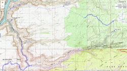
I was staring a new job and decided to squeeze in a short backpacking trip beforehand. The forecast wasn't perfect anywhere, but of the routes on my to-do list Dark Canyon seemed the most reasonable. I vaguely remember reading somewhere that the Bodie section on Allen's Dark Canyon route was a contrived bushwhack, so I decided to do my own shortened variation, cutting off that portion. I didn't know what to expect time-wise, since I had only done his Stevens/Fold loop (in the lower end of the recommended duration) and it was also early season for me. I planned for 3 nights just in case, but ended up doing 2.


Approximate Route (Caltopo link)
map.png

Trip Report & Photos
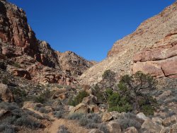
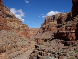
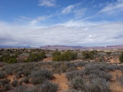
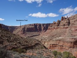
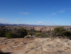
From the upper Sundance trailhead parking area, I headed into Dark Canyon down the infamous Sundance talus slope.
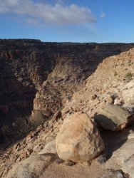
DSC03347.jpg DSC03358.jpg DSC03366.jpg

After a few minutes I crossed the junction of Lean-To and Dark Canyon, where I would close the loop portion of my hike in a few days.
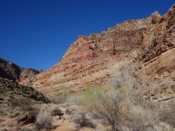
DSC03372.jpg DSC03379.jpg

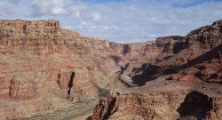
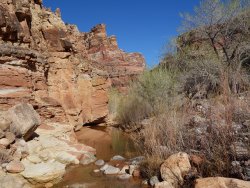
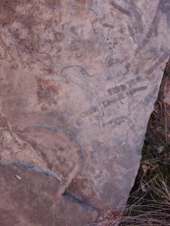
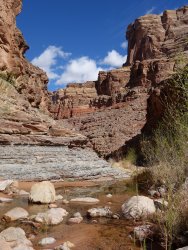
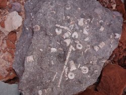
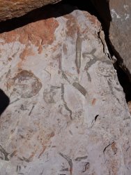
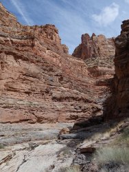
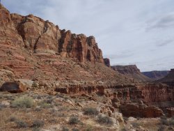
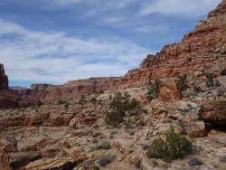
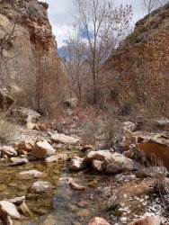
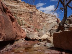
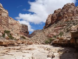
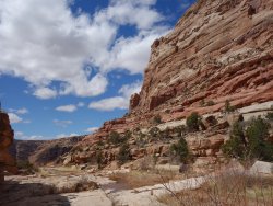
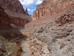
Since I knew I was skipping Bodie Canyon and wasn't sure of water availability on the Cedar Mesa plateau, instead of immediately taking the higher Allen traverse above Dark Canyon I stayed closer to the water for as long as possible. There were many opportunities for fossil viewing, and walking was reasonably easy with a combo of ledges and use trails.
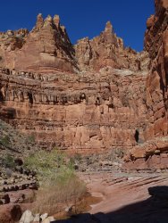
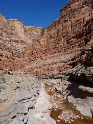
DSC03381.jpg DSC03382.jpg DSC03387.jpg

DSC03391.jpg DSC03394.jpg DSC03399.jpg

DSC03409.jpg DSC03414.jpg DSC03417.jpg

DSC03425.jpg DSC03431.jpg DSC03434.jpg

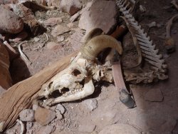
In an alcove I encountered a desert big horn skeleton with and ear tag and tracker collar. I hauled out the tag and collar to return to DWR. I later realized the leather collar was soaked with (dried) big cat urine, the smell of which I was fortunately able to wash off of my pack.
DSC03437.jpg DSC03441.jpg

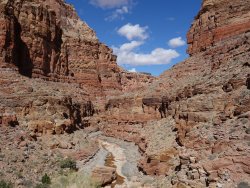
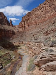
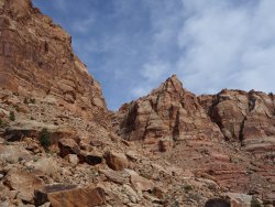
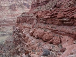
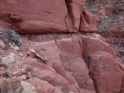
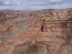
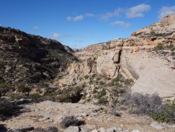
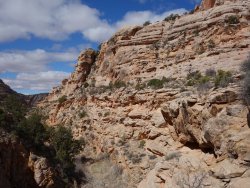
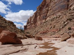
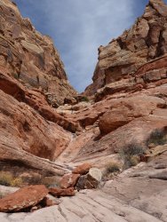
Before reaching the CO River I filled up with water and found a ramp system that would allow me to join the higher Allen traverse. There was a bit of talus side-hilling, which gave way to a broad, flat ledge. I camped just before the side canyon that contains the crux crawl.
DSC03449.jpg DSC03455.jpg DSC03457.jpg

DSC03459.jpg DSC03461.jpg DSC03465.jpg

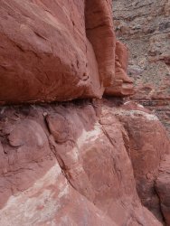
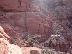
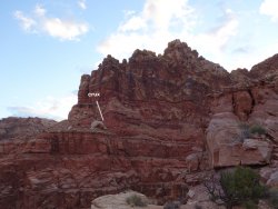
In the morning I set out for the crawl. I headed the canyon and got to what I thought was the ledge crawl. There was a rap/belay anchor. I traversed out as far as possible on the small footholds on the white band then realized I would have to get inside the horizontal crack. I had a thin pull cord with me, but was worried that I wouldn't be able to extract my pack if I wedged it in the horizontal crack. So I pulled out everything unbreakable and tossed the items to the sloping ledge that marked the end of the traverse. Then I wedged my pack in the crack, wrapped the pull cord around my waist, and laid down in the horizontal crack, scooting my way for the 15+ feet to reach the sloping ledge. The ledge was small and sloping, so I had to armbar with my left arm and use my feet to push myself forward. After getting my pack across, I looked over to find the Allen ledge around the corner ~35 feet lower that the route I took. :)
DSC03472.jpg DSC03482.jpg DSC03493.jpg

DSC03494.jpg DSC03499.jpg

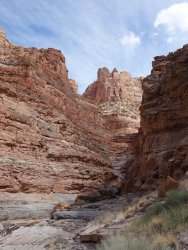
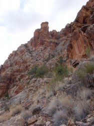
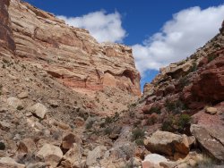
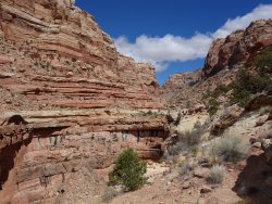
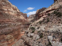
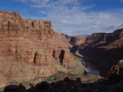
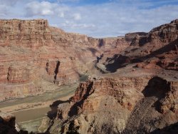
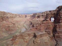
After the crawl I rounded the prow that marks the entrance to Midway Canyon. The route ascends a ramp system, which is somewhat hidden from below but it's the only break in otherwise sheer canyon walls. For future reference the ramp system was across from a small tower, which vaguely resembles Sam the Eagle from the Muppets. The brushy ledge system took me to the Cedar Mesa plateau. Some potholes contained water and I luckily had a hacked gold coffee filter prefilter to screen out the algae.
DSC03500.jpg DSC03513.jpg DSC03516.jpg

DSC03518.jpg DSC03520.jpg

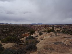
As I reached the plateau, I could see the storm clouds building. I walked toward the head of Midway Canyon, but instead of crossing it to reach Bodie Canyon, I left the Allen route to intersect the faint 4WD road that leads to the old land strip and the head of Lean-To Canyon. The weather fluctuated between sunny and rain/hail and back. I trudged along the clay-laden road, stopping for shelter only when the hail started. I camped under some junipers near the old landing strip.
DSC03523.jpg DSC03528.jpg

In the morning I dropped into Lean-To. There was a fun series of downclimbing and routefinding problems to circumvent pour-offs. Then there was a not so fun section of bushwhacking.
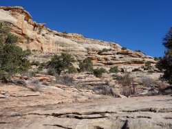
DSC03537.jpg DSC03540.jpg DSC03544.jpg

DSC03546.jpg

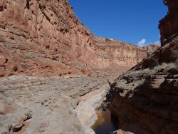
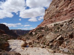
The canyon opened up again for easy walking along beautiful slickrock ledges.
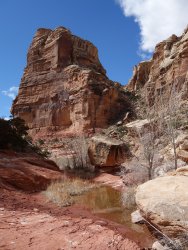
DSC03557.jpg DSC03562.jpg DSC03573.jpg

DSC03576.jpg DSC03580.jpg DSC03582.jpg

DSC03586.jpg

I kept an eye out for the trail that bypasses the huge pour-off. The bypass trail was spectacular, precipitously skirting the cliffs that guard the canyon bottom for miles. I don't know what the Youngs Canyon exit option is like, but I can't imagine it being better than this.
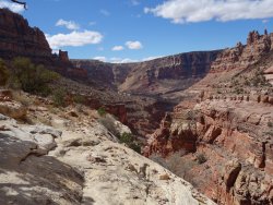
DSC03589.jpg DSC03592.jpg DSC03599.jpg

DSC03609.jpg DSC03613.jpg

The trail eventually became less precipitous and gradually made its way back to the junction of Dark Canyon. I knew I had a big climb ahead of me, so I grabbed a snack and refreshed my water. The climb up the talus slope went faster than I expected, and with the steep part out of way I knew it was just dirt road walking back to the trailhead. I got back to my car in time to drive most of the way home.
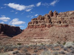
DSC03622.jpg
 
Great TR and great pics. We were planning on going in there a month ago but the world changed. Hopefully this Fall or next Spring we will all be able to get out.

Thanks for the great TRs
 
Nice.... Brings back memories. Bodie canyon had a lot of beat stuff though... I'd save it for itself.
 
I like how you show the two ledge routes. I'll take Allen's, please.
Desert TR's are killing' me, as we were going to be headed that way right about now.
But keep them coming...inspiration for the fall trip.
 
Wonderful trip and report. Thank you for the specifics on the crux "crawl". If I get there some day hopefully it will seem consistent with typical conservative Allen ratings. Impressive solo effort, not surprised!
John
 

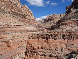
Based on the the first and third pics above, looks like the talus fan is the access onto Allen's traverse? Would that then lead to the wider gray ledge lower than you in pic 2? It's is great to get some visuals on his description. Maybe pic 2 is showing his crawl in that tight groove separating the buldging red from the gray? Well, except, then what????
 
Last edited:
Very nice! So which did you like better, this loop or the Stevens/Fold loop?
 
Based on the the first and third pics above, looks like the talus fan is the access onto Allen's traverse? Would that then lead to the wider gray ledge lower than you in pic 2? It's is great to get some visuals on his description. Maybe pic 2 is showing his crawl in that tight groove separating the buldging red from the gray? Well, except, then what????
To access the traverse you end up going pretty much as high as possible on the ledge systems. In the picture with the crux label the Allen traverse is the wider horizontal crack just to the right of the bottom of that blobby white rock. My variation was less exposed and a shorter crawl, but more awkward. If you wanted to, you could skip both of those options and use the rap anchor for a short rap that puts you at the end of the Allen traverse.
 
Very nice! So which did you like better, this loop or the Stevens/Fold loop?

Both had their positive attributes. I think I like Stevens/Fold a little better since it's more remote (no road walking), not that I saw anyone the whole time. There were 3 other cars at the trailhead, and one pair from CO a day ahead of me said they were also doing the Allen route but exiting Youngs.
 
Nice report! You would make a good dessert trail (or no trail) guide for the not so faint of heart..
Having to toss/separate your gear just to get from point A to B made for some tedious moments I'm sure.
As previously stated the written comments on some of your pics were very helpful to clarify - especially regarding Sam the Eagle!
 
Hi Fossana,

This looks like a great trip ... I really enjoyed reading your report.

How was the road to the Sundance TH ?

I've heard the last mile or so is pretty rough, but would you say the main section from the highway is accessible in a standard rental car ?

All the best.
 
How was the road to the Sundance TH ?

I've heard the last mile or so is pretty rough, but would you say the main section from the highway is accessible in a standard rental car ?

Thanks btw. The kiosk and trail register are at the upper trailhead, which is where most people park. You would likely need high-clearance 4WD for the next mile or so to reach the lower trailhead (not continuously technical, but rough in spots). It wouldn't really shave that much time off to park at the lower, plus it's a scenic walk.
 
Thanks btw. The kiosk and trail register are at the upper trailhead, which is where most people park. You would likely need high-clearance 4WD for the next mile or so to reach the lower trailhead (not continuously technical, but rough in spots). It wouldn't really shave that much time off to park at the lower, plus it's a scenic walk.

... thanks Fossana ... I do like the sound of the Lean-To Canyon descent you describe ... your photos are great of this route ... it seems that this could be a good option for Hayduke hikers heading into Dark Canyon ...
 
... thanks Fossana ... I do like the sound of the Lean-To Canyon descent you describe ... your photos are great of this route ... it seems that this could be a good option for Hayduke hikers heading into Dark Canyon ...
Other than the short bushwhack, it's a lovely section.
 
Similar threads
Thread starter Title Forum Replies Date
fossana Steve Allen presentation in Durango Feb 22 2024 General Discussion 27
regehr Allen-ish dark canyon loop video Backpacking 5
George_Washington_Hayduke High Uintas: Allen Lake and Thunderstorms Backpacking 0
Kullaberg63 Allen's Dark Canyon route Trip Planning 18
Adventure monkey Steve Allen's exit out of Happy Canyon to the Big Ridge. Trip Planning 17
G Escalante area 4-5 night backpack trip suggestions in late September. Loop if possible. Limit technical sections if any. Thanks! Backpacking 6
Tarp Boy Looking for Shuttle service for Uintas Granddaddy basin trip Trip Planning 0
John Goering More ancient past from the archives, 1981 Beartooths trip Backpacking 11
John Goering The ancient past. 1980 Beartooth trip Backpacking 11
Bob Short Motor Trip Thru Cody, Cooke City Off Road 6
Bob Wind Rivers - Short Trip to Cook Lake Trip Reports 9
Stephanie Help! Looking for a 1-2 day trip Backpacking 9
RockyMntCol Trip Planning Younts Peak / South Fork Yellowstone Trip Planning 12
C What's a good insurance company for Wilderness Trip Outfitters Trip Planning 1
scatman Pre-trip Preparation General Discussion 176
Honk34 Day Trip WY Golden Trout Hiking & Camping 1
Janice Field Trip - Washington Post podcast about national parks General Discussion 0
J Castle/Conundrum/Hot Springs Trip - Colorado Trip Planning 5
balzaccom A civilized trip--on the rivers of Europe On The Water 0
Vegan.Hiker 8 day trip to Utah Trip Planning 10
C Thorofare Trip - September 2023 Trip Planning 3
W Gulf of Slides Ski Trail Trip Report 1/25/2022 Trip Reports 0
Ymyr Suggestions in a Yellowstone and a Beartooth trip Trip Planning 29
V four day backpacking trip in southern Utah starting this weekend Trip Planning 4
travel2walk last minute Colorado trip, maybe 4 passes? Meet Up (Members Only) 0
P Bighorns (WY) Trip report Backpacking 8
kwc A Few More Photos from Scatman’s Grizzly Lake trip … Backpacking 3
John Goering Pioneer Mountains, Montana <50" UTV trip Off Road 3
Kerrie at Thru We Go Packraft Trip in the Sierra Nevada Mountains Trip Reports 3
Georgia Yankee Can't seem to edit my trip report Questions, Suggestions & Support 4
Mikjik86 Another Wind River Trip Planning! Elkhart/Titcomb/Knapsack/Shannons Pass loop back to Elkhart, or continue to Green River Lakes Trailhead? Trip Planning 10
The Trout Whisperer Dad n daughter trip in the very near future… Hiking & Camping 7
B 1-2 Night Sierra Trip Help Trip Planning 3
bouldermtn May/June trip suggestions Trip Planning 0
BJett Red River Gorge/Red Byrd Arch Packraft Trip - Kentucky Hiking & Camping 9
Bob Planning an Expedition type trip....... check this list out ..... Trip Planning 13
Janice Vermillion Cliffs Trip - Part 3 - Buckskin Gulch Hiking & Camping 3
Janice Vermillion Cliffs Trip - Part 2 - White Pocket & Coyote Buttes South Hiking & Camping 7
RyanP Does knowing the geology of the CO Plateau give practical insight for trip planning? General Discussion 20
TeamJenkins17 Washakie Wilderness Trip Advice Trip Planning 17
Janice Family trip to Grand Teton Memorial Day weekend? Trip Planning 5
Janice Yellowstone - Winter Yurt Trip? Winter Sports 22
F Hammond Canyon, UT trip planning Trip Planning 9
wsp_scott Family trip to Grand Teton and Yellowstone Hiking & Camping 15
Yvonne The Subway September 2020 - a trip that went wrong Hiking & Camping 10
SteveR Delaying Winter-A November Desert Trip. Hiking & Camping 6
The Trout Whisperer Non kilt wearin’ version of th Gneiss Creek trip, part 2, Backpacking 4
norwegianxplorer Highest Mountain in Norway, Galdhøpiggen, the start of a 9 day backpacking trip in Jotunheimen national park Backpacking 0
montanaclimber Americans: where was your favorite international backpacking trip? Trip Planning 25
Jackson A Late Summer Summit Trip Backpacking 6

Similar threads

Back
Top