A Walk in the Gunks

Vegan.Hiker

Member
Joined
Jul 5, 2014
Messages
2,099
This Sunday I day hiked with my wife and dog along a section of the Shawangunk ridge in Minnewaska State Park, NY which is about an hour from my house. The Shawangunk ridge, referred to as the "gunks" by hikers and climbers, is a bedrock ridge connecting the Kittatinny Mountains of NJ to the Catskill Mountains of NY. The area is much more popular with climbers than hikers because of the many vertical rock faces. The parking lot was full when we got there but it appeared we were the only ones without climbing gear. I normally would hesitate to take my dog Joey on a 13 mile hike, but the gunks have very little elevation gain/loss, it wasn't too hot, and I knew there would be plenty of water for him to splash around and cool off in along the way. We took our time letting him rest often, kept him well fed and hydrated, and he did just fine. According to my Gaia tracks, we only gained 1,700 ft cumulatively over 13.25 miles. It's mostly flat, very easy ridge walking, with just a few steep boulder scrambles interspersed.

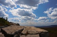
The trailhead is pretty high up the ridge, so it was only a 20 minute climb to get up top, then you walk along the ridge for the next 7 or 8 miles.
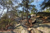
DSC03205-1.jpg

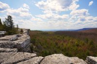
The ridge is flat and very easy to hike along.
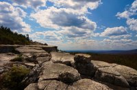
DSC03363.jpg

DSC03362-2.jpg

DSC03333-1.jpg

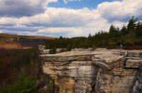
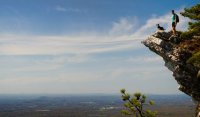
This rocky outcrop is at the summit of Millbrook Mountain. It took some coaxing to get Tyne out there for a picture.
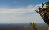
DSC03265.jpg

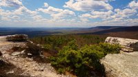
A few more miles down the ridge.
DSC03355-1.jpg

Some NY farmland down below.
DSC03331-1.jpg

The ridge isn't straight, it meanders in and out like a winding river.
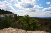
DSC03367.jpg

DSC03388.jpg

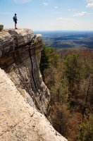
This spot is called Gertrude's Nose.
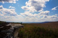
DSC03384-5.jpg

Wouldn't be a bad camp spot as long as you don't sleep walk.
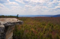
DSC03387-5.jpg

Lake Minnewaska along an easy walk back on a fire road.
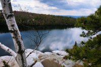
DSC03405.jpg

Featured image for home page:
slide.jpg
 
Last edited:
The American Alpine Club now has a campground in the Gunks, what a beautiful place. Thanks for sharing.
 
The American Alpine Club now has a campground in the Gunks, what a beautiful place. Thanks for sharing.

Your post confused me a little because I passed by this new campground a few times and there is a DEC (NY Dept. of Conservation) sign out front so I thought it was a State run campground. I just checked it out online and it's the same campground but run cooperatively between the American Alpine Club and the State. I'll give it a try maybe in the Fall.. tent only sites, no hookups, no generators allowed, so should be nice and quiet. And the Gunks are beautiful in the Fall.
 
Where specifically did you hike? Was it a loop? What trailhead?

Hi Joshua,

I'd be happy to share my route and can also help with any little details if you decide to do it.

I parked at the West Trapps parking lot on Route 44/55. This parking lot is used almost exclusively by climbers, not hikers, so even though the lot will be full, the trails are very quiet in that end of the park. At the end of the parking lot, you will cross a footbridge over 44/55 and take the Millbrook Ridge Trail which is blazed blue. It will be a short climb up to the ridge, then the trail goes along the ridge for several miles until you descend a small col, then rise back to the the summit of Millbrook Mountain. It feels more like a cliff than a mountain, but if you look down below, you will see fields of talus where the other half of the mountain has literally crumbled down to the valley. Just past the summit of Millbrook Mountain you'll see a sign where the Millbrook Ridge trail turns right, however, you want to continue straight, now taking the Gertrude's Nose Trail (blazed red) which continues along the ridge for a few more miles. Once you get to Gertrude's Nose (you'll definitely know when you are there) this would be a perfect spot to have a bite to eat. There are tons of great places to sit and take a break. The Gertrude's Nose Trail eventually, after several miles begins to wind back into the woods and you will eventually intersect with the Millbrook Mountain Carriage Road.

From this point of the hike, I don't recommend doing what I did. I turned left onto the Millbrook Mountain Carriage Road because I also wanted to work in Lake Minnewaska and Awosting Falls. I wouldn't recommend doing this because you end up near the main entrance of the park which is crowded and you'll end up hiking past people pushing strollers and down the paved road leading to the parking area. It felt rather anticlimactic after a nice day of ridge walking where we only encountered a few other hikers all day. Instead, I recommend doing the following: Turn RIGHT onto the Millbrook Carriage Road which will eventually intersect with the Millbrook Ridge Trail near the summit of Millbrook Mountain. From here you can either make a right onto the Millbrook RIDGE Trail (overlapping your original route to the summit of Millbrook Mountain back to the West Trapps parking lot) or you can make make a left onto the Millbrook MOUNTAIN Trail and then a right onto the Coxing Trail which will also take you back to the West Trapps parking lot. Going back this way would make it a true loop and is how I will do this hike the next time. If you really want to see Lake Minnewaska and Awosting Falls, I would go there separately mid-week or during the shoulder season (since it's near the main parking lot which is a zoo in the summer) and do an easy walk to see both from the main parking lot.

My loop ended up being 13.25 miles, but the loop I'm recommending instead would be 9.75 miles. If you Google Gertrude's Nose you will get about a dozen different routes, almost all of them involve parking (or hiking through) the crowded section of the park near Lake Minnewaska. I strongly recommend parking at the West Trapps Parking lot instead and do the route I suggested above which will keep you away from the crowded main area and keep you on the nicer, more remote trails in the park.

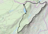
These are my Gaia tracks from the 13 mile loop I did. I hiked this loop clockwise from the West Trapps parking lot which is in the top right corner of my tracks.
What I did.jpg

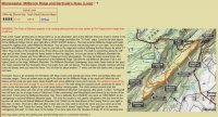
And this is the route I recommend doing instead. The first 2/3 are the same but with a different return route to the parking lot. I found this writeup of the route I'm suggesting online.
Recommended.jpg

Feel free to PM me with any other questions. There's also a really nice loop on the other side of the Gunks in Sam's Point Preserve which goes through the Ice Caves, past Verkeerderkill Falls, and has lots of nice ridge walking. That loop is 12 miles.
 
Last edited:
Hi Joshua,

I'd be happy to share my route and can also help with any little details if you decide to do it.
Thanks! I'm not in the "immediate market", if you will, but as a guy who lives out East myself, I'm always on the lookout for hikes my way that look good and don't require quite as much travel. Your pictures look amazing; those ridgeline views definitely make this a desirable hike to put on my Eastern bucket list.
 
Similar threads

Similar threads

Back
Top