- Joined
- Jul 23, 2013
- Messages
- 1,666
What happens when three guys from Ohio and two guys from Utah get together to spend five days in the High Uintas Wilderness when the only mutual connection between them all is Youtube? Amazing happens!
Earlier this year, a guy named Tim Watson who runs a well-followed YouTube channel was scheming with his two neighbor buddies in Ohio (both named Josh) about where they were going to take what has become an annual big backpacking trip for them out west. @Devin Ashby, a fellow local Utahn friend of mine who I came to know first through YouTube as well, pitched to Tim the idea to come out to Utah. Things got serious quickly and plans were made for the three Buckeyes to to fly out to Utah for a meet-up this past July. This is the story of that amazing trip!
Day 1
Wednesday - July 11, 2018
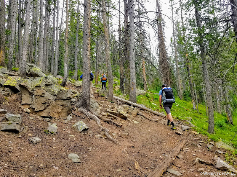
After making a short drive over to pick me up at my home, Devin and I drove on up to SLC to pick up the three Ohio amigos. Once all packed like sardines into Devin's Jeep Compass, the camaraderie was instant. We fueled up both the car at a gas station and our bodies at Crown Burger. We then made the drive up through Parley's Canyon, Park City, Kamas, and finally on up the Mirror Lake Highway where we'd ultimately pull into the Mirror Lake Trailhead lot to saddle up for the big trip ahead.
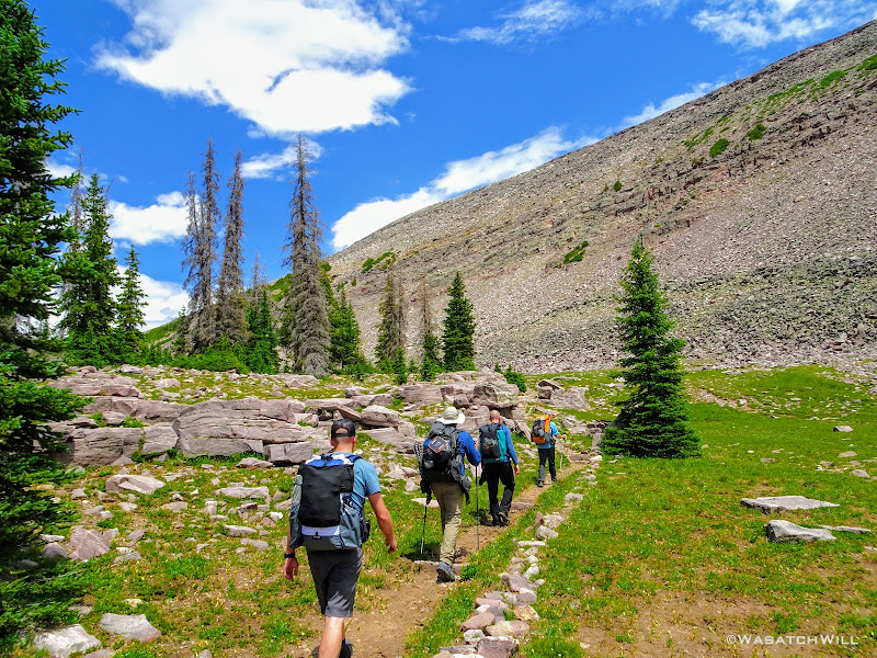
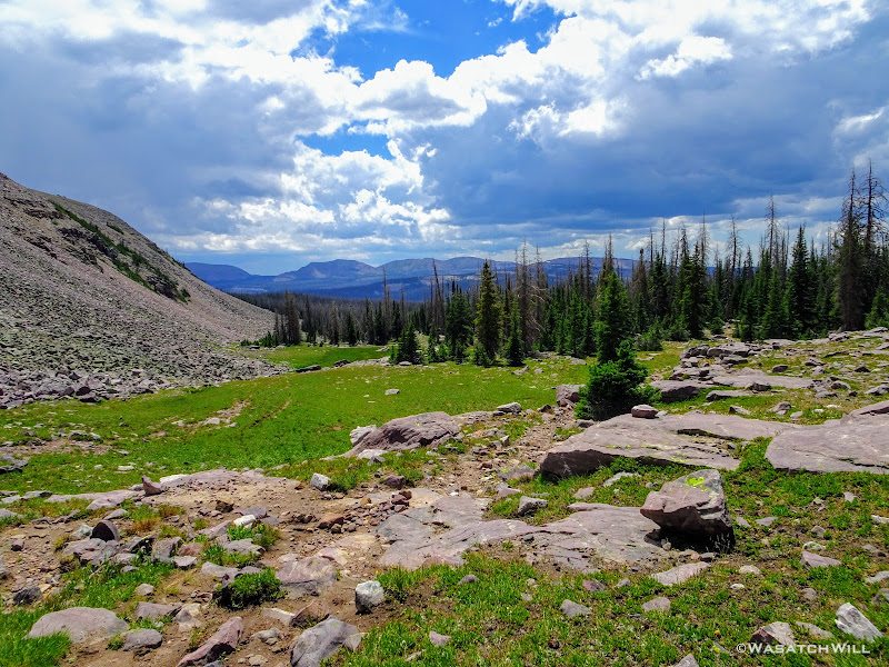
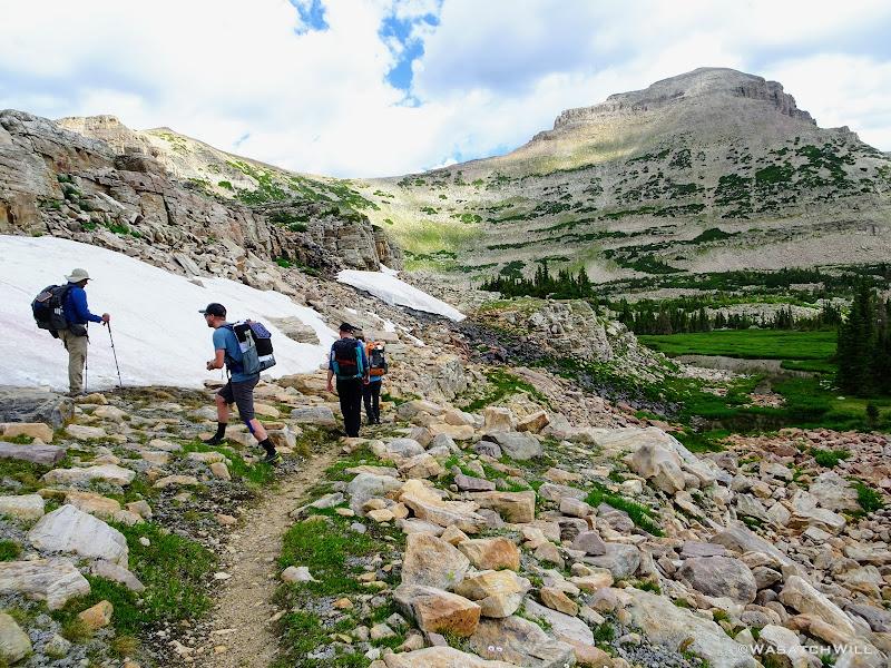
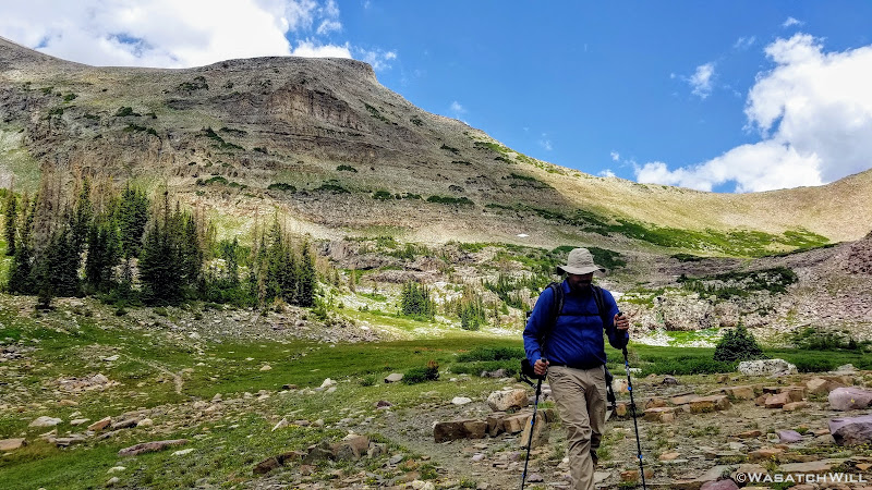
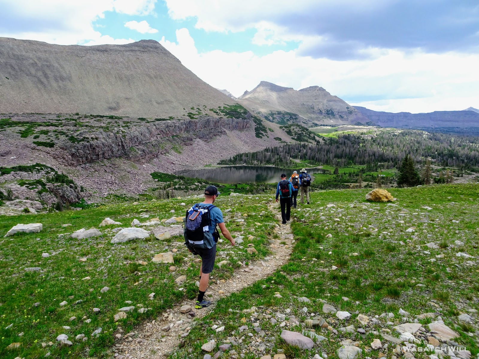
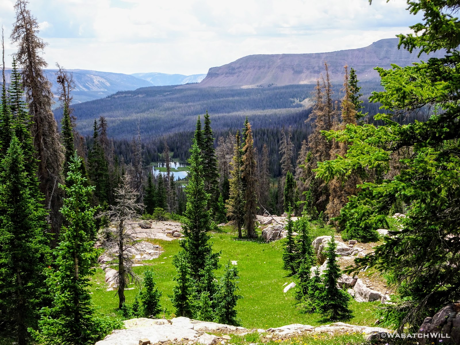
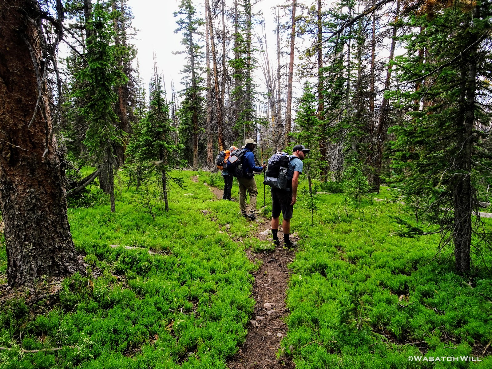
Originally we had started planning a route that would take us on a lollipop loop to hit Kings Peak and spend some time around Red Castle. After some thinking on both sides, it was mutually agreed that the elevation changes might be too strenuous for the Ohio crew coming right off the plane and at least one of them had dealt with a recent injury that he wasn't sure about being fully recovered from. So, a more moderate route was planned that would enable lesser travel time and quicker access (i.e. more trail time), less strenuous elevation gains and losses, and yet still allow us to tour some beautiful basins and get somewhat deep into the Uintas backcountry. Ultimately, a more mellow 36ish mile route mostly planned out by Devin was agreed upon. It would take us on somewhat of a figure 8 course, nipping off a corner of Granddaddy Basin before cutting back up into Four Lakes Basin, then up and over Rocky Sea Pass to spend a couple nights in Rock Creek Basin, before returning back up and over and down the Highline Trail before rounding out the trip.
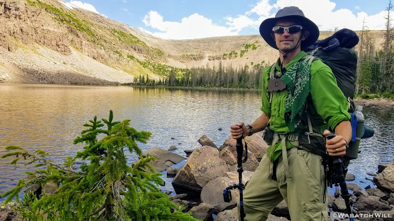
It should also be noted here that to distinguish the two Joshes, one has been dubbed Karate Josh because he is a well-trained martial arts guru. That also made him a good defense for us to have against bears. The other has been dubbed Subaru Josh because he is an official ambassador for Subaru automobiles.
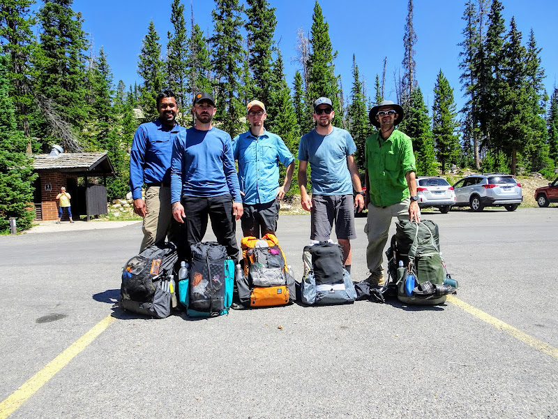
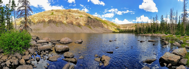
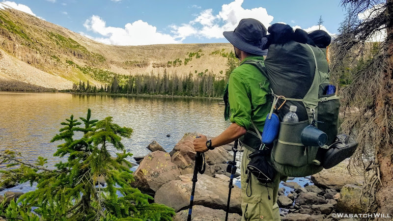
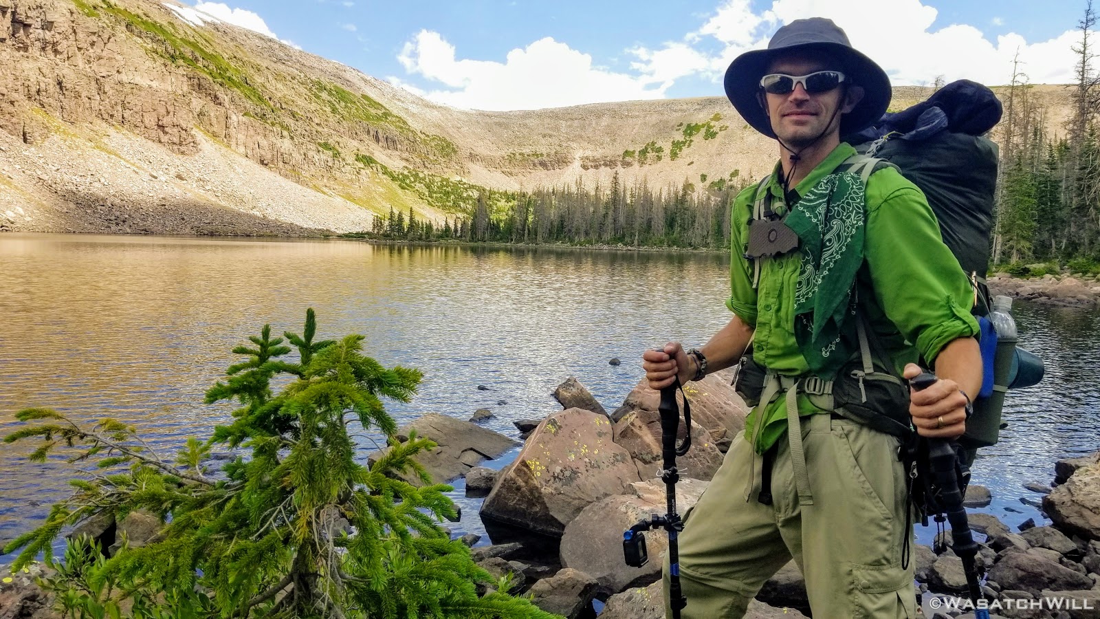
Tim, 'Karate' Josh, 'Subaru Josh', Devin, Will (myself)
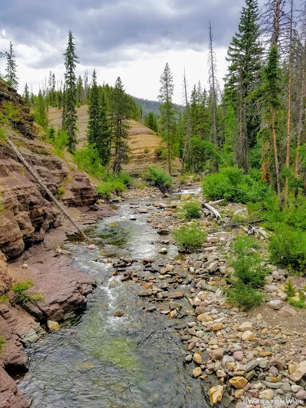
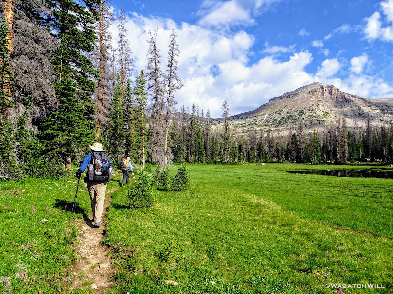
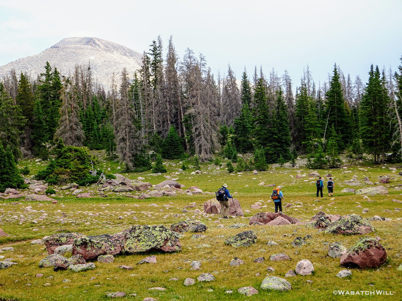
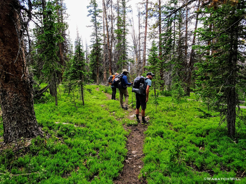
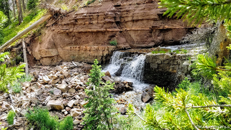
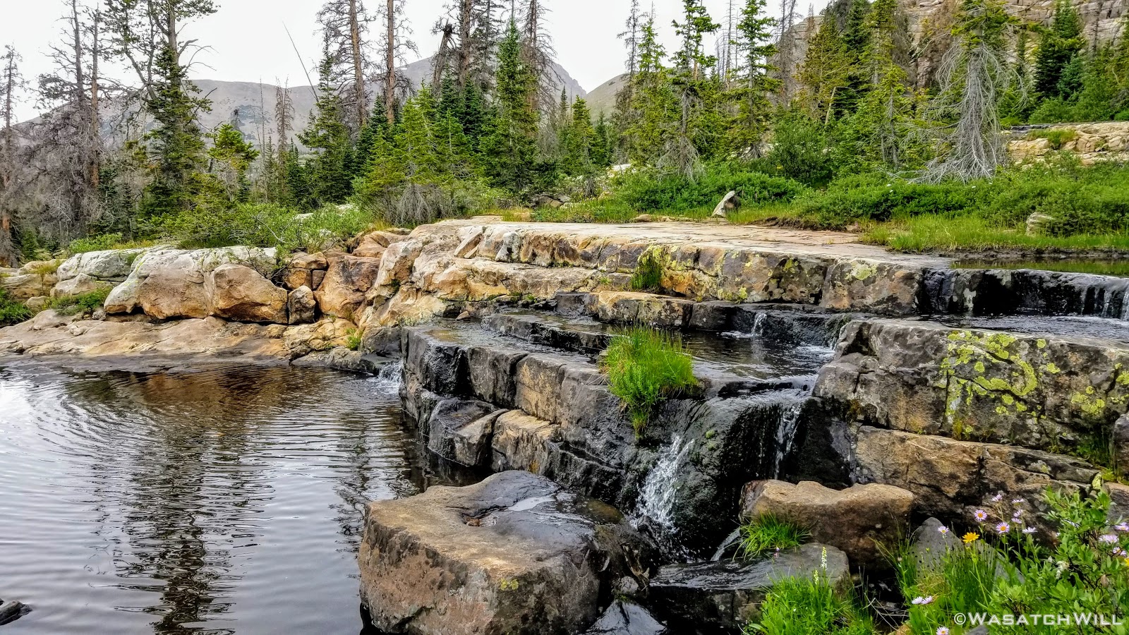
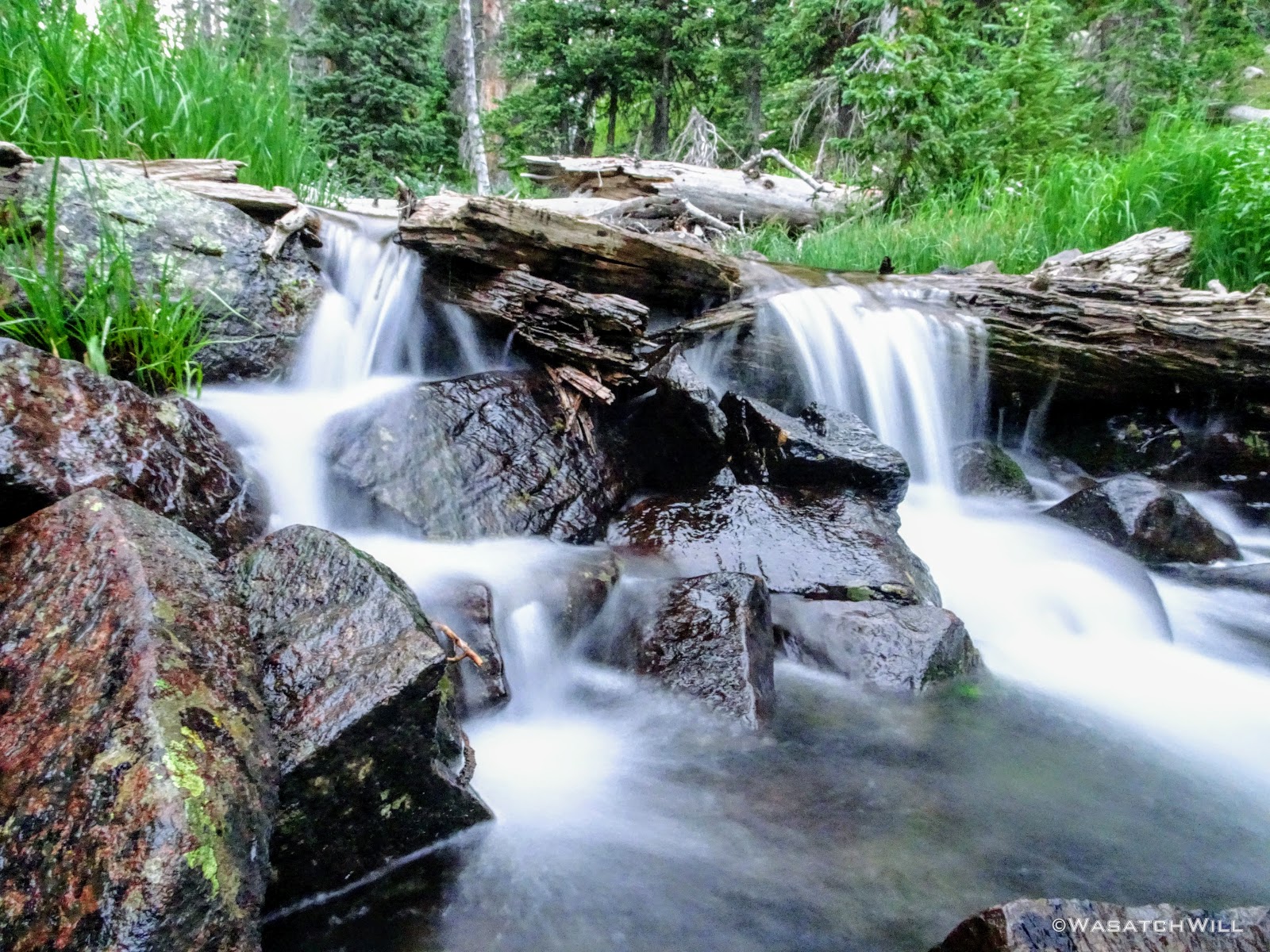
All geared up, we were able to hit the trail by mid-afternoon. The first couple miles ran parallel with the Duchesne River through dense forest leaving little for views. But occasionally we'd find ourselves passing by some nice little picturesque spots including a nice little unexpected waterfall.
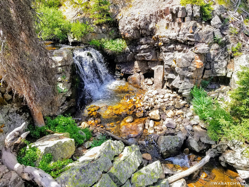
Waterfall along Duchesne River
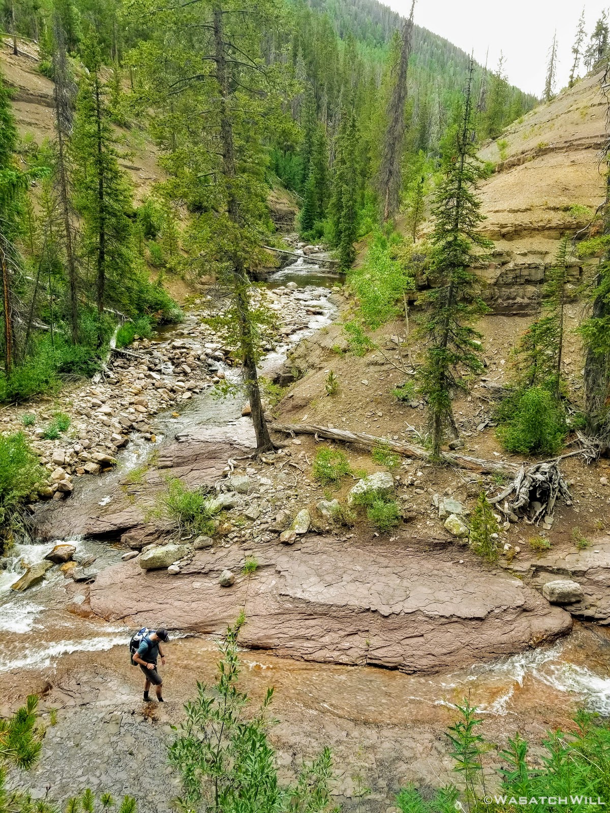
The typical afternoon monsoon storms were threatening not far to the east and we'd hear the occasional crack of thunder but never encountered more than a brief light shower that quickly passed us over. As the trail approached the East Fork of the Duchesne, it presented us with more variation in the terrain. From here on out, the scenery would just mount up and become more and more beautiful and breathtaking as it carried us through to the final day.
Duchesne River
Along the trail approaching East Fork
View from bridge over Duchesne River near East Fork
Of course, once we reached the river's fork, Devin couldn't resist dropping down to see it up close.
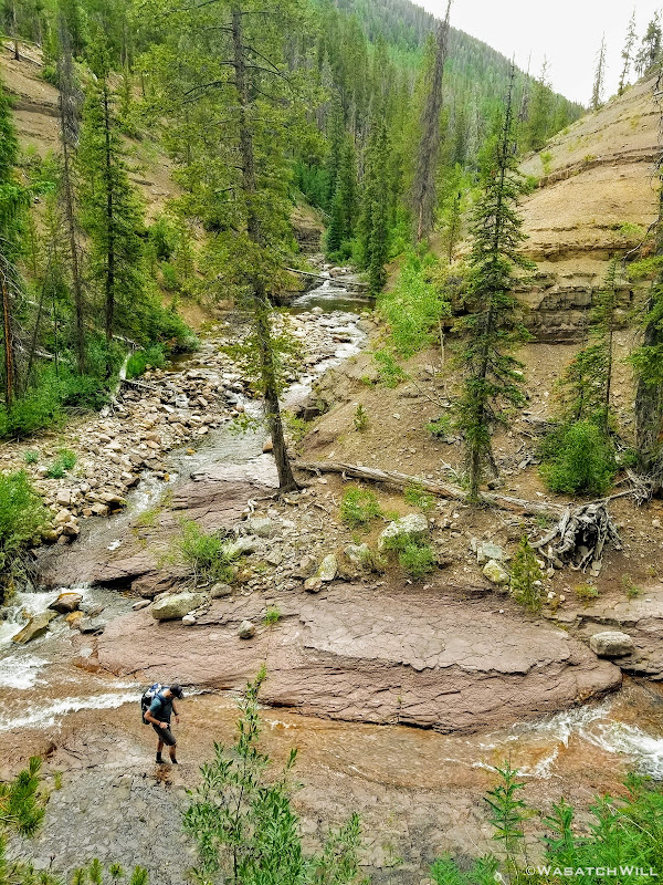
Devin getting up close with Duchesne River and East Fork
Back on trail, we continued our course for the upper edge of Grandaddy Basin to look for camp in the neighborhood of Governor Dern Lake.
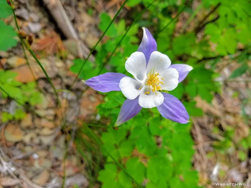
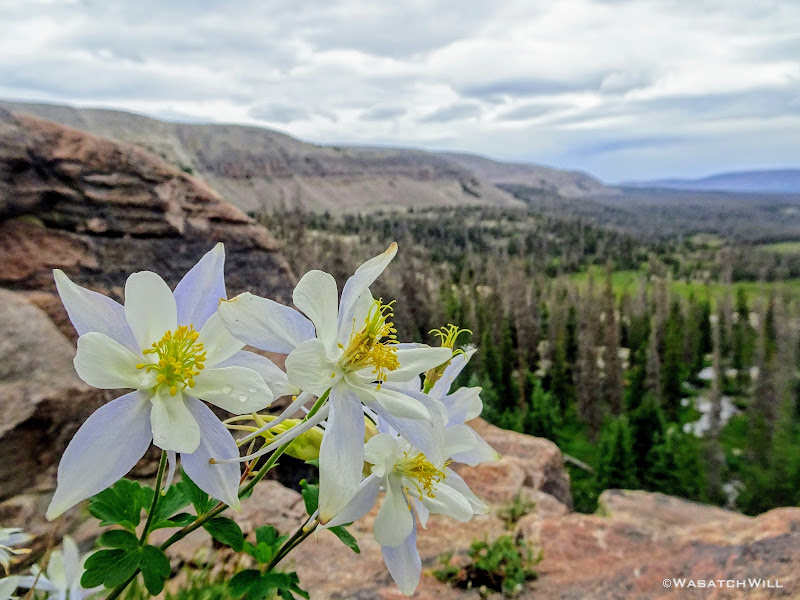
Purple Columbine
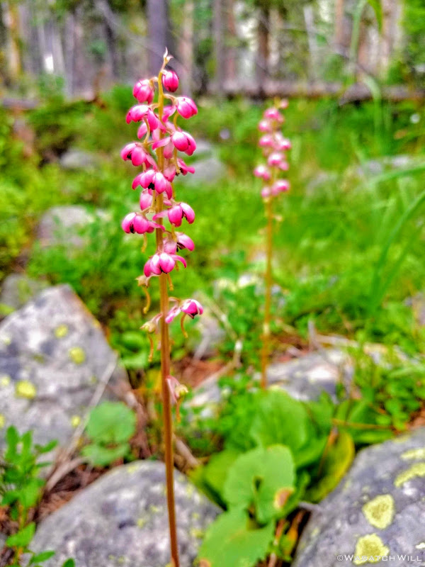
Pink Pyrola
Devin gaining hill up into Grandaddy Basin with others up ahead
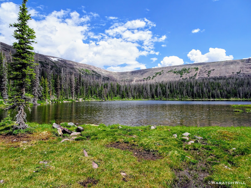
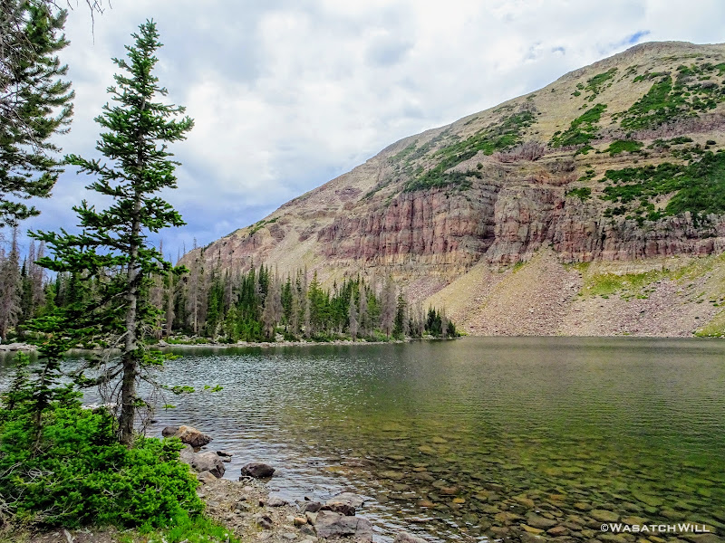
Just after passing by Pinto Lake where a number of campers were set up and fishing, we reached Governor Dern Lake.
Governor Dern Lake
We continued on a bit further and found ourselves a fantastic site within a stand of trees not far below.

First night's camp
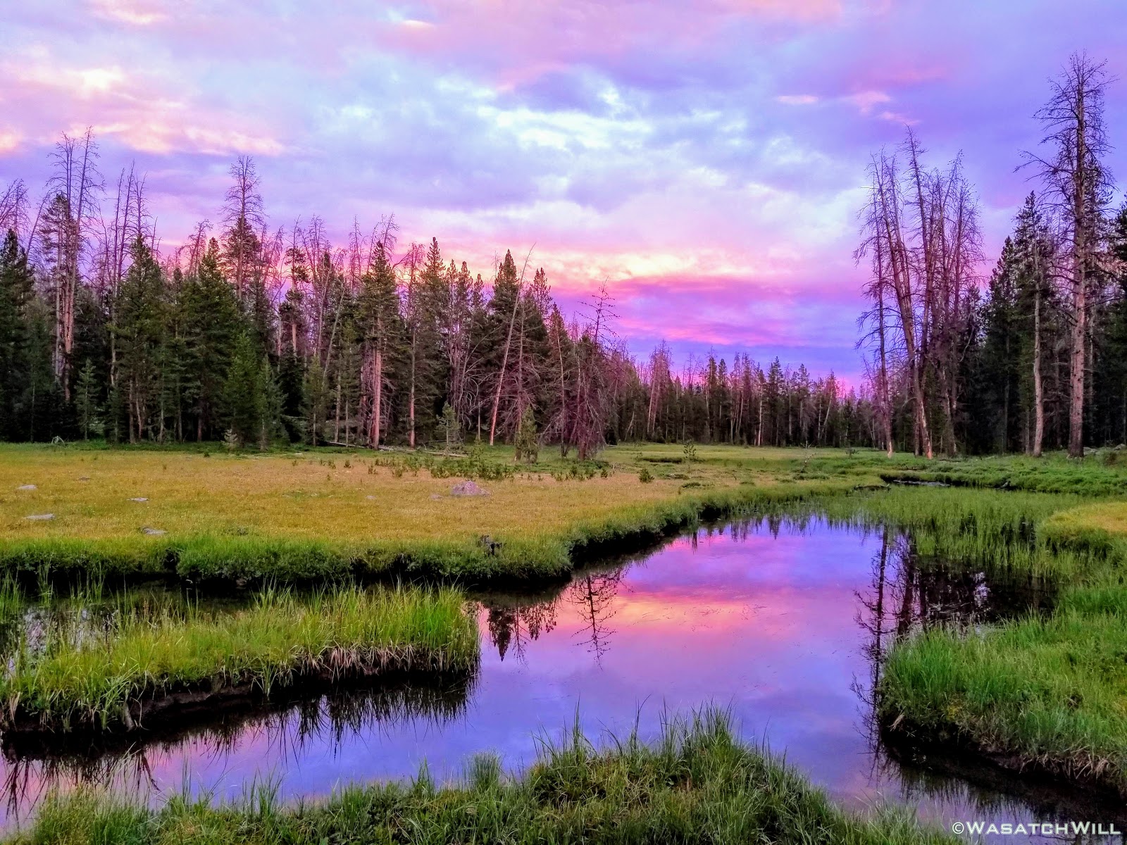
Once we had camp set up, we were treated to a colorful sky to close out the day.

Purple clouds
Not bad for day one. Once we were all settled into our beds for the night, the clouds must have gathered back together for a bit because we received a light shower later on overnight.
Day 2
Thursday - July 12, 2018
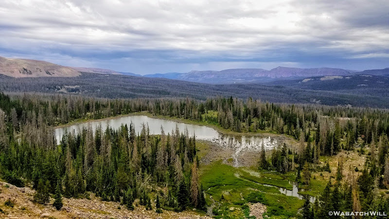
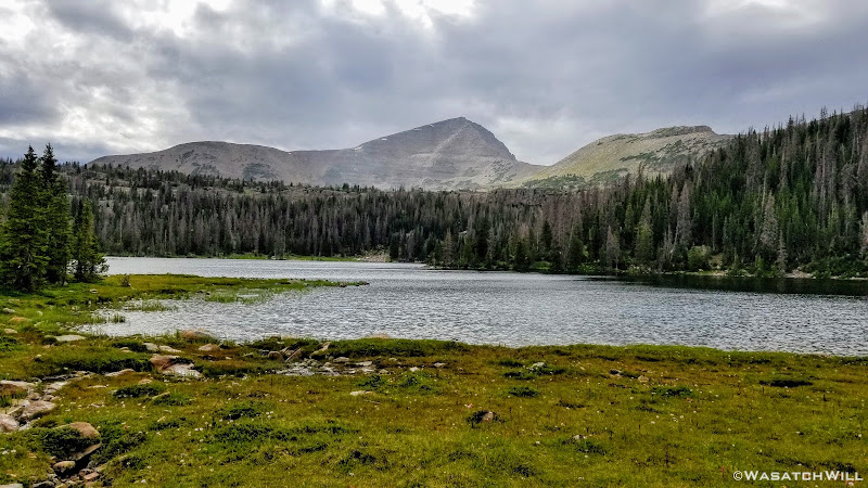
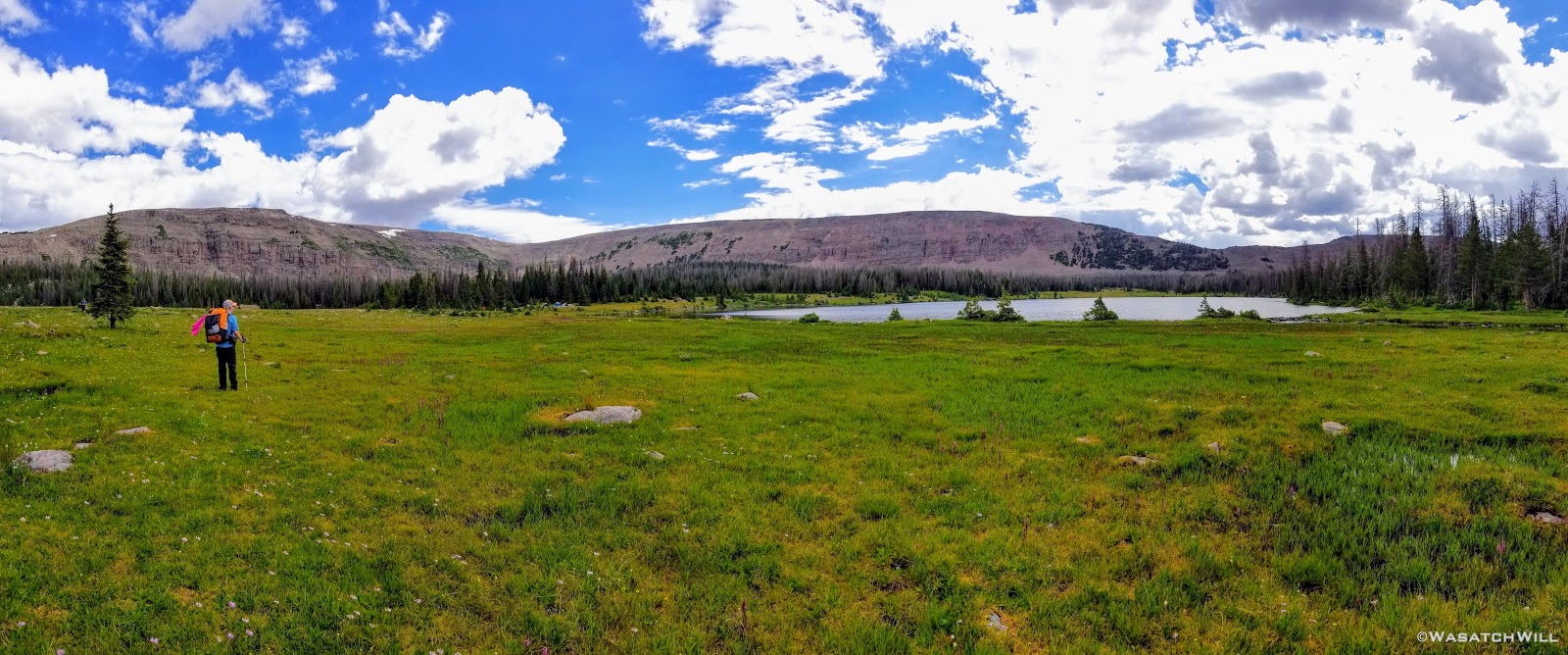
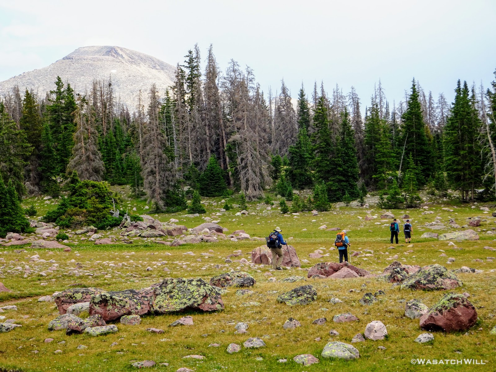
Day two greeted us with blue skies and a pleasant morning. After some breakfast and breaking camp, we moved on along the trail. A few miles later and we were into Four Lakes Basin looking out across Daynes Lake. We knew Four Lakes was a popular destination for many backpackers and it didn't take long for us to see why. In fact, there was a larger group camped out not far up the shore from where we paused at.
Daynes Lake
Daynes Lake Pano
We opted to take a good rest there. While snacking up we were confronted by a couple of horse packers out doing some fishing as they were concluding a multi-day trip of their own. One of them recognized Devin from his Youtube channel (albeit confusing his channel with one of Devin's other good friends who also runs a channel). His name was Clay and without seeing me yet, mentioned my channel. "That's me," I bragged from his other side, raising up my hand. He then looked my way and we exchanged pleasantries as well. And then it was Tim's turn to be recognized. It turns out Clay had recently started documenting his trips on video inspired by following our channels and others. He was now publishing his trips on his own channel, Clay On The Trail. What a small world something like YouTube and other digital forums and communities can make for outdoor enthusiasts.
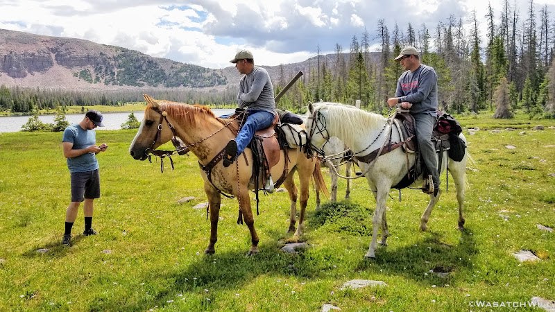
Devin (left) chatting with Clay (middle) and his friend Shad (sp?)(right)
After a good chat with Clay and his good friend, we slung our packs back onto our backs and continued up through the basin, passing by Dale and Jean Lakes.
Dale Lake
Small pond near Jean Lake
Jean Lake
Jean Lake pano
Myself at Jean Lake (credit: Josh Herod)
Enjoying the view at Jean Lake (credit: Josh Herod)
As we were leaving Jean Lake, we encountered a wilderness ranger out patrolling the area. He was an interesting fellow to say the least. Little did we know we'd have another encounter with him closer to the trailhead on our last day. But that's another story to be told further below in this trip report.

Devin and Karate Josh make their way up trail from Jean Lake
Looking back down at Jean Lake
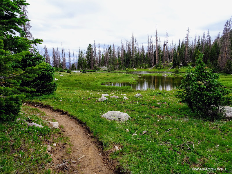
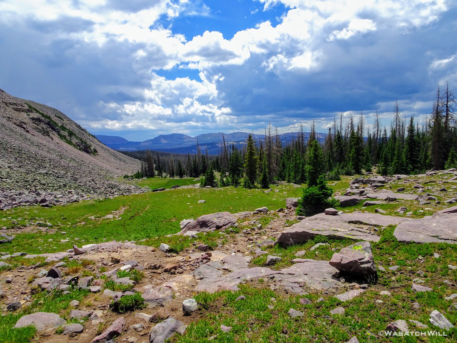
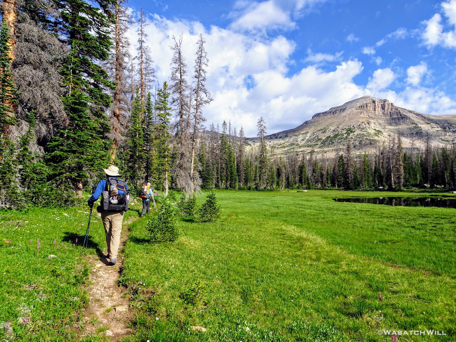
Shortly before reaching the confluence with the Highline Trail, we pulled over into a meadow to break for lunch.

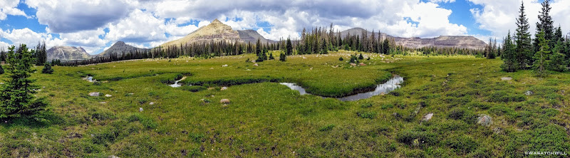
Green Meadow
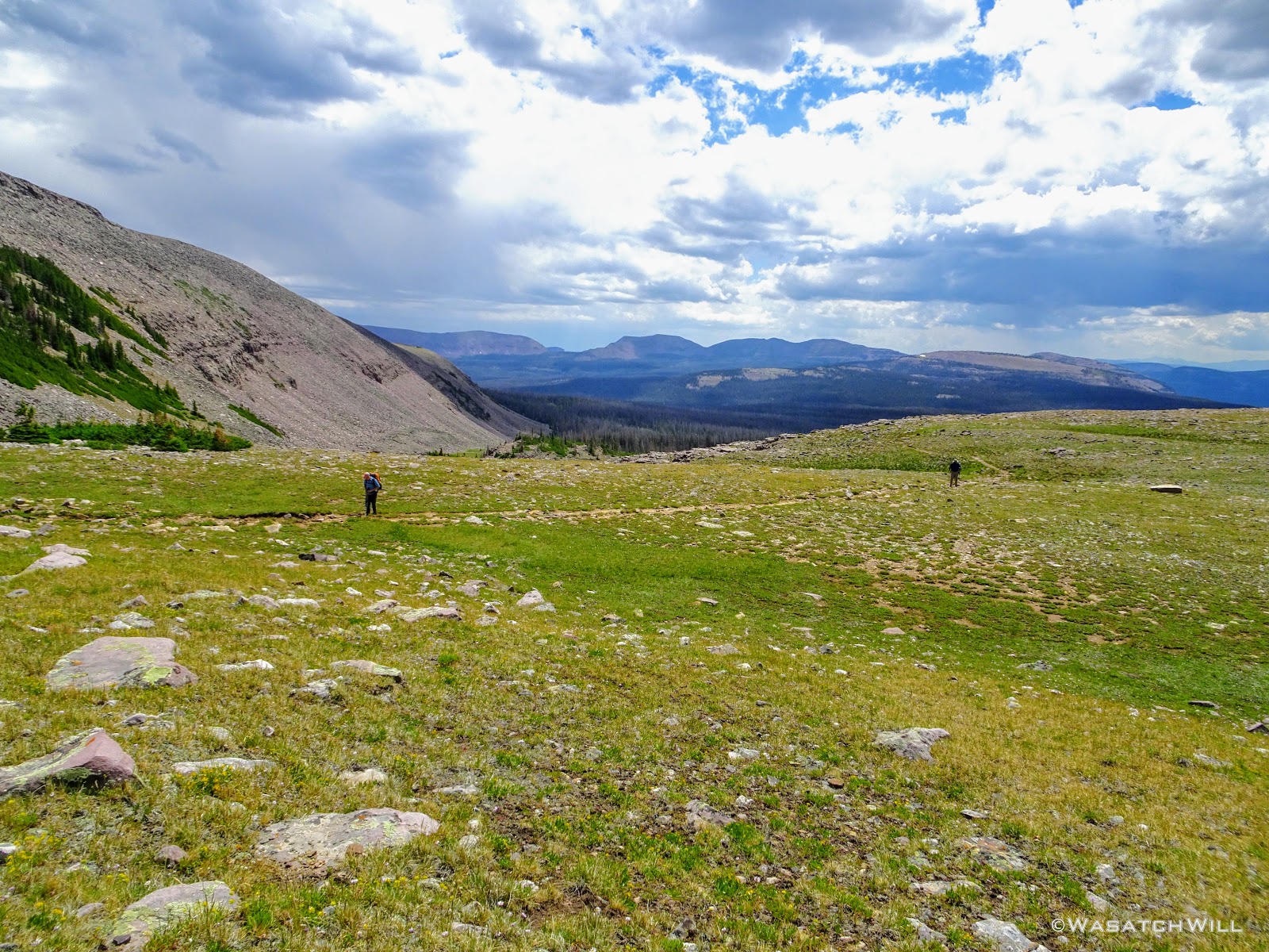
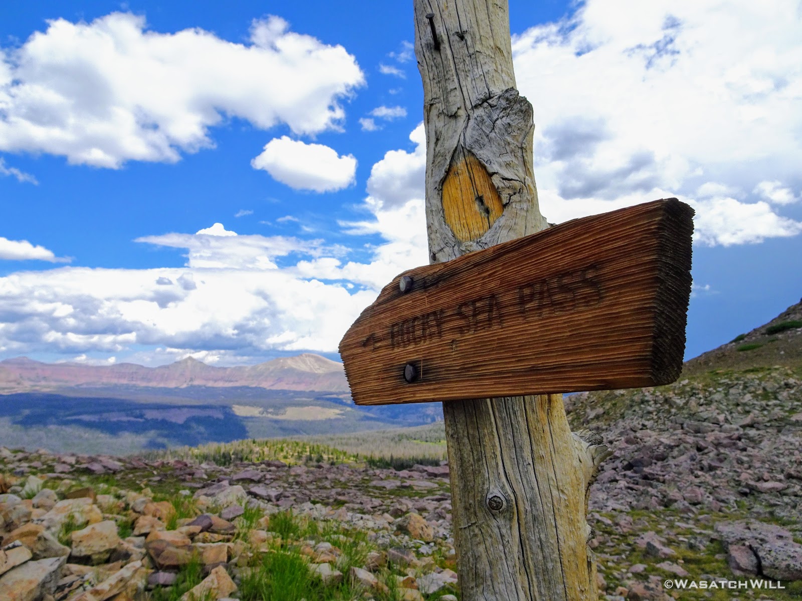
Once done with lunch, and back on trail, we found ourselves connecting with the Highline Trail just a few moments later. It was at this point that we reached a familiar trail, one I had already traveled in the past when I hiked a majority of the Highline Trail westward a couple years prior with friend, @Parma, and his brother. Once we arrived at Pigeon Milk Springs, we took the opportunity to retrieve some of the mineral rich water. Rocky Sea Pass loomed immediately after.
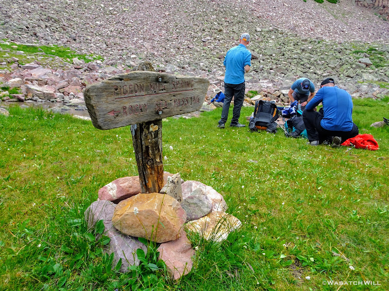
Retrieving water at Pigeon Milk Spring
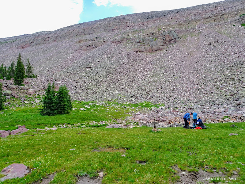
Pigeon Milk Spring at the base of Rocky Sea Pass
At this point, in looking ahead, skies were mostly blue. Looking behind from whence we came, clouds were gathering up and getting darker. We gauged the weather as best we could and decided we'd be good to go. So, up we went!
Heading up Rocky Sea Pass
Looking back at gathering clouds
Looking westward from trail up Rocky Sea Pass
Devin keeps it going up the pass

Looking back down trail with Subaru Josh on his way up

View of Mount Agassiz

Subaru Josh and Tim
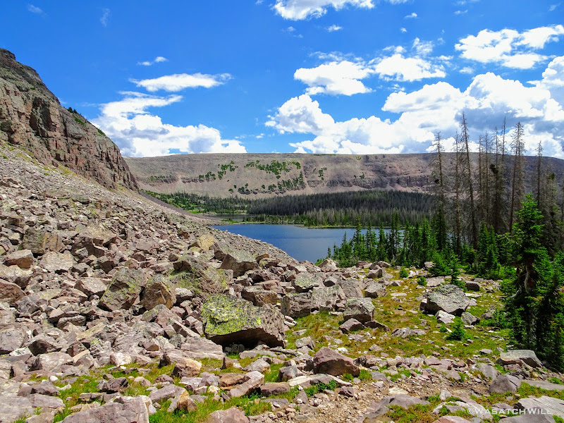
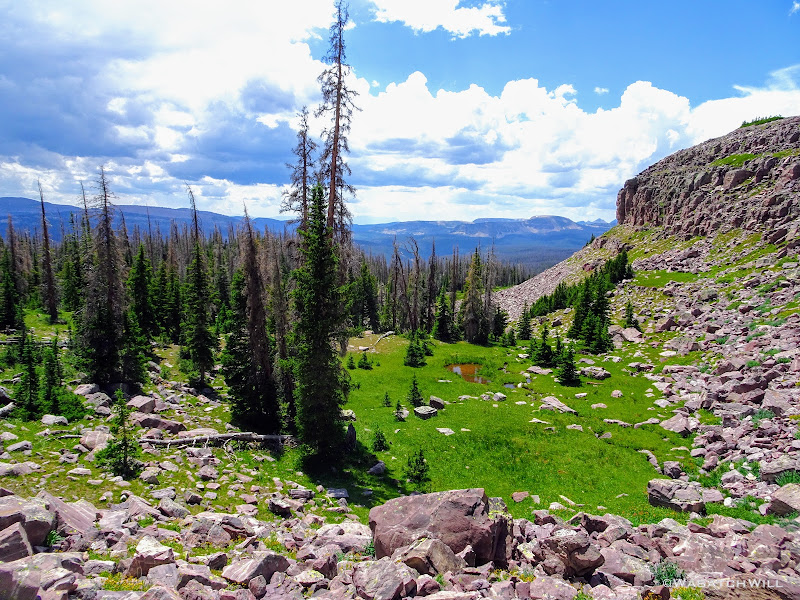
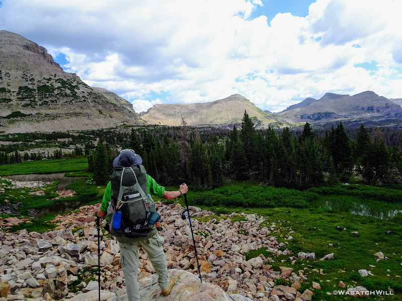
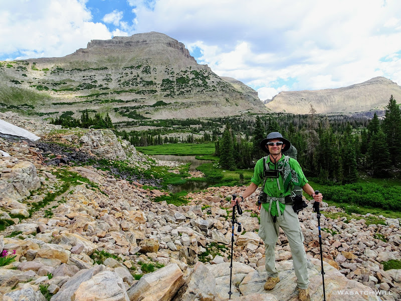
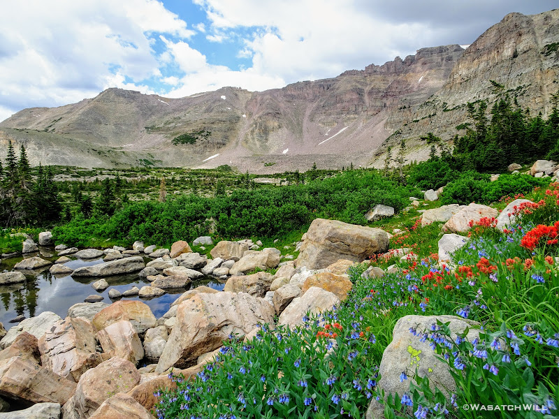
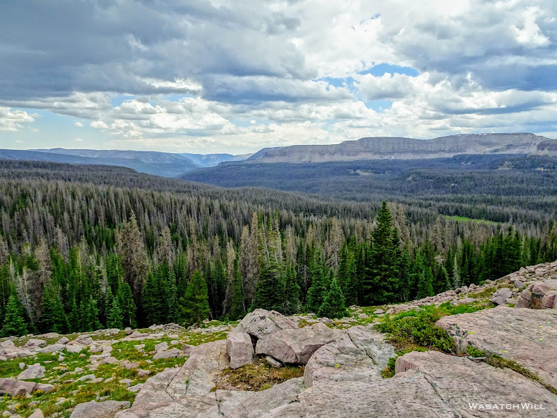
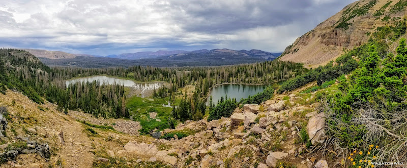
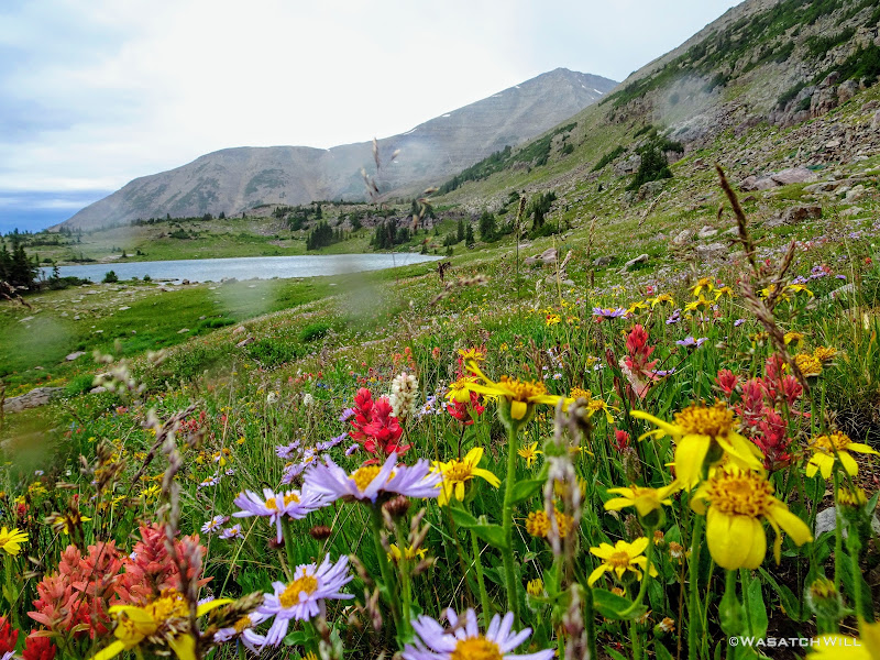
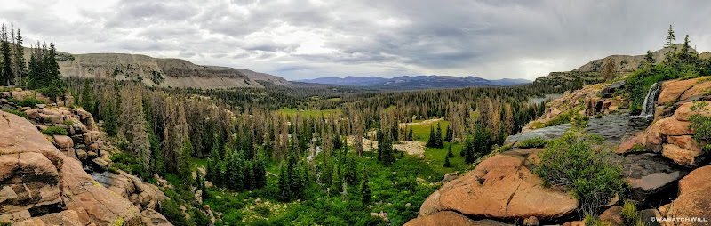
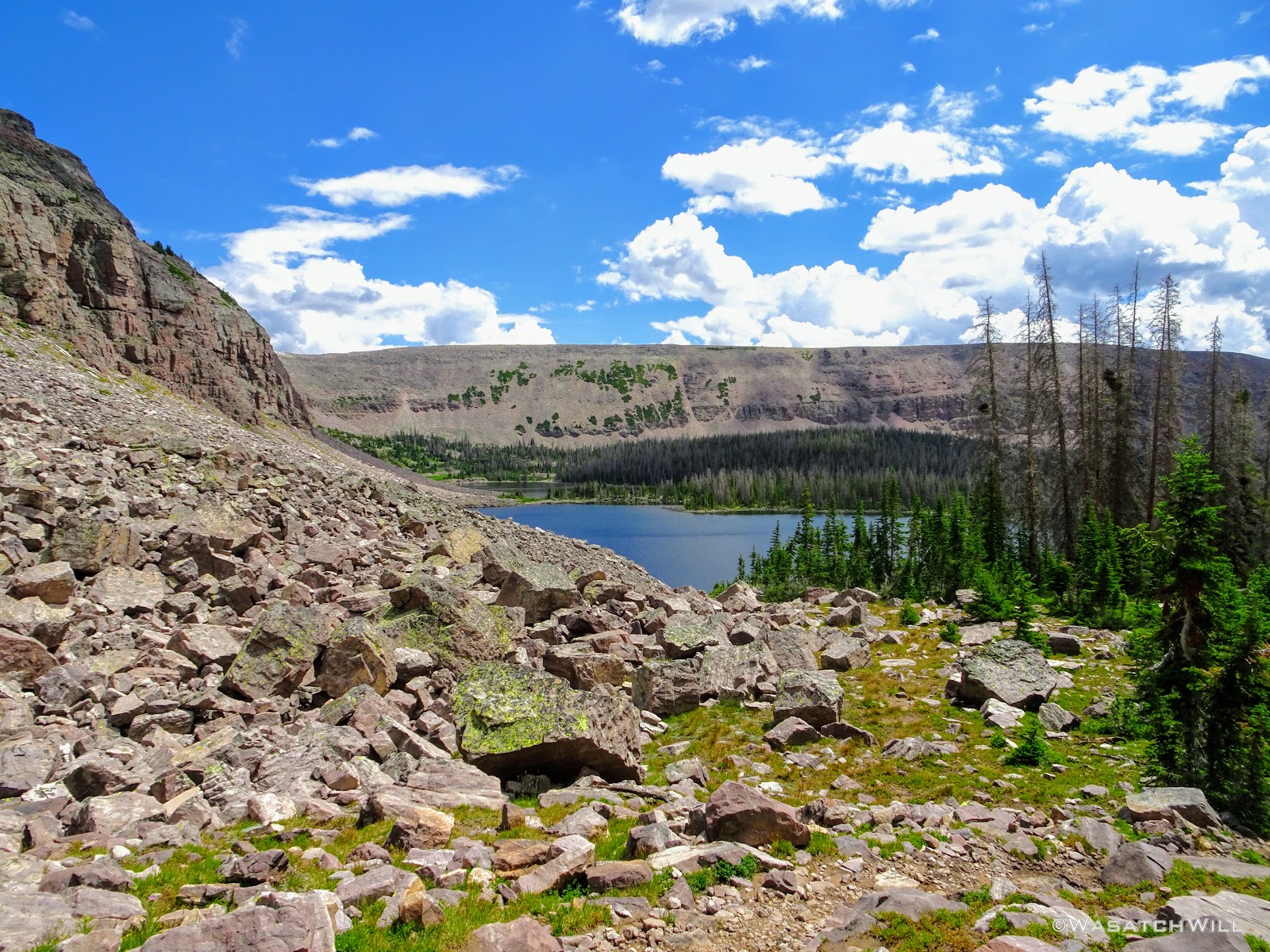
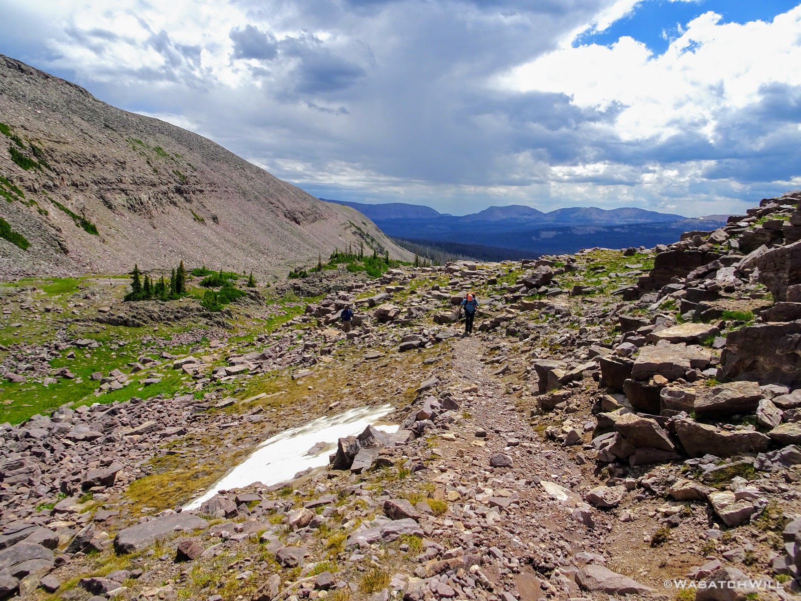
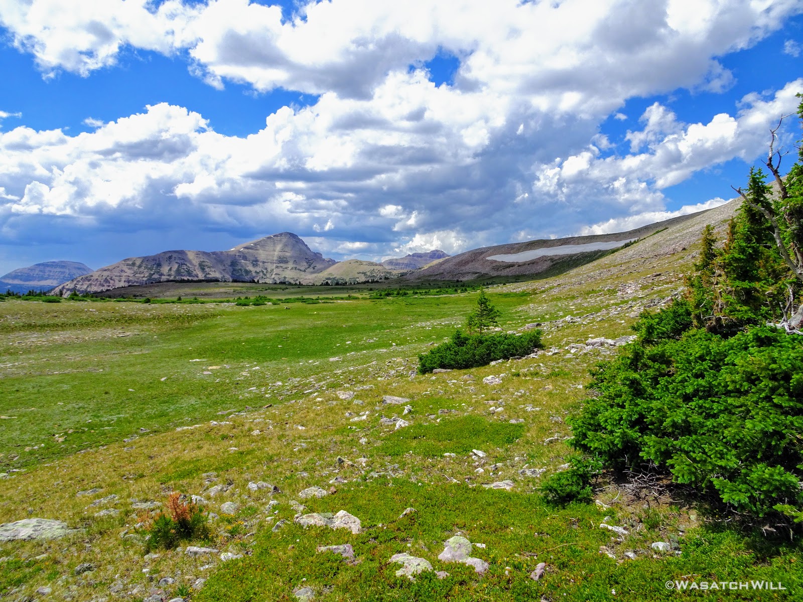
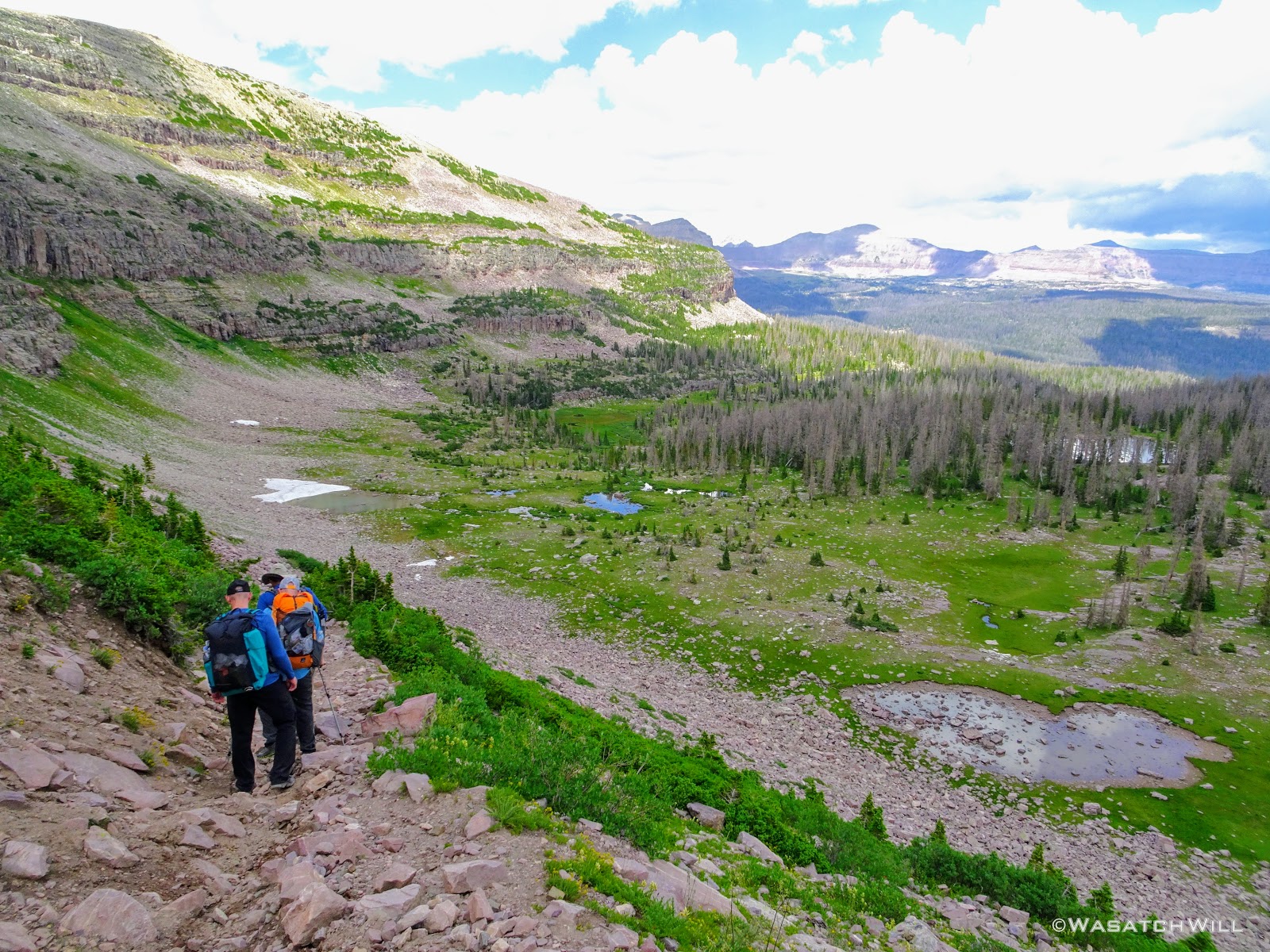
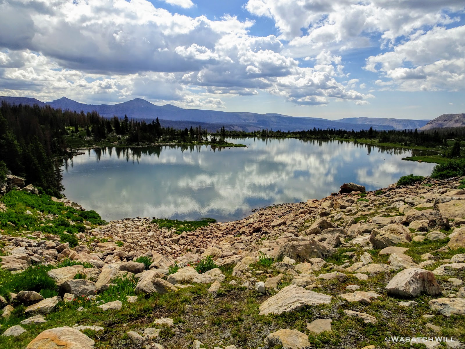
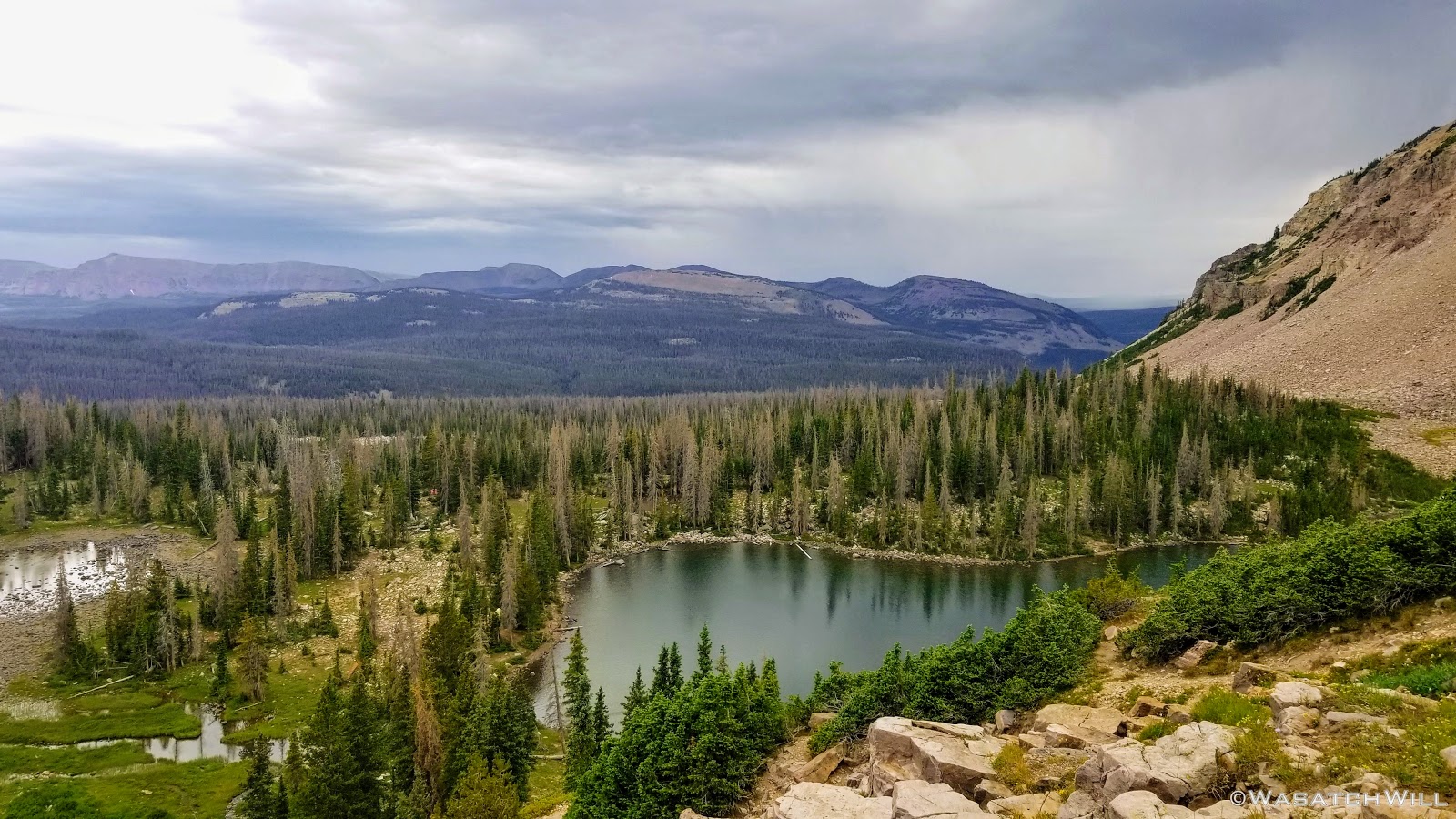
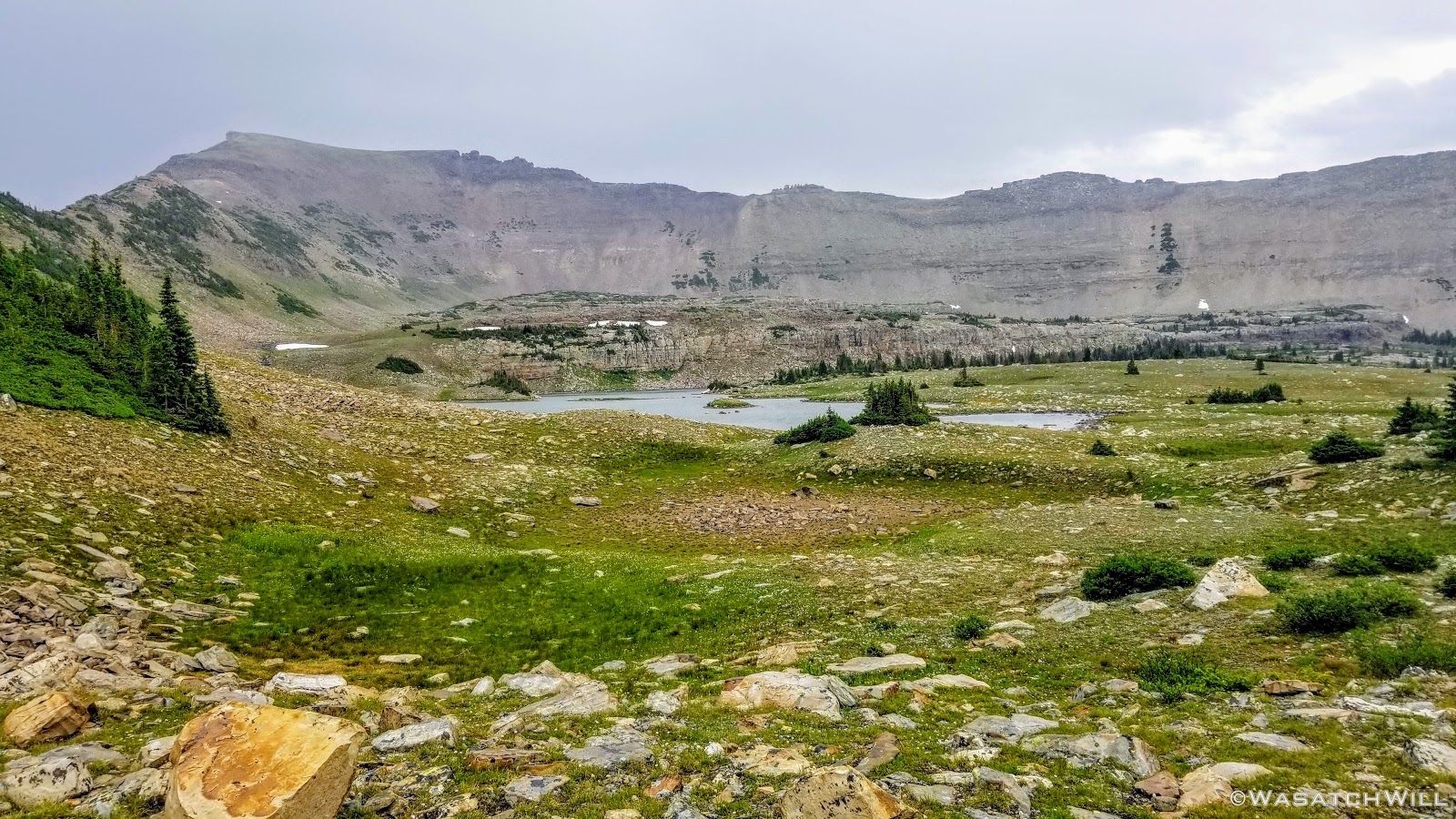
The greenery was glorious! In due time, we reached the top of the pass and took ample time to soak up the views, particularly down into Rock Creek Basin where we'd be spending the next two nights.

Rocky Sea Pass
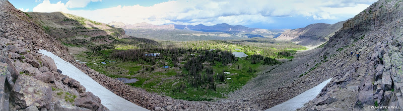
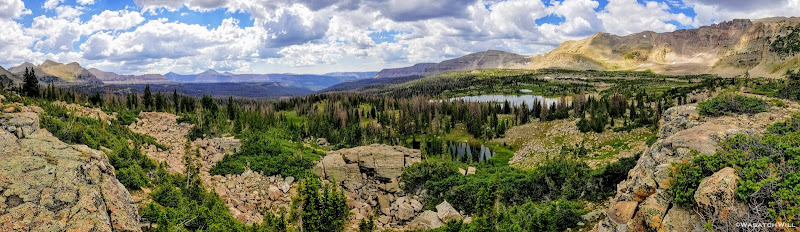
Pano view into Rock Creek Basin
So as to not give weather any more time to make us regret the stay, we trotted on down off the pass.
Descending Rocky Sea Pass

Karate Josh and Subaru Josh continue the descent
Thistle

Indian Paintbrush
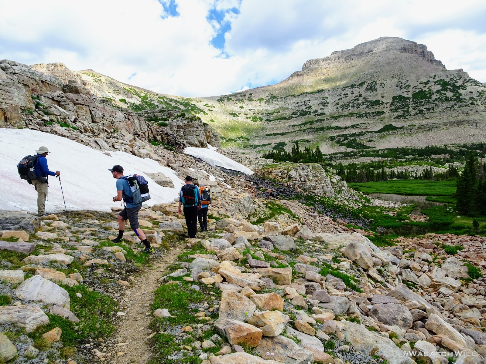
Once off the pass, it was tempting to start looking for a place to camp right away, but since it wasn't that late into the day yet, we chose to move down the trail a little further and look for site in the neighborhood of the Brinkley and Brinkly Lakes.

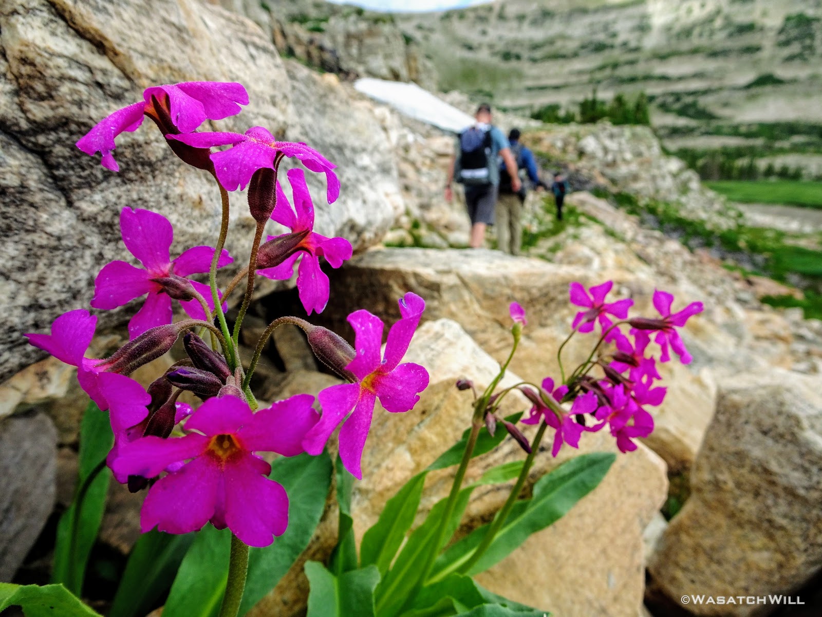
Myself pausing for a view across a tarn (credit: Josh Herod)
Karate Josh and Subaru Josh with Devin and Time further behind
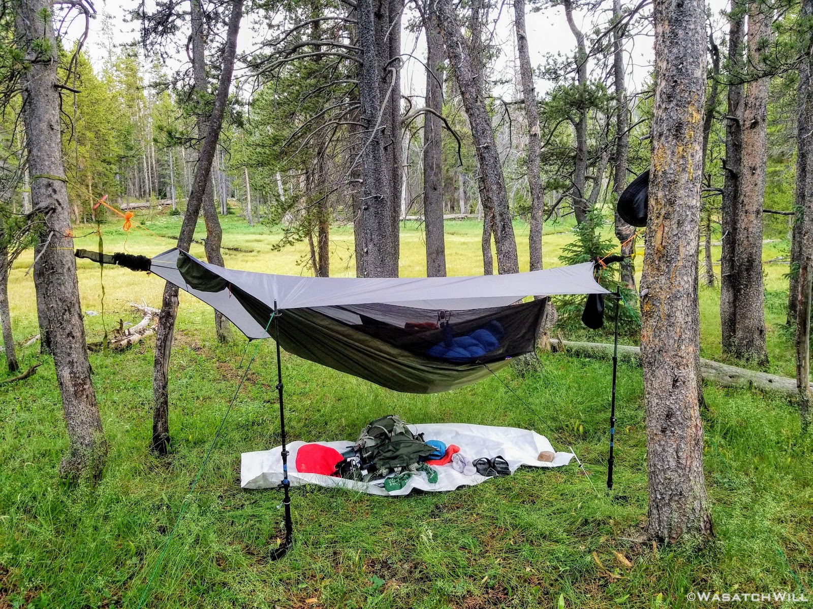
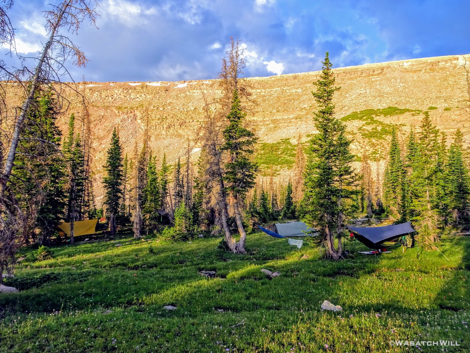
As we approached the lakes, we got showered on a bit with some light rain and hail, but it didn't stick around long. Once we arrived at Brinkley Lake we began to scout around for a suitable site. Three of us had brought hammocks and two of us had brought tents. Unfortunately, many sections of the Uintas have had their trees devastated by a beetle infestation over the years and this was one of those areas. It proved too difficult to find a spot nearby with enough healthy trees in safe spots (sans widow-makers) for 3 different hammocks to be hung in close proximity.
Ultimately, Tim and Karate Josh sacrificed a night in their hammocks and settled on cramming in with Subaru Josh for the night. The tent Subaru Josh had packed along was a Tarptent Rainshadow 3. It was actually Tim's tent, a new one he had just recently got for nights out with his own family, but Subaru Josh had recently decided he has a preference for tents over hammocks and given the lightweight and spacious properties, it was a prime opportunity to take Tim's new tent out for a spin himself.
Fortunately, it was designed as a 3 man shelter and it was indeed just big enough to accommodate all of them with virtually no room to spare. As for me, I was able to spare myself from going to ground by finding a lone pair of trees that worked out just fine for my hammock.
Day Two Camp
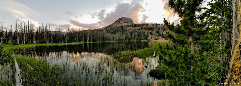
Now that camp was all set up, we took a short stroll over to neighboring Brinkly Lake to enjoy the the evening's reflection.
Brinkly Lake with Priord Peak and South Yard Peak on horizon

Brinkly Lake with Priord Peak (middle) in view

Brinkly Lake pano
We all returned to camp to laze about and have some dinner. Thereafter, I went back out to the lake to catch more reflection shots, this time with some colorful clouds as the sun was setting in the other direction.
Evening reflection looking east across Brinkly Lake
Evening reflection on Brinkly Lake
Rock intruding on reflection on Brinkly Lake
Before returning to camp and settling in for the night, I made a quick visit to nearby Brinkley Lake -- the 'e' before the 'y' is important here as it distinguishes to the two side by side lakes, Brinkley and Brinkly.
Sunset at Brinkley Lake
Brinkley Lake pano
Day 3
Friday - July 13, 2018
Once again we were treated to mostly clear blue skies as we awoke for day three. I returned back to Brinkley Lake to check out the morning's reflection.
Morning at Brinkley Lake
Back across camp and looking out over Brinkly Lake, some evaporative fog danced across the surface of the lake giving the morning an enchanted feel to it.
Karate Josh greets the sun at Brinkly Lake
South Yard Peak above foggy Brinkly Lake
Once again, we got back on trail after breaking camp. This day's journey would take us up along the Head of Rock Creek Trail on the upper bench around, well...the head of Rock Creek Basin. For the rest of the morning, we'd be back on a stretch of trail I had not hiked before. I was excited to see what the views at Rosalie and Gladys Lakes were like as we made our way around.
Tim trots along trail with Subaru Josh ahead
Karate Josh and Devin take in a view from along the trail
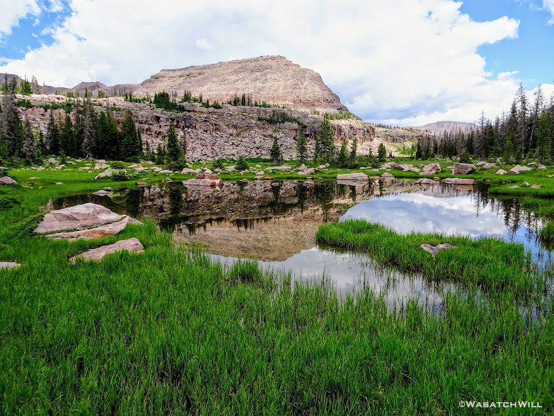
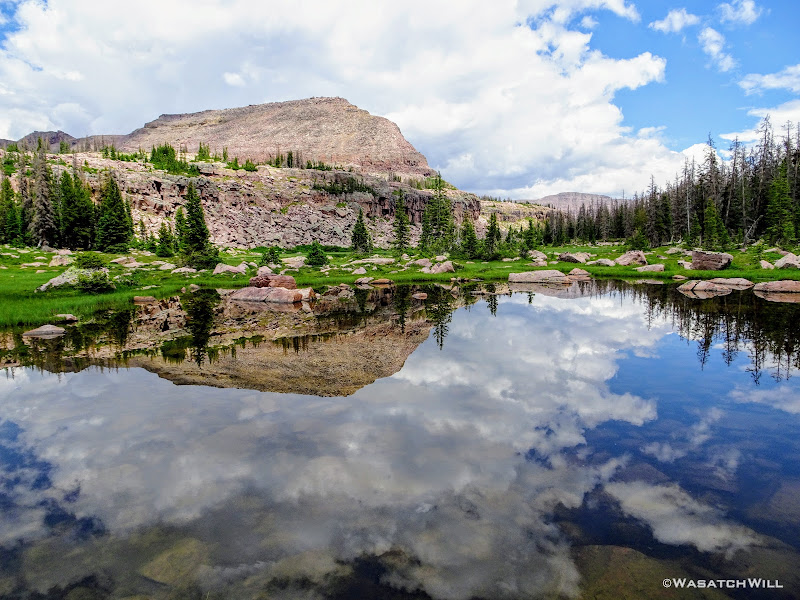
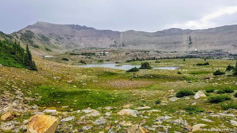
The views did not disappoint. Rosalie Lake was gorgeous!

Rosalie Lake
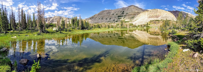
Rosalie Lake Pano
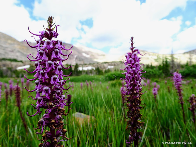
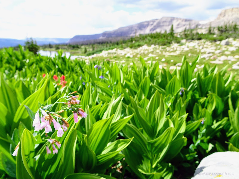
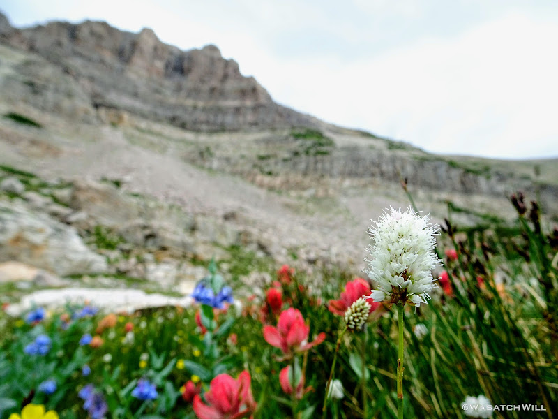
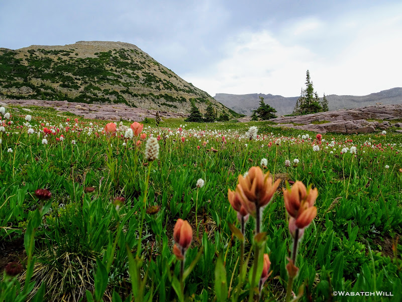
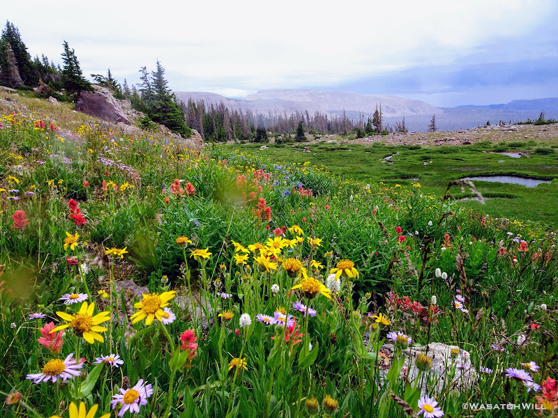
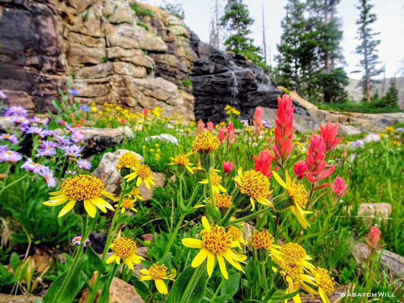
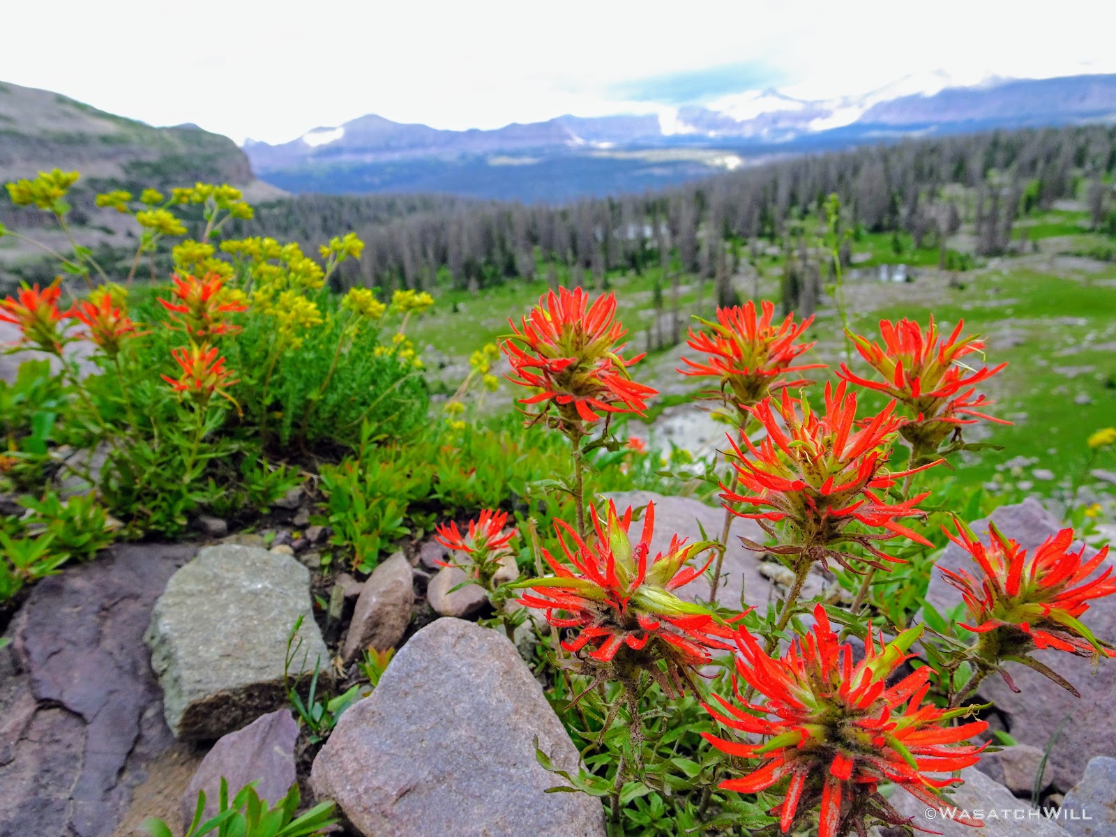
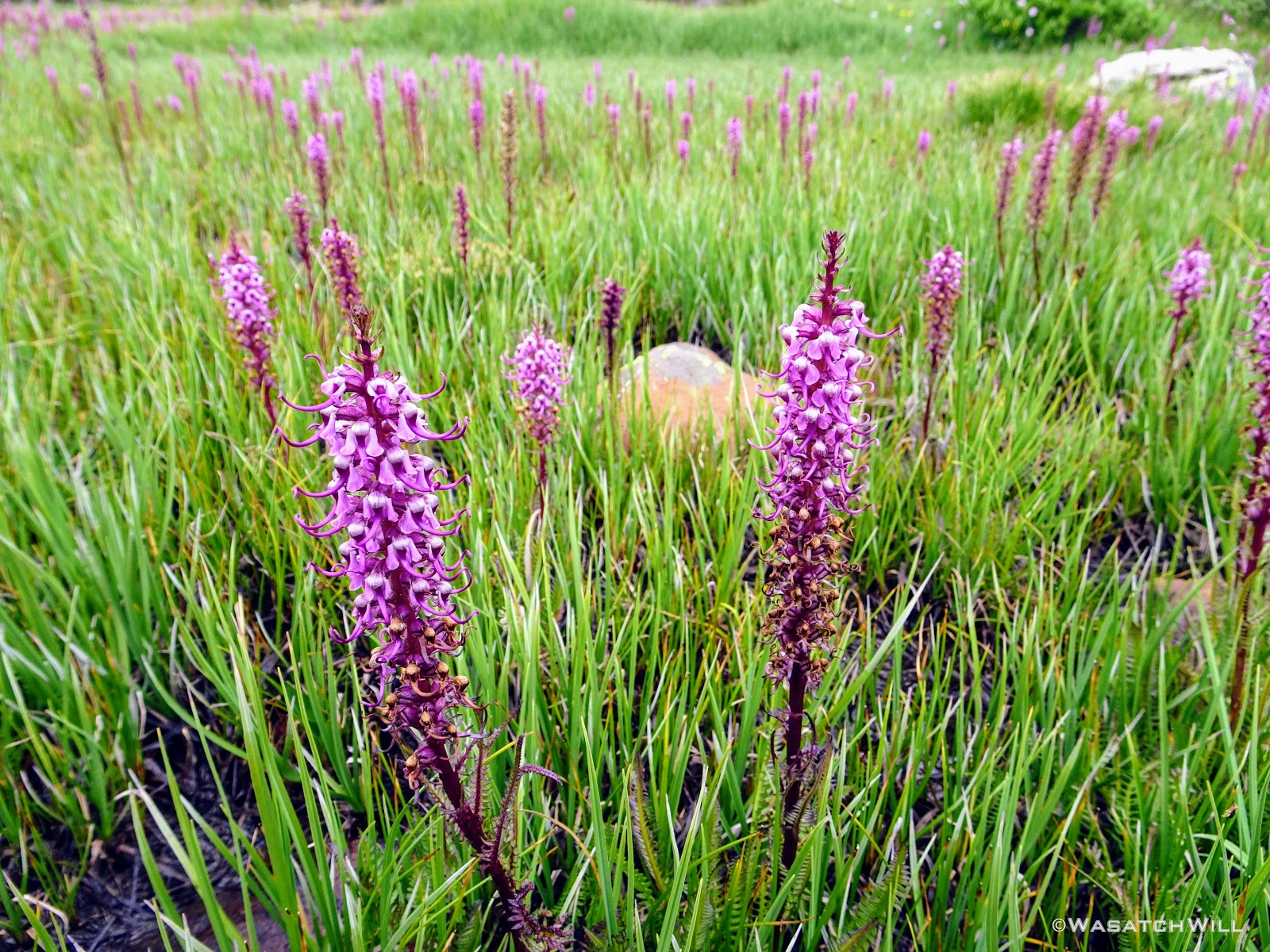
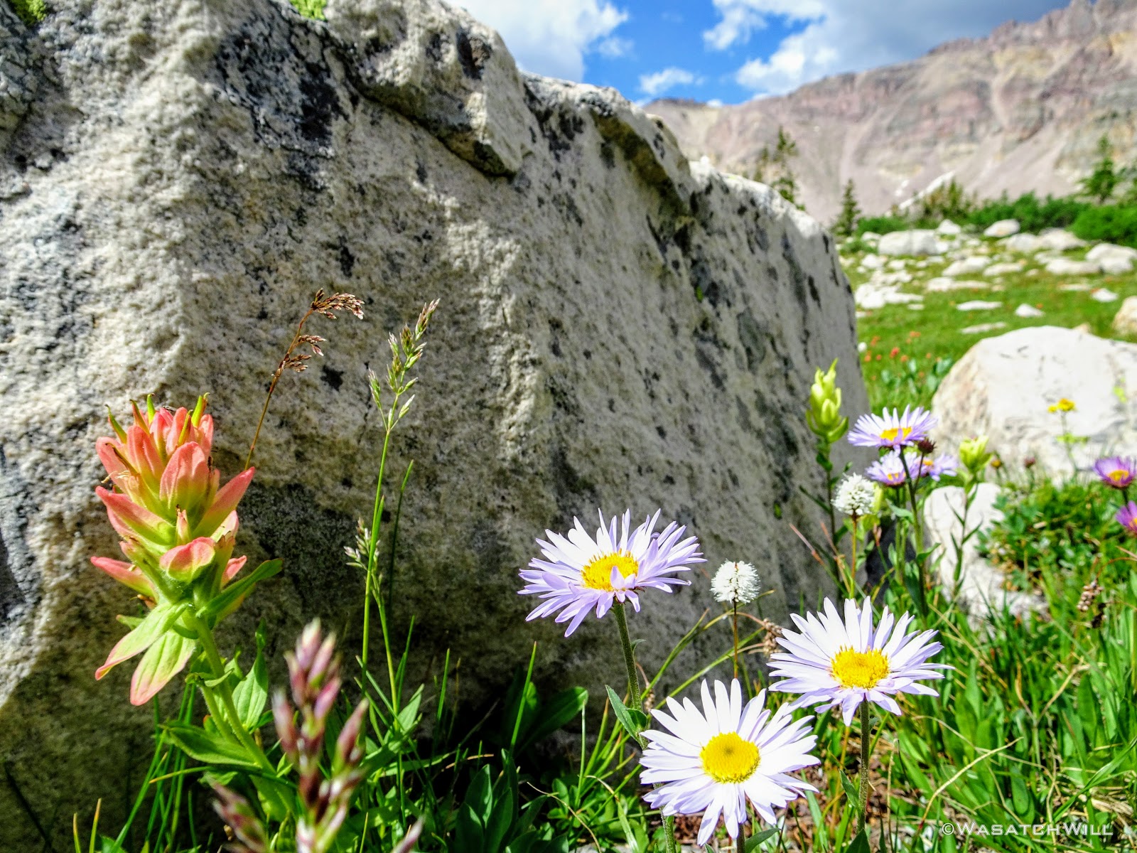
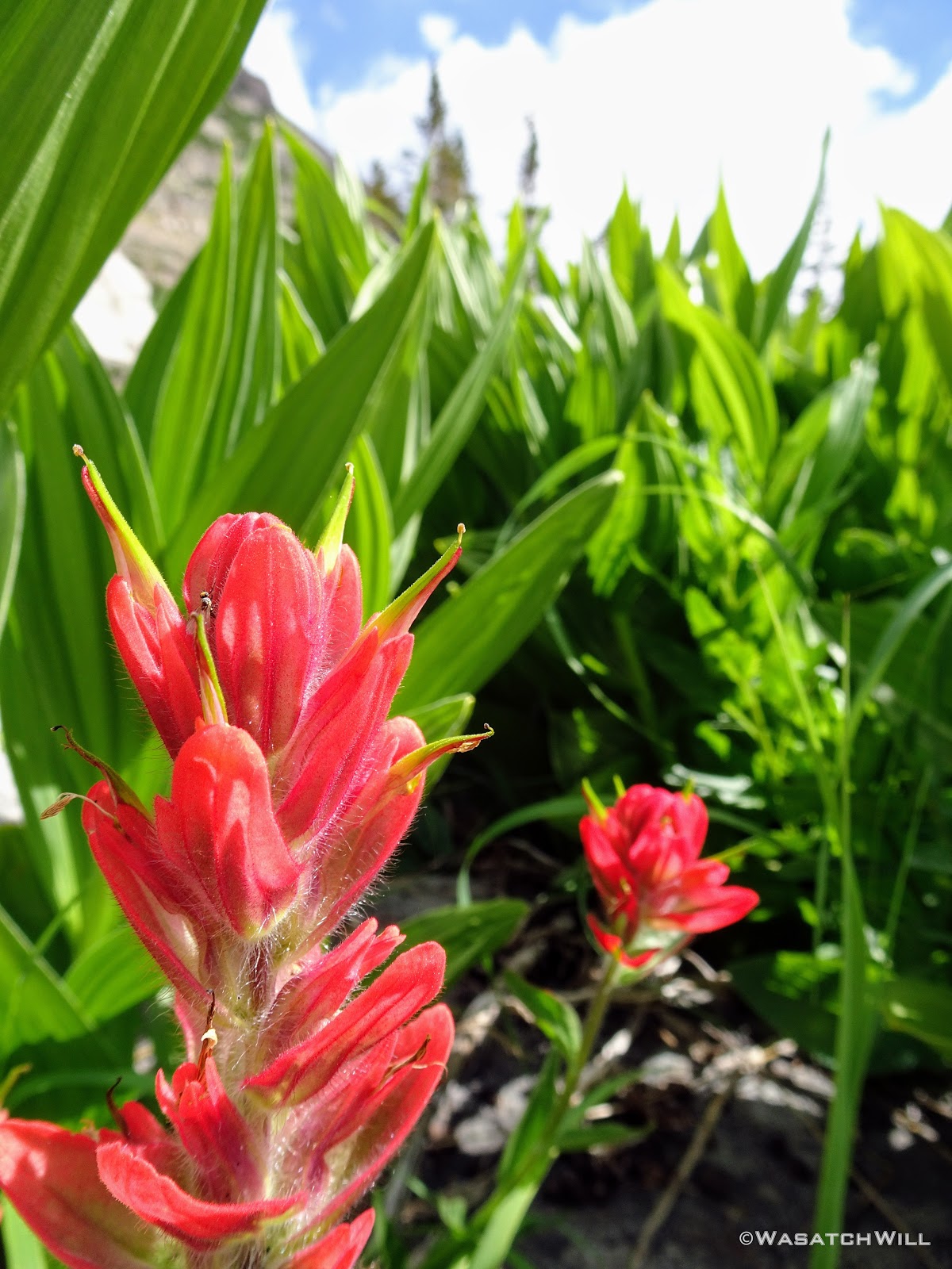
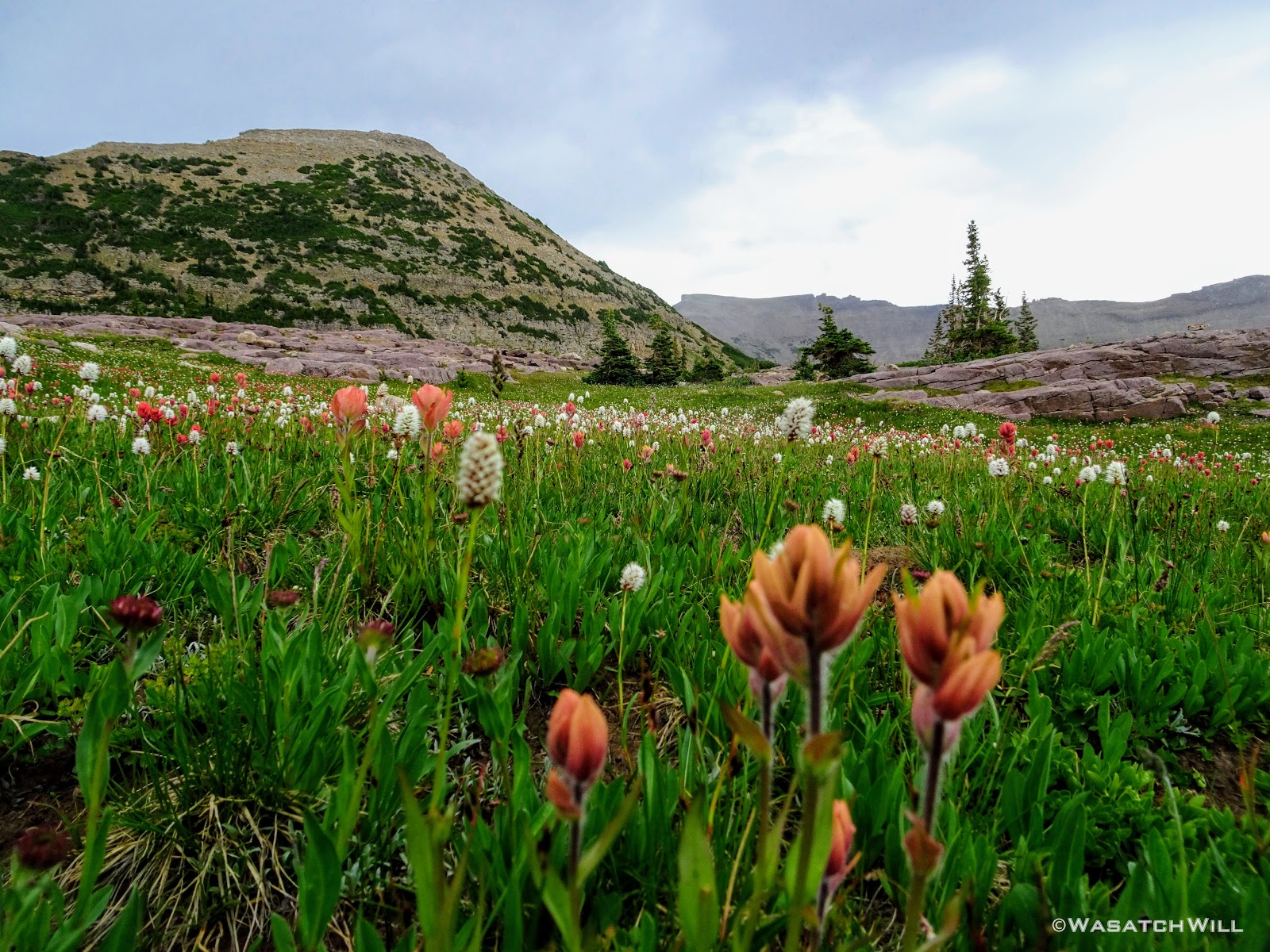
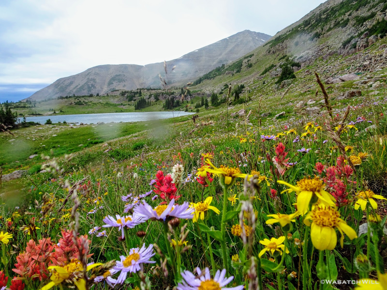
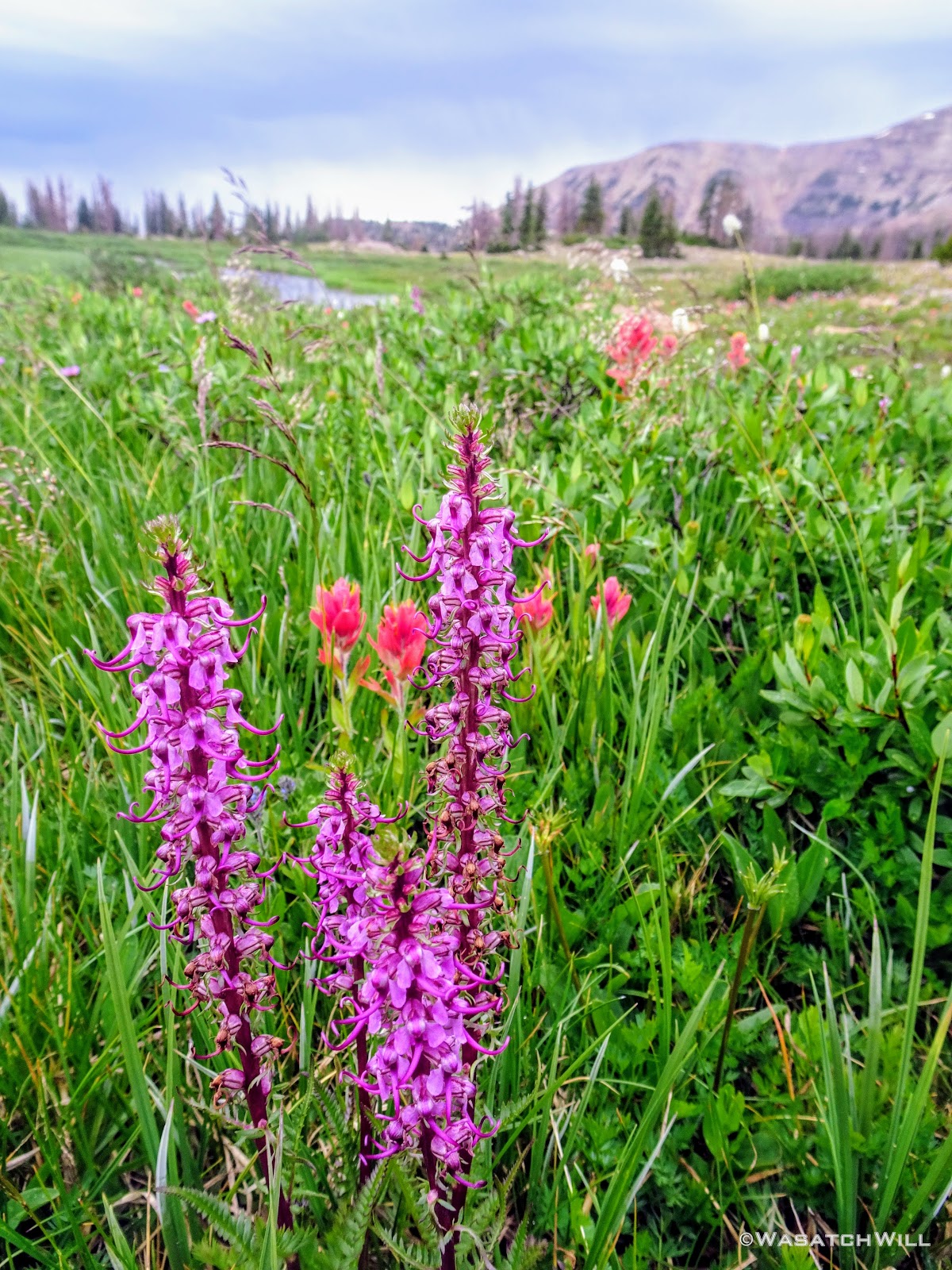
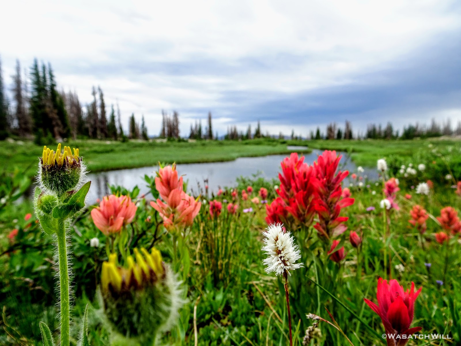
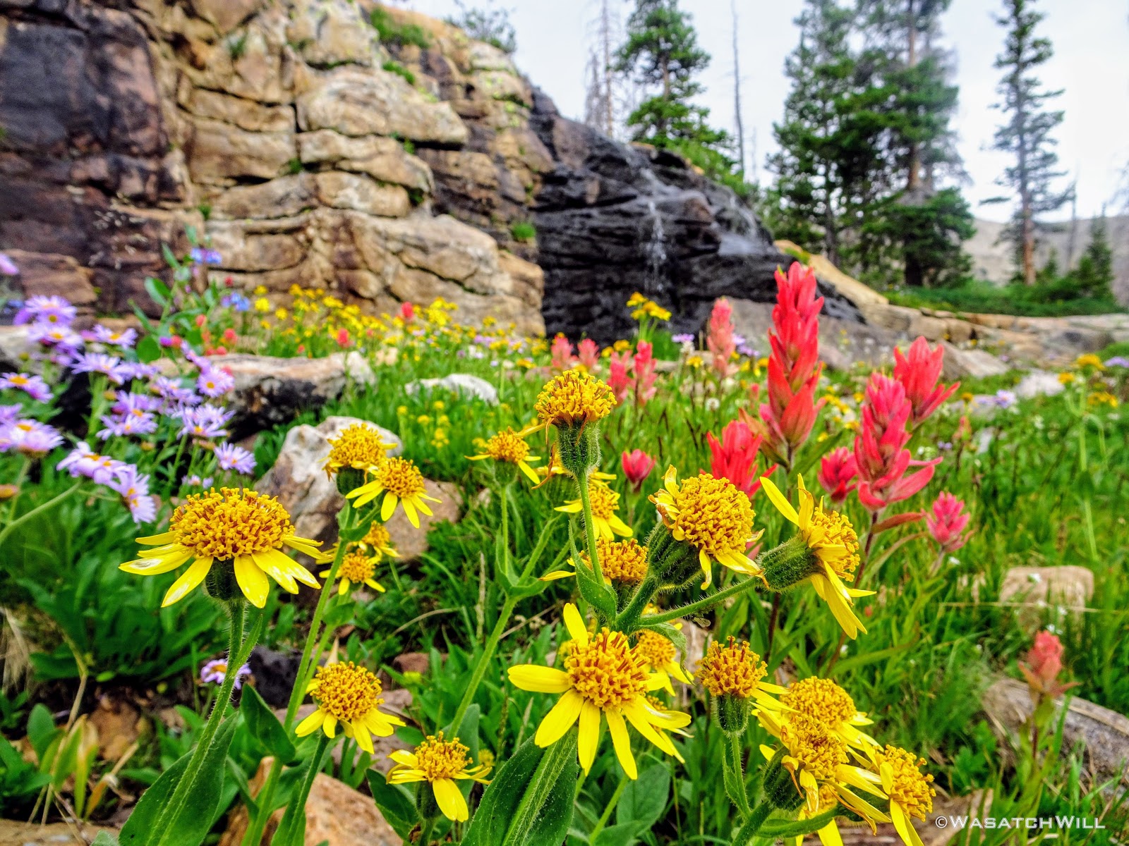
And then there were the flowers. Up along this bench, it was like flower bombs had exploded all over the place. There were Elephant Heads, Primrose, Indian Paintbrush, Daisies, Bluebells, and so on! At times it felt like we were walking through a rainbow with the variety of colors there were.
'Elephant Head Meadow' with Spread Eagle Peak above
Elephant Head flowers close up

Elephant Heads

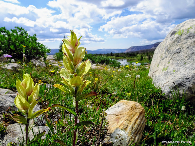
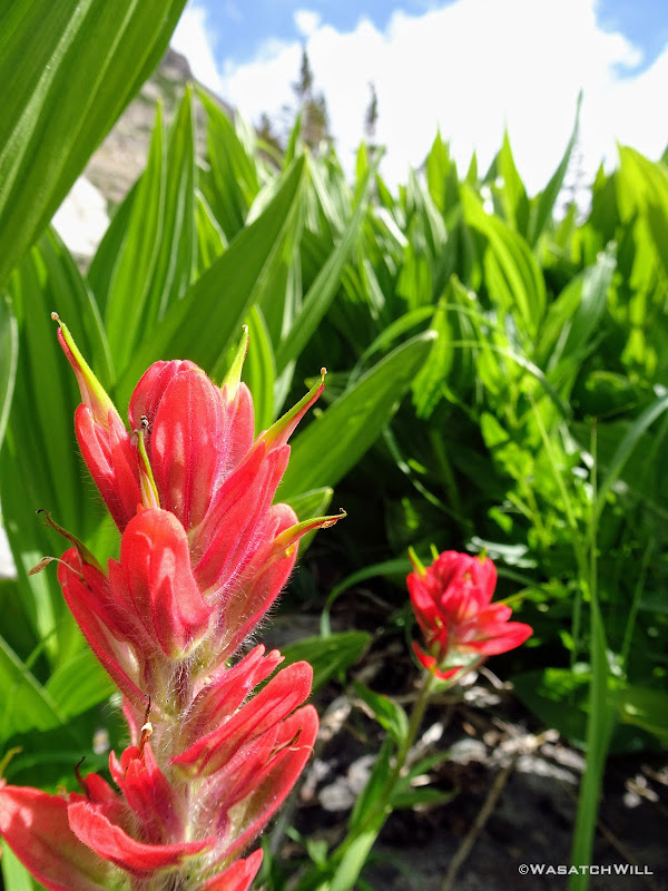
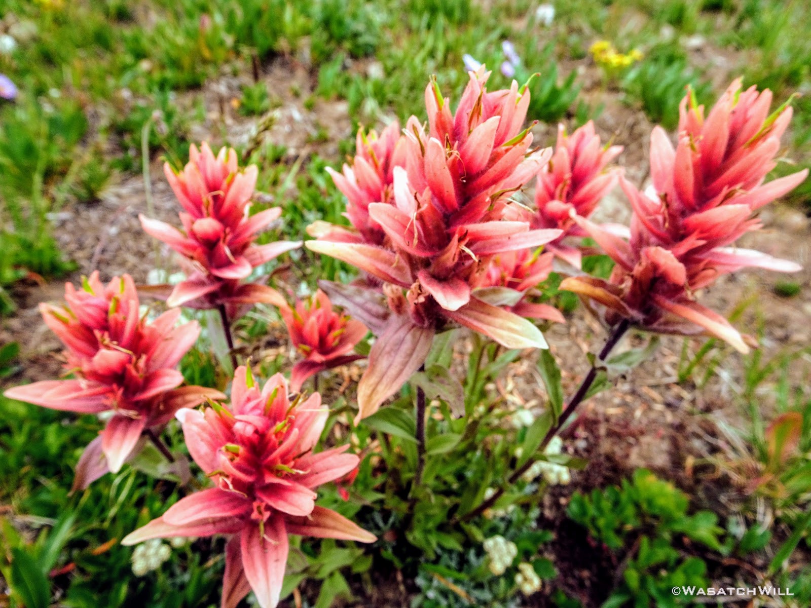
Indian Paintbrush
Between Rosalie Lake and Gladys Lake, we encountered a lingering snow bank just off trail. The urge to pause for a brief snowball fight and a bit of glissading could not be resisted. Fun was had!
Time for fun in the snow
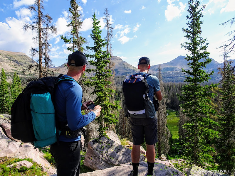
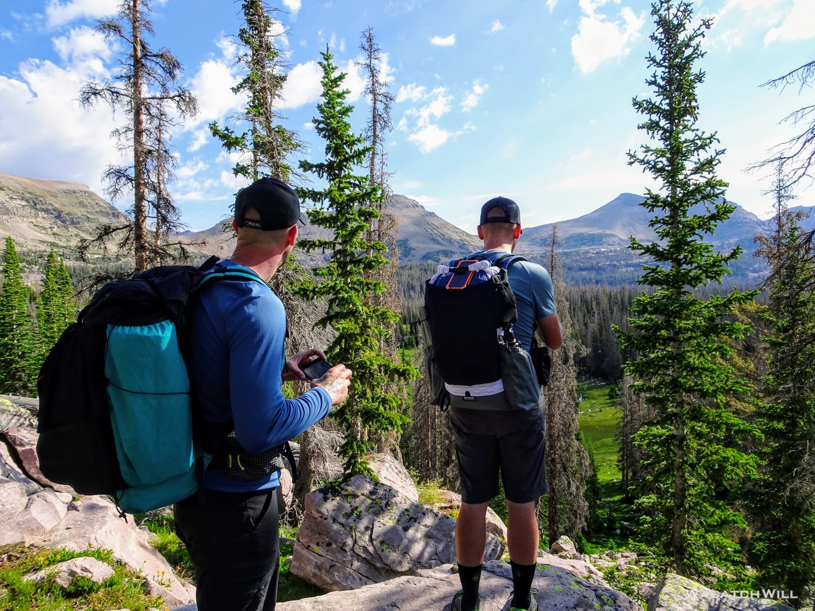
All along the bench, there were great views to be had out across the basin.
Myself checking out the view across the basin (credit: Tim Watson)
Front view of myself (credit: Tim Watson)

Parry Primrose flowers with Devin and Tim beyond
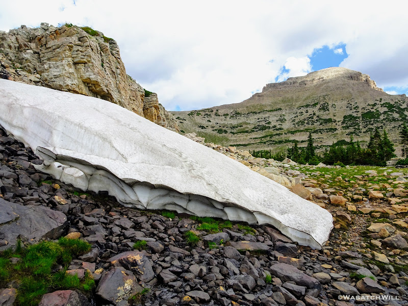
Snowbank
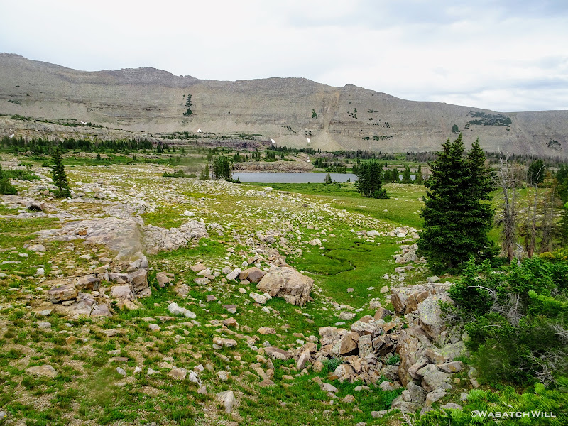
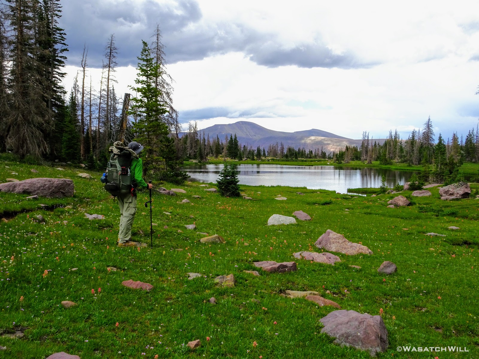
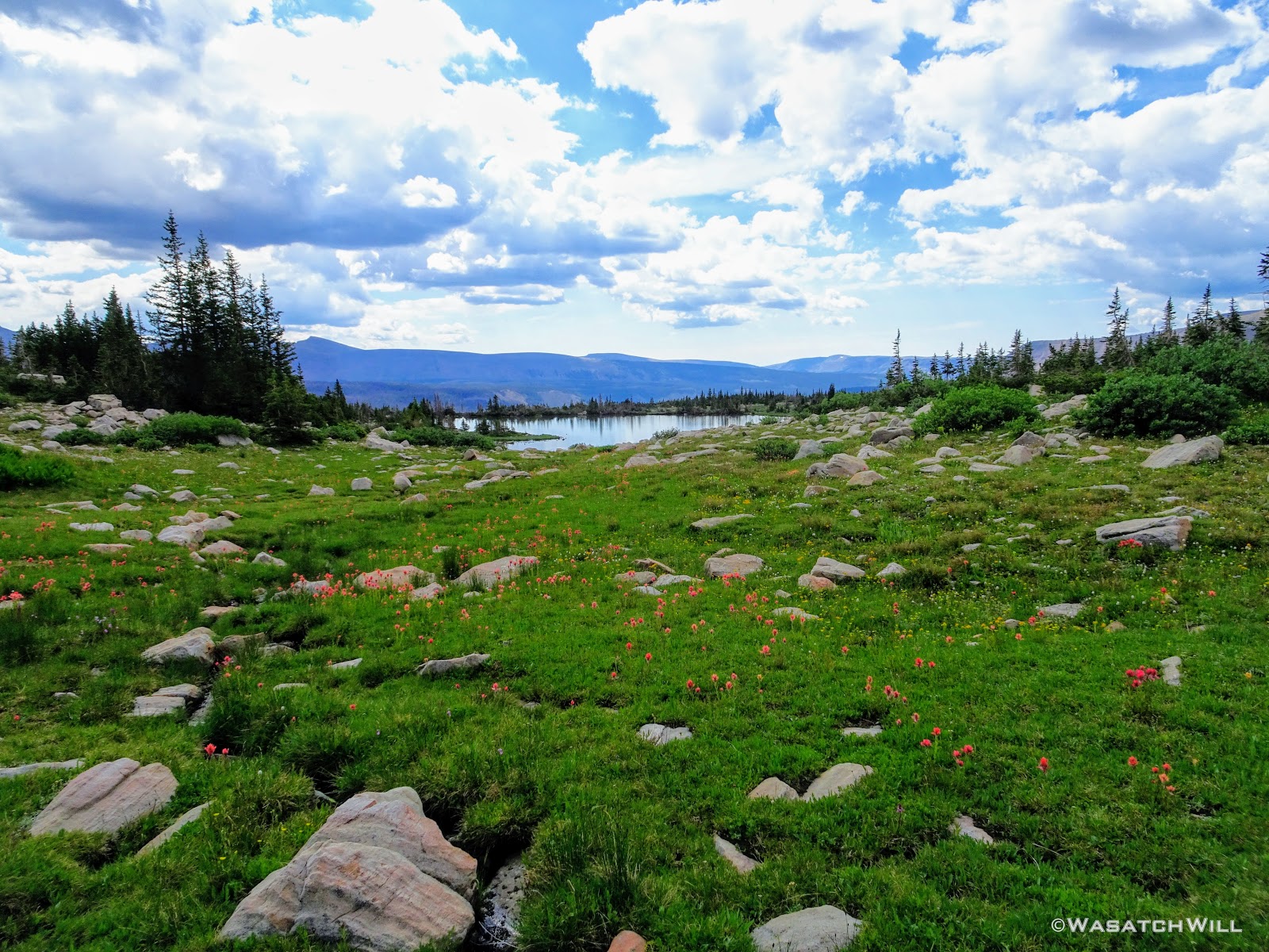
The flowers continued to roll out before us as we rounded around Gladys Lake and continued north and west until we reached Helen Lake at the head of the basin.

Gladys Lake in the distance

Gladys Lake
Yellow Indian Paintbrush

Paintbrush and Daisies
Up close Paintbrush among Corn Lillies
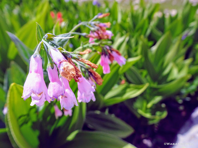
Bluebells
Bluebells and Corn Lillies
Flowers, boulders, and watery reflection
Gladys Lake Pano
Getting closer to Helen Lake
A white Bistort flower among Bluebells and Paintbrush
As we came into a view of Helen Lake, we agreed it was a good area to put the brakes on and pull over for lunch.

Helen Lake comes into view
And so we did, with a fantastic view of the lake out below. Many a fishermen were spied upon as we exercised our palates.
Lunch and a view
Refueled and recharged, we commenced the second half of the day. We'd drop down between Helen and Lightning Lake and keep to the east before turning south as we continued to follow the upper benches around the other side of the basin. From this point onward for the next few miles, we'd be once again traveling trail that was familiar to me.
Tim on the trail between Helen Lake and Lightning Lake

Looking southward down into the basin
Karate Josh, Subaru Josh, and Tim on the trail with Ostler Peak behind them
Rock Creek Basin overlook
Along the way, we'd pass by the point where shelter was taken from an afternoon thunderstorm last time I was in these parts. It was also the point I'd left behind my prescription Oakley sunglasses that I ended up running back over a mile (+ two round trip) to retrieve them.
This the view from about the point I left my sunglasses behind on my last trip through here
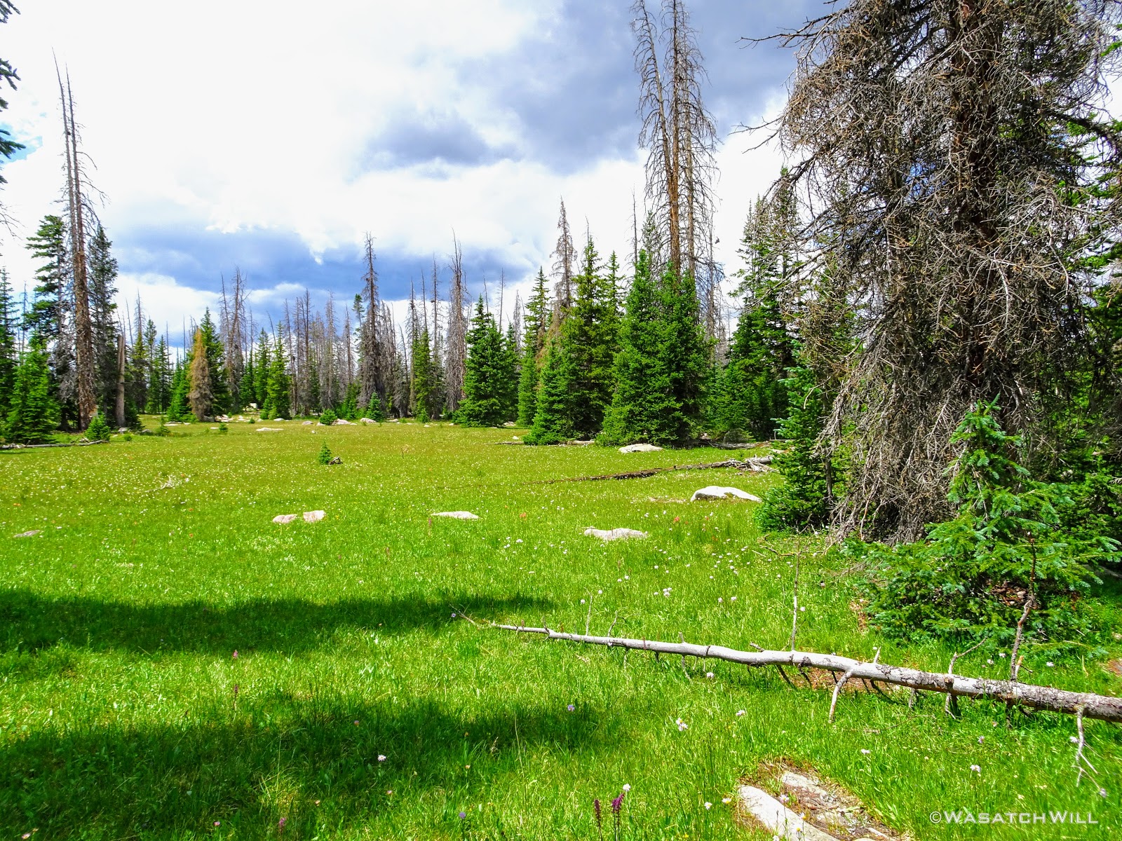
Moving on, we passed through the eastern bench's meadows. They were every bit as big and expansive as I remembered them being, though much greener this time around.
Massive meadows on east bench
Subaru Josh and Tim add some perspective
East meadows pano
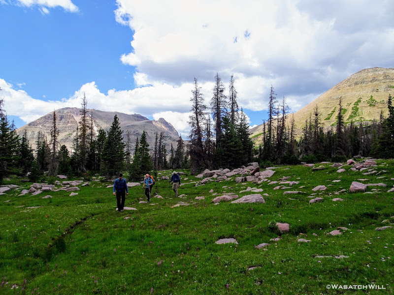
The gang moves ahead
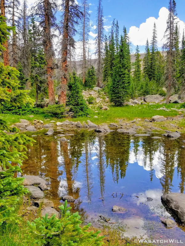
Shortly before joining back up with the Highline Trail proper, I snuck off trail to check out another reflection across a beautiful tarn while the others continued ahead.
Beautiful Tarn
Up close reflection
Right at the junction with the Highline, I rejoined the guys where they had pulled over for another good rest. At this point Suburu Josh's knee was flaring up and starting to bother him quite a bit. Devin, being trained in not only wilderness first-aid, but as a wilderness first responder, spared no expense in getting Josh taped up with some knee support and prescribed a generous dose of vitamin I.
This rest point also marked the furthest we'd get from the trailhead from which we started and which we'd be returning to. From here, we'd officially be making our return back to the trailhead.
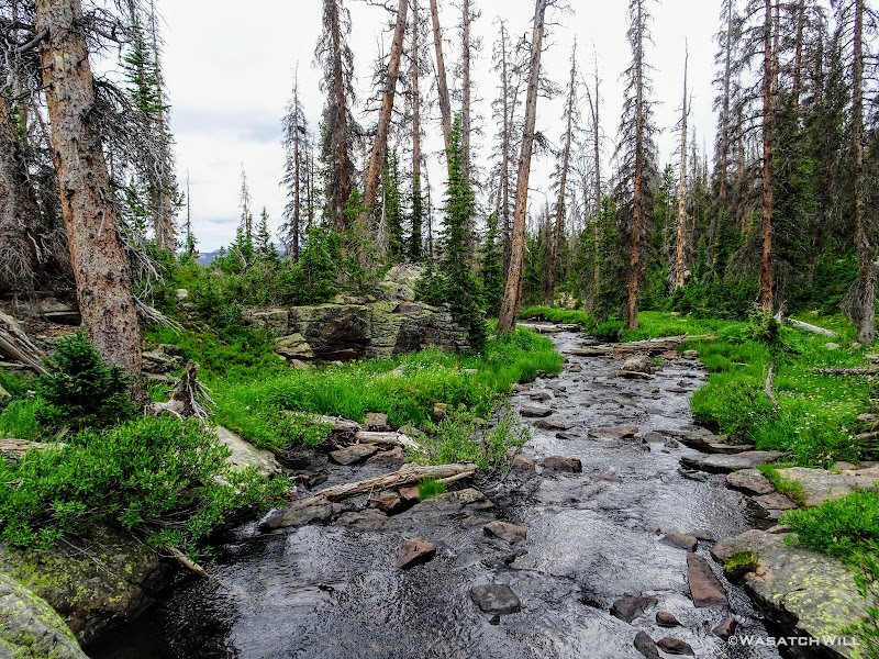
Keeping to the Highline again, we now headed westward, and once again, back on a new section of trail for me, having bypassed this section of the Highline in favor of the more scenic bench up to Helen Lake last time I passed through the area. We'd also lose quite a bit of elevation to get across Rock Creek, only to gain most of it all back again before searching out a camp in an area we desired closer to Rocky Sea Pass. It remained to be seen how Josh's knee would respond to the treatment.
Not sure what Subaru Josh, Tim, and Devin were looking at
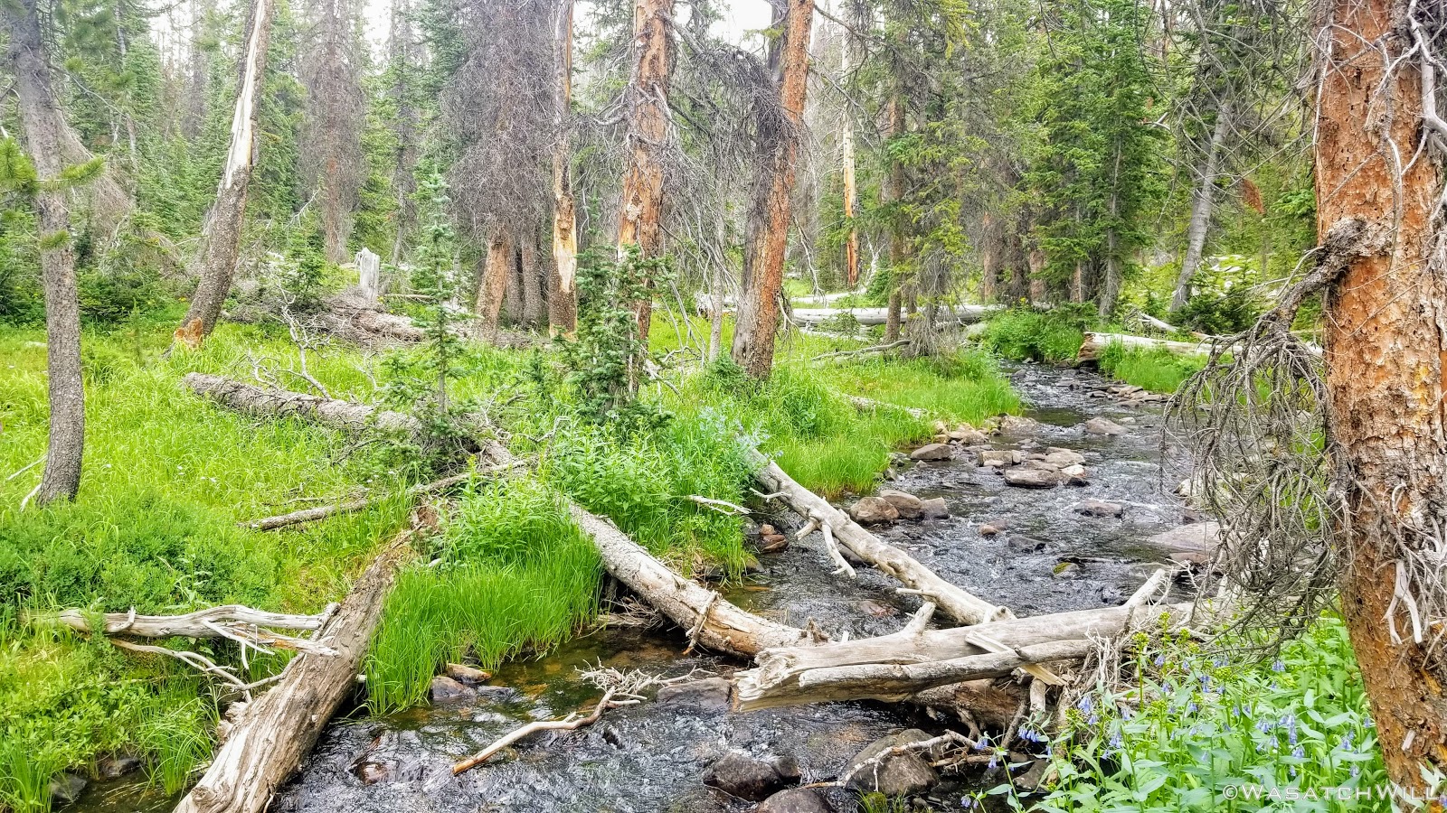
Small waterfall along tributary of Rock Creek
We all made it down to Rock Creek rather swiftly and without incident.
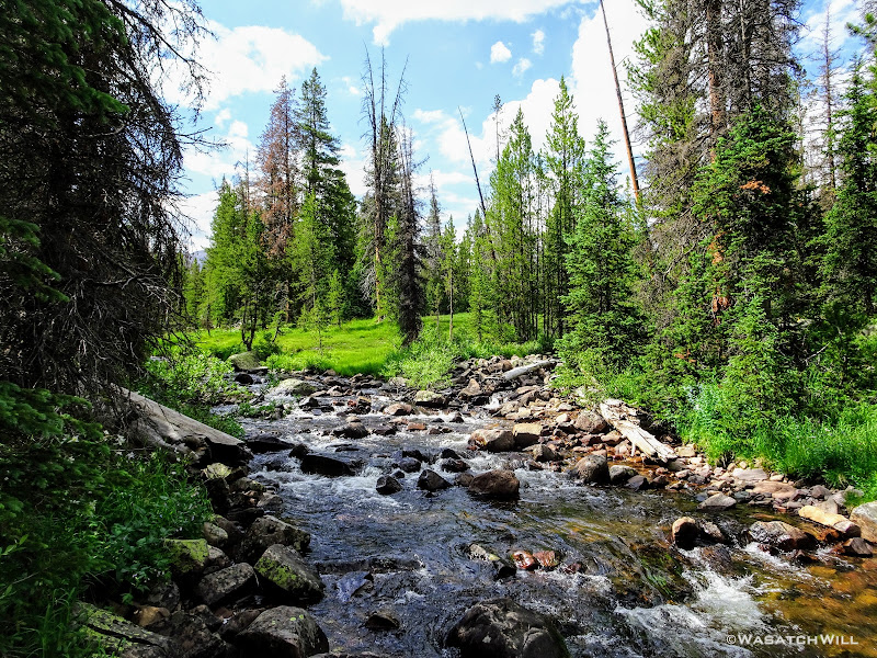
Rock Creek
Getting across the creek was another matter. I pioneered the crossing, carefully using my poles as I navigated across a narrow log and some rocks that proved to be a bit more of an obstacle course. I then coached a few others across, but it was all enough to make Subaru Josh a bit more nervous given the condition of his leg now. We employed some team work to get his pack across and then get him across.
This was certainly the crux of our trip which really wasn't much of a crux given so many other trips I've done, but I'm still proud to say, we all made it over with dry feet.
Only moments in our journey up the other side and beginning to gain back the elevation we had lost, Josh's knee started bothering him again. We paused for him to rest a bit while I thought through some options to help him out. Being one with a healthy amount of stamina, I volunteered to cruise ahead up the trail and hide my own pack at the next trail junction sitting between Brinkley Lake and Rocky Sea pass a mile ahead. I'd then return down trail and catch the other guys wherever they were and carry Josh's pack for him back up to the junction to spare him from having to carry it the full length of the steep gain.
When I returned down the trail to meet the group and take Josh's pack, they had already managed to make it up about 3/4 of the way. Still, to take the stress off of Josh's knee, I took over his pack the rest of the way up.
Once at the junction, we all had a nice rest. We all agreed to still go about another mile to seek out camp closer to Rocky Sea Pass and to ensure a shorter day for the next day. This time however, Devin, Karate Josh, and I would each take a turn front-packing Subaru's pack in addition to our own packs on our backs. Thankfully, we were all packing packs with not much more than 10 to 15 pounds of gear each and so it wasn't a horribly strenuous affair. I learned that this was another good reason for any backpacker to embrace a lightweight philosophy and endeavor to evolve their system to a lightweight to ultralight system. Not only does it make the hike more comfortable for one's own self, but should some type of injury happen, it makes it much easier for any hiking buddies to share the load and carry that burden, thus making it easier for one to travel with a minor injury.
With no stress of carrying a pack, Josh was able to make it up to our final destination for the day without further incident.
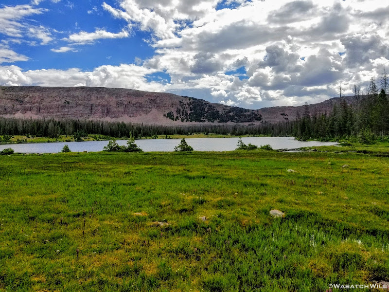
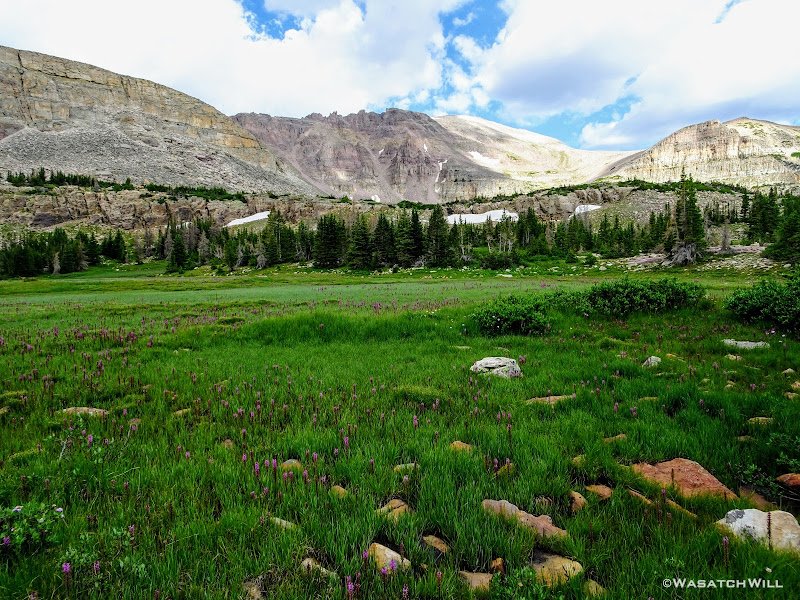
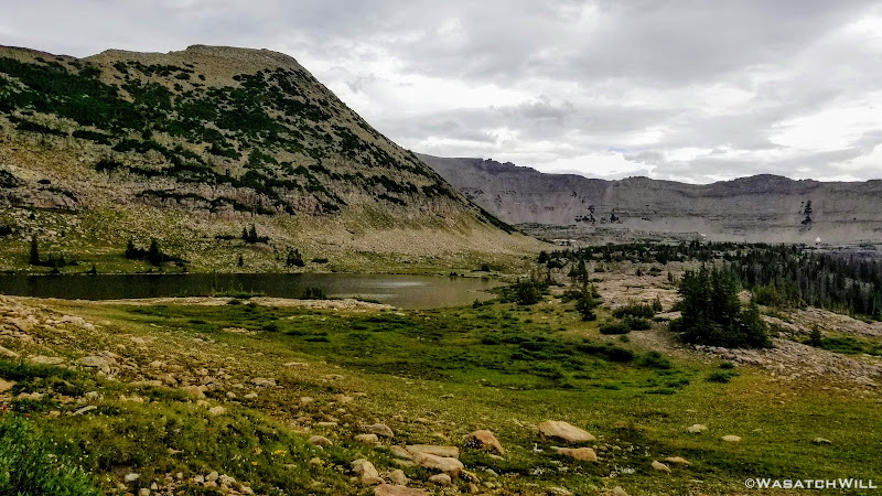
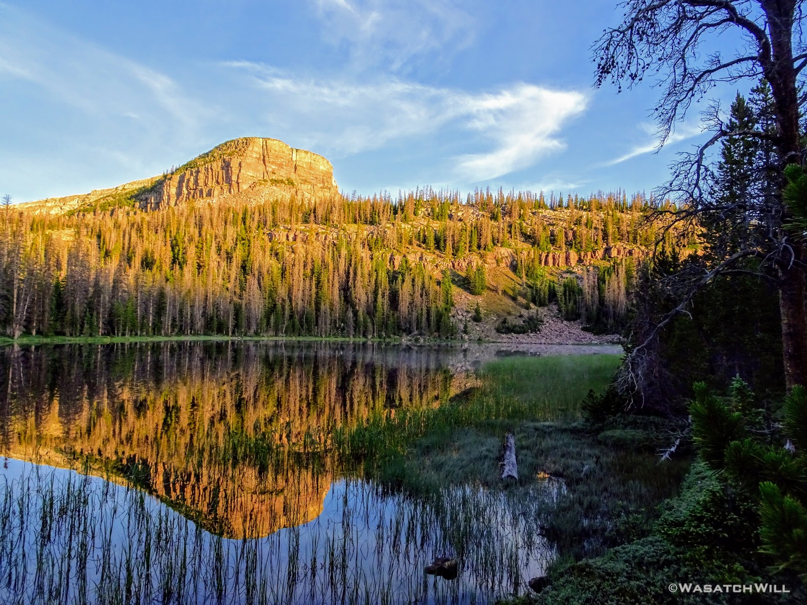
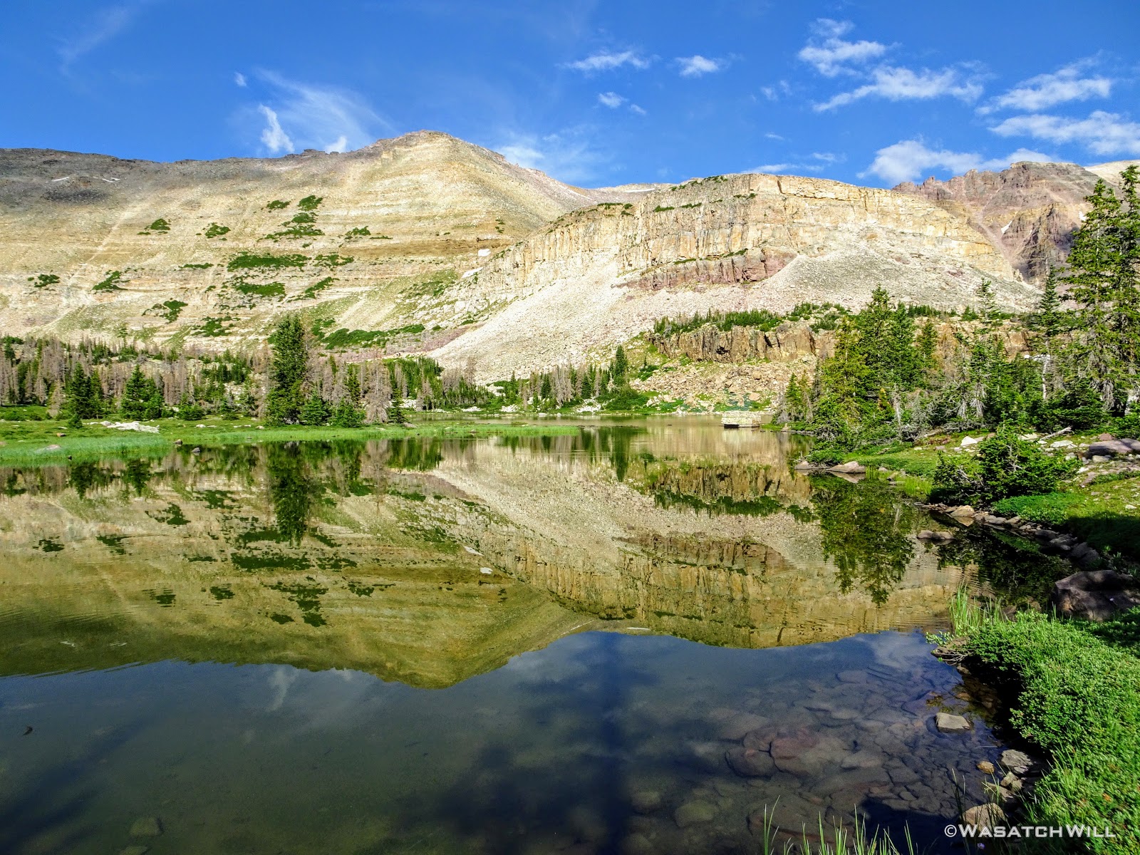
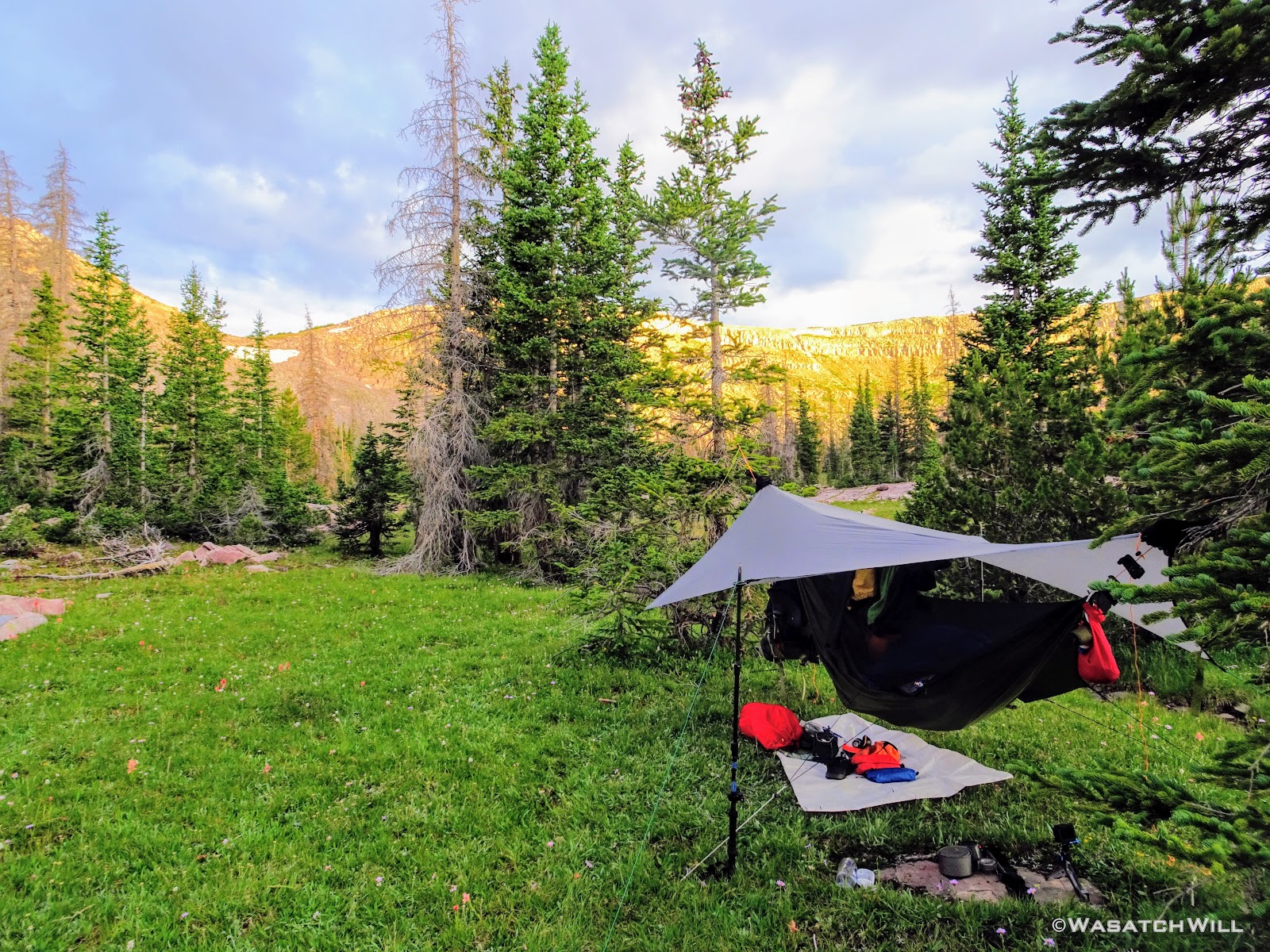
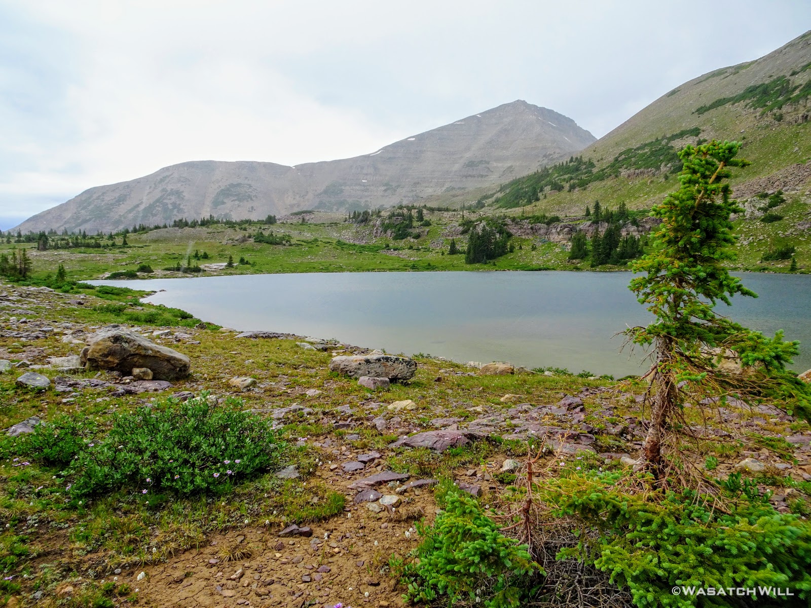
We found a cozy little spot not far from Rocky Sea Pass to set up camp for the evening. In fact, from the area all around camp, we had a great view of the pass and it was undeniably the most scenic camp we'd enjoy throughout the trip.

View from camp
Unlike the night before, Karate Josh and Tim were all able to find suitable hanging spots. It was once again nice to get into camp with a good amount of light left where beds and dinners could be prepared with lots of time to relax, enjoy one another's company, and reflect on the day.
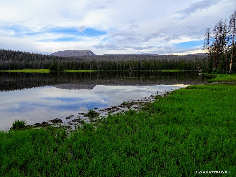
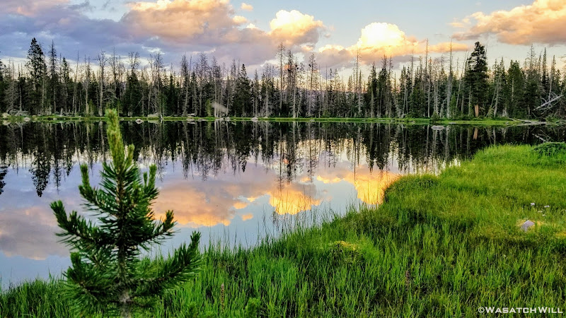
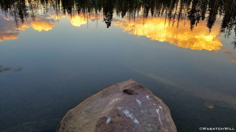
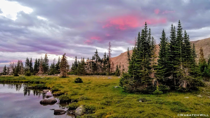
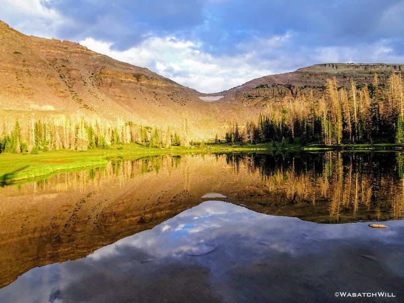
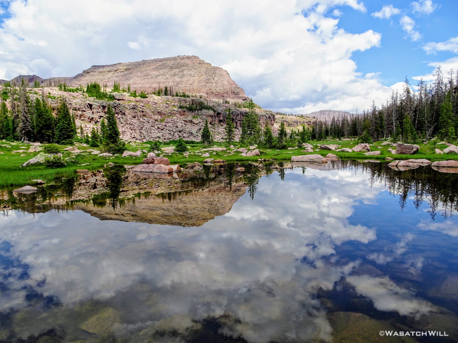
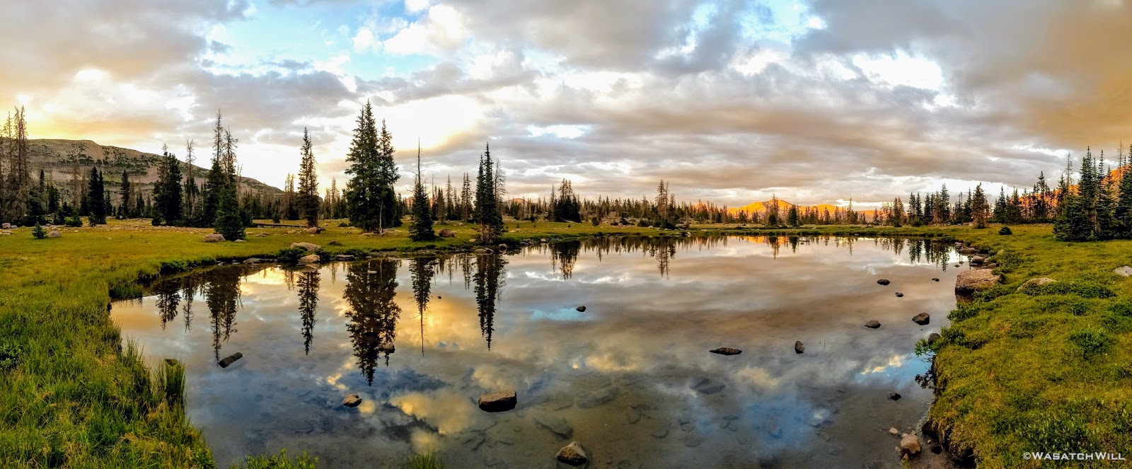
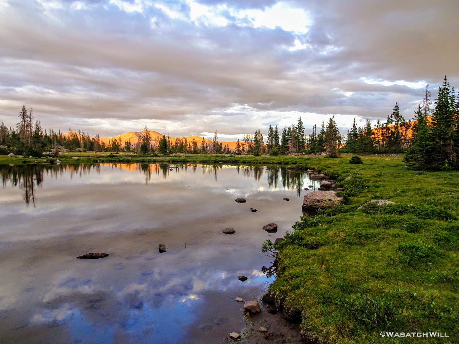
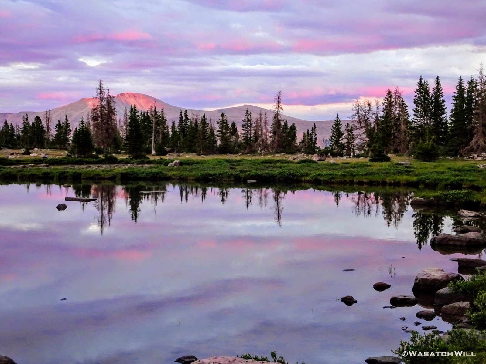
Speaking of reflections, not far from camp were some larger tarns where more reflections of the sky could be enthusiastically enjoyed. I'm always a sucker for a nice reflection! It appeared that the clouds all around were shaping up for quite a nice sunset too.

Tarn reflection pano

Tarn reflection
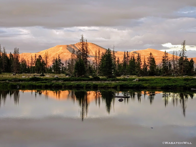
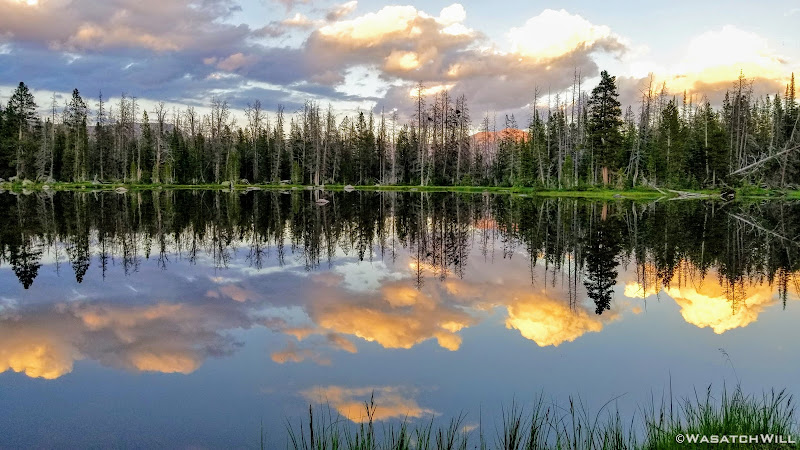
Alpenglow on Explorer Peak
And then it happened. We were all treated to one of the most spectacular and memorable moments of the trip as the glorious light of the sun danced across the ridge line over the pass before fading off into its western bed. It really was quite a show!
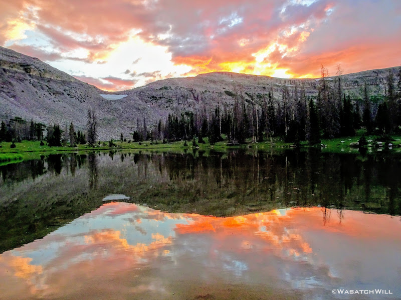
Sunset show
Pink and purple hues
Purple Power

Last light on Explorer Peak
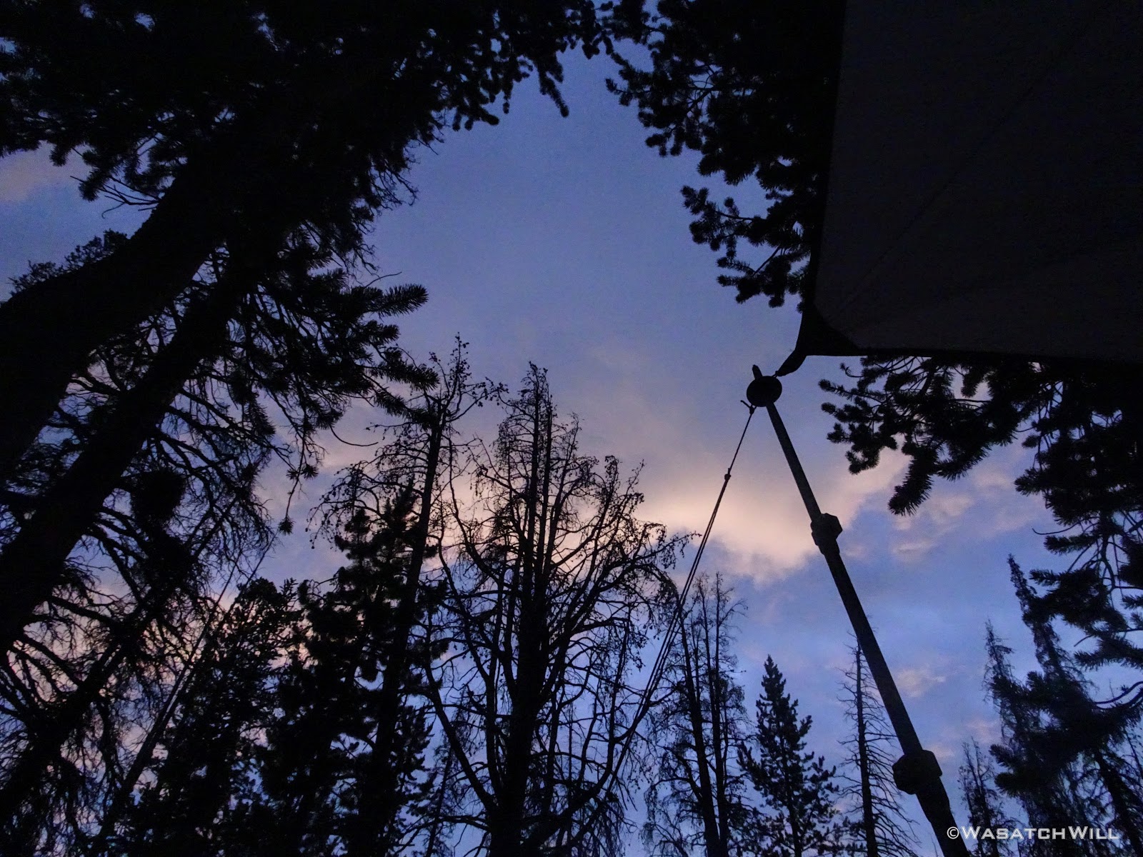
As was now routine, we all settled into our beds for some much desired rest as the dark of night enveloped us.
Day 4
Saturday - July 14, 2018
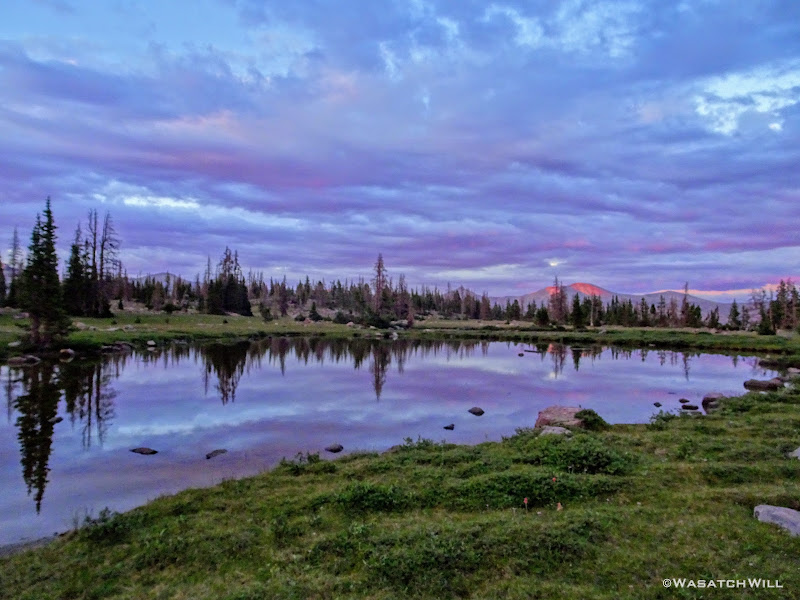
Morning arrived once again with calm skies, but unlike the previous mornings, clouds began to gather in the skies around us quite quickly once the sun had rose.
Dawn arrives on day four
Still, there were often good cracks of light that illuminated the scenery surrounding us, keeping things pleasant for our morning routines.
View from my hammock

Rocky Sea Pass (left) as seen from camp

Morning sunlight arrives at camp
One of the better alpine camps I've ever slept at

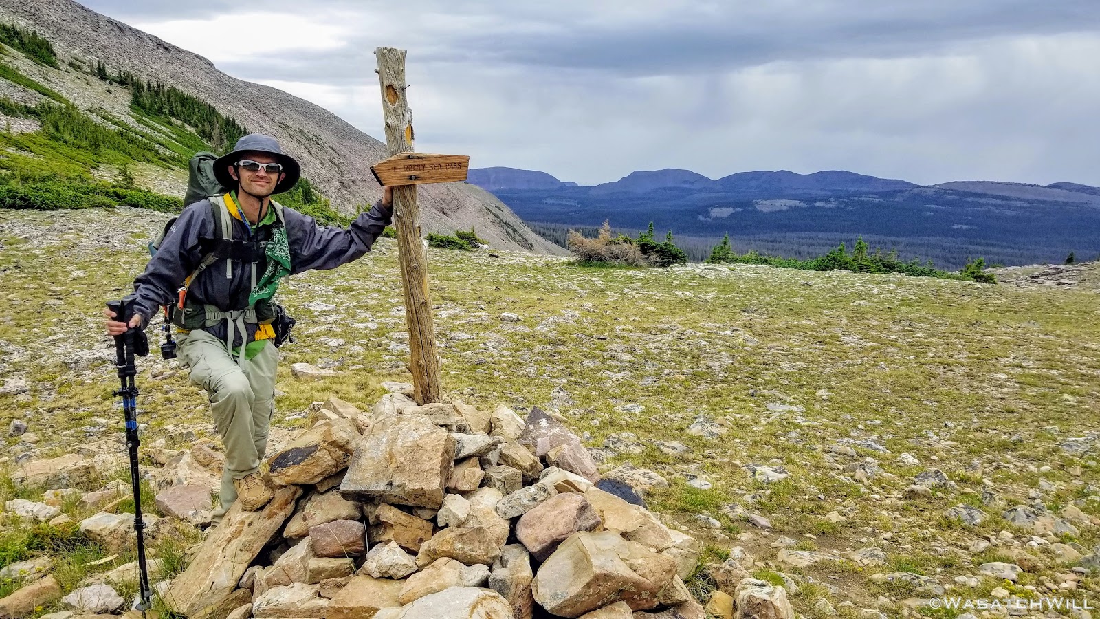
Rocky Sea Pass
Rocky Sea Pass reflects on tarn
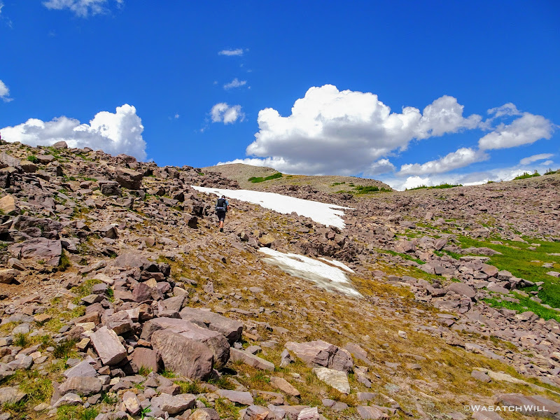
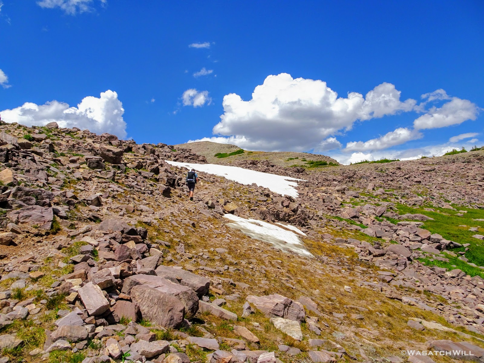
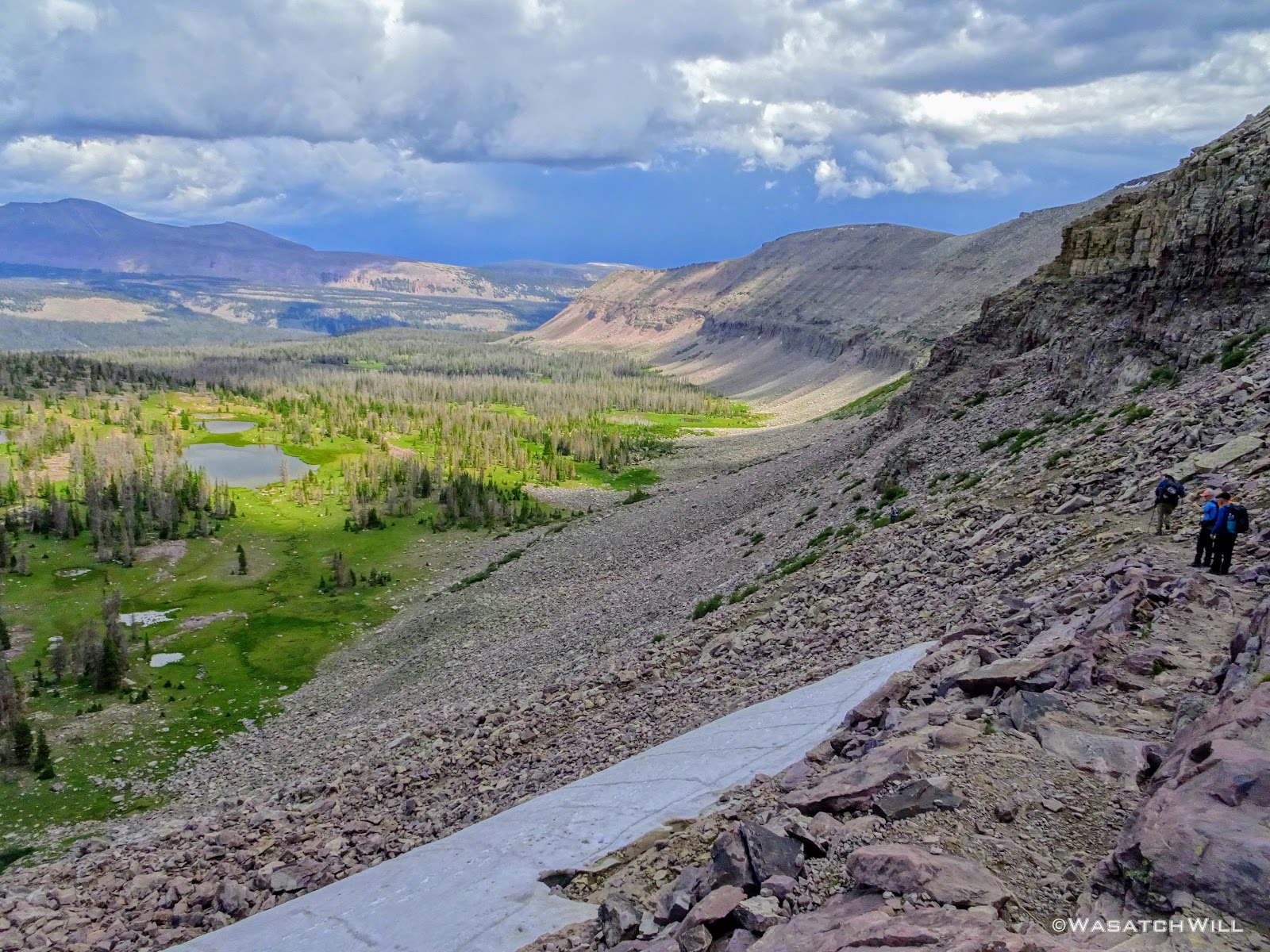
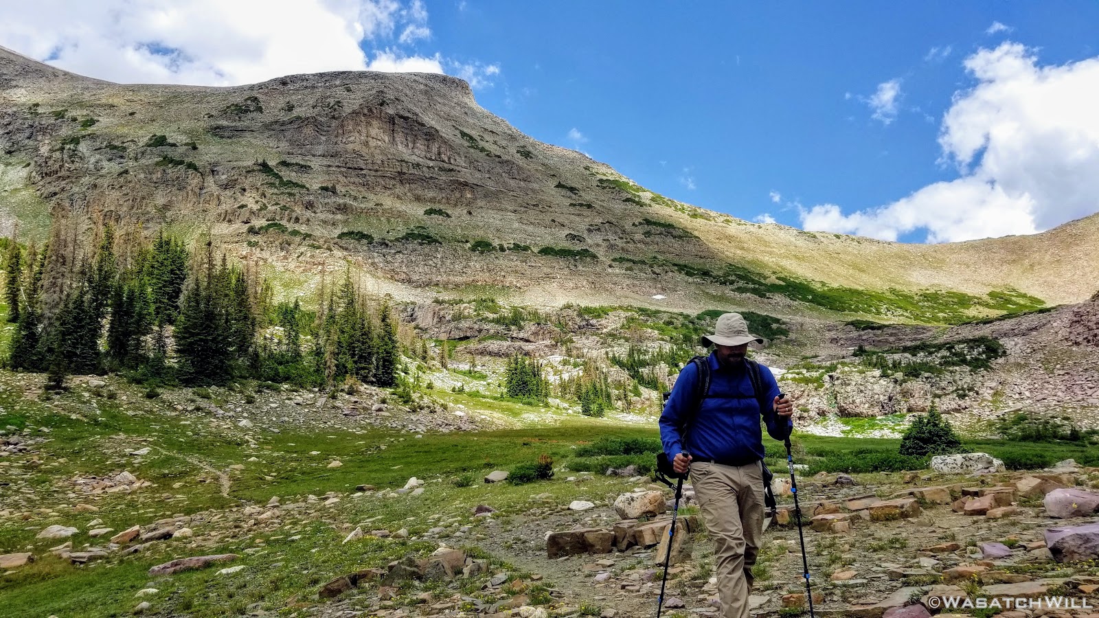
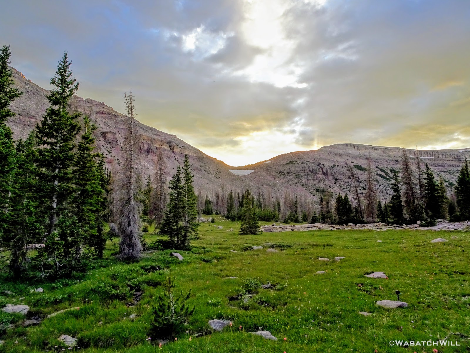
Fortunately, Subaru Josh's knee was know feeling well enough to take on his own pack again. To ensure we didn't hike more than necessary given Josh's knee, we'd be hiking our shortest day, only four miles, but with Rocky Sea Pass looming right among the first half of it all. Clouds continued to gather our whole way up, but the air was still quite cool and and there was no sights of lightning or sounds of thunder in any direction, so we felt comfortable forging ahead up and over.
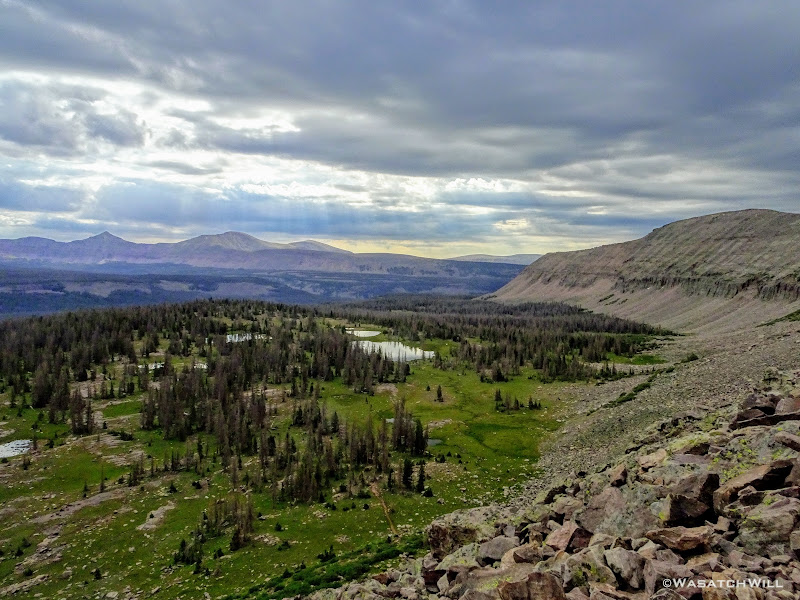
Sun rays reach through clouds above Rock Creek Basin
Once we hit the ridge, it grew quite windy and we did not linger up high for nearly as long as the last time over.

Myself atop Rocky Sea Pass (credit: Devin Ashby)

Mount Agassiz beneath gloomy skies
Trail descending west side of Rocky Sea pass
Once back down the other side, we again paused at Pigeon Milk Springs to retrieve some more water and have a good rest. Now the clouds opened up and began to put down a decent shower. Still no thunder or lightning though. No matter, we'd be in the cover of trees the rest of the way.
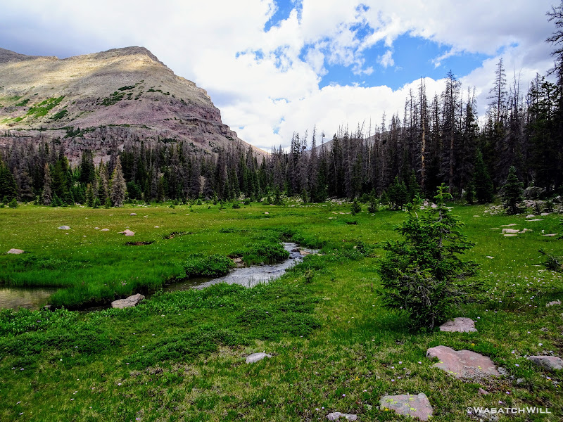
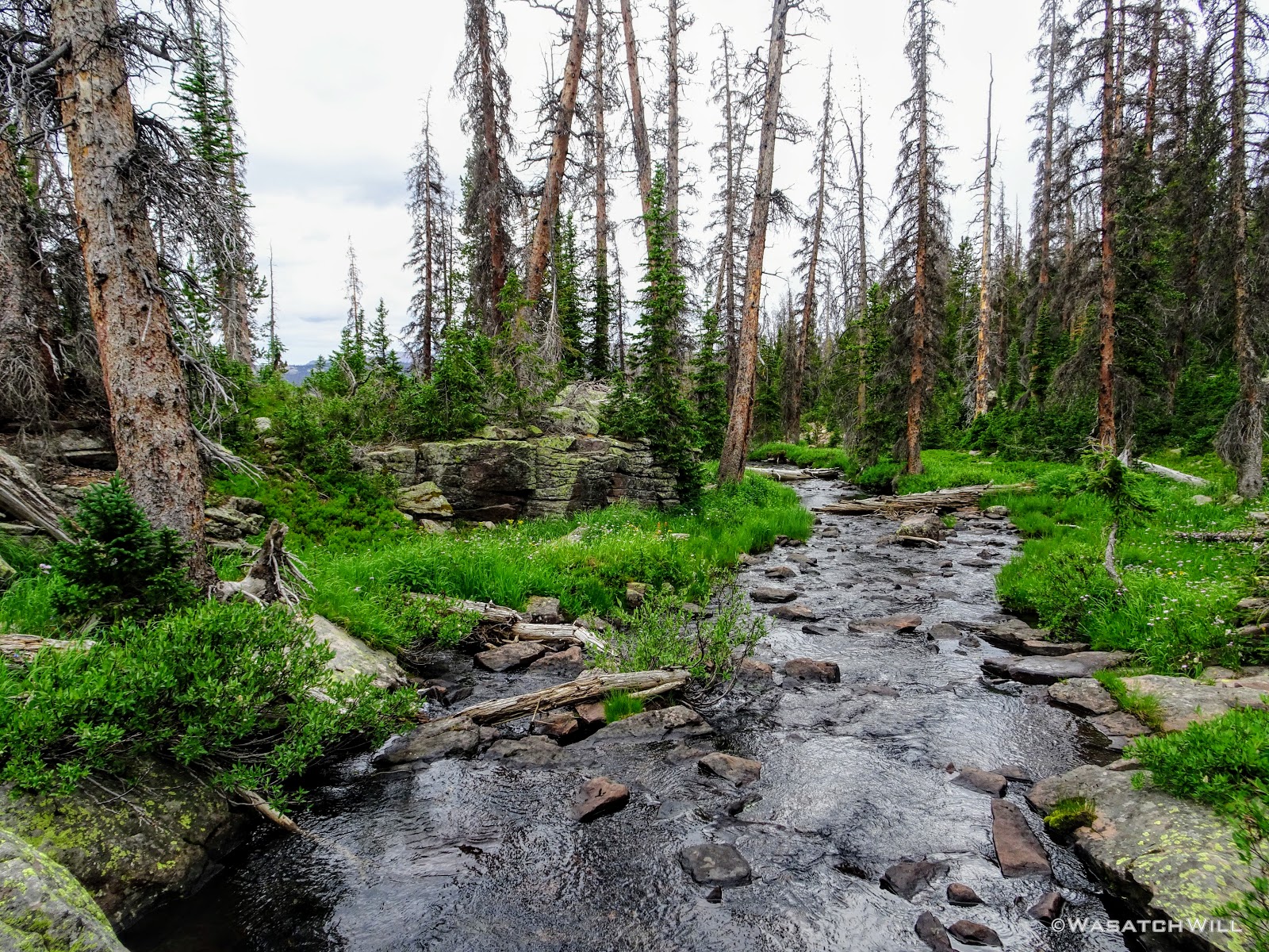
We finished out our day's mileage by settling into a camp a good distance off trail along the creek that drains out Naturalist Basin. Therefore, might as well call it 'Naturalist Creek'. The rain had also given way to some sunshine in our final mile.
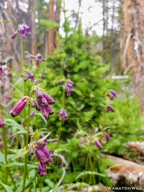
Penstemons

'Naturalist Creek'
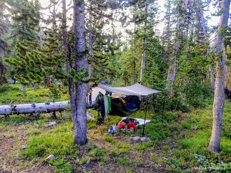
Final camp
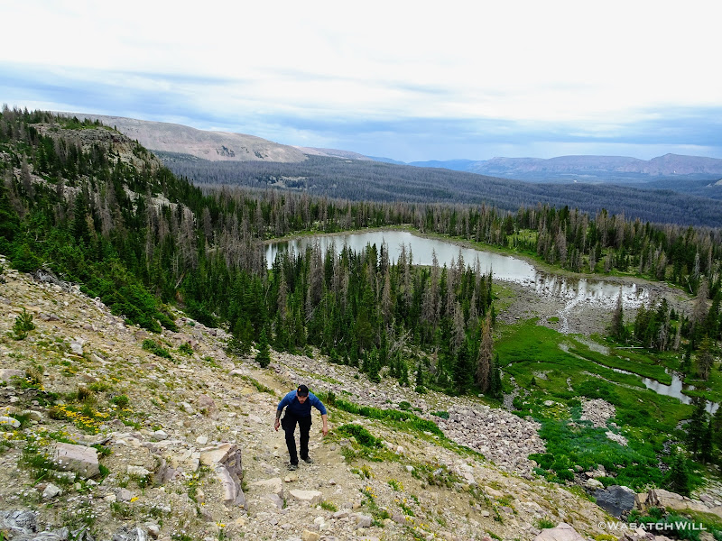
When we started setting up camp, it wasn't quite 1 pm yet. It was by far, the earliest I had ever arrived into a campsite while on a backpacking trip and it felt awesome! Of course, a big part of that was knowing that Josh would now be able to rest his knee again and just enjoy some much deserved R and R time for the rest of the day. For me though...I had itchy feet and couldn't resist the temptation to take a stroll up and around Naturalist Basin up the creek to the north of us. The only other time I had been up into Naturalist Basin was late one June when the upper basin was still much covered in snow. I was now eager to see the basin all greened up.
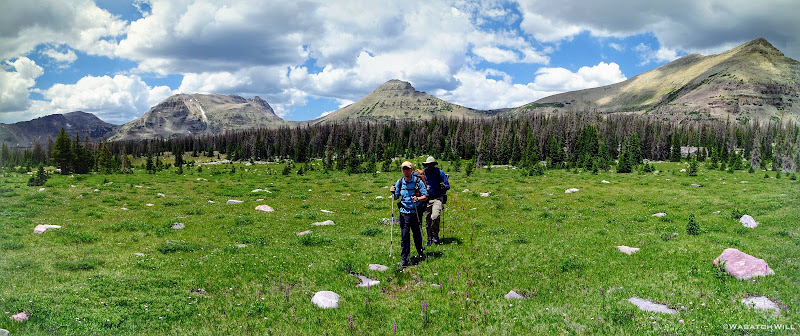
Karate Josh was keen to accompany me while Devin and Tim chose to take it easy and stick around in camp with Subaru Josh. Karate Josh really takes care of his health both in diet and exercise, and it really showed on this trip. For being a resident of the lower lands of Ohio, the elevation and altitude of the High Uintas never seemed to effect him one bit.
So with that, I was confident the two of us would have no trouble circling the basin and back within 2-3 hours. Prior to setting off though, much of the group chose to soak their feet in the creek while we all feasted on some lunch.
By about 3 pm or so, Josh and I were ready to head up. I packed a little summit bag with some essentials and off we went. The point where the trail up into Naturalist Basin breaks away from the Highline was a considerable distance away from where we were camped, so we opted to travel cross country following the creek from our camp until we intersected the trail as it approached closer to the creek higher up.
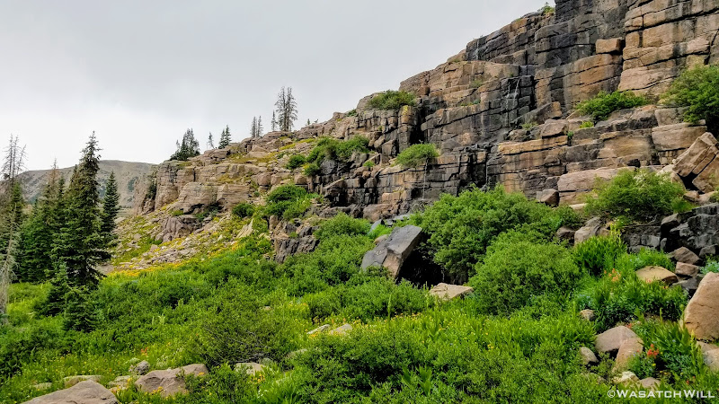
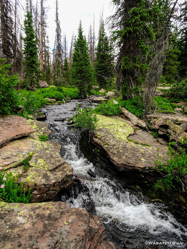
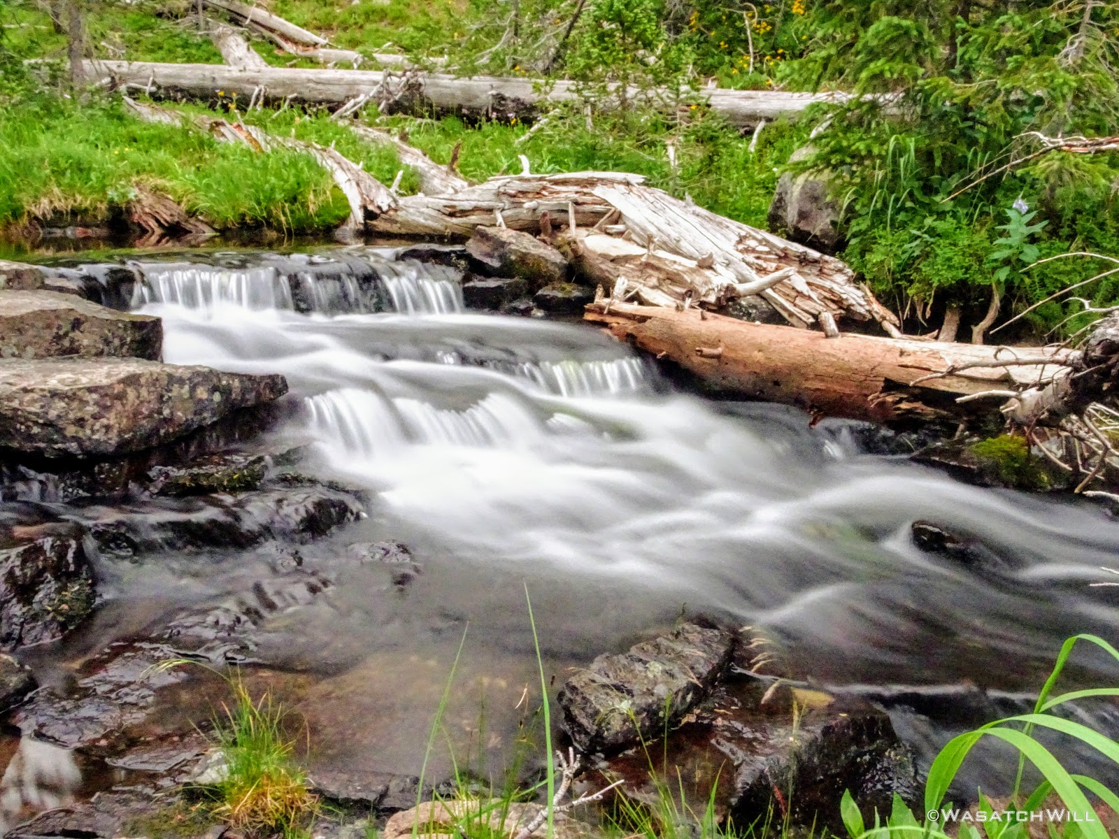
Along the way we were treated to a pleasant little cascade.
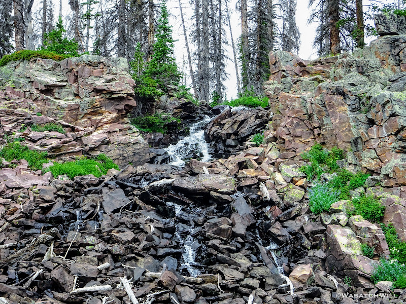
Small cascade on 'Naturalist Creek'
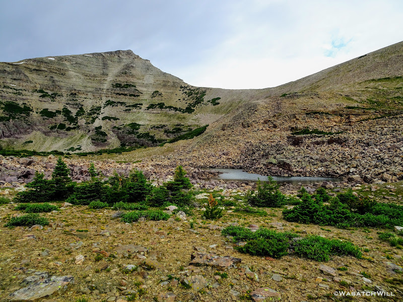
Soon after, we emerged out on the trail and to the split where one has a choice to go west up to Morat Lakes, or east out to Jordan Lake. I opted to lead Josh on the tour in the clockwise direction, beginning with Morat Lakes, where I had made camp my last time in the area.
The trail up the lakes was certainly as steep as I remembered. Unlike last time however when I encountered nobody else up in the very popular basin, there were quite a few camps set up around the lakes, particularly at the more scenic of the two, the western lake.
West Morat Lake

East Morat Lake
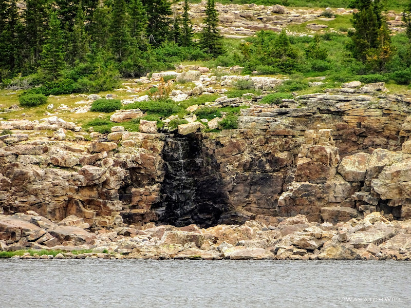
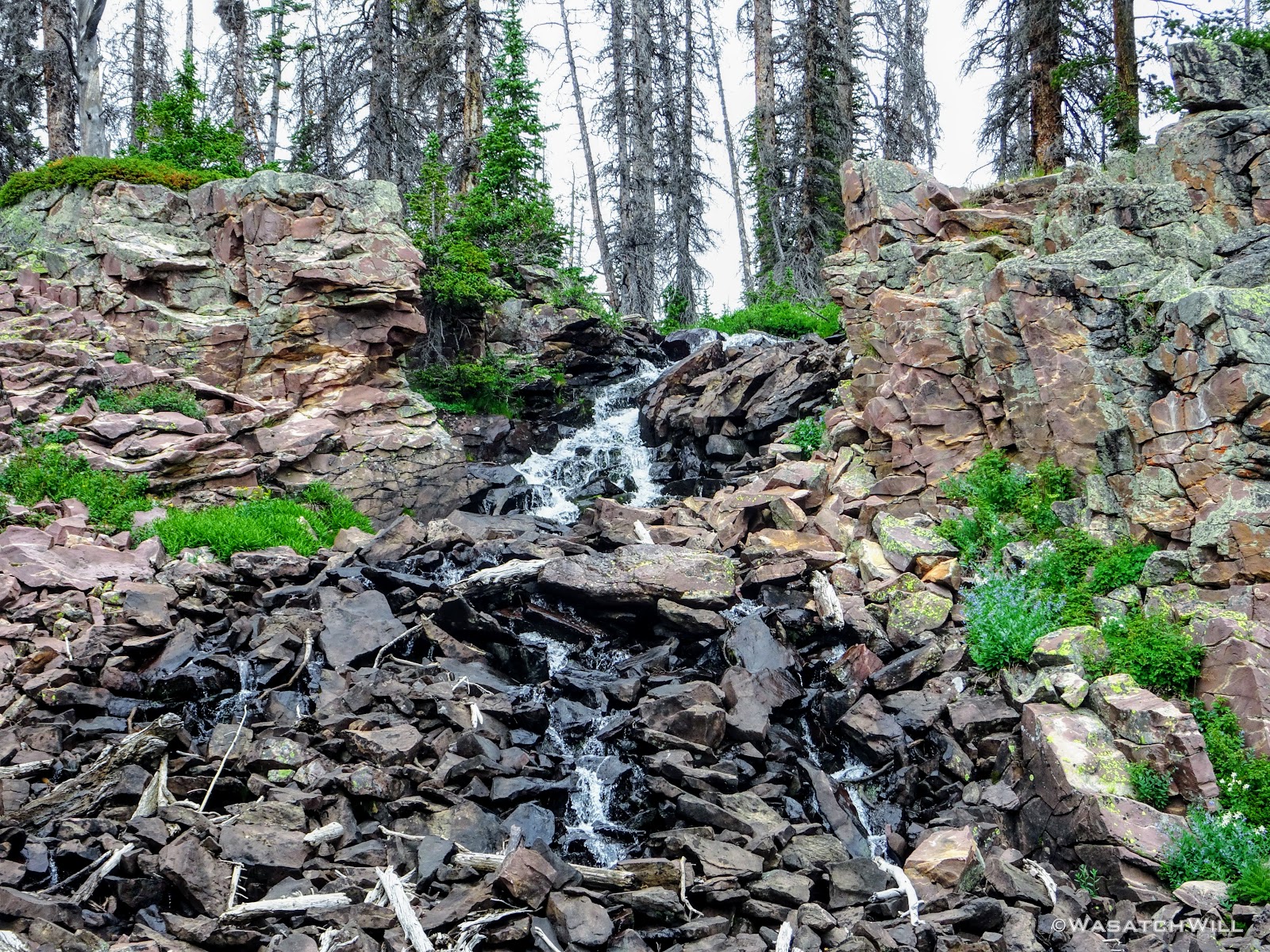
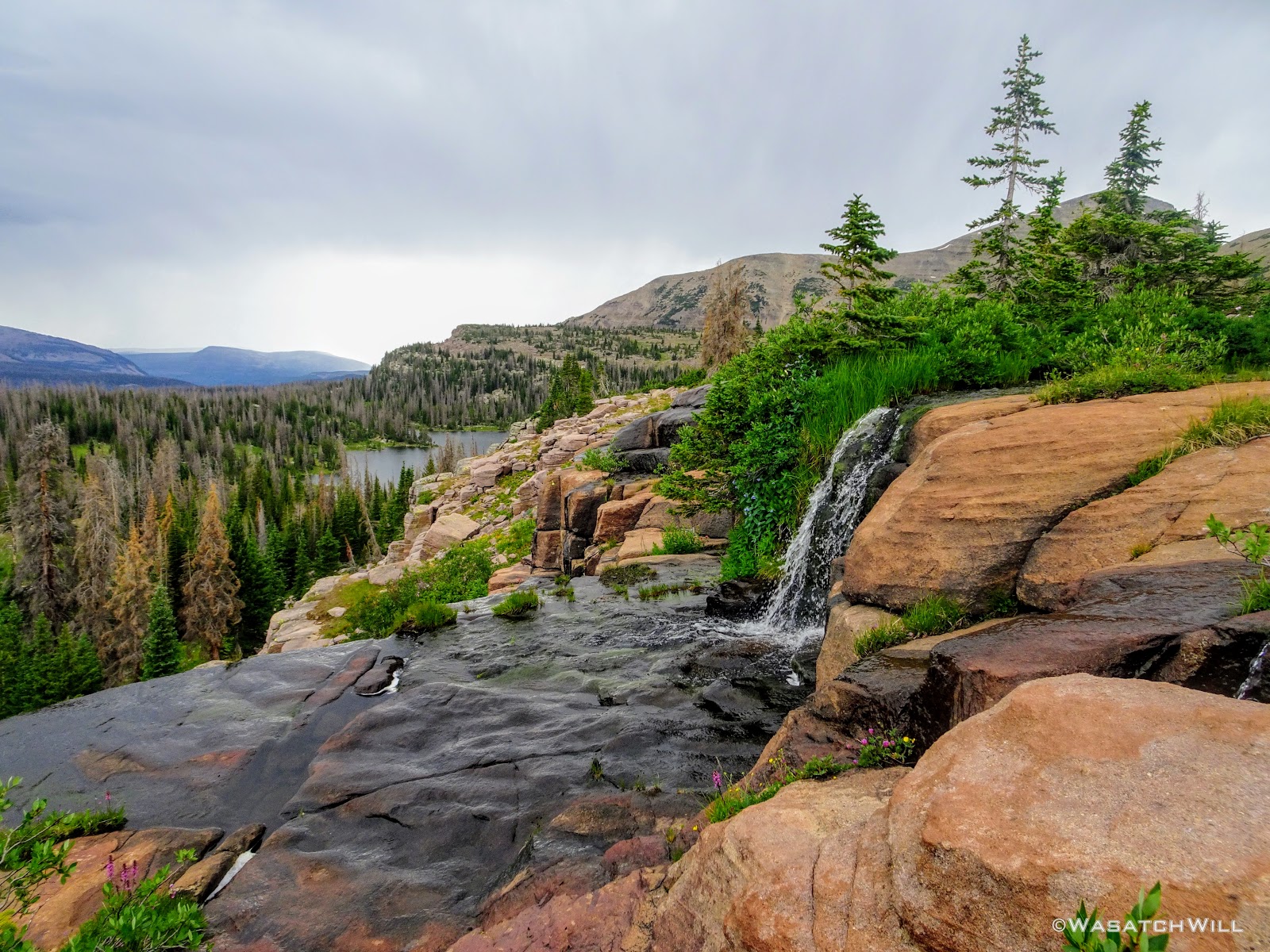
Once past Morat Lakes, we'd not see much of anyone else again until we rounded back around to Jordan Lake, save one or two people out exploring along the high bench. To get up onto that bench though required a hefty push up a steep slope riddled with loose dirt and rocks alongside a waterfall, now much more meager than I had last seen it.
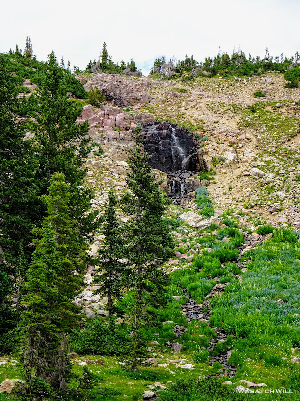
Waterfall and the way up
Karate Josh making the push up
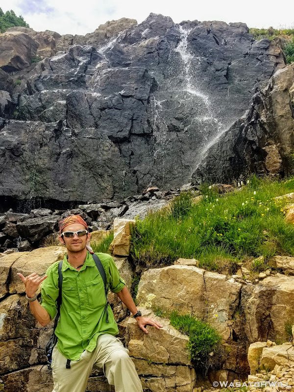
Myself hanging loose at the falls
Still, once at the top of the falls, the view back out over Morat Lakes and across Grandaddy Basin further out in the distance was breathtaking, both in the literal and figurative sense. We'd also come to realize that clouds were quickly gathering, darkening, and approaching again, making rain look imminent once more.

Looking out over West Morat Lake
Looking out over East Morat Lake
Morat Lakes Pano
The day had remained quite cool and with still no sign of thunder or lightning, I deemed the conditions unlikely for any threatening lightning to materialize, so onward we went, rain or no rain.
Within moments we'd be going cross country again as we passed by Blue Lake.
Mount Agassiz above Blue Lake
And then scraggly little Walcott Lake.
Mount Agassiz and Walcott Lake
From there, Leconte Lake came into view and we rounded around the near side of it.
LoConte Lake comes into view

Looking back at Mount Agassiz across LaConte Lake
An abundance of flowers once again graced us with their presence for the next mile or so.
Heaps of Paintbrush and Bistort flowers
Mix in a variety of Aster/Daisy flowers
Flowers, LaConte Lake, and Mount Agassiz through a rain-coated lens
Here the coming rain had caught us. I had packed along both a windbreaker jacket and a proper rain jacket, just in case. Both were employed as I lended out the rain jacket to Josh who had not thought one would come in handy. It was a good lesson on how quickly weather can change in these high alpine environments. Fortunately the rain never grew strong and my windbreaker served me well enough also.
The scenery continued to wow us as we approached Faxon Lake.
Faxon Lake beneath Spread Eagle Peak (left)
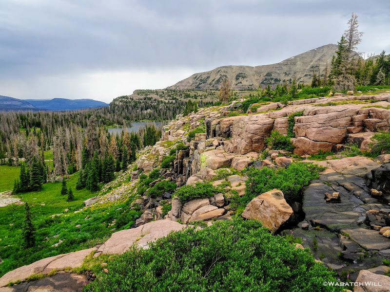
From Faxon Lake it was on out toward Shaler Lake.
Shaler Lake comes into view
Waterfall feeding Shaler Lake
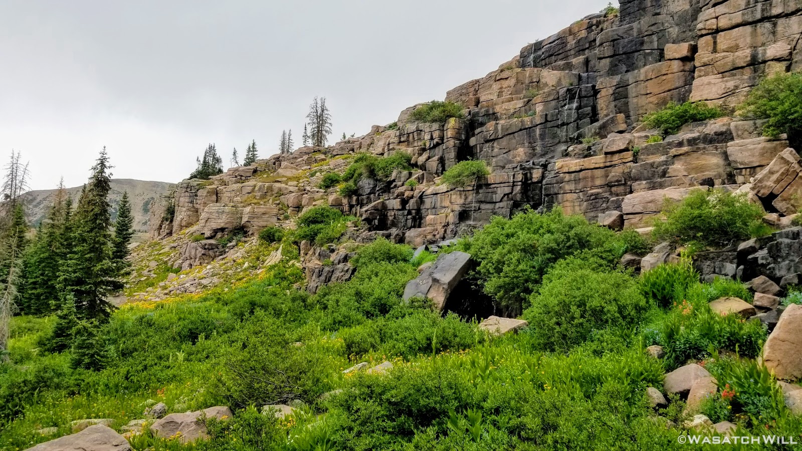
When we reached Shaler Lake, the rain backed off allowing the skies to lighten up a bit as we made our way out to the edge of the bench we'd have to now climb down to reach Jordan Lake. This part of the journey could have been relatively quick, but unexpectedly, the scenery grew more intense with more flowers, waterfalls, and continued vast views. The whole journey through this section was as much of a paradise as I can ever recall finding myself surrounded with and I wanted to soak up as much detail as I reasonably could along the way. I made many stops for pictures while Josh stayed as patient as a saint.

Paintbrush close up

Elephant Heads

More flowers, more bodies of water
At the edge of the Naturalist Basin's upper bench

Small waterfall
Pano of lower Naturalist Basin
Columbines up close
A view back up at the bench

A clean running stream
Paradise found
At last, we found ourselves on the shores of Jordan Lake, the last of the named lakes along our tour or Naturalist Basin. This was also the point where we'd pick up a developed trail once more and we'd encounter many more people, as expected.
Jordan Lake...and yes, Mount Agassiz again
The scenery had obviously reached its climax and we were now eager to get back to camp to join the other guys for dinner and a campfire for our final night, the only one we'd have on the whole trip. We followed the trail back to the fork and then back down a short way before leaving the trail again to follow the creek back down to our camp.
Heading back to camp
Back along 'Naturalist Creek'
'Naturalist Creek'
We arrived at camp right on schedule at 6 pm and spared no time in preparing our last dinner. Reunited with the rest of the gang and with full tummies, we had ourselves a nice chat around a small fire as we recollected on all the highs and lows of the trip. Those bittersweet feelings that always come at the end of such epic multi-day trips swarmed over us all: sad to know we'd soon be leaving the confines of a beautiful and majestic wilderness area but also eager and excited to get back home to our respective families and loved ones.

Karate Josh, Tim, myself, Subaru Josh, Devin
With the fading light, I tried my hand at a few long exposures along the creek before settling into my hammock one last time.

'Naturalist Creek' LE #1

'Naturalist Creek' LE #2

Goodnight!
Day 5
Sunday - July 15, 2018
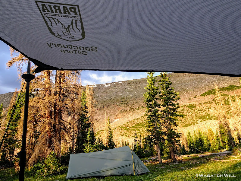
The final day arrived under the canopy of both my tarp and a blue bird sky.
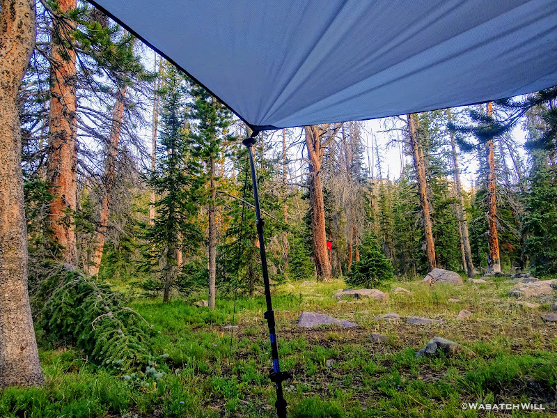
Good morning!
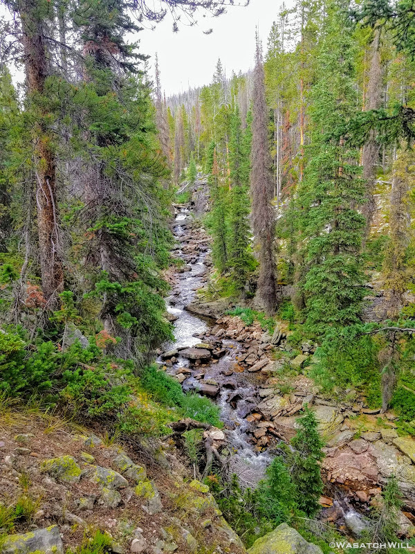
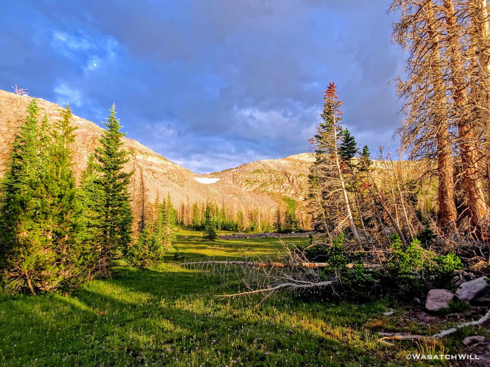
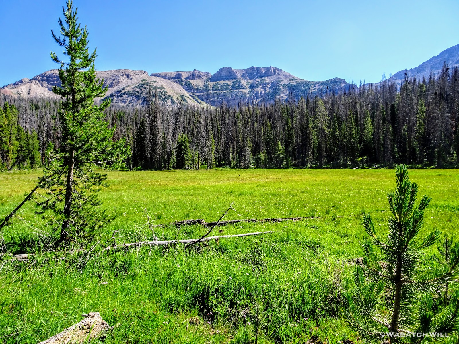
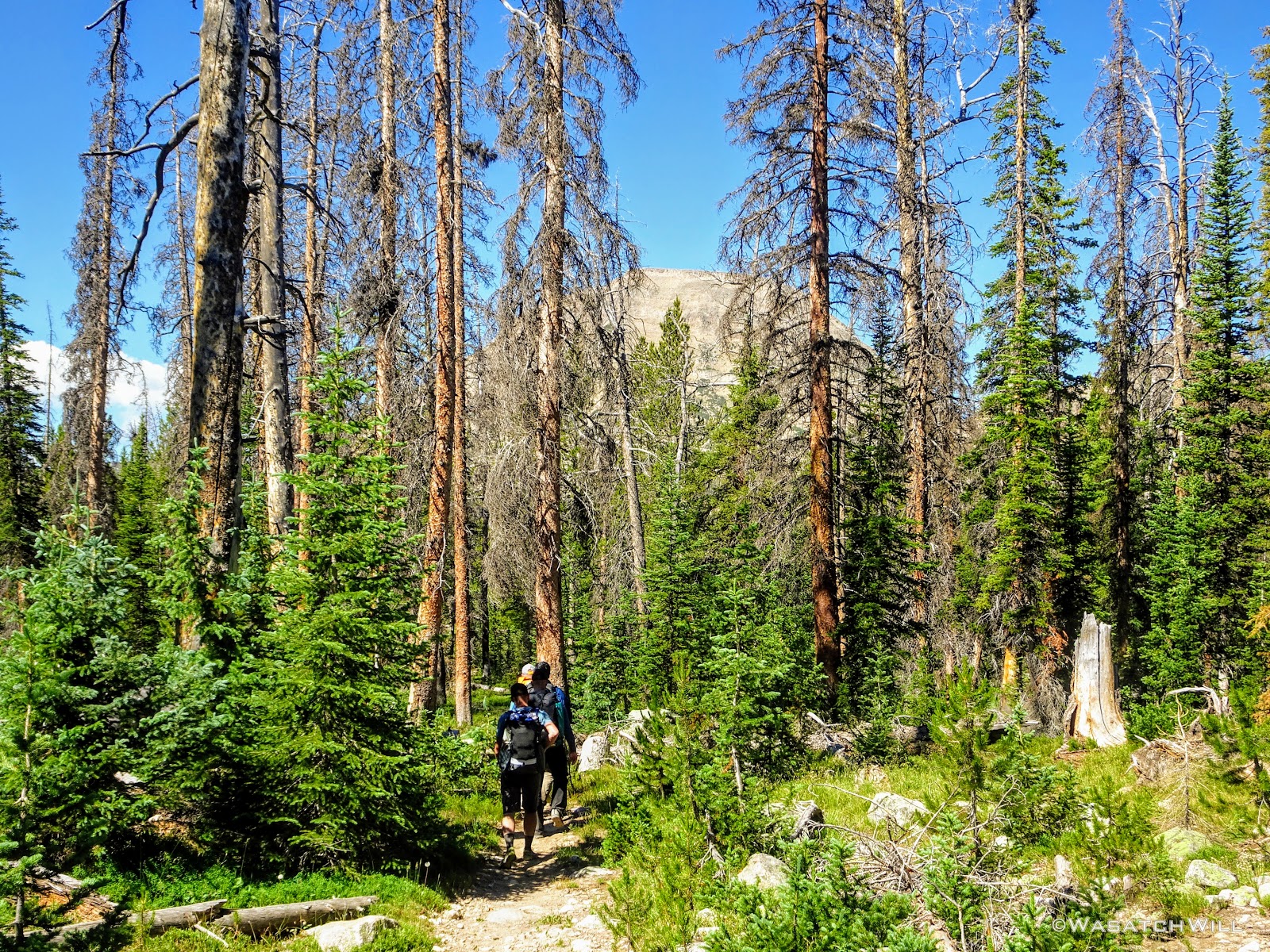
Our final 6 miles of the trip would go through much of a green tunnel, much like the first day, whereby the trail would pass by few clearings among the dense forest to allow for much of any views.
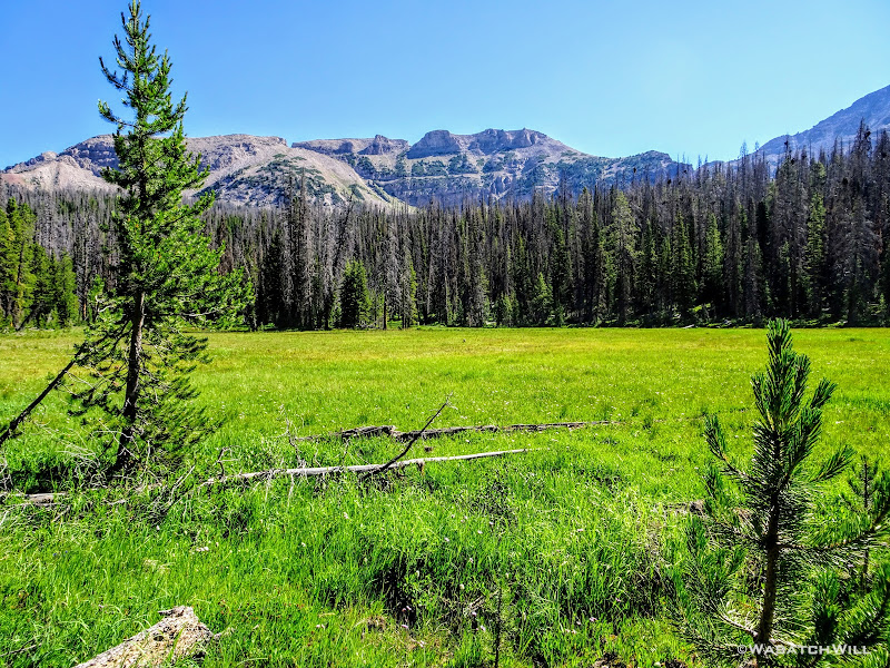
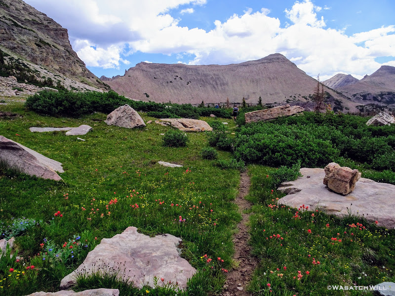
A rare open space along the trail
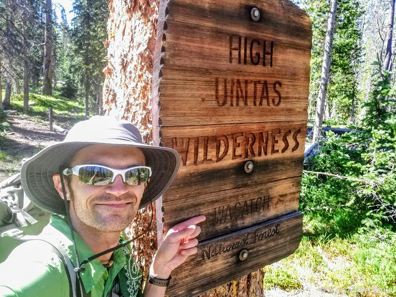
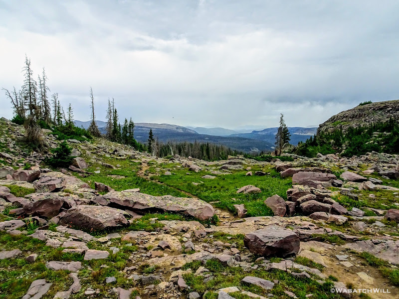
Farewell HUW!
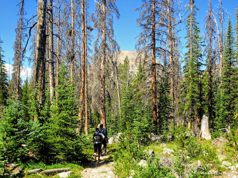
About a mile left with Bald Mountain beyond the trees
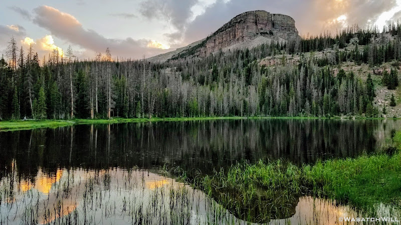
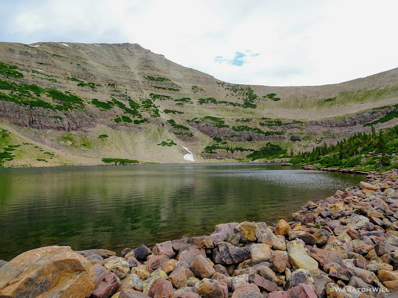
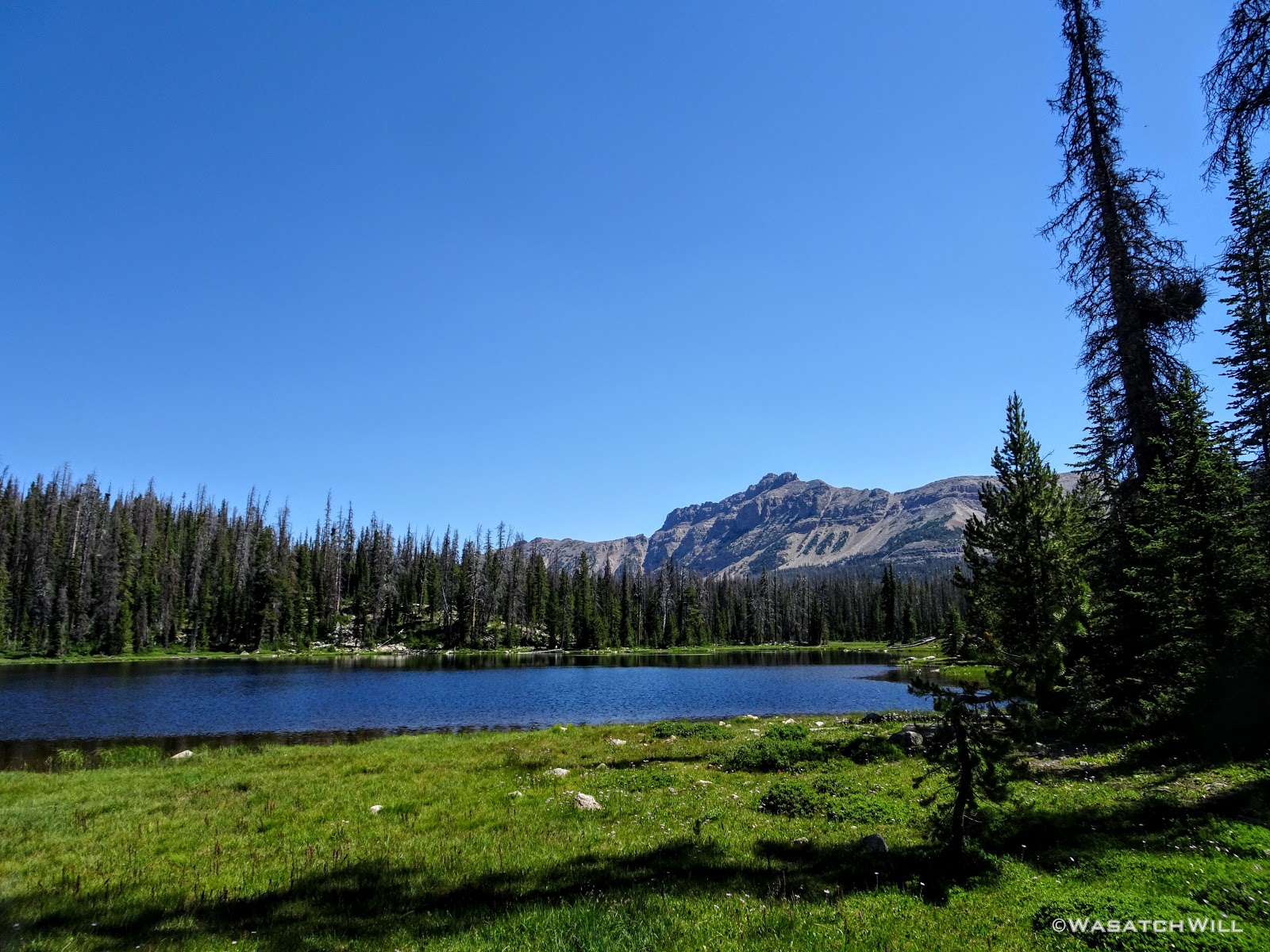
It wasn't until we reached Bonnie Lake along our final mile that we ran into the same wilderness ranger that had intercepted us in Four Lakes Basin 3 days earlier. Did I mention he was quite a character? What we thought would be another 3 to 5 minute chat somehow turned into something well over a half hour. Adrian proved to be quite entertaining with lots of jokes and stories to tell, albeit with quite a bit of colorful language at times. Overall, he had a personality far different from any other ranger any of us had ever conversed with. I did not think to get a picture of us with him, but I did shoot some video for Devin of some of that conversation which he's published into a short four minute video here. Well worth the 4 minutes to watch it for sure!

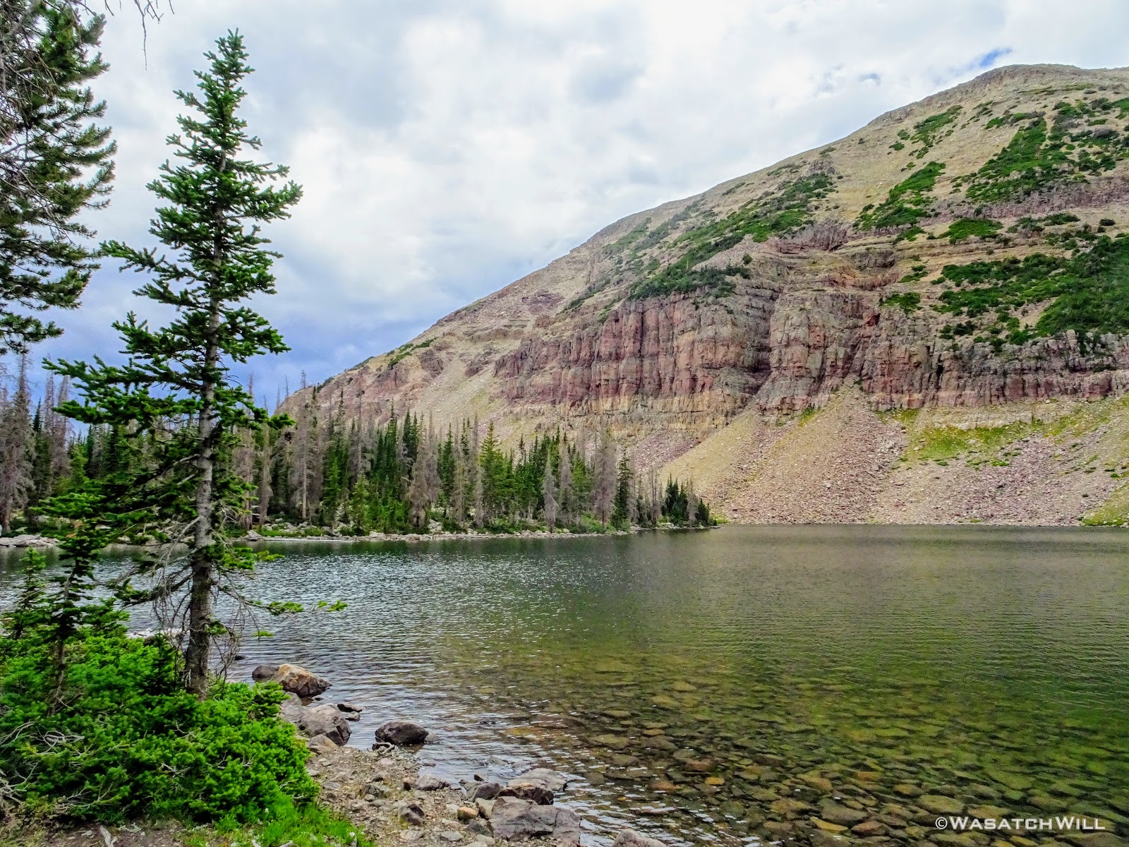
Bonnie Lake, Hayden Peak beyond
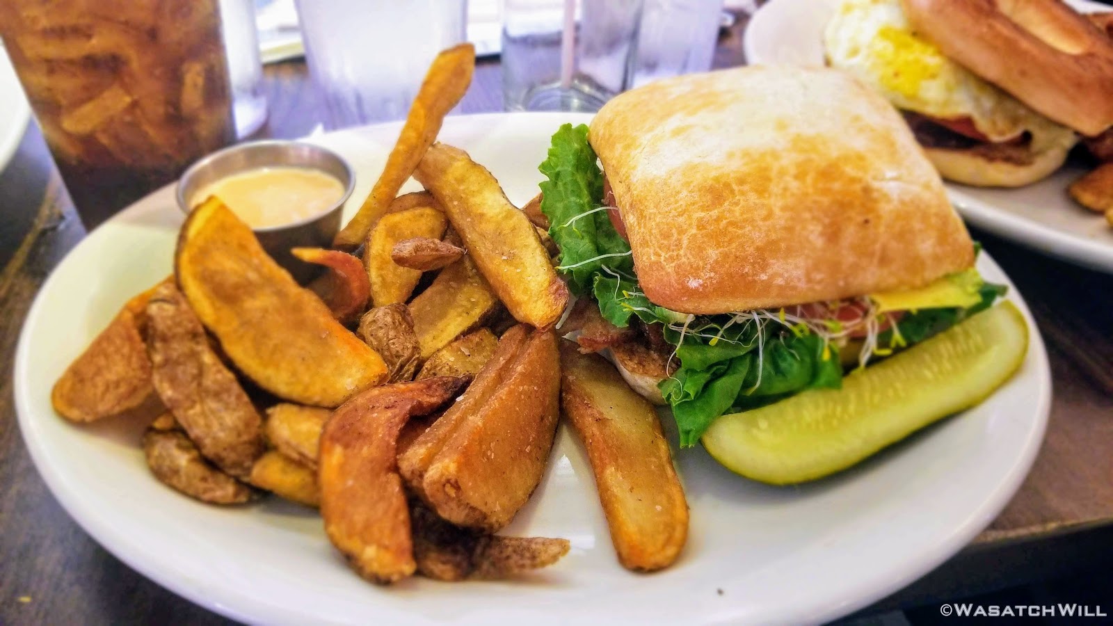
Once we finally broke ways, we finished out the homestretch back to the car at the trailhead. We discarded our packs for the last time of the trip and after a routine freshening up and the enjoyment of some cold tailgate drinks, we drove on down to Kamas where we stopped at the Mirror Lake Diner there and treated ourselves to some delicious and hearty meals.

Yum!
Needless to say, I'm so thankful to Devin and Tim for teaming up to put this trip together for the rest of us and to have thus been a part of it. Many great memories were made, new friends were made, and the scenery was as stunning as we could have ever hoped for. The hope is now that sometime in the next few years, Devin and I can return a trip out east to visit the three Ohioans and have them lead us on a similar tour in a nearby wilderness of their choosing, be it somewhere in the Smokies, around Lake Michigan, or elsewhere out there.
If you enjoyed this trip report, then be sure to check out my video below when when you have 90 minutes to spare. You may enjoy that just as much. Below that, you can also check out the other guys' videos to get their respective perspectives as they documented the trip, all under an hour in duration each.
Videos:
Mine:
Devin:
Tim:
Karate Josh:
Subaru Josh:
Earlier this year, a guy named Tim Watson who runs a well-followed YouTube channel was scheming with his two neighbor buddies in Ohio (both named Josh) about where they were going to take what has become an annual big backpacking trip for them out west. @Devin Ashby, a fellow local Utahn friend of mine who I came to know first through YouTube as well, pitched to Tim the idea to come out to Utah. Things got serious quickly and plans were made for the three Buckeyes to to fly out to Utah for a meet-up this past July. This is the story of that amazing trip!
Day 1
Wednesday - July 11, 2018
After making a short drive over to pick me up at my home, Devin and I drove on up to SLC to pick up the three Ohio amigos. Once all packed like sardines into Devin's Jeep Compass, the camaraderie was instant. We fueled up both the car at a gas station and our bodies at Crown Burger. We then made the drive up through Parley's Canyon, Park City, Kamas, and finally on up the Mirror Lake Highway where we'd ultimately pull into the Mirror Lake Trailhead lot to saddle up for the big trip ahead.
Originally we had started planning a route that would take us on a lollipop loop to hit Kings Peak and spend some time around Red Castle. After some thinking on both sides, it was mutually agreed that the elevation changes might be too strenuous for the Ohio crew coming right off the plane and at least one of them had dealt with a recent injury that he wasn't sure about being fully recovered from. So, a more moderate route was planned that would enable lesser travel time and quicker access (i.e. more trail time), less strenuous elevation gains and losses, and yet still allow us to tour some beautiful basins and get somewhat deep into the Uintas backcountry. Ultimately, a more mellow 36ish mile route mostly planned out by Devin was agreed upon. It would take us on somewhat of a figure 8 course, nipping off a corner of Granddaddy Basin before cutting back up into Four Lakes Basin, then up and over Rocky Sea Pass to spend a couple nights in Rock Creek Basin, before returning back up and over and down the Highline Trail before rounding out the trip.
It should also be noted here that to distinguish the two Joshes, one has been dubbed Karate Josh because he is a well-trained martial arts guru. That also made him a good defense for us to have against bears. The other has been dubbed Subaru Josh because he is an official ambassador for Subaru automobiles.

Tim, 'Karate' Josh, 'Subaru Josh', Devin, Will (myself)
All geared up, we were able to hit the trail by mid-afternoon. The first couple miles ran parallel with the Duchesne River through dense forest leaving little for views. But occasionally we'd find ourselves passing by some nice little picturesque spots including a nice little unexpected waterfall.
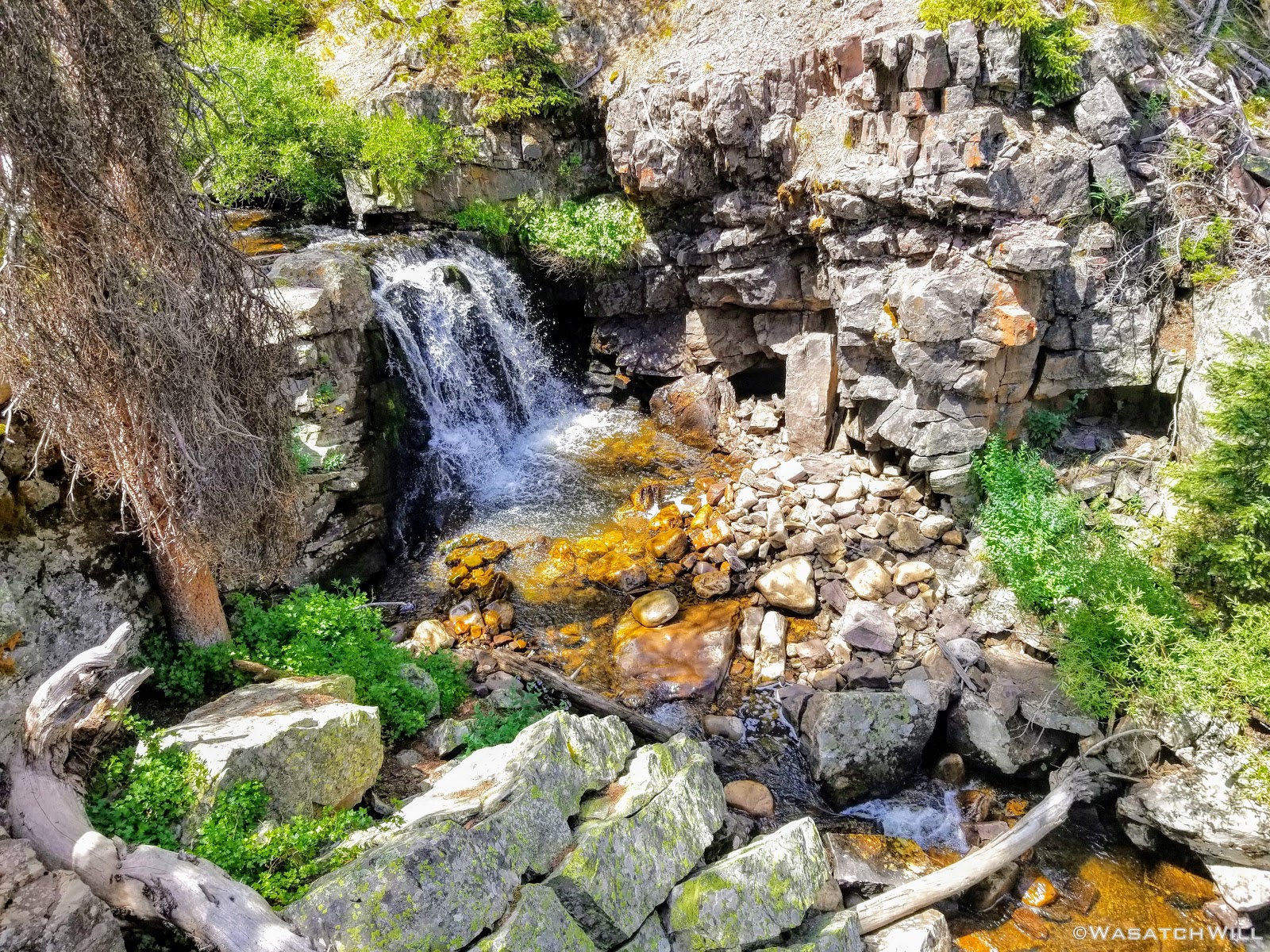
Waterfall along Duchesne River
The typical afternoon monsoon storms were threatening not far to the east and we'd hear the occasional crack of thunder but never encountered more than a brief light shower that quickly passed us over. As the trail approached the East Fork of the Duchesne, it presented us with more variation in the terrain. From here on out, the scenery would just mount up and become more and more beautiful and breathtaking as it carried us through to the final day.

Duchesne River

Along the trail approaching East Fork

View from bridge over Duchesne River near East Fork
Of course, once we reached the river's fork, Devin couldn't resist dropping down to see it up close.
Devin getting up close with Duchesne River and East Fork
Back on trail, we continued our course for the upper edge of Grandaddy Basin to look for camp in the neighborhood of Governor Dern Lake.

Purple Columbine

Pink Pyrola

Devin gaining hill up into Grandaddy Basin with others up ahead
Just after passing by Pinto Lake where a number of campers were set up and fishing, we reached Governor Dern Lake.
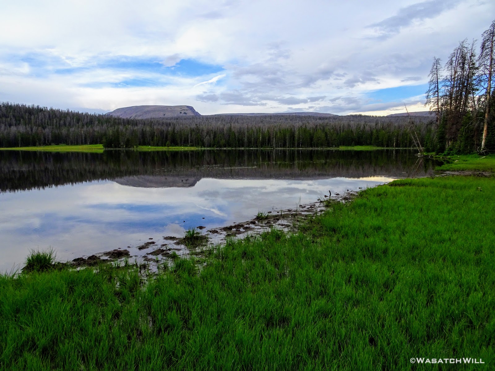
Governor Dern Lake
We continued on a bit further and found ourselves a fantastic site within a stand of trees not far below.
First night's camp
Once we had camp set up, we were treated to a colorful sky to close out the day.
Purple clouds
Not bad for day one. Once we were all settled into our beds for the night, the clouds must have gathered back together for a bit because we received a light shower later on overnight.
Day 2
Thursday - July 12, 2018
Day two greeted us with blue skies and a pleasant morning. After some breakfast and breaking camp, we moved on along the trail. A few miles later and we were into Four Lakes Basin looking out across Daynes Lake. We knew Four Lakes was a popular destination for many backpackers and it didn't take long for us to see why. In fact, there was a larger group camped out not far up the shore from where we paused at.

Daynes Lake
Daynes Lake Pano
We opted to take a good rest there. While snacking up we were confronted by a couple of horse packers out doing some fishing as they were concluding a multi-day trip of their own. One of them recognized Devin from his Youtube channel (albeit confusing his channel with one of Devin's other good friends who also runs a channel). His name was Clay and without seeing me yet, mentioned my channel. "That's me," I bragged from his other side, raising up my hand. He then looked my way and we exchanged pleasantries as well. And then it was Tim's turn to be recognized. It turns out Clay had recently started documenting his trips on video inspired by following our channels and others. He was now publishing his trips on his own channel, Clay On The Trail. What a small world something like YouTube and other digital forums and communities can make for outdoor enthusiasts.

Devin (left) chatting with Clay (middle) and his friend Shad (sp?)(right)
After a good chat with Clay and his good friend, we slung our packs back onto our backs and continued up through the basin, passing by Dale and Jean Lakes.
Dale Lake

Small pond near Jean Lake

Jean Lake
Jean Lake pano
Myself at Jean Lake (credit: Josh Herod)

Enjoying the view at Jean Lake (credit: Josh Herod)
As we were leaving Jean Lake, we encountered a wilderness ranger out patrolling the area. He was an interesting fellow to say the least. Little did we know we'd have another encounter with him closer to the trailhead on our last day. But that's another story to be told further below in this trip report.
Devin and Karate Josh make their way up trail from Jean Lake
Looking back down at Jean Lake
Shortly before reaching the confluence with the Highline Trail, we pulled over into a meadow to break for lunch.
Green Meadow
Once done with lunch, and back on trail, we found ourselves connecting with the Highline Trail just a few moments later. It was at this point that we reached a familiar trail, one I had already traveled in the past when I hiked a majority of the Highline Trail westward a couple years prior with friend, @Parma, and his brother. Once we arrived at Pigeon Milk Springs, we took the opportunity to retrieve some of the mineral rich water. Rocky Sea Pass loomed immediately after.

Retrieving water at Pigeon Milk Spring

Pigeon Milk Spring at the base of Rocky Sea Pass
At this point, in looking ahead, skies were mostly blue. Looking behind from whence we came, clouds were gathering up and getting darker. We gauged the weather as best we could and decided we'd be good to go. So, up we went!

Heading up Rocky Sea Pass
Looking back at gathering clouds

Looking westward from trail up Rocky Sea Pass
Devin keeps it going up the pass
Looking back down trail with Subaru Josh on his way up
View of Mount Agassiz
Subaru Josh and Tim
The greenery was glorious! In due time, we reached the top of the pass and took ample time to soak up the views, particularly down into Rock Creek Basin where we'd be spending the next two nights.
Rocky Sea Pass
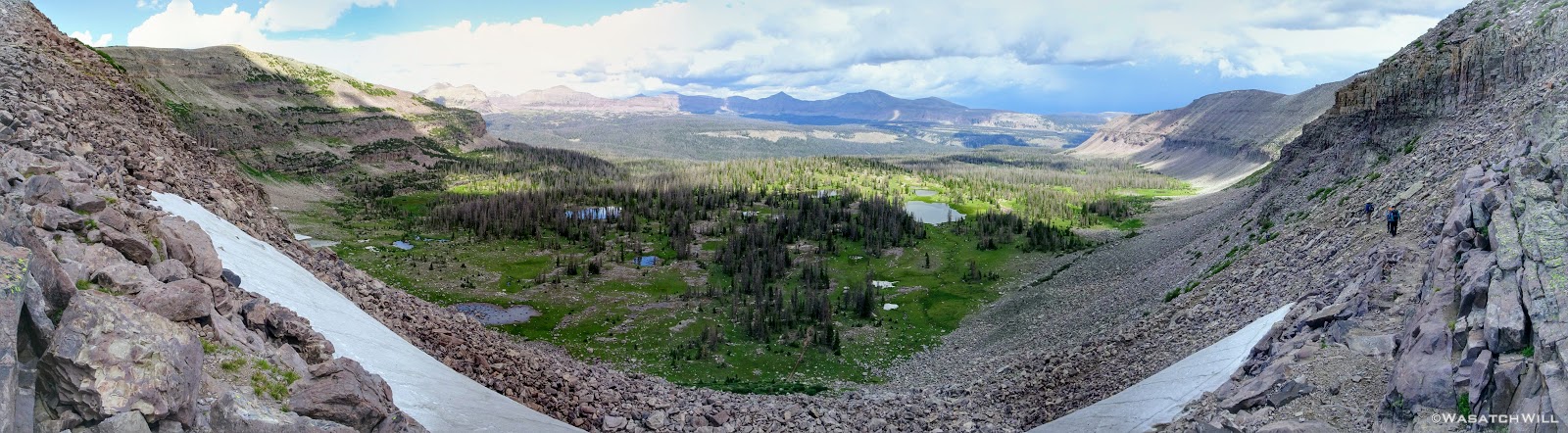
Pano view into Rock Creek Basin
So as to not give weather any more time to make us regret the stay, we trotted on down off the pass.
Descending Rocky Sea Pass
Karate Josh and Subaru Josh continue the descent

Thistle
Indian Paintbrush
Once off the pass, it was tempting to start looking for a place to camp right away, but since it wasn't that late into the day yet, we chose to move down the trail a little further and look for site in the neighborhood of the Brinkley and Brinkly Lakes.
Myself pausing for a view across a tarn (credit: Josh Herod)

Karate Josh and Subaru Josh with Devin and Time further behind
As we approached the lakes, we got showered on a bit with some light rain and hail, but it didn't stick around long. Once we arrived at Brinkley Lake we began to scout around for a suitable site. Three of us had brought hammocks and two of us had brought tents. Unfortunately, many sections of the Uintas have had their trees devastated by a beetle infestation over the years and this was one of those areas. It proved too difficult to find a spot nearby with enough healthy trees in safe spots (sans widow-makers) for 3 different hammocks to be hung in close proximity.
Ultimately, Tim and Karate Josh sacrificed a night in their hammocks and settled on cramming in with Subaru Josh for the night. The tent Subaru Josh had packed along was a Tarptent Rainshadow 3. It was actually Tim's tent, a new one he had just recently got for nights out with his own family, but Subaru Josh had recently decided he has a preference for tents over hammocks and given the lightweight and spacious properties, it was a prime opportunity to take Tim's new tent out for a spin himself.
Fortunately, it was designed as a 3 man shelter and it was indeed just big enough to accommodate all of them with virtually no room to spare. As for me, I was able to spare myself from going to ground by finding a lone pair of trees that worked out just fine for my hammock.

Day Two Camp
Now that camp was all set up, we took a short stroll over to neighboring Brinkly Lake to enjoy the the evening's reflection.

Brinkly Lake with Priord Peak and South Yard Peak on horizon
Brinkly Lake with Priord Peak (middle) in view
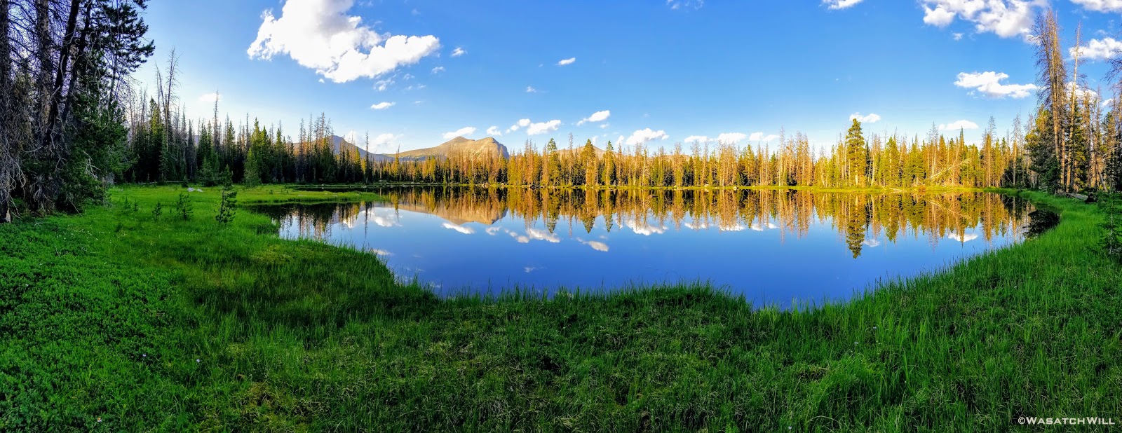
Brinkly Lake pano
We all returned to camp to laze about and have some dinner. Thereafter, I went back out to the lake to catch more reflection shots, this time with some colorful clouds as the sun was setting in the other direction.
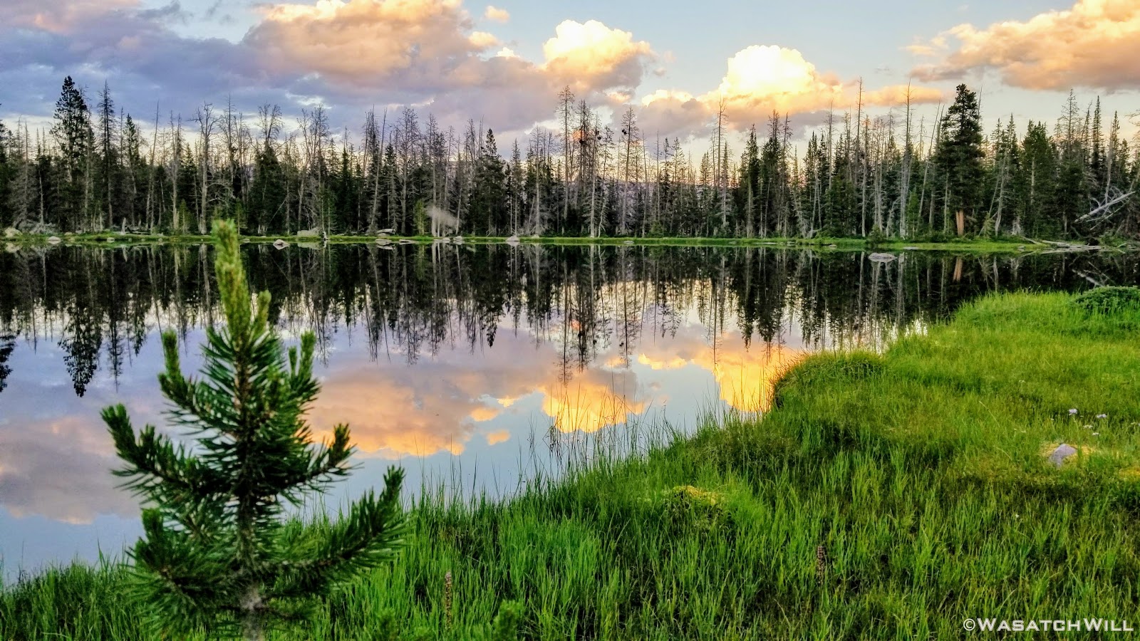
Evening reflection looking east across Brinkly Lake
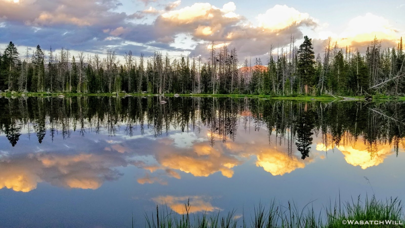
Evening reflection on Brinkly Lake

Rock intruding on reflection on Brinkly Lake
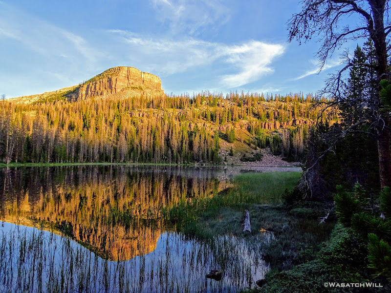
Before returning to camp and settling in for the night, I made a quick visit to nearby Brinkley Lake -- the 'e' before the 'y' is important here as it distinguishes to the two side by side lakes, Brinkley and Brinkly.

Sunset at Brinkley Lake

Brinkley Lake pano
Day 3
Friday - July 13, 2018
Once again we were treated to mostly clear blue skies as we awoke for day three. I returned back to Brinkley Lake to check out the morning's reflection.
Morning at Brinkley Lake
Back across camp and looking out over Brinkly Lake, some evaporative fog danced across the surface of the lake giving the morning an enchanted feel to it.

Karate Josh greets the sun at Brinkly Lake

South Yard Peak above foggy Brinkly Lake
Once again, we got back on trail after breaking camp. This day's journey would take us up along the Head of Rock Creek Trail on the upper bench around, well...the head of Rock Creek Basin. For the rest of the morning, we'd be back on a stretch of trail I had not hiked before. I was excited to see what the views at Rosalie and Gladys Lakes were like as we made our way around.
Tim trots along trail with Subaru Josh ahead
Karate Josh and Devin take in a view from along the trail
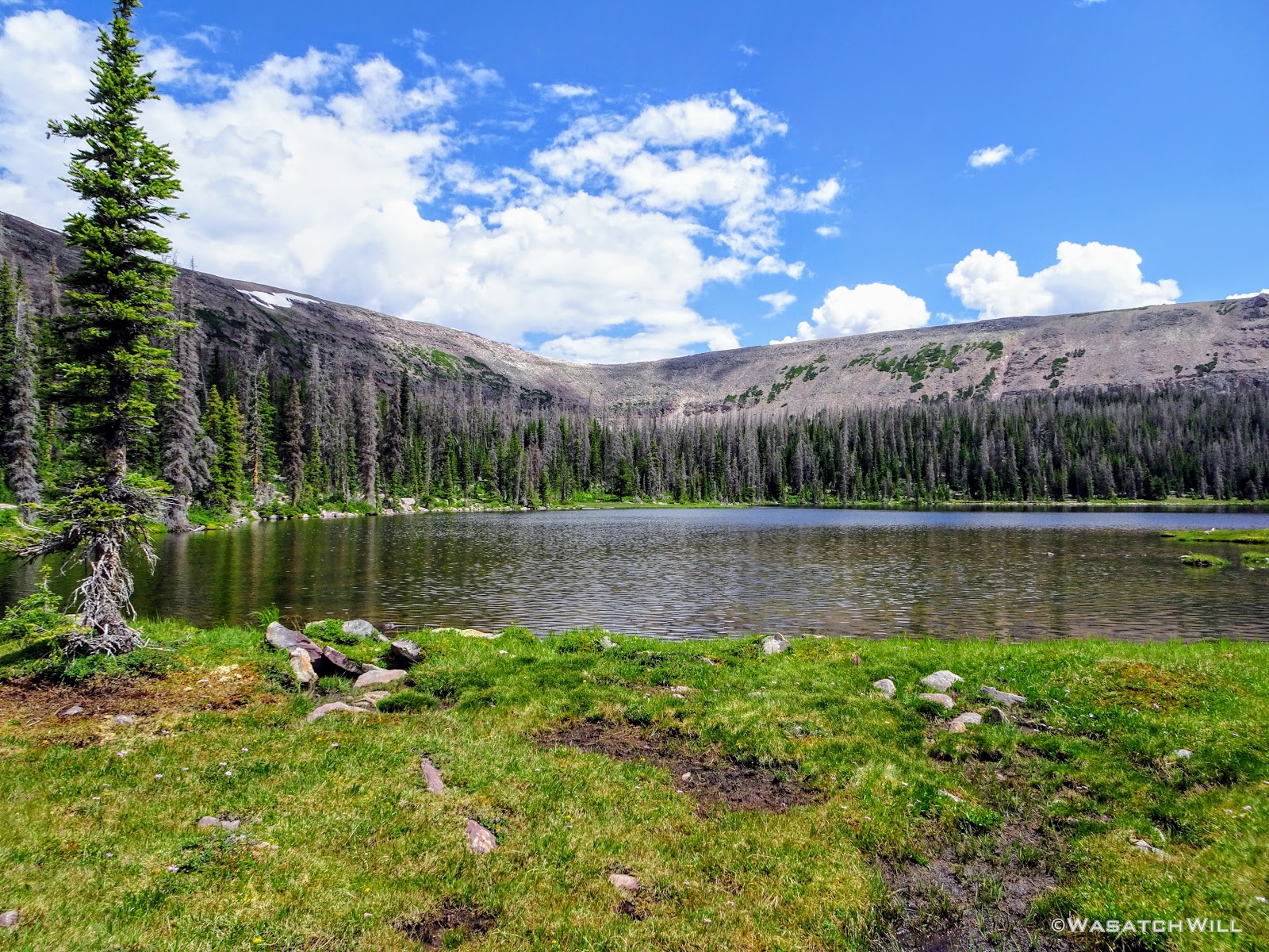
The views did not disappoint. Rosalie Lake was gorgeous!
Rosalie Lake

Rosalie Lake Pano
And then there were the flowers. Up along this bench, it was like flower bombs had exploded all over the place. There were Elephant Heads, Primrose, Indian Paintbrush, Daisies, Bluebells, and so on! At times it felt like we were walking through a rainbow with the variety of colors there were.

'Elephant Head Meadow' with Spread Eagle Peak above

Elephant Head flowers close up
Elephant Heads
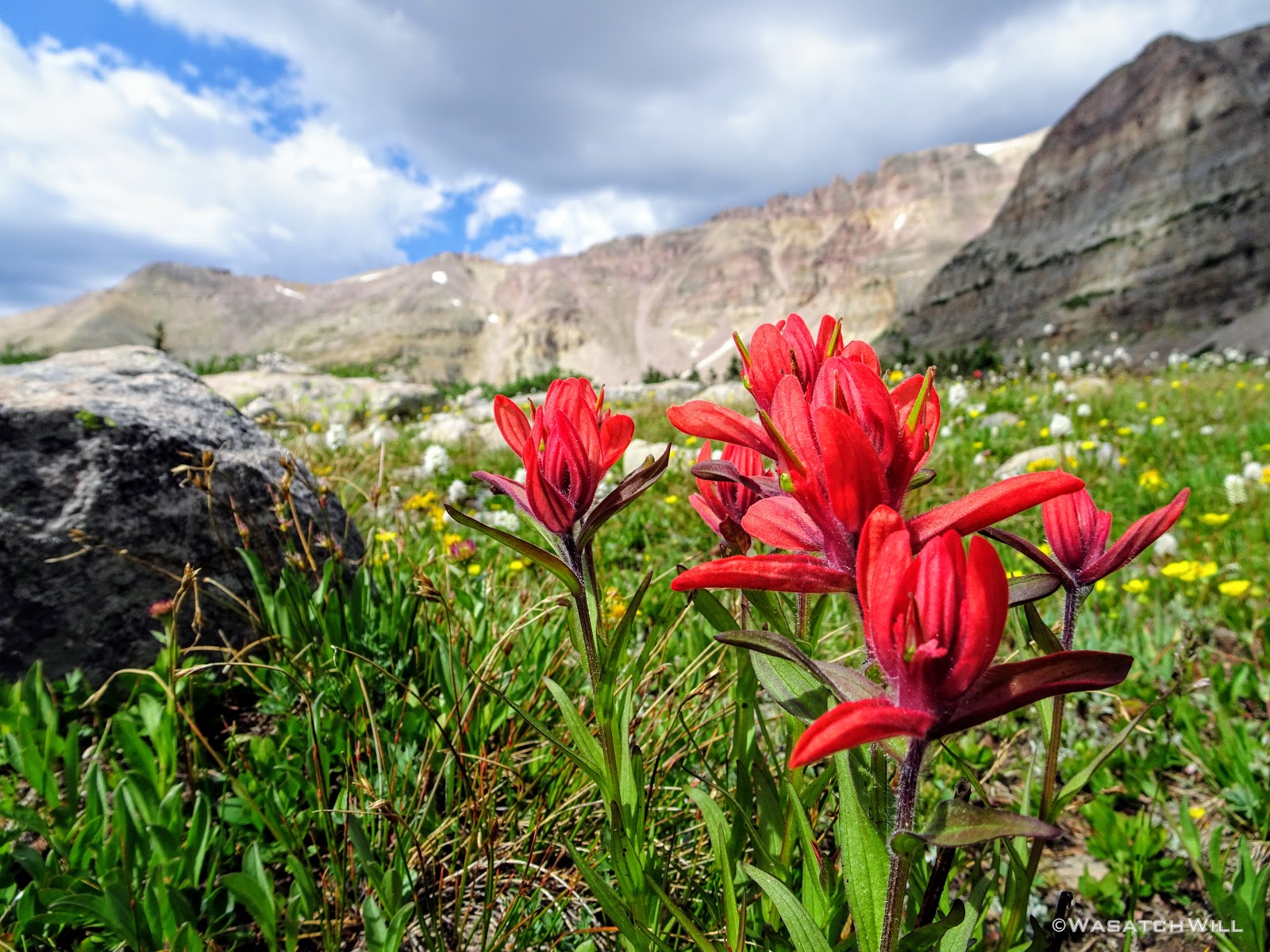
Indian Paintbrush
Between Rosalie Lake and Gladys Lake, we encountered a lingering snow bank just off trail. The urge to pause for a brief snowball fight and a bit of glissading could not be resisted. Fun was had!
Time for fun in the snow
All along the bench, there were great views to be had out across the basin.

Myself checking out the view across the basin (credit: Tim Watson)

Front view of myself (credit: Tim Watson)
Parry Primrose flowers with Devin and Tim beyond

Snowbank
The flowers continued to roll out before us as we rounded around Gladys Lake and continued north and west until we reached Helen Lake at the head of the basin.
Gladys Lake in the distance
Gladys Lake

Yellow Indian Paintbrush
Paintbrush and Daisies
Up close Paintbrush among Corn Lillies

Bluebells

Bluebells and Corn Lillies

Flowers, boulders, and watery reflection

Gladys Lake Pano

Getting closer to Helen Lake

A white Bistort flower among Bluebells and Paintbrush
As we came into a view of Helen Lake, we agreed it was a good area to put the brakes on and pull over for lunch.
Helen Lake comes into view
And so we did, with a fantastic view of the lake out below. Many a fishermen were spied upon as we exercised our palates.

Lunch and a view
Refueled and recharged, we commenced the second half of the day. We'd drop down between Helen and Lightning Lake and keep to the east before turning south as we continued to follow the upper benches around the other side of the basin. From this point onward for the next few miles, we'd be once again traveling trail that was familiar to me.
Tim on the trail between Helen Lake and Lightning Lake
Looking southward down into the basin

Karate Josh, Subaru Josh, and Tim on the trail with Ostler Peak behind them

Rock Creek Basin overlook
Along the way, we'd pass by the point where shelter was taken from an afternoon thunderstorm last time I was in these parts. It was also the point I'd left behind my prescription Oakley sunglasses that I ended up running back over a mile (+ two round trip) to retrieve them.

This the view from about the point I left my sunglasses behind on my last trip through here
Moving on, we passed through the eastern bench's meadows. They were every bit as big and expansive as I remembered them being, though much greener this time around.

Massive meadows on east bench

Subaru Josh and Tim add some perspective
East meadows pano
The gang moves ahead
Shortly before joining back up with the Highline Trail proper, I snuck off trail to check out another reflection across a beautiful tarn while the others continued ahead.

Beautiful Tarn
Up close reflection
Right at the junction with the Highline, I rejoined the guys where they had pulled over for another good rest. At this point Suburu Josh's knee was flaring up and starting to bother him quite a bit. Devin, being trained in not only wilderness first-aid, but as a wilderness first responder, spared no expense in getting Josh taped up with some knee support and prescribed a generous dose of vitamin I.
This rest point also marked the furthest we'd get from the trailhead from which we started and which we'd be returning to. From here, we'd officially be making our return back to the trailhead.
Keeping to the Highline again, we now headed westward, and once again, back on a new section of trail for me, having bypassed this section of the Highline in favor of the more scenic bench up to Helen Lake last time I passed through the area. We'd also lose quite a bit of elevation to get across Rock Creek, only to gain most of it all back again before searching out a camp in an area we desired closer to Rocky Sea Pass. It remained to be seen how Josh's knee would respond to the treatment.
Not sure what Subaru Josh, Tim, and Devin were looking at

Small waterfall along tributary of Rock Creek
We all made it down to Rock Creek rather swiftly and without incident.

Rock Creek
Getting across the creek was another matter. I pioneered the crossing, carefully using my poles as I navigated across a narrow log and some rocks that proved to be a bit more of an obstacle course. I then coached a few others across, but it was all enough to make Subaru Josh a bit more nervous given the condition of his leg now. We employed some team work to get his pack across and then get him across.
This was certainly the crux of our trip which really wasn't much of a crux given so many other trips I've done, but I'm still proud to say, we all made it over with dry feet.
Only moments in our journey up the other side and beginning to gain back the elevation we had lost, Josh's knee started bothering him again. We paused for him to rest a bit while I thought through some options to help him out. Being one with a healthy amount of stamina, I volunteered to cruise ahead up the trail and hide my own pack at the next trail junction sitting between Brinkley Lake and Rocky Sea pass a mile ahead. I'd then return down trail and catch the other guys wherever they were and carry Josh's pack for him back up to the junction to spare him from having to carry it the full length of the steep gain.
When I returned down the trail to meet the group and take Josh's pack, they had already managed to make it up about 3/4 of the way. Still, to take the stress off of Josh's knee, I took over his pack the rest of the way up.
Once at the junction, we all had a nice rest. We all agreed to still go about another mile to seek out camp closer to Rocky Sea Pass and to ensure a shorter day for the next day. This time however, Devin, Karate Josh, and I would each take a turn front-packing Subaru's pack in addition to our own packs on our backs. Thankfully, we were all packing packs with not much more than 10 to 15 pounds of gear each and so it wasn't a horribly strenuous affair. I learned that this was another good reason for any backpacker to embrace a lightweight philosophy and endeavor to evolve their system to a lightweight to ultralight system. Not only does it make the hike more comfortable for one's own self, but should some type of injury happen, it makes it much easier for any hiking buddies to share the load and carry that burden, thus making it easier for one to travel with a minor injury.
With no stress of carrying a pack, Josh was able to make it up to our final destination for the day without further incident.
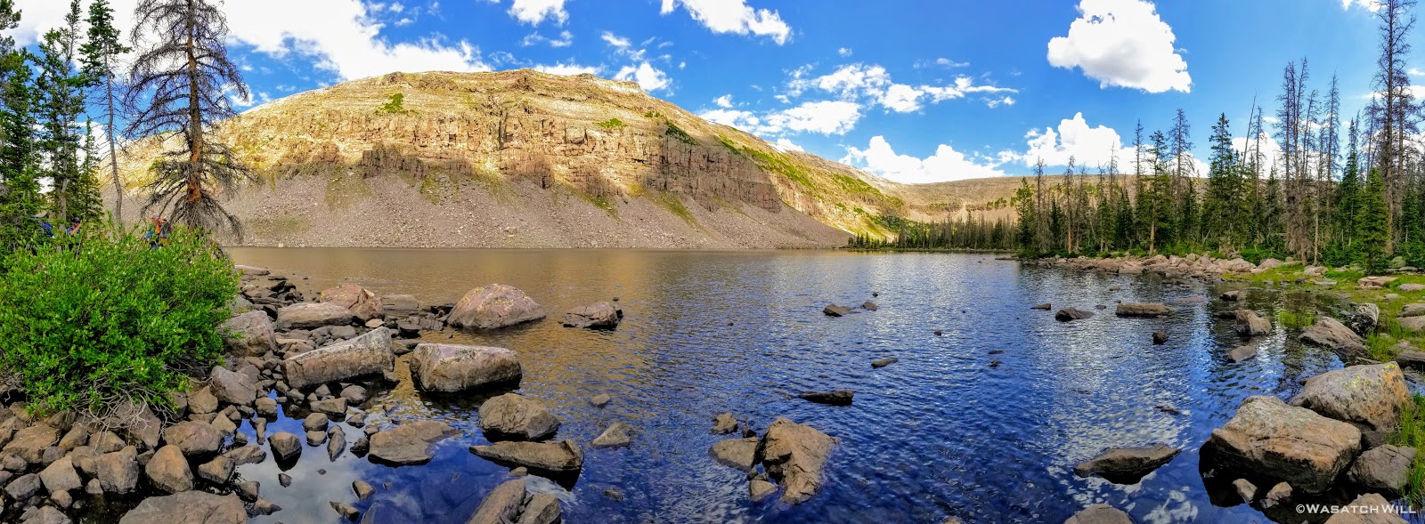
We found a cozy little spot not far from Rocky Sea Pass to set up camp for the evening. In fact, from the area all around camp, we had a great view of the pass and it was undeniably the most scenic camp we'd enjoy throughout the trip.
View from camp
Unlike the night before, Karate Josh and Tim were all able to find suitable hanging spots. It was once again nice to get into camp with a good amount of light left where beds and dinners could be prepared with lots of time to relax, enjoy one another's company, and reflect on the day.
Speaking of reflections, not far from camp were some larger tarns where more reflections of the sky could be enthusiastically enjoyed. I'm always a sucker for a nice reflection! It appeared that the clouds all around were shaping up for quite a nice sunset too.
Tarn reflection pano
Tarn reflection

Alpenglow on Explorer Peak
And then it happened. We were all treated to one of the most spectacular and memorable moments of the trip as the glorious light of the sun danced across the ridge line over the pass before fading off into its western bed. It really was quite a show!

Sunset show

Pink and purple hues

Purple Power
Last light on Explorer Peak
As was now routine, we all settled into our beds for some much desired rest as the dark of night enveloped us.
Day 4
Saturday - July 14, 2018
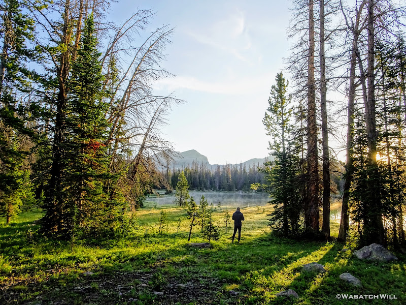
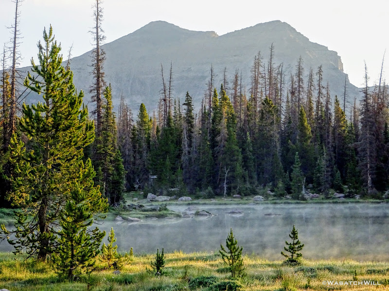
Morning arrived once again with calm skies, but unlike the previous mornings, clouds began to gather in the skies around us quite quickly once the sun had rose.

Dawn arrives on day four
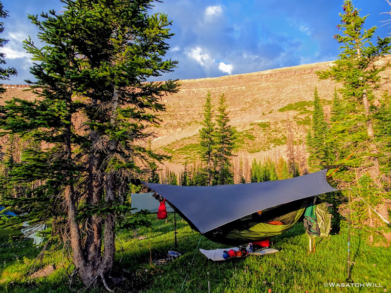
Still, there were often good cracks of light that illuminated the scenery surrounding us, keeping things pleasant for our morning routines.

View from my hammock
Rocky Sea Pass (left) as seen from camp
Morning sunlight arrives at camp
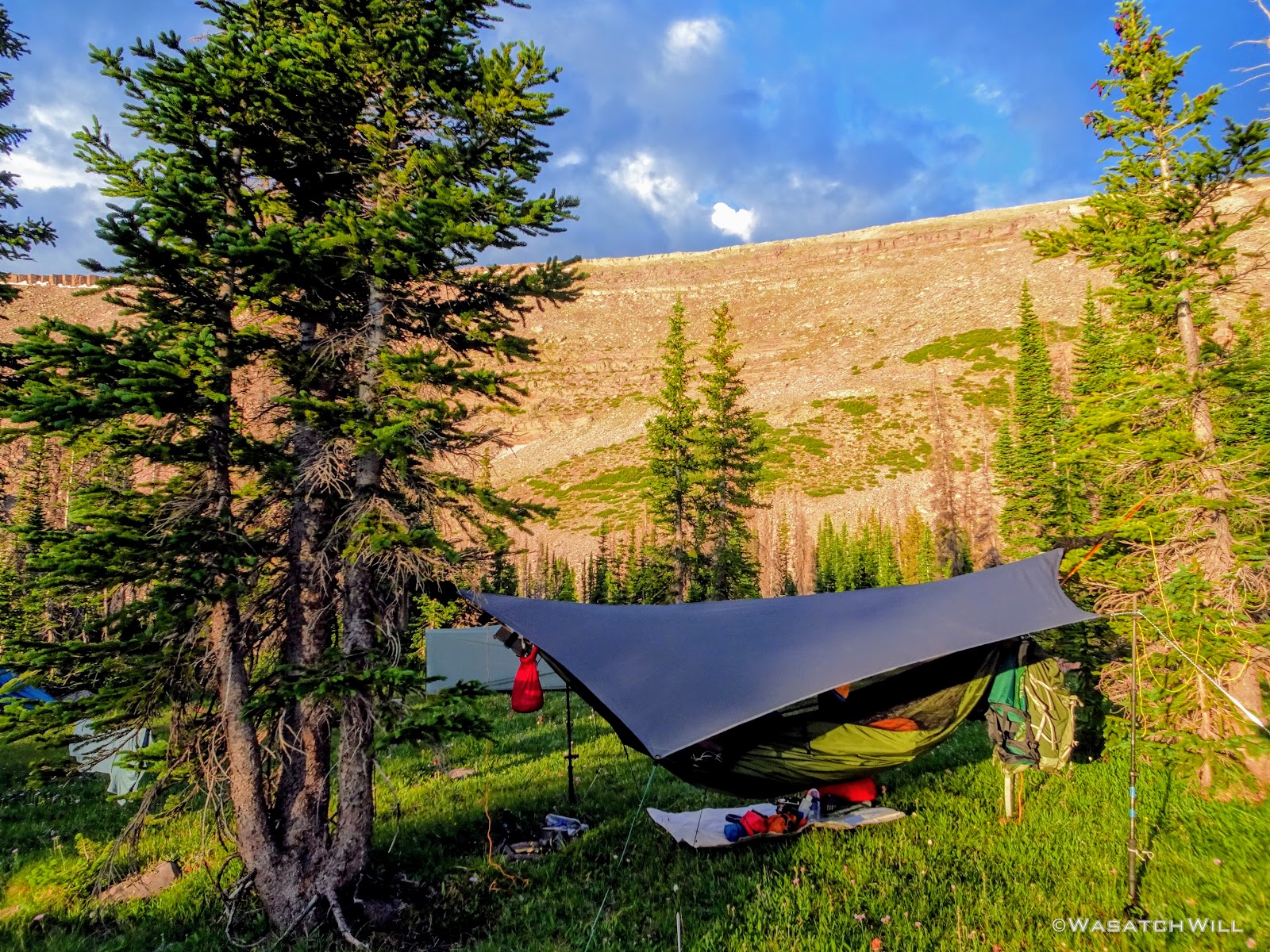
One of the better alpine camps I've ever slept at
Rocky Sea Pass

Rocky Sea Pass reflects on tarn
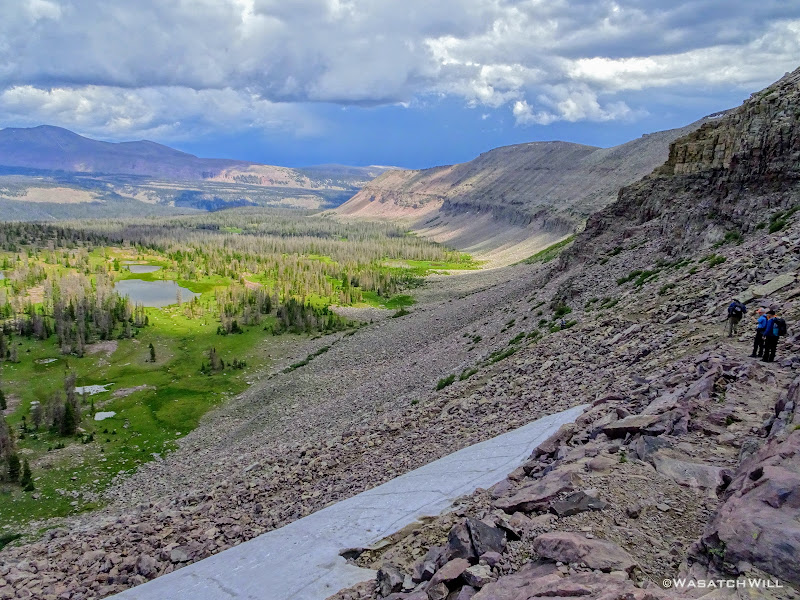
Fortunately, Subaru Josh's knee was know feeling well enough to take on his own pack again. To ensure we didn't hike more than necessary given Josh's knee, we'd be hiking our shortest day, only four miles, but with Rocky Sea Pass looming right among the first half of it all. Clouds continued to gather our whole way up, but the air was still quite cool and and there was no sights of lightning or sounds of thunder in any direction, so we felt comfortable forging ahead up and over.
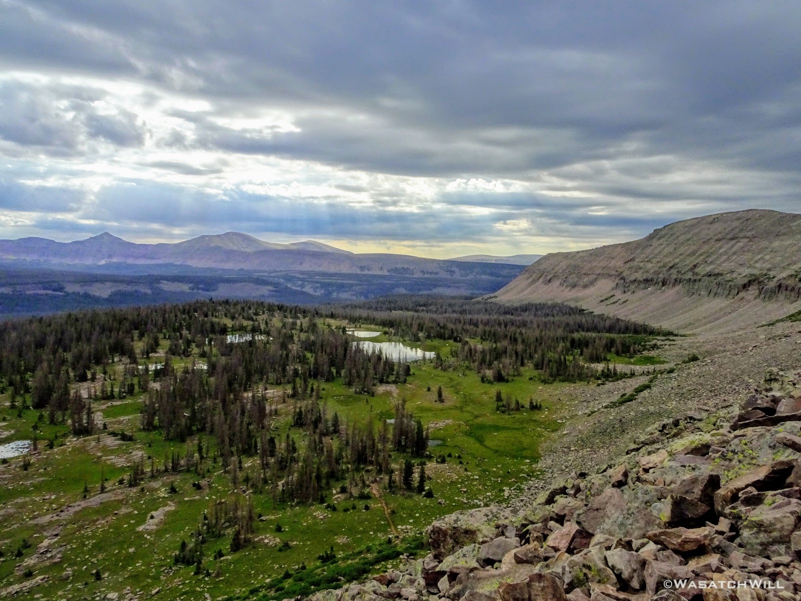
Sun rays reach through clouds above Rock Creek Basin
Once we hit the ridge, it grew quite windy and we did not linger up high for nearly as long as the last time over.
Myself atop Rocky Sea Pass (credit: Devin Ashby)
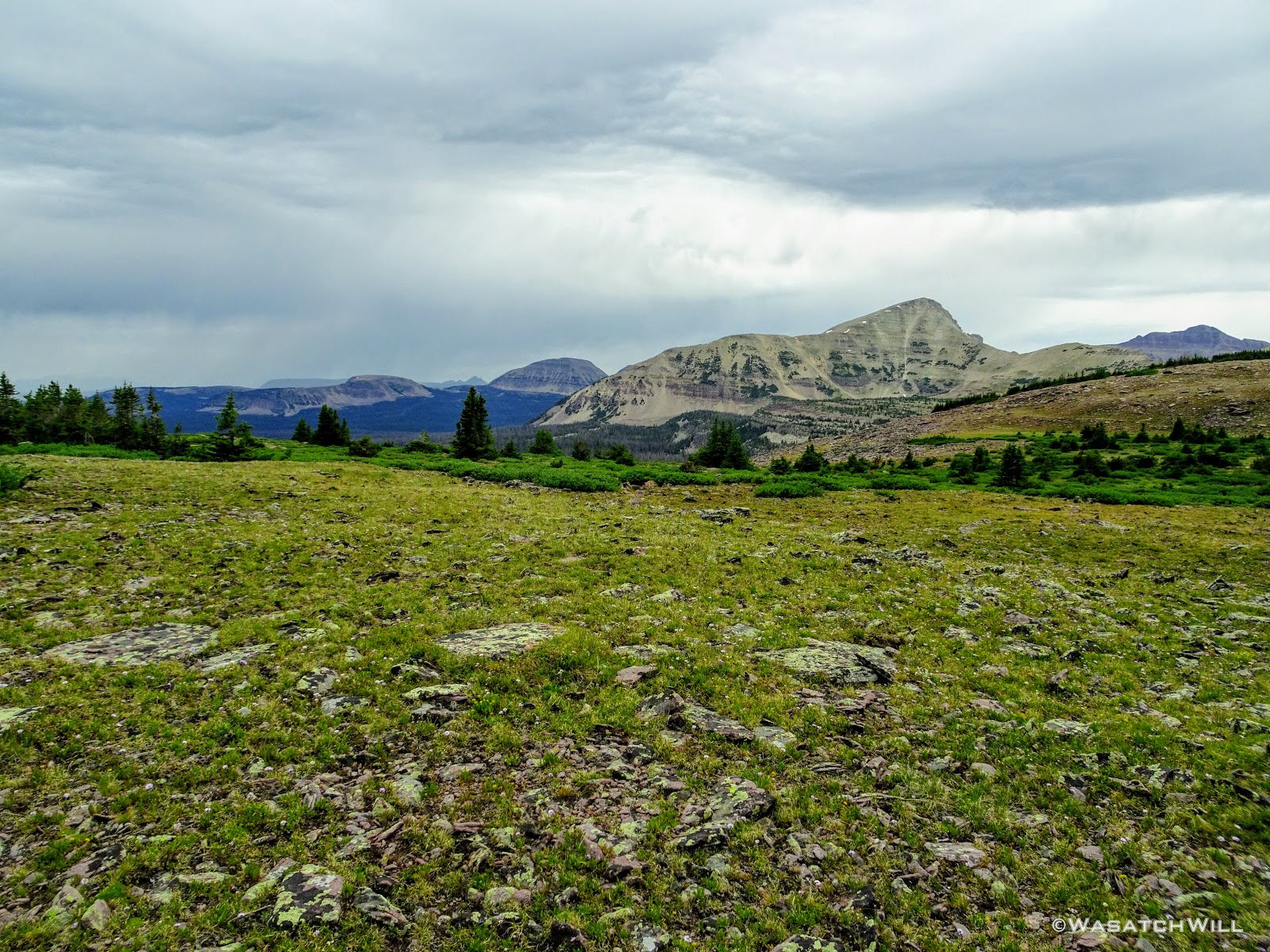
Mount Agassiz beneath gloomy skies

Trail descending west side of Rocky Sea pass
Once back down the other side, we again paused at Pigeon Milk Springs to retrieve some more water and have a good rest. Now the clouds opened up and began to put down a decent shower. Still no thunder or lightning though. No matter, we'd be in the cover of trees the rest of the way.
We finished out our day's mileage by settling into a camp a good distance off trail along the creek that drains out Naturalist Basin. Therefore, might as well call it 'Naturalist Creek'. The rain had also given way to some sunshine in our final mile.

Penstemons
'Naturalist Creek'

Final camp
When we started setting up camp, it wasn't quite 1 pm yet. It was by far, the earliest I had ever arrived into a campsite while on a backpacking trip and it felt awesome! Of course, a big part of that was knowing that Josh would now be able to rest his knee again and just enjoy some much deserved R and R time for the rest of the day. For me though...I had itchy feet and couldn't resist the temptation to take a stroll up and around Naturalist Basin up the creek to the north of us. The only other time I had been up into Naturalist Basin was late one June when the upper basin was still much covered in snow. I was now eager to see the basin all greened up.
Karate Josh was keen to accompany me while Devin and Tim chose to take it easy and stick around in camp with Subaru Josh. Karate Josh really takes care of his health both in diet and exercise, and it really showed on this trip. For being a resident of the lower lands of Ohio, the elevation and altitude of the High Uintas never seemed to effect him one bit.
So with that, I was confident the two of us would have no trouble circling the basin and back within 2-3 hours. Prior to setting off though, much of the group chose to soak their feet in the creek while we all feasted on some lunch.
By about 3 pm or so, Josh and I were ready to head up. I packed a little summit bag with some essentials and off we went. The point where the trail up into Naturalist Basin breaks away from the Highline was a considerable distance away from where we were camped, so we opted to travel cross country following the creek from our camp until we intersected the trail as it approached closer to the creek higher up.
Along the way we were treated to a pleasant little cascade.
Small cascade on 'Naturalist Creek'
Soon after, we emerged out on the trail and to the split where one has a choice to go west up to Morat Lakes, or east out to Jordan Lake. I opted to lead Josh on the tour in the clockwise direction, beginning with Morat Lakes, where I had made camp my last time in the area.
The trail up the lakes was certainly as steep as I remembered. Unlike last time however when I encountered nobody else up in the very popular basin, there were quite a few camps set up around the lakes, particularly at the more scenic of the two, the western lake.
West Morat Lake
East Morat Lake
Once past Morat Lakes, we'd not see much of anyone else again until we rounded back around to Jordan Lake, save one or two people out exploring along the high bench. To get up onto that bench though required a hefty push up a steep slope riddled with loose dirt and rocks alongside a waterfall, now much more meager than I had last seen it.

Waterfall and the way up

Karate Josh making the push up

Myself hanging loose at the falls
Still, once at the top of the falls, the view back out over Morat Lakes and across Grandaddy Basin further out in the distance was breathtaking, both in the literal and figurative sense. We'd also come to realize that clouds were quickly gathering, darkening, and approaching again, making rain look imminent once more.
Looking out over West Morat Lake

Looking out over East Morat Lake

Morat Lakes Pano
The day had remained quite cool and with still no sign of thunder or lightning, I deemed the conditions unlikely for any threatening lightning to materialize, so onward we went, rain or no rain.
Within moments we'd be going cross country again as we passed by Blue Lake.

Mount Agassiz above Blue Lake
And then scraggly little Walcott Lake.

Mount Agassiz and Walcott Lake
From there, Leconte Lake came into view and we rounded around the near side of it.

LoConte Lake comes into view
Looking back at Mount Agassiz across LaConte Lake
An abundance of flowers once again graced us with their presence for the next mile or so.
Heaps of Paintbrush and Bistort flowers

Mix in a variety of Aster/Daisy flowers
Flowers, LaConte Lake, and Mount Agassiz through a rain-coated lens
Here the coming rain had caught us. I had packed along both a windbreaker jacket and a proper rain jacket, just in case. Both were employed as I lended out the rain jacket to Josh who had not thought one would come in handy. It was a good lesson on how quickly weather can change in these high alpine environments. Fortunately the rain never grew strong and my windbreaker served me well enough also.
The scenery continued to wow us as we approached Faxon Lake.
Faxon Lake beneath Spread Eagle Peak (left)
From Faxon Lake it was on out toward Shaler Lake.

Shaler Lake comes into view

Waterfall feeding Shaler Lake
When we reached Shaler Lake, the rain backed off allowing the skies to lighten up a bit as we made our way out to the edge of the bench we'd have to now climb down to reach Jordan Lake. This part of the journey could have been relatively quick, but unexpectedly, the scenery grew more intense with more flowers, waterfalls, and continued vast views. The whole journey through this section was as much of a paradise as I can ever recall finding myself surrounded with and I wanted to soak up as much detail as I reasonably could along the way. I made many stops for pictures while Josh stayed as patient as a saint.
Paintbrush close up
Elephant Heads
More flowers, more bodies of water

At the edge of the Naturalist Basin's upper bench
Small waterfall

Pano of lower Naturalist Basin
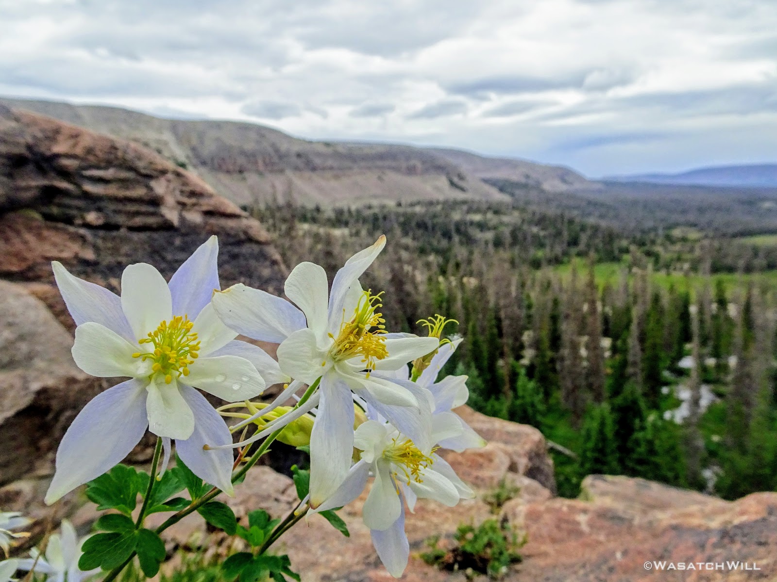
Columbines up close
A view back up at the bench
A clean running stream
Paradise found
At last, we found ourselves on the shores of Jordan Lake, the last of the named lakes along our tour or Naturalist Basin. This was also the point where we'd pick up a developed trail once more and we'd encounter many more people, as expected.

Jordan Lake...and yes, Mount Agassiz again
The scenery had obviously reached its climax and we were now eager to get back to camp to join the other guys for dinner and a campfire for our final night, the only one we'd have on the whole trip. We followed the trail back to the fork and then back down a short way before leaving the trail again to follow the creek back down to our camp.

Heading back to camp
Back along 'Naturalist Creek'

'Naturalist Creek'
We arrived at camp right on schedule at 6 pm and spared no time in preparing our last dinner. Reunited with the rest of the gang and with full tummies, we had ourselves a nice chat around a small fire as we recollected on all the highs and lows of the trip. Those bittersweet feelings that always come at the end of such epic multi-day trips swarmed over us all: sad to know we'd soon be leaving the confines of a beautiful and majestic wilderness area but also eager and excited to get back home to our respective families and loved ones.
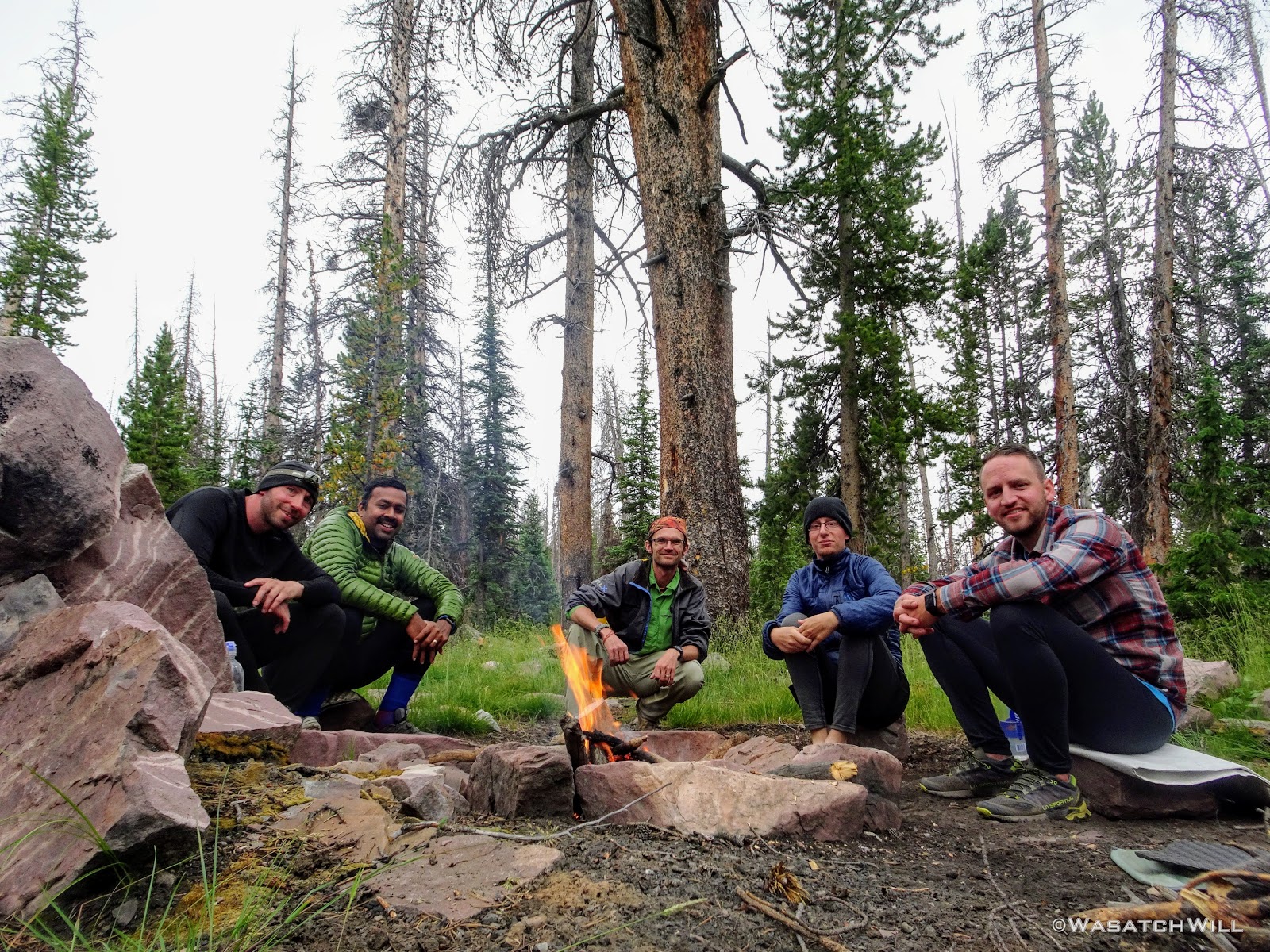
Karate Josh, Tim, myself, Subaru Josh, Devin
With the fading light, I tried my hand at a few long exposures along the creek before settling into my hammock one last time.
'Naturalist Creek' LE #1
'Naturalist Creek' LE #2
Goodnight!
Day 5
Sunday - July 15, 2018
The final day arrived under the canopy of both my tarp and a blue bird sky.

Good morning!
Our final 6 miles of the trip would go through much of a green tunnel, much like the first day, whereby the trail would pass by few clearings among the dense forest to allow for much of any views.
A rare open space along the trail

Farewell HUW!
About a mile left with Bald Mountain beyond the trees
It wasn't until we reached Bonnie Lake along our final mile that we ran into the same wilderness ranger that had intercepted us in Four Lakes Basin 3 days earlier. Did I mention he was quite a character? What we thought would be another 3 to 5 minute chat somehow turned into something well over a half hour. Adrian proved to be quite entertaining with lots of jokes and stories to tell, albeit with quite a bit of colorful language at times. Overall, he had a personality far different from any other ranger any of us had ever conversed with. I did not think to get a picture of us with him, but I did shoot some video for Devin of some of that conversation which he's published into a short four minute video here. Well worth the 4 minutes to watch it for sure!
Bonnie Lake, Hayden Peak beyond
Once we finally broke ways, we finished out the homestretch back to the car at the trailhead. We discarded our packs for the last time of the trip and after a routine freshening up and the enjoyment of some cold tailgate drinks, we drove on down to Kamas where we stopped at the Mirror Lake Diner there and treated ourselves to some delicious and hearty meals.
Yum!
Needless to say, I'm so thankful to Devin and Tim for teaming up to put this trip together for the rest of us and to have thus been a part of it. Many great memories were made, new friends were made, and the scenery was as stunning as we could have ever hoped for. The hope is now that sometime in the next few years, Devin and I can return a trip out east to visit the three Ohioans and have them lead us on a similar tour in a nearby wilderness of their choosing, be it somewhere in the Smokies, around Lake Michigan, or elsewhere out there.
If you enjoyed this trip report, then be sure to check out my video below when when you have 90 minutes to spare. You may enjoy that just as much. Below that, you can also check out the other guys' videos to get their respective perspectives as they documented the trip, all under an hour in duration each.
Videos:
Mine:
Devin:
Tim:
Karate Josh:
Subaru Josh:
")