- Joined
- Jul 23, 2013
- Messages
- 1,655
For the month of June, my shift at work has me getting Tuesdays and Wednesdays off. I had Naturalist Basin penciled in for the last week of June. Due to wet and muddy conditions earlier in the month in the area I had planned a daddy-daughter trip with my second oldest, I decided to allow a couple more weeks for it to dry out and green up and postponed that trip until the final week so at to make it all more enjoyable for her. So now I had a free "weekend" the third week of June.
In a spur of the moment decision, I asked my wife, Jessica, if she'd be alright with me dropping her and the kids off at her parents' place in Park City for the night while I backpacked up to Naturalist Basin. It was like an early Father's Day gift when she ok'd it.
Day 1
Tuesday - June 17, 2015
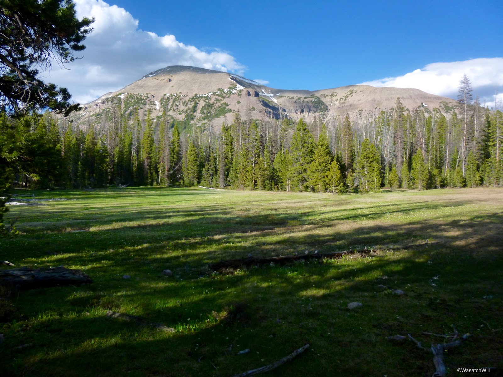
I've had Naturalist Basin on my to-do list for a few years now so I was excited. A week and a half prior, the Highline trailhead was still under several inches of snow. Since then, the weather had been so warm and sunny that it was safe to assume snow was melting out fast. Seeing pics from others camped nearby during the weekend prior helped to confirm the improving conditions. I decided to chance it with a contingency to turn back and camp in an area closer to the highway if I encountered more snow than I could comfortably navigate through.
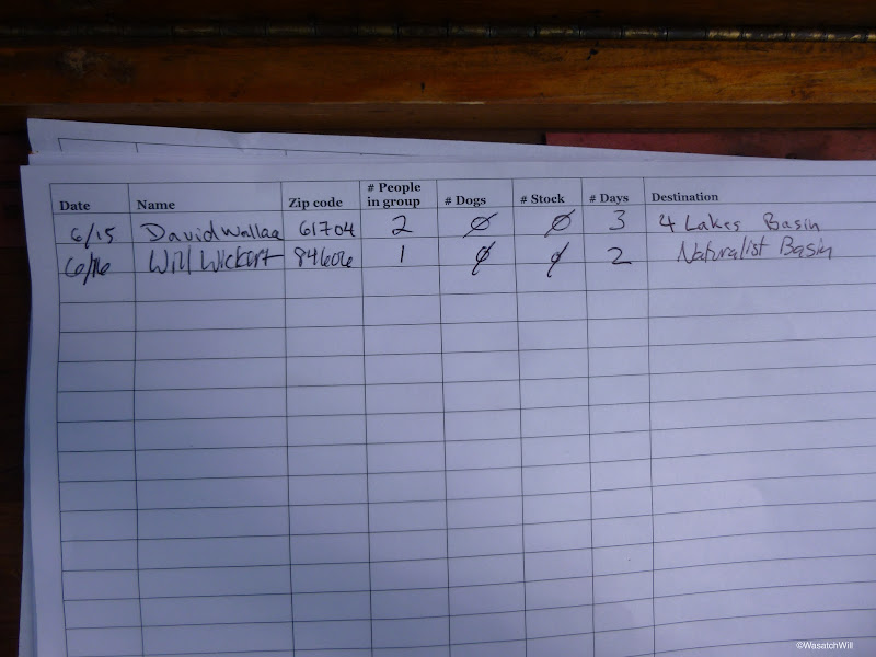
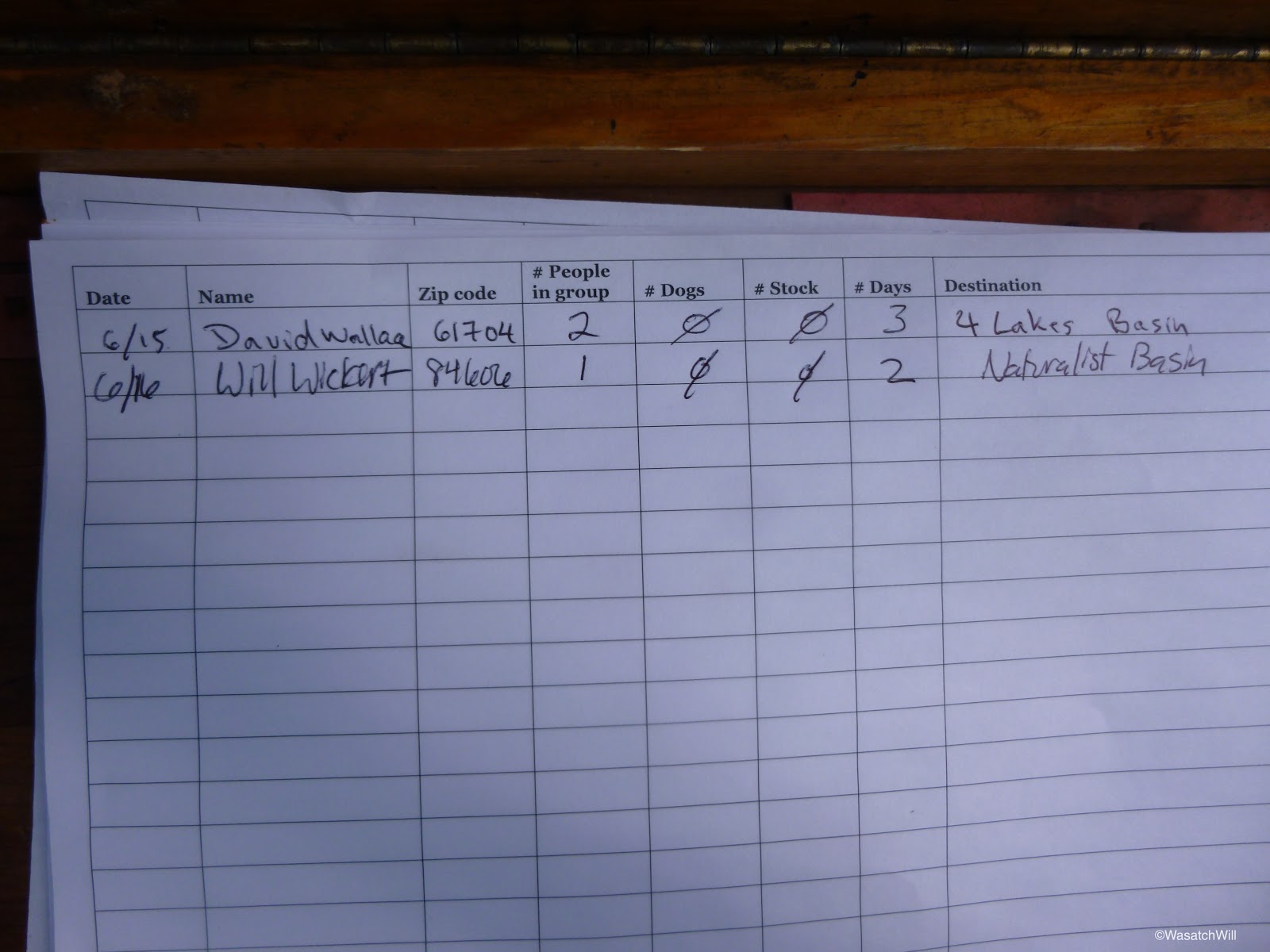
Once again, it was another late start on the trail for me though. It was about 6 pm when I was able to start up the trail. Two other cars were parked at the trailhead when I arrived. The trail register showed only one other party to be out and they were at Four Lakes Basin. All other sheets were blank. It was looking like I'd have all of Naturalist Basin to myself.
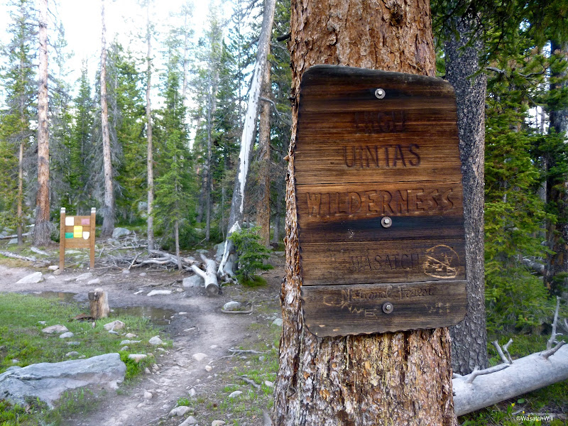
After about a mile, it was time to officially enter the High Uintas Wilderness.

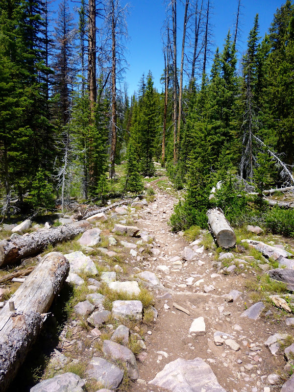
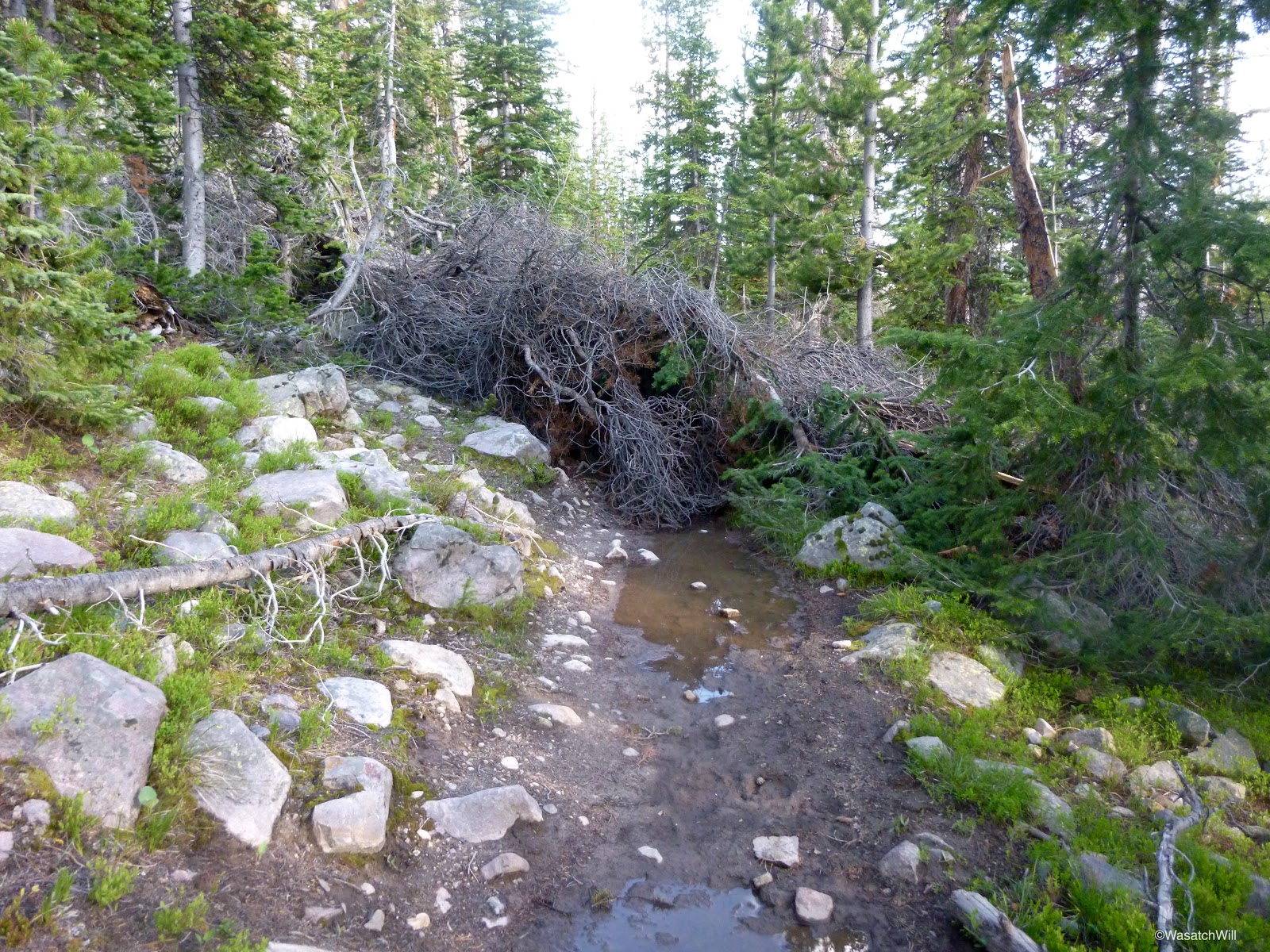
Trail conditions along the Highline trail were decent for most of the way. Obstacles were several small stretches of mud and water and over a dozen tree falls. The mud and water spots were easily avoided by stepping across larger rocks in the middle and along sides of the trail. Some of the tree falls were low enough to step up and over. Others required a significant detour off trail to get around.

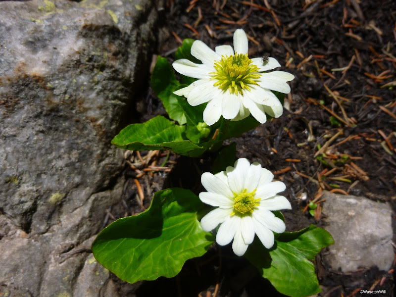
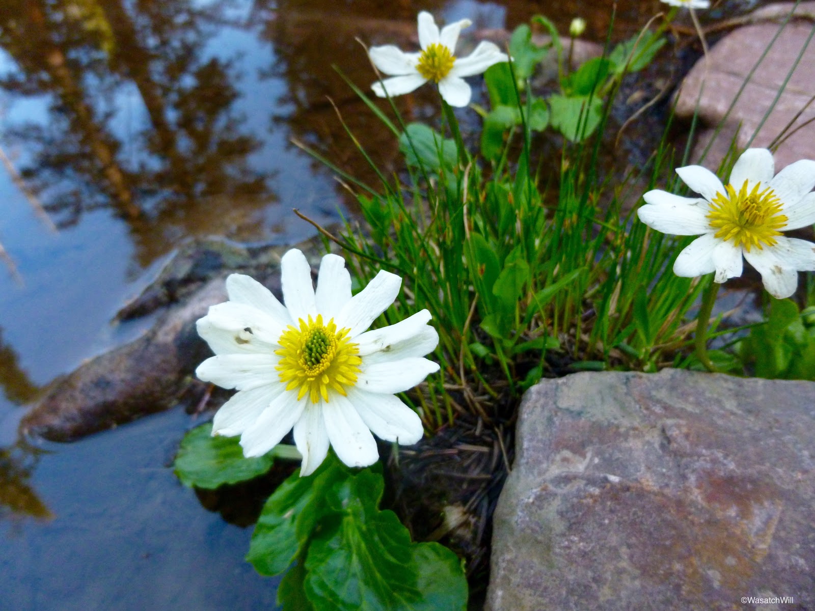
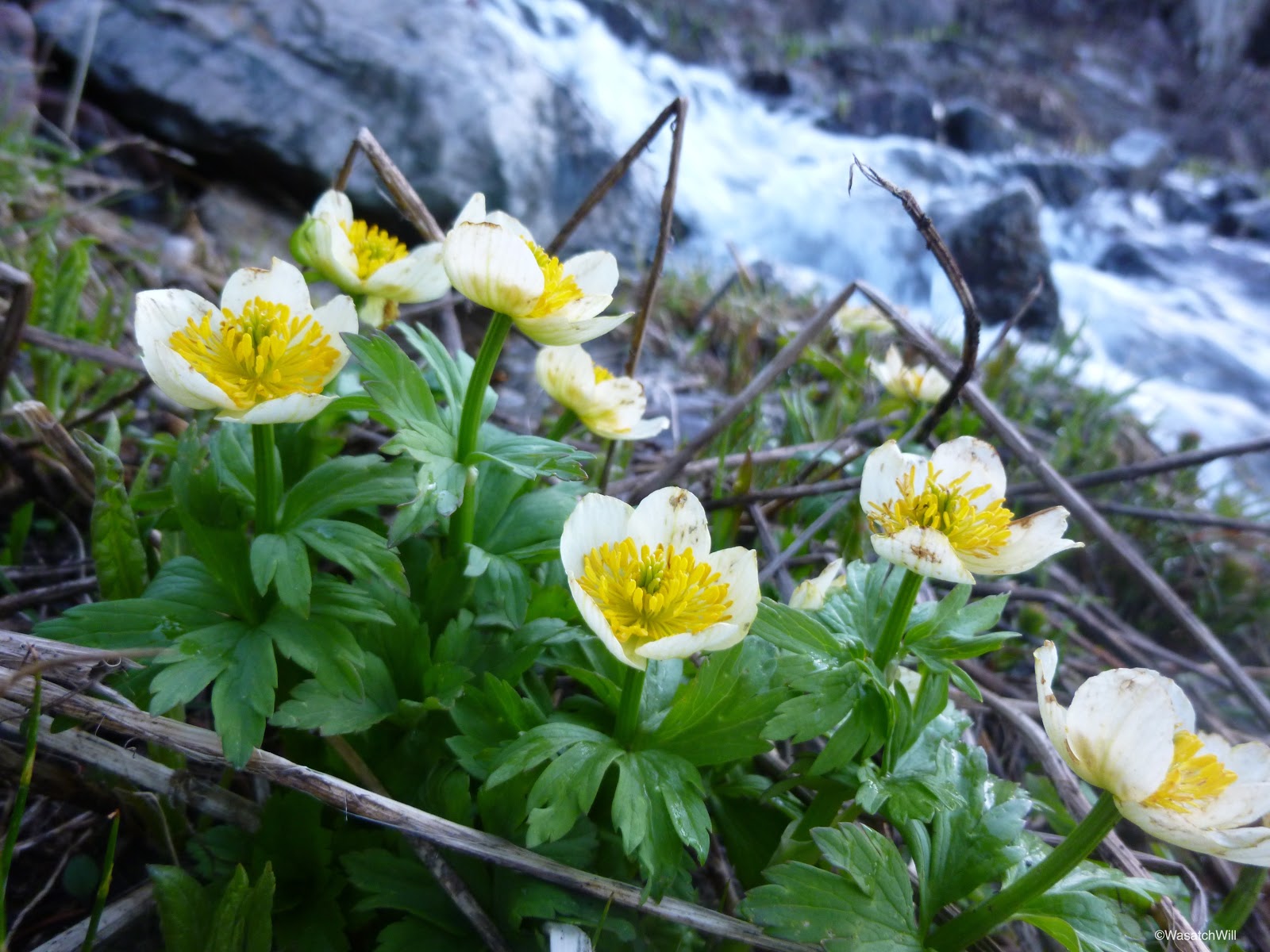
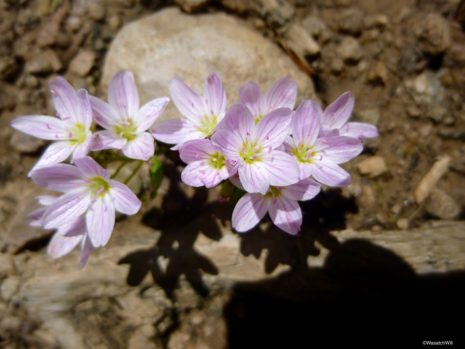
Wildflowers dotted the sides of the trail. It's impressive how quickly they can pop up and bloom, knowing that much of the trail was likely still under snow just two weeks prior.

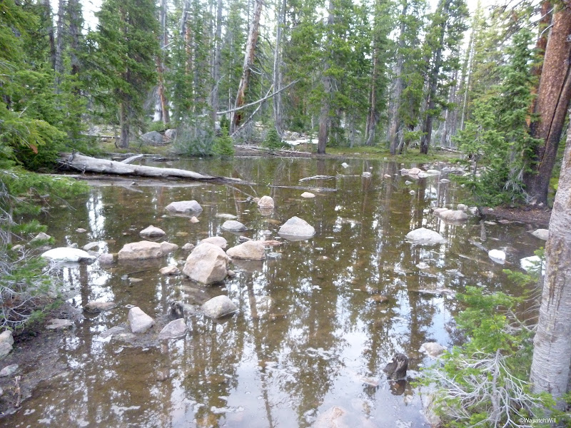
After leaving the Highline trail and turning up for Naturalist Basin, the trail conditions soon got bad. Very bad. Or so it appeared. The trail just disappeared into a pool of water a good foot or two deep.
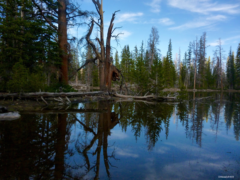
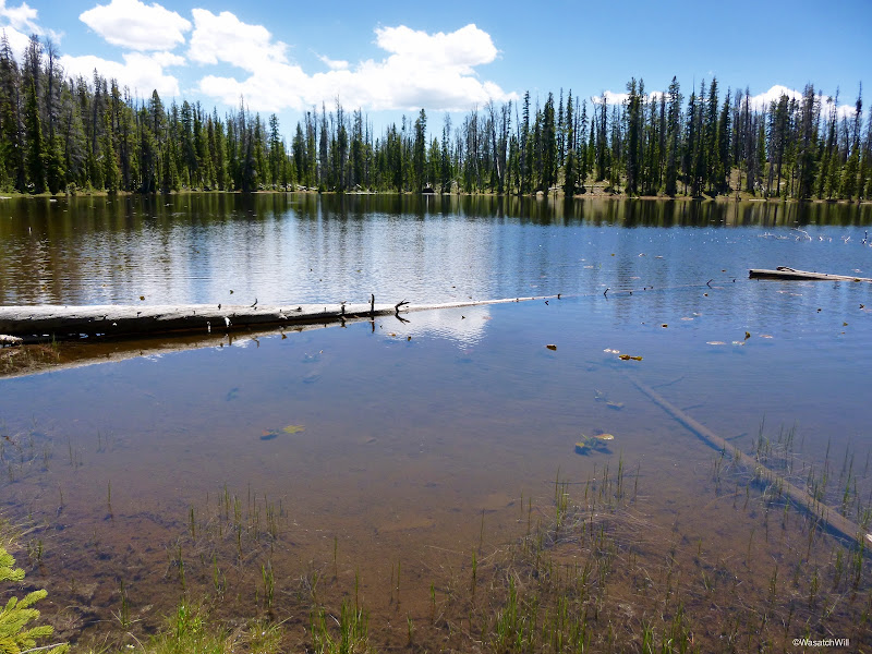
There was not enough big stepping stones to get me across. Fortunately, it didn't take much to go off trail and bypass around it. There would be a few more similar obstacles through this area. Just after getting around that obstacle, there was a nice little lake that hugged the side of the trail.
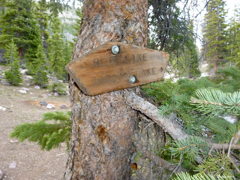
At last, I was looking at the sign that signals the arrival into Naturalist Basin. Left for Blue Lake or right for Jordan Lake. I had planned to do what most others do when visiting the area: settle into a camp site around or just above Jordan Lake and see what it was all about.
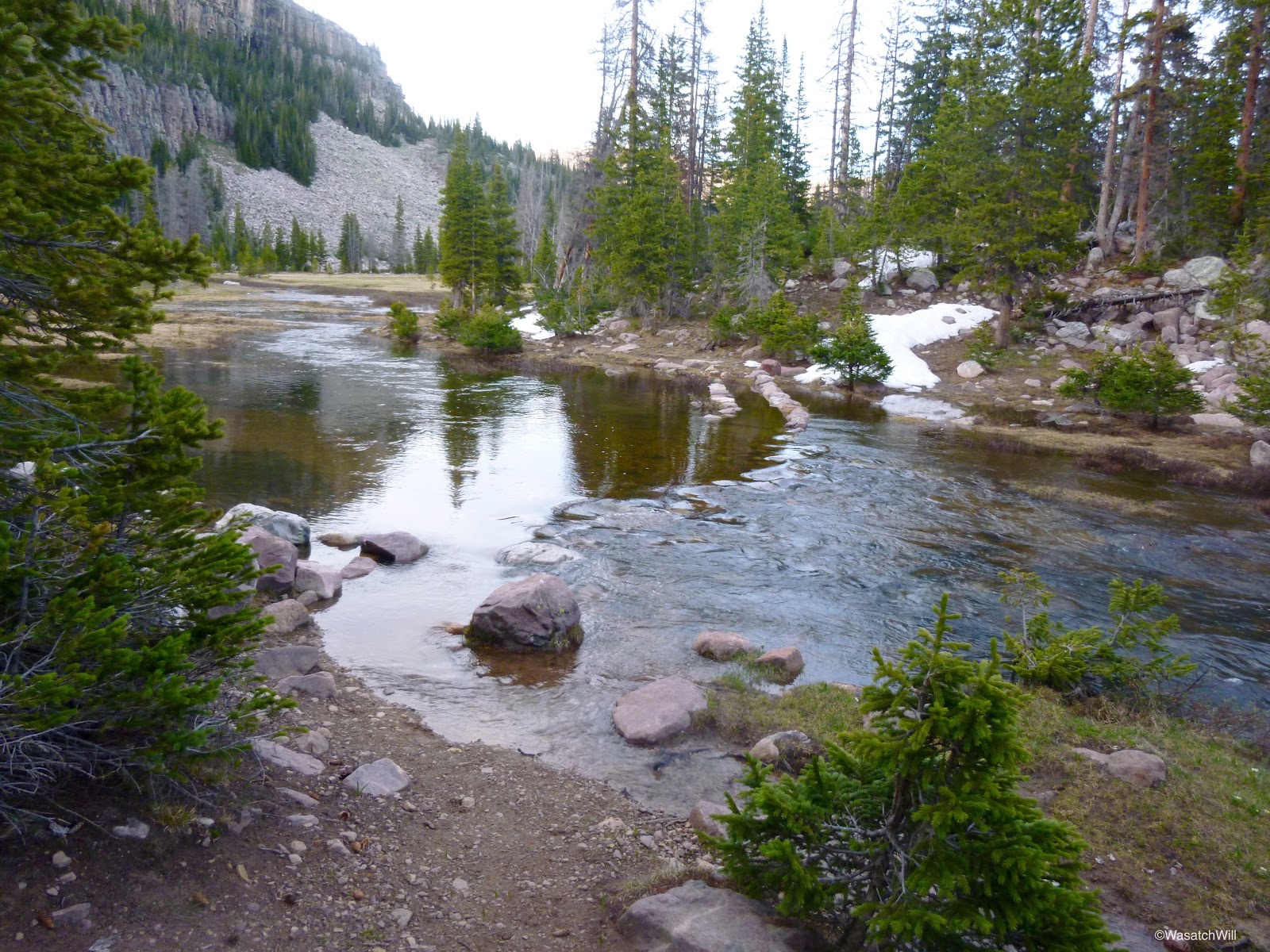
After only a few yards along the right fork, the trail once again disappeared into some water, this time a strong running creek.

I probably could have walked across the rocks lined up along the right side of the trail, but the majority of them were well submerged through the middle of the creek by several inches and I wasn't excited to get my feet all icy cold with no sunshine left in the day. I opted to take the fork leading up to Blue Lake.
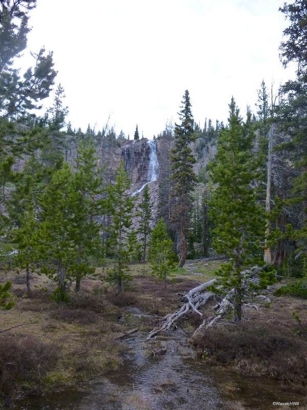
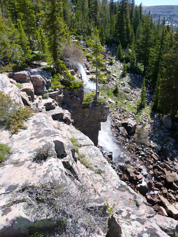
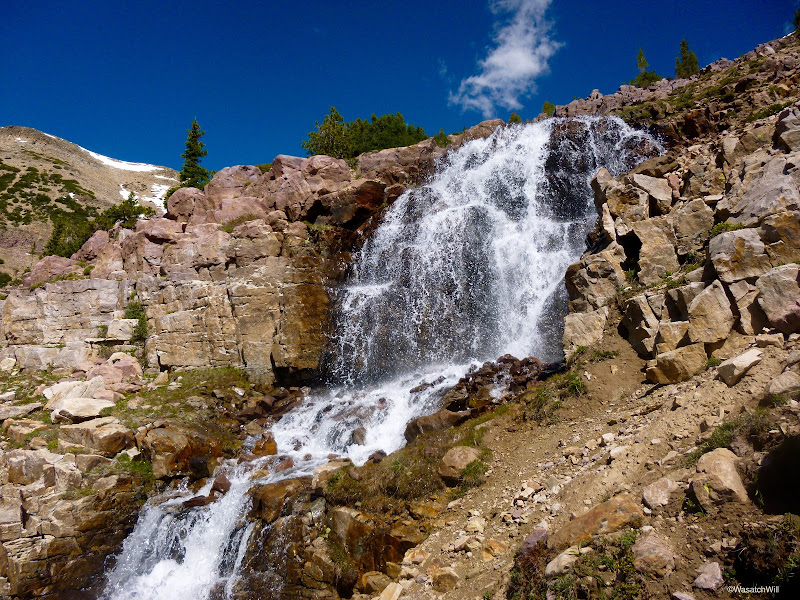
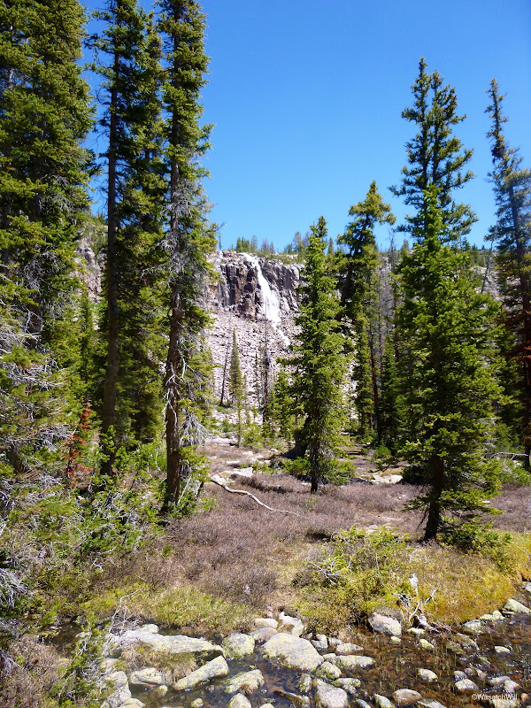
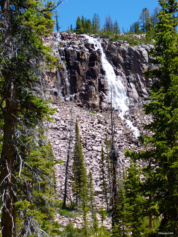
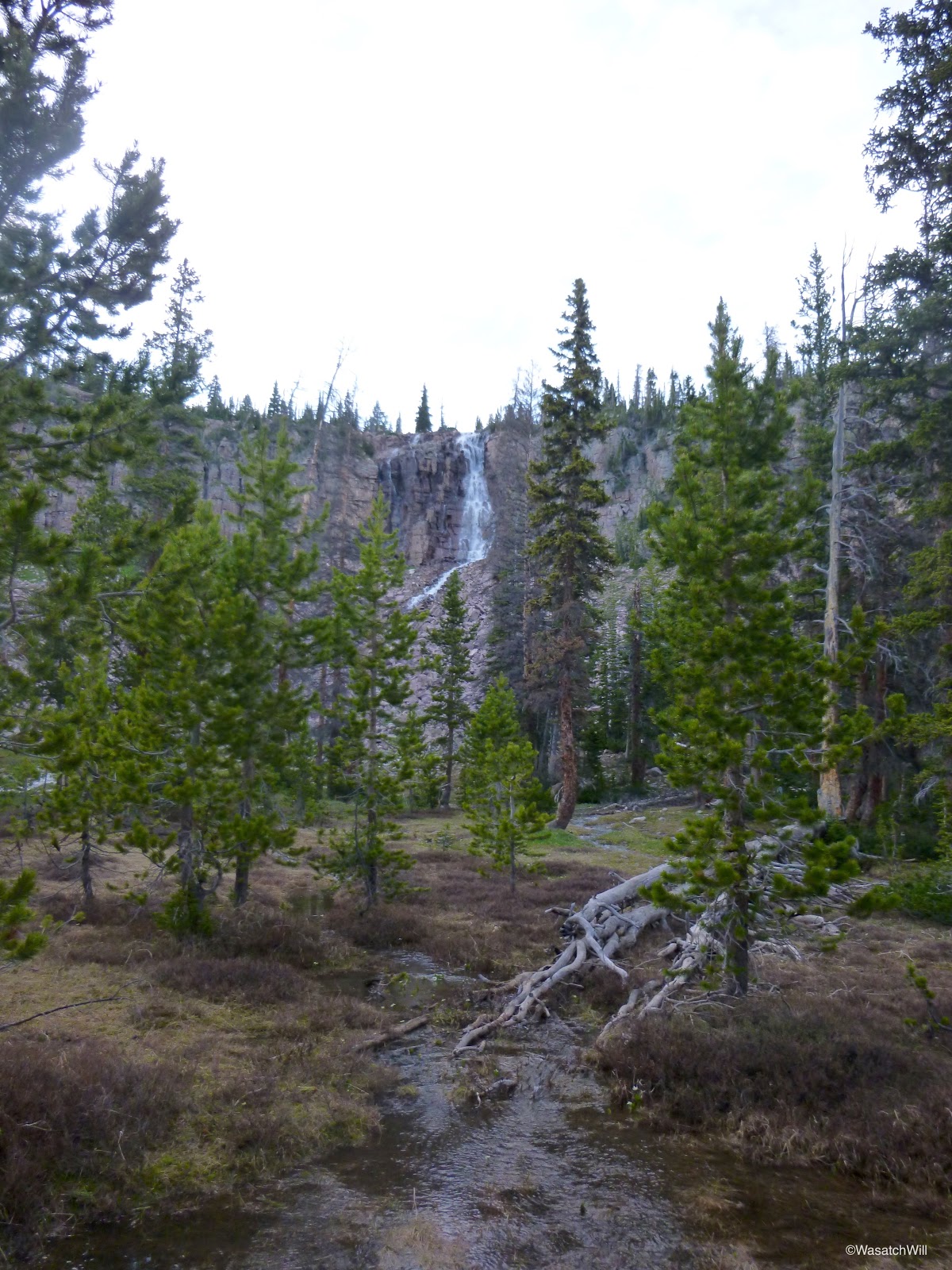
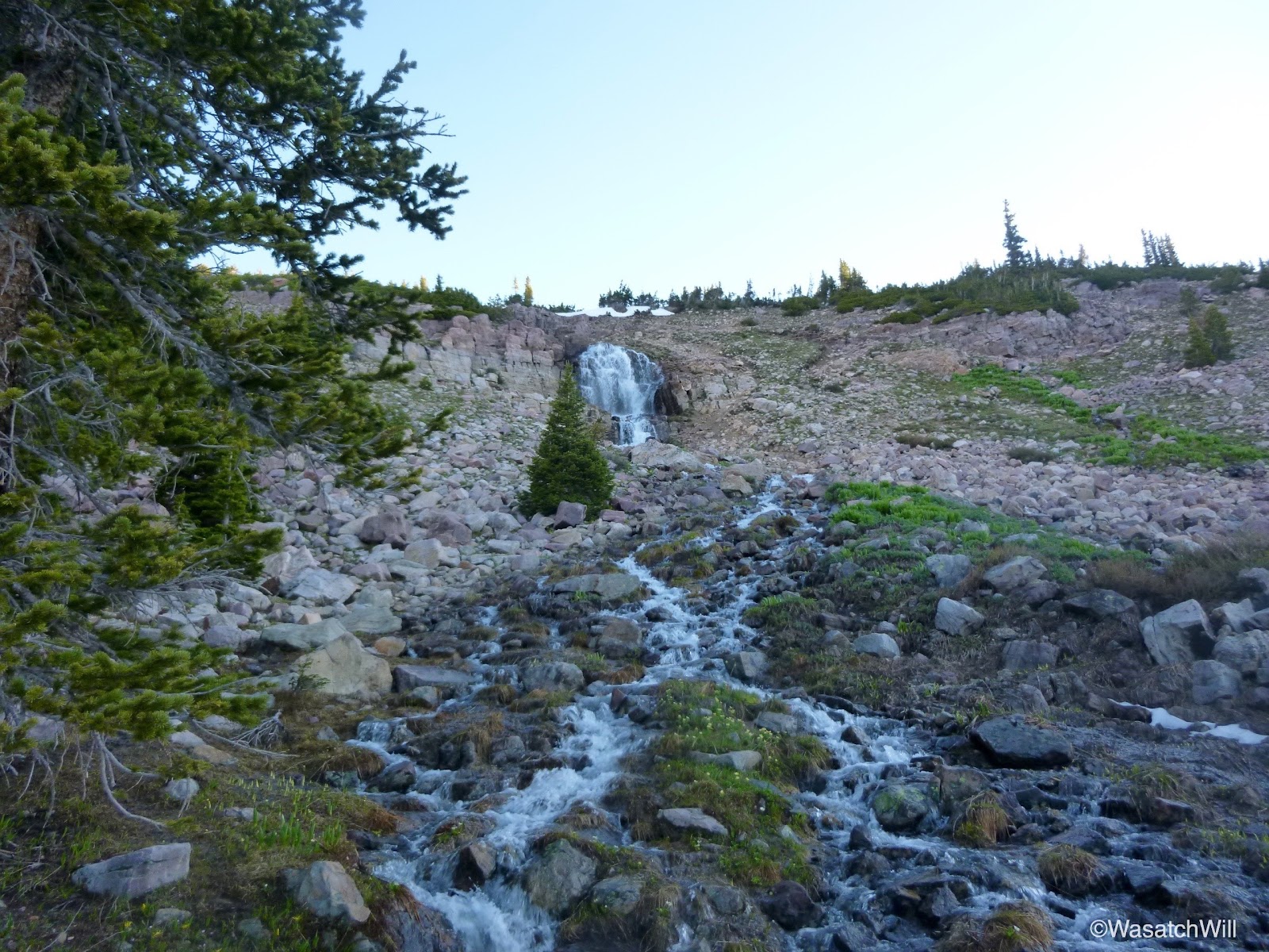
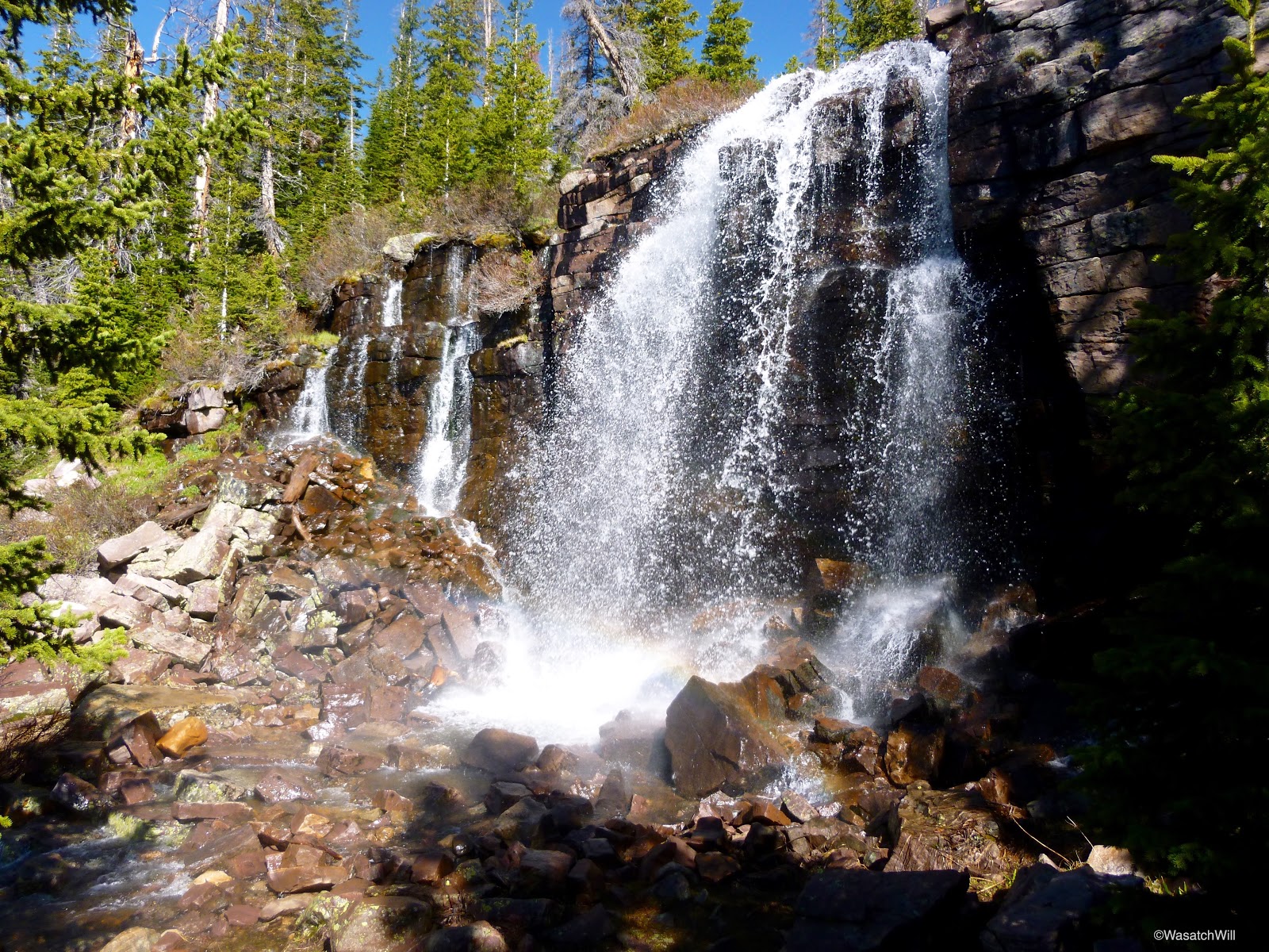
By now, the sun was well behind the mountain to the west and it wouldn't be long before the daylight was all gone. After only a few yards up the left fork, a roaring waterfall could be heard and then seen as I looked up through the trees.
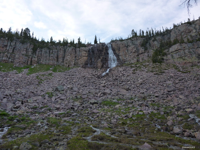
I made my way across the meadow by post-holing through some snow drifts and leaping across a number of little streams to get a wide open view of the falls.
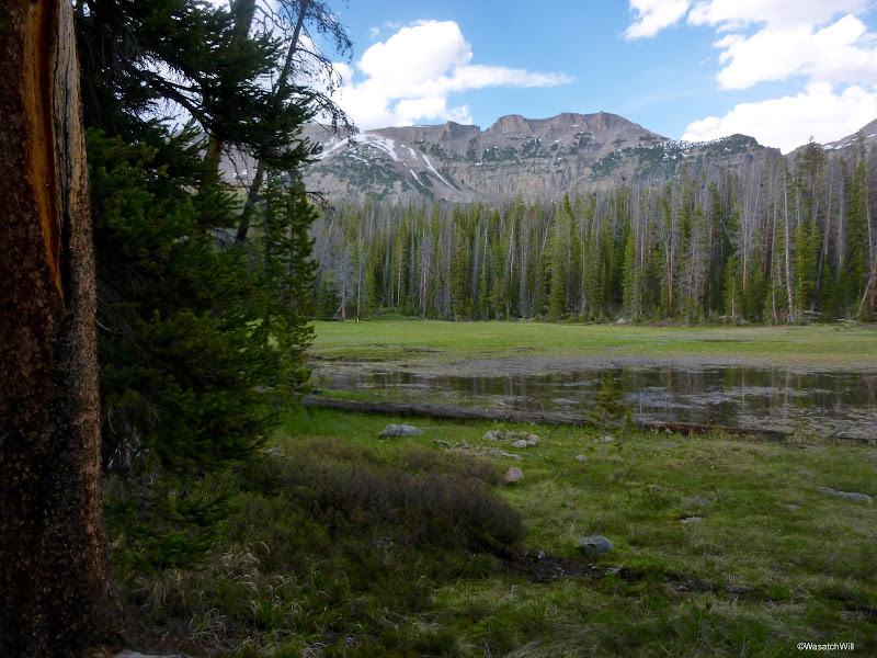
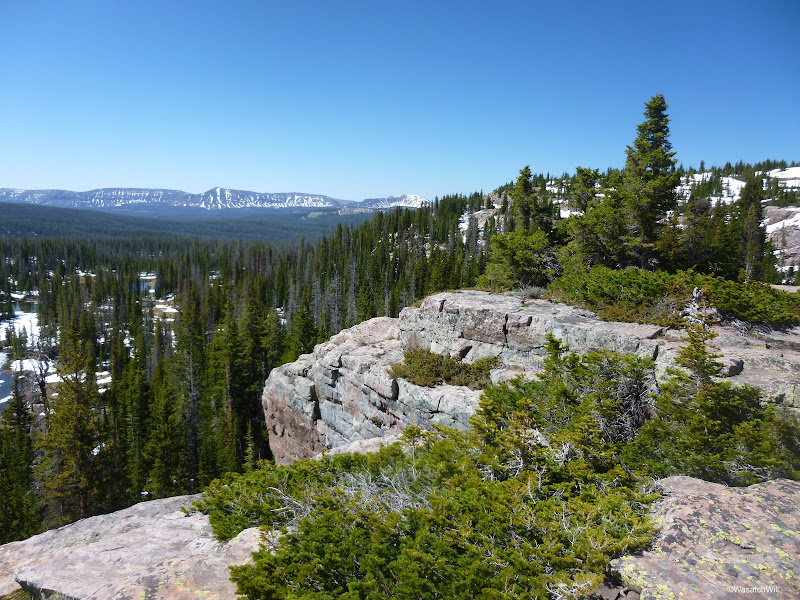
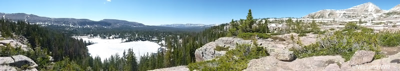
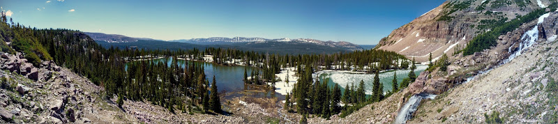
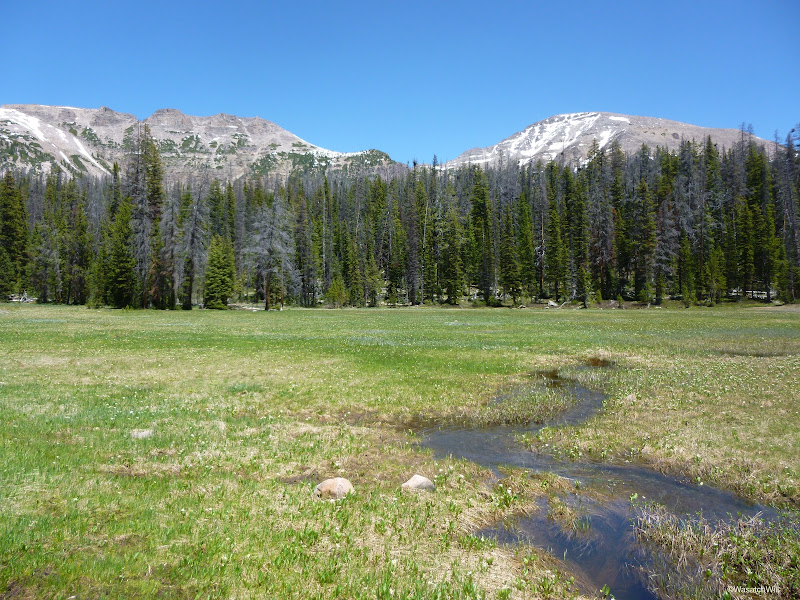
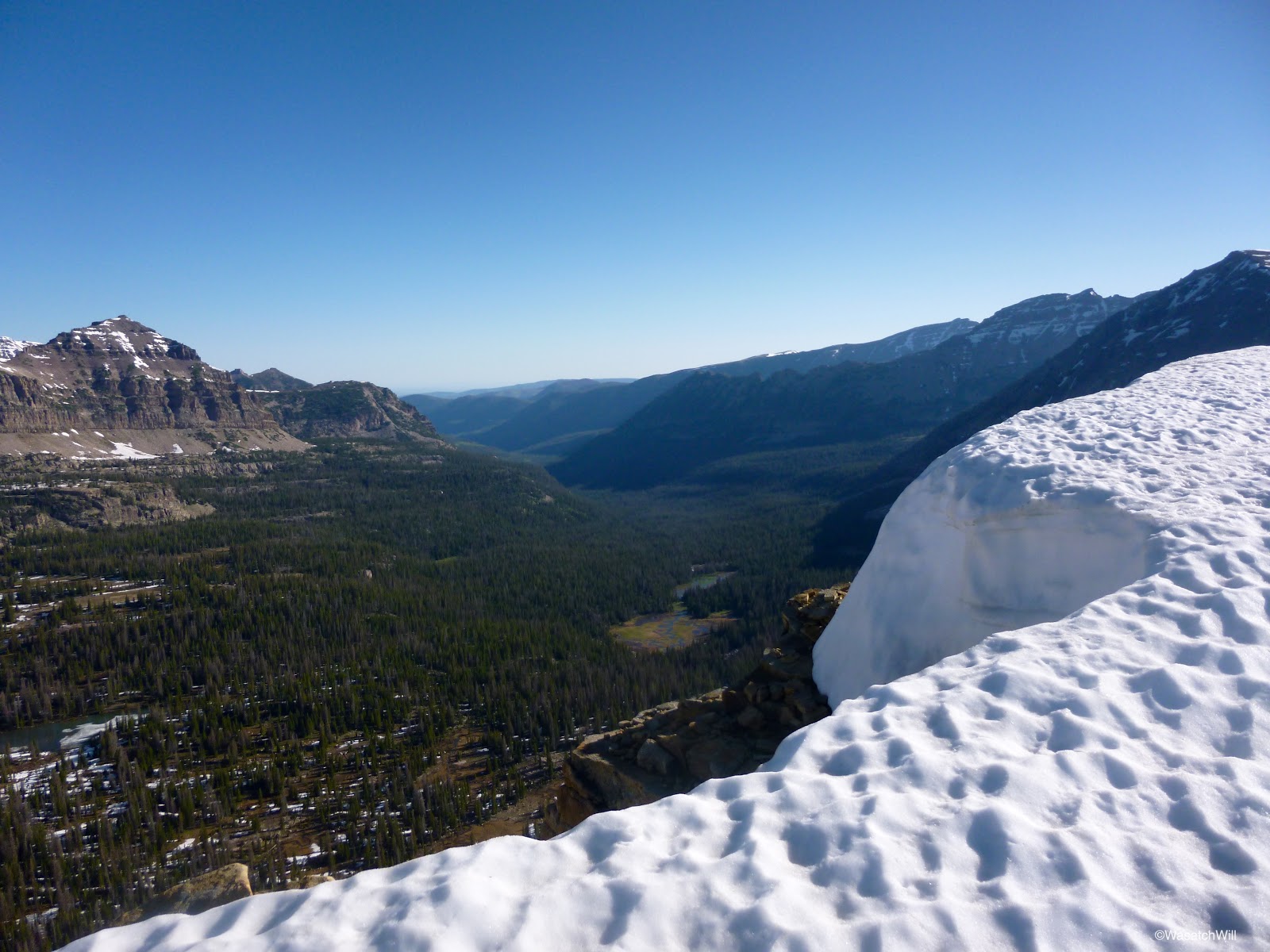
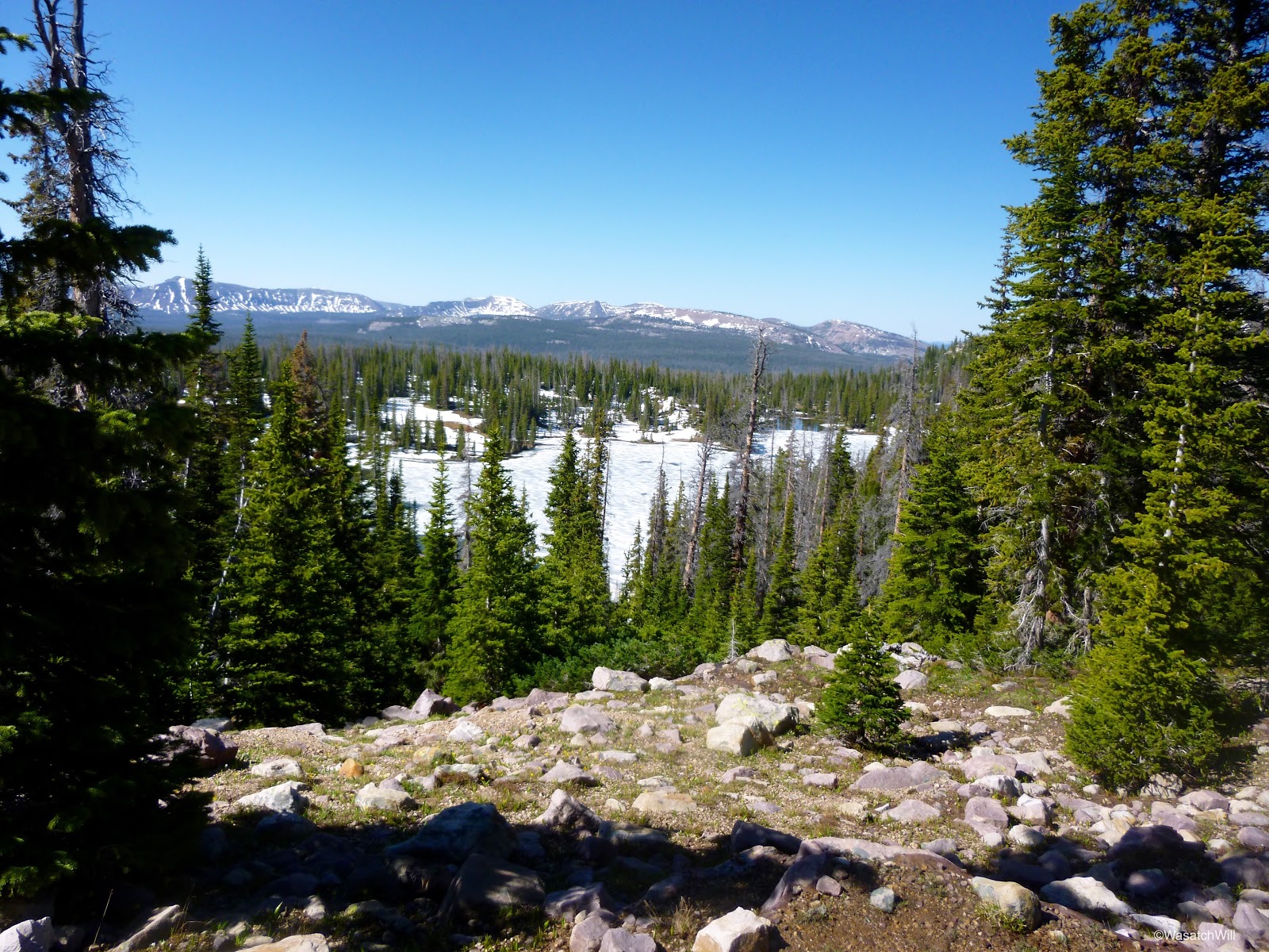
I then worked my way back searching for the trail. There were lots of snow drifts now and with all the run-off running through the area, it was hard to keep on it. I soon found myself in a wide open marshy area. I lost the trail again and just looked upward knowing I needed to get to the other side of the marsh and up onto the bench above. My feet would have to get wet after all. Had I looked at my map right then and there, I would have known to stay to the right of the marsh. Instead, I just went cross country across the marsh before checking my map and then scrambling through some trees and boulders to intercept the trail once more. From there it was just a steep little hike up the trail to reach the bench where I got my first view out across the East Fork Duchesne River drainage and Grandaddy Mountain to the south.
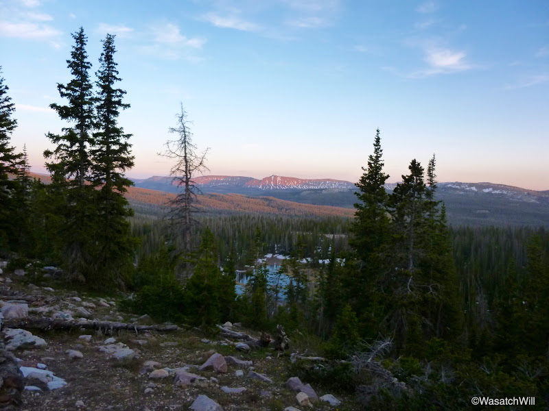
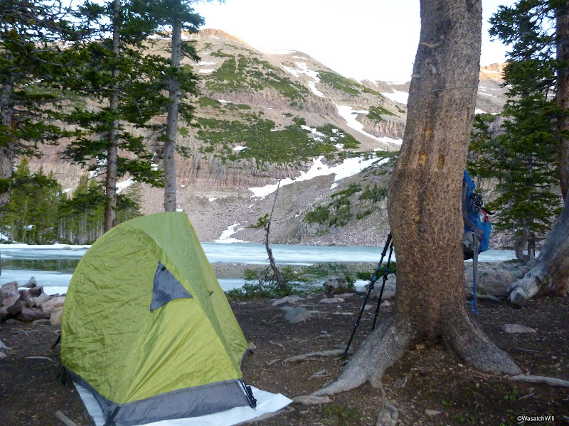
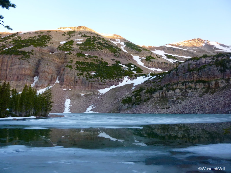
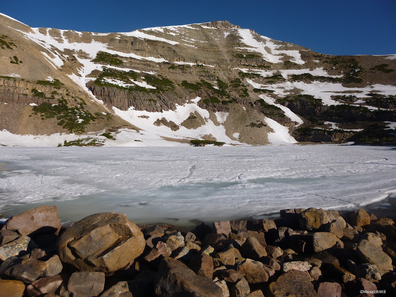
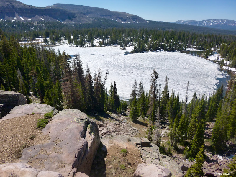
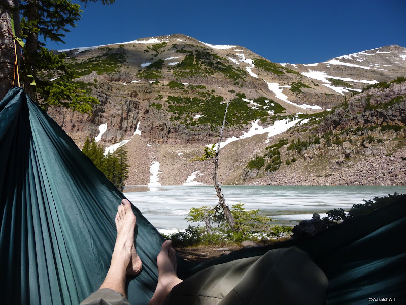
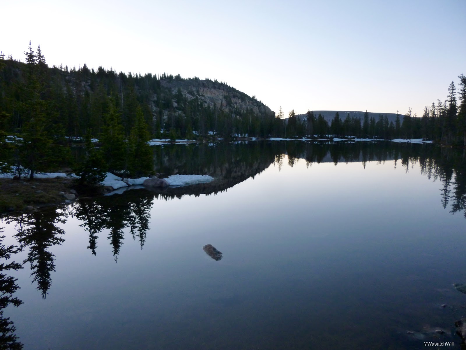
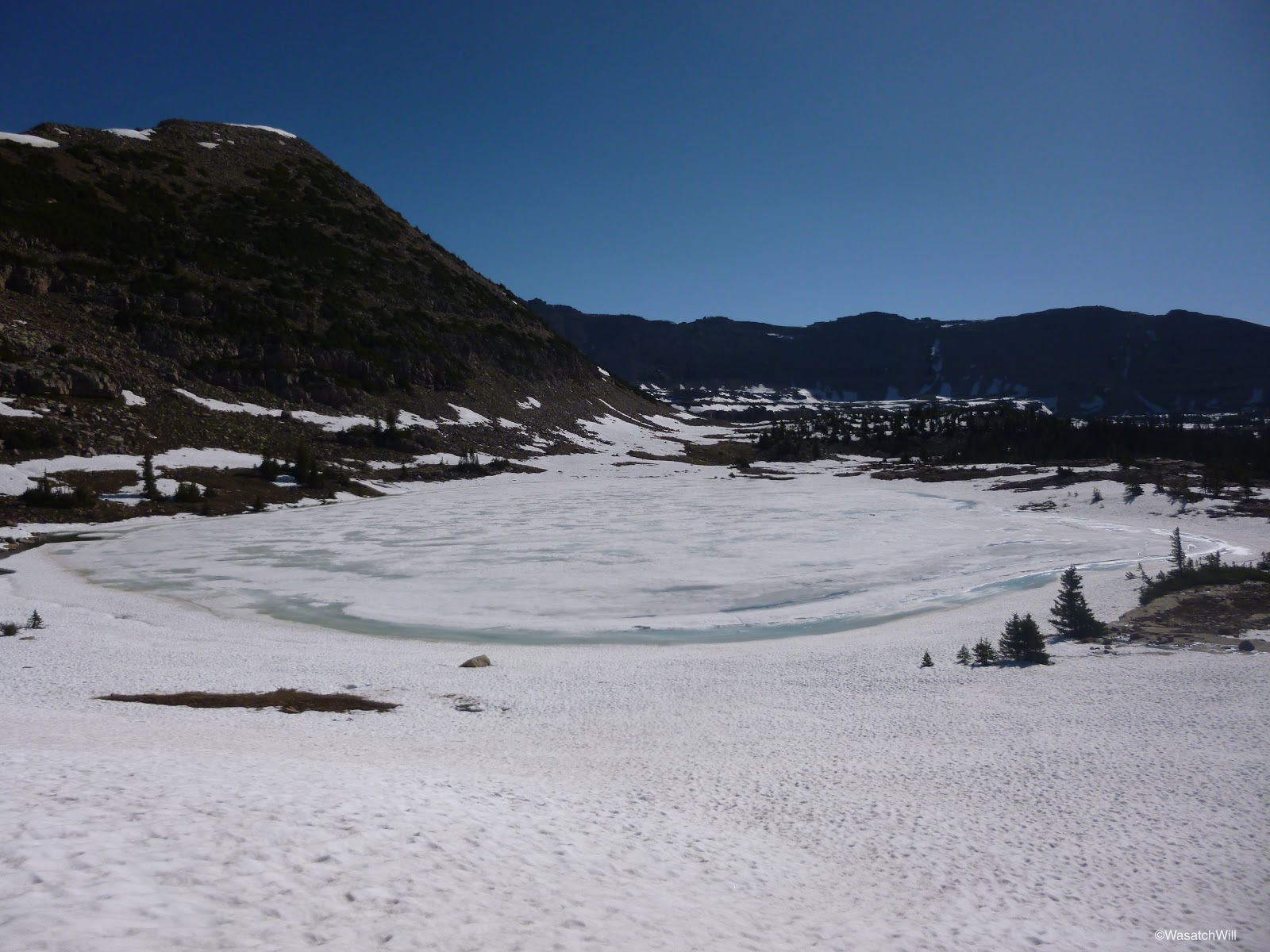
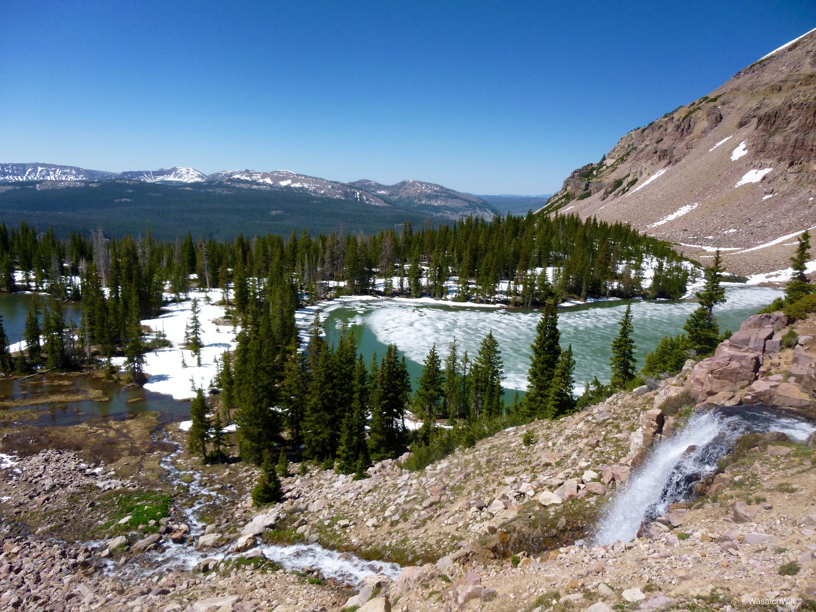
It was about 9 pm now and I knew that daylight would soon be gone. I turned back around, and after another moment of post-holing through more snowdrifts, I was between the Morat Lakes, where I found a cozy little campsite just above the shoreline of the western lake. The lake was still mostly frozen, the outer edges almost glowing with turquoise water. Mount Aggasiz rose above it.
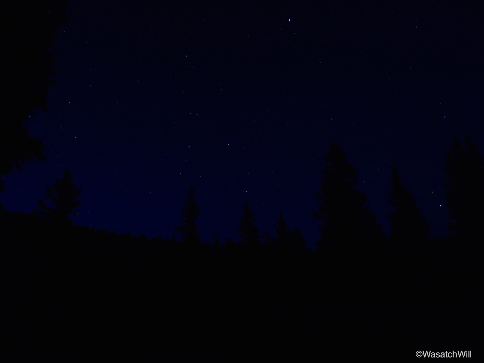
I soaked in the beauty of the site for a moment. I didn't think to take any pics. I was anxious to get set up and have some dinner. After dinner, I enjoyed a bit of star gazing under clear skies. It quickly got colder and I soon sought the warmth of my sleeping bag for the night.

Day 2
Wednesday, June 18, 2015
Knowing I was the only person around for several miles had my mind running all through the night. I don't know why, but I found it difficult to sleep, despite being plenty tired and very warm. I cherished the solitude and basked in the thought of having such a popular basin all to myself, but it also made me a bit nervous being so far away from anyone else. I was between a state of exhaustion and a state of anticipation and excitement for the areas to be explored upon waking up.
By the time daylight began to creep back into the sky, I was finding myself more relaxed. It was tempting to sleep in, but I also knew that it would be best to get up ahead of the sun to get in all the exploring I wanted and still be able to get back to my car and back to my family at a reasonable time.
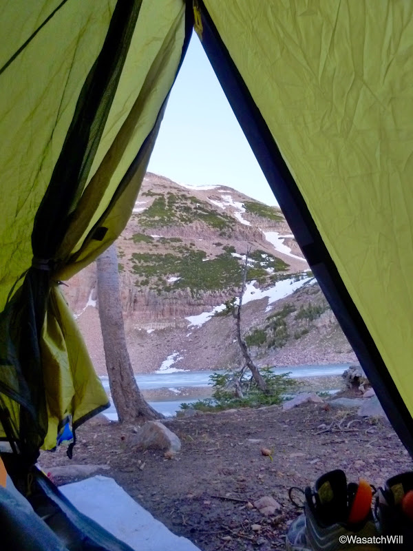
I cracked open my tent fly and once again soaked in the beautiful backdrop.
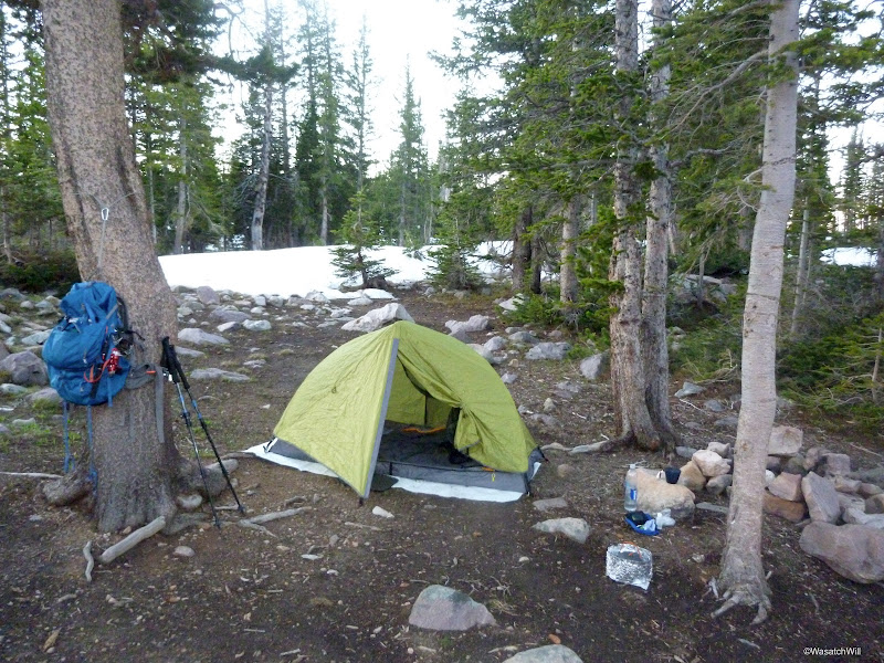
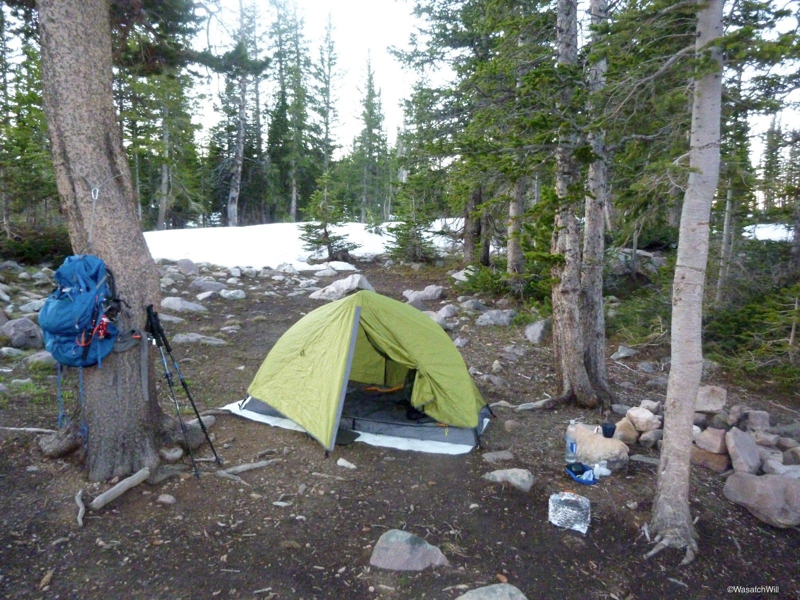
At about 6 am, I got up and out to get some hot water going. While waiting for the water to heat up, I took some pics of camp and the surrounding area while making the effort to be active to get my blood going and stay warm.

After breakfast, I cleaned up camp and placed all my non-essentials into my tent before strapping on my lightened pack for some exploring up into the upper bench.
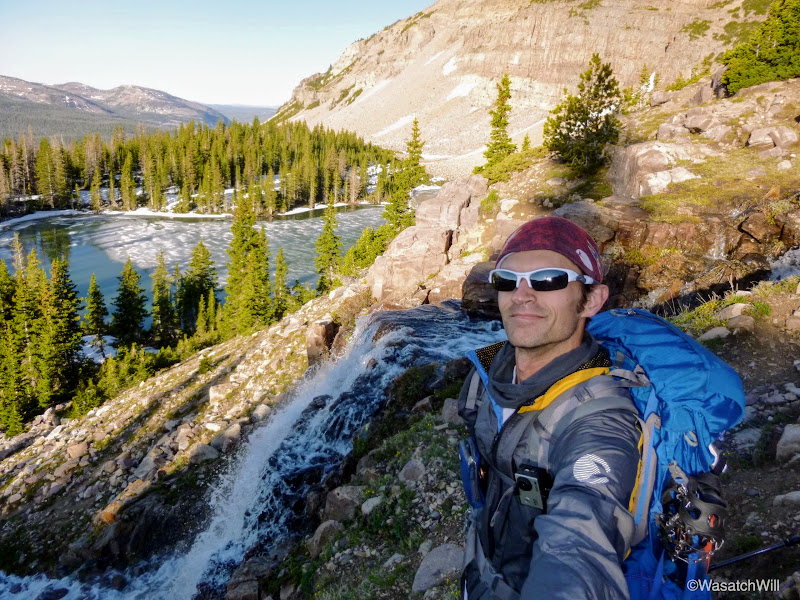
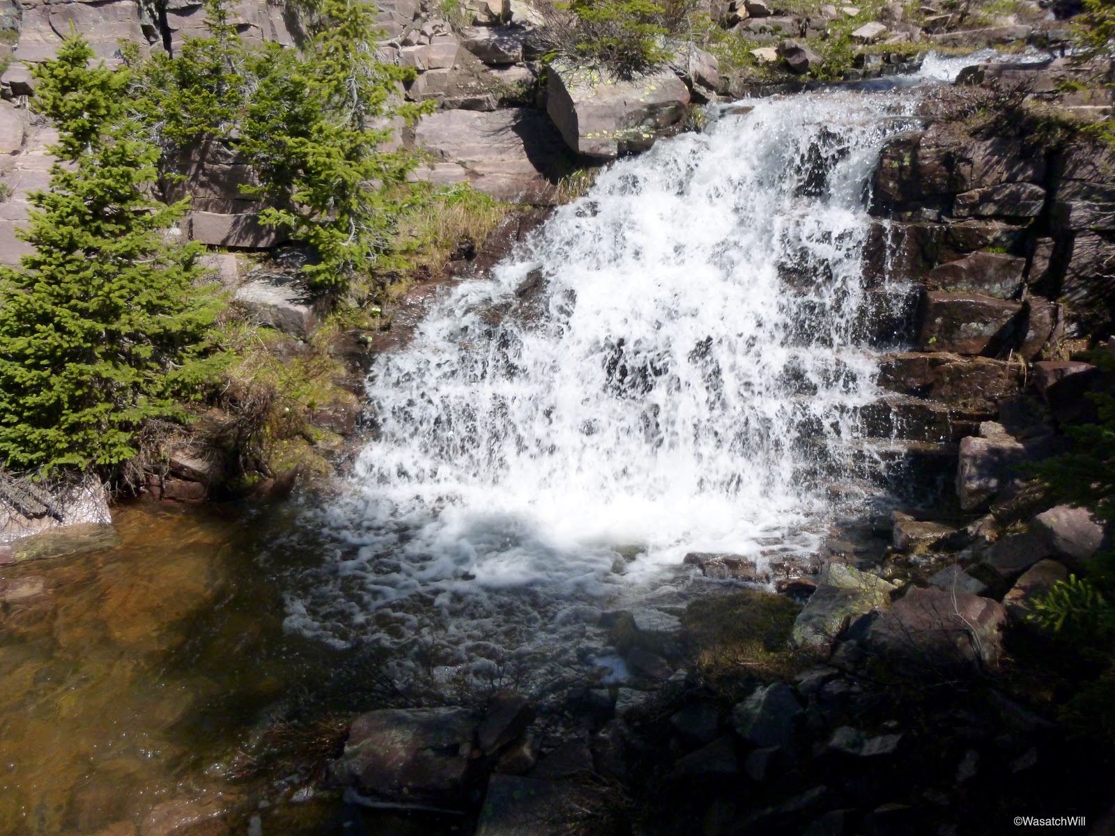
There was a waterfall right above my camp but it was masked by trees from my tent. The route up to the upper bench took me right up the side of it.


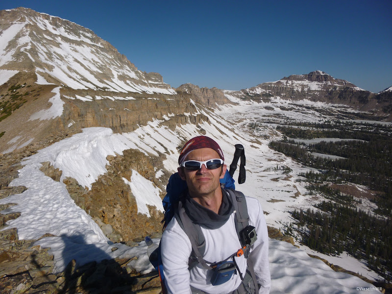
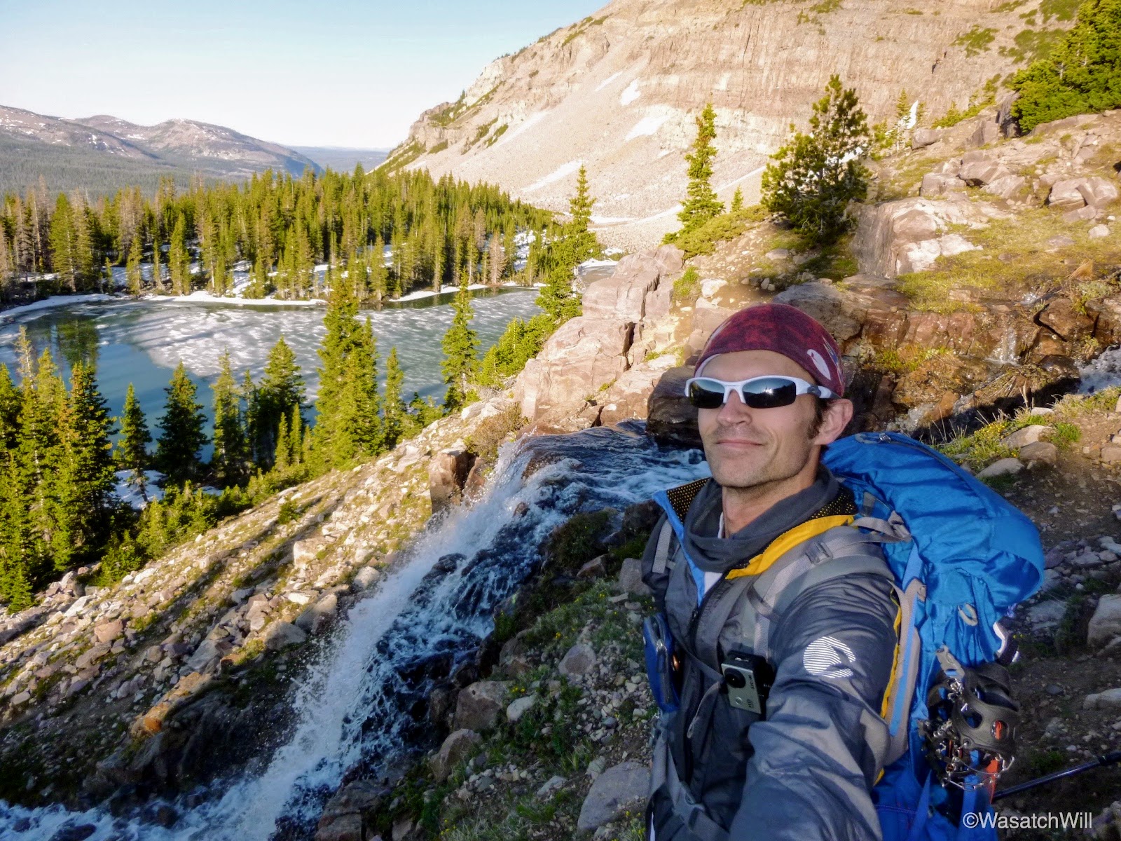
Once I got above the falls and looked back, I realized this was where a many others have taken photos and framed a similar shot. Sometimes selfies are appropriate. This was one of those times.
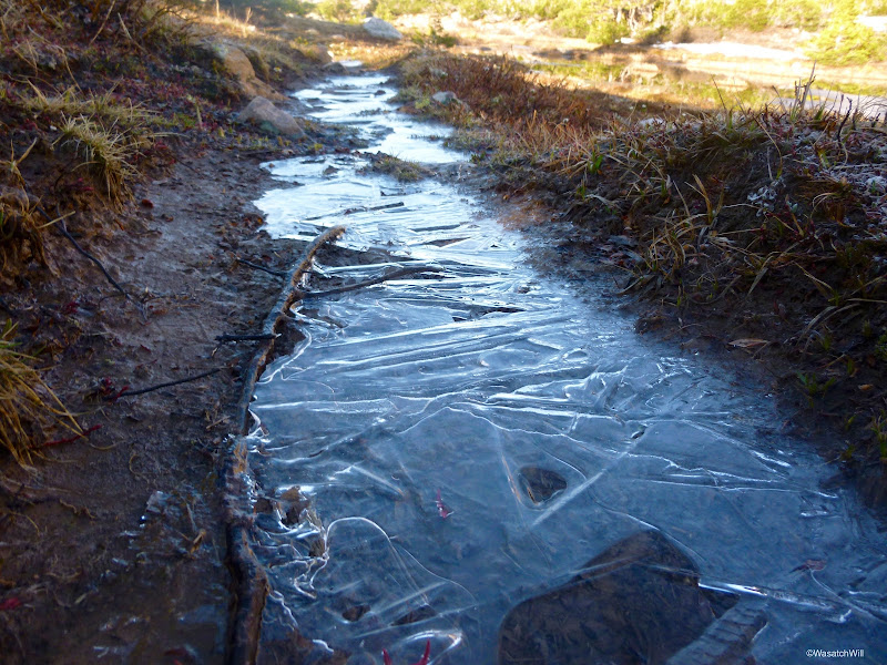
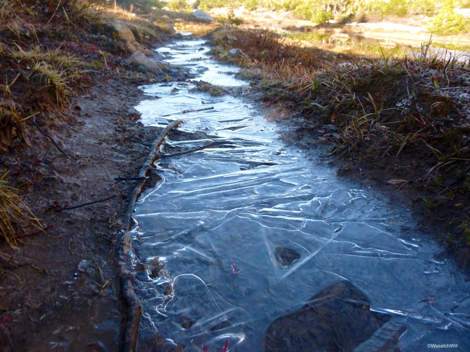
Once on top of the shelf which the waterfall descended over, the trail was iced over. I did not think it had gotten that cold overnight, but apparently it did dip below freezing.
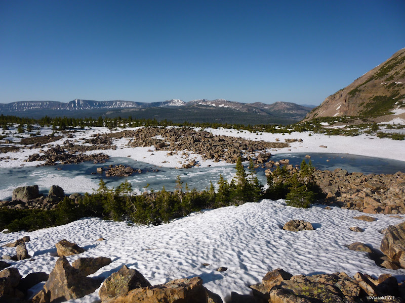
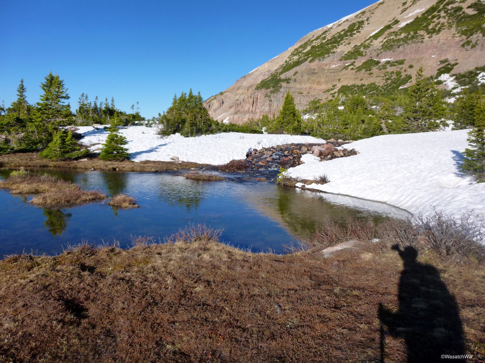
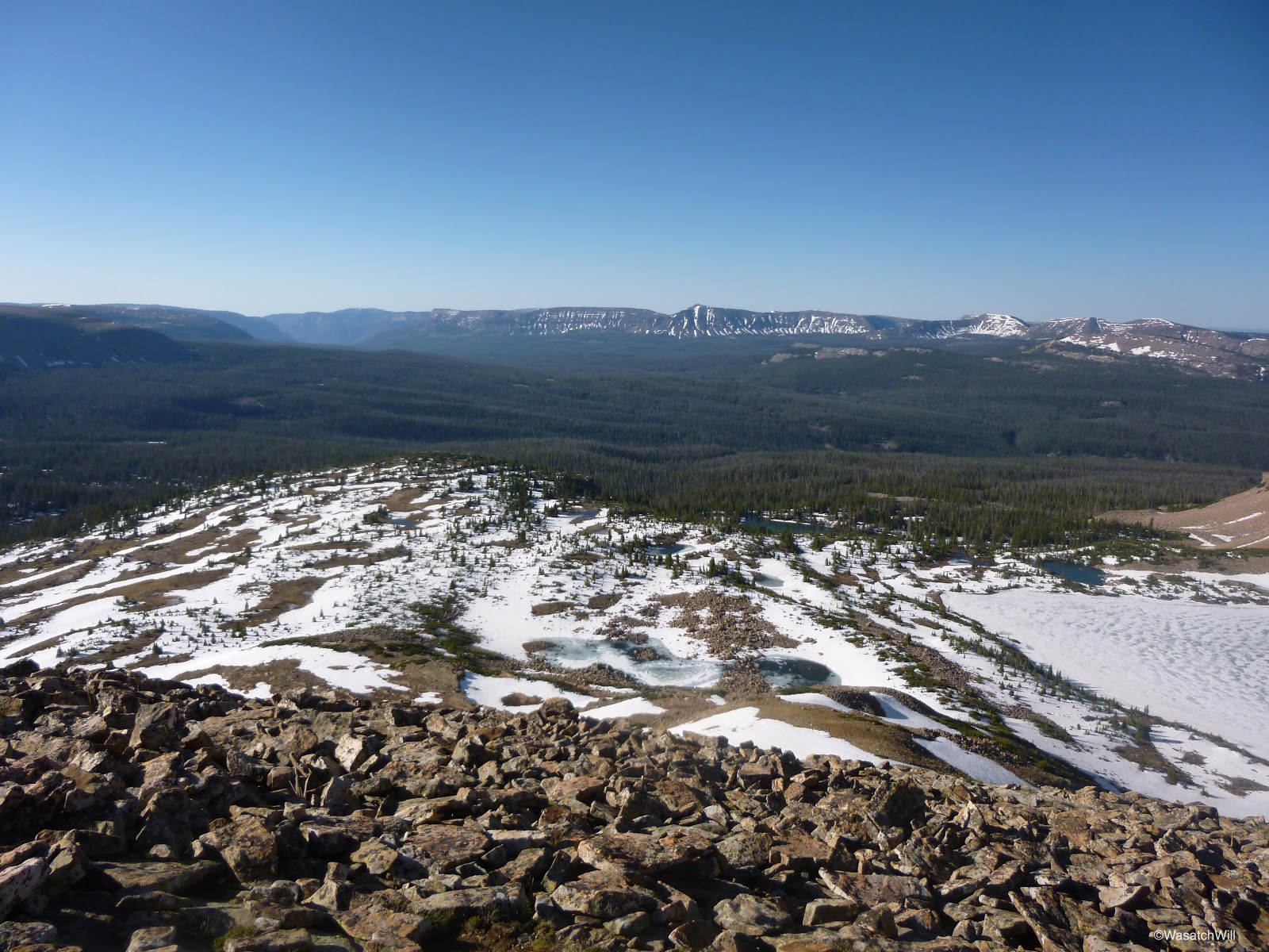
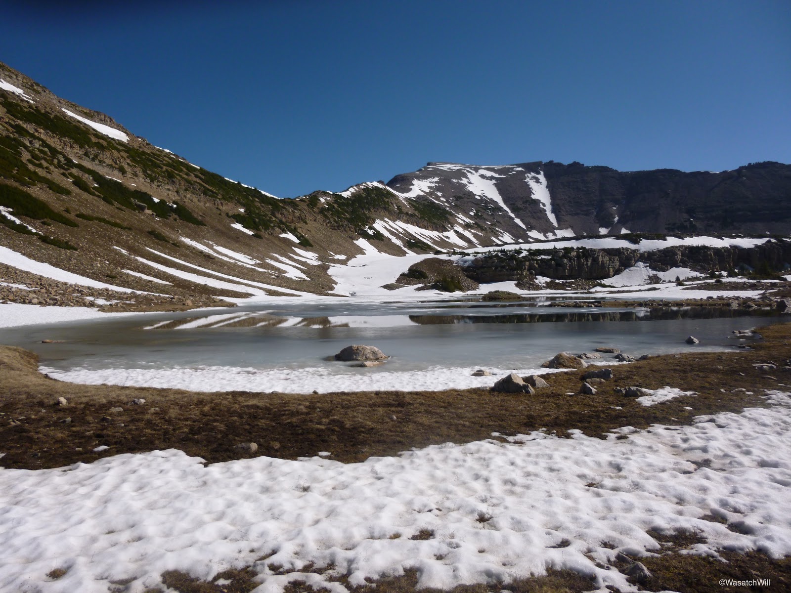
Besides the bigger named lakes, there were lots of tarns that added to the beauty of the landscape.

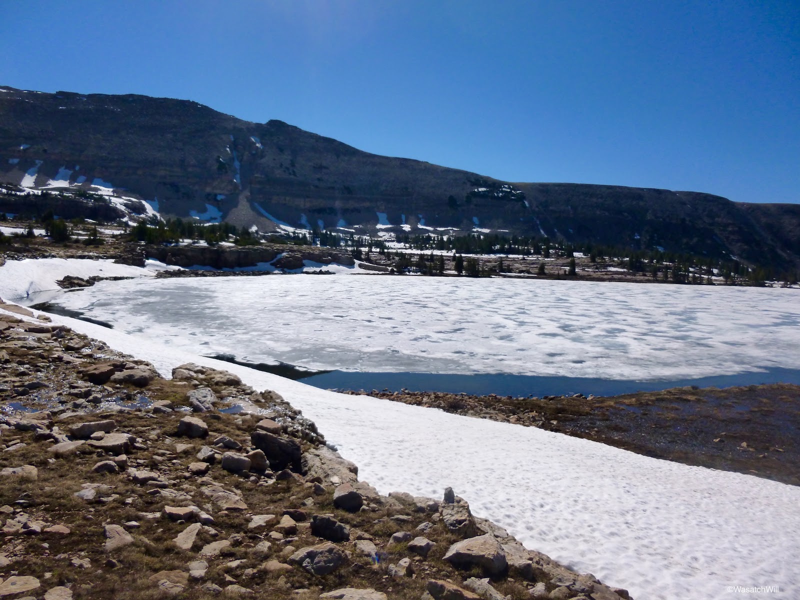
Blue Lake, still completely frozen.
I then began working my way up to the ridge above the basin.
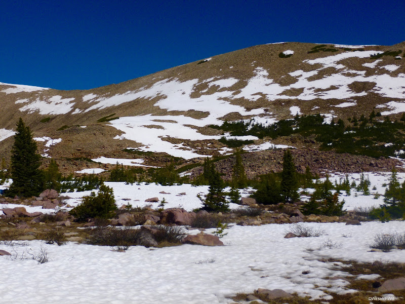
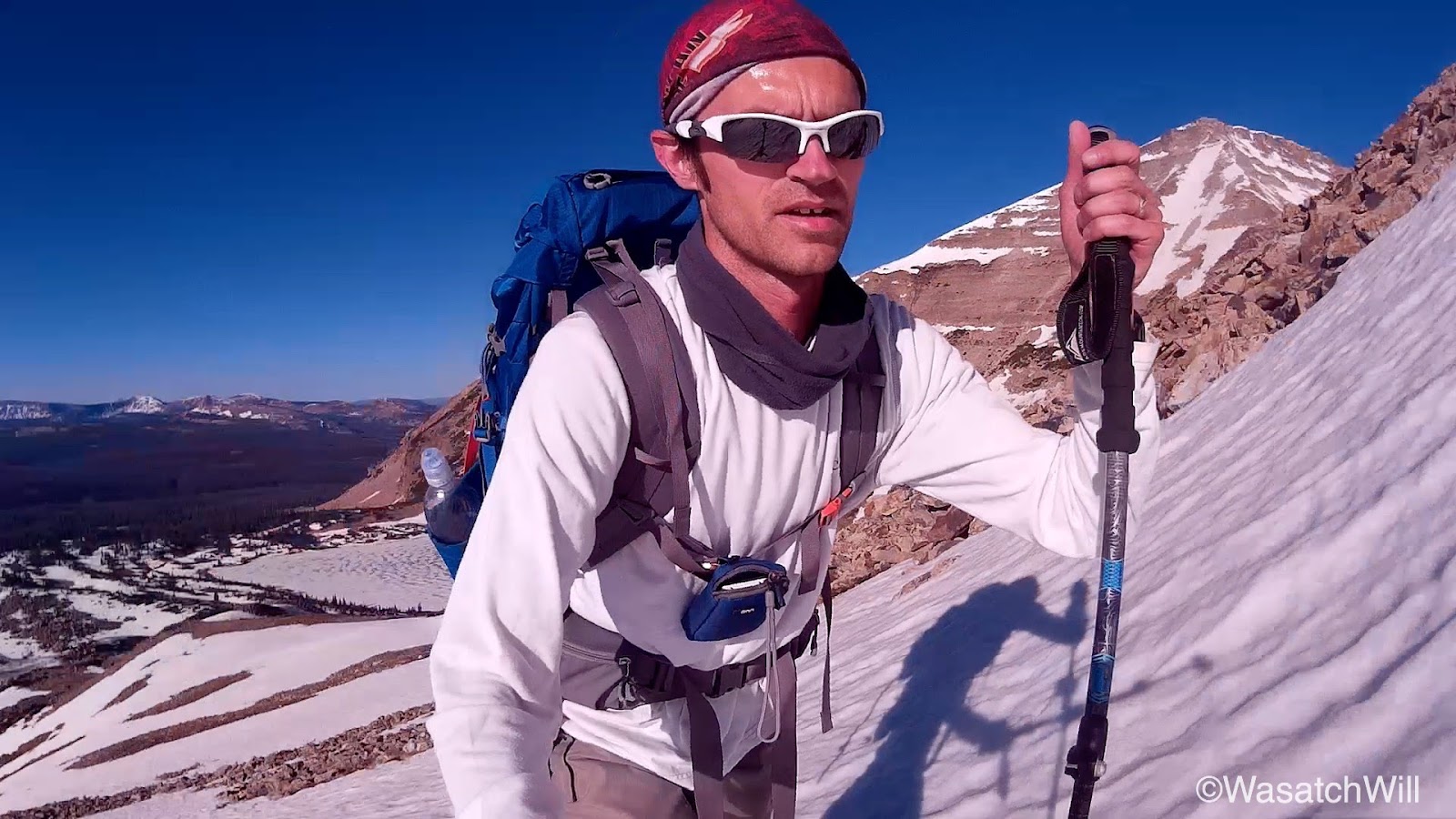
I didn't know if I'd need them, but I'm glad I brought my spikes along. The snow was still pretty solid from the cold night, and once the slope became about 45 degrees for a bit, I put my spikes to use. Much easier with those on than trying to kick in steps.

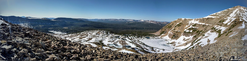
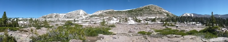
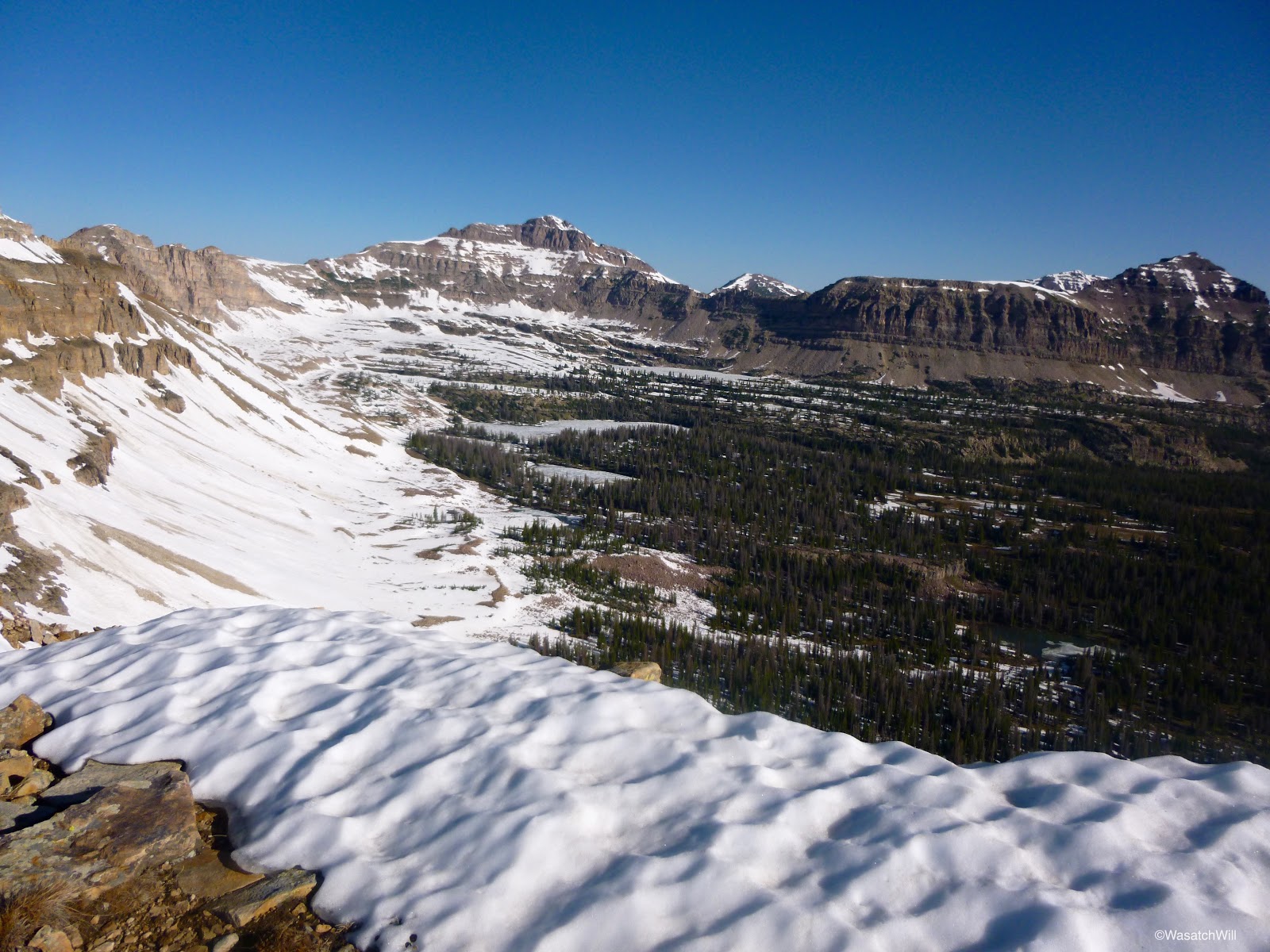
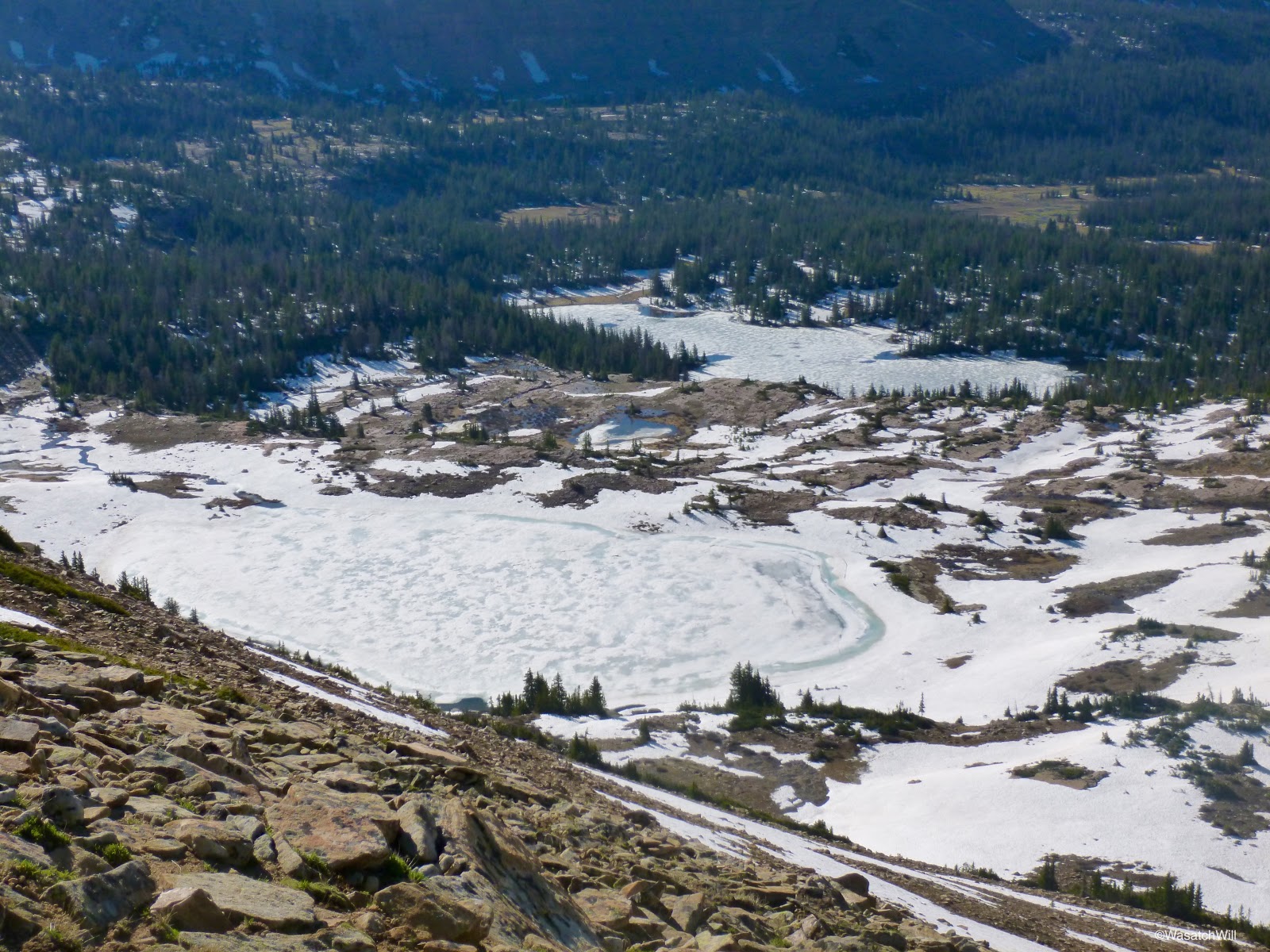
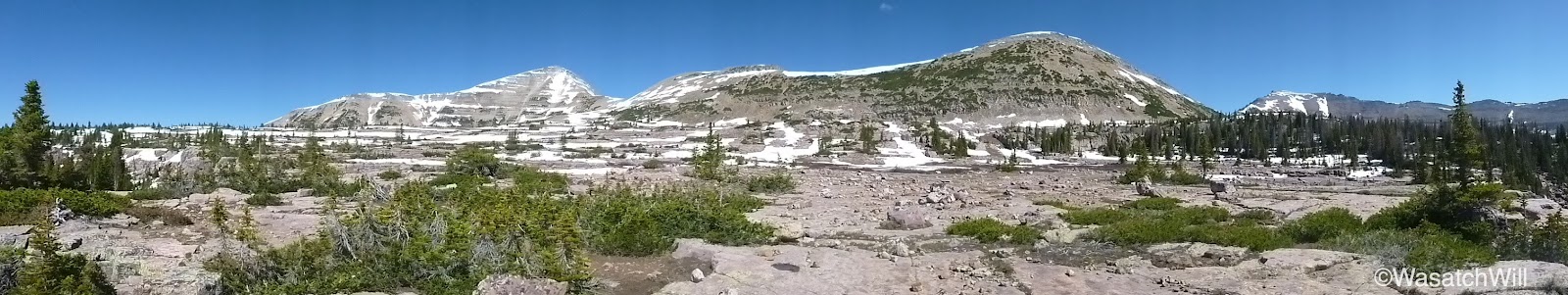
It didn't take too long to shoot up the snow and boulder fields. The views from the ridge were nothing short of spectacular. It was neat to sit at the edge of a cornice and look down into Middle Basin.
Hayden Peak is in the middle.

Hayden Peak with McPheters and Ryder Lakes still frozen below.
Looking to the right down toward Christmas Meadows.

Another ridge shot. Spread Eagle Peak in the middle and Ostler just off to the left of it?
Again, sometimes selfies are appropriate. This was another. Aggasiz on left, Hayden on right.
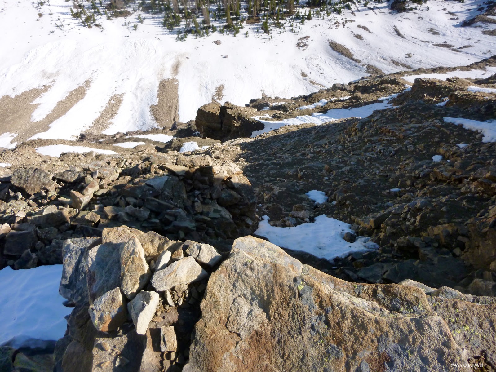
Not a place you want to slip and fall from.

I wanted to try and bag Aggasiz, but with the patches of snow still plastered on it and what looked like quite a bit of class 3 from scoping it out from the ridge, I decided against it for this trip. I was satisfied enough to be a saddle bagger for the day rather than a peak bagger. I sat down along a rock bench and soaked up the panorama of Naturalist Basin below me and out across Granddaddy.

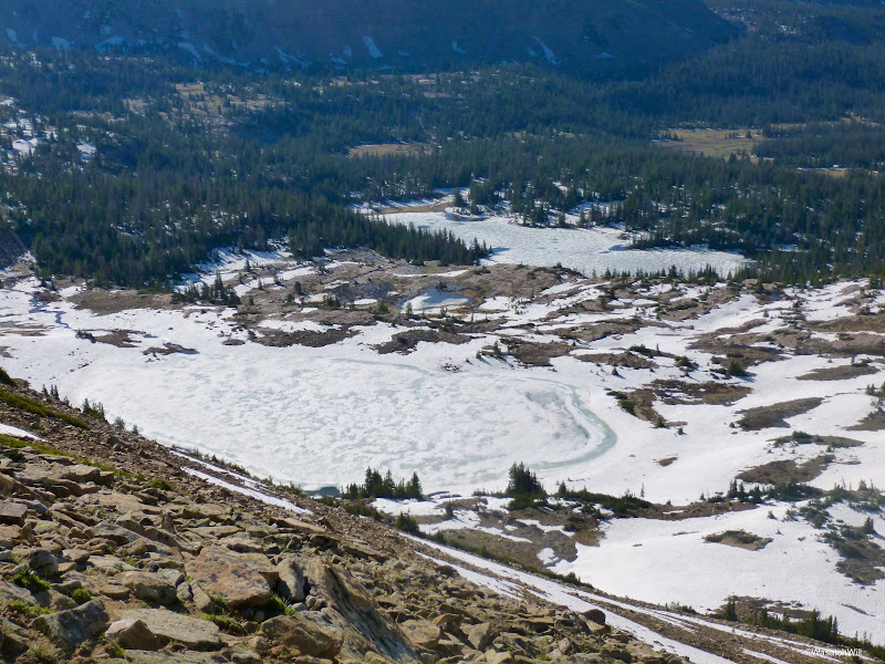
Leconte Lake (left) & Jordan Lake (right)
After a snack and a reasonable rest, I went back down, including a short little glissade, to make the rounds to the rest of the bigger basin lakes. I continually surveyed the landscape, minimizing the stretches of post-holing as best I could in my route finding.
LeConte Lake

Faxon Lake

Shaler Lake

The final lake to visit was Jordan Lake. I did not want to drop down to its shoreline knowing it'd be another good climb back up to get back to my camp so I just combed around the shelf above it.

I'm glad I did. There were waterfalls galore.


I was now standing above the western end of Jordan Lake. This spot could easily be a favorite for the area. It was centrally located and offered views down into the lower bench and the upper bench. A great 360 panorama spot.
Lower Bench
Upper Bench
The upper ridge on the right is where I had climbed up to.
It was time to return to camp. Rather than go back up around the upper edge of the basin, I just made a b-line straight back over to the shelf above Morat Lakes. This resulted in lots more post-holing.
With the sun now fully out, it gave a new perspective back down into Morat Lakes. I felt a connection here.

Back at camp, I took down my tent and threw up my little lightweight hammock. I made a vein attempt to dry out my shoes and socks a bit while resting up and eating some lunch.
It was now about 11:30. Time to start heading back to the car.
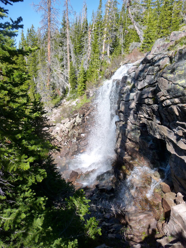
The first big waterfall I had encountered on my way up was there to greet me again on the way down. Again, with the sun up and illuminating the surrounding area, it appeared more spectacular than the night before.
Once out of the basin, the heat of the day really came on. I think it was a good thing that I got such a late start on the trail the day before. The air was much more cool and made for pleasant hiking. No matter. Onward, I went.
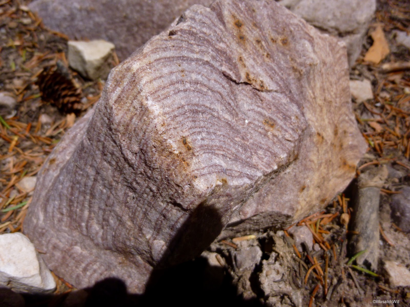
A rock trying to disguise itself as a cut of wood?

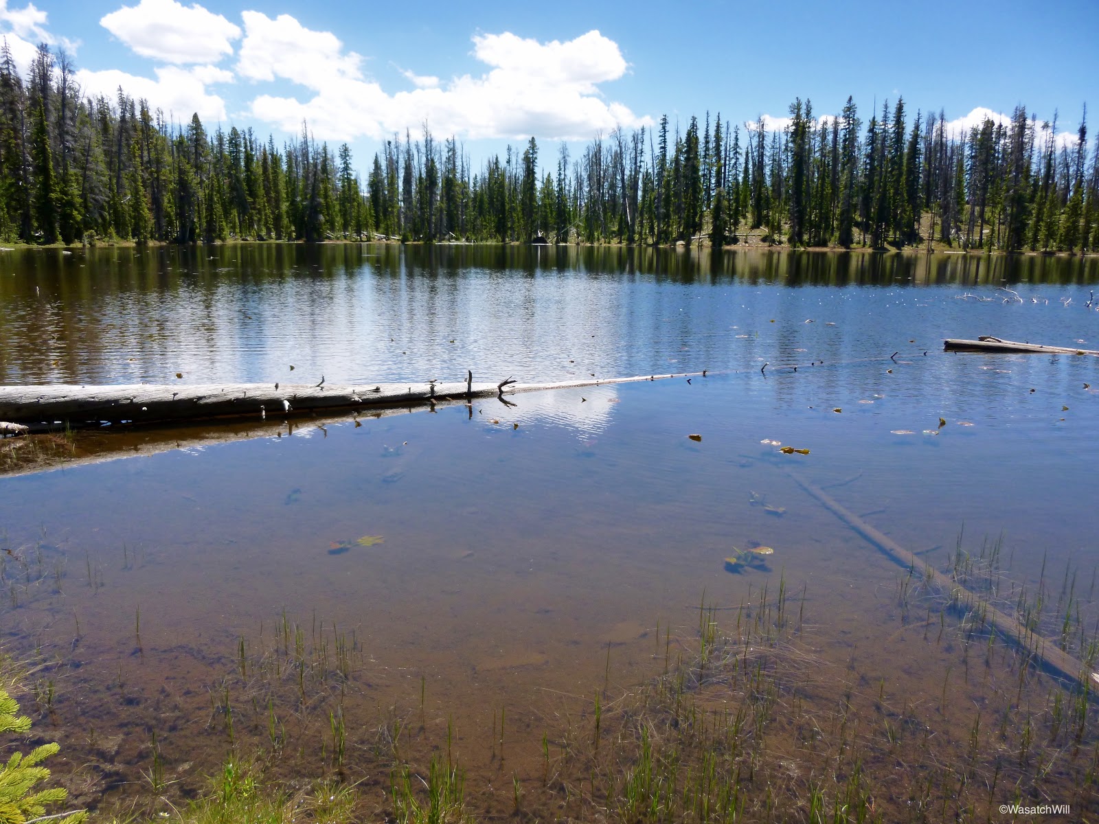
Scudder Lake lies just off the trail nearly half way between the basin and the trailhead.
After a brief break at Scudder, I finished off the hike back.
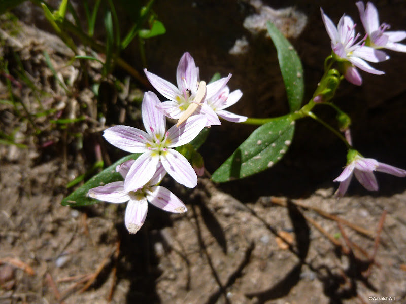
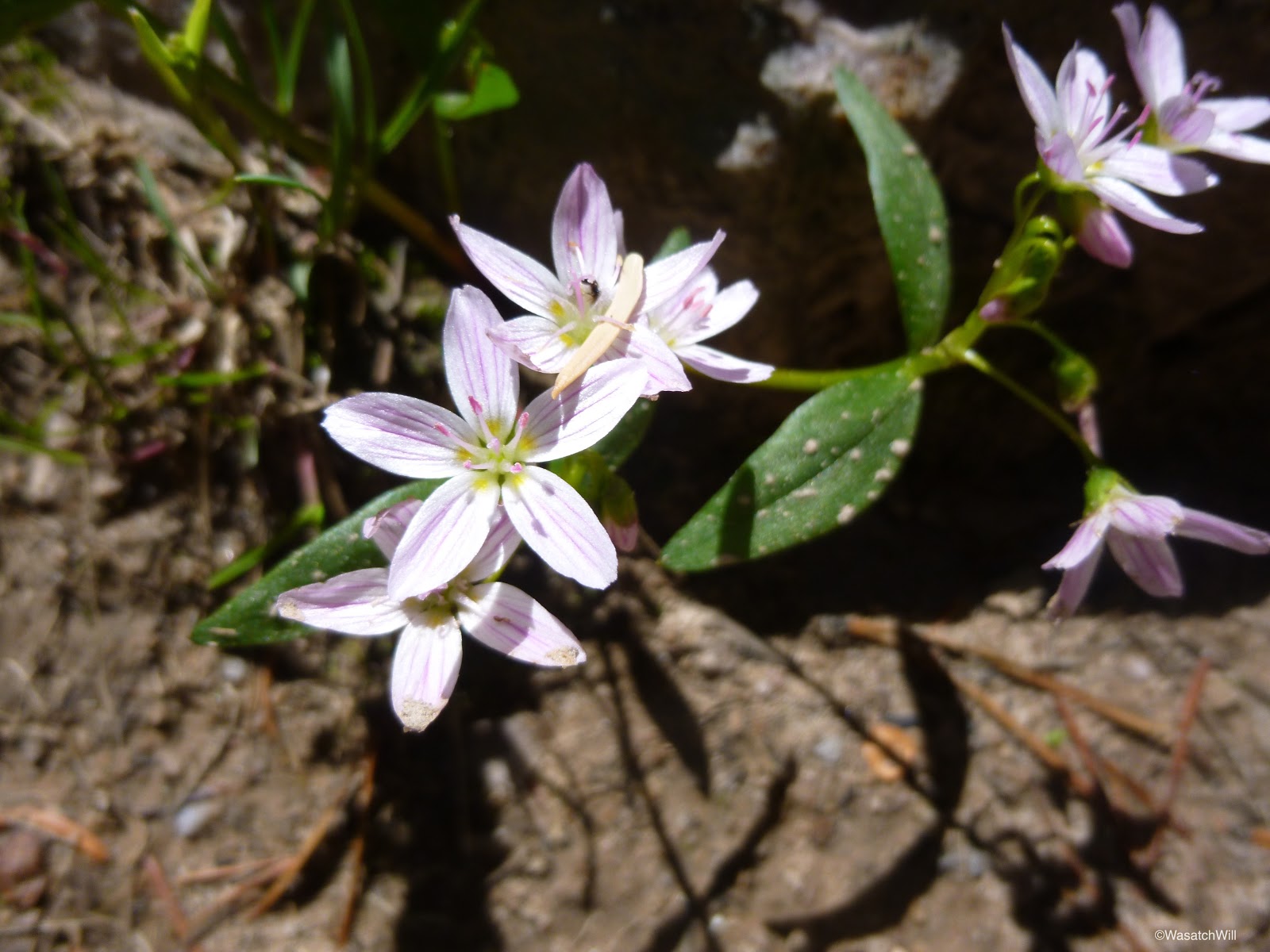
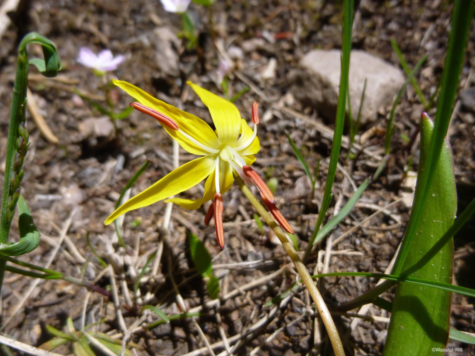
And yet more flowers along the way.


I had been alone the whole way. It wasn't until about a mile or two from the trailhead that I encountered another person. A day hiker and his dog. A few minutes later, another couple was heading up the trail. They were geared up for a couple nights around Grandaddy and a couple more up in Four Lakes Basin.
At last, I was back at my car where a cold drink awaited. I thoroughly enjoyed the trip. I felt fortunate to have experienced such a popular area in absolute and complete solitude.
Route:
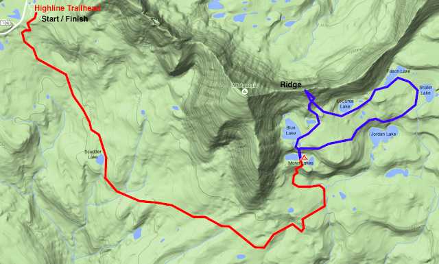
Trailhead: Highline
Stats:
Total Distance: 15 miles
Elevation Low: 9,950 feet
Elevation High: 11,600 feet
Final Thoughts:
It was great to cross it off my list, but I'd love to see what the area looks like later in the season when it has a chance to green up more and when the lakes are all thawed out. The summer crowds can have Jordan where all the good fishing is supposedly at. I'd see myself coming back to Morat Lakes to camp on any return trips with the areas around Blue Lake and Faxon & Shaler Lake being alternatives. I'd also love to press further on up into Four Lakes Basin and up and over Rocky Sea Pass into the Rock Creek basin.
I took along a head net and some repellant expecting mosquitos to be bad. I did not use either. There must have still been too much snow and ice in the area because I was never bothered at all.
VIDEO:
Featured image for home page:

In a spur of the moment decision, I asked my wife, Jessica, if she'd be alright with me dropping her and the kids off at her parents' place in Park City for the night while I backpacked up to Naturalist Basin. It was like an early Father's Day gift when she ok'd it.
Day 1
Tuesday - June 17, 2015
I've had Naturalist Basin on my to-do list for a few years now so I was excited. A week and a half prior, the Highline trailhead was still under several inches of snow. Since then, the weather had been so warm and sunny that it was safe to assume snow was melting out fast. Seeing pics from others camped nearby during the weekend prior helped to confirm the improving conditions. I decided to chance it with a contingency to turn back and camp in an area closer to the highway if I encountered more snow than I could comfortably navigate through.
Once again, it was another late start on the trail for me though. It was about 6 pm when I was able to start up the trail. Two other cars were parked at the trailhead when I arrived. The trail register showed only one other party to be out and they were at Four Lakes Basin. All other sheets were blank. It was looking like I'd have all of Naturalist Basin to myself.
After about a mile, it was time to officially enter the High Uintas Wilderness.


Trail conditions along the Highline trail were decent for most of the way. Obstacles were several small stretches of mud and water and over a dozen tree falls. The mud and water spots were easily avoided by stepping across larger rocks in the middle and along sides of the trail. Some of the tree falls were low enough to step up and over. Others required a significant detour off trail to get around.
Wildflowers dotted the sides of the trail. It's impressive how quickly they can pop up and bloom, knowing that much of the trail was likely still under snow just two weeks prior.
After leaving the Highline trail and turning up for Naturalist Basin, the trail conditions soon got bad. Very bad. Or so it appeared. The trail just disappeared into a pool of water a good foot or two deep.

There was not enough big stepping stones to get me across. Fortunately, it didn't take much to go off trail and bypass around it. There would be a few more similar obstacles through this area. Just after getting around that obstacle, there was a nice little lake that hugged the side of the trail.

At last, I was looking at the sign that signals the arrival into Naturalist Basin. Left for Blue Lake or right for Jordan Lake. I had planned to do what most others do when visiting the area: settle into a camp site around or just above Jordan Lake and see what it was all about.

After only a few yards along the right fork, the trail once again disappeared into some water, this time a strong running creek.
I probably could have walked across the rocks lined up along the right side of the trail, but the majority of them were well submerged through the middle of the creek by several inches and I wasn't excited to get my feet all icy cold with no sunshine left in the day. I opted to take the fork leading up to Blue Lake.
By now, the sun was well behind the mountain to the west and it wouldn't be long before the daylight was all gone. After only a few yards up the left fork, a roaring waterfall could be heard and then seen as I looked up through the trees.
I made my way across the meadow by post-holing through some snow drifts and leaping across a number of little streams to get a wide open view of the falls.

I then worked my way back searching for the trail. There were lots of snow drifts now and with all the run-off running through the area, it was hard to keep on it. I soon found myself in a wide open marshy area. I lost the trail again and just looked upward knowing I needed to get to the other side of the marsh and up onto the bench above. My feet would have to get wet after all. Had I looked at my map right then and there, I would have known to stay to the right of the marsh. Instead, I just went cross country across the marsh before checking my map and then scrambling through some trees and boulders to intercept the trail once more. From there it was just a steep little hike up the trail to reach the bench where I got my first view out across the East Fork Duchesne River drainage and Grandaddy Mountain to the south.

It was about 9 pm now and I knew that daylight would soon be gone. I turned back around, and after another moment of post-holing through more snowdrifts, I was between the Morat Lakes, where I found a cozy little campsite just above the shoreline of the western lake. The lake was still mostly frozen, the outer edges almost glowing with turquoise water. Mount Aggasiz rose above it.
I soaked in the beauty of the site for a moment. I didn't think to take any pics. I was anxious to get set up and have some dinner. After dinner, I enjoyed a bit of star gazing under clear skies. It quickly got colder and I soon sought the warmth of my sleeping bag for the night.
Day 2
Wednesday, June 18, 2015
Knowing I was the only person around for several miles had my mind running all through the night. I don't know why, but I found it difficult to sleep, despite being plenty tired and very warm. I cherished the solitude and basked in the thought of having such a popular basin all to myself, but it also made me a bit nervous being so far away from anyone else. I was between a state of exhaustion and a state of anticipation and excitement for the areas to be explored upon waking up.
By the time daylight began to creep back into the sky, I was finding myself more relaxed. It was tempting to sleep in, but I also knew that it would be best to get up ahead of the sun to get in all the exploring I wanted and still be able to get back to my car and back to my family at a reasonable time.
I cracked open my tent fly and once again soaked in the beautiful backdrop.

At about 6 am, I got up and out to get some hot water going. While waiting for the water to heat up, I took some pics of camp and the surrounding area while making the effort to be active to get my blood going and stay warm.


After breakfast, I cleaned up camp and placed all my non-essentials into my tent before strapping on my lightened pack for some exploring up into the upper bench.
There was a waterfall right above my camp but it was masked by trees from my tent. The route up to the upper bench took me right up the side of it.
Once I got above the falls and looked back, I realized this was where a many others have taken photos and framed a similar shot. Sometimes selfies are appropriate. This was one of those times.
Once on top of the shelf which the waterfall descended over, the trail was iced over. I did not think it had gotten that cold overnight, but apparently it did dip below freezing.
Besides the bigger named lakes, there were lots of tarns that added to the beauty of the landscape.
Blue Lake, still completely frozen.

I then began working my way up to the ridge above the basin.

I didn't know if I'd need them, but I'm glad I brought my spikes along. The snow was still pretty solid from the cold night, and once the slope became about 45 degrees for a bit, I put my spikes to use. Much easier with those on than trying to kick in steps.
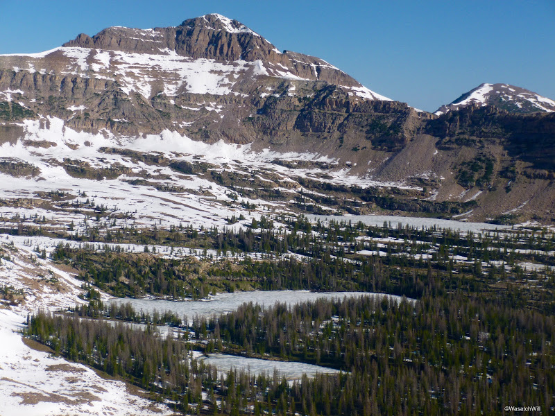
It didn't take too long to shoot up the snow and boulder fields. The views from the ridge were nothing short of spectacular. It was neat to sit at the edge of a cornice and look down into Middle Basin.
Hayden Peak is in the middle.
Hayden Peak with McPheters and Ryder Lakes still frozen below.

Looking to the right down toward Christmas Meadows.
Another ridge shot. Spread Eagle Peak in the middle and Ostler just off to the left of it?

Again, sometimes selfies are appropriate. This was another. Aggasiz on left, Hayden on right.

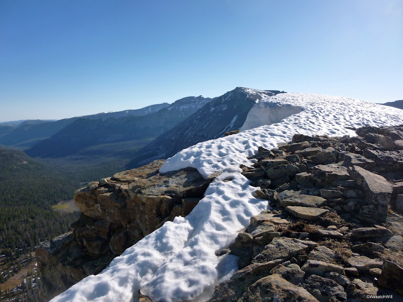
Not a place you want to slip and fall from.
I wanted to try and bag Aggasiz, but with the patches of snow still plastered on it and what looked like quite a bit of class 3 from scoping it out from the ridge, I decided against it for this trip. I was satisfied enough to be a saddle bagger for the day rather than a peak bagger. I sat down along a rock bench and soaked up the panorama of Naturalist Basin below me and out across Granddaddy.

Leconte Lake (left) & Jordan Lake (right)
After a snack and a reasonable rest, I went back down, including a short little glissade, to make the rounds to the rest of the bigger basin lakes. I continually surveyed the landscape, minimizing the stretches of post-holing as best I could in my route finding.
LeConte Lake
Faxon Lake
Shaler Lake
The final lake to visit was Jordan Lake. I did not want to drop down to its shoreline knowing it'd be another good climb back up to get back to my camp so I just combed around the shelf above it.
I'm glad I did. There were waterfalls galore.


I was now standing above the western end of Jordan Lake. This spot could easily be a favorite for the area. It was centrally located and offered views down into the lower bench and the upper bench. A great 360 panorama spot.


Lower Bench

Upper Bench
The upper ridge on the right is where I had climbed up to.

It was time to return to camp. Rather than go back up around the upper edge of the basin, I just made a b-line straight back over to the shelf above Morat Lakes. This resulted in lots more post-holing.
With the sun now fully out, it gave a new perspective back down into Morat Lakes. I felt a connection here.


Back at camp, I took down my tent and threw up my little lightweight hammock. I made a vein attempt to dry out my shoes and socks a bit while resting up and eating some lunch.

It was now about 11:30. Time to start heading back to the car.
The first big waterfall I had encountered on my way up was there to greet me again on the way down. Again, with the sun up and illuminating the surrounding area, it appeared more spectacular than the night before.


Once out of the basin, the heat of the day really came on. I think it was a good thing that I got such a late start on the trail the day before. The air was much more cool and made for pleasant hiking. No matter. Onward, I went.


A rock trying to disguise itself as a cut of wood?
Scudder Lake lies just off the trail nearly half way between the basin and the trailhead.
After a brief break at Scudder, I finished off the hike back.

And yet more flowers along the way.
I had been alone the whole way. It wasn't until about a mile or two from the trailhead that I encountered another person. A day hiker and his dog. A few minutes later, another couple was heading up the trail. They were geared up for a couple nights around Grandaddy and a couple more up in Four Lakes Basin.
At last, I was back at my car where a cold drink awaited. I thoroughly enjoyed the trip. I felt fortunate to have experienced such a popular area in absolute and complete solitude.
Route:

Trailhead: Highline
Stats:
Total Distance: 15 miles
Elevation Low: 9,950 feet
Elevation High: 11,600 feet
Final Thoughts:
It was great to cross it off my list, but I'd love to see what the area looks like later in the season when it has a chance to green up more and when the lakes are all thawed out. The summer crowds can have Jordan where all the good fishing is supposedly at. I'd see myself coming back to Morat Lakes to camp on any return trips with the areas around Blue Lake and Faxon & Shaler Lake being alternatives. I'd also love to press further on up into Four Lakes Basin and up and over Rocky Sea Pass into the Rock Creek basin.
I took along a head net and some repellant expecting mosquitos to be bad. I did not use either. There must have still been too much snow and ice in the area because I was never bothered at all.
VIDEO:
Featured image for home page:
Last edited: