NorthwestWanderer
Member
- Joined
- May 3, 2018
- Messages
- 292
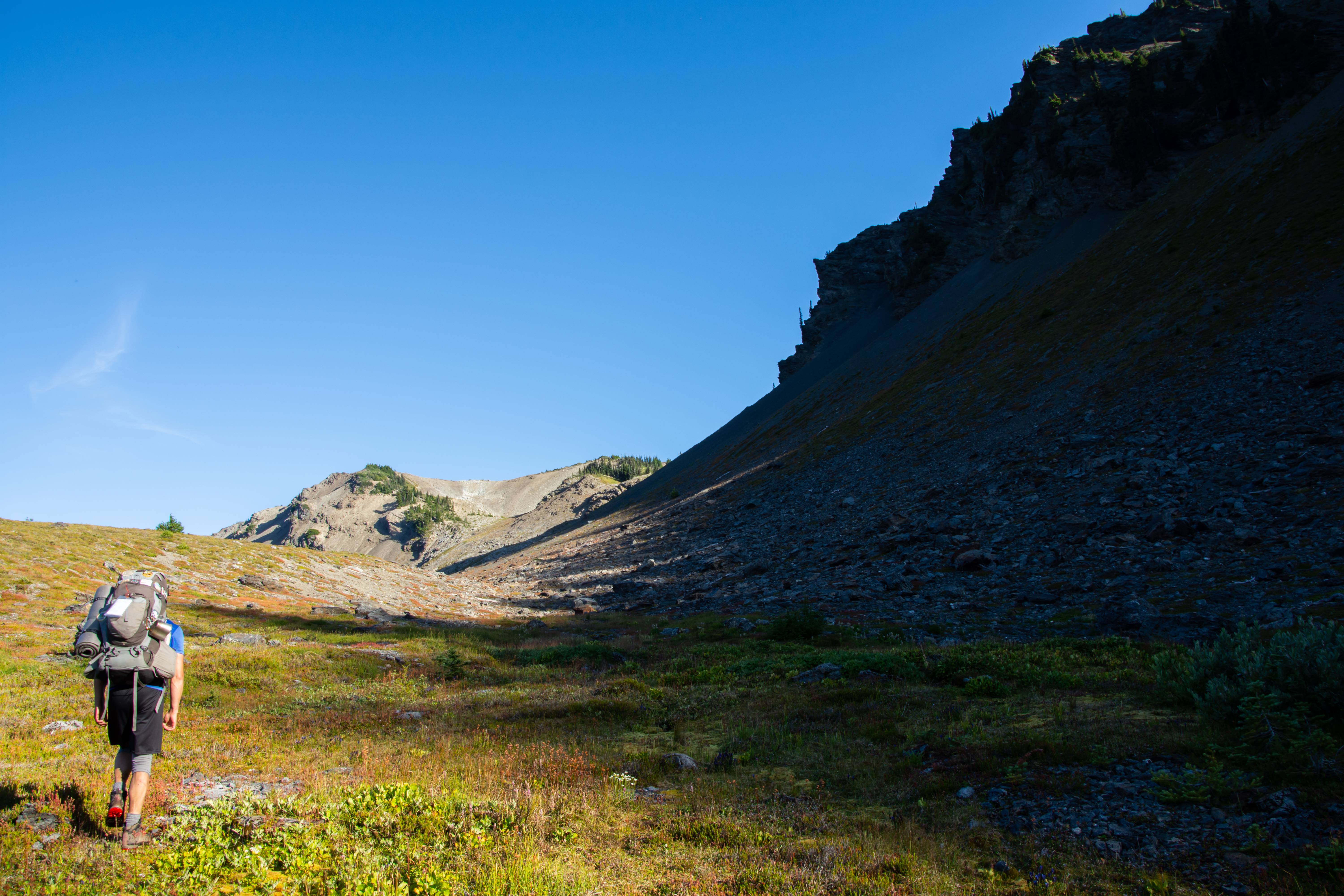
Last week I did a grand trip with a good friend. A friend I made this year during my crazy Glacier Peak off-trail trip. Aaron. Aaron has tons of knowledge on the Olympic Mountains where I have next to none. The main goal of this trip was to strike deep into ONP's interior and reach '1000 Acre Meadow' and 'Cedar Lake'. 1000 Acre Meadow is to Aaron as what Bannock Lakes was to me. Something we've been eyeing up for years but just never had the chance to go for it. Luckily we had the chance. Straight to the point, the Olympic mountains are amazing.
Things to know about the Olympic Mountains that I didn't know
- Barely any flat, you're either losing elevation or gaining it.
- Surprisingly lots of elevation gain & loss
- Tons of wildlife
- The corner of the park we did has a "Rain shadow" effect so it's very dry.
- Despite being lower elevation, the local relief will make 6000ft peaks look like 8000 footers.
- The trees are HUGE and TALL. Even the normal alpine trees are 10-20ft taller than normal
DAY 1 : Obstruction Point to Upper Cameron Basin (Trail) 13 Miles - 3500ft Elev. Gain (100% trail)
We started out at the end of Obstruction Point road which branches off from the crowded hurricane ridge visitor center. Great start. Already in the alpine!
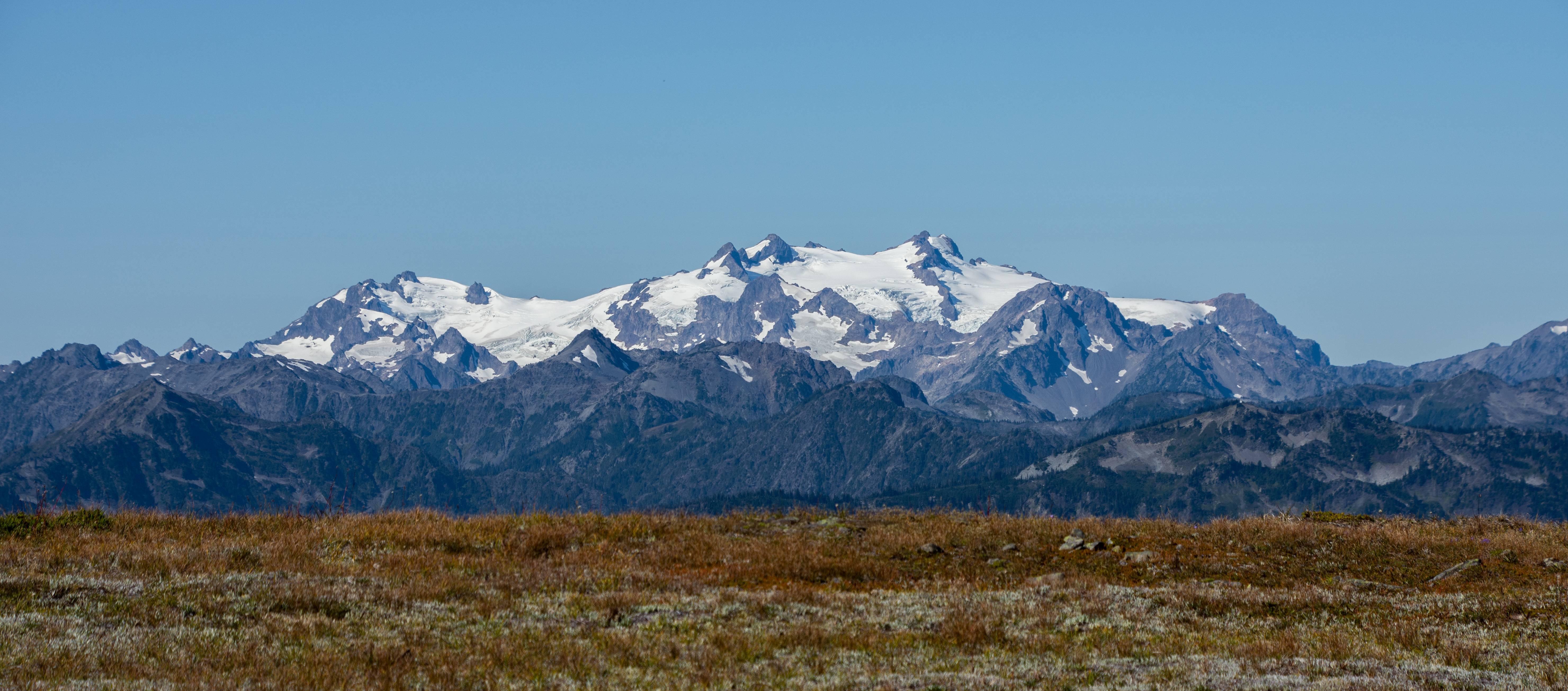
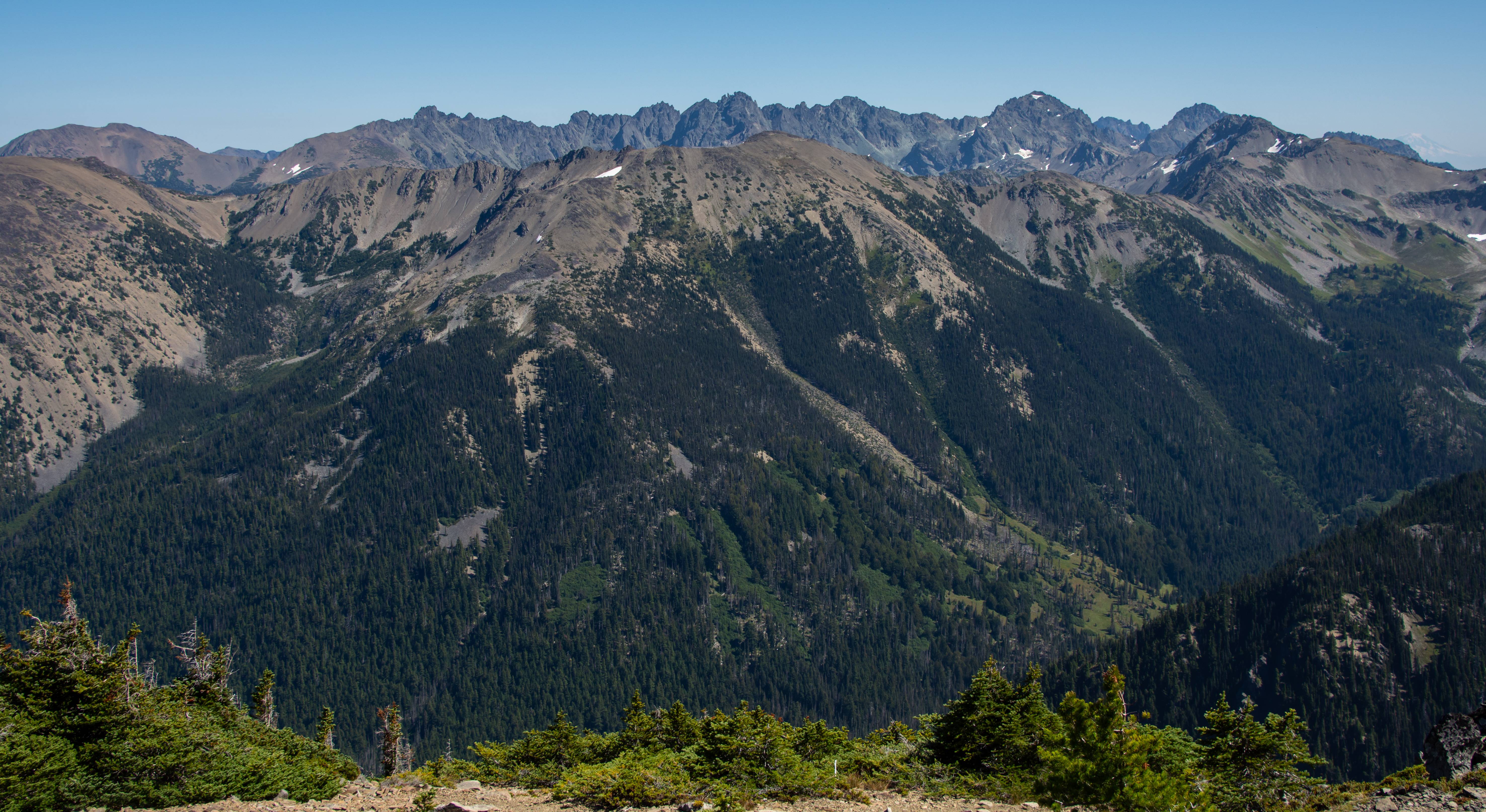
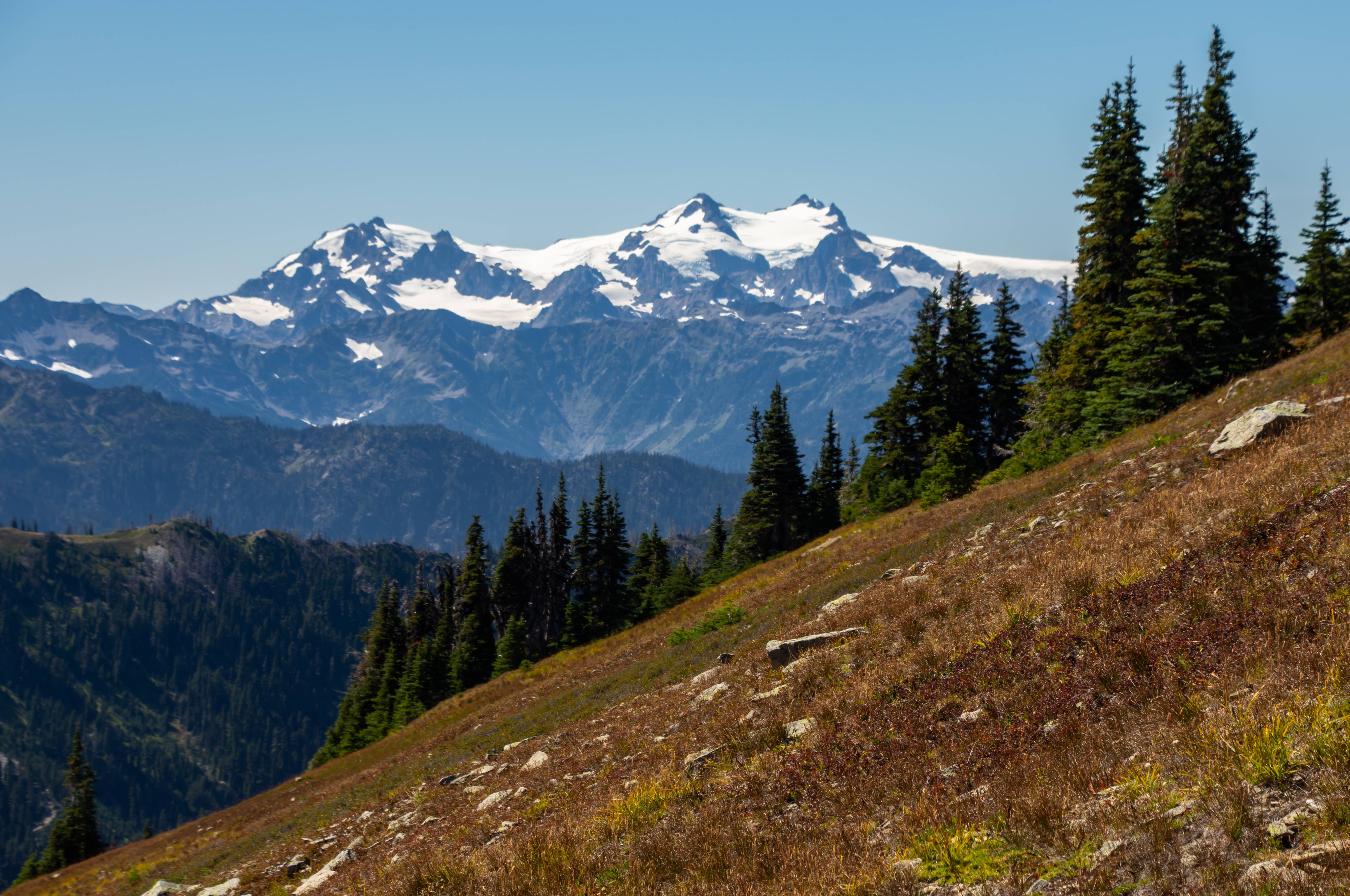
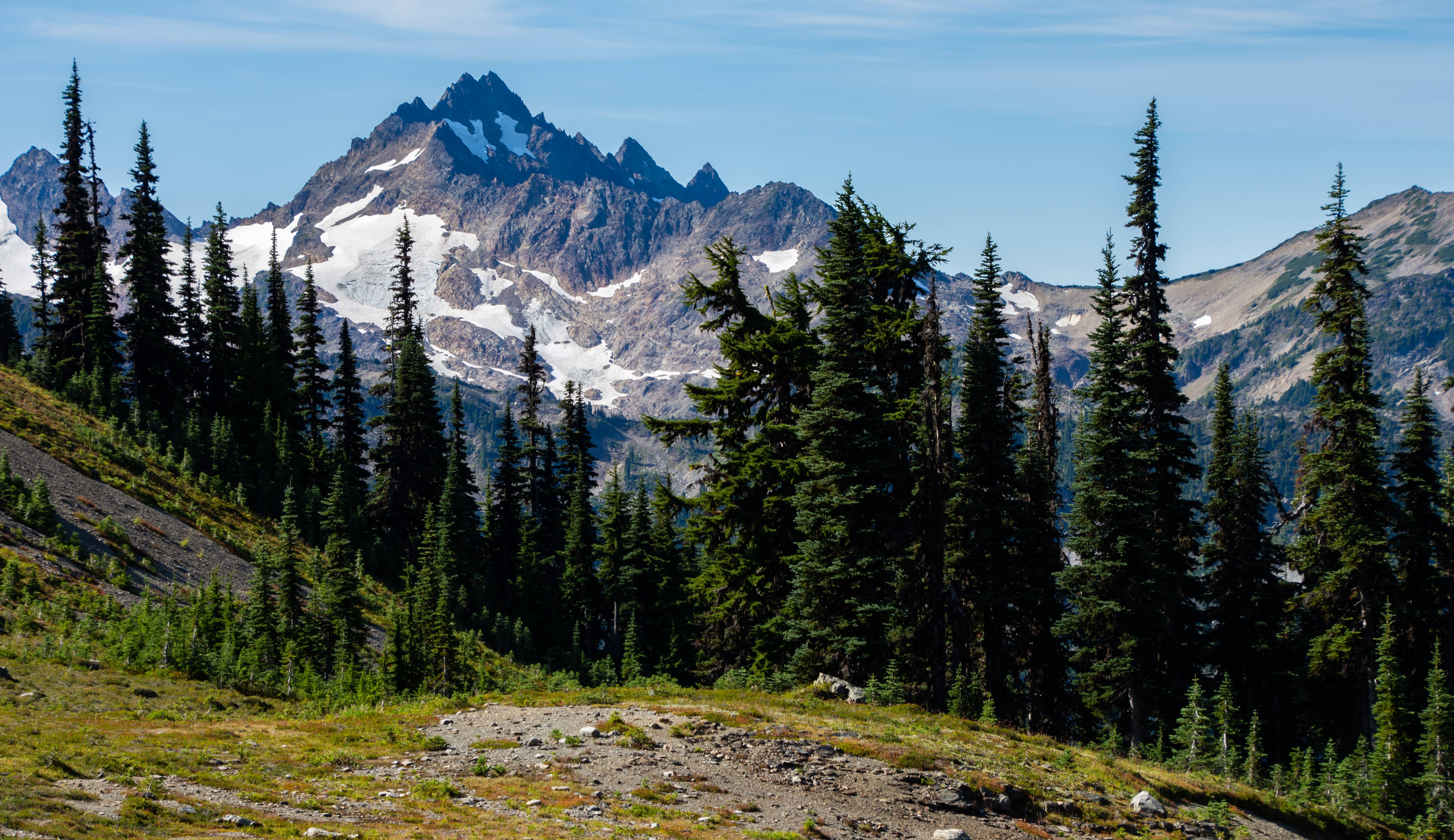
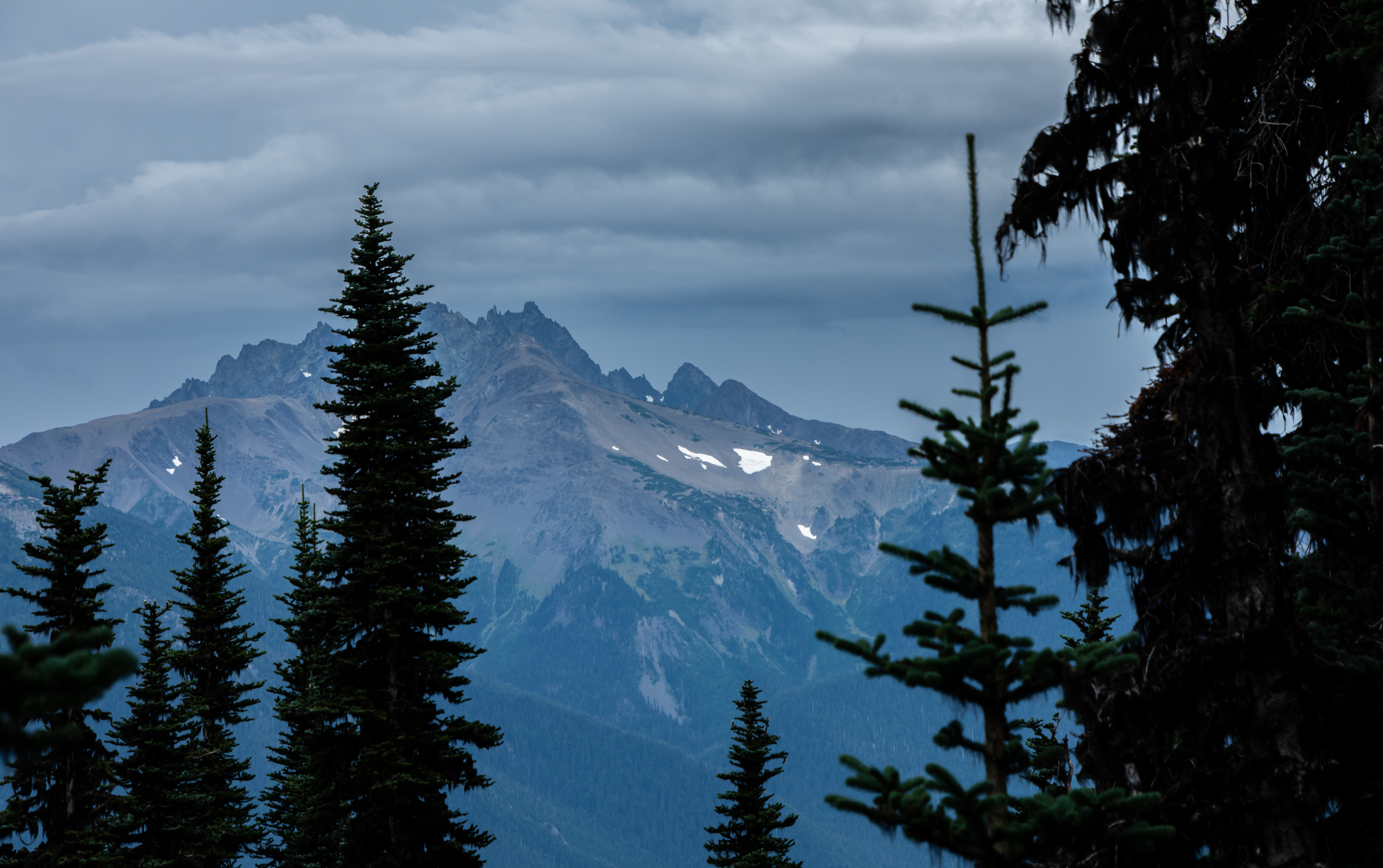
Mount Olympus in the distance
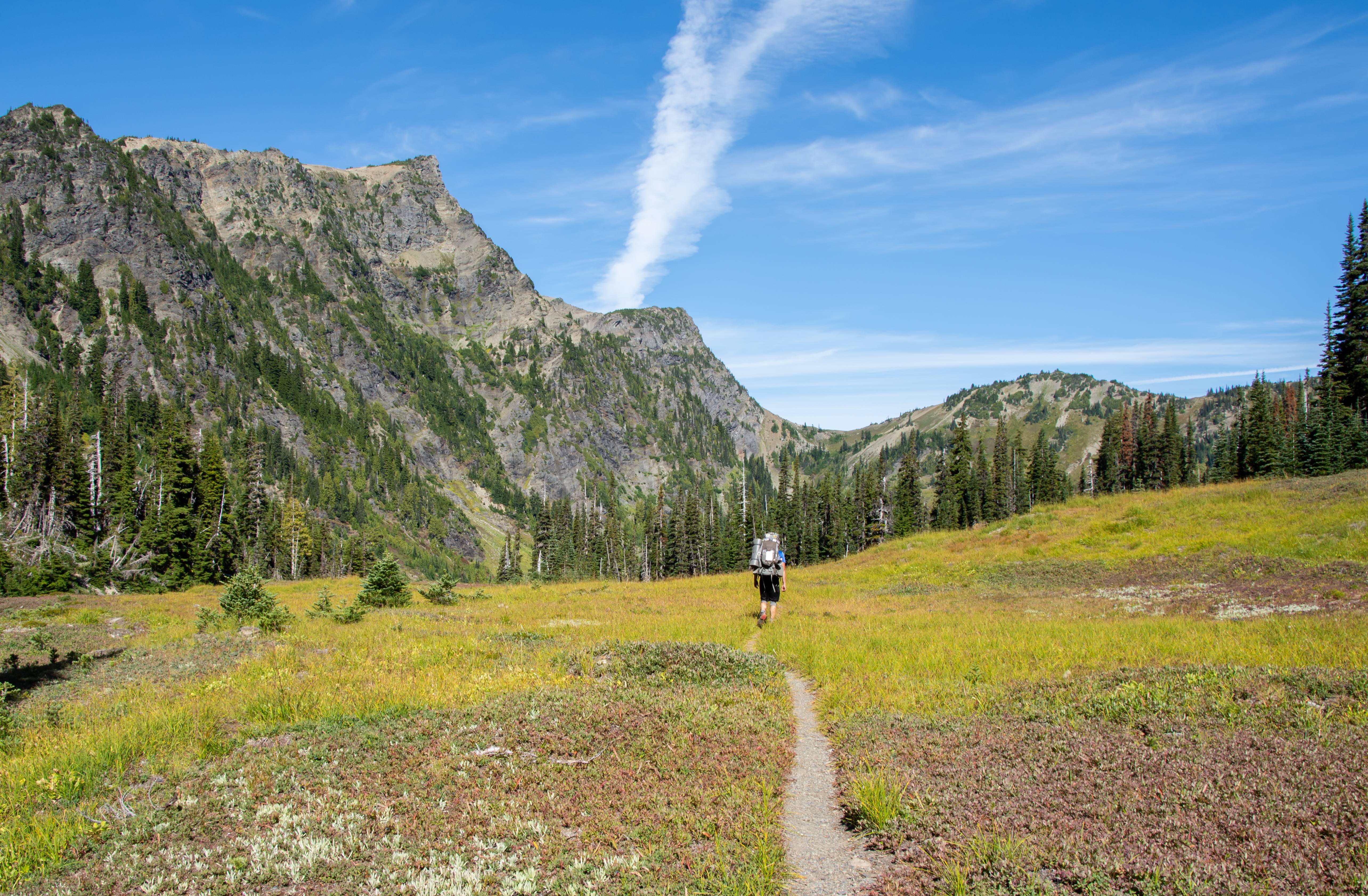
Beautiful trail (our trail veered left of here off camera toward 'GRAND VALLEY')
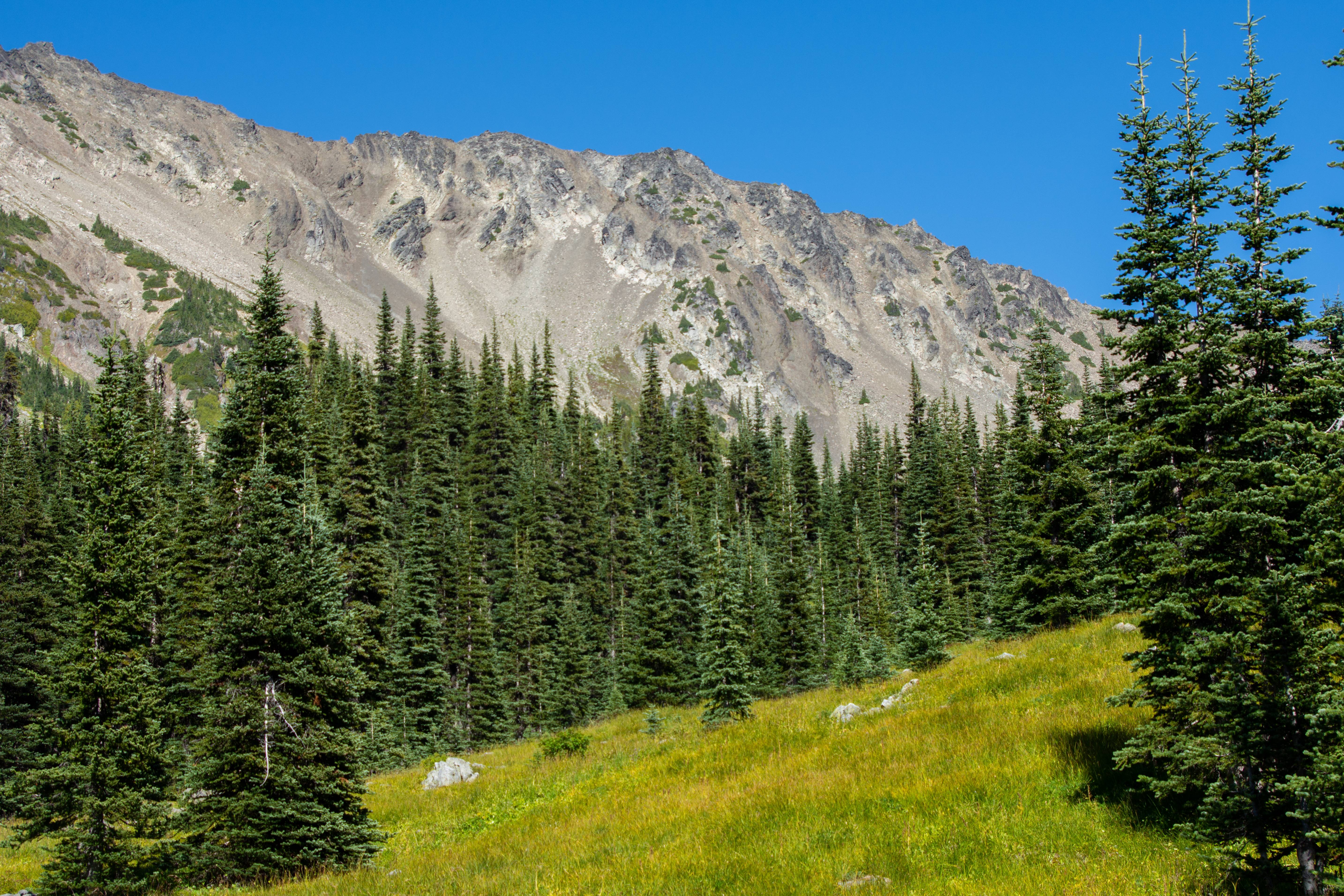
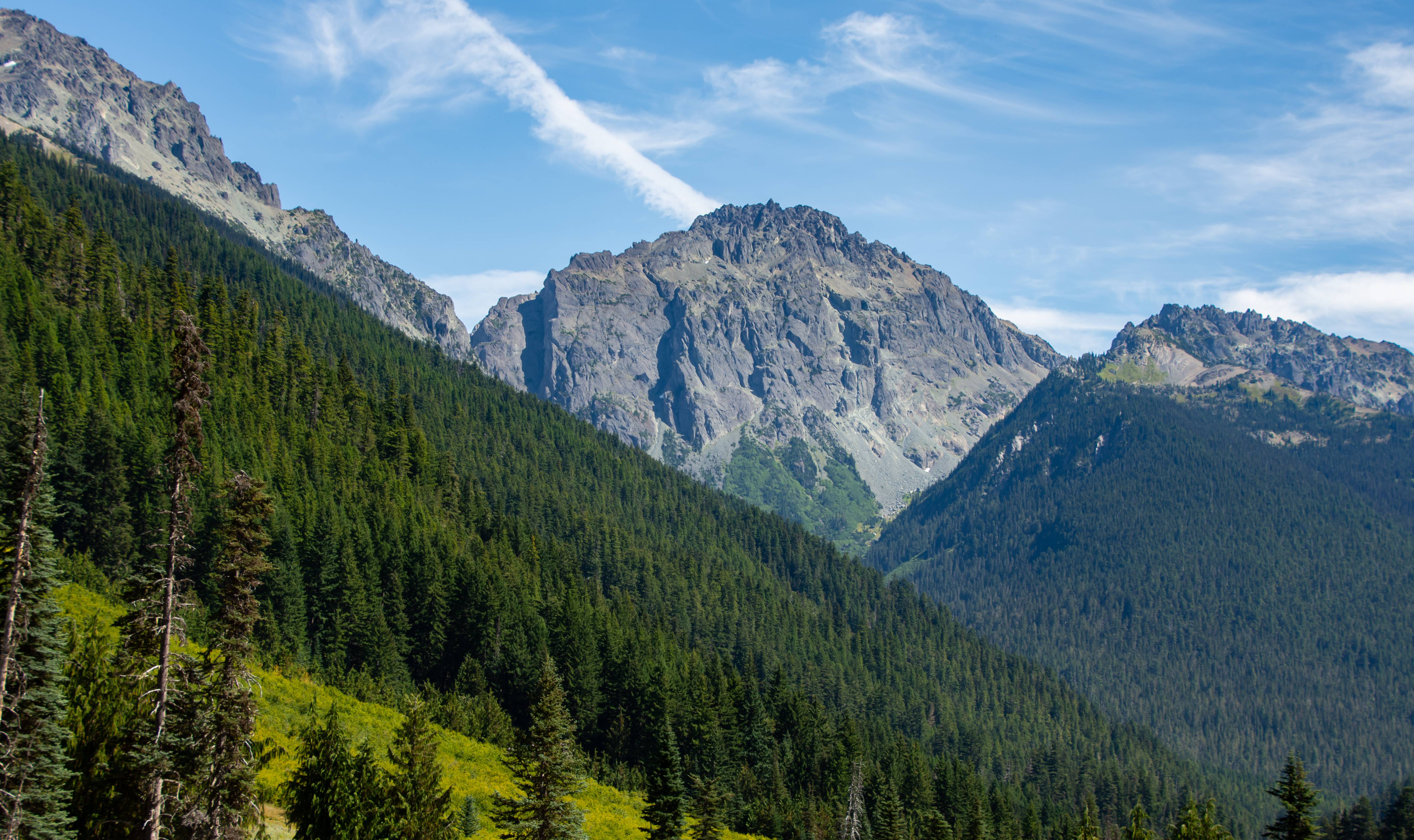
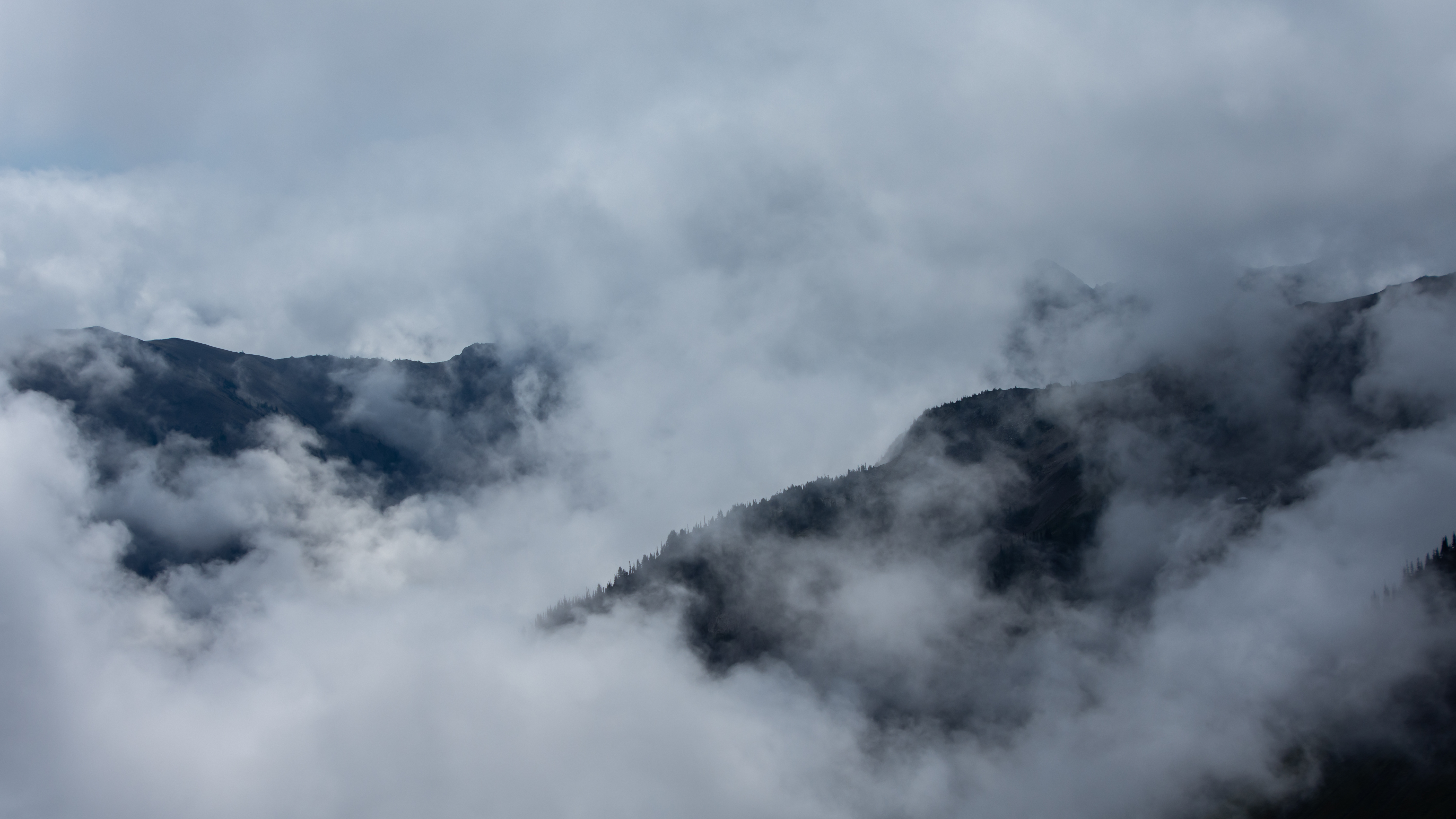
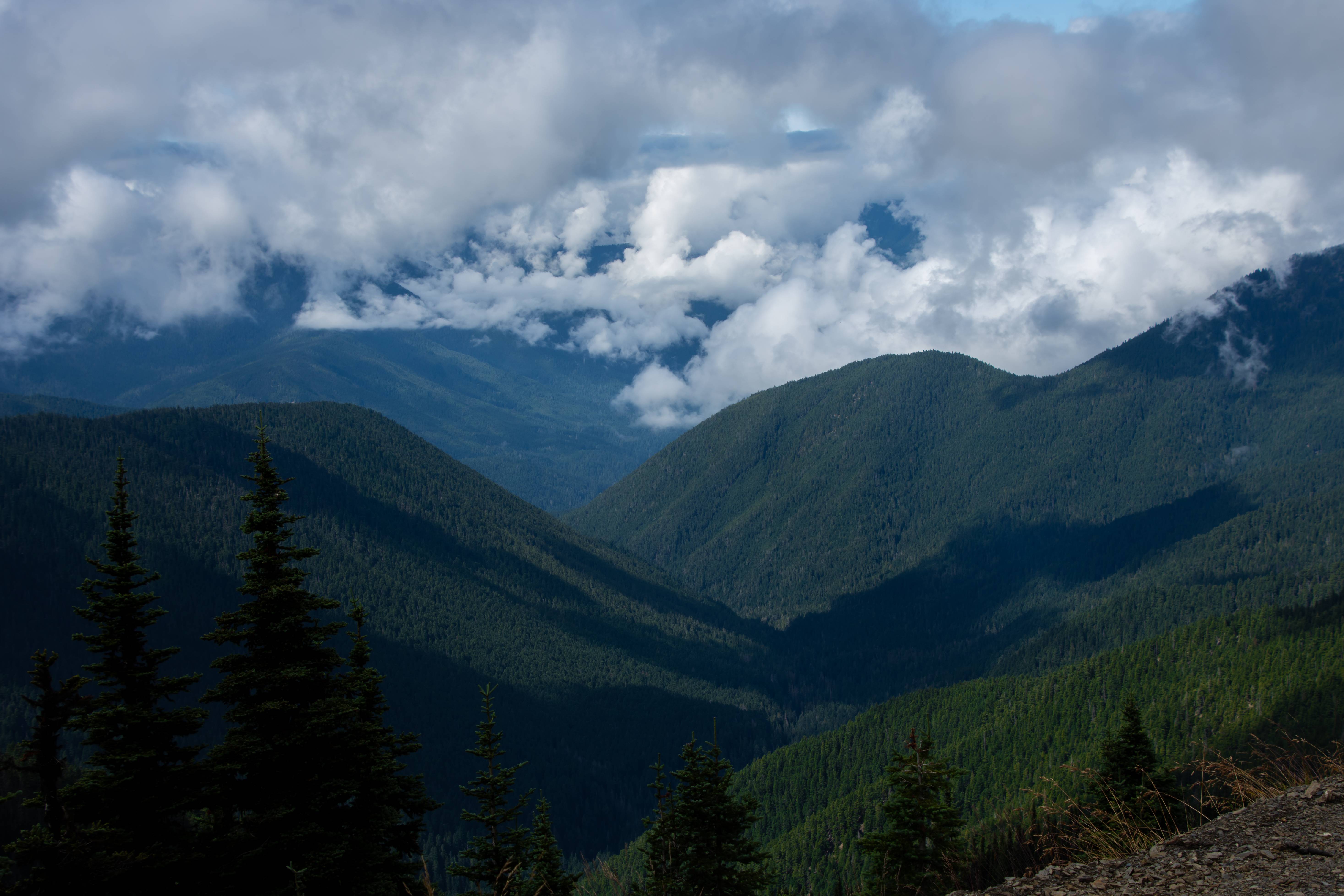
Are we still in the rainy olympics?
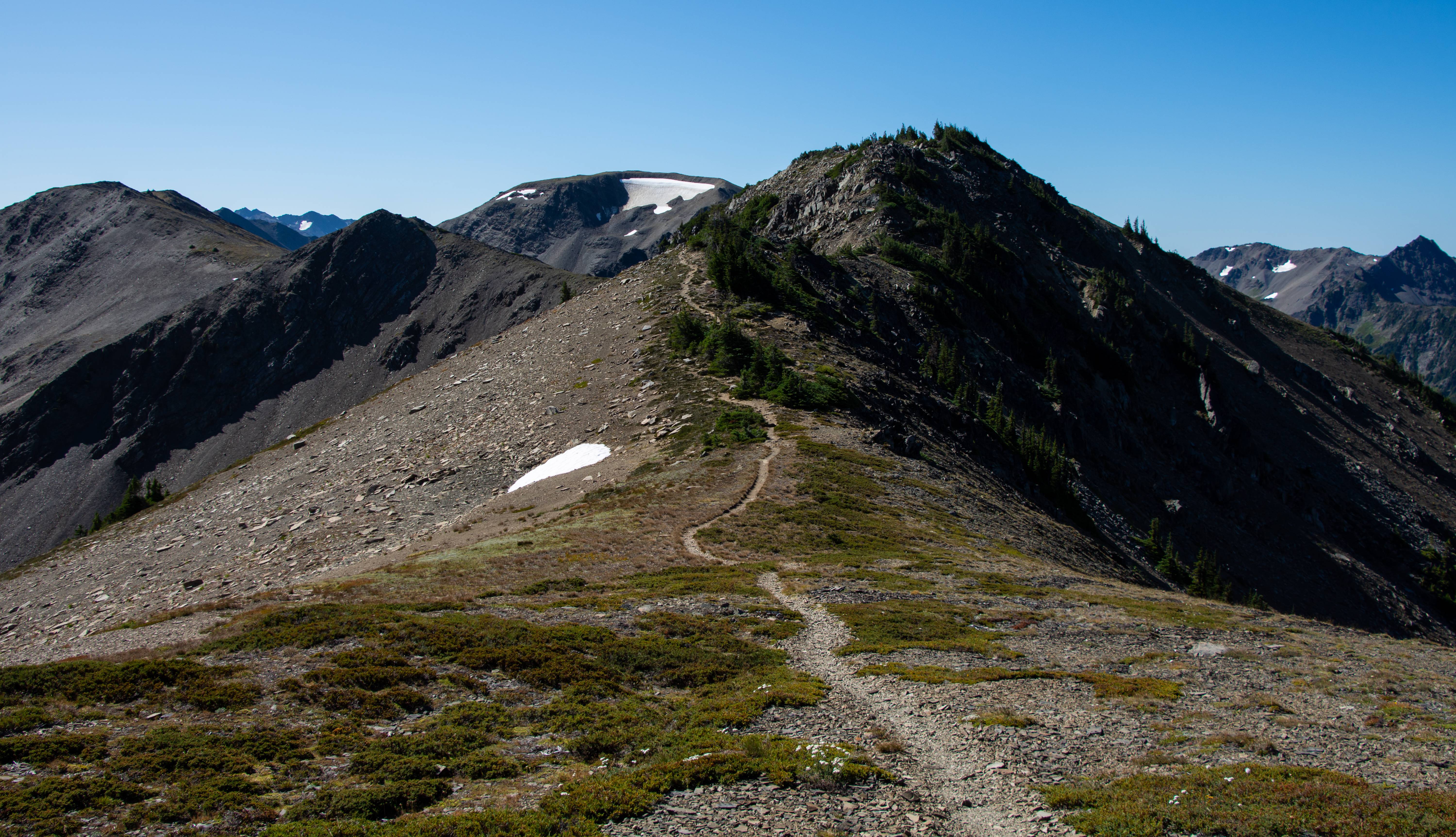
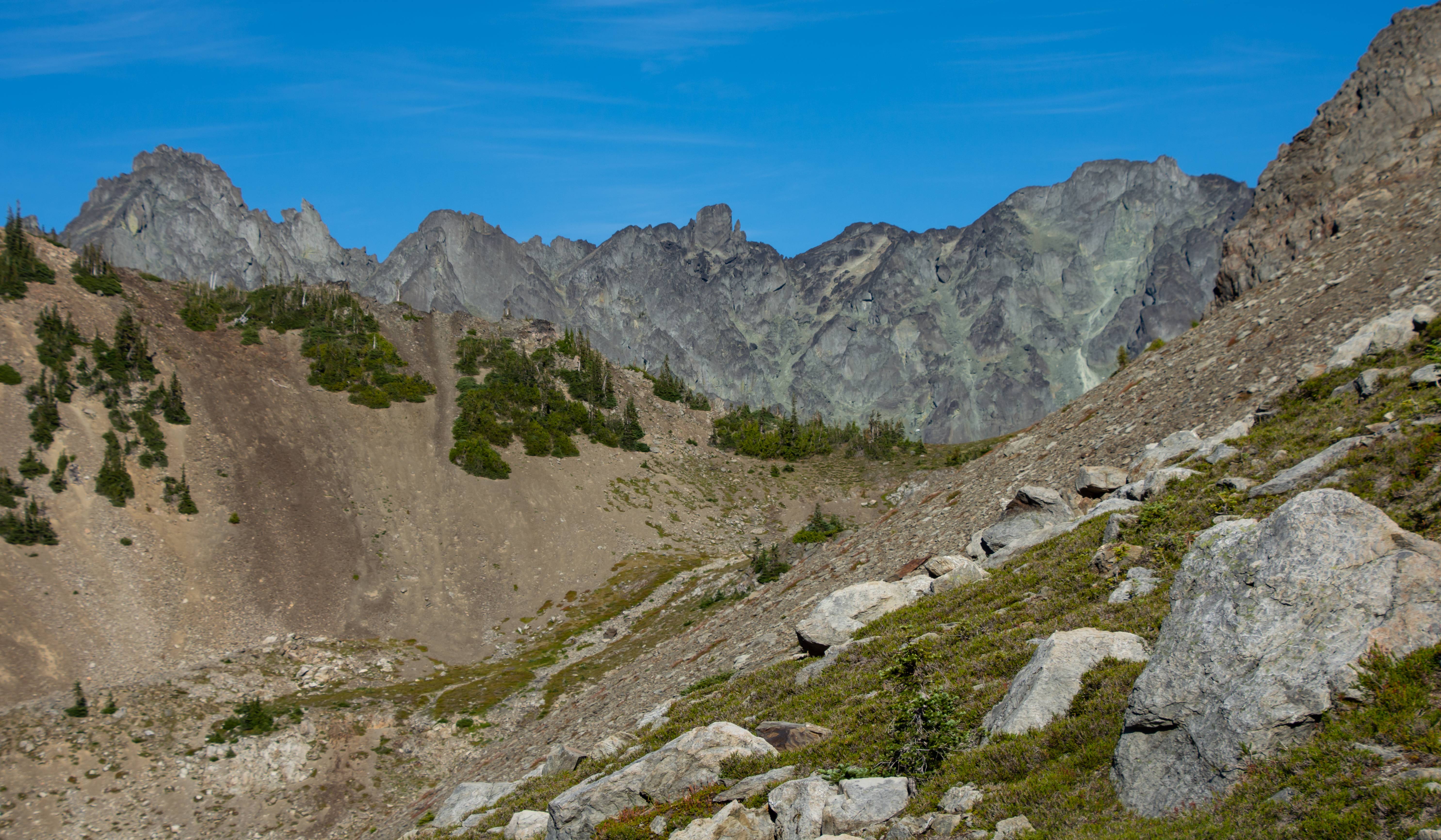
Our loop on Day 5 ends with walking the ridge off in the distance. You can see a part of the trail on camera left.
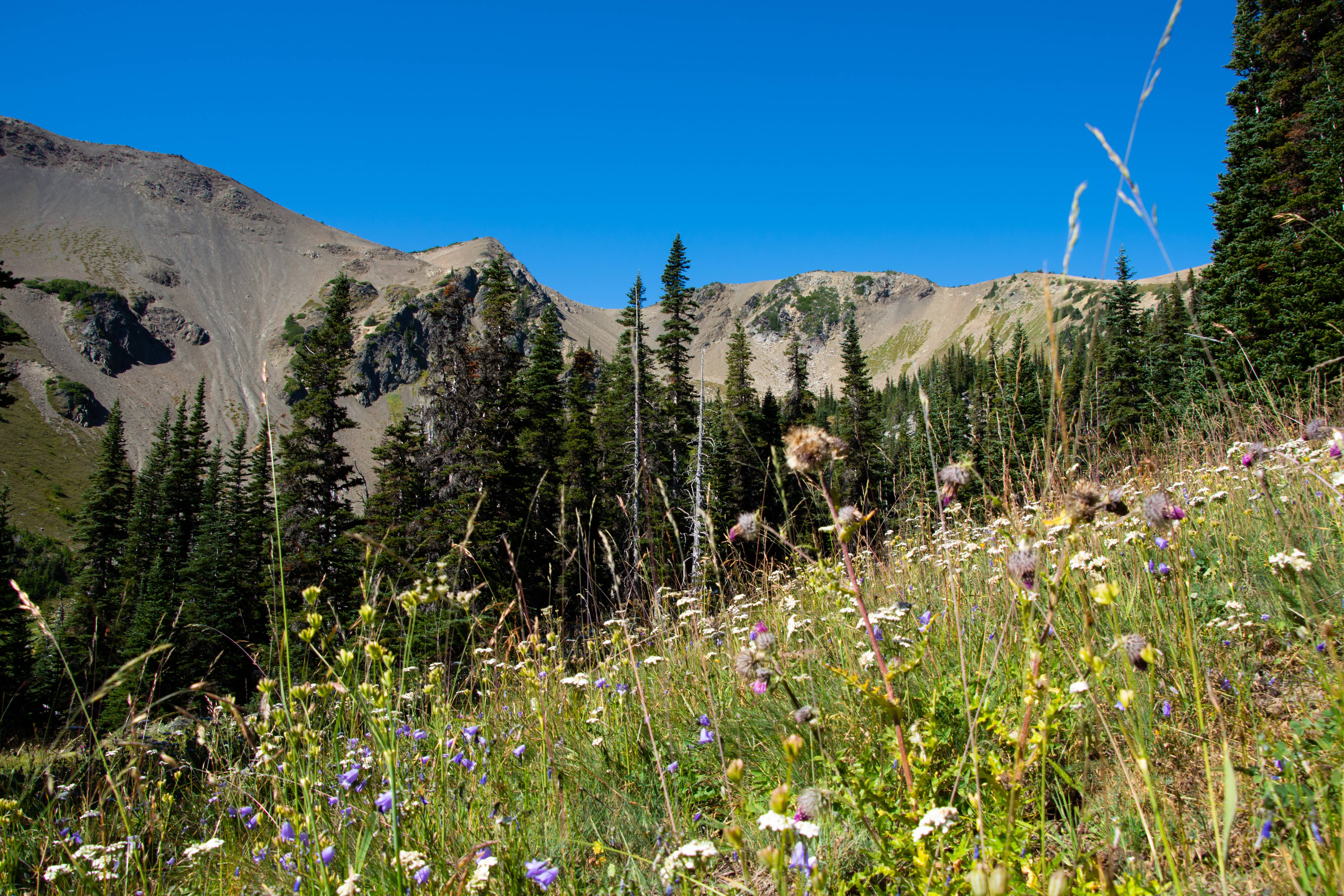
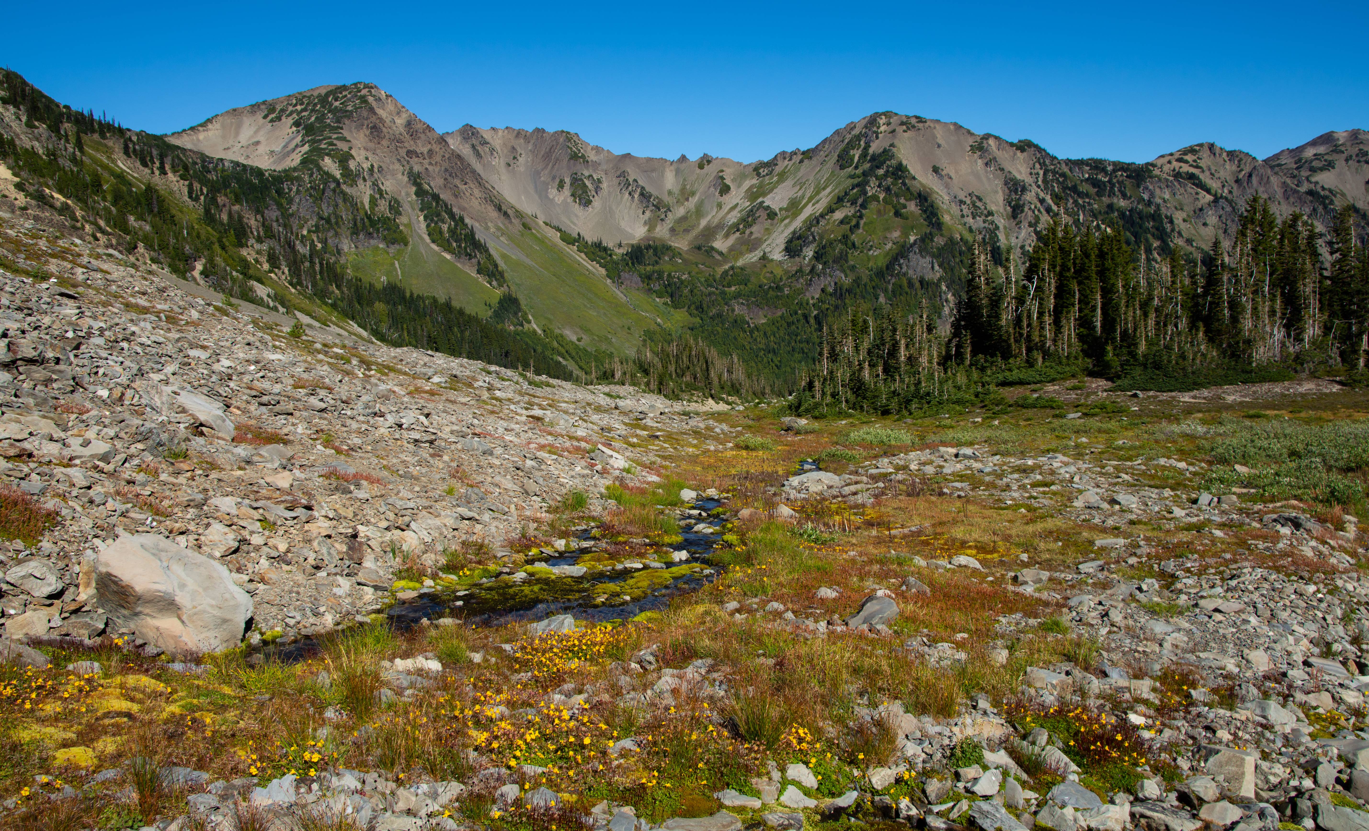
Flowers trying to hang on in Grand Valley
Lunch time @ Moose Lake.
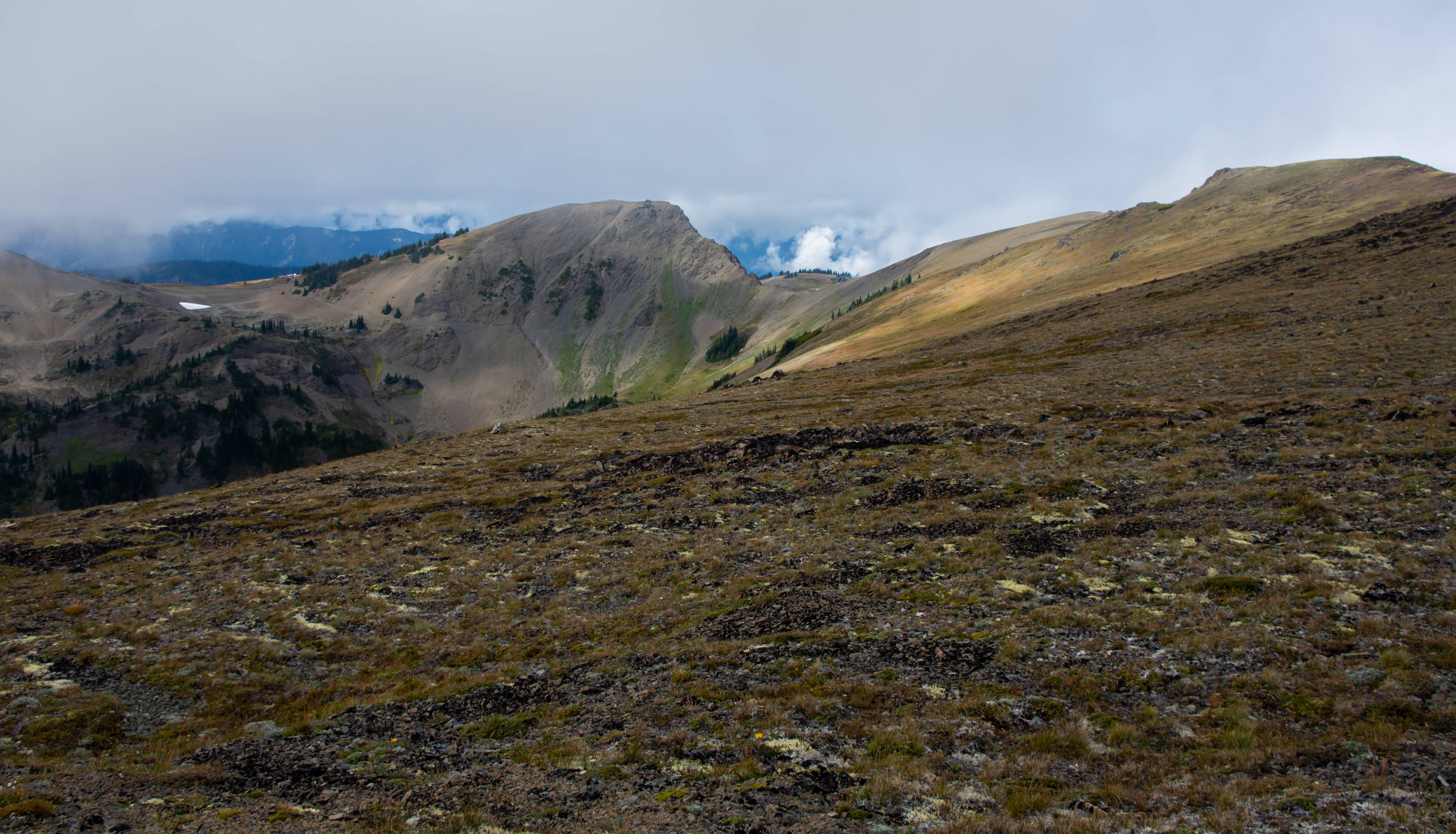
Our next stop. Grand Pass. Center pic.
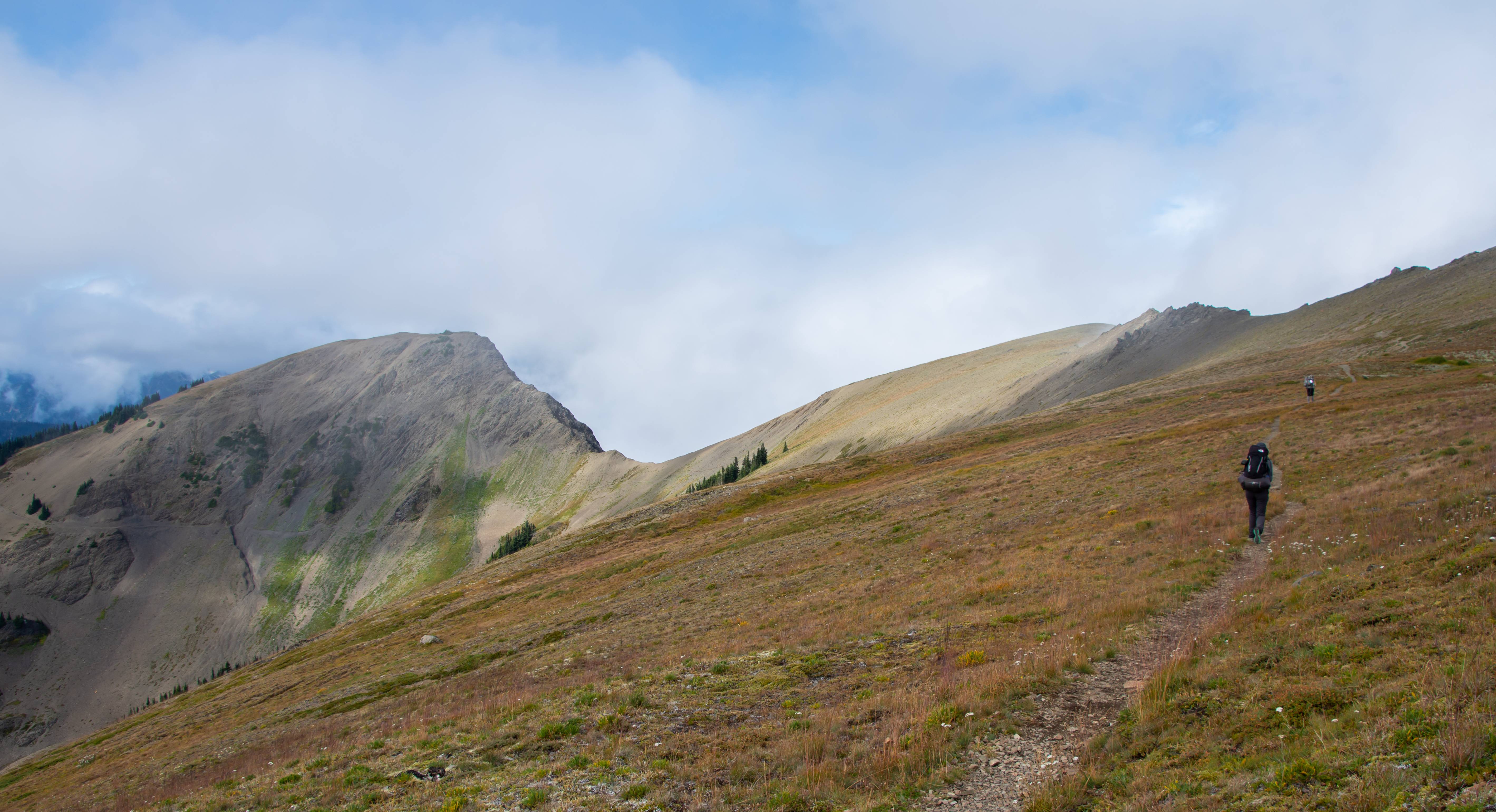
Making our way to Grand Pass
Looking back down into Grand Valley.
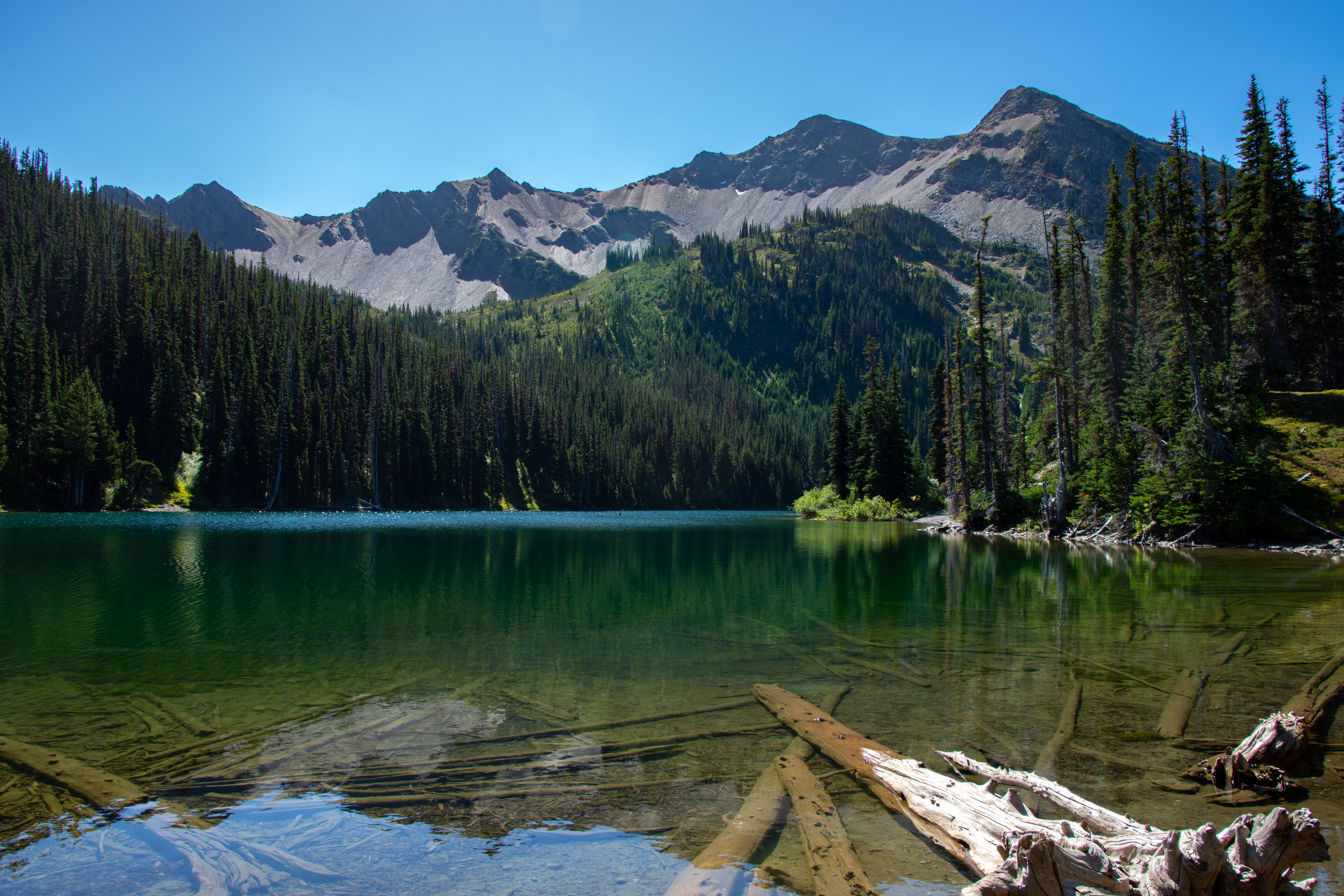
Cool tarn & Grand Valley
Great views from Grand Pass
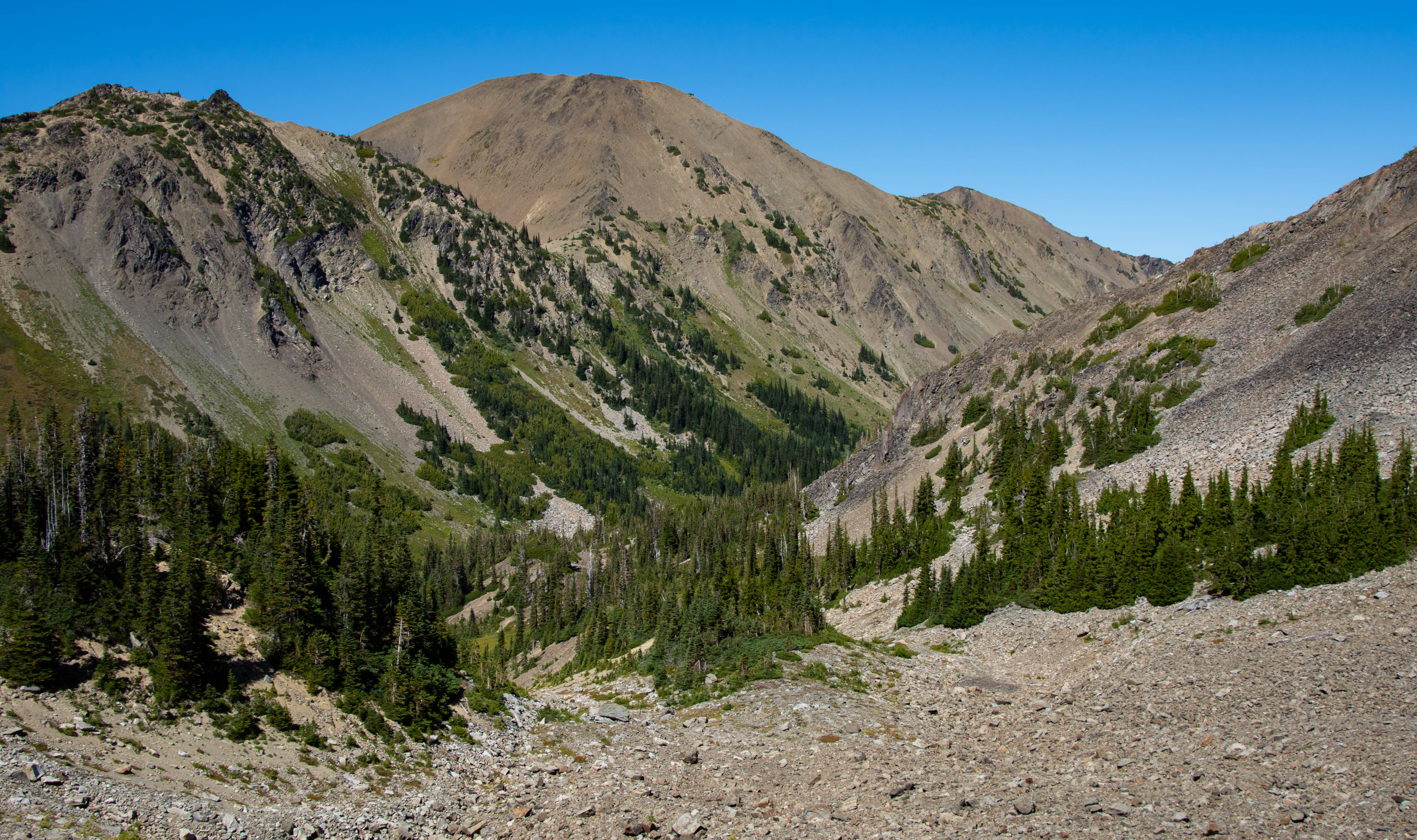
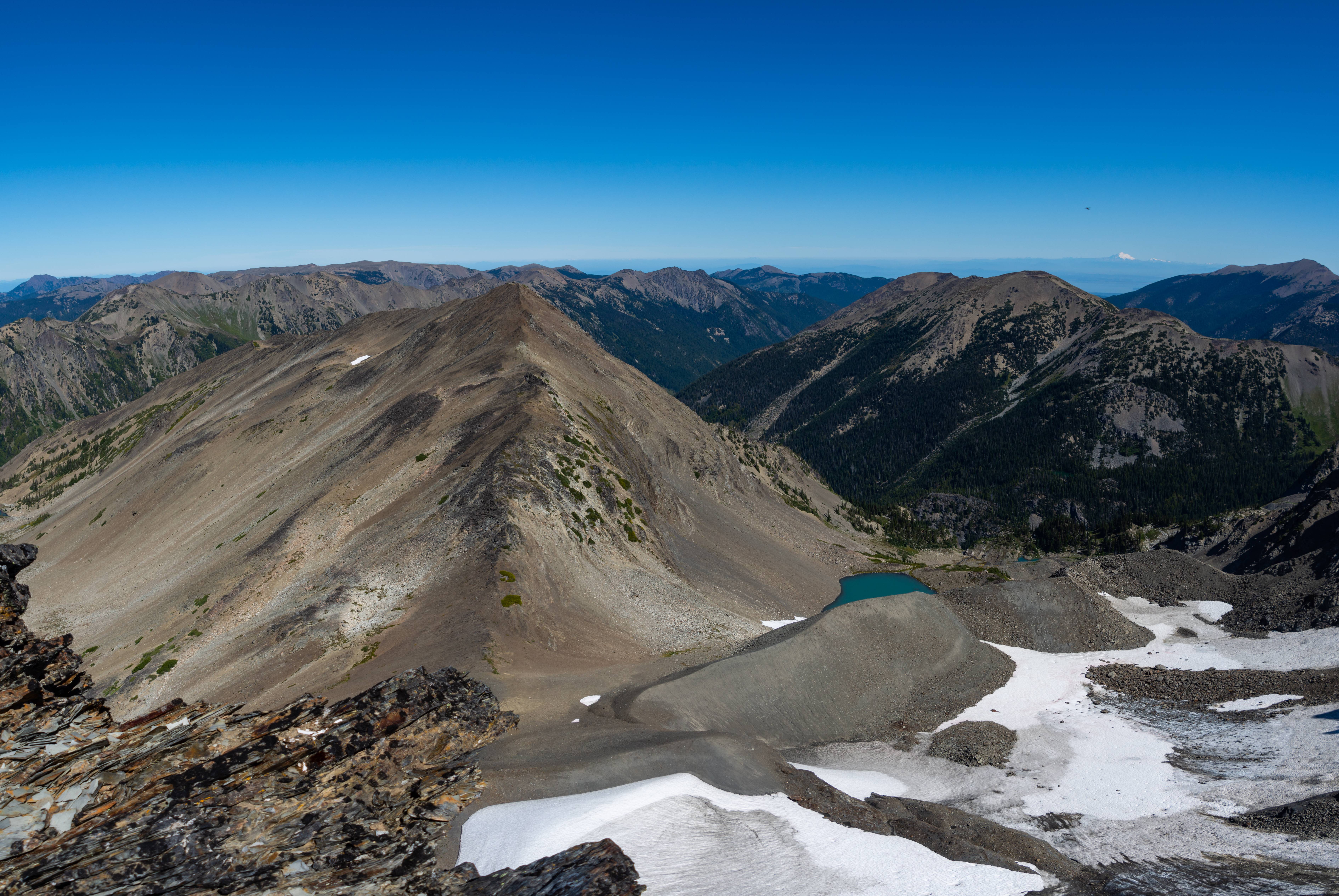
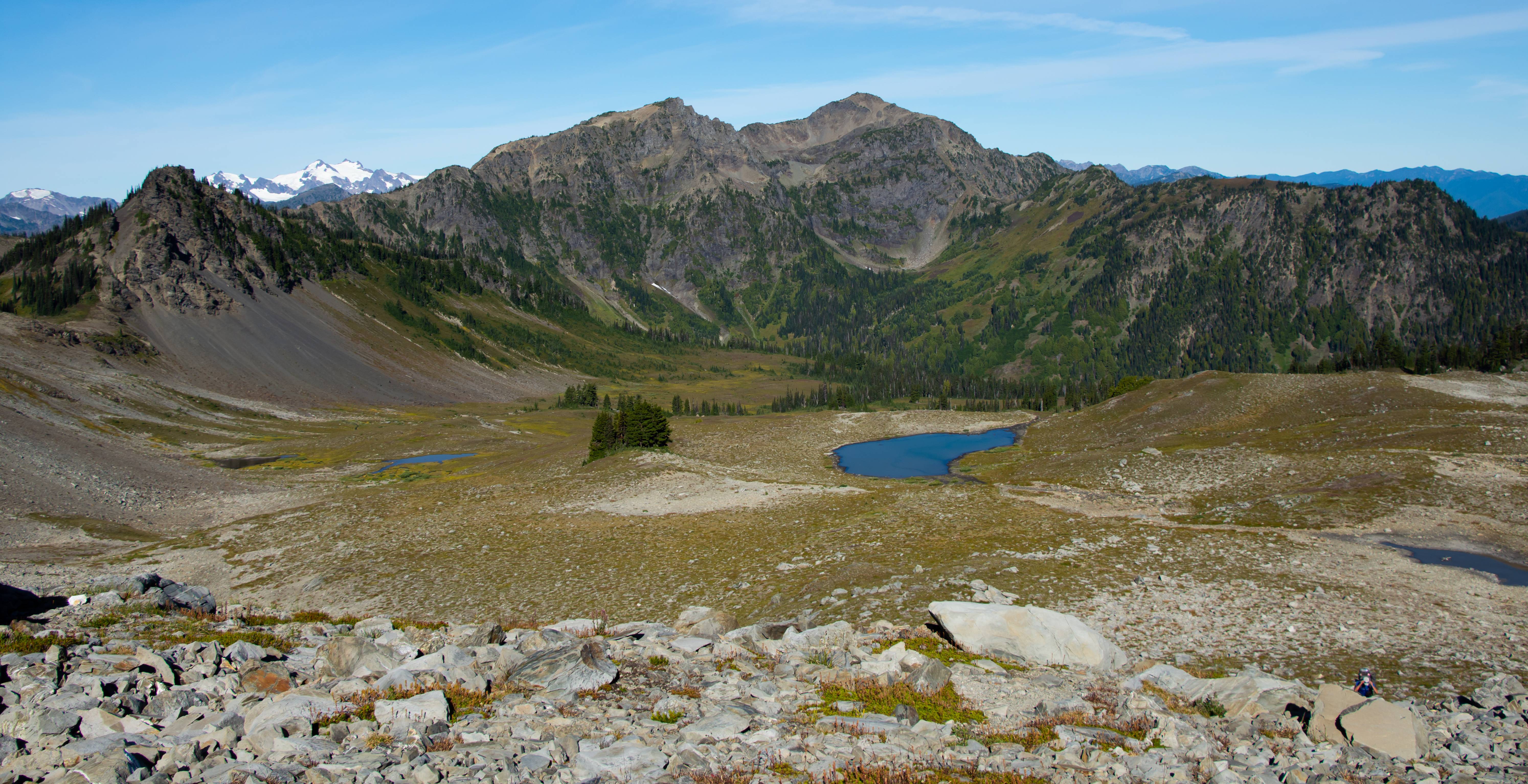
Our destination. Center pic. Cameron Basin. We will lose about 1600ft of elevation in 1 mile then regain 1000ft of it immediately after.
Dropping down with Aaron. Cameron basin in the distance.
Getting water at the tarn from the previous pic.
Olympics and knee joints have a great relationship with each other.
Sun hitting the needles of trees all trippy like.
Cameron Basin!
About 100ft from our camp.
Our view from camp.
Day 2 : Cameron Basin > Mt. Cameron > 1000 Acre Meadow (On & off trail)
14.35 Miles @ 3800ft of Elev. Gain (70% trail - 30% off trail)
Slept like a rock listening to that waterfall all night.
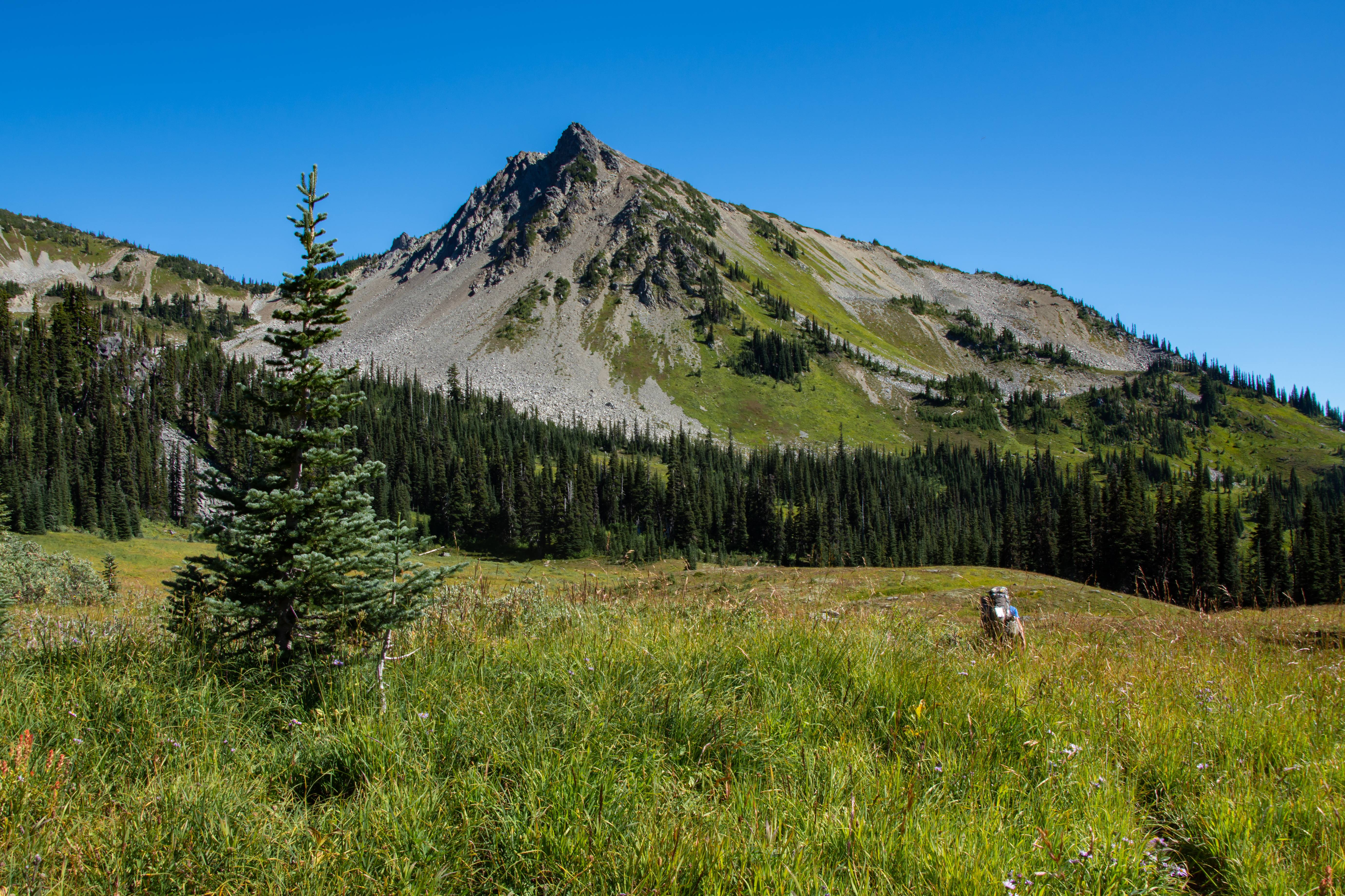
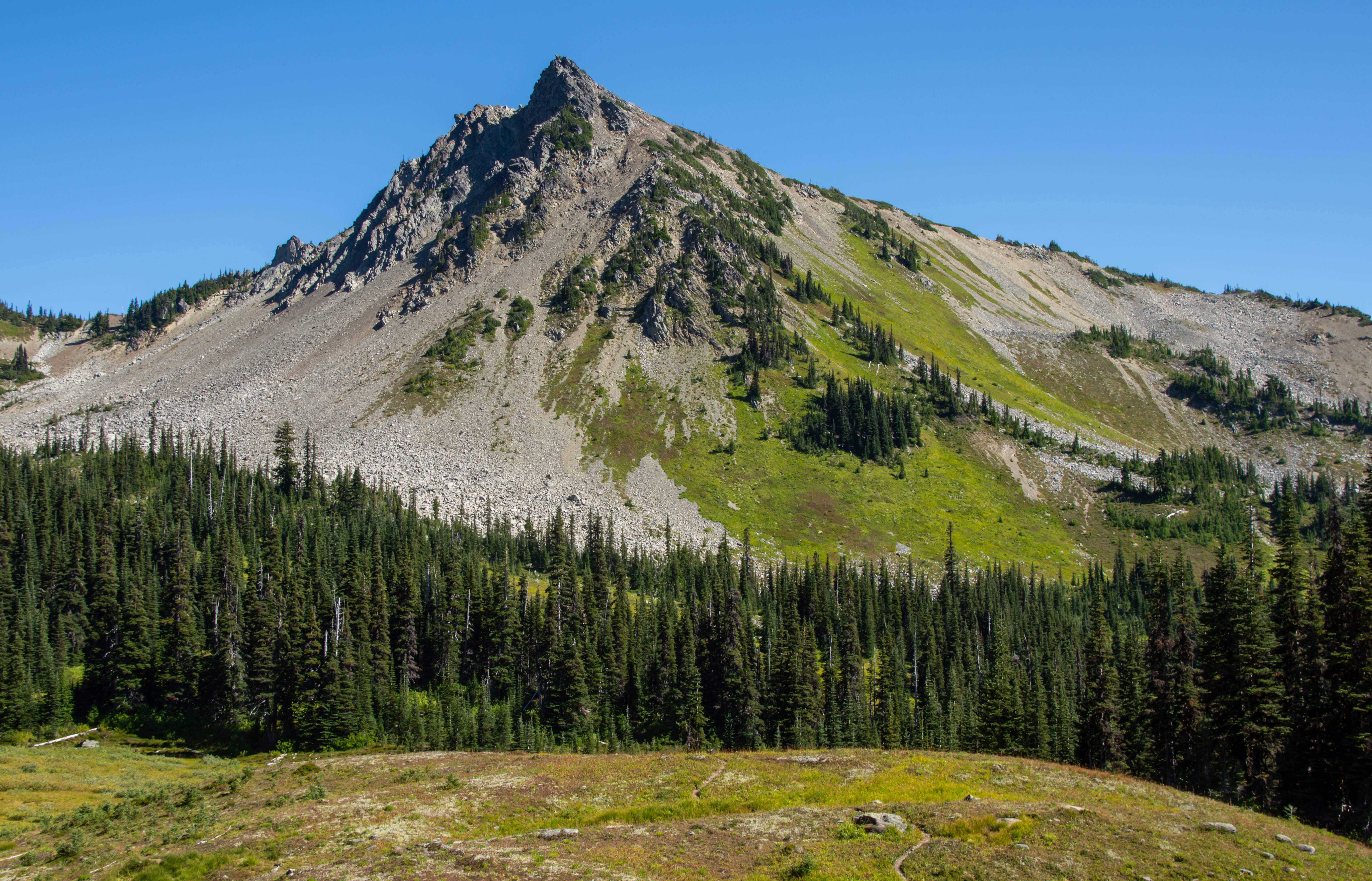
Headed up to Cameron Pass. The highest trailed pass in the Olympics.
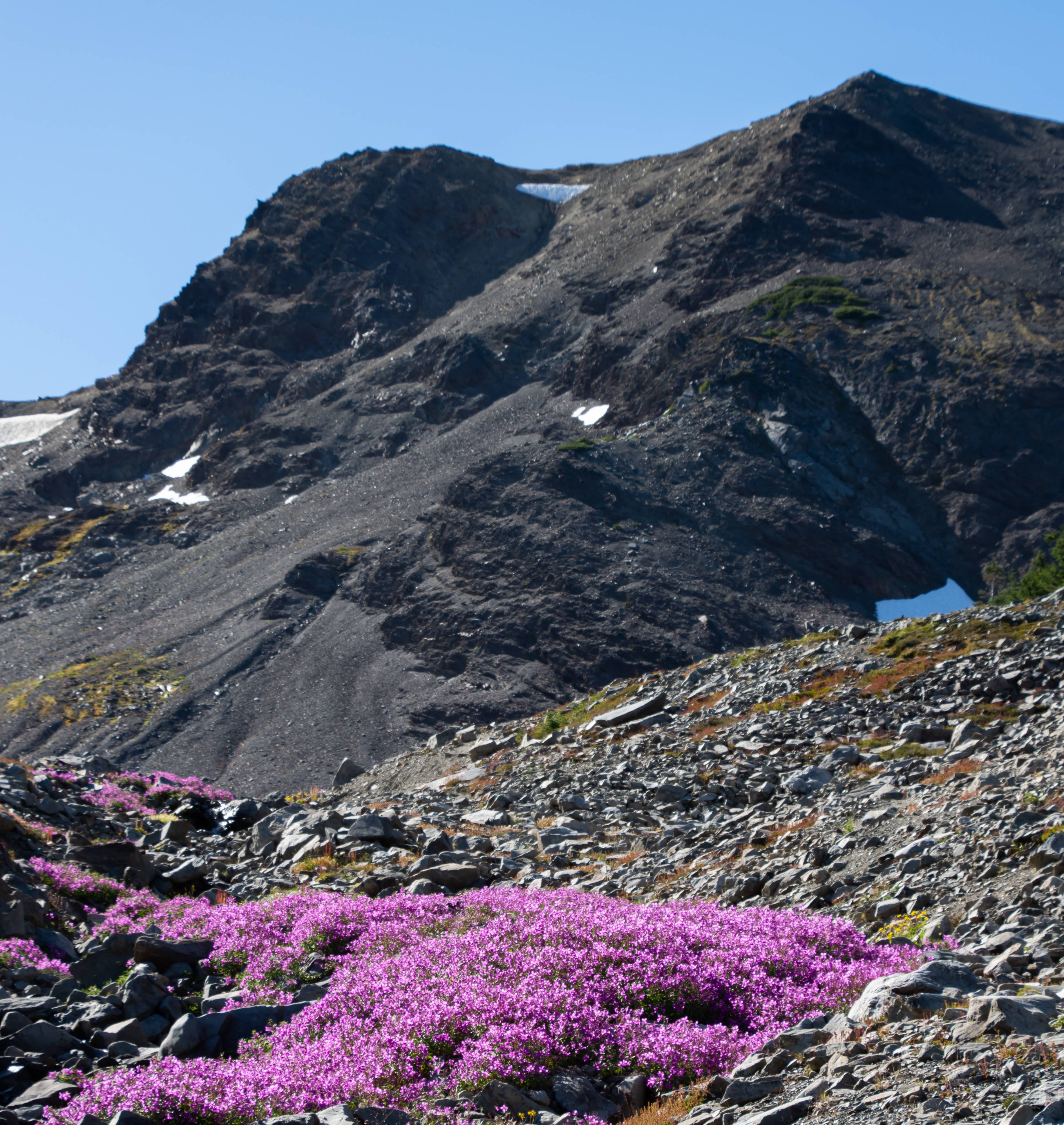
Monkey flower.
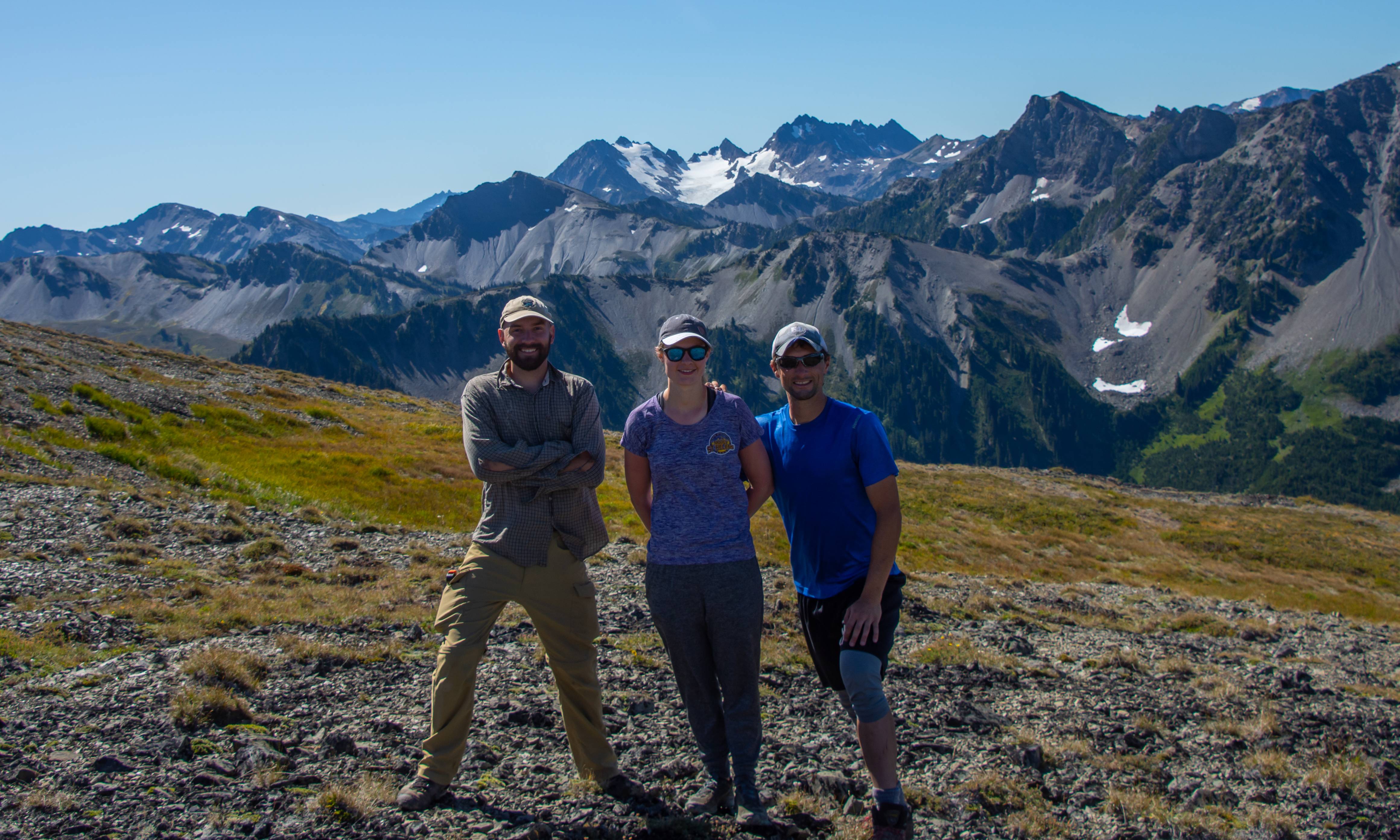
Aaron and his GF sarah and I @ the top of Cameron Pass
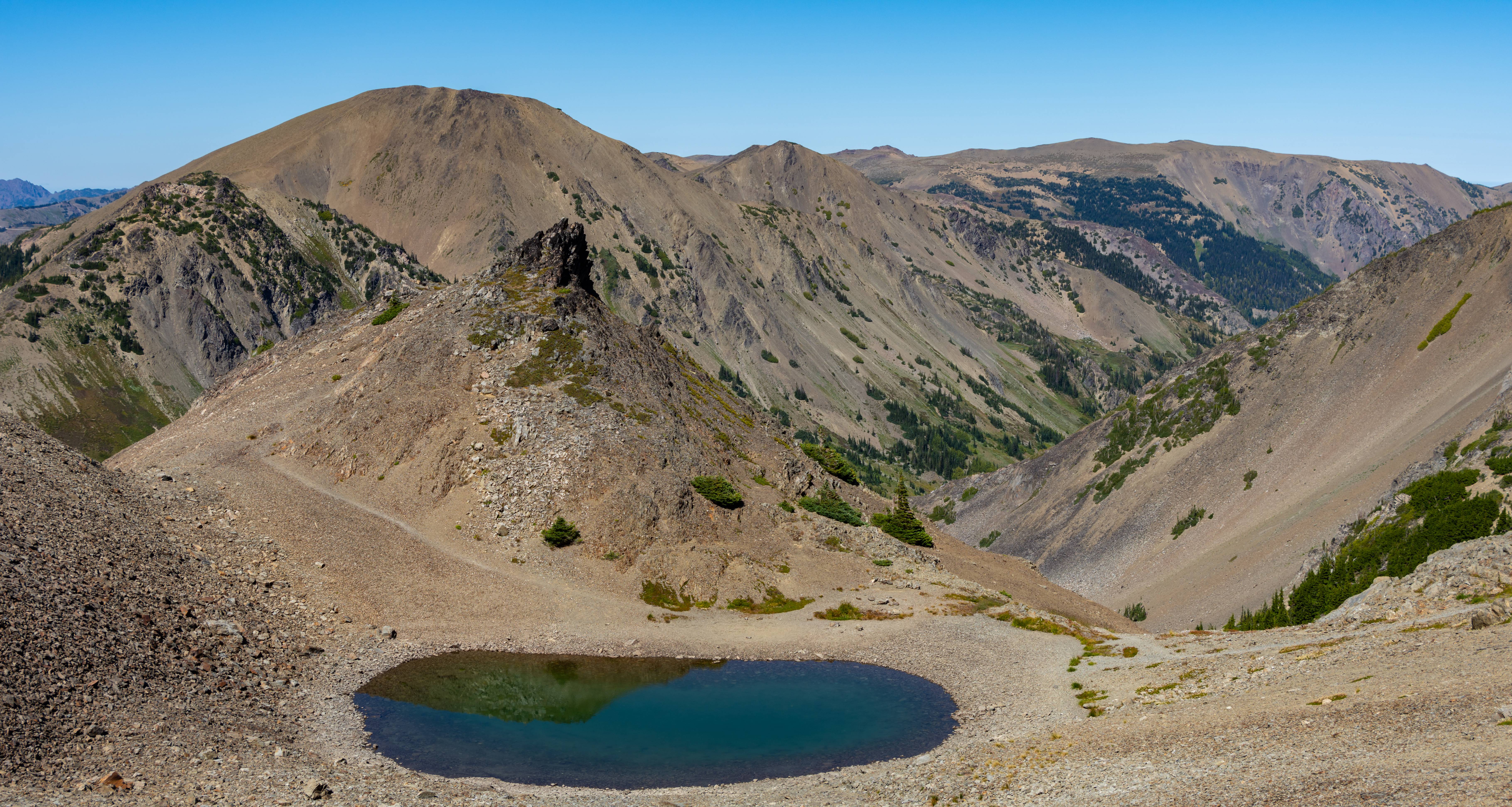
Off trail to Mt. Cameron. About 1/2 way we drop our packs for a quicker advance to Cameron.
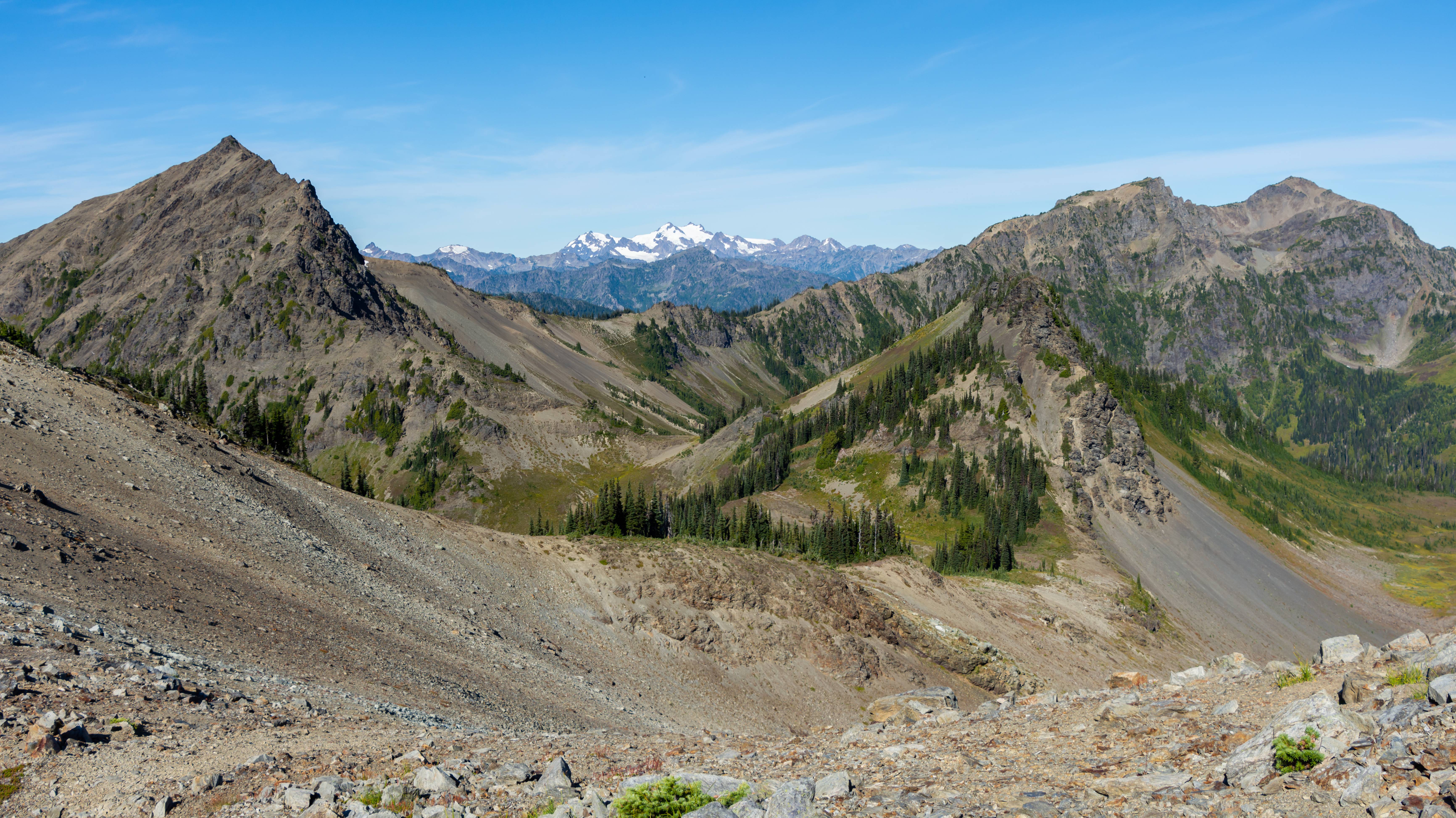
Mt. Rainier about 110 miles away.
Baker and Mt. Shuksan about 100 miles away. Puget Sound in view.
Whats left of the Cameron Glacier
Great views and a photo bomb from Baker.
We got back to our packs and started steeply side-hilling to intersect with the trail which headed for Lost Pass. We ran into what Aaron described a "Classic Olympic scene" a Steep grass slope with Olympus in view. We got buzzed by a Coast Guard / NPS helicopter. We assumed they were still on patrol to catch the remaining convict mountain goats they are rounding up and releasing into the North Cascades. (Mountain goats aren't native to the Olympics)
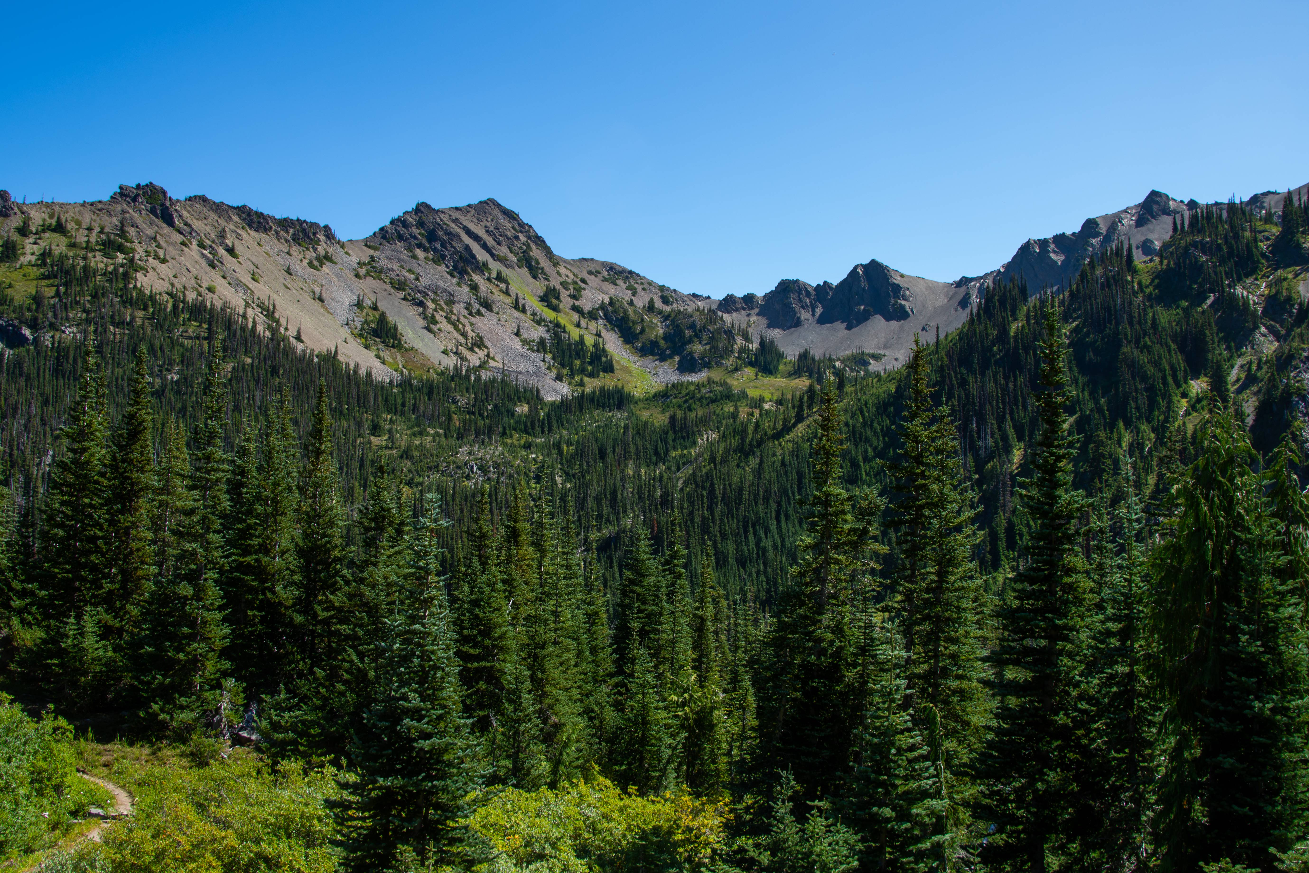
Lost Basin & back on trail lol
Loved this basin
Looking back up where we came from. We were on that highpoint center pic.
Lost Pass.
Olympic Marmot ready to fight
We started our first extended off trail venture toward the unknown 1000 acre meadow. There was less online about this place than Bannock Lakes surprisingly. We shwacked 750ft of gain uphill a much more mellow experience than the 2600ft of gain up Character Ridge to bannock lakes. There were signs of marmot and bear EVERYWHERE.
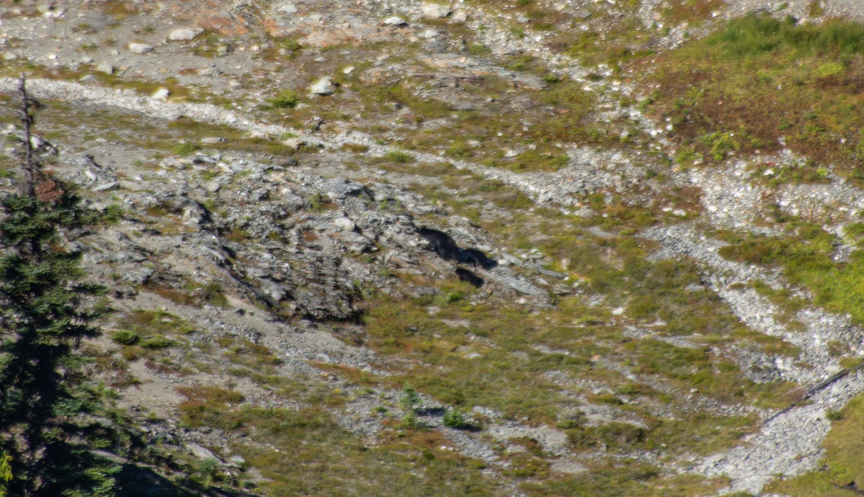
Our first view of 1000 acre meadow. Once we cleared the trees it was immediate. BEAR! (looks right) ANOTHER BEAR! (looks further right) ANOTHER BEAR!
3 Bears. 1 Meadow.
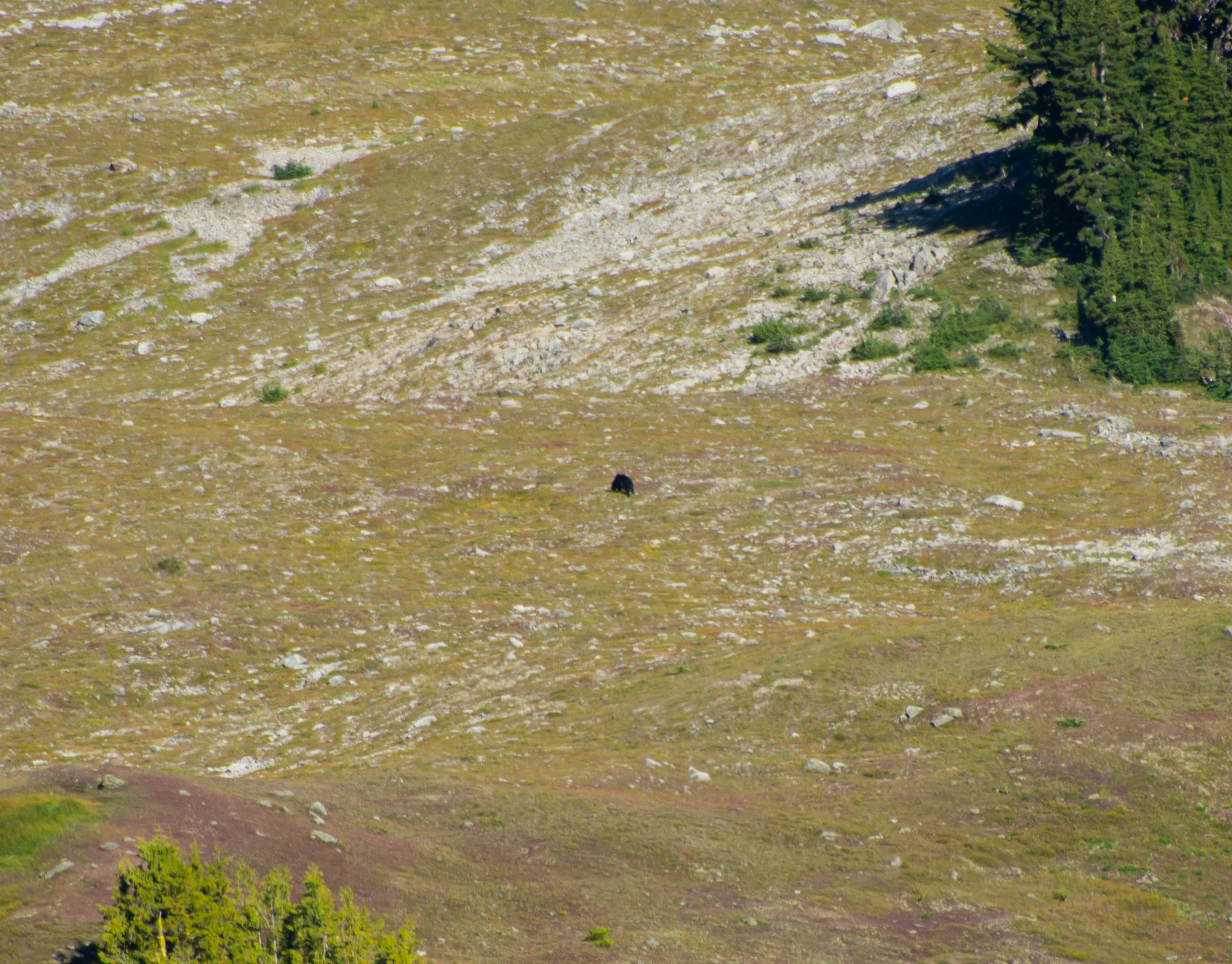
Bear 1 off by where we want to camp.
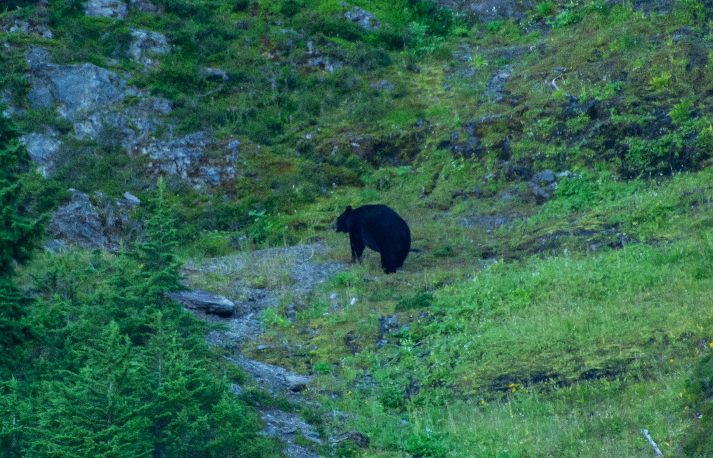
Bear 2
Bear 3. He was frozen. Staring at us the whole time while the other two ate berries.
Making our way up the meadow. We tried to stay in the shade as the sun was brutal (for us northerners). Most of the trip it was mid-80's with 40-50% humidity.
At camp! Bear #1 saw us coming from a ways away and trotted over a hill where we assumed he grazed for the remainder of the day only to flank our camp at night to rejoin his 2 buddies downhill. (All 3 of them were near each other next morning)
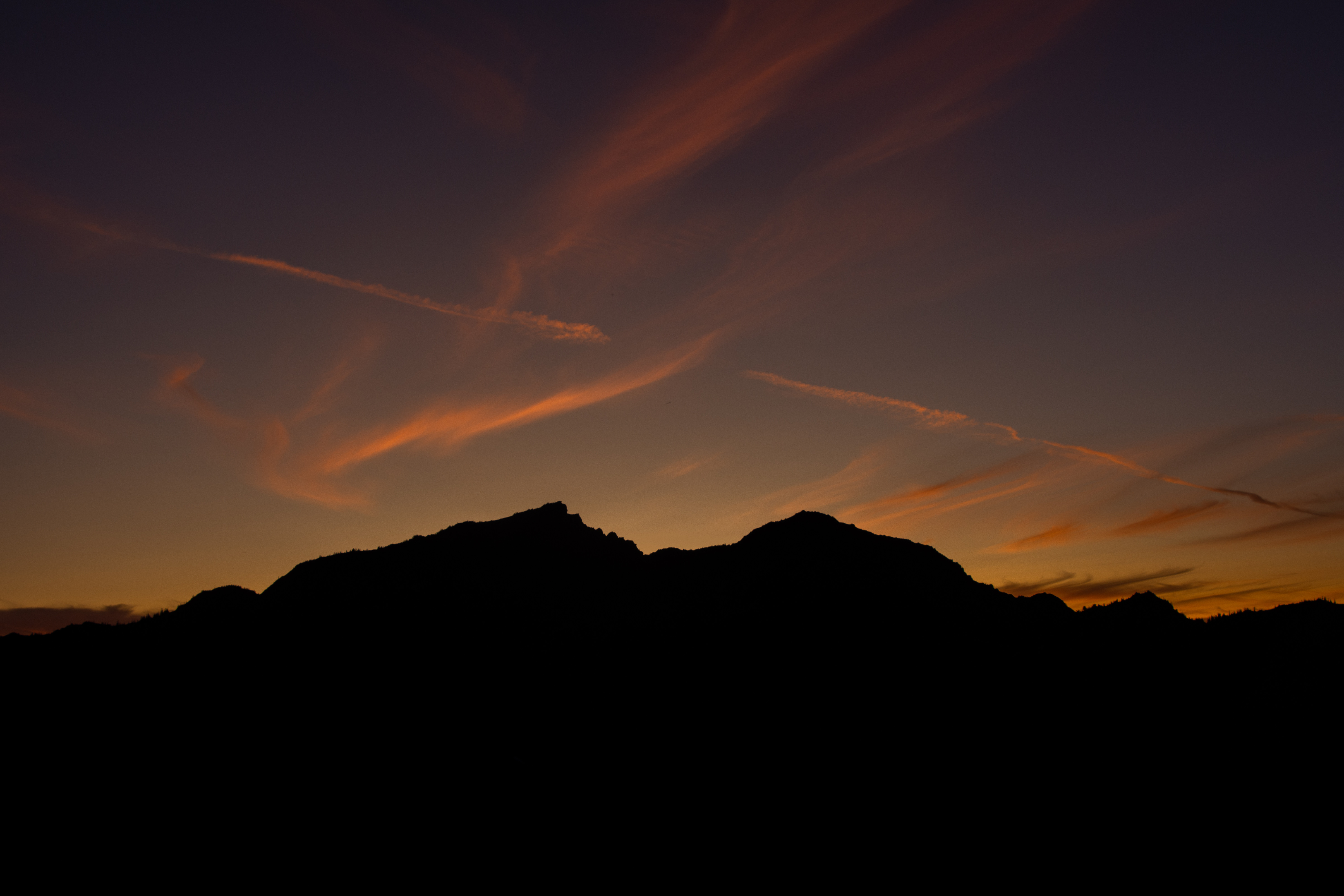
Amazing sunset
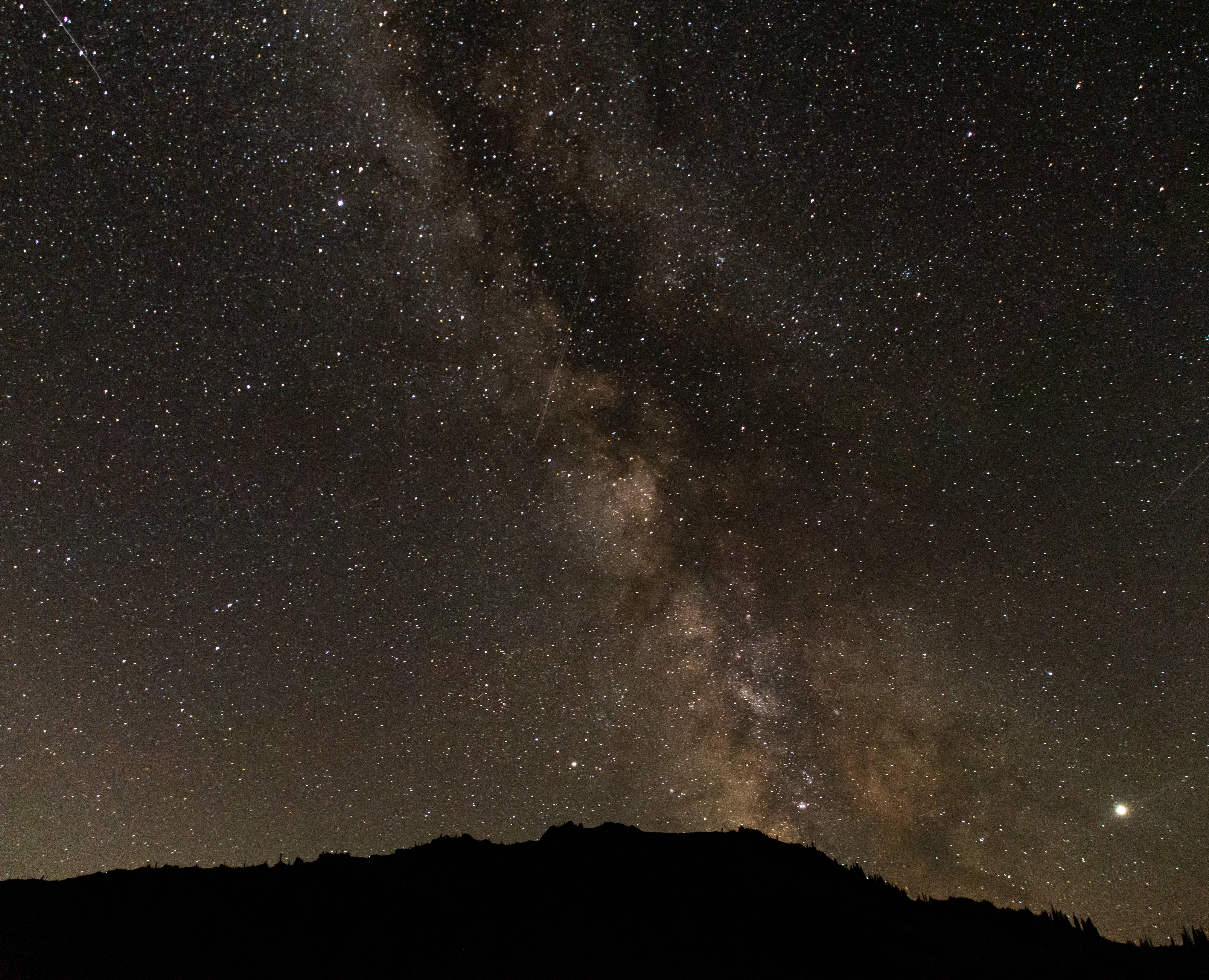
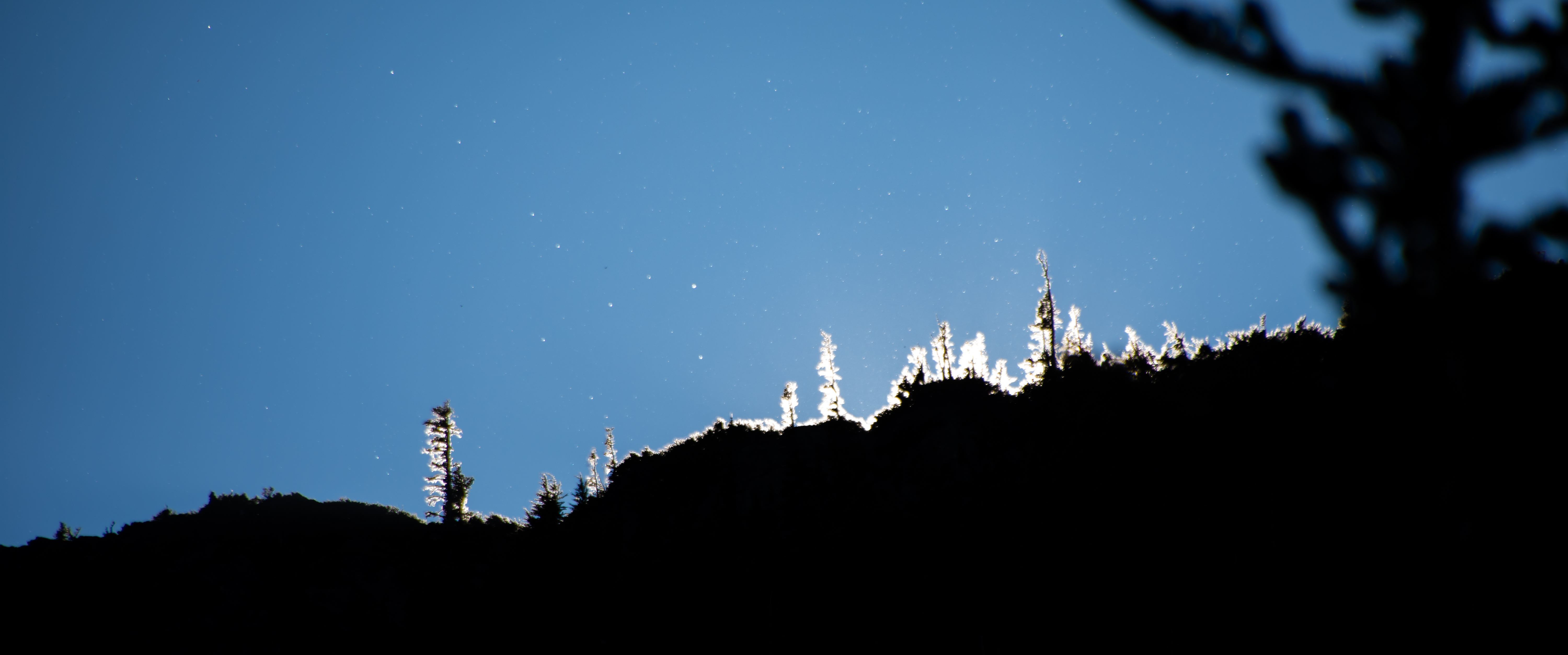
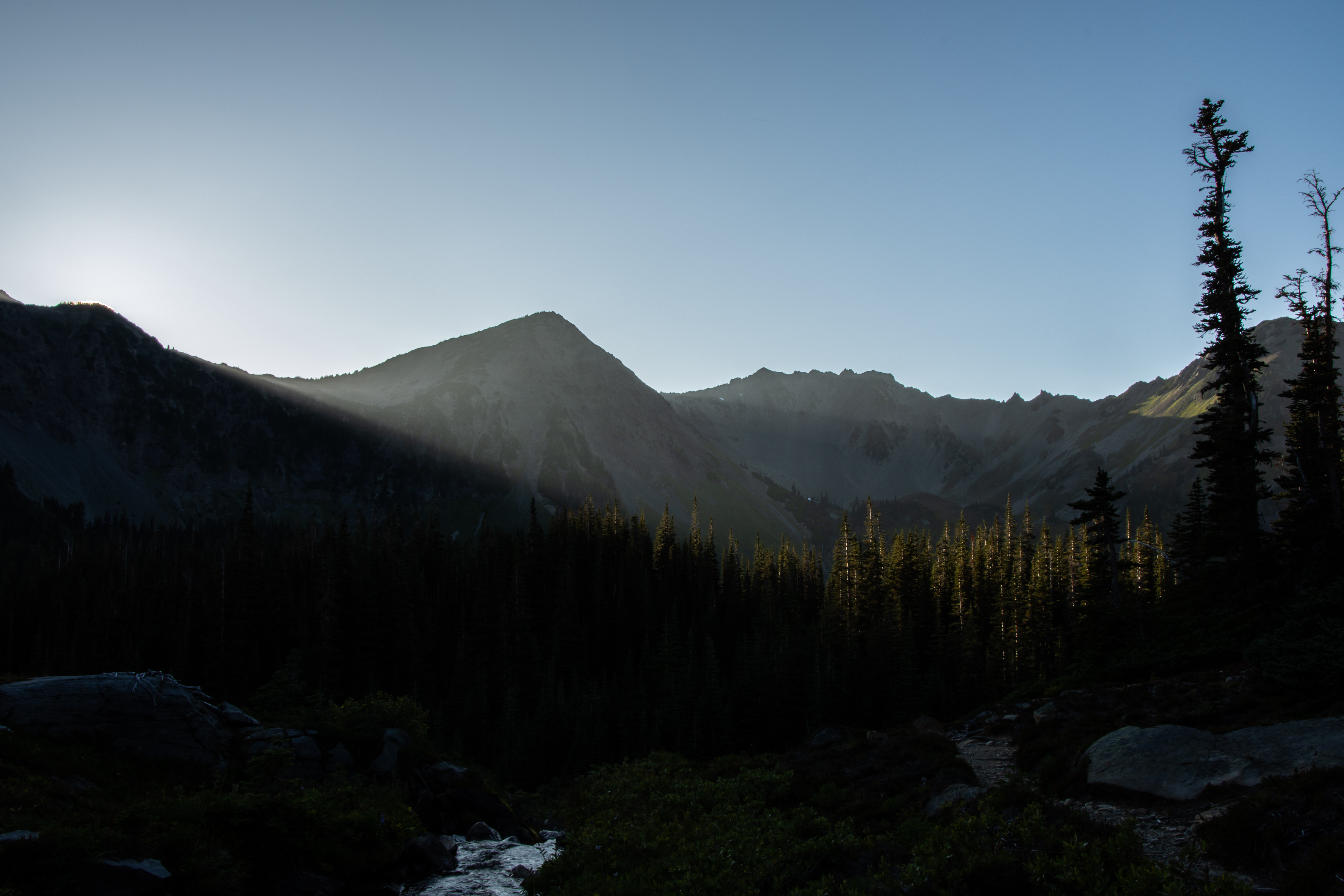
Much darker skies in the parks Interior.
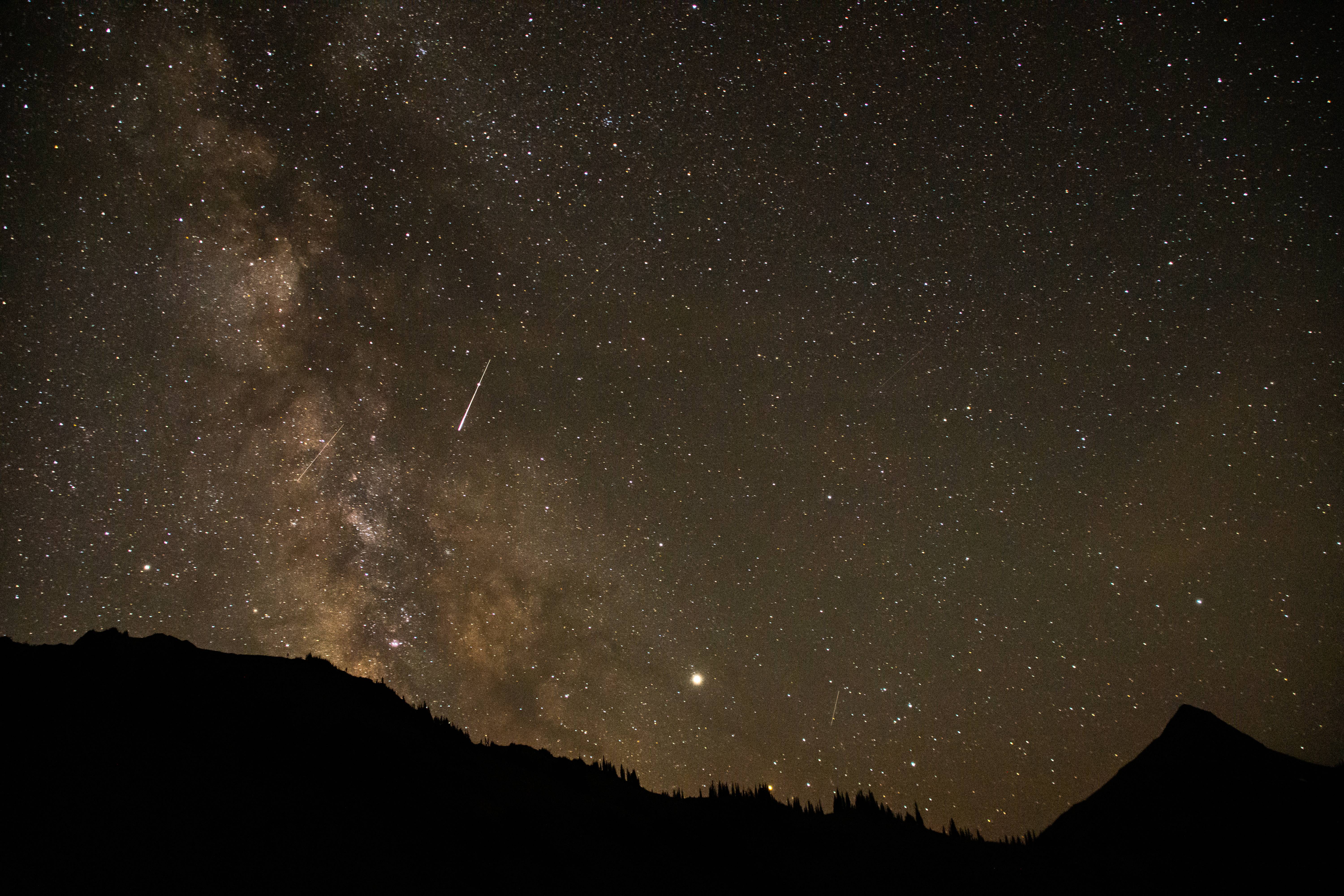
Camera caught some skyglow @ 3:00 AM
Day 3 : 1000 Acre Meadow > Off trail ridge walk to Hayden Pass area > Gray Wolf Pass > off trail to Cedar Lake
14 Miles @ 3800ft of elevation gain (50% trail - 50% off trail)
Good morning neighbors!
Got to watch our friends graze while we packed up our tents.
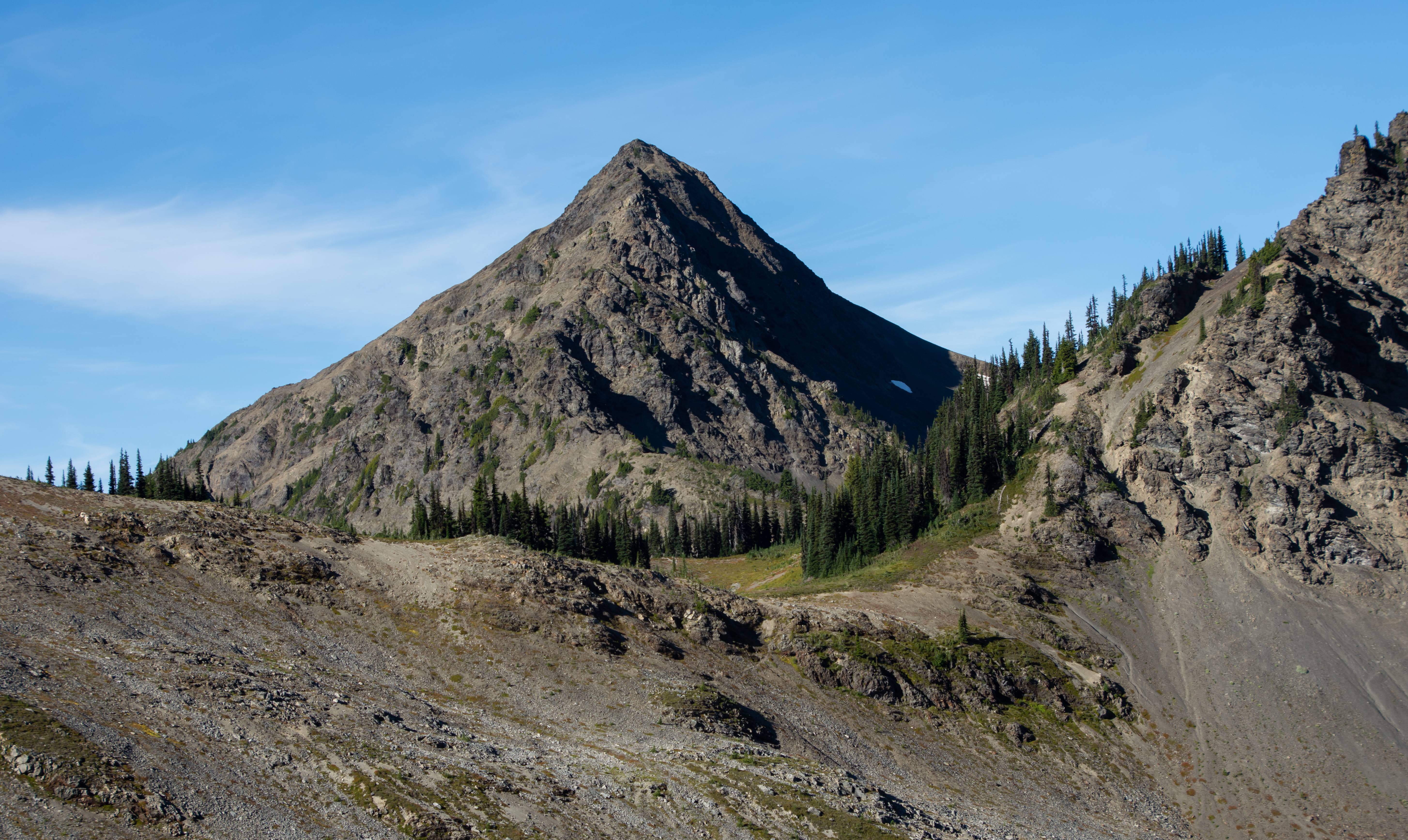
Current goal : get to the base of Sentinel Peak then cut down HARD to rejoin Hayden Pass trail.
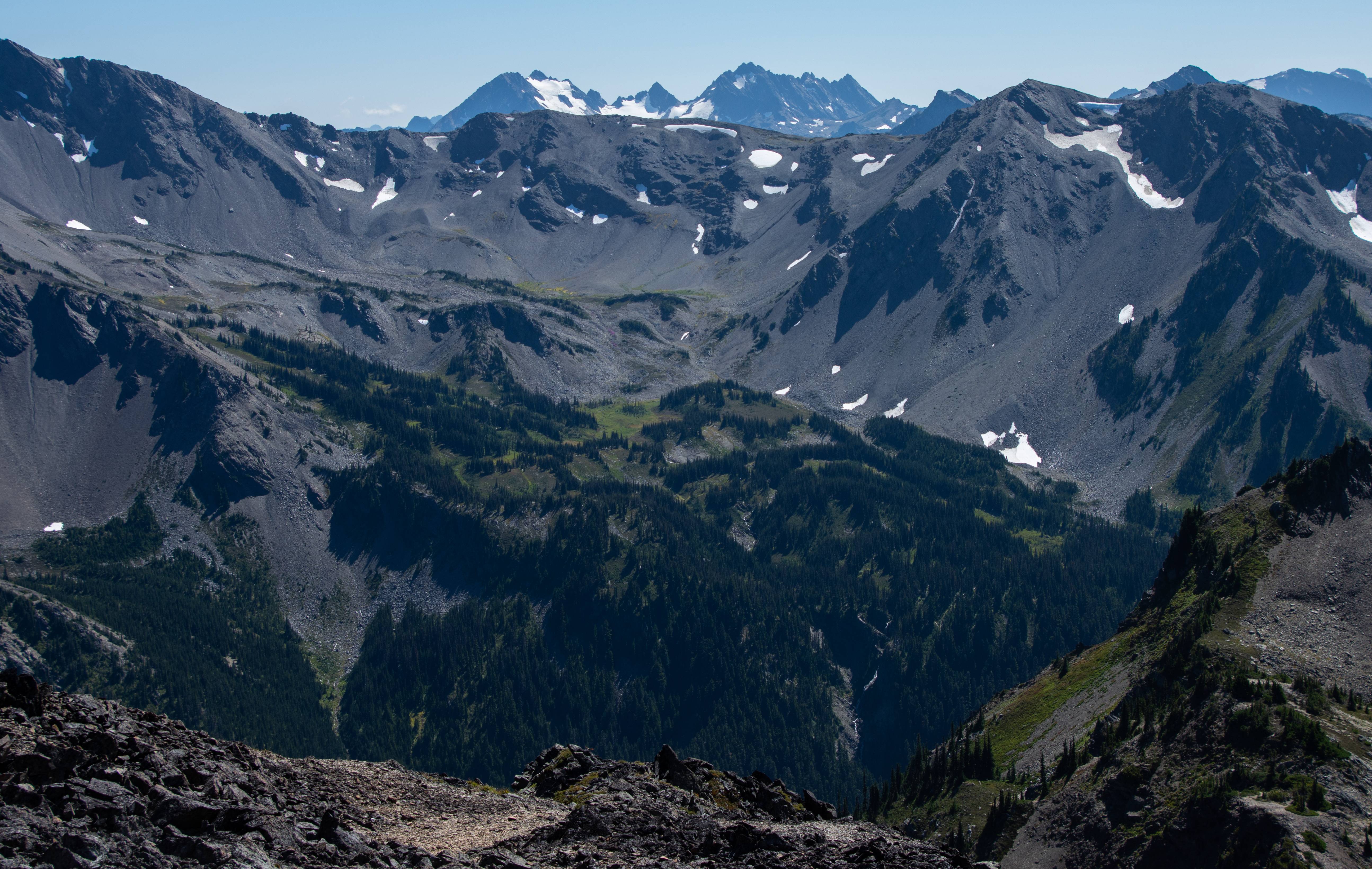
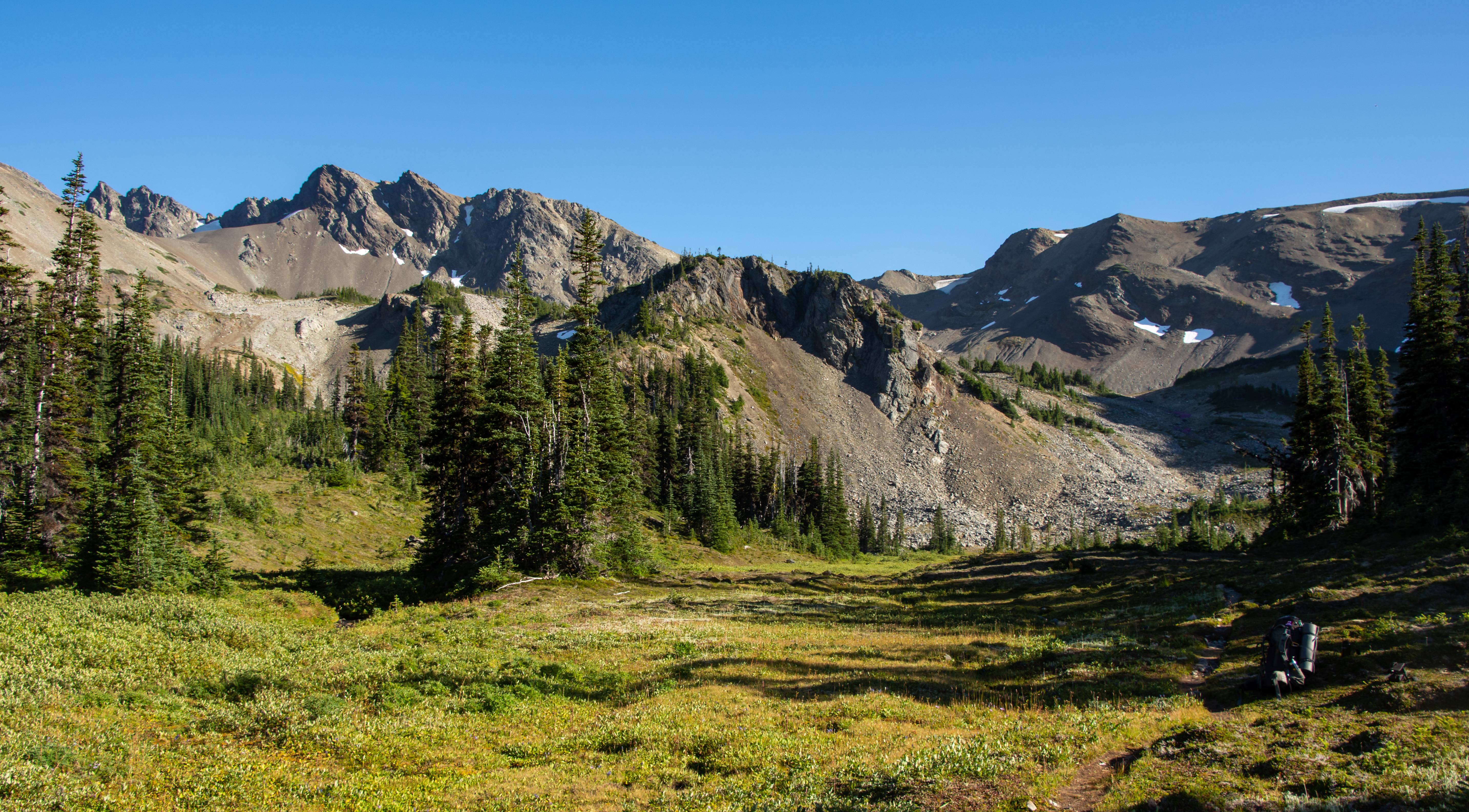
Grand view as we got up on the ridge. We camped near the big pond.
Wrapping around toward Sentinel
Mama and cubs! They knew our presence WAAAY before we saw them. They were across the valley running. Funniest part which I didn't get on camera unfortunately is that they scared a deer up above them. So the deer was running from the bears who were running from us. Chain reaction.

Somewhere between the bears and these shots we had to veggie-belay down a steep section of forest which left its battle scar marks on Aaron. His legs looked like freddy got a hold of them.
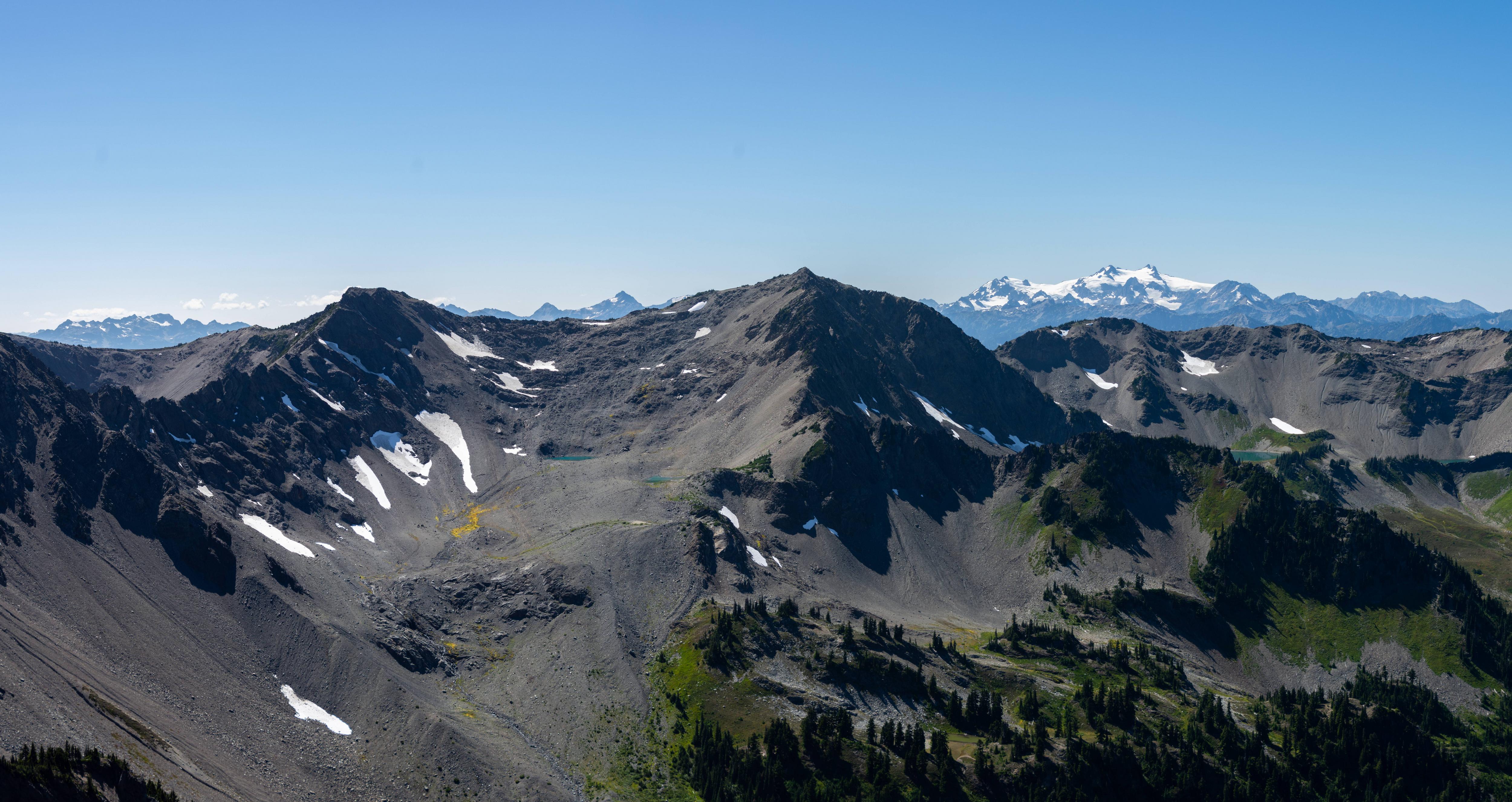
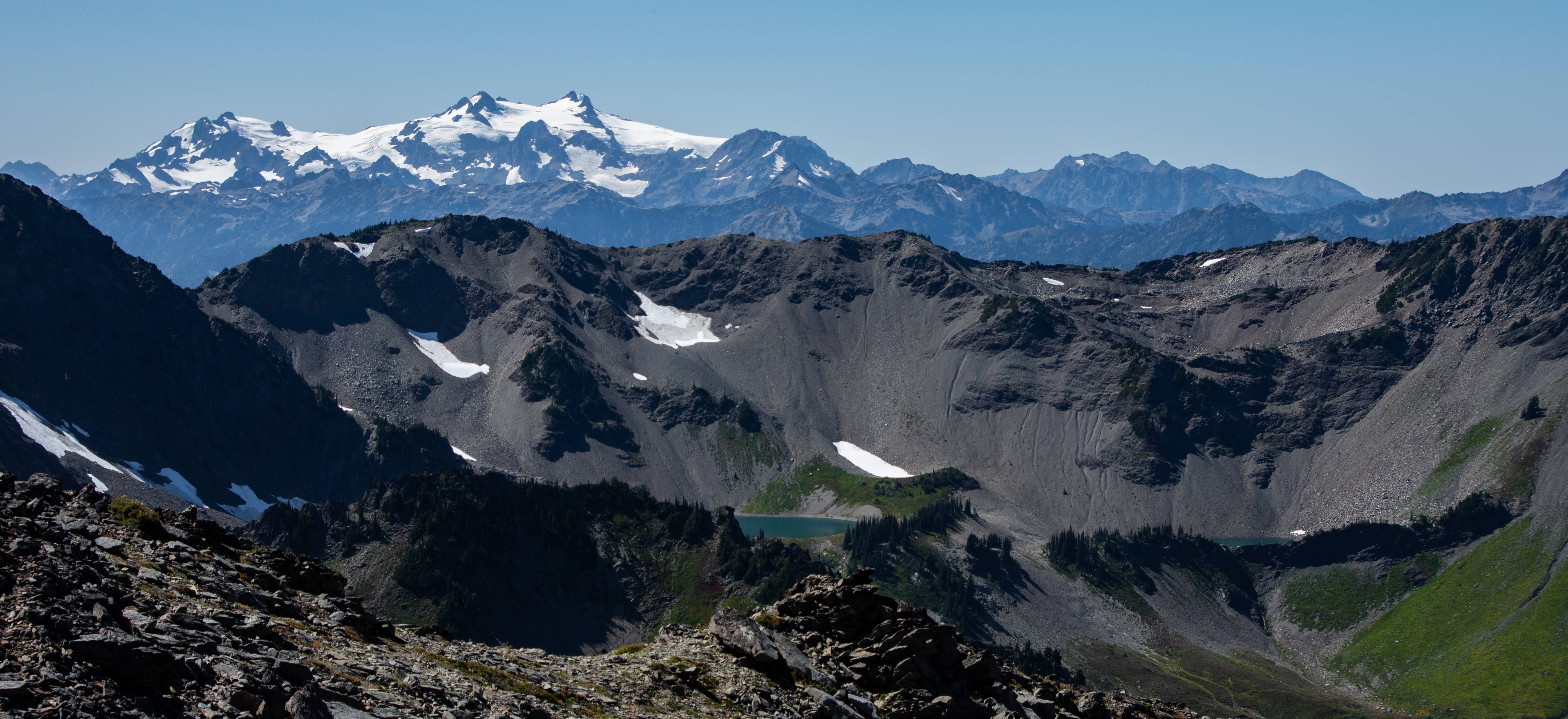
This off trail section had 2 of the best photos of the trip IMO. Mount Anderson above is Olympics mini-version of GNP's triple divide peak. Andersons melt water drains to the Pacific Ocean, Strait of Juan de Fuca and the Hood Canal

Never alone off-trailing
Back on the trail!
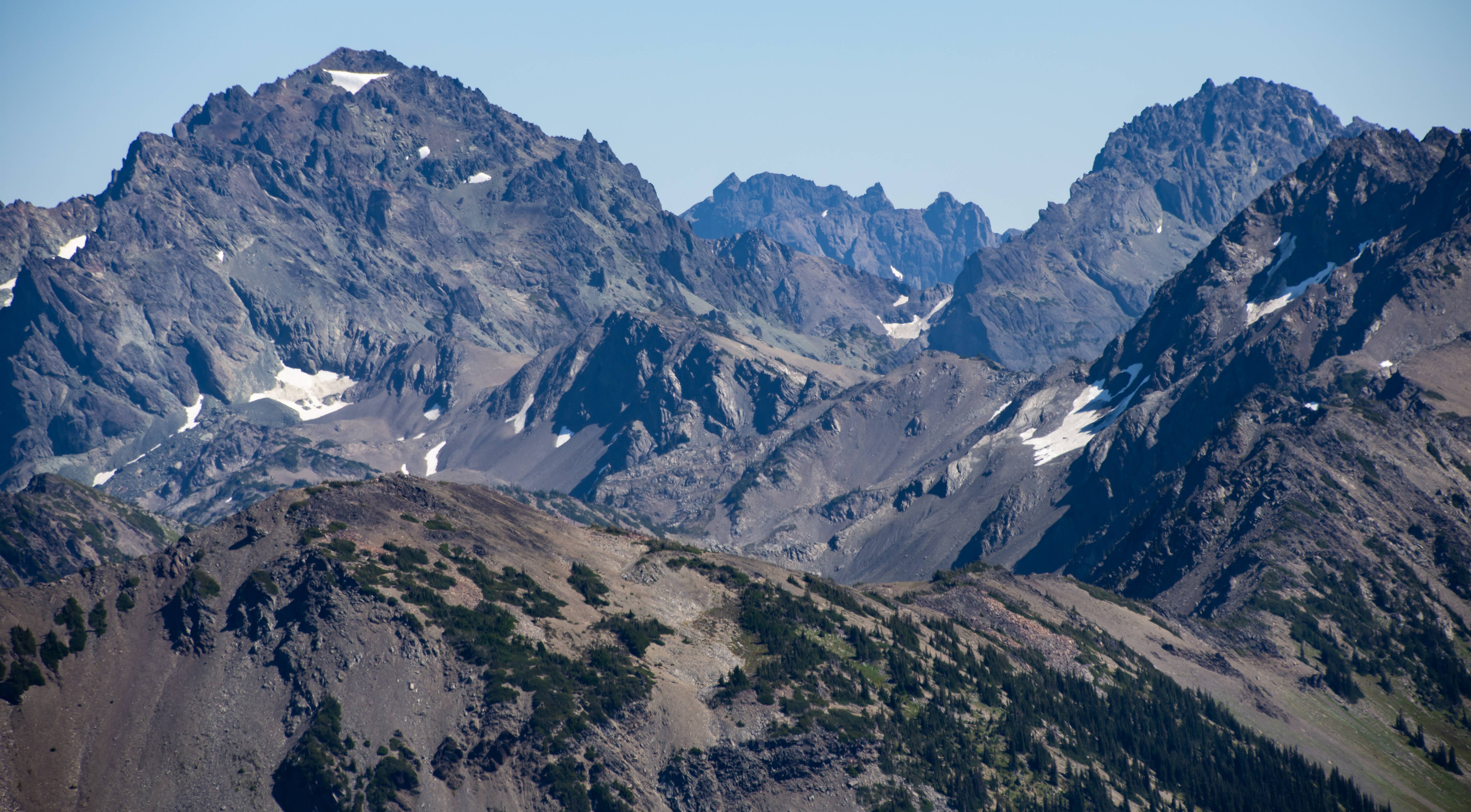
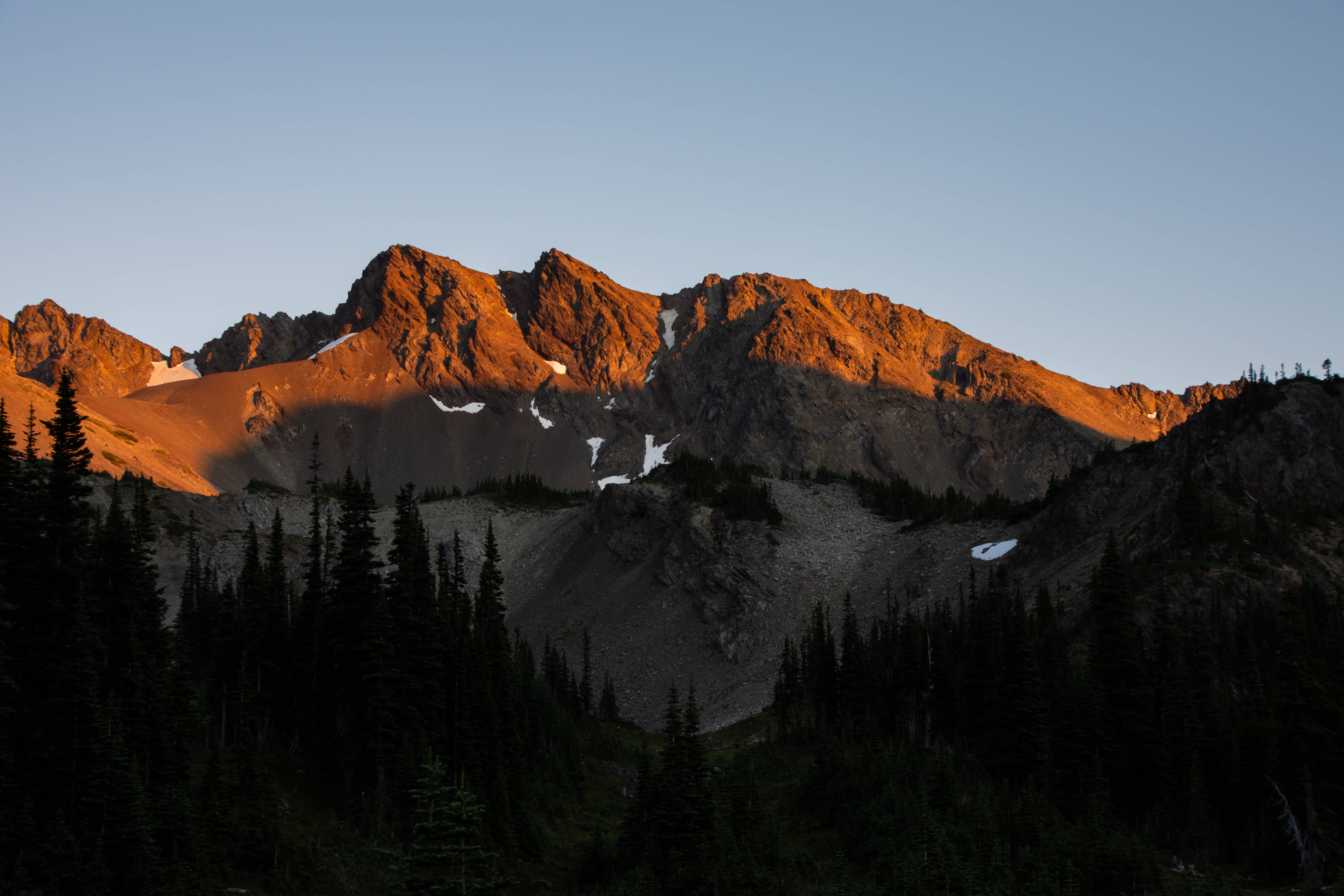
Mt. Deception and Mystery. Mystery is probably now one of my favorite looking mountains in the Olympics.
We began our slog up Gray Wolf Pass in the midday heat. Once at Gray wolf pass we branched off trail toward Cedar Lake.
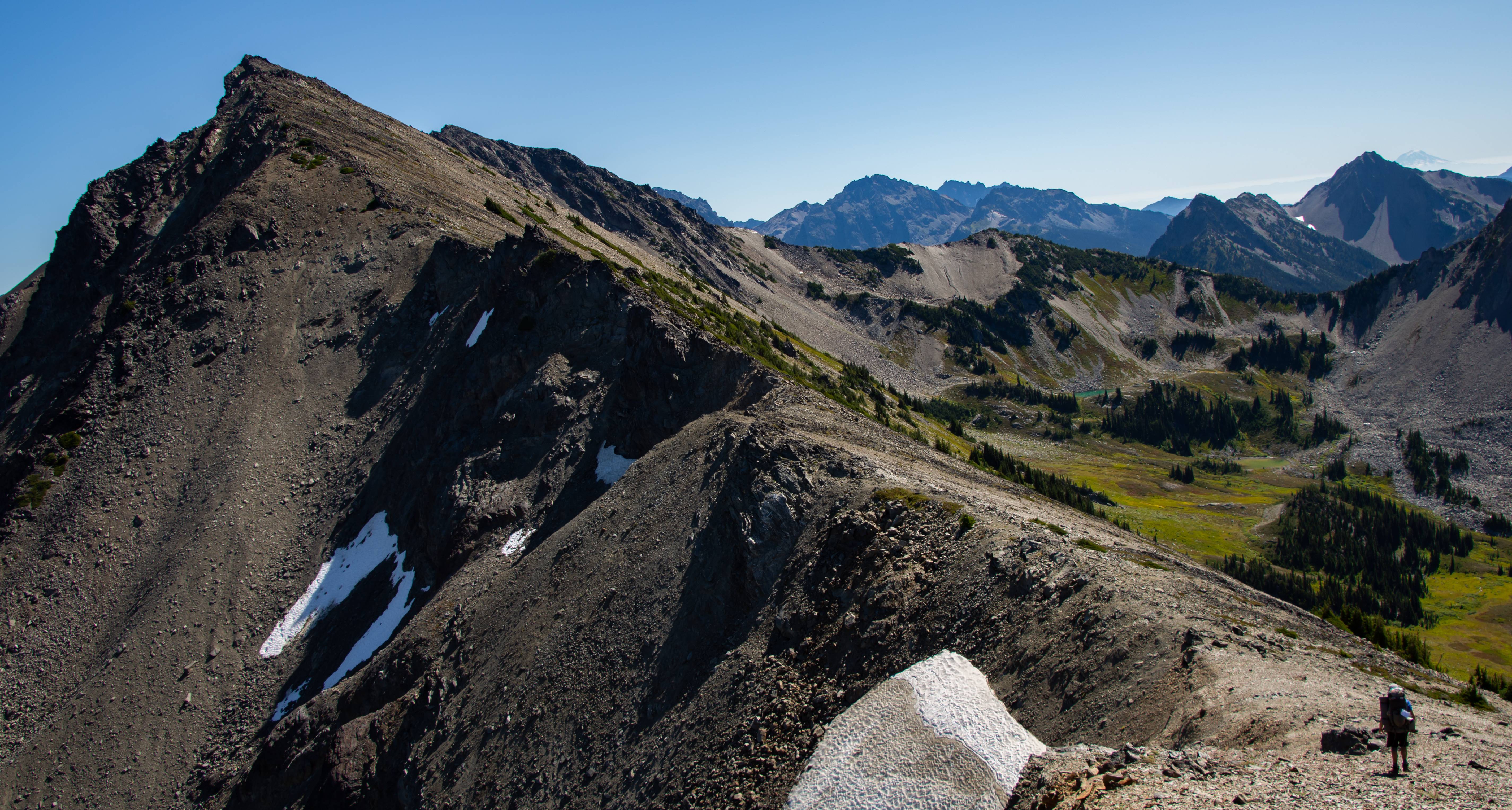
Side hilling with the view of the Needles. We came from the low bowl center pic.
Racing daylight. Off trail travel in the morning was slow going.
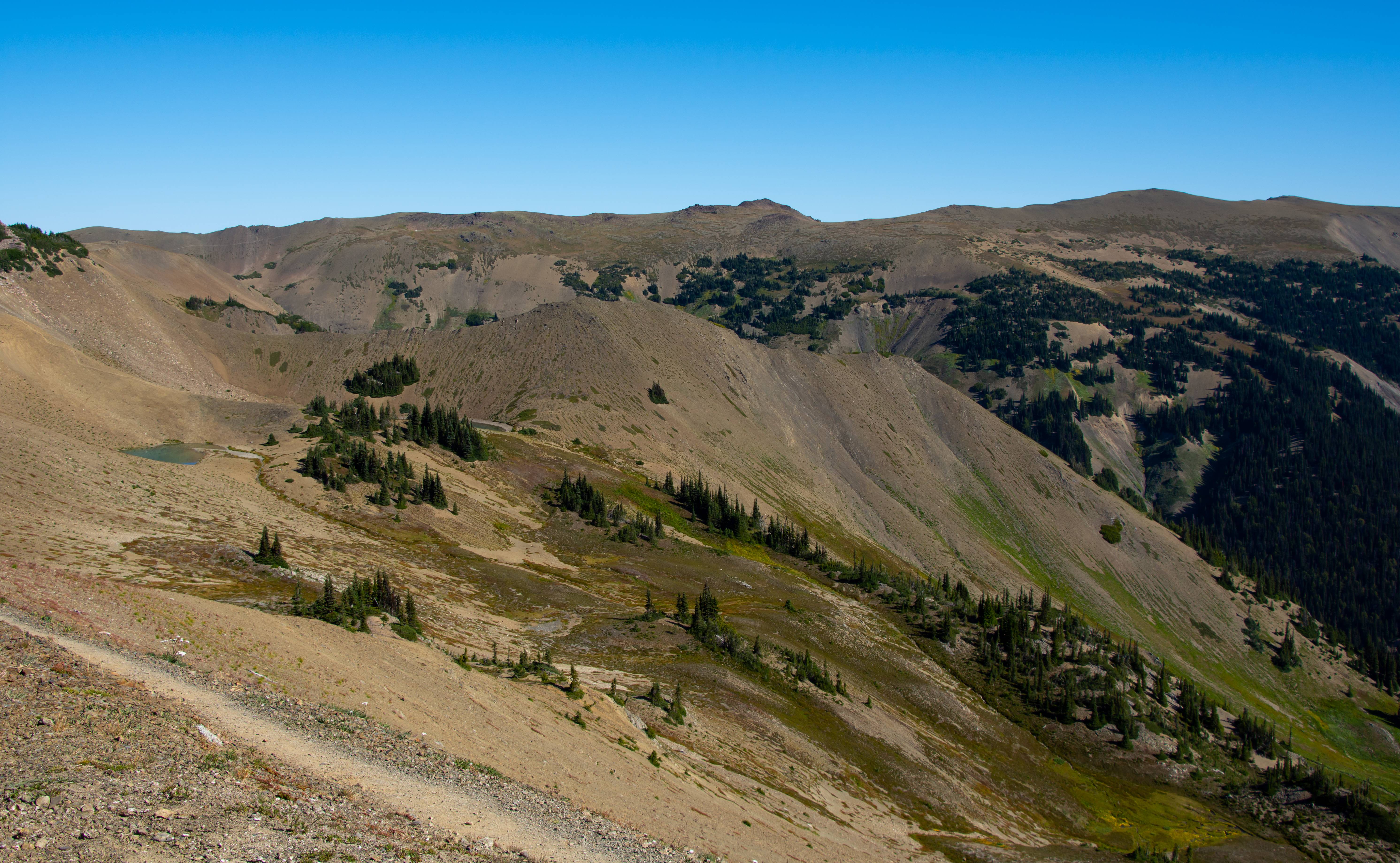
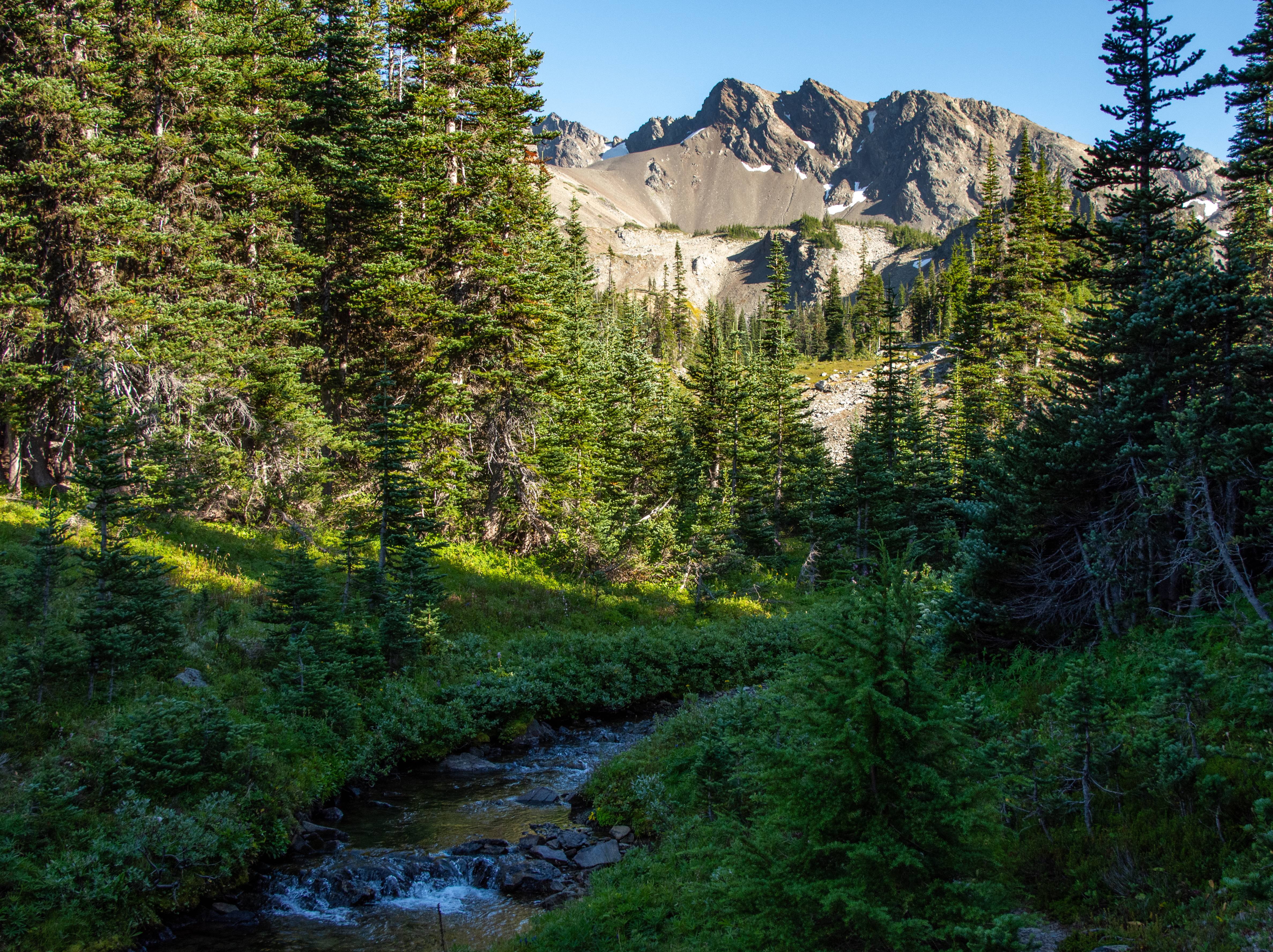
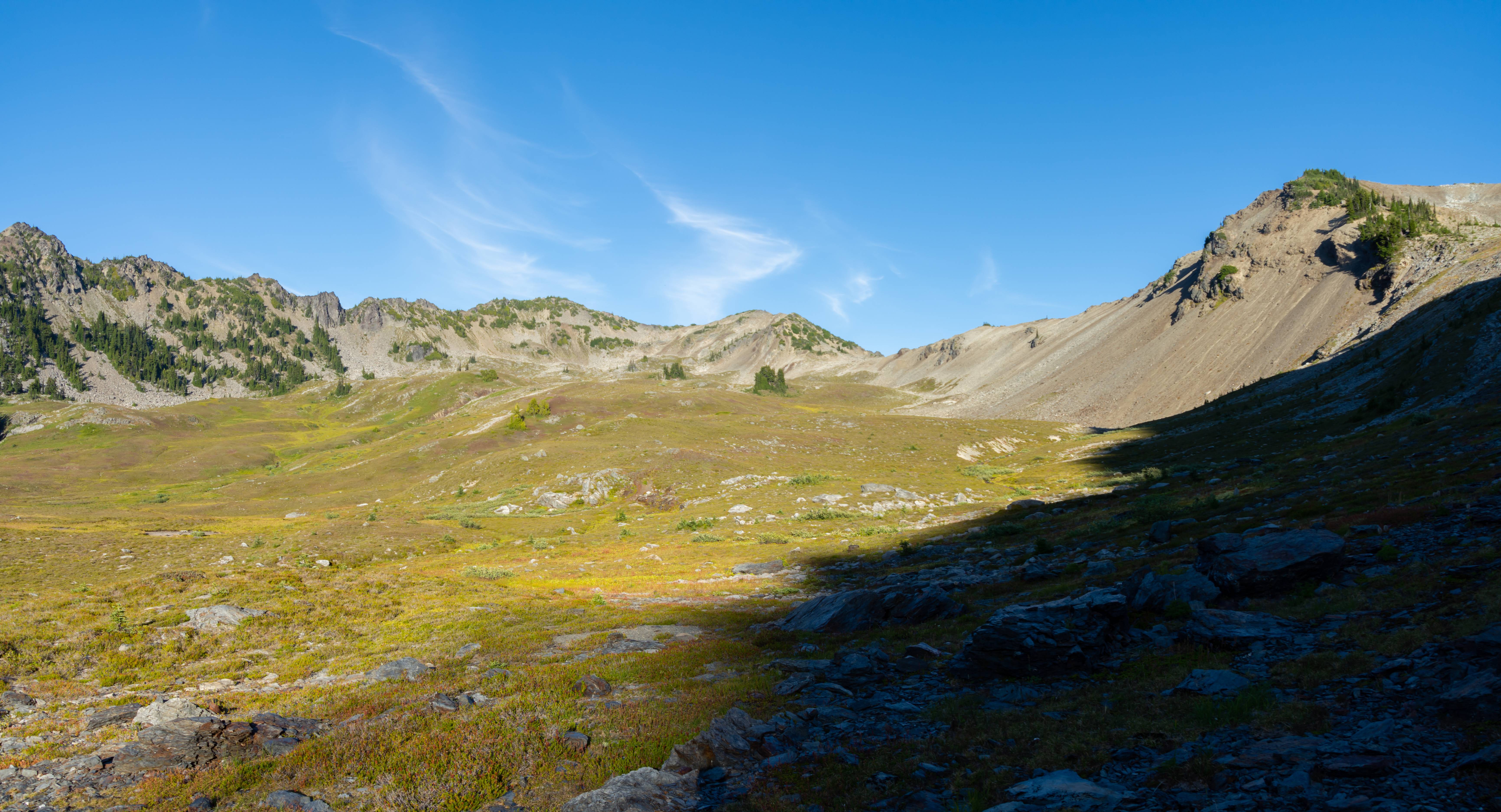
Beautiful basin.
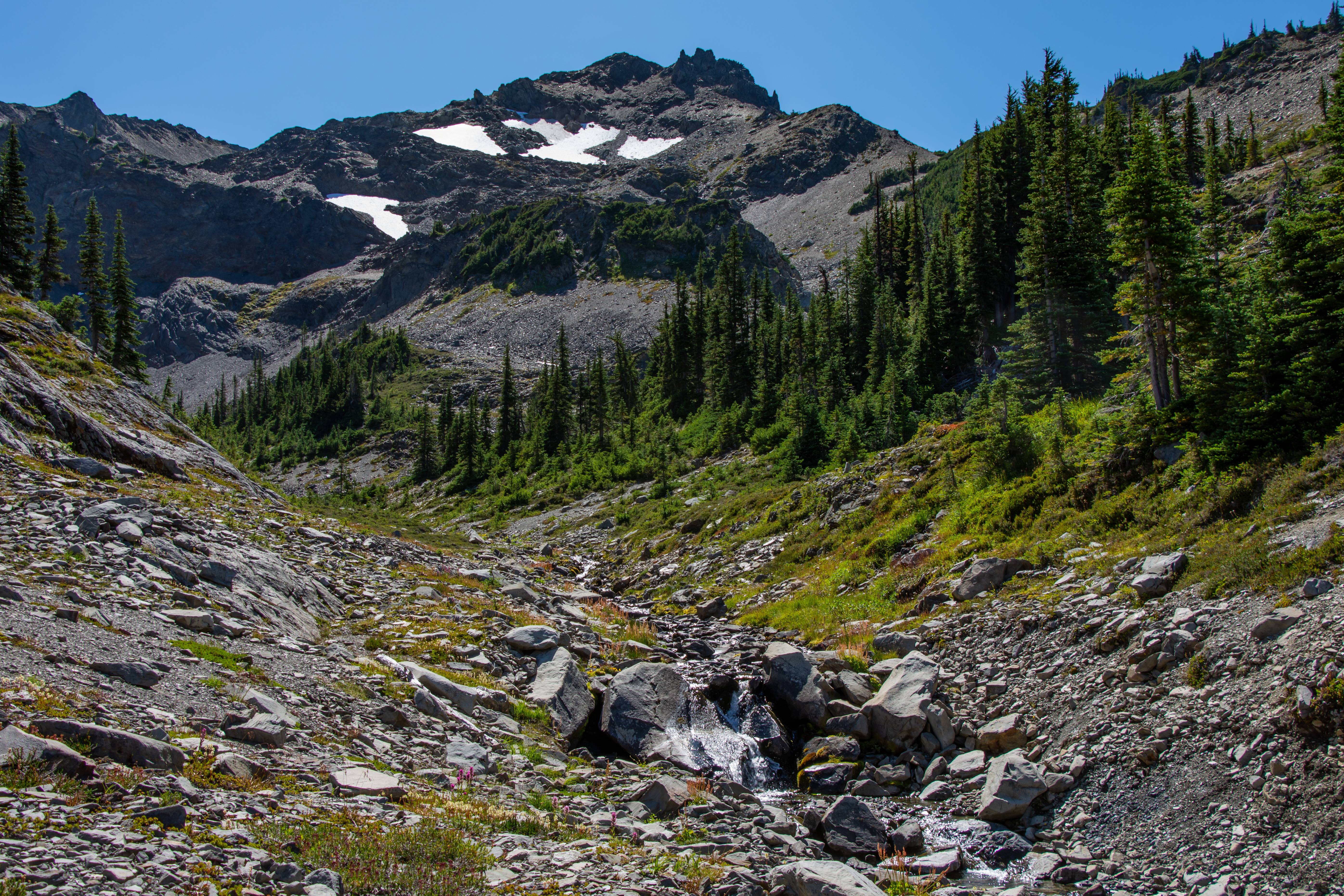
Awesome creek which led to a 200 foot sheer drop.
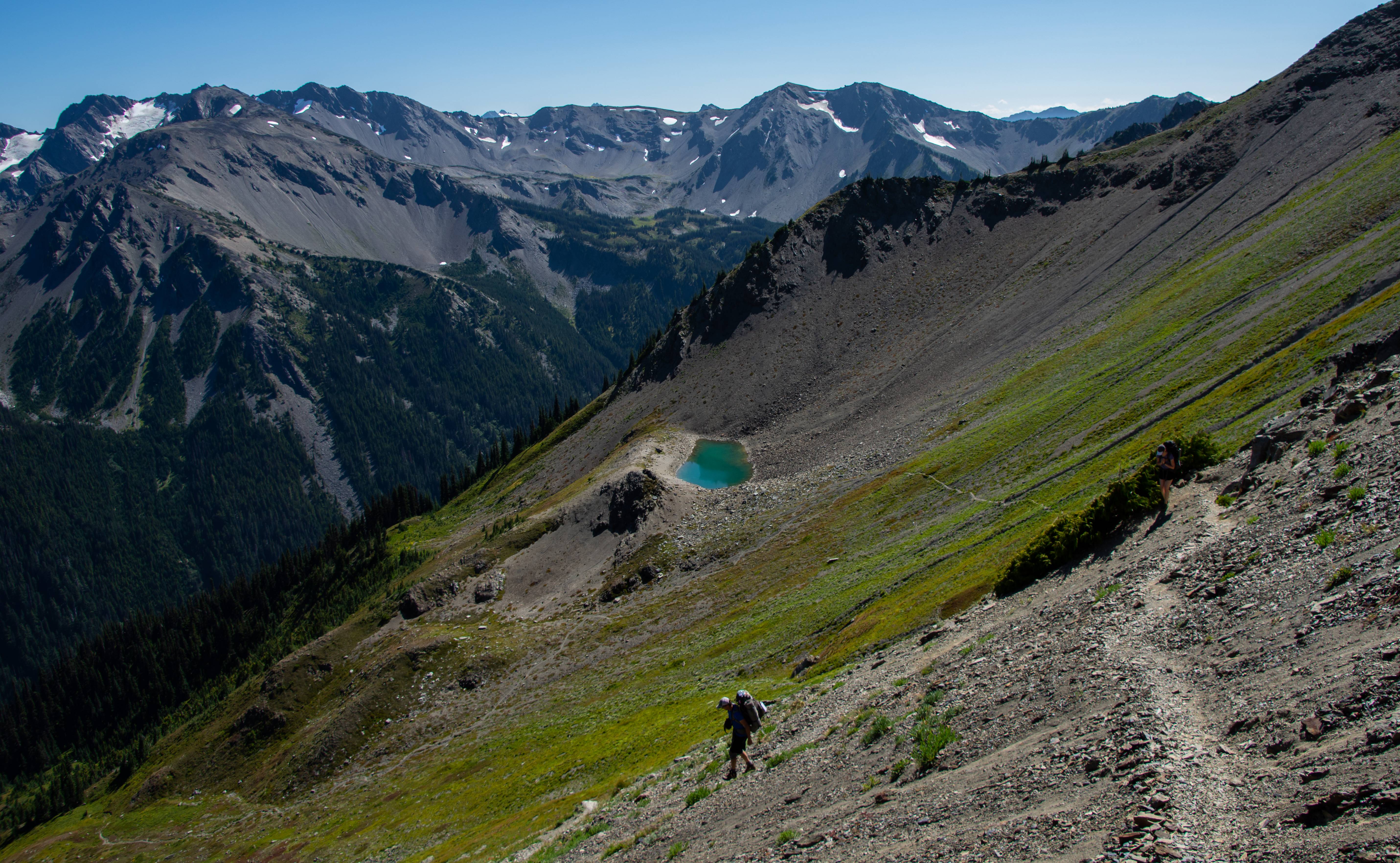
Pano of an unnamed lake on our way to Cedar Lake. Here we picked up an old goat trail which we then lost near the next saddle toward Cedar.
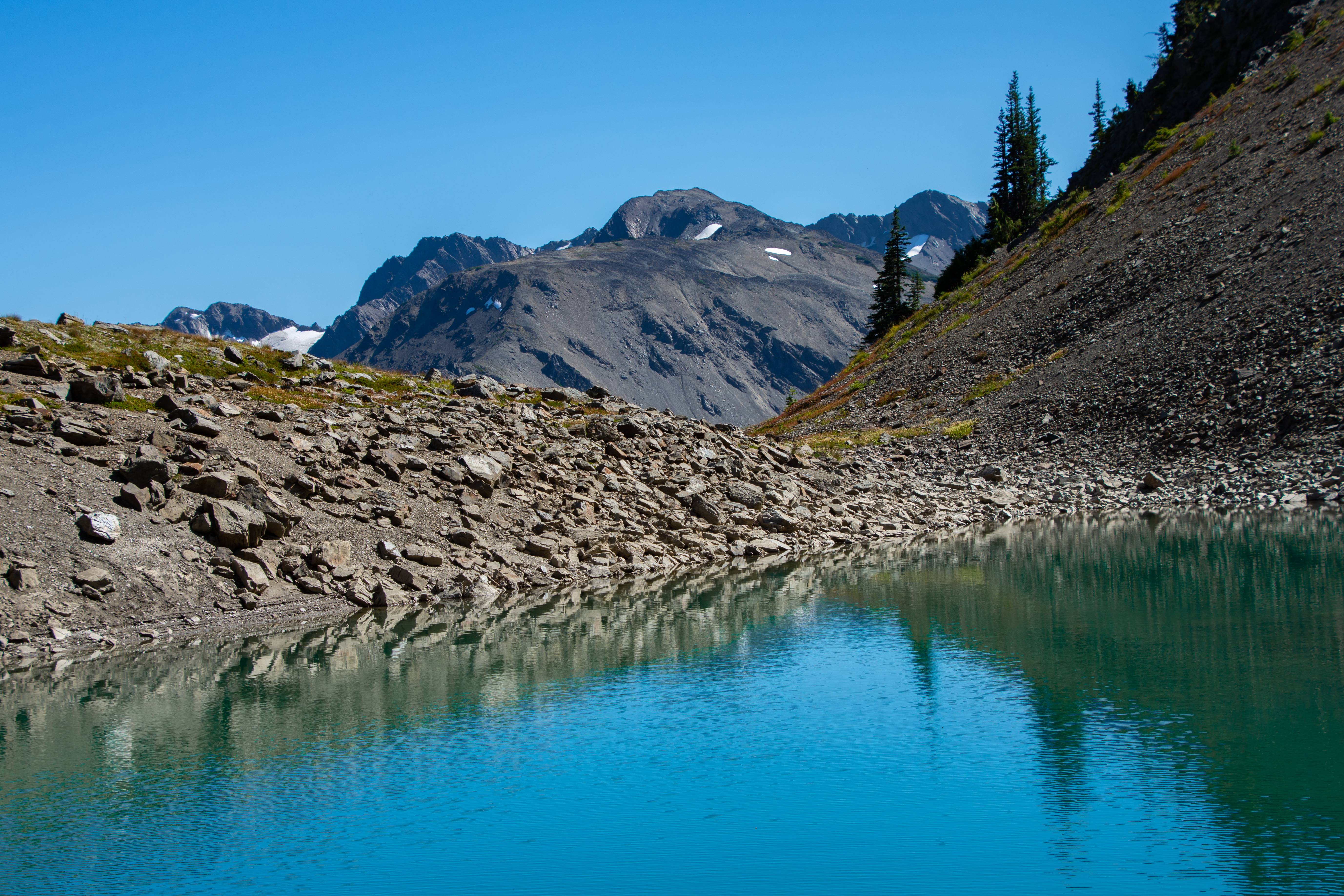
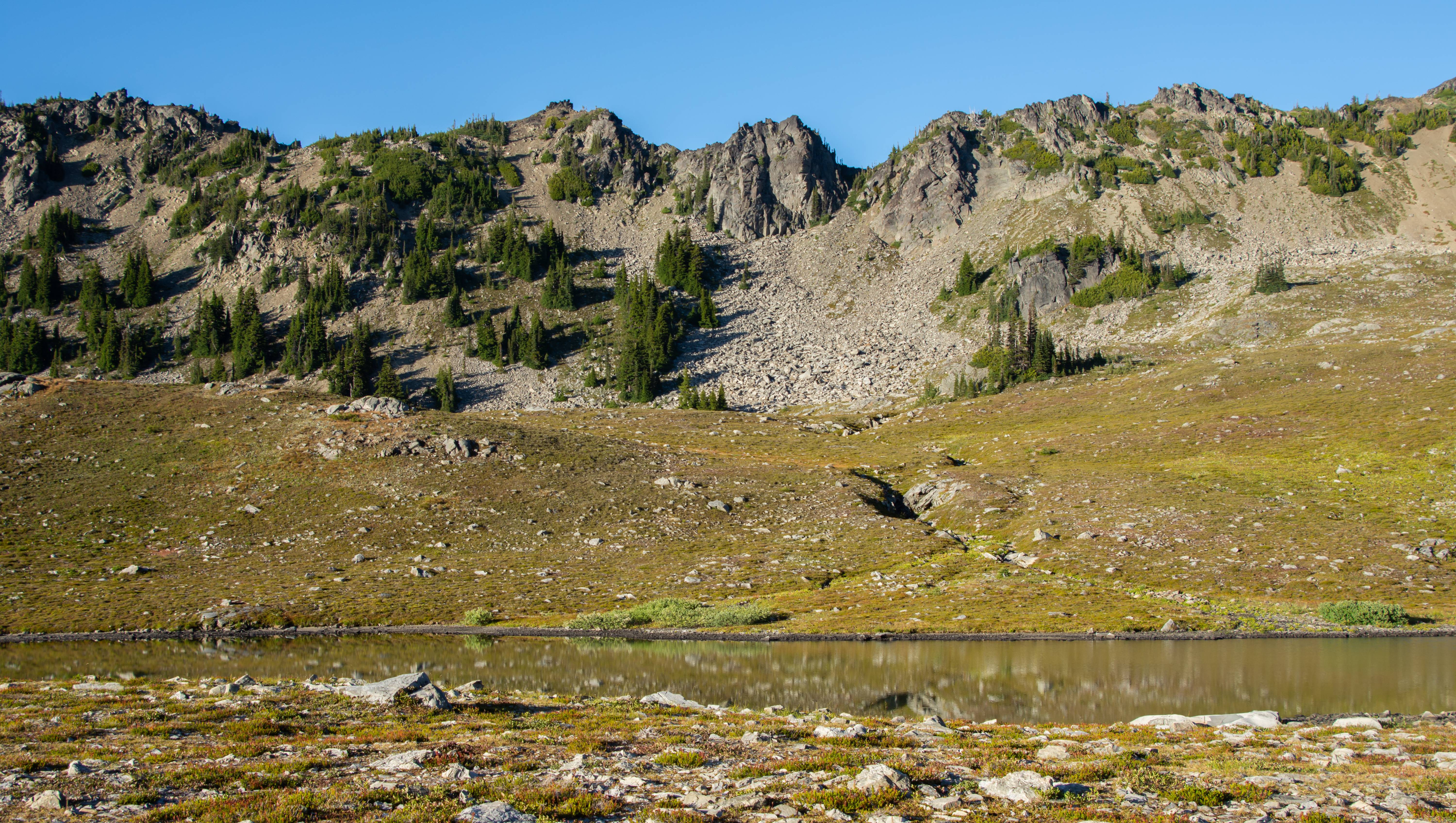
Cedar Lake!
This section really reminded me of the Upper Lyman/Lower Lyman transition in the GPW
Boots cant take much more side-hilling.
Cedar Lake 2.0 near camp. We came down from low point on picture left.
Day 4 : Cedar Lake to Deer Park (100% trail) 10 Miles @ 3900ft of Elev. Gain
A trail starts up near the drainage exit of Cedar Lake which we used to connect up with the Gray Wolf drainage.
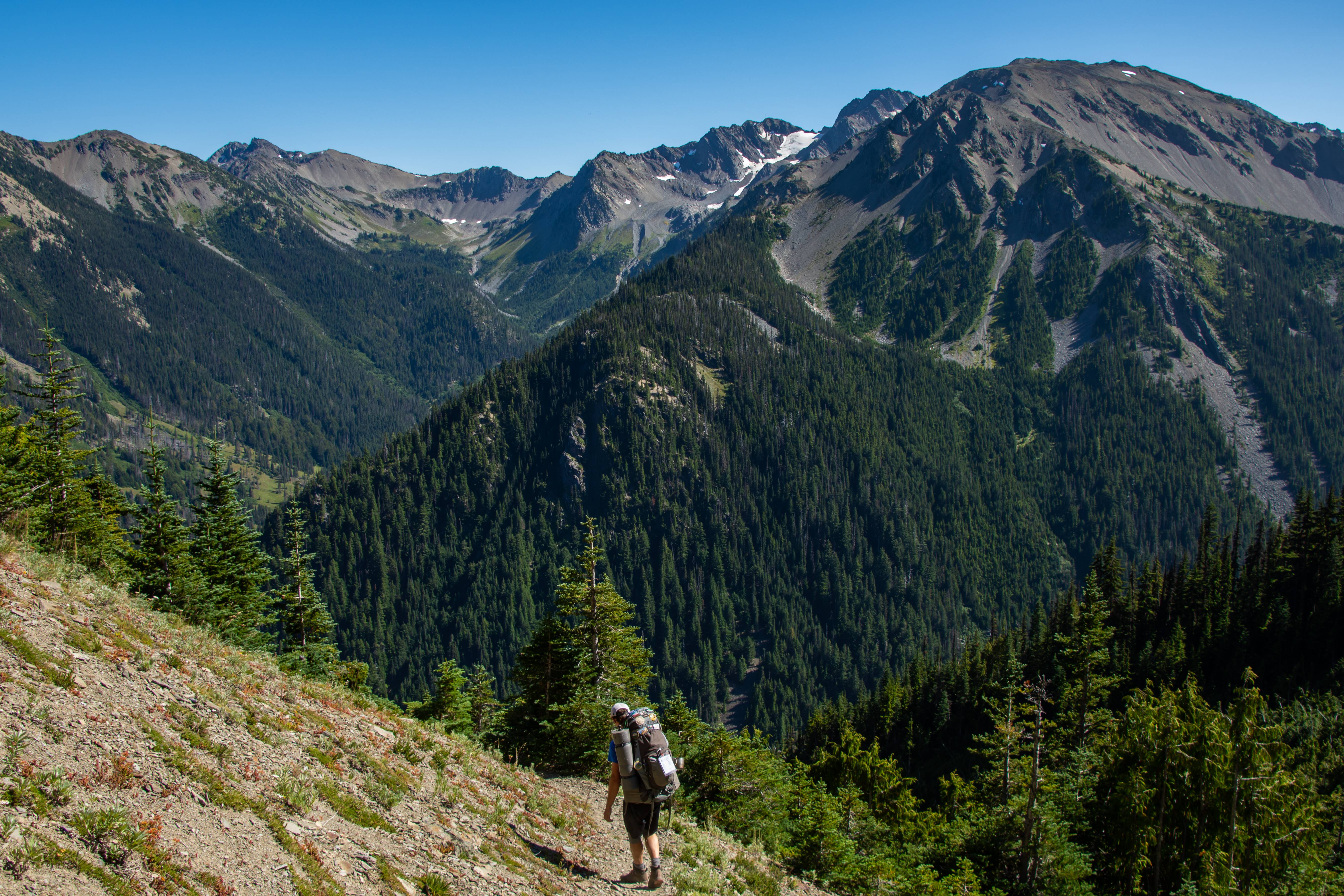
A lot of this was valley walking. It was a typical beautiful Olympic forest but I didn't take many photos as it had brushy sections and I lost my lense cap near Gray Wolf Pass and didn't want to scratch it. I got some good video of it but the photos I snapped after the video shots didn't turn out too good. The 4 mile 3600 ft of elevation gain up to Deer Park from Three Forks wasn't too bad. I thought the 3 mile 2600ft of gain from Gray Wolf was actually worse due to the sun and heat. We had clouds come in and it was a cooler day. Then it rained on us @ deer park.
Storms
Day 5: Deer Park to Obstruction Point (END) (100% trail) 7.2 Miles @ 1500ft of Elev. Gain
The rain kept up through the night and most of the views on the open ridge walk were socked in. Until the very end and last mile stretch!
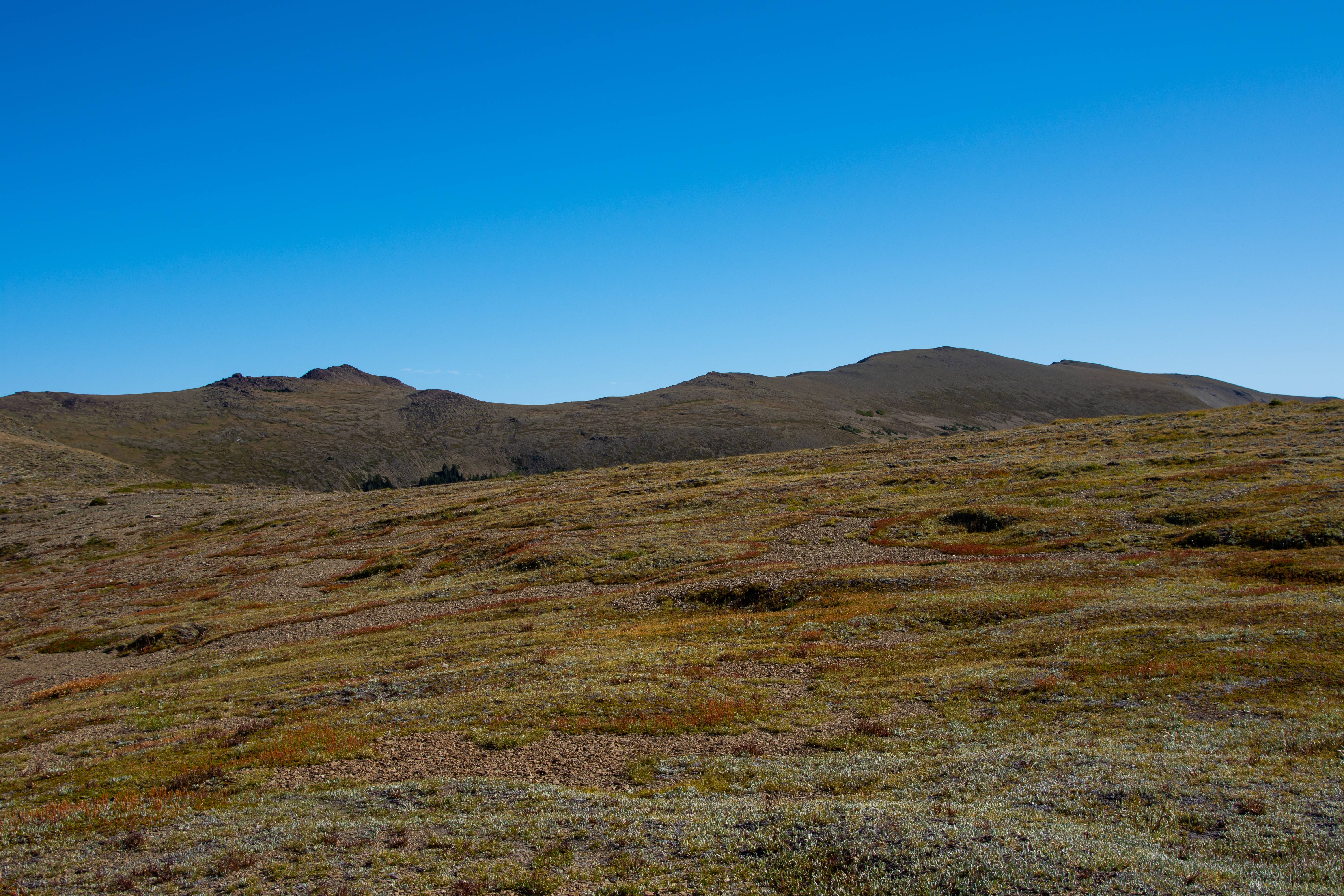
The views most of the walk.
Parking lot can be seen near the trees of the center peak (left).
Amazing open landscape.
Very smoky mountain esque shot
Overall it was an amazing trip. A lot more lax than the GPW trek which made it all the better. Loved every bit of this corner of the Olympic mountains and hope to get back there again. Especially the Royal Basin area Aaron talked up. Now Lacey and I are off to the Chelan-Sawtooth range!
Things to know about the Olympic Mountains that I didn't know
- Barely any flat, you're either losing elevation or gaining it.
- Surprisingly lots of elevation gain & loss
- Tons of wildlife
- The corner of the park we did has a "Rain shadow" effect so it's very dry.
- Despite being lower elevation, the local relief will make 6000ft peaks look like 8000 footers.
- The trees are HUGE and TALL. Even the normal alpine trees are 10-20ft taller than normal
DAY 1 : Obstruction Point to Upper Cameron Basin (Trail) 13 Miles - 3500ft Elev. Gain (100% trail)
We started out at the end of Obstruction Point road which branches off from the crowded hurricane ridge visitor center. Great start. Already in the alpine!
Mount Olympus in the distance
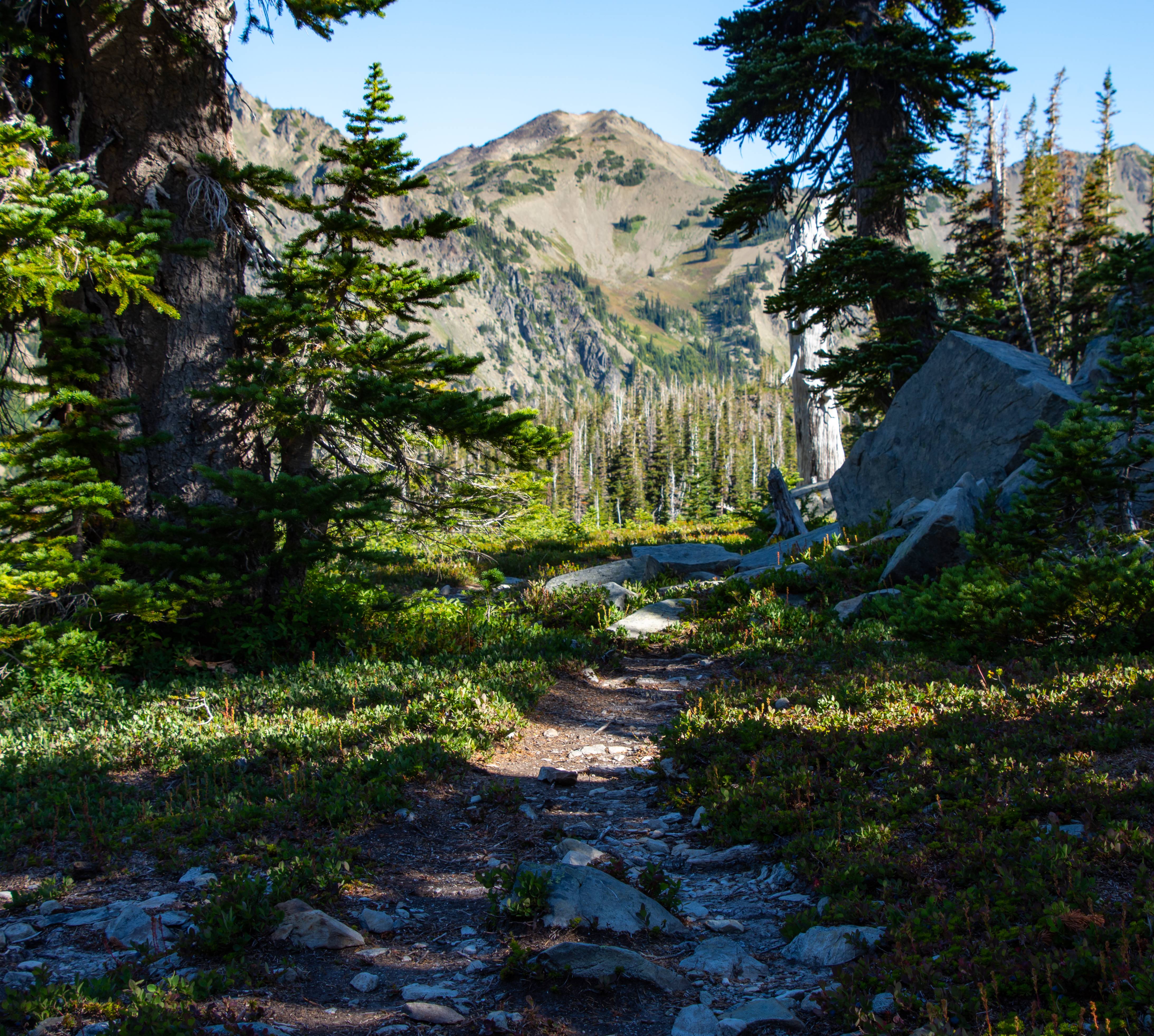
Beautiful trail (our trail veered left of here off camera toward 'GRAND VALLEY')
Are we still in the rainy olympics?
Our loop on Day 5 ends with walking the ridge off in the distance. You can see a part of the trail on camera left.
Flowers trying to hang on in Grand Valley
Lunch time @ Moose Lake.
Our next stop. Grand Pass. Center pic.
Making our way to Grand Pass
Looking back down into Grand Valley.
Cool tarn & Grand Valley
Great views from Grand Pass
Our destination. Center pic. Cameron Basin. We will lose about 1600ft of elevation in 1 mile then regain 1000ft of it immediately after.
Dropping down with Aaron. Cameron basin in the distance.
Getting water at the tarn from the previous pic.
Olympics and knee joints have a great relationship with each other.
Sun hitting the needles of trees all trippy like.
Cameron Basin!
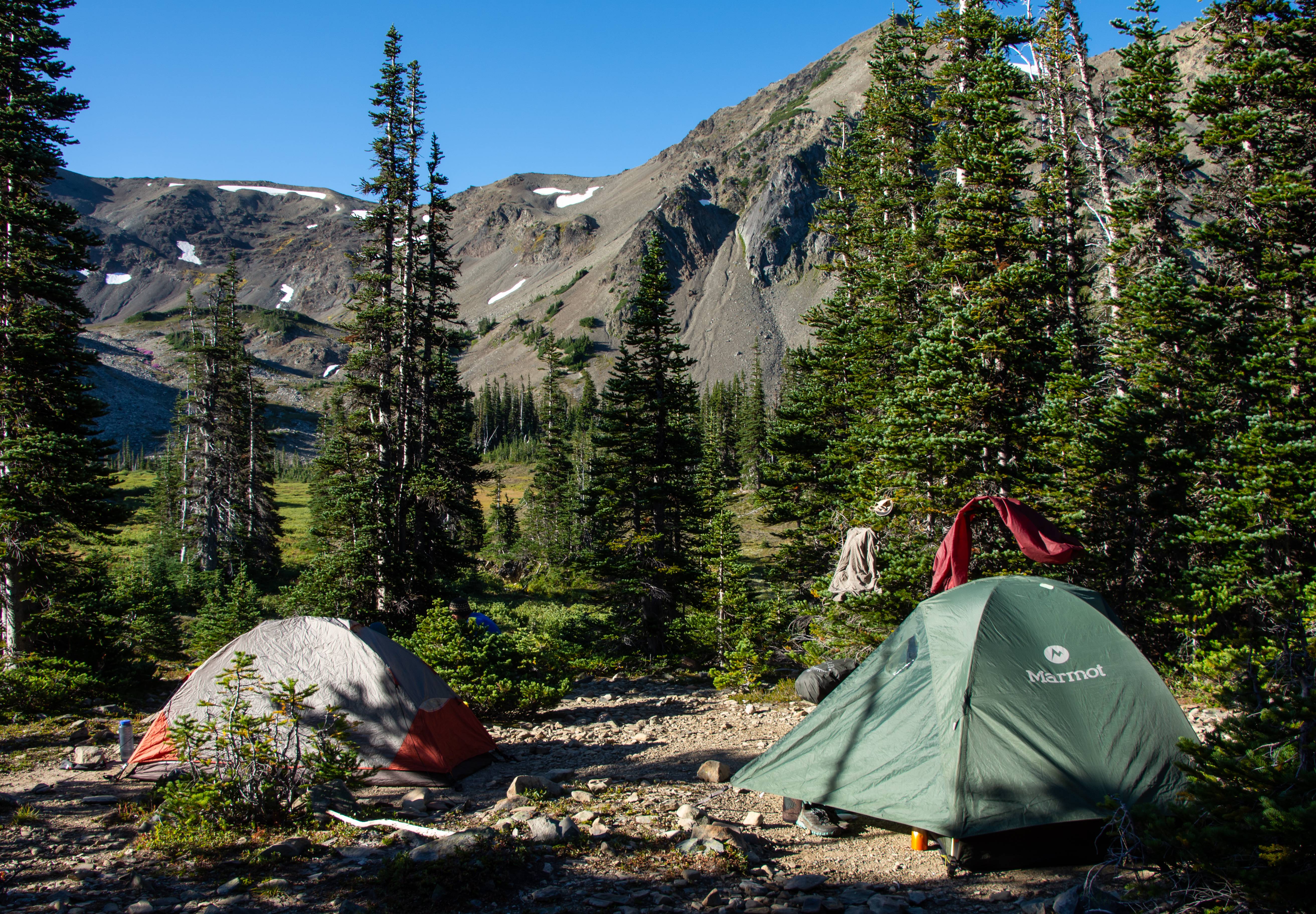
About 100ft from our camp.
Our view from camp.
Day 2 : Cameron Basin > Mt. Cameron > 1000 Acre Meadow (On & off trail)
14.35 Miles @ 3800ft of Elev. Gain (70% trail - 30% off trail)
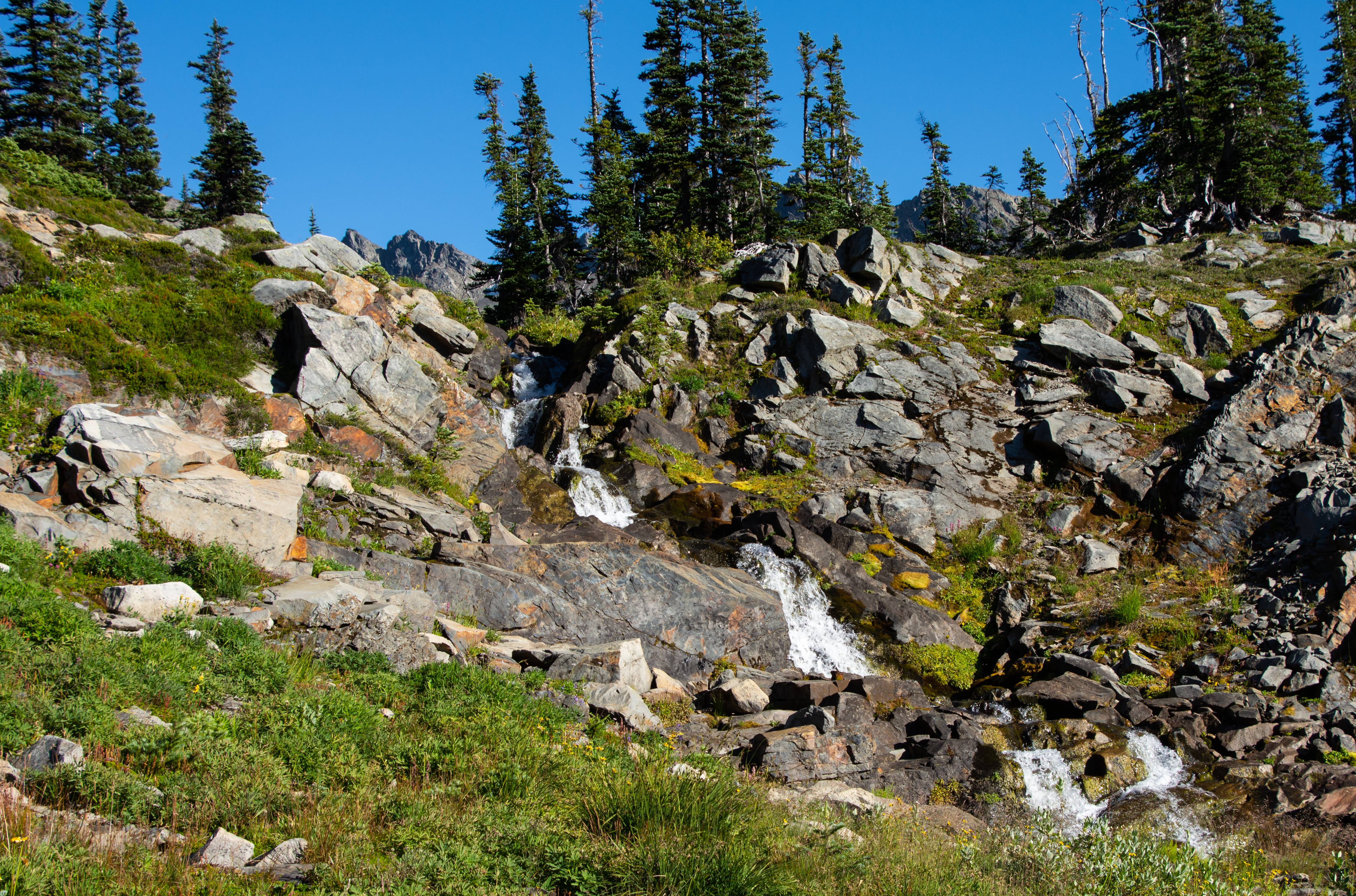
Slept like a rock listening to that waterfall all night.
Headed up to Cameron Pass. The highest trailed pass in the Olympics.
Monkey flower.
Aaron and his GF sarah and I @ the top of Cameron Pass
Off trail to Mt. Cameron. About 1/2 way we drop our packs for a quicker advance to Cameron.
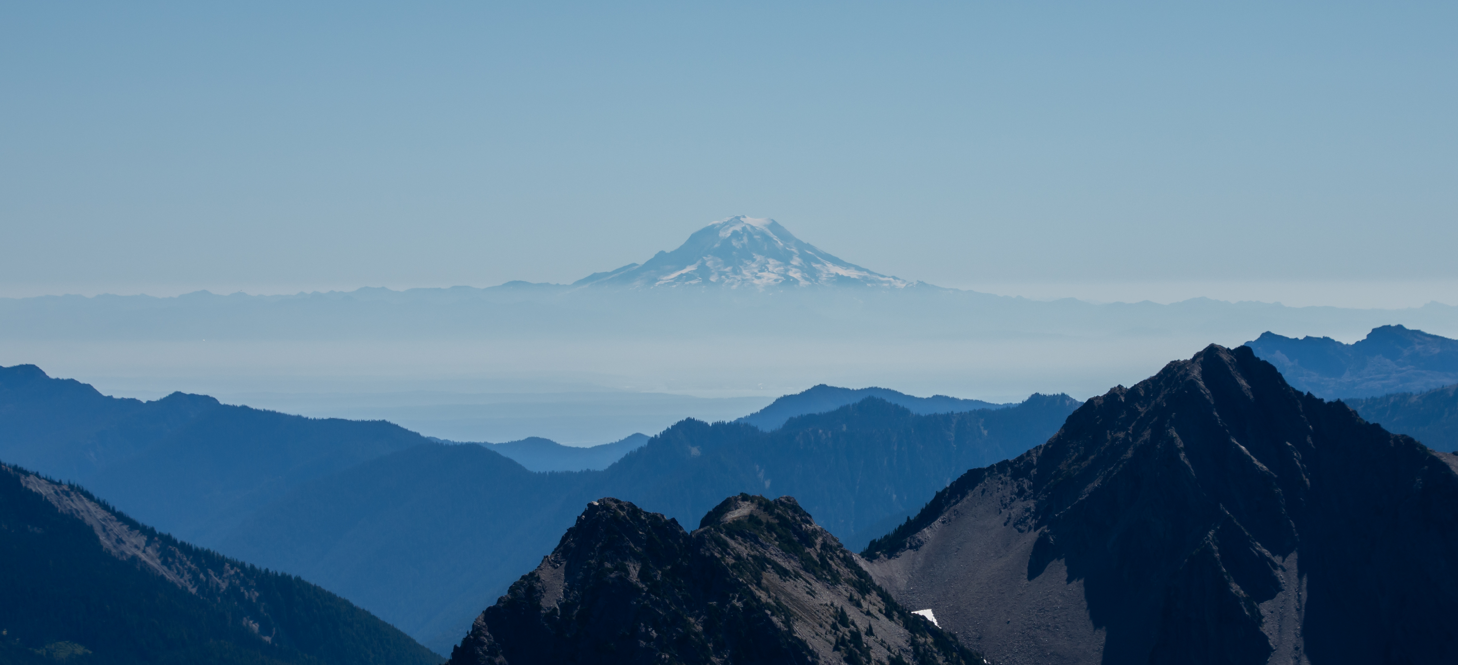
Mt. Rainier about 110 miles away.
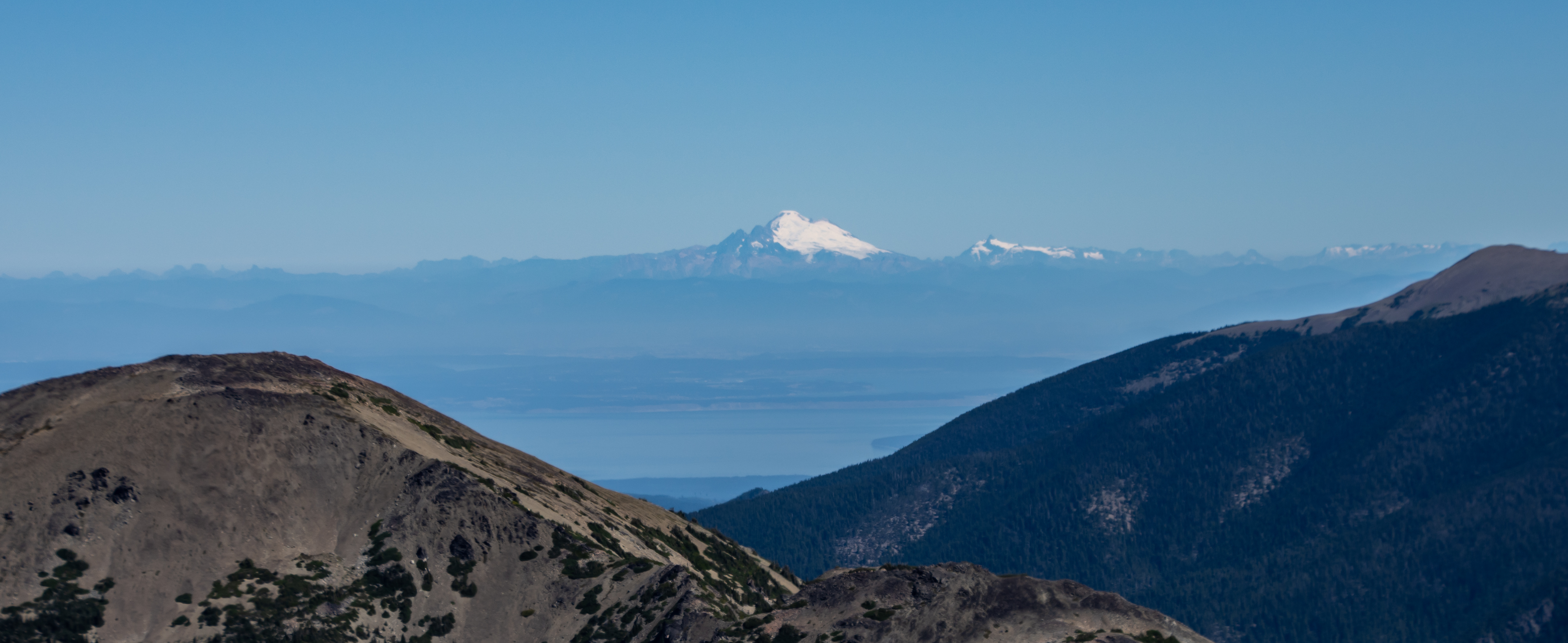
Baker and Mt. Shuksan about 100 miles away. Puget Sound in view.
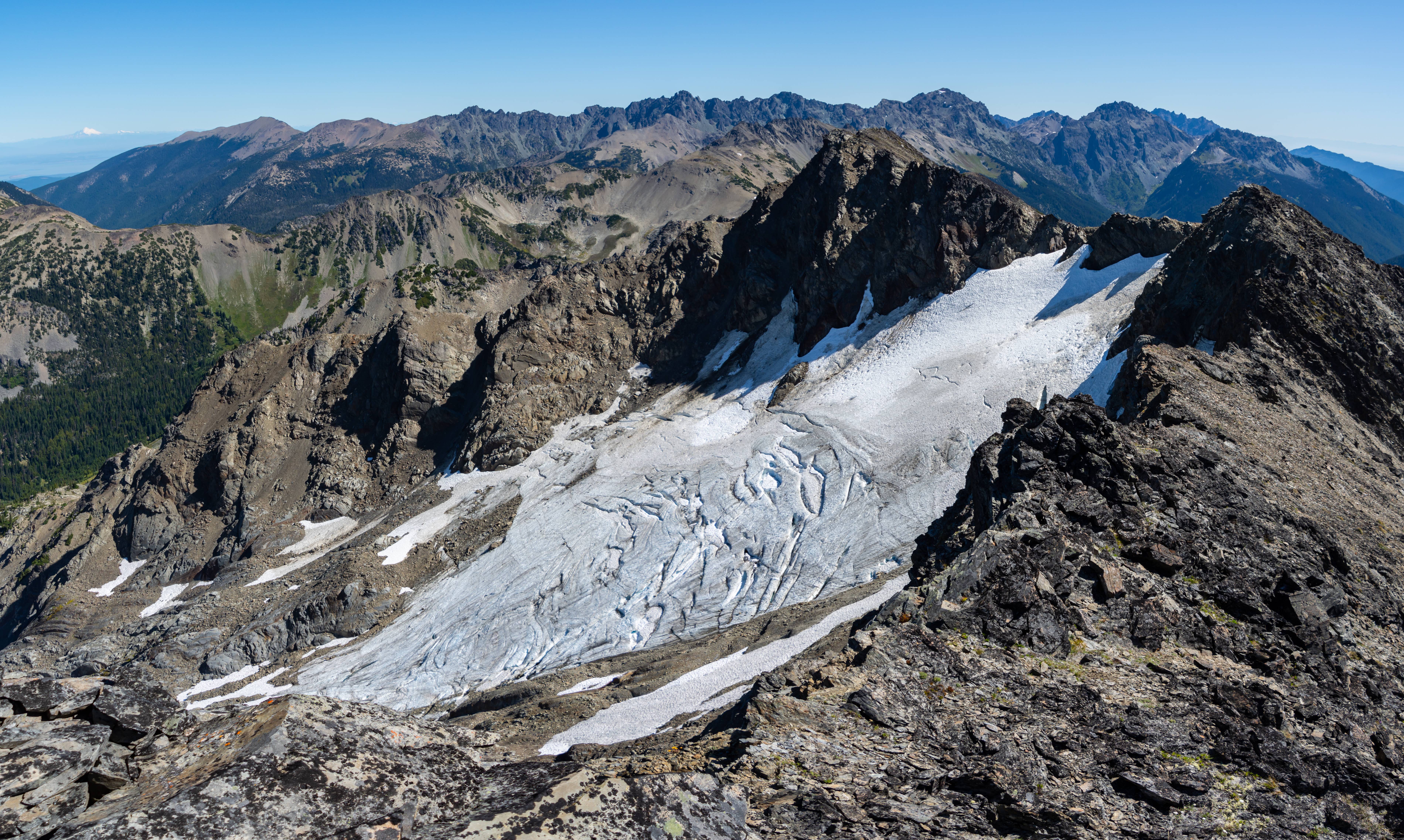
Whats left of the Cameron Glacier
Great views and a photo bomb from Baker.
We got back to our packs and started steeply side-hilling to intersect with the trail which headed for Lost Pass. We ran into what Aaron described a "Classic Olympic scene" a Steep grass slope with Olympus in view. We got buzzed by a Coast Guard / NPS helicopter. We assumed they were still on patrol to catch the remaining convict mountain goats they are rounding up and releasing into the North Cascades. (Mountain goats aren't native to the Olympics)
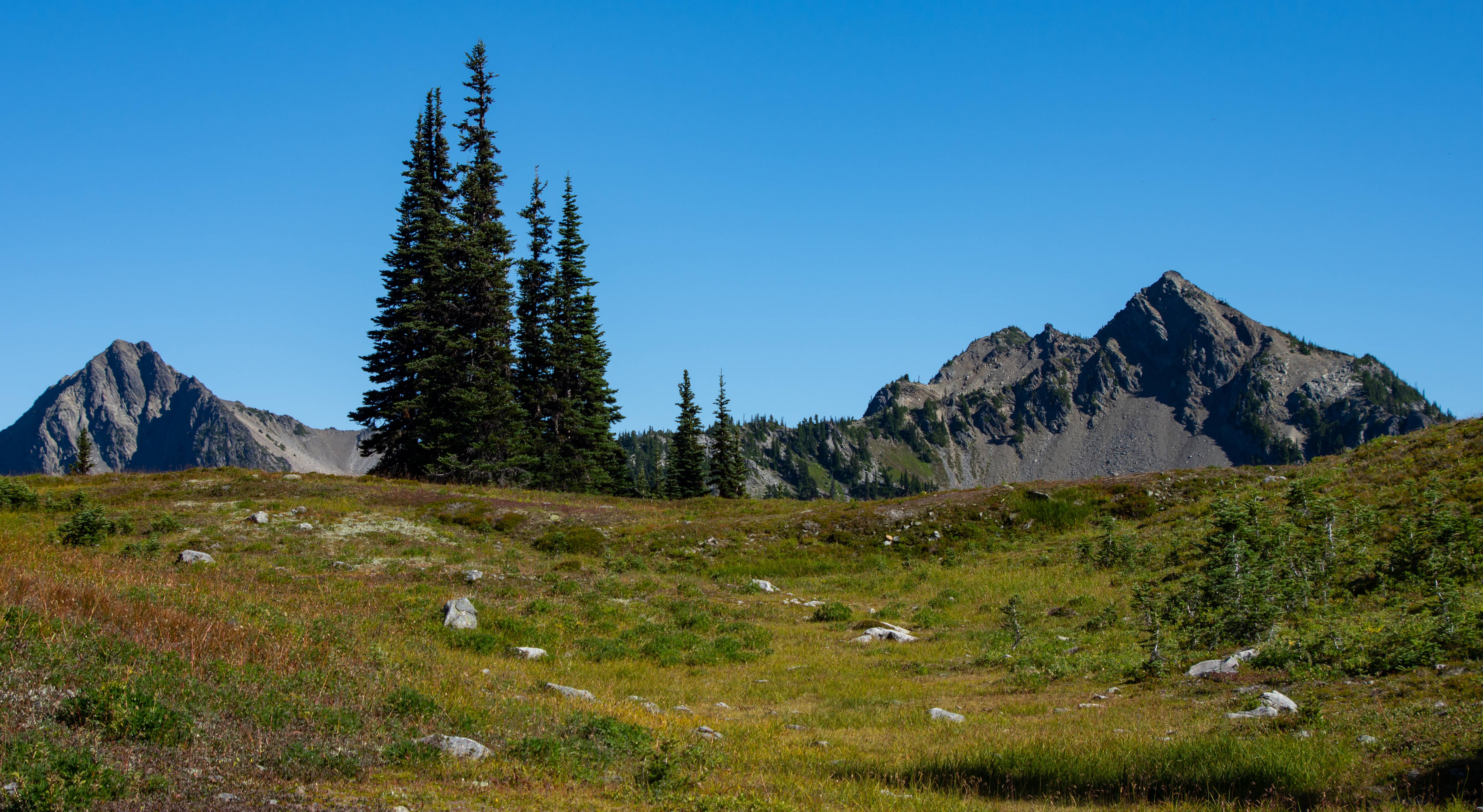
Lost Basin & back on trail lol
Loved this basin
Looking back up where we came from. We were on that highpoint center pic.
Lost Pass.
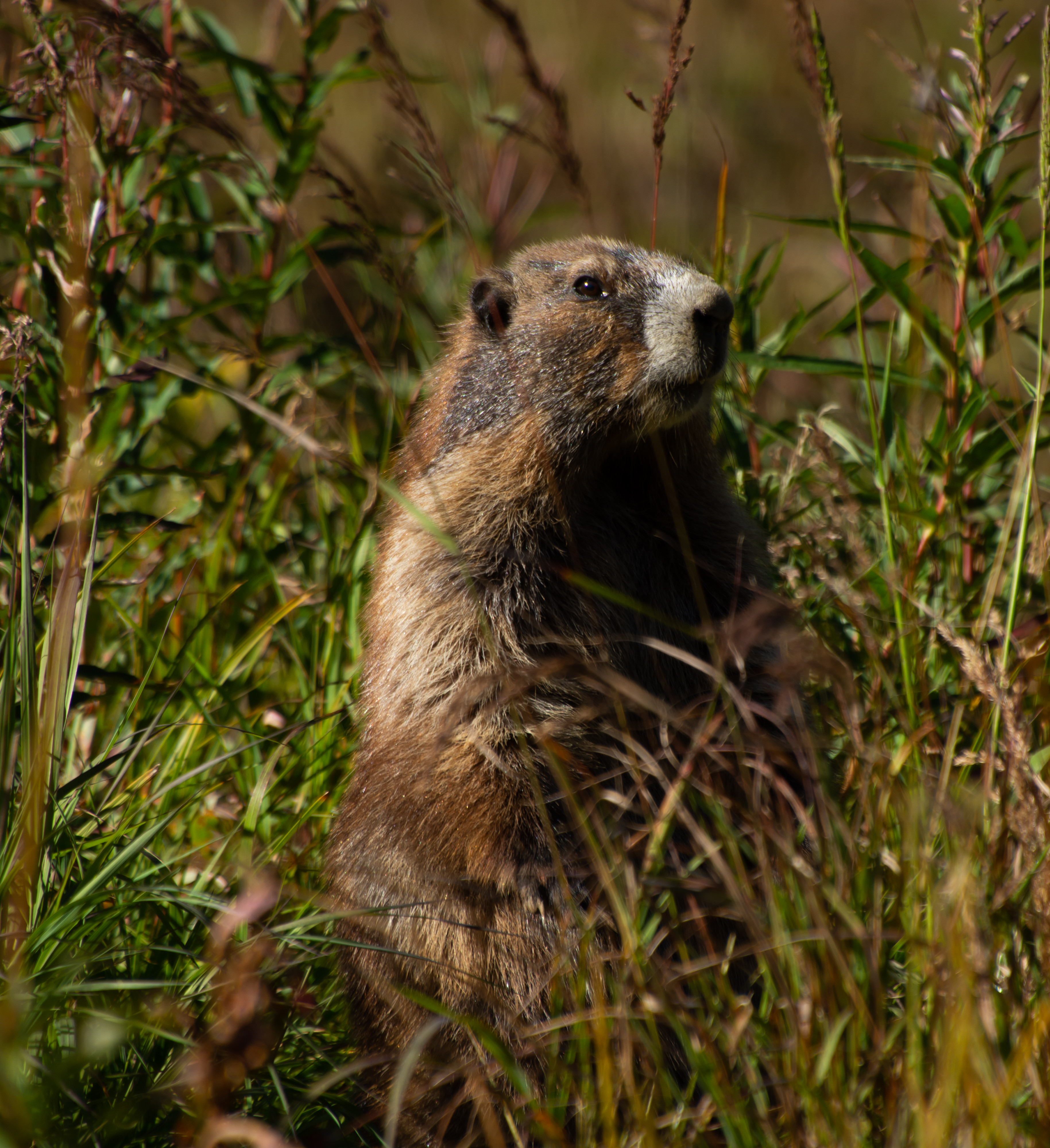
Olympic Marmot ready to fight
We started our first extended off trail venture toward the unknown 1000 acre meadow. There was less online about this place than Bannock Lakes surprisingly. We shwacked 750ft of gain uphill a much more mellow experience than the 2600ft of gain up Character Ridge to bannock lakes. There were signs of marmot and bear EVERYWHERE.
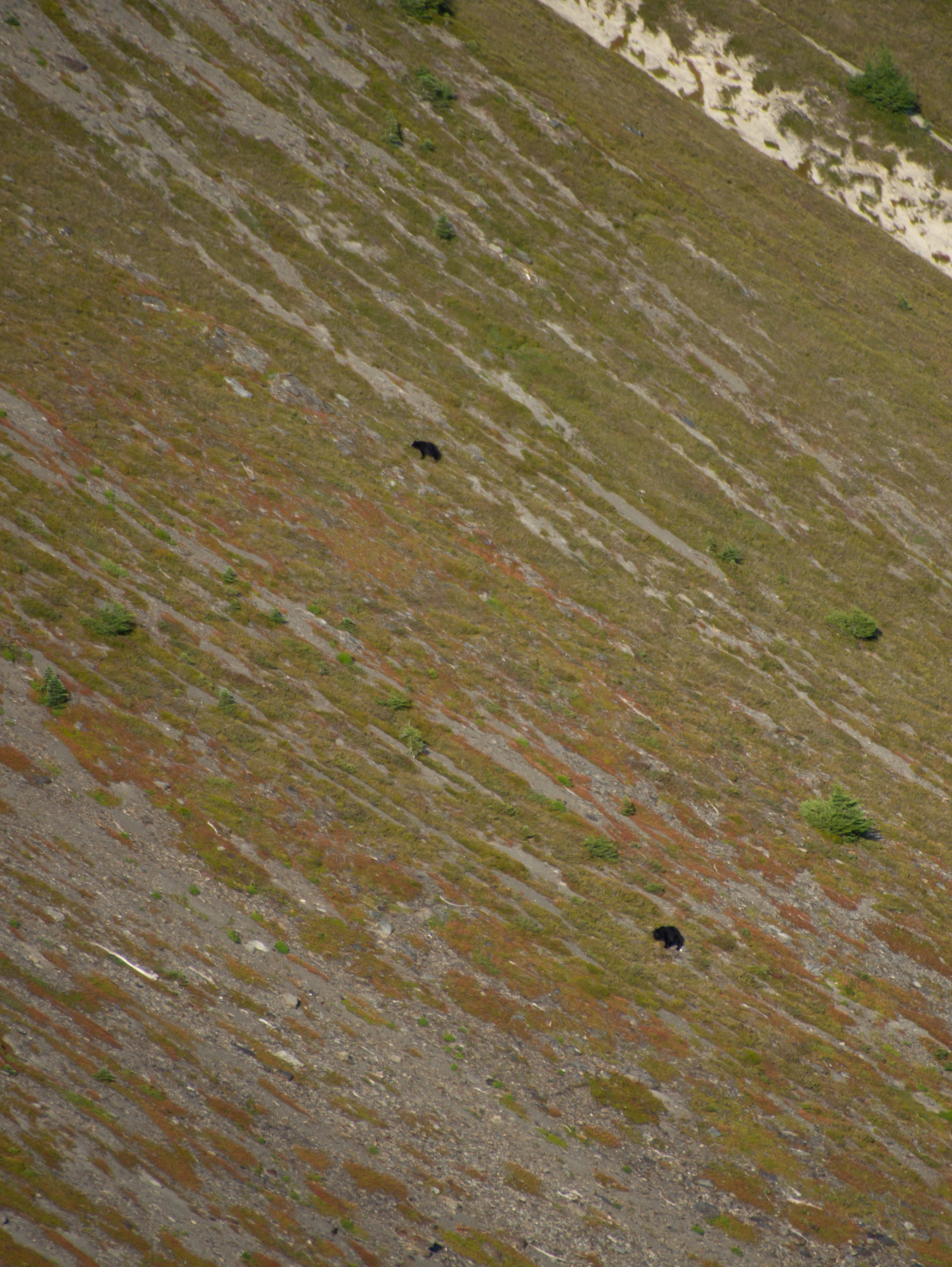
Our first view of 1000 acre meadow. Once we cleared the trees it was immediate. BEAR! (looks right) ANOTHER BEAR! (looks further right) ANOTHER BEAR!
3 Bears. 1 Meadow.
Bear 1 off by where we want to camp.
Bear 2
Bear 3. He was frozen. Staring at us the whole time while the other two ate berries.
Making our way up the meadow. We tried to stay in the shade as the sun was brutal (for us northerners). Most of the trip it was mid-80's with 40-50% humidity.
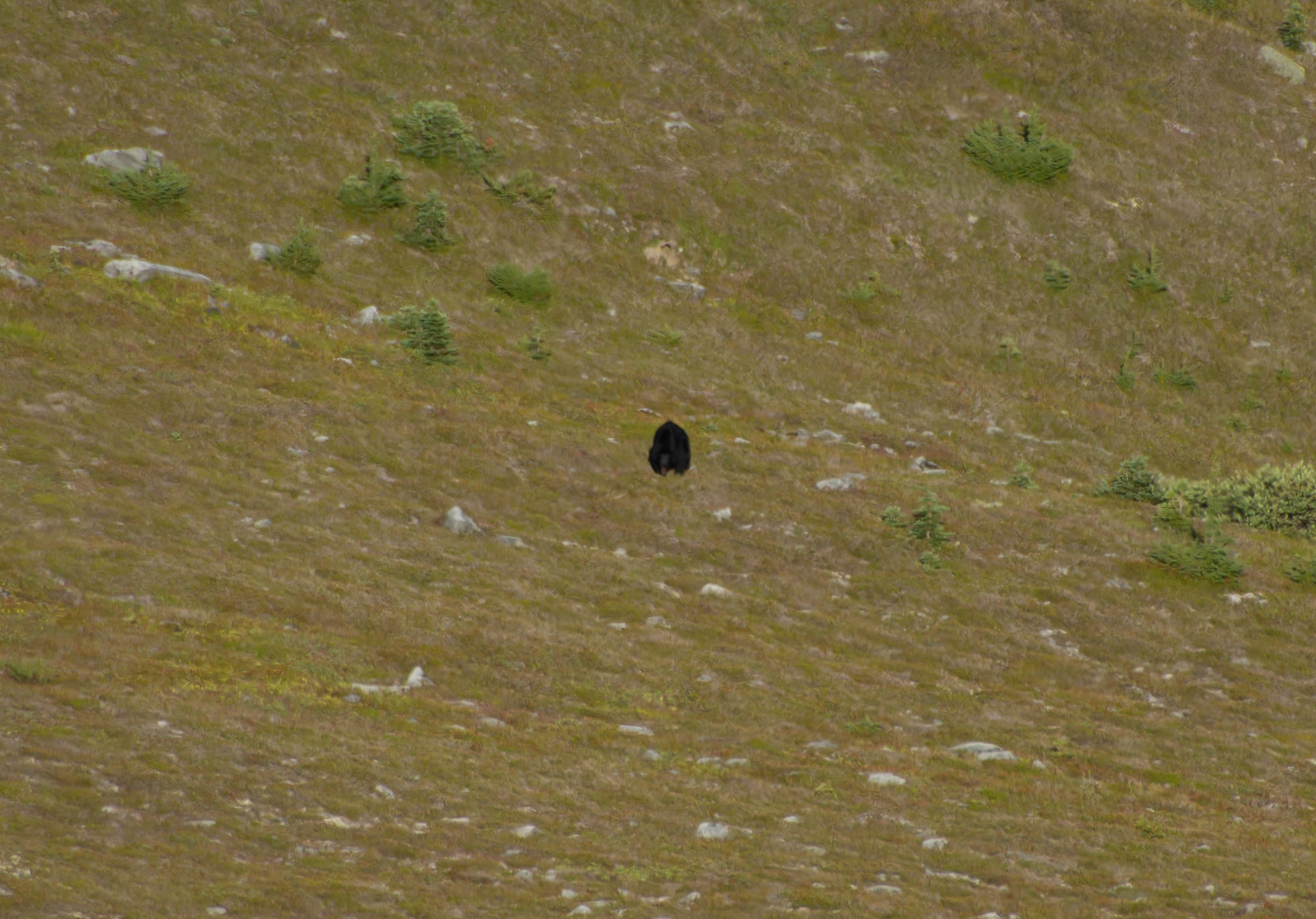
At camp! Bear #1 saw us coming from a ways away and trotted over a hill where we assumed he grazed for the remainder of the day only to flank our camp at night to rejoin his 2 buddies downhill. (All 3 of them were near each other next morning)
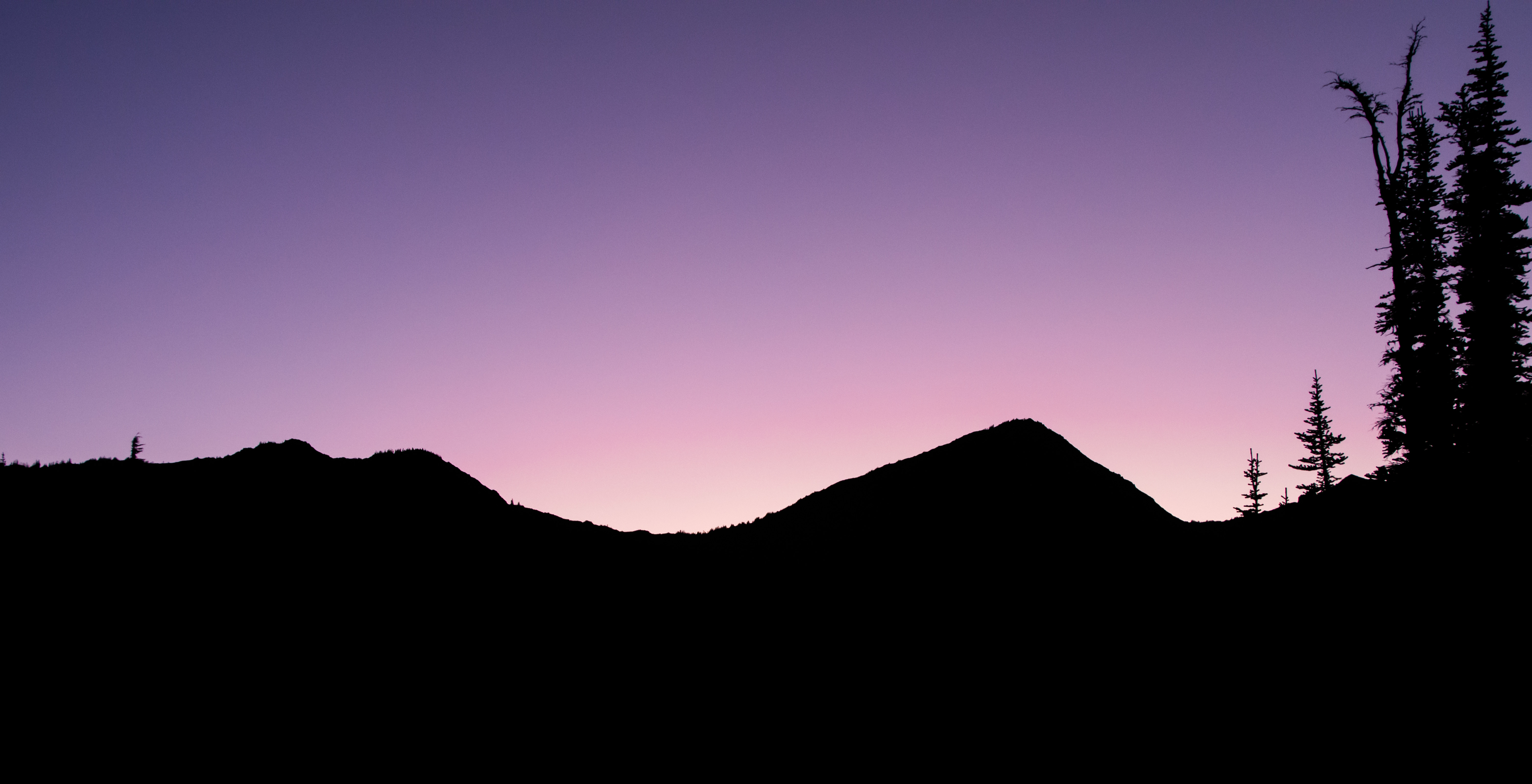
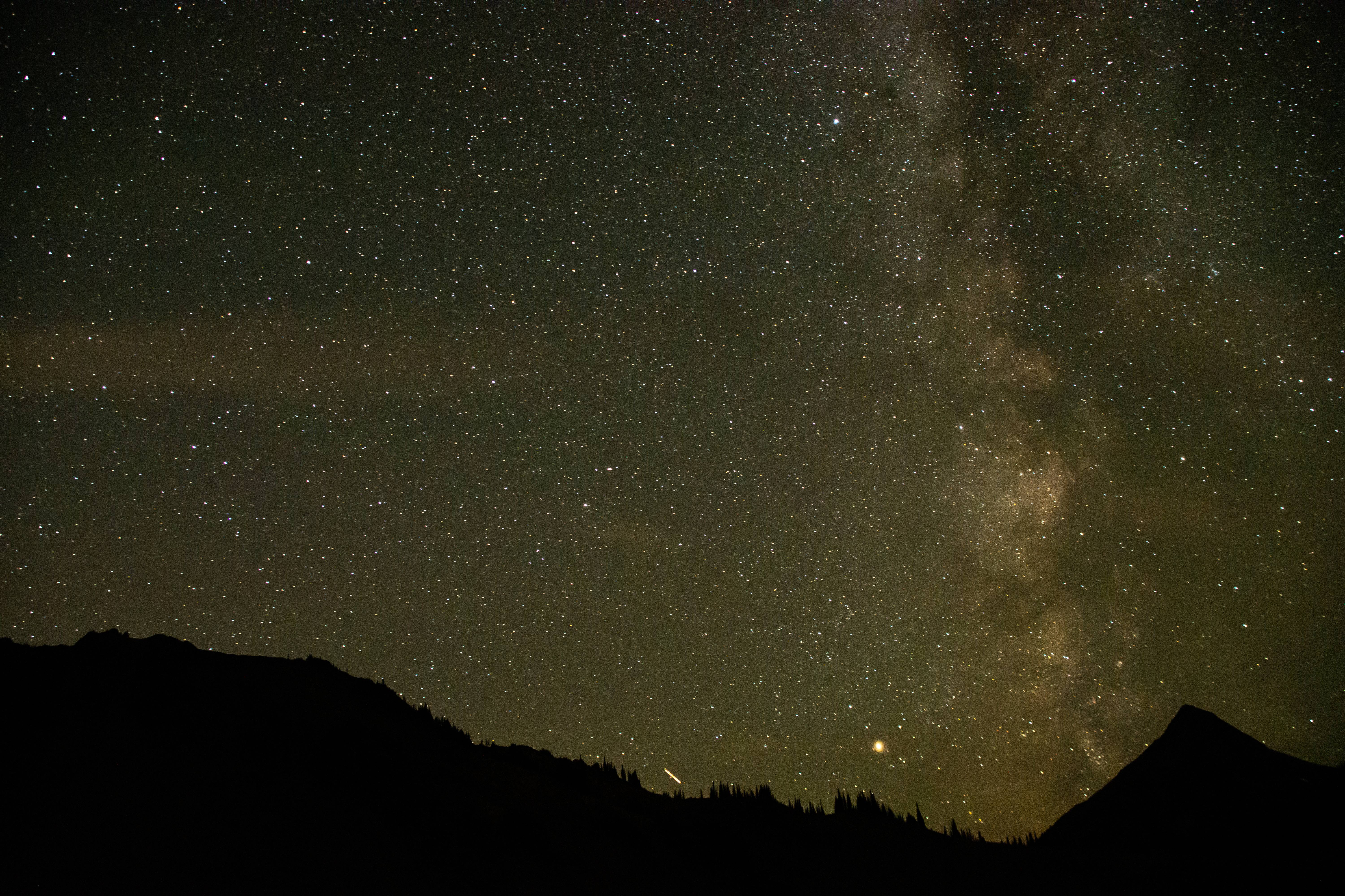
Amazing sunset
Much darker skies in the parks Interior.
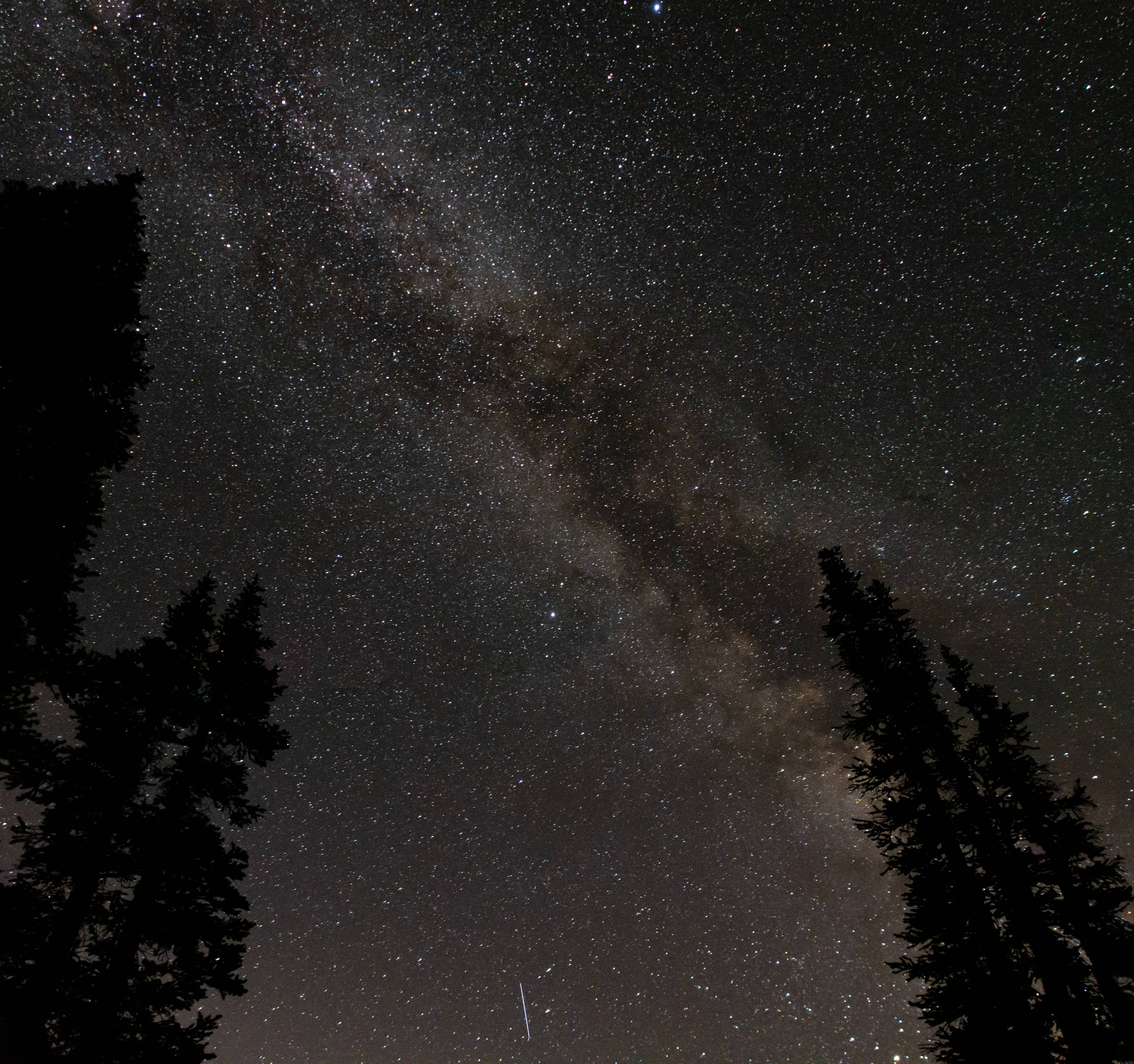
Camera caught some skyglow @ 3:00 AM
Day 3 : 1000 Acre Meadow > Off trail ridge walk to Hayden Pass area > Gray Wolf Pass > off trail to Cedar Lake
14 Miles @ 3800ft of elevation gain (50% trail - 50% off trail)
Good morning neighbors!
Got to watch our friends graze while we packed up our tents.
Current goal : get to the base of Sentinel Peak then cut down HARD to rejoin Hayden Pass trail.
Grand view as we got up on the ridge. We camped near the big pond.
Wrapping around toward Sentinel
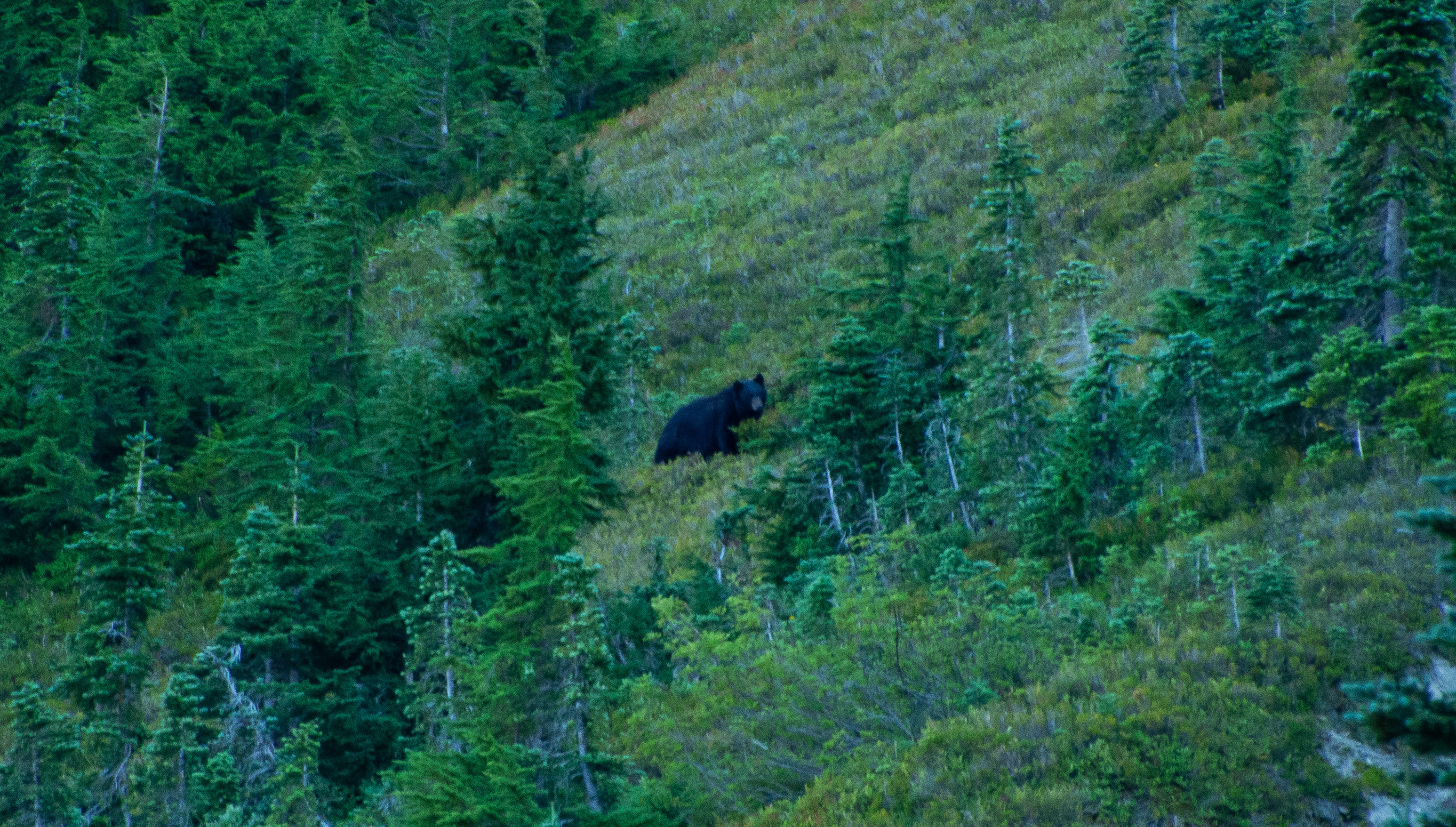
Mama and cubs! They knew our presence WAAAY before we saw them. They were across the valley running. Funniest part which I didn't get on camera unfortunately is that they scared a deer up above them. So the deer was running from the bears who were running from us. Chain reaction.
Somewhere between the bears and these shots we had to veggie-belay down a steep section of forest which left its battle scar marks on Aaron. His legs looked like freddy got a hold of them.
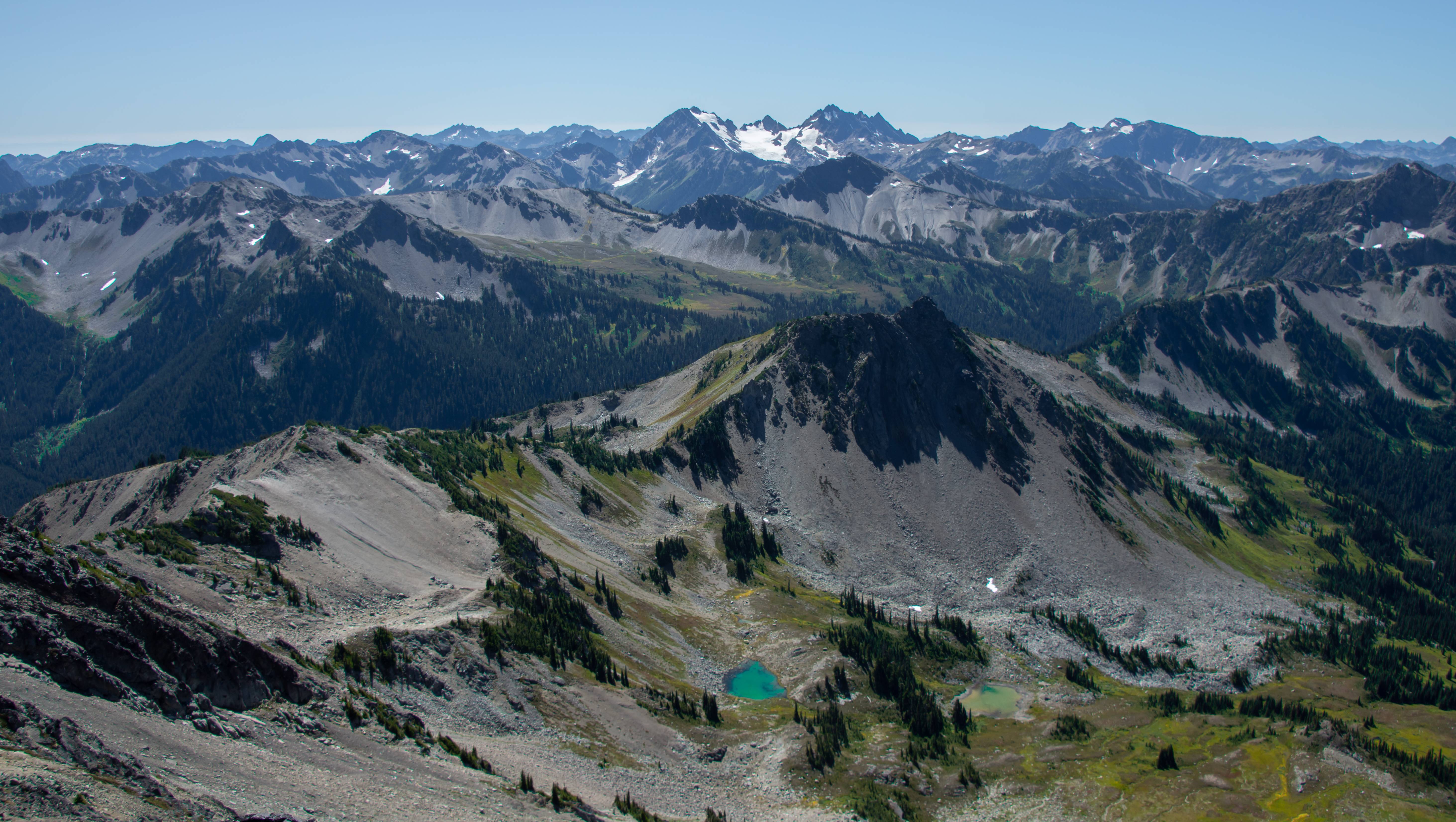
This off trail section had 2 of the best photos of the trip IMO. Mount Anderson above is Olympics mini-version of GNP's triple divide peak. Andersons melt water drains to the Pacific Ocean, Strait of Juan de Fuca and the Hood Canal
Never alone off-trailing
Back on the trail!
Mt. Deception and Mystery. Mystery is probably now one of my favorite looking mountains in the Olympics.
We began our slog up Gray Wolf Pass in the midday heat. Once at Gray wolf pass we branched off trail toward Cedar Lake.
Side hilling with the view of the Needles. We came from the low bowl center pic.
Racing daylight. Off trail travel in the morning was slow going.
Beautiful basin.
Awesome creek which led to a 200 foot sheer drop.
Pano of an unnamed lake on our way to Cedar Lake. Here we picked up an old goat trail which we then lost near the next saddle toward Cedar.
Cedar Lake!
This section really reminded me of the Upper Lyman/Lower Lyman transition in the GPW
Boots cant take much more side-hilling.
Cedar Lake 2.0 near camp. We came down from low point on picture left.
Day 4 : Cedar Lake to Deer Park (100% trail) 10 Miles @ 3900ft of Elev. Gain
A trail starts up near the drainage exit of Cedar Lake which we used to connect up with the Gray Wolf drainage.
A lot of this was valley walking. It was a typical beautiful Olympic forest but I didn't take many photos as it had brushy sections and I lost my lense cap near Gray Wolf Pass and didn't want to scratch it. I got some good video of it but the photos I snapped after the video shots didn't turn out too good. The 4 mile 3600 ft of elevation gain up to Deer Park from Three Forks wasn't too bad. I thought the 3 mile 2600ft of gain from Gray Wolf was actually worse due to the sun and heat. We had clouds come in and it was a cooler day. Then it rained on us @ deer park.
Storms
Day 5: Deer Park to Obstruction Point (END) (100% trail) 7.2 Miles @ 1500ft of Elev. Gain
The rain kept up through the night and most of the views on the open ridge walk were socked in. Until the very end and last mile stretch!
The views most of the walk.
Parking lot can be seen near the trees of the center peak (left).
Amazing open landscape.
Very smoky mountain esque shot
Overall it was an amazing trip. A lot more lax than the GPW trek which made it all the better. Loved every bit of this corner of the Olympic mountains and hope to get back there again. Especially the Royal Basin area Aaron talked up. Now Lacey and I are off to the Chelan-Sawtooth range!
 .
.