12 days in Wyoming's Teton Wilderness, part 7 of 9, July 26-27, 2022

Fungi

Member
Joined
May 9, 2022
Messages
57
THE GREAT DIVIDE


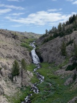
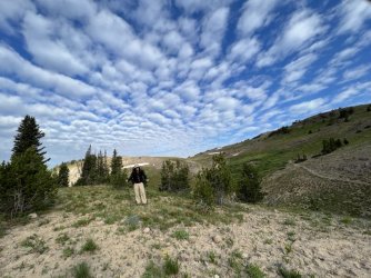
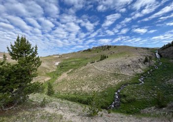
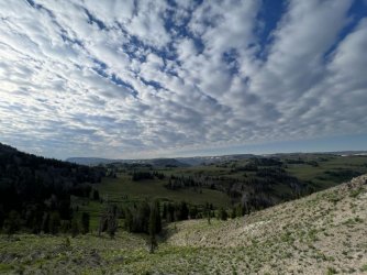
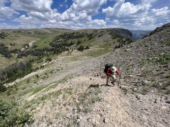
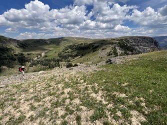
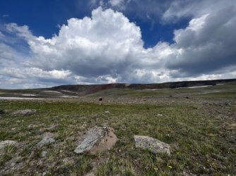
We broke camp early the next day. It was a gorgeous morning, with beautiful clouds. We enjoyed a colorful sunrise and a few final views of the waterfall below. We returned to the trail and headed back east. We made good time until we found ourselves above Lost Creek. This was the optimal area to leave the trail and head cross country towards the Continental Divide. We descended steeply to Lost Creek. After hunting around for a few minutes we found a spot where we could rock hop across. On the far side we climbed steeply to access a grassy ridge running east towards the Continental Divide. The ridge climbs fairly gently, and we made good time on the initial ascent. We enjoyed incredible views in every direction along the way.
IMG_4062.jpg
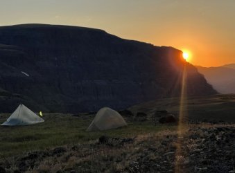
Morning light from our campsite

52256471447_b8cd4583a3_o.jpg
Parting view of our waterfall

IMG_4071.jpg
Larry leaving our campsite

IMG_4074.jpg
Parting view of our waterfall

IMG_4077.jpg
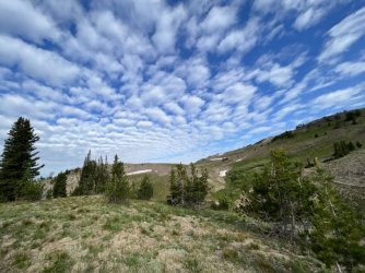
Beautiful clouds above our campsite
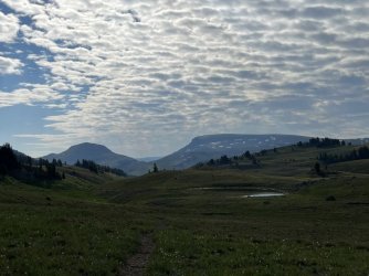
IMG_4080.jpg

IMG_4093.jpg

IMG_4101.jpg
Amazing clouds
IMG_4134.jpg
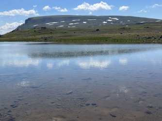
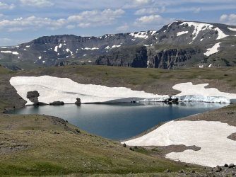
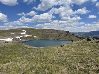
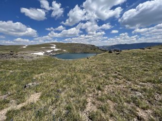
Tarn just below the Continental Divide
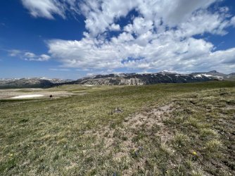
IMG_4150.jpg
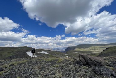
Larry climbing towards the divide

IMG_4155.jpg
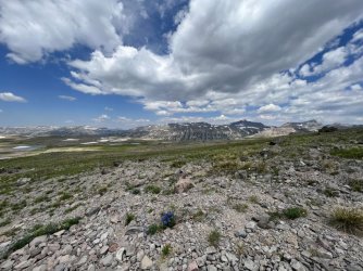
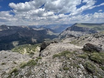
Huge view from the Continental Divide
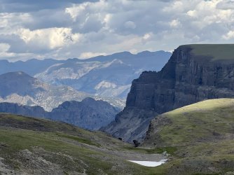
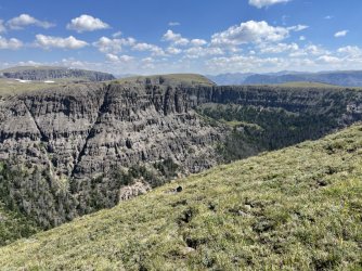
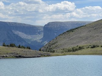
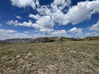
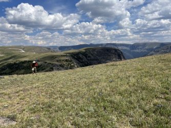
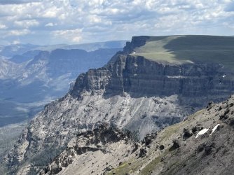
We stopped at a tarn for water a bit before the Continental Divide. Then we continued up to the Divide itself. We followed it south and east, climbing steeply to a grassy unnamed summit. We had lunch there, and I took a brief side trip to the northeast, to the edge of the escarpment. There I was treated to astonishing views of Younts Peak, Thorofare Mountain, and down the Marston Creek valley.

IMG_4181.jpg
Wall Mountain

IMG_4184.jpg
View from the Continental Divide
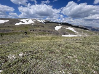
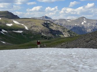
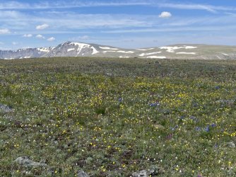
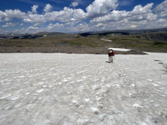
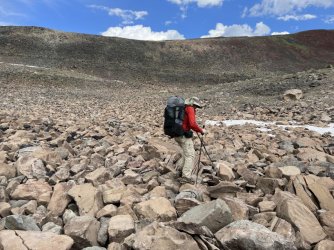
At that point we had the toughest part of the day behind us. After lunch we followed the Continental Divide south, enjoying mostly easy hiking. The terrain was gently rolling for the most part, and the footing was good. At times, we found it easier to avoid talus and scree by walking across snowfields. The navigation was pretty straightforward, though it was surprisingly easy to drift off of the Continental Divide. That happened occasionally, but it didn’t really matter. We just tried to stay close to it.
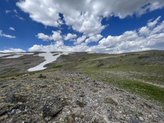
IMG_4217.jpg
Along the Continental Divide

IMG_4228.jpg
Wall Mountain

IMG_4230.jpg
Larry taking in the view

IMG_4245.jpg
Larry on the Continental Divide
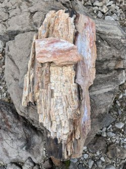
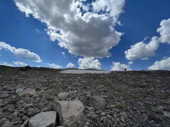
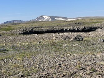
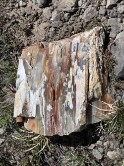
The views were continuous, and the partly cloudy afternoon made for great photos. One of the more interesting sights of the day was several chunks of petrified wood right on the Continental Divide. It was amazing to see, since we were miles from the nearest tree. We ran into more of it the next day, too. Specimen Ridge in Yellowstone National Park is famous for its petrified wood. I’m guessing the petrified wood we found had a similar origin.

IMG_4253.jpg
Petrified wood on the Continental Divide
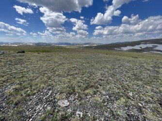
IMG_4269.jpg
Big Sky Country

IMG_4272.jpg
Larry hiking the Continental Divide

IMG_4281.jpg
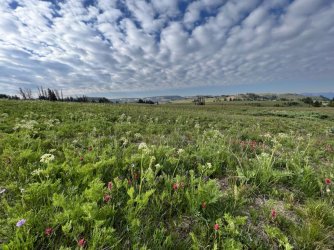
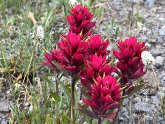
Paintbrush

IMG_4291.jpg
Larry hiking the Continental Divide​

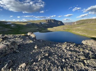
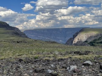
My original plan had been to camp near the Divide below Wall Mountain. The goal was to spend the following morning hiking to Wall Mountain’s summit. However, we had to sacrifice that side trip when we decided to hike out a day early. We did look for a possible campsite in that area anyway, but we didn’t see anything appealing. We continued on, and before long we spotted a beautiful alpine lake at the head of Bliss Creek far below. That seemed like a it might be a good place to camp, so we headed that way. We descended steeply from the Divide and ended up on a bench about 100’ above the lake. The bench ends in a sheer cliff. We could have worked our way around it and down, but the bench itself offered great camping options. There was a small stream nearby, and great views of Wall Mountain, the lake, and the Bliss Creek valley. It ended up being one of the best campsites of the trip.
IMG_4310.jpg
View from the Continental Divide

IMG_4323.jpg
View from our campsite of an alpine lake at the beginning of Bliss Creek
While getting water, I stumbled upon a dead muskrat that had been crushed. How had that happened? And what was it doing up on this bench, high above the lake? Perhaps it had fallen from the cliffs above?

IMG_4337.jpg
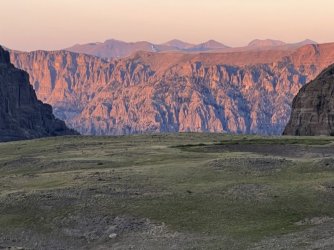
Sunset from our campsite​

I got up late that night and was treated to a spectacular star show. Even the Milky Way was visible. I attempted a few photos, but that was challenging with a phone and without a tripod.


THE GREAT DIVIDE​


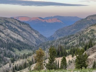
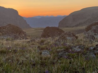
I was up for a lovely sunrise the next morning. During breakfast I heard coyotes singing, and later we heard an elk bugling. We broke camp and climbed back up to the Continental Divide. From there, we enjoyed mostly easy hiking again, following the divide south. We were treated to another morning of non-stop views and pretty clouds.
IMG_4346.jpg
Sunrise from our campsite

IMG_4352.jpg
Sunrise from our campsite


IMG_4380.jpg
Weird rock feature

IMG_4395.jpg
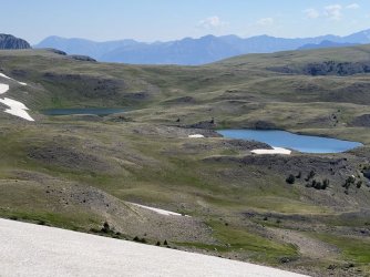
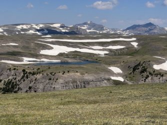
Alpine lakes below the Continental Divide
IMG_4426.jpg
View back towards Younts Peak

IMG_4430.jpg
Amazing snow cornice

IMG_4435.jpg
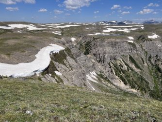
Interesting geology

IMG_4441.jpg
Alpine wildflowers

IMG_4445.jpg
More petrified wood
We stopped for lunch at Lake 10,445’, which is an alpine beauty. It would make a great place to camp, but we were only able to stay there for an hour or so. From there, we enjoyed views of Crescent Mountain across the Crescent Creek valley. The Continental Divide crosses Crescent Mountain, but our intended route would bypass it to the west. Crescent Mountain is notorious for its difficult talus, so most hikers bypass it.

IMG_4451.jpg
Crescent Mountain beyond Lake 10,445'
IMG_4462.jpg
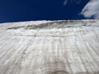
Giant wall of snow

IMG_4480.jpg
View across Lake 10,445'

IMG_4482.jpg
View from the Continental Divide

IMG_4490.jpg
Lake 10,445'

IMG_4491.jpg
Lake 10,445'​

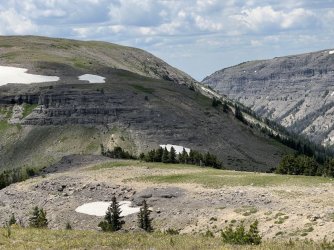
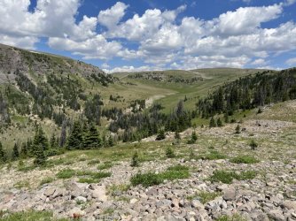
First though, we had to tackle one of the more difficult sections of the route. After leaving the lake we followed the Divide west. We descended steeply into a gap and eyed up the route ahead. The Continental Divide follows a very steep ridge through bands of cliffs. Fortunately, there is actually a beaten path that veers a bit north of the Divide, avoiding the worst of the cliffs. It was still a tough climb with a lot of loose scree, but it wasn’t nearly as bad as I feared. From there, easy terrain led to the base of Crescent Mountain. We dropped off the Divide there, contouring around the west side of the mountain. There was still a lot of talus along our route, so I’m not sure if it was much easier. Some people have trouble navigating this stretch, as it is easy to drift too far west and too far downhill. We fought against that by trying to maintain the same elevation as we contoured around the mountain.
IMG_4498.jpg
A steep trail winds around to the right of that band of cliffs
IMG_4507.jpg
Looking back

IMG_4510.jpg
Larry climbing the steep trail

IMG_4518.jpg
Larry climbing the steep trail


IMG_4533.jpg
Larry climbing the steep trail

IMG_4547.jpg
Larry crossing a snowfield
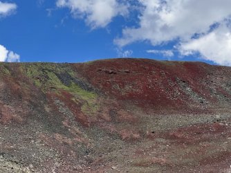
This stretch had one scenic highlight. The ridge above was mostly made of bright red and green rock. The green may have been moss or algae, but it was hard to tell from a distance.

IMG_4573.jpg
We avoided the talus on Crescent Mountain by hiking through the talus below it
IMG_4576.jpg
Crescent Mountain is very colorful​

The weather was a little threatening that afternoon. There were a lot of thunderheads building, but most of them missed us. We did get a brief sprinkle, which was enough to make me put on my rain gear. As soon as I accomplished that, the rain stopped, the sun came out, and the temperature went up about 30 degrees.

IMG_4580.jpg
That storm missed us​

We rejoined the Continental Divide southwest of Crescent Mountain. A long descent followed, ending in a gap separating the headwaters of the South Fork of the Buffalo from the headwaters of Perry N Boday Creek. I had originally planned to camp at Perry N Boday Lake, but that was a mile out of the way. The weather had cleared, so we decided to continue along the Continental Divide.

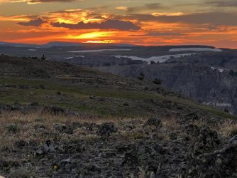
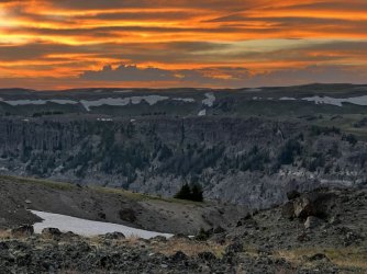
A big climb followed. We turned south and continued on the divide, but then left it by taking a shortcut to the southwest. We crossed a small stream and continued west, wandering among small hills and gullies. My rough goal was a tarn farther west, just below the Continental Divide. However, we stumbled upon a smaller, unmapped tarn a bit sooner. It was getting late, and there was a grassy area near the tarn that was adequate for camping. It wasn’t a great spot, but it had a nice view, and we were serenaded by frogs that night. We were also treated to a spectacular sunset right from our campsite. I wish I had known that there was an absolutely spectacular place to camp a couple of miles farther west, but we didn’t discover that until the next morning.

IMG_4622.jpg
Sunset from our campsite
IMG_4647.jpg
Sunset from our campsite

Note - the attached maps show the route I planned, which we changed a bit on the fly. I didn't record a track (it takes too much phone battery) or redo the maps.
 

Attachments

  • Day 10 Part 1 Ferry Lake to Continental Divide below Wall Mountain.pdf
    1.1 MB · Views: 16
  • Day 10 Part 2 Continental Divide and side trip to Wall Mountain.pdf
    890.7 KB · Views: 12
  • Day 11 Part 1 - Continental Divide.pdf
    880.9 KB · Views: 11
  • Day 11 Part 2 - CD to Perry N Boday Lake.pdf
    893.9 KB · Views: 14
Loved reading this. Probably one of my favorite sections I've ever done - plan to hit parts of it again this year. Brought back great memories.

Don't feel too bad about missing Wall Mountain - it's kind of a slog in July when things are still melting, especially the western aspect. I only came down that way and it was pretty slow and wet. The views are fantastic, but that's true for most of your route anyway. :)

Lake 10,445' really shows how much things melted in just a little over a week - we considered camping there, but the snowfields made water access pretty annoying and/or risky.

Edit: Just looked at your PDF - looks like you had the right idea going up/down Wall from the south, but still kind of a slog honestly.
 
Last edited:
Loved reading this. Probably one of my favorite sections I've ever done - plan to hit parts of it again this year. Brought back great memories.

Don't feel too bad about missing Wall Mountain - it's kind of a slog in July when things are still melting, especially the western aspect. I only came down that way and it was pretty slow and wet. The views are fantastic, but that's true for most of your route anyway. :)

Lake 10,445' really shows how much things melted in just a little over a week - we considered camping there, but the snowfields made water access pretty annoying and/or risky.

Edit: Just looked at your PDF - looks like you had the right idea going up/down Wall from the south, but still kind of a slog honestly.
Yeah, I had those same thoughts when I was near the base of Wall Mountain. It looks easy, but long, and the view probably isn't much different from the rest of the Continental Divide through there.

I'm already thinking about including some or all of this section in a future trip, too. Most of it is really pretty easy, and the non-stop views are incredible!
 
Another fabulous trip report! You had such a Great Trip! Am happy for you! Loving all your photos and everything. They bring back sooooo many wonderful memories. And plus the trip report and photos makes me miss this good country soooo freaking much. Can't wait for spring to get back into this wonderful country again. Also as for myself, will probably start going back into this country in late May. If you are back in here next summer then might meet up somewheres.

Now for some comments. Several times have had Grizzly Bears right near where you camped by that waterfall. And above that waterfall is a wonderful alpine valley that is wonderful to wander around in. Also you noticed those few trees on the Continental Divide Ridge right north of Lost Creek ... well, once had to retreat to these trees as a rainstorm passed over and here in the trees was a rusty old small wood stove left from years gone by. Have climbed Wall Mountain and there is a possibility of Bighorn Sheep all around in that area. Also for myself found nice little camping spots near the base of Wall Mountain. There is an old route that runs down Crescent Creek that goes over to the Upper South Fork of the Buffalo. Crescent Mountain has a nice fabulous view also. As you found out there is soooo much country back in here that one can spend countless summers back in here and still never see it all.

Again loved this and all of your Teton Wilderness trip reports. Just Fabulous!!!!
 
Last edited:
Another fabulous trip report! You had such a Great Trip! Am happy for you! Loving all your photos and everything. They bring back sooooo many wonderful memories. And plus the trip report and photos makes me miss this good country soooo freaking much. Can't wait for spring to get back into this wonderful country again. Also as for myself, will probably start going back into this country in late May. If you are back in here next summer then might meet up somewheres.

Now for some comments. Several times have had Grizzly Bears right near where you camped by that waterfall. And above that waterfall is a wonderful alpine valley that is wonderful to wander around in. Also you noticed those few trees on the Continental Divide Ridge right north of Lost Creek ... well, once had to retreat to these trees as a rainstorm passed over and here in the trees was a rusty old small wood stove left from years gone by. Have climbed Wall Mountain and there is a possibility of Bighorn Sheep all around in that area. Also for myself found nice little camping spots near the base of Wall Mountain. There is an old route that runs down Crescent Creek that goes over to the Upper South Fork of the Buffalo. Crescent Mountain has a nice fabulous view also. As you found out there is soooo much country back in here that one can spend countless summers back in here and still never see it all.

Again loved this and all of your Teton Wilderness trip reports. Just Fabulous!!!!
Thanks, I'm glad you're enjoying the reports!

Ferry Lake and the alpine country to the north are high on my priority list for a return trip. I'm not sure when I'll get back there - hopefully soon!

Question - are you familiar with the Crescent Creek Trail shown on the maps? It appears to connect the South Fork Shoshone with the Continental Divide just west of Lake 10,445'. One trip I'd like to do is up the South Fork Shoshone, along the Continental Divide, and then back down Marston Creek Trail to make a loop. If that Crescent Creek Trail is passable that would probably be the ideal route. If not, it might be possible to go all the way to Shoshone Pass, over Crescent Mountain, and then along the Divide from there. That would be a lot longer and harder though.
 
Fungi, Hi There! Yes have sooooo loved these trip reports and photos bigtime! Looks like you had a great and fabulous trip!

Yes am familiar with it to some degree. I have had several trips where I either went up or down the South Fork of the Shoshone. Now have never much been in Crescent Creek, but have been on the companion drainage that runs down to the South Fork of the Buffalo on the other side of the Continental Divide. Now the route I followed down was a good and solid rote also. There is a trail or route here that goes up Crescent Creek, then over the C. Divide, and down a Drainage to the S. Fork of the Buffalo. This later is what I was on and it was a good route. When used this route, I had crossed the Buffalo Plateau from near Marston Pass to here near Crescent Mtn. Instead of climbing Crescent Mtn., I just took this Drainage down to the Upper end of the South Fork of the Buffalo. And when doing so found this good trail and route in this Drainage. Do think it is one route from the upper South Fork of the Buffalo, up to the C. Divide via Crescent Creek, and then down to the Upper South Fork of the Shoshone right on the other side. In actuality lots of these side drainages have trails and routes in them from all the outfitter use thru the years.

Also I have been several times up around Shoshone Pass and went over to the head of the South Fork of the Buffalo without having to climb to the top of Crescent Mountain. There is a route here that goes around Crescent Mountain towards Boday Lake. For myself at Shoshone Pass, there is a little basin right above the pass on the right or west side of the pass area. One has to climb a little to this basin. Have camped in this little basin on several occasions. There is a little route here to this little basin also. It is a flat basin with a little Creek, and with trees. From here there is a sort of notch one climbs up thru, easy, to the alpine tundra country right above. Here is a big flat alpine area below Crescent Mountain. When doing this saw a route that goes from here around on the south facing slopes of Crescent Mtn., and a good route also, that goes over then on the slope to above Boday Lake. Here an easy descent to Boday Lake. I have used this route around Crescent Mtn. On a number of occasions and was quite a good route. When doing this ... here was Crescent Mtn. above me and then some nice alpine ponds below, with it all being so wild and nice. One very well might be able to cross on this alpine flat, below Crescent Mountain on the east heading north very possibly also with connecting up to the Continental Divide. But do not have a map of the area with me at the moment. But a big nice alpine tundra flat here on the east side of Crescent Mtn. with some lakes and such. From my recollections.

Now hope this helps you out. Wishing You the Best!
 
Last edited:
The talus below Crescent is still infinitely better than the talus on Crescent! With a little routefinding it's never steep or dangerous, but so very tedious.
 
Fungi, Hi There! Yes have sooooo loved these trip reports and photos bigtime! Looks like you had a great and fabulous trip!

Yes am familiar with it to some degree. I have had several trips where I either went up or down the South Fork of the Shoshone. Now have never much been in Crescent Creek, but have been on the companion drainage that runs down to the South Fork of the Buffalo on the other side of the Continental Divide. Now the route I followed down was a good and solid rote also. There is a trail or route here that goes up Crescent Creek, then over the C. Divide, and down a Drainage to the S. Fork of the Buffalo. This later is what I was on and it was a good route. When used this route, I had crossed the Buffalo Plateau from near Marston Pass to here near Crescent Mtn. Instead of climbing Crescent Mtn., I just took this Drainage down to the Upper end of the South Fork of the Buffalo. And when doing so found this good trail and route in this Drainage. Do think it is one route from the upper South Fork of the Buffalo, up to the C. Divide via Crescent Creek, and then down to the Upper South Fork of the Shoshone right on the other side. In actuality lots of these side drainages have trails and routes in them from all the outfitter use thru the years.

Also I have been several times up around Shoshone Pass and went over to the head of the South Fork of the Buffalo without having to climb to the top of Crescent Mountain. There is a route here that goes around Crescent Mountain towards Boday Lake. For myself at Shoshone Pass, there is a little basin right above the pass on the right or west side of the pass area. One has to climb a little to this basin. Have camped in this little basin on several occasions. There is a little route here to this little basin also. It is a flat basin with a little Creek, and with trees. From here there is a sort of notch one climbs up thru, easy, to the alpine tundra country right above. Here is a big flat alpine area below Crescent Mountain. When doing this saw a route that goes from here around on the south facing slopes of Crescent Mtn., and a good route also, that goes over then on the slope to above Boday Lake. Here an easy descent to Boday Lake. I have used this route around Crescent Mtn. On a number of occasions and was quite a good route. When doing this ... here was Crescent Mtn. above me and then some nice alpine ponds below, with it all being so wild and nice. One very well might be able to cross on this alpine flat, below Crescent Mountain on the east heading north very possibly also with connecting up to the Continental Divide. But do not have a map of the area with me at the moment. But a big nice alpine tundra flat here on the east side of Crescent Mtn. with some lakes and such. From my recollections.

Now hope this helps you out. Wishing You the Best!
That's great info, thanks! It does look like you could hike cross country from Shoshone Pass around the east side of Crescent Mountain by avoiding the steeper areas. That looks like it would be more scenic than just going up Crescent Creek from the South Fork of the Shoshone. I'll definitely consider that on a future trip.
 
The talus below Crescent is still infinitely better than the talus on Crescent! With a little routefinding it's never steep or dangerous, but so very tedious.
I was wondering how much worse the actual mountain was. Yeah, our route was just slow and annoying, but not a big deal. Steep, loose talus isn't fun with a big pack on (or without, for that matter).
 
I was wondering how much worse the actual mountain was. Yeah, our route was just slow and annoying, but not a big deal. Steep, loose talus isn't fun with a big pack on (or without, for that matter).
I'm actually gonna disagree w/ @LarryBoy - I found Crescent itself a little easier on the feet than the basin below it. Of course, it's a lot of space and there's a hundred unique ways you could navigate each that could swing your opinion either way. Not too different is my assessment, I guess.
 
This looks like an amazing day. I'm always annoyed when I put on rain gear just to have the weather change, then I remind myself that the alternative is I keep the rain gear on for the rest of the day :)

thanks for all the photos/details, I'm having fun following your route on Caltopo
 
This looks like an amazing day. I'm always annoyed when I put on rain gear just to have the weather change, then I remind myself that the alternative is I keep the rain gear on for the rest of the day :)

thanks for all the photos/details, I'm having fun following your route on Caltopo
I like to follow along on the map when I read trip reports, too! BTW, does your user name refer to Widespread Panic?
 
I like to follow along on the map when I read trip reports, too! BTW, does your user name refer to Widespread Panic?

Yes, it is a reference to Widespread Panic. Way back when I used to participate in a lot of live music forums, so wsp_scott is the name I have used for most internet things for a long time.
 
Yes, it is a reference to Widespread Panic. Way back when I used to participate in a lot of live music forums, so wsp_scott is the name I have used for most internet things for a long time.
Cool, my wife and I are big fans, too!
 
Similar threads
Thread starter Title Forum Replies Date
F 12 days in Wyoming's Teton Wilderness, part 9 of 9, 7-29 & 30, /2022 Backpacking 5
F 12 days in Wyoming's Teton Wilderness, part 8 of 9, 7/28/2022 Backpacking 5
F 12 days in Wyoming's Teton Wilderness, part 6, 7/25/2022 Backpacking 17
F 12 days in Wyoming's Teton Wilderness, part 5 of 9, 7/23-24, 2022 Backpacking 10
F 12 days in Wyoming's Teton Wilderness, part 4 of 9, 7/22, 2022 Backpacking 4
F 12 days in Wyoming's Teton Wilderness, part 3 of 9, 7/20-21, 2022 Backpacking 2
F 12 days in Wyoming's Teton Wilderness, part 2, 7/19/2022 Backpacking 4
F 12 days in Wyoming's Teton Wilderness, part 1, 7/15-18, 2022 Backpacking 13
Mikjik86 4 Days Backpacking Grand Teton Wilderness/Teton Crest Trail - Wyoming, July, 2021 Backpacking 0
U Any recommendations for 5 days hiking in Wyoming, Idaho or MT? This is around July 15-20. Not counting on Glacier being open Trip Planning 9
scatman Yellowstone's Thorofare, Headwaters of Thorofare Creek, Majo Pass, Younts Peak, Bob's Canyon, and Cub Creek - August 9, 2023 - Days 7 through 10 Backpacking 34
scatman Yellowstone's Thorofare, Headwaters of Thorofare Creek, Majo Pass, Younts Peak, Bob's Canyon, and Cub Creek - August 9, 2023 - Days 1 through 6 Backpacking 56
B 5 Days in the Sawtooths Backpacking 2
M Backpacking 50 miles in the Uinta Mountains for 5 days with ~50 pound pack Backpacking 4
Bob The Thorofare to Brooks Lake - 9 Days in Pictures Backpacking 10
RyanP Four Days in the IPW (8/9 - 8/12) Backpacking 17
D Four Days in the Maze, April 17-20 2023 Backpacking 7
norwegianxplorer 6 days Backpacking Norway in the Fall (Part 2) Backpacking 4
norwegianxplorer 6 days backpacking Jotunheimen in the fall Trip Reports 4
regehr King's in two days Hiking & Camping 5
Desertratgal 5 Days Solo Packrafting Canyonlands On The Water 4
norwegianxplorer 7 days backpacking Breheimen/Glacier Home National Park in Norway Backpacking 2
Bob Slickhorn Canyon System - 6 days Backpacking 22
J Death Valley Natl. Pk. 6 Days hiking. Nov 14-19, 2021 Hiking & Camping 1
norwegianxplorer Finding Hidden Glacier, 9 days backpacking Jotunheimen National Park Pt3, Norway. Trip Reports 0
norwegianxplorer 5 days Backpacking Rondane National Park, Norway Backpacking 3
norwegianxplorer 10 days Backpacking Femundsmarka National Park and Rogen Nature Reserve, Norway and Sweden Backpacking 8
napatony13 1100 Miles, 43 Days, Summits All 58 14ers in Colorado General Discussion 4
Titans Reflections in ponds: 4 days in The Adirondacks, Sept 1-4, 2021 Hiking & Camping 5
Janice 7 Breathtaking Days in the Winds Trip Reports 15
2eez4life 4 days 3 nights in the Uintas Trip Planning 9
Bob Bob Marshall - 7 days Backpacking 7
norwegianxplorer Backpacking Norway, Lysefjorden/Kjerag/Kjerag Waterfall/Kjeragbolten, 4 days Solo Hiking high above the Norwegian Fjords Trip Reports 2
Laura V. Four Days in Salt Creek Canyon, April 2021 Backpacking 31
NorthwestWanderer 4 Days Backpacking Capitol Reef : Spring Canyon & Various side canyons Backpacking 5
norwegianxplorer Ski Dogs, Norway, fun days off piste ski touring amazing conditions Winter Sports 0
WasatchWill The High Uintas 4-4-4: Four Basins, Four Passes, Four Days Backpacking 20
J A few days in Mojave National Preserve Dec. 5-7, 2020 Hiking & Camping 9
J N. Mojave Desert Rambles and Scrambles (start of 40 desert days) Nov. 14-20, 2020 Hiking & Camping 4
LarryBoy Five Days on Boulder Mountain Backpacking 5
Hiker Seth A few days in Baxter SP Backpacking 5
W 9 Days Solo Escalante Loop in October (water advice) - Stevens Canyon, Baker Route over Waterpocket fold, Halls Narrows to Moody Canyons Trip Planning 11
norwegianxplorer Summiting Mount Whitney from Guitar Lake, 6 Days backpacking the Sierra before the Creek Fire closed everything down. Backpacking 5
Happyidiot 4 Days In The Winds Backpacking 10
M 5 days Green > Elk Wind River route advice August 17th Trip Planning 9
balzaccom Five days in Yosemite Backpacking 2
TrailScot 10 days in The Maze - April 2019 Backpacking 22
NorthwestWanderer 3 days in Idaho/Oregon's Hells Canyon: Pittsburgh Landing to Willow Creek Backpacking 2
pstm13 HELP NEEDED- Idaho in Early June for 2-3 Days Trip Planning 6
C Days of Old General Discussion 14

Similar threads

Back
Top