- Joined
- May 5, 2012
- Messages
- 1,732
"No self-respecting Utah backpacker has not done the Narrows top-down."
I found myself repeating that line to coworkers, explaining my enthusiasm for a long-planned backpacking trip along the North Fork of the Virgin.
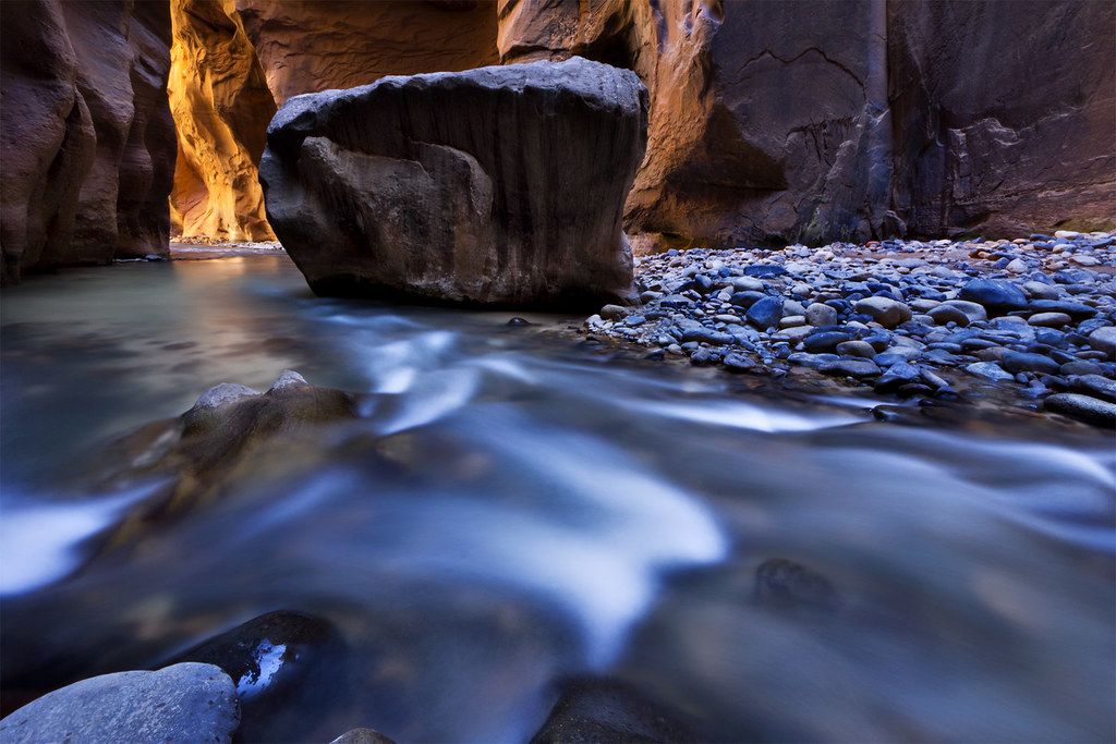
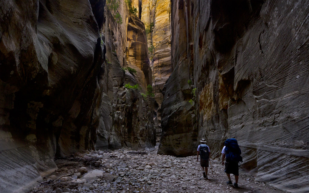
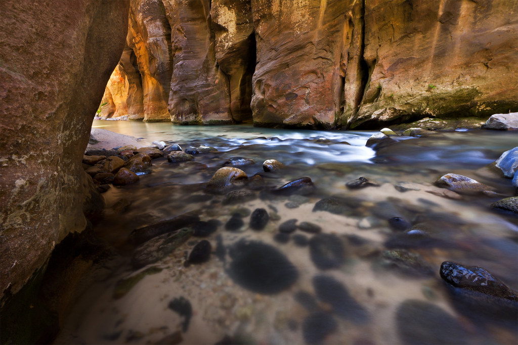
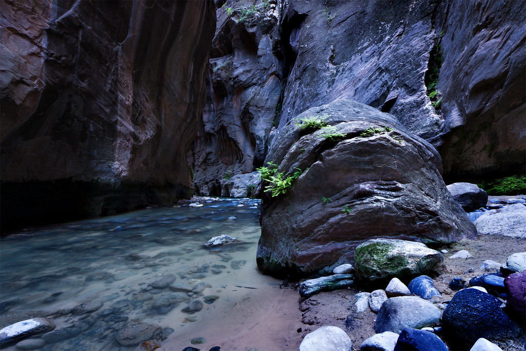
Obstruction by ashergrey, on Flickr
As a hiker and backer, not to mention as a person in general, I tend to appreciate solitude. When I venture into the outdoors, I march into the expanse solo or in the company of a small group of friends.
The experiences I crave come in the quiet moments, when the entire Earth seems to unfold. I'll never rise early to watch the first early fingers of sunlight pierce a city street. I will, however, sit in silence alongside a chilly lake shore, breathing in the fogged remainders of last night's embers as the sun crests a far ridge and creeps along the ground like a stealthy reptile.
These moments only happen in the quiet stillness that occurs away from crowds.
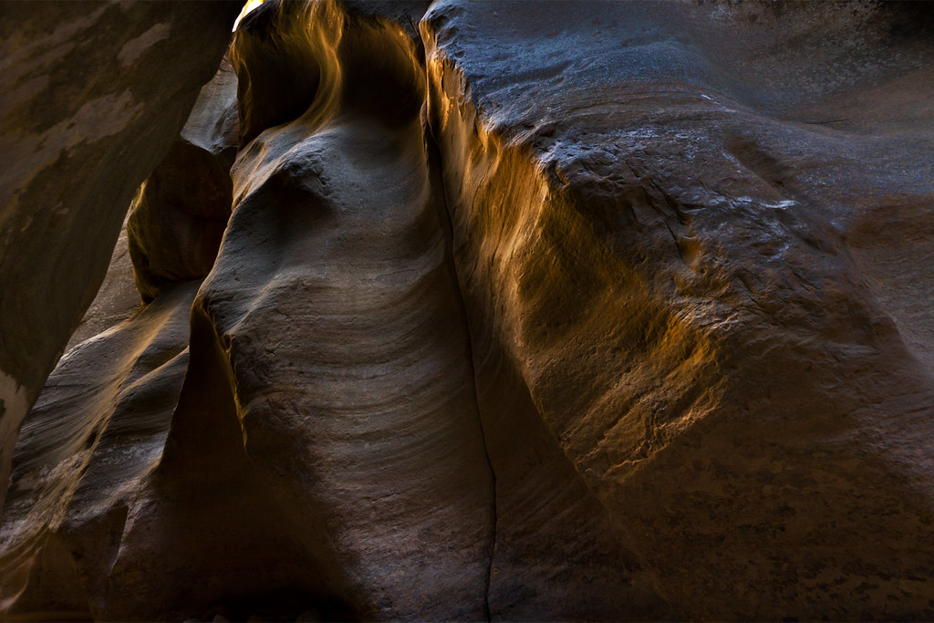
Canyon Glow by ashergrey, on Flickr
As such, knocking the through-hike of the Narrows off the to-do list had not been a high priority.
But I also hike to share, dragging a camera and tripod and at times cursing their bulk and weight. More directly, I enjoy the frank discussions the trail tends to engender. I've come to know siblings and friends alike better over miles of hard packed Uinta dirt and Navajo sandstone.
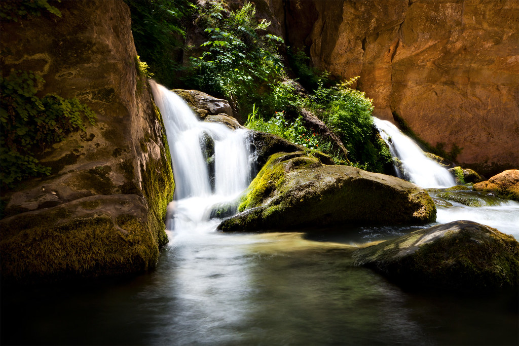
One of my oldest and best friends has accompanied me to the top of Kings Peak and to the bottom of Ashdown Gorge in recent years, among other places. In fact, during May of 2012 Jeff and I looked across the sprawling high country north of Zion National Park from the North Fork of the Virgin's headwaters at Cascade Falls.
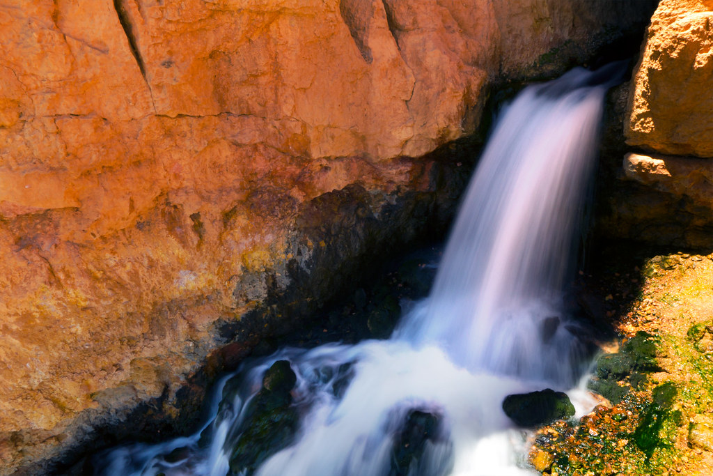
Cascade Falls by ashergrey, on Flickr
Jeff and I go back to the 3rd grade. Another of our good friends had been excluded from these excursions and I hoped to rectify that. The lure of an iconic destination would make that an easier sell. So was born the plan for a June descent of the Narrows.
With commitments from Jeff and Craig, I went about the process of securing the permit. On the 5th of April, I sat habitually refreshing my browser on the park's backcountry reservation page. It took roughly 40 minutes for campsites to become available. Within moments, I'd locked in site five, entered my credit card information and confirmed the permit reservation.

Then, the problems started. First I received an email stating the reservation system had double-booked site five. As a result, the backcountry desk was moving the reservation to site four.
I felt frustrated and dumbfounded. The process of reserving the site had gone smoothly. The website never hiccuped, though it did take forever to become available. The park does not take online reservations for site four. I feared arriving the morning of our trip to pick up the permit, only to have the ranger apologize and say it had been awarded to a walk-in visitor the day prior.
This is all the reassurance the park staff would provide.

We'd selected the date as a balance between the summer heat, threat of later season monsoons and the end of the spring runoff. As bad luck would have it, the runoff petered out in a matter of days a month prior to the trip. But come hell or low water, we were locked in for the Narrows.
But first, we had to deal with being locked out.
I picked Craig up from Sandy, Utah after finishing my work shift on Thursday, June 20. We hoped to make good time down to St. George, where we'd overnight at Jeff's place. Unfortunately, I managed to lock my keys in the trusty Subaru while stopping to grab food.

An hour and $60 to the locksmith later, we were on our way. The delay meant we didn't get into St. George until well after midnight. We had a short night, waking early Friday to make an 8 a.m. appointment at the visitor center.
I'd arranged to interview one of Zion National Park's wilderness rangers about management challenges on the North Fork for a special piece I planned for KSL Newsradio's weekend Outdoors show. When that formality finished, we were at last headed for Chamberlain Ranch.

Warm temps and stunning blue skies abounded as we pounded through the first few dry miles.

In our heads, we dreamed of the deep canyons to come full of pools and reflected light.
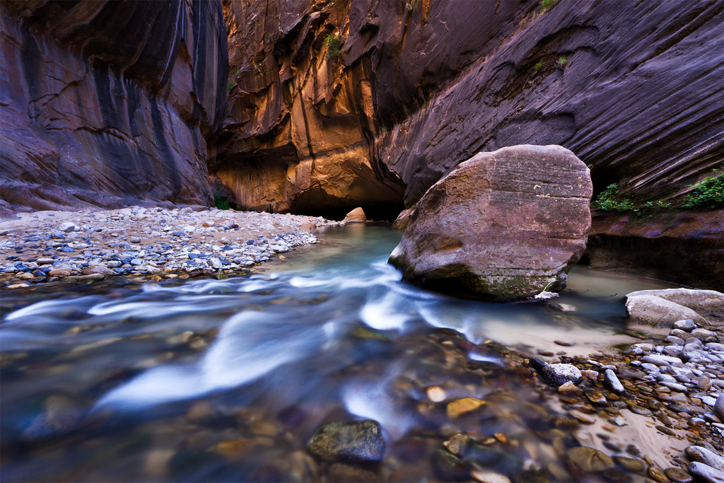
Upstream by ashergrey, on Flickr
We'd each only ever approached the Narrows from the traditional, tourist-crowded bottom-up route. The uplands here outside the park's boundary were a welcome change. We saw a total of two people and only from a distance. Our voices were the only sound aside from the occasional call of a bird or the gurgling of the stream.
That is, until the stream stopped. At one point we turned a corner in the canyon and something caught my attention. I told Jeff and Craig to stop, asking if they noticed anything.
"Where did the water go?"
We turned around and walked back to find the place where the tepid stream went underground or filtered through the pebbled bottom to some unseen seep. Instead, we found the water fingering its way slowly forward. It clawed across rocks, pooling in places until enough gathered to push forward again. The "river" had the unsteady pace of a toddler just learning to walk.
In our haste, we'd caught up to the toe of the creek.
Utah had entered a second year of drought in 2013 and here we stared disappointedly at the results.

For the next several miles, we walked over dry fields of rocks and across mud bogs devoid of running water.
Upper Narrows by ashergrey, on Flickr
I felt cheated. Here I'd hoped to share an amazing experience in the backcountry with two friends.

Instead we slogged through a dry canyon, nervous at how long the underwhelming conditions would persist.

Even the highlight of the upper Narrows, the small waterfall, disappointed. It had diminished to a mere cesspool headed by a bunch of boulders and logs. I had looked forward to photographing the water pouring over the lip. Instead I soaked in some sunlight and fought to keep my commentary from becoming too acerbic.
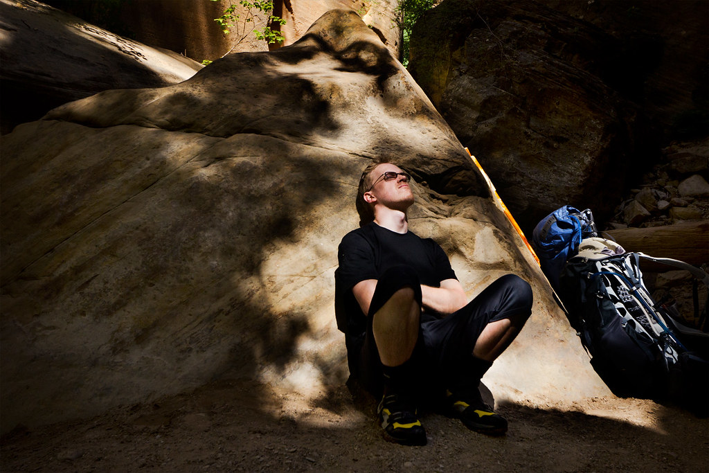
Respite by ashergrey, on Flickr
At times a warm wind would filter through the canyon, rustling the pines. Hopeful, we'd mistake the sound for moving water.
Our best chance for regaining any semblance of the promised wet hike would come at the confluence with Deep Creek. Its thunder sounded in our ears about 100 yards upstream of where it joins the North Fork. We were doubtful, having been fooled by the wind too many times already.
It wasn't until we set eyes on the moving water again that our hopes to soared.

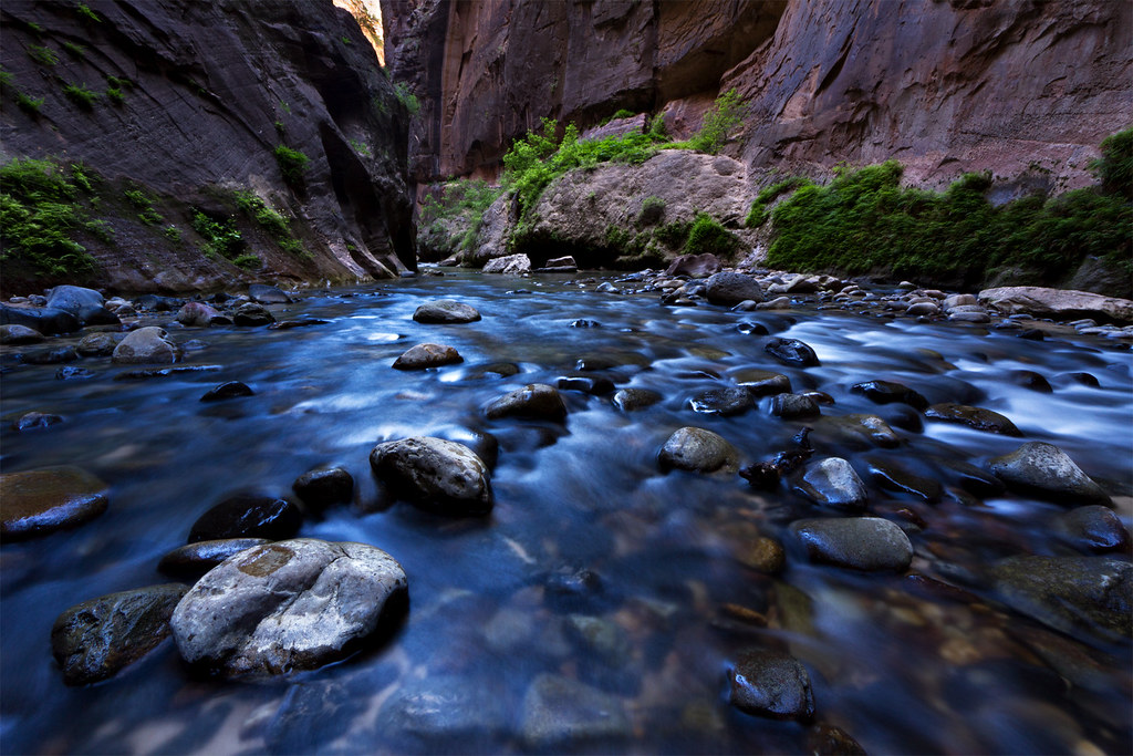
Cool water soothed our feet and scared away the sweat. We traded dust and mud for mossy rocks. At last, we were in the traditional Narrows.
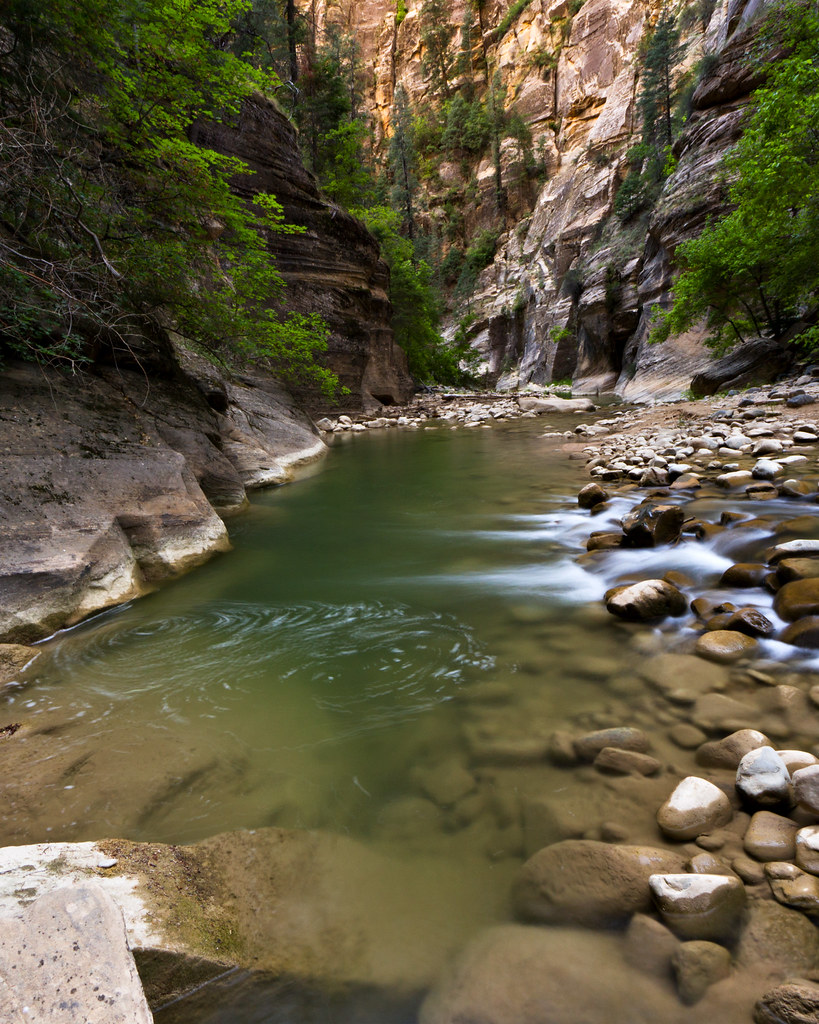
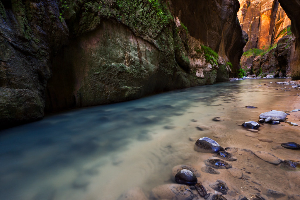
Swirls by ashergrey, on Flickr
The first campsite sits right at the confluence. We tip-toed around, not wanting to disturb anyone camped there. Site four, our site, is only a short way downstream. We arrived and pitched camp.

In keeping with the trend of stupid things going wrong, we found the site contaminated by the stench of skunk spray. It did not dissipate with time, lingering like an unwelcome in-law. We did our best to ignore it.
Jeff and I were both attempting hammock camping for the first time. He had a traditional mesh hammock, while I was trying the newly redesigned and rereleased ENO Reactor.

The Reactor's gimmick is an incorporated sleeve that allows the sleeper to insert a partially-inflated air mattress into the hammock. The nature of the design presents some problems. The mattress increases rigidity of the hammock. If you don't position it just so, it can throw the balance out of whack. Because the mattress is not providing cushioning but only a static air pocket, it is not necessary to fully or even halfway inflate it. Keeping the inflation low can help with the balance.
On the upside, the feature performs admirably at keeping the sleeper's bottom side warm. Jeff and I compared notes the next morning. He dealt with chills on his back during the night. I did not, until I opened the valve on the mattress and allowed it to deflate.
The night started quite warm. Craig, sleeping on the ground, had a nice view of a pocket of stars from his location. Unfortunately, he also had a host of mice scurrying about in the darkness. I heard one in my pack and found it had chewed through the mesh pocket on the Osprey Atmos hip pouch to access some salted almonds I'd forgotten to place in our hanging food bag.
While Jeff and Craig bedded down, I went to shoot some night shots. We were one night ahead of the supermoon but the pale light on this Friday night proved no less glorious. But since things needed to go wrong on this trip, I left my camera shooting jpegs from an earlier timelapse. To make matters worse, I shot a nice long 40 minute exposure showing the moonlight creeping into the bottom of the canyon but the battery gave out while the camera processed a dark frame for long-exposure noise reduction.
I walked away with only one usable night shot for about an hour and a half of shooting.
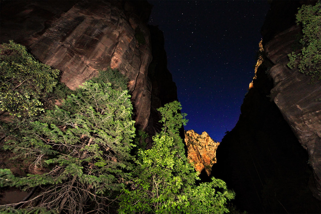
Dipper by ashergrey, on Flickr
We'd all started the night mostly uncovered. The air, though stinking of skunk, felt quite warm. That changed overnight. It fell quite chill and, as a cold sleeper, I felt gratified at the overkill of having a 15º bag. Seven a.m. came and passed. I rose but found my companions both still sleeping. Out-voted, I climbed back into the hammock and snoozed a little longer. This decision would haunt us later.
We had a leisurely breakfast after waking and took our time breaking camp. Groups from the upstream sites started to pass along the watercourse as we cinched down our packs and tucked away the human refuse bags as discreetly as possible. It still reeked of skunk.

For the next couple of hours we enjoyed a peaceful walk down the canyon, spotting lizards and birds along the way. Soft morning light hardened as it moved overhead. We counted down the passing campsites. The side canyons joining the North Fork contributed nothing. Kolob Creek was dry. Goose Creek trickled from beneath a massive logjam.
Golden by ashergrey, on Flickr
Upstream of Big Spring, we started running into day hikers. Their presence shocked and infuriated me. Park rules state day hikers are not supposed to proceed beyond Big Spring but this is unenforced. Further more, outfitters in Springdale encourage day hikers to go upstream as far as they wish. The rented Canyoneers and Zion Adventure Company hiking poles (which are cheap hardware store dowels, rented for $7 a day — what a steal!) told me all I needed to know.
Worse yet, the day hikers we found poaching the permit area wore giant smiles on their faces with no hint of shame. If they knew what they were doing was against the rules, they didn't care. It was all I could do not to yell at these people to turn around and get back down canyon.
Is trail rage a thing? I think it is.
That frustration all seemed quaint by the time we arrived at Big Spring.
Big Spring by ashergrey, on Flickr
A group of five people arrived from the bottom at the same time. I set up in the water for a long exposure shot, only to have the day hikers walk right into the frame. Annoyed, I moved and changed my angle. They walked into the frame again. More crowds started to arrive. Within minutes, the pools around Big Spring were teeming with people.
Fighting for position and angles, I waded out into a chest-deep pool with my camera. I erected the tripod while struggling against the current and fired off a series of shots from right at water level. When I turned back to shore, I gripped the tripod by the ball joint. My feet hit slick rock beneath the surface and I tripped.
My head went under as I kicked and flailed, trying to keep the camera from submerging. An ear surfaced momentarily and I heard the crowd give a communal, expectant "ohhhhhhhh…" before it dunked beneath the water again. Still I fought, my one dry arm only just holding the camera over the water like the Lady of the Lake bearing Excalibur.
When I at last trudged onto the river bank, blowing away droplets of water that streamed into my eyes, people clapped and shouted "nice save!" My response of "thanks" came through gritted teeth.
Jeff and Craig didn't say much as they lunched in the shade. We laughed when a girl came up and asked how much farther she'd need to hike to reach the waterfall. She'd seen it on the internet. She had no supplies, barely any water and an obvious, impetuous disregard for the terrain. But she'd seen it, on the internet.
At least one thing on the trip had not gone wrong. The camera survived.
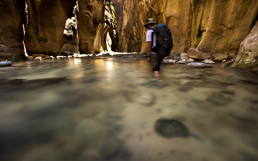
Pathfinding by ashergrey, on Flickr
The rest of the trip could be described as a race to the finish. We joked about seeing men in Euro-Speedos, then we did. We found a plastic baggie containing the personal effects of a 21-year-old California girl, including her drenched iPhone, and bore it back to the visitor center. We saw a mother posing naked children in the stream for photos and felt grateful that we'd filtered our water at the campsite, well upstream.
Moss by ashergrey, on Flickr
I timed photos between pulses of day hikers, losing a few to the blur of their bodies.
Fern by ashergrey, on Flickr
Increasingly exhausted, we marched toward the Riverside Walk. Hitting it felt like suddenly finding ourselves in Manhattan. Walking burdened with packs, we still shouldered past slow-moving shuttle bus tourists. We laughed when one man asked how far to "the end." To the end of what, we wondered, the Riverside Walk? Chamberlain Ranch? How do so many people come here in complete ignorance?
The End by ashergrey, on Flickr
Hot, sore and starving we engaged on a bit of banter while riding the shuttle bus before scarfing down a pizza at Zion Pizza & Noodle Company. Then it was off to retrieve our shuttle vehicle at Chamberlain Ranch.
We sweet-talked our way through the park entrance station (to avoid paying a second $25 entrance fee). By the time we came back through the park staff had retired for the evening. In our two cars we cruised through the park as the supermoon lit the cooling sandstone. Photographers lined the dark road, hoping to get a shot of the moon's giant disk rising over one feature or another.
Craig and I sang along to the car stereo as warm southern Utah wind rushed through the open windows. In spite of all that had gone wrong, I felt restored. Friendships eroded by time and the obligations of adult life seemed again vibrant and alive.
Forget the tourists and the skunk smell and the embarrassment of an unexpected swim. It was the new moments with old friends that I'd craved. It was sharing the experience, whatever that experience might be. And so in that sense, the trip went just right.

This is the radio piece I put together for the radio show, put to rather poorly-shot video.
[PARSEHTML]<iframe src="http://www.mappingsupport.com/p/gmap4.php?q=http://dl.dropbox.com/u/3847512/GPS/Narrows.kml&t=t4" frameborder="0" marginheight="0" scrolling="no" width="800" height="800"></iframe><br><br>[/PARSEHTML]I only tracked the first day of our trip, since the path is well known and the narrow walls kind of make GPS tracking pointless in the lower Narrows.
Featured image for home page:

I found myself repeating that line to coworkers, explaining my enthusiasm for a long-planned backpacking trip along the North Fork of the Virgin.
Obstruction by ashergrey, on Flickr
As a hiker and backer, not to mention as a person in general, I tend to appreciate solitude. When I venture into the outdoors, I march into the expanse solo or in the company of a small group of friends.
The experiences I crave come in the quiet moments, when the entire Earth seems to unfold. I'll never rise early to watch the first early fingers of sunlight pierce a city street. I will, however, sit in silence alongside a chilly lake shore, breathing in the fogged remainders of last night's embers as the sun crests a far ridge and creeps along the ground like a stealthy reptile.
These moments only happen in the quiet stillness that occurs away from crowds.
Canyon Glow by ashergrey, on Flickr
As such, knocking the through-hike of the Narrows off the to-do list had not been a high priority.
But I also hike to share, dragging a camera and tripod and at times cursing their bulk and weight. More directly, I enjoy the frank discussions the trail tends to engender. I've come to know siblings and friends alike better over miles of hard packed Uinta dirt and Navajo sandstone.
One of my oldest and best friends has accompanied me to the top of Kings Peak and to the bottom of Ashdown Gorge in recent years, among other places. In fact, during May of 2012 Jeff and I looked across the sprawling high country north of Zion National Park from the North Fork of the Virgin's headwaters at Cascade Falls.
Cascade Falls by ashergrey, on Flickr
Jeff and I go back to the 3rd grade. Another of our good friends had been excluded from these excursions and I hoped to rectify that. The lure of an iconic destination would make that an easier sell. So was born the plan for a June descent of the Narrows.
With commitments from Jeff and Craig, I went about the process of securing the permit. On the 5th of April, I sat habitually refreshing my browser on the park's backcountry reservation page. It took roughly 40 minutes for campsites to become available. Within moments, I'd locked in site five, entered my credit card information and confirmed the permit reservation.
Then, the problems started. First I received an email stating the reservation system had double-booked site five. As a result, the backcountry desk was moving the reservation to site four.
I felt frustrated and dumbfounded. The process of reserving the site had gone smoothly. The website never hiccuped, though it did take forever to become available. The park does not take online reservations for site four. I feared arriving the morning of our trip to pick up the permit, only to have the ranger apologize and say it had been awarded to a walk-in visitor the day prior.
This is all the reassurance the park staff would provide.
We'd selected the date as a balance between the summer heat, threat of later season monsoons and the end of the spring runoff. As bad luck would have it, the runoff petered out in a matter of days a month prior to the trip. But come hell or low water, we were locked in for the Narrows.
But first, we had to deal with being locked out.
I picked Craig up from Sandy, Utah after finishing my work shift on Thursday, June 20. We hoped to make good time down to St. George, where we'd overnight at Jeff's place. Unfortunately, I managed to lock my keys in the trusty Subaru while stopping to grab food.
An hour and $60 to the locksmith later, we were on our way. The delay meant we didn't get into St. George until well after midnight. We had a short night, waking early Friday to make an 8 a.m. appointment at the visitor center.
I'd arranged to interview one of Zion National Park's wilderness rangers about management challenges on the North Fork for a special piece I planned for KSL Newsradio's weekend Outdoors show. When that formality finished, we were at last headed for Chamberlain Ranch.
Warm temps and stunning blue skies abounded as we pounded through the first few dry miles.
In our heads, we dreamed of the deep canyons to come full of pools and reflected light.
Upstream by ashergrey, on Flickr
We'd each only ever approached the Narrows from the traditional, tourist-crowded bottom-up route. The uplands here outside the park's boundary were a welcome change. We saw a total of two people and only from a distance. Our voices were the only sound aside from the occasional call of a bird or the gurgling of the stream.
That is, until the stream stopped. At one point we turned a corner in the canyon and something caught my attention. I told Jeff and Craig to stop, asking if they noticed anything.
"Where did the water go?"
We turned around and walked back to find the place where the tepid stream went underground or filtered through the pebbled bottom to some unseen seep. Instead, we found the water fingering its way slowly forward. It clawed across rocks, pooling in places until enough gathered to push forward again. The "river" had the unsteady pace of a toddler just learning to walk.
In our haste, we'd caught up to the toe of the creek.
Utah had entered a second year of drought in 2013 and here we stared disappointedly at the results.
For the next several miles, we walked over dry fields of rocks and across mud bogs devoid of running water.
Upper Narrows by ashergrey, on Flickr
I felt cheated. Here I'd hoped to share an amazing experience in the backcountry with two friends.
Instead we slogged through a dry canyon, nervous at how long the underwhelming conditions would persist.
Even the highlight of the upper Narrows, the small waterfall, disappointed. It had diminished to a mere cesspool headed by a bunch of boulders and logs. I had looked forward to photographing the water pouring over the lip. Instead I soaked in some sunlight and fought to keep my commentary from becoming too acerbic.
Respite by ashergrey, on Flickr
At times a warm wind would filter through the canyon, rustling the pines. Hopeful, we'd mistake the sound for moving water.
Our best chance for regaining any semblance of the promised wet hike would come at the confluence with Deep Creek. Its thunder sounded in our ears about 100 yards upstream of where it joins the North Fork. We were doubtful, having been fooled by the wind too many times already.
It wasn't until we set eyes on the moving water again that our hopes to soared.
Cool water soothed our feet and scared away the sweat. We traded dust and mud for mossy rocks. At last, we were in the traditional Narrows.
Swirls by ashergrey, on Flickr
The first campsite sits right at the confluence. We tip-toed around, not wanting to disturb anyone camped there. Site four, our site, is only a short way downstream. We arrived and pitched camp.
In keeping with the trend of stupid things going wrong, we found the site contaminated by the stench of skunk spray. It did not dissipate with time, lingering like an unwelcome in-law. We did our best to ignore it.
Jeff and I were both attempting hammock camping for the first time. He had a traditional mesh hammock, while I was trying the newly redesigned and rereleased ENO Reactor.
The Reactor's gimmick is an incorporated sleeve that allows the sleeper to insert a partially-inflated air mattress into the hammock. The nature of the design presents some problems. The mattress increases rigidity of the hammock. If you don't position it just so, it can throw the balance out of whack. Because the mattress is not providing cushioning but only a static air pocket, it is not necessary to fully or even halfway inflate it. Keeping the inflation low can help with the balance.
On the upside, the feature performs admirably at keeping the sleeper's bottom side warm. Jeff and I compared notes the next morning. He dealt with chills on his back during the night. I did not, until I opened the valve on the mattress and allowed it to deflate.
The night started quite warm. Craig, sleeping on the ground, had a nice view of a pocket of stars from his location. Unfortunately, he also had a host of mice scurrying about in the darkness. I heard one in my pack and found it had chewed through the mesh pocket on the Osprey Atmos hip pouch to access some salted almonds I'd forgotten to place in our hanging food bag.
While Jeff and Craig bedded down, I went to shoot some night shots. We were one night ahead of the supermoon but the pale light on this Friday night proved no less glorious. But since things needed to go wrong on this trip, I left my camera shooting jpegs from an earlier timelapse. To make matters worse, I shot a nice long 40 minute exposure showing the moonlight creeping into the bottom of the canyon but the battery gave out while the camera processed a dark frame for long-exposure noise reduction.
I walked away with only one usable night shot for about an hour and a half of shooting.
Dipper by ashergrey, on Flickr
We'd all started the night mostly uncovered. The air, though stinking of skunk, felt quite warm. That changed overnight. It fell quite chill and, as a cold sleeper, I felt gratified at the overkill of having a 15º bag. Seven a.m. came and passed. I rose but found my companions both still sleeping. Out-voted, I climbed back into the hammock and snoozed a little longer. This decision would haunt us later.
We had a leisurely breakfast after waking and took our time breaking camp. Groups from the upstream sites started to pass along the watercourse as we cinched down our packs and tucked away the human refuse bags as discreetly as possible. It still reeked of skunk.
For the next couple of hours we enjoyed a peaceful walk down the canyon, spotting lizards and birds along the way. Soft morning light hardened as it moved overhead. We counted down the passing campsites. The side canyons joining the North Fork contributed nothing. Kolob Creek was dry. Goose Creek trickled from beneath a massive logjam.
Golden by ashergrey, on Flickr
Upstream of Big Spring, we started running into day hikers. Their presence shocked and infuriated me. Park rules state day hikers are not supposed to proceed beyond Big Spring but this is unenforced. Further more, outfitters in Springdale encourage day hikers to go upstream as far as they wish. The rented Canyoneers and Zion Adventure Company hiking poles (which are cheap hardware store dowels, rented for $7 a day — what a steal!) told me all I needed to know.
Worse yet, the day hikers we found poaching the permit area wore giant smiles on their faces with no hint of shame. If they knew what they were doing was against the rules, they didn't care. It was all I could do not to yell at these people to turn around and get back down canyon.
Is trail rage a thing? I think it is.
That frustration all seemed quaint by the time we arrived at Big Spring.
Big Spring by ashergrey, on Flickr
A group of five people arrived from the bottom at the same time. I set up in the water for a long exposure shot, only to have the day hikers walk right into the frame. Annoyed, I moved and changed my angle. They walked into the frame again. More crowds started to arrive. Within minutes, the pools around Big Spring were teeming with people.
Fighting for position and angles, I waded out into a chest-deep pool with my camera. I erected the tripod while struggling against the current and fired off a series of shots from right at water level. When I turned back to shore, I gripped the tripod by the ball joint. My feet hit slick rock beneath the surface and I tripped.
My head went under as I kicked and flailed, trying to keep the camera from submerging. An ear surfaced momentarily and I heard the crowd give a communal, expectant "ohhhhhhhh…" before it dunked beneath the water again. Still I fought, my one dry arm only just holding the camera over the water like the Lady of the Lake bearing Excalibur.
When I at last trudged onto the river bank, blowing away droplets of water that streamed into my eyes, people clapped and shouted "nice save!" My response of "thanks" came through gritted teeth.
Jeff and Craig didn't say much as they lunched in the shade. We laughed when a girl came up and asked how much farther she'd need to hike to reach the waterfall. She'd seen it on the internet. She had no supplies, barely any water and an obvious, impetuous disregard for the terrain. But she'd seen it, on the internet.
At least one thing on the trip had not gone wrong. The camera survived.
Pathfinding by ashergrey, on Flickr
The rest of the trip could be described as a race to the finish. We joked about seeing men in Euro-Speedos, then we did. We found a plastic baggie containing the personal effects of a 21-year-old California girl, including her drenched iPhone, and bore it back to the visitor center. We saw a mother posing naked children in the stream for photos and felt grateful that we'd filtered our water at the campsite, well upstream.
Moss by ashergrey, on Flickr
I timed photos between pulses of day hikers, losing a few to the blur of their bodies.
Fern by ashergrey, on Flickr
Increasingly exhausted, we marched toward the Riverside Walk. Hitting it felt like suddenly finding ourselves in Manhattan. Walking burdened with packs, we still shouldered past slow-moving shuttle bus tourists. We laughed when one man asked how far to "the end." To the end of what, we wondered, the Riverside Walk? Chamberlain Ranch? How do so many people come here in complete ignorance?
The End by ashergrey, on Flickr
Hot, sore and starving we engaged on a bit of banter while riding the shuttle bus before scarfing down a pizza at Zion Pizza & Noodle Company. Then it was off to retrieve our shuttle vehicle at Chamberlain Ranch.
We sweet-talked our way through the park entrance station (to avoid paying a second $25 entrance fee). By the time we came back through the park staff had retired for the evening. In our two cars we cruised through the park as the supermoon lit the cooling sandstone. Photographers lined the dark road, hoping to get a shot of the moon's giant disk rising over one feature or another.
Craig and I sang along to the car stereo as warm southern Utah wind rushed through the open windows. In spite of all that had gone wrong, I felt restored. Friendships eroded by time and the obligations of adult life seemed again vibrant and alive.
Forget the tourists and the skunk smell and the embarrassment of an unexpected swim. It was the new moments with old friends that I'd craved. It was sharing the experience, whatever that experience might be. And so in that sense, the trip went just right.
This is the radio piece I put together for the radio show, put to rather poorly-shot video.
[PARSEHTML]<iframe src="http://www.mappingsupport.com/p/gmap4.php?q=http://dl.dropbox.com/u/3847512/GPS/Narrows.kml&t=t4" frameborder="0" marginheight="0" scrolling="no" width="800" height="800"></iframe><br><br>[/PARSEHTML]I only tracked the first day of our trip, since the path is well known and the narrow walls kind of make GPS tracking pointless in the lower Narrows.
Featured image for home page:
