Ben
Member
- Joined
- Sep 12, 2014
- Messages
- 1,873
Back in july my girl and i went down to San Francisco to visit her grandparents. On the way there we were able to camp for two nights in Yosemite, and do a little hiking. Not quite as much as i would have liked, but you know, it's never enough.
We slept at a rest stop on the way down, and then got into the park the next morning. We camped at Tamarack Flat, because it is a first come first served campground, and it had space there. We hadn't planned on this trip, the time off had been a surprise, so we had no reservations. I liked Tamarack Flat better than Wawona, where we stayed last year. It's more removed from the road, and the bustle. But it's still a little bit of a drive from destinations in the valley, if that's where you're going. The drive down from Tioga road to the actual campground was exciting every time though. Very windy, RVs and trailers not recommended. It is a wise recommendation.
Any way, the first day there, after settling in for a minute, we went down to go hike up Yosemite Falls. I wanted to see it. It's just 3.6 miles to the top of the falls, but the trail gains 2700' of elevation.
Also, due to some minor battery problems, almost all of these pictures were taken on my girl's iphone.
View of Half Dome, not too far along the Yosemite Falls Trail.
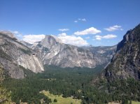
Half Dome, and Glacier Point on the right. I'd hiked up to Half Dome the summer before this, and one of the things that i liked best about the Yosemite Falls trail was the different perspective it gave of the whole valley. Also, from certain points, we were able to look down on the swimming pool at the Ahwanee Hotel. It was over 90 degrees out on this after noon hike.

This was our first view coming up on Yosemite Falls. It's 2400' tall, but doesn't flow year round. The trail ascends to the left of the falls up nice switch backs through a break in the wall.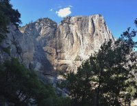
Nearer the falls.
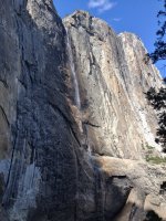
An other good view over the valley.
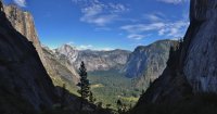
A couple hours later we made it to the top of the trail by this big tree. Great views. We made decent time, may be two and a half hours.
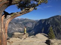
We went and hung out in the pools above the actual fall.
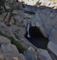
It was really nice. Relaxing, cool, there was no one else around here.
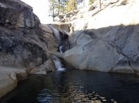
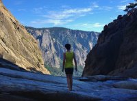
Above the pools we were at were more people, near where the trail continues and crosses Yosemite Creek.
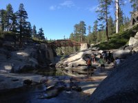
Looking back down.
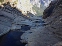
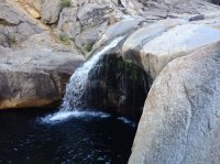
I enjoyed scrambling around between them.
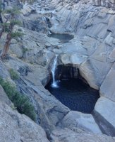
I walked all the way out to the brink of the falls. It was pretty crazy. But no good picture came of it.
The hike back down took a long time. Brittinei's knee was bothering her, and so was the heat a little bit. Though not as bad as on the way up. We made it down after sun set, but before dark. We went a lot slower on that descent.
The next day i wanted to do a longer hike, about 12 miles. We had all day to do it. After chocolate chip pancakes and bacon we went to go hike from Happy Isles, up the Mist Trail past Vernal and Nevada Falls, and along the Panorama Cliff to Glacier Point. We had done part of this hike, the Mist Trail, along the falls, the year before, on the way to Half Dome. But it's nice, and i wanted to do it again.
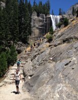
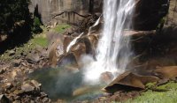
Vernal Falls. There is a hint in this picture of how many people are along this part of the trail. Most of them turn back around here though. And above Nevada Falls there is hardly any one.
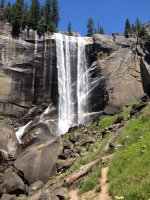
This picture is from july. The year before, we went here in june, and i was amazed at how much less water there was flowing over the falls. But then, this year was a pretty sever drought.
The base of Vernal Falls.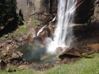
Looking up the trail at Nevada Falls. I like Nevada better than Vernal, but the view from the trail isn't quite as head on.
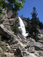
From the top of Nevada Falls. From here we would hike along the left side of the picture to the point in the center.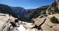
Stopping along the river above the falls.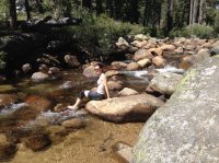
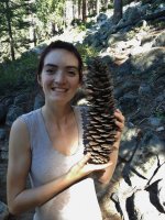
Also, they have these things in Yosemite. The pine cones.
We hiked up nice clean switch backs again from Nevada Falls. If i remember correctly, a lot of the trail was still paved even. Most of this stretch was through trees that blocked views, but there occasioned views like this of Half Dome from the back side. It looks like an elephant. Sub Dome is it's shoulder on the right.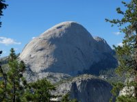
Eventually the trail comes around back down to Illouete Creek. You can see the creek's valley for a long ways coming, and the trail going back up on the other side. We stopped by the creek for a while and ate and played around some more. There was a nice bridge there. This was one of the nicest spots we stopped at. We saw less than five people the whole time we were there, and two of them were a nice couple from Chile and Spain now living in New York together that we talked to for a while.
Just the other side of the creek there is a good view of Illouete Falls from the trail, or near the trail.
Beyond Illouete Creek, on the Glacier Point side, there are less trees, and the views are more open.
You end up getting to see Half Dome in profile.
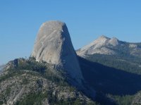
And here is Half Dome with the Merced River running through the center. You can see Vernal and Nevada Falls if you look, descending the Grand Staircase of the Merced. Panorama Cliff that we hiked above on the right.
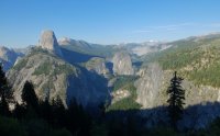
Zoomed in with Nevada Falls. The trail goes up the cut to the left of it.
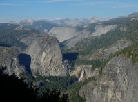
Not far from Glacier Point. You can see Tenaya Canyon to the left of Half Dome. It's a good view of the whole country here.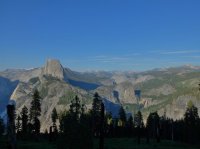
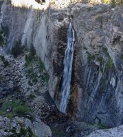
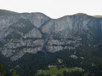
Here's an over exposed view, coming down from Glacier Point, of where we hiked the day before. Yosemite Creek comes out of the low point in the center, making the grayer trail down the wall where it's wet from the spray. The darker green that cuts diagonally from the low point there is where the trail runs up.
Once we'd arrived at Glacier i left my girl friend there. It was getting slightly late, and i was worried about how long it would take her to hike back down from the top to our car in the valley, especially with how much worse going down hill was on her knee. It's just 3000' of descent, in little more than three miles. So i ran down most of it alone. When i got to the valley floor, i found that the buses weren't running there at that time, so i had to go an other mile or so to where the valley buses were running. And once i got to my car i drove all the way around to Glacier Point. It took me a couple good hours, and it was dark by the time i got up there, and Brittinei was cold then. I don't know for sure if i made the right decision having her wait for me there, but i think i did.
One other thing that i will say about both of these hikes is that it was hot out, and both days we ended up giving some of our water to other hikers near the end of the trail who were running low. They would have made it out ok, but not comfortably. It was hot. I brought a full gallon along, more on the second hike, just to be safe. And it paid off for some people we passed by.
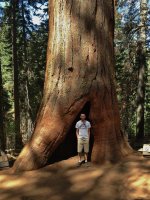
On the way out the next morning we stopped and walked through Tuolumne Grove, where there are a few sequoias. Pretty short hike. It was on our way. It's hard to photograph them well, or it's hard to me to photograph them well.
Those are full size trees behind this one.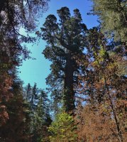
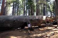
It's a little easier to get a perspective of them once they're down on their side, with a person in front of them.
That's it.
Featured image for home page:
We slept at a rest stop on the way down, and then got into the park the next morning. We camped at Tamarack Flat, because it is a first come first served campground, and it had space there. We hadn't planned on this trip, the time off had been a surprise, so we had no reservations. I liked Tamarack Flat better than Wawona, where we stayed last year. It's more removed from the road, and the bustle. But it's still a little bit of a drive from destinations in the valley, if that's where you're going. The drive down from Tioga road to the actual campground was exciting every time though. Very windy, RVs and trailers not recommended. It is a wise recommendation.
Any way, the first day there, after settling in for a minute, we went down to go hike up Yosemite Falls. I wanted to see it. It's just 3.6 miles to the top of the falls, but the trail gains 2700' of elevation.
Also, due to some minor battery problems, almost all of these pictures were taken on my girl's iphone.
View of Half Dome, not too far along the Yosemite Falls Trail.

Half Dome, and Glacier Point on the right. I'd hiked up to Half Dome the summer before this, and one of the things that i liked best about the Yosemite Falls trail was the different perspective it gave of the whole valley. Also, from certain points, we were able to look down on the swimming pool at the Ahwanee Hotel. It was over 90 degrees out on this after noon hike.

This was our first view coming up on Yosemite Falls. It's 2400' tall, but doesn't flow year round. The trail ascends to the left of the falls up nice switch backs through a break in the wall.

Nearer the falls.

An other good view over the valley.

A couple hours later we made it to the top of the trail by this big tree. Great views. We made decent time, may be two and a half hours.

We went and hung out in the pools above the actual fall.

It was really nice. Relaxing, cool, there was no one else around here.


Above the pools we were at were more people, near where the trail continues and crosses Yosemite Creek.

Looking back down.


I enjoyed scrambling around between them.

I walked all the way out to the brink of the falls. It was pretty crazy. But no good picture came of it.
The hike back down took a long time. Brittinei's knee was bothering her, and so was the heat a little bit. Though not as bad as on the way up. We made it down after sun set, but before dark. We went a lot slower on that descent.
The next day i wanted to do a longer hike, about 12 miles. We had all day to do it. After chocolate chip pancakes and bacon we went to go hike from Happy Isles, up the Mist Trail past Vernal and Nevada Falls, and along the Panorama Cliff to Glacier Point. We had done part of this hike, the Mist Trail, along the falls, the year before, on the way to Half Dome. But it's nice, and i wanted to do it again.
Vernal Falls. There is a hint in this picture of how many people are along this part of the trail. Most of them turn back around here though. And above Nevada Falls there is hardly any one.


This picture is from july. The year before, we went here in june, and i was amazed at how much less water there was flowing over the falls. But then, this year was a pretty sever drought.
The base of Vernal Falls.

Looking up the trail at Nevada Falls. I like Nevada better than Vernal, but the view from the trail isn't quite as head on.

From the top of Nevada Falls. From here we would hike along the left side of the picture to the point in the center.

Stopping along the river above the falls.

Also, they have these things in Yosemite. The pine cones.

We hiked up nice clean switch backs again from Nevada Falls. If i remember correctly, a lot of the trail was still paved even. Most of this stretch was through trees that blocked views, but there occasioned views like this of Half Dome from the back side. It looks like an elephant. Sub Dome is it's shoulder on the right.

Eventually the trail comes around back down to Illouete Creek. You can see the creek's valley for a long ways coming, and the trail going back up on the other side. We stopped by the creek for a while and ate and played around some more. There was a nice bridge there. This was one of the nicest spots we stopped at. We saw less than five people the whole time we were there, and two of them were a nice couple from Chile and Spain now living in New York together that we talked to for a while.
Just the other side of the creek there is a good view of Illouete Falls from the trail, or near the trail.

Beyond Illouete Creek, on the Glacier Point side, there are less trees, and the views are more open.
You end up getting to see Half Dome in profile.

And here is Half Dome with the Merced River running through the center. You can see Vernal and Nevada Falls if you look, descending the Grand Staircase of the Merced. Panorama Cliff that we hiked above on the right.

Zoomed in with Nevada Falls. The trail goes up the cut to the left of it.

Not far from Glacier Point. You can see Tenaya Canyon to the left of Half Dome. It's a good view of the whole country here.

Here's an over exposed view, coming down from Glacier Point, of where we hiked the day before. Yosemite Creek comes out of the low point in the center, making the grayer trail down the wall where it's wet from the spray. The darker green that cuts diagonally from the low point there is where the trail runs up.

Once we'd arrived at Glacier i left my girl friend there. It was getting slightly late, and i was worried about how long it would take her to hike back down from the top to our car in the valley, especially with how much worse going down hill was on her knee. It's just 3000' of descent, in little more than three miles. So i ran down most of it alone. When i got to the valley floor, i found that the buses weren't running there at that time, so i had to go an other mile or so to where the valley buses were running. And once i got to my car i drove all the way around to Glacier Point. It took me a couple good hours, and it was dark by the time i got up there, and Brittinei was cold then. I don't know for sure if i made the right decision having her wait for me there, but i think i did.
One other thing that i will say about both of these hikes is that it was hot out, and both days we ended up giving some of our water to other hikers near the end of the trail who were running low. They would have made it out ok, but not comfortably. It was hot. I brought a full gallon along, more on the second hike, just to be safe. And it paid off for some people we passed by.
On the way out the next morning we stopped and walked through Tuolumne Grove, where there are a few sequoias. Pretty short hike. It was on our way. It's hard to photograph them well, or it's hard to me to photograph them well.
Those are full size trees behind this one.

It's a little easier to get a perspective of them once they're down on their side, with a person in front of them.


That's it.
Featured image for home page:

Last edited:
