- Joined
- Dec 23, 2013
- Messages
- 4,110
I was going to post the entire report as one report, but as I was working on day seven, I reached the maximum limit for uploading images, so this part will be days one through six, and I'll finish seven through ten in a different report.
Come November, after my last backpacking trip in October (and watching Jeremiah Johnson of course), I start settling in and begin thinking about what to do for the next year. There are a few things that go into my decision making, things like what distance do I want to do, rough terrain or easy, and generally how I think my body will hold up 9 months into the future. I'm not a spring chicken anymore and dealing with little aches and pains is probably the definitive factor on what I think I can accomplish as far as backpacking is concerned.
So after a bit of contemplation, I decided that I'd like to see the Thorofare, which is located south of Yellowstone Lake (probably don't need to tell this crowd where it is) one more time before I hang my hiking boots and backpack on a couple pegs downstairs for the last time. Now if you count my canoe trips in the past that included day hikes, I've been into and through the Thorofare four times in the past. The Thorofare is a special place in my book, with some of the wildest country in the lower 48, and certainly worth your time to visit if you have yet to do so.
My outlaw partner the last few years has been the infamous @TractorDoc, so I floated the idea past him to see if he might be interested. This would have to be a shuttle trip, putting in at Yellowstone Lake, and exiting at Brooks Lake just south of the Teton Wilderness. The total mileage was somewhere in the neighborhood of 85 to 90 miles depending on our exact route.
Dave gave it some thought and decided that if we could do the trip in August that he could probably pull it off. Since I had promised @wsp_scott that he would see a bear on our Hayden Valley day hike a couple of years ago, I felt it was only right to invite him along since we whiffed on the bears that day in Hayden. Scott checked his schedule and decided he would join us on our merry adventure. I also let @Bob know of my attentions, but at the time Bob was planning an adventure of his own, starting out in the Washakie Wilderness, heading into Hidden Creek, and up and over the mountains, dropping down into the North Fork of the Yellowstone before heading back out. Fortunately for us, Bob's potential backpacking partners had to back out of his trip which freed up his time to join us instead.
So now that we had our fellowship, we set the dates for August 8th through the 18th, with the 8th being the day we would travel to Yellowstone to meet up, and the 9th being the day we actually headed into the backcountry.
Those unfortunate enough to read the pre-trip hype on this one know how we were approaching getting ready for our trip.") I think I finally weighed in at 55 pounds for my pack. This included water, food, gear and two cameras. I think I had originally weighed in at 54, but I forgot some beef jerky, and some crystallized ginger when I stepped on the scales the first time.
I think I finally weighed in at 55 pounds for my pack. This included water, food, gear and two cameras. I think I had originally weighed in at 54, but I forgot some beef jerky, and some crystallized ginger when I stepped on the scales the first time.
So let's see if this old mule has one trip report left in him and get down to business of writing this thing up. Again, it's going to be long report, so if you start reading it here at the end of summer, it might be mid-fall before you finish it up. I hope that I can do the route/terrain we covered justice on this one.
I might mention that I took over three thousand pictures over ten days, and the two cameras I used were the Canon EOS 90D, and the Canon PowerShot SX730 HS. I think I took about one hundred more with the 90D than I did with the PowerShot, so it was fairly even on which camera got the most use.
Well, let's get after it as they say.
Day before the Big Trip
On the 8th, I drove up to the Brooks Lake Trailhead, and met Bob and his wife, you shuttled me over to West Yellowstone to meet up with Dave and Scott. On our way through the Park, we picked up our official permit for the nights we were camping in the backcountry. Bob was heading back to Island Park for one more night in his own bed, while Dave, Scott and I would head to Lake to stay at some rented cabins for the night. We would all meet at Bridge Bay the morning of the 9th to start our trip. Before all that though, we met up at the Buffalo Bar in West Yellowstone for dinner.

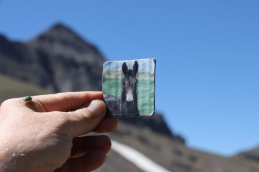
Mules at the Brooks Lake Lodge. I just couldn't pass them up.

Looks like he is getting a bit agitated. I saw a moose like that once, just before it charged me.

View of Brooks Lake, while I waited for Bob to pick me up

The Subaru parked at the trailhead. It's going to have to be lonely for ten days.

Info sign at the trailhead

Picked up our permit at the Ranger Station on our way to West Yellowstone, for our campsites in the park

My gracious shuttlers

Remember, don't drink downstream from the buffalo!

The Hog Trough Nachos were on my radar for dinner. I didn't eat all the fresh jalapeños though, as I was afraid of the repercussions
the next day.

Don't remember what these gents were eating, so they will have to tell you themselves
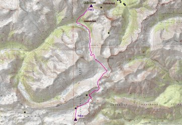
Day 1 - Campsite 5E6 to campsite 5E1 - 8.6 miles
I need to back up a little before moving on to day one. At first, I had the idea to hike down the east side of Yellowstone Lake before heading out into the Thorofare. @TractorDoc had the idea of taking a boat ride across the lake to campsite 5E6 and starting from there. Now I have seen three black bears along the trail on the east side of the lake and didn't want to miss an opportunity to see one again, but Tractordoc convinced me that taking the boat ride would allow us one more day in the Thorofare and maybe allow us to see some remote backcountry waterfalls, so in the end I acquiesced.
We got up early on the 9th and ate a buffet breakfast at the Lake Hotel before heading over to Bridge Bay to meet Bob and catch our boat. Besides the ride across the lake which took approximately 30 minutes, we would then hike 8.6 miles to campsite 5E1. Wildflowers were in bloom and I was eager to get some pictures, so you'll see a lot of images on day one.

Boat ride overview. The route is just an approximation.

Overview map for day 1

Sunrise at Lake cabins in Yellowstone

Heading to breakfast before our boat ride

The last boat at the dock would be our ride

Ready to board with captain John Mississippi

Stevenson Island out ahead. Speaking of heads, who's head is that out front?

Bob seems cool as a cucumber

Approaching the Southeast Arm of Yellowstone Lake. It seems a bit choppy in the channel to me.

Time for the land part of our route

John Mississippi heading back to pick up more passengers

Bob, doing the James Brown moon walk before setting off along the trail.

Dave seems a wee bit excited to get going.


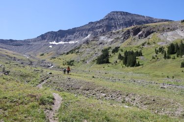
Right off we encountered these guys. What a way to start the trip!

Lupine along the trail

Already trying to figure out where we are. Taking a quick rest on Nine Mile Trail

It didn't take long to run into these

Fireweed along the trail

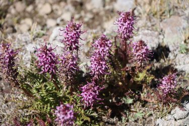
Monkshood

What! More mules! This trip was bordering on epicness already.

Nine Mile Trail. I think @TractorDoc 's pack weighed in around 60 pounds.

Geranium

Yarrow

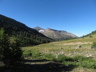
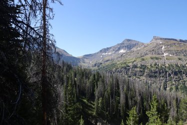
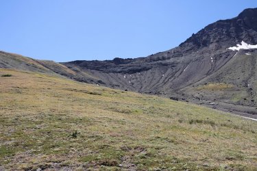
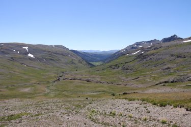
Finally we broke out of the trees to a view of the southern portion of the Southeast Arm and Two Ocean Plateau

The view ahead as we work our way towards the Thorfare

Pretty sulphur buckwheat

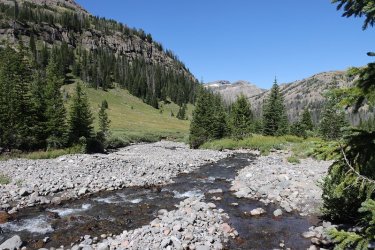
The Yellowstone River Delta and the Thorofare

Canadian Geese enjoying the day

View to the south, down the Thorofare

I call this Lupine Shadow

Arriving at the spur trail to our campsite

Fleabane was abundant

Arriving at 5E1. While this campsite had a nice view, getting to the water source was not optimal, being a long distance from camp

View to the east from 5E1

Dinner for night one. It was the first time that I tried this, and I liked it.

Beaverdam Creek, our distant water source

Some brave chipmunks that I ran into on my way back to camp from getting water. They didn't move an inch as I passed by them

Close up of third chipmunk
Day 2 - Campsite 5E1 to Campsite 6D2 - 9.01 miles
I promised everyone that we wouldn't get any rain on this trip, so you can imagine my surprise when it sprinkled on us just before everyone got up in the morning. Thankfully it didn't last long and would be the beginning of a eight day stretch with no rain.
Today's route would take us deeper into the Thorofare, with several creek crossings to contend with, and glimpses of the Yellowstone River on our way to 6D2.

Overview map for day 2

Can you make out the Southeast Arm Ranger Station in the distant trees? Zoomed shot from 5E1

Breakfast after a short shower

Not sure what type of butterfly this is. Anyone know?

Bob, preparing to cross Beaverdam Creek

Tractordoc showing us how it is done

Heading into some willows

Looking north towards Langford Cairn, the leftmost hump on the ridge

A common occurrence

Mariposa Lily

Typical Thorofare fare

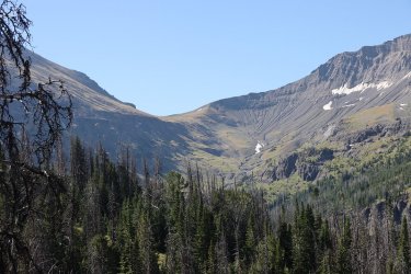
Looking southwest across the Thorofare towards Two Ocean Plateau

I'm beginning to sense a common theme.

Junction sign

We saw plenty of frogs on this trip

The Yellowstone River. Check out the large log jam left of center.

More chipmunk action

More Yellowstone River too

Wild rose

A white lupine. @Rockskipper is that like seeing a white bison?

Bob on the Thorofare Trail

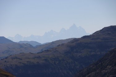
Mountains to the east

Clover

Trappers Creek

The Thorofare Trail

Looking back towards Turret Mountain

Junction sign for the Mountain Creek Trail

Mountain Creek

Bob crossing Mountain Creek

Confusing, at least for me, campsite sign for 6D2

Scott on Mountain Creek, the water source for 6D2.

Dinner time.
I didn't particularly like 6D2. The water source was fine and the views were reasonable, but there was only one good tent site at the camp.

Dinner for night two

I thought this log end was interesting

I hiked down after dinner to see what tomorrow's crossing of Mountain Creek looked like

Dave, looking for a good shot at 6D2
Day 3 - Campsite 6D2 to Campsite 6Y2 - 9.47 miles
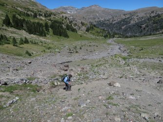
Today's route would take us further south through the Thorofare, and the west along the South Boundary Trail to campsite 6Y2, located on the Yellowstone River. While heading south, we off-trailed it to check out the waterfall on Cliff Creek called Mist of Trident Falls. The hiking along the South Boundary Trail was mostly through willows, and at one point due to excessive marshiness, we had to bushwhack south a bit to find a spot to get over a creek, and then make our way back north to the trail. I also got to see my first beaver trails as we approached 6Y2. @TractorDoc and @wsp_scott got to see a beaver later that night, but I had to be satisfied with their trails through the low lying willows.

Day 3 overview map

Morning at 6D2

Bob, fording Mountain Creek

Scott, giving it a go

Nice big print this time

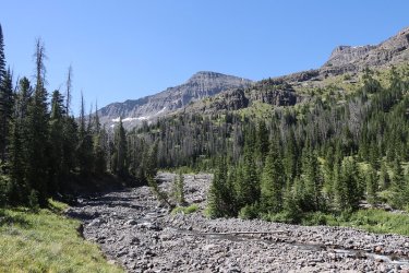
View to the west across the Thorofare

Looking back to the north from whence we came

Wolves too

@TractorDoc in the Thorofare

Yellowstone River

Paintbrush

More Thorofare expanse

The Yellowstone River

View back to the east from the trail towards The Trident

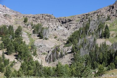
Off-trailing it to the falls

This required some contortional skills

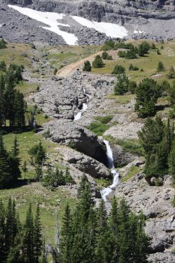
Mist of Trident Falls

View looking down from on top of the falls

View of the southern end of the Thorofare from the top of the falls

Time to head back and find Bob

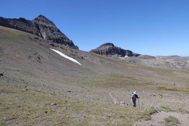
Back on the trail with Hawks Rest in the distance to the left

View to the east from the trail

Close to the Thorofare Ranger Station, but that would be tomorrow's treat.

The Thorofare Trail

Hawks Rest

Arriving at Thorofare Creek

Fording Thorofare Creek

Found this on the other side of the creek hanging in a tree. The can was half empty. Did someone
spray a bear?

Looking back east at a potion of The Trident

View to the southwest

The Yellowstone River and Hawks Rest

The bear pole at 6Y2

My tent at 6Y2

Dinner for night three - one of my favorites.

I think this was the spot that Dave and Scott would see the beaver later in the evening.

Monkshood at camp
Day 4 - Campsite 6Y2 to Campsite on Open Creek in the Teton Wilderness - 9.63 miles
Day four was originally supposed to go all the way to Hidden Creek in the Teton Wilderness. Remember Bob's original plans before joining our group? We'll, we thought that we would meet up with Bob and his entourage at Hidden Creek and do a day hike with his group up the valley before they went up and over to the North Fork of the Yellowstone. Now going all the way to Hidden Creek from 6Y2 would add a couple more miles to our total, so when Dave and Scott invited me to hike to Isolation Falls in the morning, i declined feeling that I could not make it to the falls, and then manage to get all the way to Hidden Creek on the same day.
Isolation Falls by the way is supposed to be the most isolated falls in Yellowstone National Park. So if you want to see some beautiful shots of Isolation, you'll have to wait for Dave's and Scott's trip reports to see it. It was the reason we chose campsite 6Y2 in the first place, but I just couldn't see myself adding it to a long day.
So as Dave and Scott headed off to the falls, Bob and I packed up and head back the way we had come the day before. This time though we would cut over to the Thorofare Ranger Cabin which I have been told that it is the most remote (furthest from a road) location in the lower 48. Even though I have backpacked through the Thorofare before, I had never made it to the Ranger's Cabin, so I was excited to see it and check it off my bucket list.
We had told Dave and Scott that we would wait for 20 minutes at the cabin for them, and then if they didn't show we would wait twenty more at the park boundary, and if they were still no shows, we would wait for them at the trail intersection coming up from Bridger Lake, where at this point we were making our way up the Thorofare Creek Trail.
We ended up staying about an hour at the cabin, and just as we were putting our packs on and getting ready to leave, they both showed up. We cut the day short though when we got to Open Creek and decided to pitch camp there instead of continuing on to Hidden Creek.

Overview map for day 4

Yellowstone River in the morning

Bob, all packed up and ready to head out

Looking back west from the South Boundary Trail

Crossing Thorofare Creek again. We chose a different crossing point on our way back which made the ford a bit easier.

The Ranger Station is that way

View to the north up the Thorofare

Beavers are active in the Thorofare

The Thorofare Ranger Station

The barn at the station

And of course, the outhouse

I recorded in the log book about the two slackers just before they showed up.

Rest time for the waterfallers.

Just in case you wanted to know what was under the kilt.

And guess who graced us with her presence?

And now it was off to the Teton Wilderness, with The Trident looming to our north

Crossing the boundary

A Fish and Wildlife cabin on Thorofare Creek

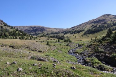
We were now going to follow Thorofare Creek for a few days to its headwaters

The meandering Thorofare Creek

I liked this shot of the buckwheat

Could be @Rockskipper following us? She is sneaky.

Thorofare Creek

Crossing Open Creek

Night four's meal

A looksee inside at the finished product.

Time to break out the Ursacks
Day 5 - Campsite on Open Creek to Campsite on Woody Creek - 9.09 miles
Day five would be the beginning of three special days for me as we continued on up Thorofare Creek. Originally, this was going to be our day hike day up Hidden Creek, but since that fell through, we headed up creek to see how far we could get.

Overview map for day 5

Bears and mules, quite the combination. I think I'm in heaven.

A grouse that I actually saw before it scared the shite out of me.

Looking back down creek as @wsp_scott checks out the northern slopes for grizzlies

The entrance to Hidden Creek. I think it might be a place worth exploring in the future?

Thorofare Creek, our trusted companion for a few days


Hmmm ..........................

What have we here?

Apparently some horseback riders
Okay, stop the filming, I've got a little story to tell.
So as this lass and lad passed me on the trail they were very cordial and asked how long I was going to be in the backcountry, and where I was heading. They told me they had come down Butte Creek and were heading down Thorofare Creek to camp for the night. When the last horse in their train (four total) saw me, it tried to bolt. It broke free of its lead rope and fell over into the shrubs on the opposite side of the trail from me. I was thinking, "My God!" The guy dismounted his horse and was able to get the other back up, and he led it a little further down the trail. I felt just awful. I hoped that the horse was not injured. The lady tried to calm the horse down by stoking its nose and telling the horse that it was okay, it was only a straggler. "A straggler" I said to myself. Scatman is a straggler? I don't think that I have ever been called that before. Well, I'll wear it with pride I guess. I sure hope the horse was okay.

Comforting the horse and calling old Scat a straggler.

Sign for the Butte Creek Trail

Butte Creek

Thorofare Creek

Trail crew!

Catching a few Z's at break

The view up ahead as we near Woody Creek

A frog

Morale is high?

Mt tent, just off Woody Creek


Dinner for night five

Bob's word of wisdom on the bottom of his Mountain House meal.
Now before we get to the end of day five, I've got a little story to pass on.
Usually after dinner I head down to the nearest water source (Thorofare Creek in this case) and splash off my face and arms to get the dirt, the grime, the sweat, and the sunscreen that I have applied throughout the day all off of me. So as I am heading down to the creek to splash off I have a single row of medium sized willows in front of me, then an artery of Thorofare creek which is relatively narrow, then an elevated gravel/sand bar, and then the main channel of Thorofare Creek. As I approached the willows, I heard a splash, splash, splash. My first thought was oh no an angry moose is about to charge me, but instead it turned out to be a grizzly that ran out in front of me and across the elevated gravel bar and into the willows and trees to the southeast from where I was standing. That got the blood pumping! I called back up to the others that we have a grizzly down here, and they came down, but the bear did not reappear.
Now I have been lucky over the years that my close encounters with grizzlies have never turned south on me. Pure luck I'm guessing. I've only had one grizzly bear become agitated with me and that was along the Lamar River a few years back. But after a couple minutes of "Hey Bear," it moved off into the burned trees and left me alone.
I did feel bad for Dave and Scott since they had yet to see a grizzly in the backcountry and I've seen my fair share of them. We ended up sitting on the edge of a meadow next to our campsite to see if the bear would emerge further up creek, but it never did.
I thought it was quite a coincidence that Bob showed us Mountain House wisdom and then I run into a bear. I promise that I didn't poke it.
Day 6 - Campsite on Woody Creek to Campsite on Tributary of the North Fork of the Yellowstone - 8.2 miles
Today was going to be a big day for us as we were heading up towards the headwaters of Thorofare Creek and hopefully find the old outfitters' trail up and over Majo Pass, and potentially find ourselves camped on the North Fork of the Yellowstone by days end.
Though it was unfortunate that Dave and Scott, and Bob for that matter didn't get to see the grizzly the previous evening, things were about to change. We packed up camp and headed out, still following Thorofare Creek. As we rounded a wooded area near the trail, Dave and Bob spotted a grizzly grazing in the meadow not far from the tree line. We stopped and watched the bear do its thing for maybe five minutes before it caught wind of us and took off back into the forest. This grizzly was the biggest one I've ever seen in the GYE, and its shoulder hump matched the bear. At first, we all thought it was a bison. And that was just the start of our day.

Day 6 overview map

Breakfast near Woody Creek

What I saw as a tough day ahead, I had a breakfast skillet instead of oatmeal.

Outfitters' camp on Woody Creek

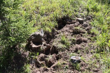
Don't remember crossing a beaver dam before, but we had to today to find the trail
And then came the grizzly bear


Finally catches wind of us

And runs back into the trees
What a thrill! Always a privilege to get o watch a grizzly just being a bear even if it was only for a few minutes.

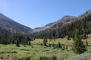
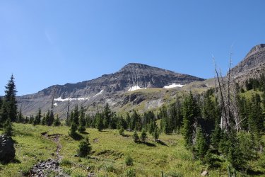
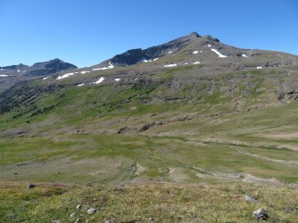
After watching the grizzly, it was time to continue on upstream, with Yellow Mountain looming ahead

More Thorofare Creek for you

Thorofare creek has dropped down into a small gorge beneath Yellow Mountain

Breaking out into open meadows. Just around the first ridgeline that comes down from the right in the image will be our route uo
to Majo Pass.

Still heading south through the meadow

These two are ready for Majo

And so is this one.

Some cascades coming off Yellow Mountain to the east of us

And just as the meadow starts to squeeze us in towards the forest, we ran into a second grizzly, more blonde colored than the one
we saw earlier


After a short time it caught wind of us and took of into the trees just ahead of it.
What a day, and we haven't even gotten to the pass yet.
Now I suspect that the old outfitters' trail popped out into this meadow where the grizzly was, but we found a trail that still headed south and followed it instead. It turned out that this trail continues to the end of the basin where the headwaters of Thorofare Creek is located, and does not turn up the stream that comes to the east of Majo Pass.

Thorofare Creek is getting smaller as we continue to follow it

The stream that flows down the east side of Majo

The trail we thought might lead us to Majo, but unfortunately it didn't

At this point we realized the trail we were following wasn't going to lead us to the pass, so we had to undertake some nasty
bushwhacking up the drainage. This was time consuming and wore me out.

Lots of downfall to balance on through some thick timber

A side steam that I filled my water bottle at. These little side drainages were steep to climb down
into and back out of.

We'd only gone about 0.3 of a miles through this stuff before we needed a rest. Rough going indeed.

We finally made our way back to the main stream coming down the drainage

Following the stream up now we eventually broke out into a clearing. Still no sign of the old trail though. Bob posing with Yellow
Mountain

Heading cross country towards the pass - still some snow above

The serious climbing begins

Always time for a shot of white paintbrush

Now just following the streambed up. @TractorDoc is up ahead somewhere.

Dead porcupine just next to the stream

The images don't do the steepness justice

Looking back down the drainage. You can see the forest we had to bushwhack through
on the right side of the drainage below

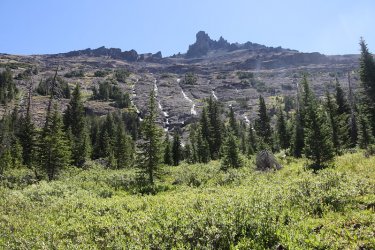
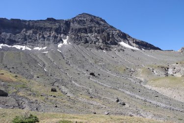
Finally ran into the old trail. Can you make it out? It is a steep son of a gun.

More of the old trail. Doesn't look like it gets used much

Finally made it to the top of the pass.

Bob approaches the pass

Bob, at the pass.

Of course, we had to celebrate with half a Tony's Chocolonely bar at the top.

Group shot at the top. How is @TractorDoc still smiling? Sometimes I don't think he is human.

Just over the pass, we dropped down to the stream and set up camp

Dinner for night six

View to the south at dusk, a fitting end to tough but fulfilling day
Link to Part Two
Days 7 though 10
End Part 1
Come November, after my last backpacking trip in October (and watching Jeremiah Johnson of course), I start settling in and begin thinking about what to do for the next year. There are a few things that go into my decision making, things like what distance do I want to do, rough terrain or easy, and generally how I think my body will hold up 9 months into the future. I'm not a spring chicken anymore and dealing with little aches and pains is probably the definitive factor on what I think I can accomplish as far as backpacking is concerned.
So after a bit of contemplation, I decided that I'd like to see the Thorofare, which is located south of Yellowstone Lake (probably don't need to tell this crowd where it is) one more time before I hang my hiking boots and backpack on a couple pegs downstairs for the last time. Now if you count my canoe trips in the past that included day hikes, I've been into and through the Thorofare four times in the past. The Thorofare is a special place in my book, with some of the wildest country in the lower 48, and certainly worth your time to visit if you have yet to do so.
My outlaw partner the last few years has been the infamous @TractorDoc, so I floated the idea past him to see if he might be interested. This would have to be a shuttle trip, putting in at Yellowstone Lake, and exiting at Brooks Lake just south of the Teton Wilderness. The total mileage was somewhere in the neighborhood of 85 to 90 miles depending on our exact route.
Dave gave it some thought and decided that if we could do the trip in August that he could probably pull it off. Since I had promised @wsp_scott that he would see a bear on our Hayden Valley day hike a couple of years ago, I felt it was only right to invite him along since we whiffed on the bears that day in Hayden. Scott checked his schedule and decided he would join us on our merry adventure. I also let @Bob know of my attentions, but at the time Bob was planning an adventure of his own, starting out in the Washakie Wilderness, heading into Hidden Creek, and up and over the mountains, dropping down into the North Fork of the Yellowstone before heading back out. Fortunately for us, Bob's potential backpacking partners had to back out of his trip which freed up his time to join us instead.
So now that we had our fellowship, we set the dates for August 8th through the 18th, with the 8th being the day we would travel to Yellowstone to meet up, and the 9th being the day we actually headed into the backcountry.
Those unfortunate enough to read the pre-trip hype on this one know how we were approaching getting ready for our trip.
I think I finally weighed in at 55 pounds for my pack. This included water, food, gear and two cameras. I think I had originally weighed in at 54, but I forgot some beef jerky, and some crystallized ginger when I stepped on the scales the first time.So let's see if this old mule has one trip report left in him and get down to business of writing this thing up. Again, it's going to be long report, so if you start reading it here at the end of summer, it might be mid-fall before you finish it up.
I hope that I can do the route/terrain we covered justice on this one.I might mention that I took over three thousand pictures over ten days, and the two cameras I used were the Canon EOS 90D, and the Canon PowerShot SX730 HS. I think I took about one hundred more with the 90D than I did with the PowerShot, so it was fairly even on which camera got the most use.
Well, let's get after it as they say.
Day before the Big Trip
On the 8th, I drove up to the Brooks Lake Trailhead, and met Bob and his wife, you shuttled me over to West Yellowstone to meet up with Dave and Scott. On our way through the Park, we picked up our official permit for the nights we were camping in the backcountry. Bob was heading back to Island Park for one more night in his own bed, while Dave, Scott and I would head to Lake to stay at some rented cabins for the night. We would all meet at Bridge Bay the morning of the 9th to start our trip. Before all that though, we met up at the Buffalo Bar in West Yellowstone for dinner.
Mules at the Brooks Lake Lodge. I just couldn't pass them up.
Looks like he is getting a bit agitated. I saw a moose like that once, just before it charged me.
View of Brooks Lake, while I waited for Bob to pick me up
The Subaru parked at the trailhead. It's going to have to be lonely for ten days.
Info sign at the trailhead
Picked up our permit at the Ranger Station on our way to West Yellowstone, for our campsites in the park
My gracious shuttlers
Remember, don't drink downstream from the buffalo!
The Hog Trough Nachos were on my radar for dinner. I didn't eat all the fresh jalapeños though, as I was afraid of the repercussions
the next day.
Don't remember what these gents were eating, so they will have to tell you themselves
Day 1 - Campsite 5E6 to campsite 5E1 - 8.6 miles
I need to back up a little before moving on to day one. At first, I had the idea to hike down the east side of Yellowstone Lake before heading out into the Thorofare. @TractorDoc had the idea of taking a boat ride across the lake to campsite 5E6 and starting from there. Now I have seen three black bears along the trail on the east side of the lake and didn't want to miss an opportunity to see one again, but Tractordoc convinced me that taking the boat ride would allow us one more day in the Thorofare and maybe allow us to see some remote backcountry waterfalls, so in the end I acquiesced.
We got up early on the 9th and ate a buffet breakfast at the Lake Hotel before heading over to Bridge Bay to meet Bob and catch our boat. Besides the ride across the lake which took approximately 30 minutes, we would then hike 8.6 miles to campsite 5E1. Wildflowers were in bloom and I was eager to get some pictures, so you'll see a lot of images on day one.
Boat ride overview. The route is just an approximation.
Overview map for day 1
Sunrise at Lake cabins in Yellowstone
Heading to breakfast before our boat ride
The last boat at the dock would be our ride
Ready to board with captain John Mississippi
Stevenson Island out ahead. Speaking of heads, who's head is that out front?
Bob seems cool as a cucumber
Approaching the Southeast Arm of Yellowstone Lake. It seems a bit choppy in the channel to me.
Time for the land part of our route
John Mississippi heading back to pick up more passengers
Bob, doing the James Brown moon walk before setting off along the trail.
Dave seems a wee bit excited to get going.
Right off we encountered these guys. What a way to start the trip!
Lupine along the trail
Already trying to figure out where we are.
Taking a quick rest on Nine Mile TrailIt didn't take long to run into these
Fireweed along the trail
Monkshood
What! More mules! This trip was bordering on epicness already.
Nine Mile Trail. I think @TractorDoc 's pack weighed in around 60 pounds.
Geranium
Yarrow
Finally we broke out of the trees to a view of the southern portion of the Southeast Arm and Two Ocean Plateau
The view ahead as we work our way towards the Thorfare
Pretty sulphur buckwheat
The Yellowstone River Delta and the Thorofare
Canadian Geese enjoying the day
View to the south, down the Thorofare
I call this Lupine Shadow
Arriving at the spur trail to our campsite
Fleabane was abundant
Arriving at 5E1. While this campsite had a nice view, getting to the water source was not optimal, being a long distance from camp
View to the east from 5E1
Dinner for night one. It was the first time that I tried this, and I liked it.
Beaverdam Creek, our distant water source
Some brave chipmunks that I ran into on my way back to camp from getting water. They didn't move an inch as I passed by them
Close up of third chipmunk
Day 2 - Campsite 5E1 to Campsite 6D2 - 9.01 miles
I promised everyone that we wouldn't get any rain on this trip, so you can imagine my surprise when it sprinkled on us just before everyone got up in the morning. Thankfully it didn't last long and would be the beginning of a eight day stretch with no rain.
Today's route would take us deeper into the Thorofare, with several creek crossings to contend with, and glimpses of the Yellowstone River on our way to 6D2.
Overview map for day 2
Can you make out the Southeast Arm Ranger Station in the distant trees? Zoomed shot from 5E1
Breakfast after a short shower
Not sure what type of butterfly this is. Anyone know?
Bob, preparing to cross Beaverdam Creek
Tractordoc showing us how it is done
Heading into some willows
Looking north towards Langford Cairn, the leftmost hump on the ridge
A common occurrence
Mariposa Lily
Typical Thorofare fare
Looking southwest across the Thorofare towards Two Ocean Plateau
I'm beginning to sense a common theme.
Junction sign
We saw plenty of frogs on this trip
The Yellowstone River. Check out the large log jam left of center.
More chipmunk action
More Yellowstone River too
Wild rose
A white lupine. @Rockskipper is that like seeing a white bison?
Bob on the Thorofare Trail
Mountains to the east
Clover
Trappers Creek
The Thorofare Trail
Looking back towards Turret Mountain
Junction sign for the Mountain Creek Trail
Mountain Creek
Bob crossing Mountain Creek
Confusing, at least for me, campsite sign for 6D2
Scott on Mountain Creek, the water source for 6D2.
Dinner time.
I didn't particularly like 6D2. The water source was fine and the views were reasonable, but there was only one good tent site at the camp.
Dinner for night two
I thought this log end was interesting
I hiked down after dinner to see what tomorrow's crossing of Mountain Creek looked like
Dave, looking for a good shot at 6D2
Day 3 - Campsite 6D2 to Campsite 6Y2 - 9.47 miles
Today's route would take us further south through the Thorofare, and the west along the South Boundary Trail to campsite 6Y2, located on the Yellowstone River. While heading south, we off-trailed it to check out the waterfall on Cliff Creek called Mist of Trident Falls. The hiking along the South Boundary Trail was mostly through willows, and at one point due to excessive marshiness, we had to bushwhack south a bit to find a spot to get over a creek, and then make our way back north to the trail. I also got to see my first beaver trails as we approached 6Y2. @TractorDoc and @wsp_scott got to see a beaver later that night, but I had to be satisfied with their trails through the low lying willows.
Day 3 overview map
Morning at 6D2
Bob, fording Mountain Creek
Scott, giving it a go
Nice big print this time
View to the west across the Thorofare
Looking back to the north from whence we came
Wolves too
@TractorDoc in the Thorofare
Yellowstone River
Paintbrush
More Thorofare expanse
The Yellowstone River
View back to the east from the trail towards The Trident
Off-trailing it to the falls
This required some contortional skills
Mist of Trident Falls
View looking down from on top of the falls
View of the southern end of the Thorofare from the top of the falls
Time to head back and find Bob
Back on the trail with Hawks Rest in the distance to the left
View to the east from the trail
Close to the Thorofare Ranger Station, but that would be tomorrow's treat.
The Thorofare Trail
Hawks Rest
Arriving at Thorofare Creek
Fording Thorofare Creek
Found this on the other side of the creek hanging in a tree. The can was half empty. Did someone
spray a bear?
Looking back east at a potion of The Trident
View to the southwest
The Yellowstone River and Hawks Rest
The bear pole at 6Y2
My tent at 6Y2
Dinner for night three - one of my favorites.
I think this was the spot that Dave and Scott would see the beaver later in the evening.
Monkshood at camp
Day 4 - Campsite 6Y2 to Campsite on Open Creek in the Teton Wilderness - 9.63 miles
Day four was originally supposed to go all the way to Hidden Creek in the Teton Wilderness. Remember Bob's original plans before joining our group? We'll, we thought that we would meet up with Bob and his entourage at Hidden Creek and do a day hike with his group up the valley before they went up and over to the North Fork of the Yellowstone. Now going all the way to Hidden Creek from 6Y2 would add a couple more miles to our total, so when Dave and Scott invited me to hike to Isolation Falls in the morning, i declined feeling that I could not make it to the falls, and then manage to get all the way to Hidden Creek on the same day.
Isolation Falls by the way is supposed to be the most isolated falls in Yellowstone National Park. So if you want to see some beautiful shots of Isolation, you'll have to wait for Dave's and Scott's trip reports to see it. It was the reason we chose campsite 6Y2 in the first place, but I just couldn't see myself adding it to a long day.
So as Dave and Scott headed off to the falls, Bob and I packed up and head back the way we had come the day before. This time though we would cut over to the Thorofare Ranger Cabin which I have been told that it is the most remote (furthest from a road) location in the lower 48. Even though I have backpacked through the Thorofare before, I had never made it to the Ranger's Cabin, so I was excited to see it and check it off my bucket list.
We had told Dave and Scott that we would wait for 20 minutes at the cabin for them, and then if they didn't show we would wait twenty more at the park boundary, and if they were still no shows, we would wait for them at the trail intersection coming up from Bridger Lake, where at this point we were making our way up the Thorofare Creek Trail.
We ended up staying about an hour at the cabin, and just as we were putting our packs on and getting ready to leave, they both showed up. We cut the day short though when we got to Open Creek and decided to pitch camp there instead of continuing on to Hidden Creek.
Overview map for day 4
Yellowstone River in the morning
Bob, all packed up and ready to head out
Looking back west from the South Boundary Trail
Crossing Thorofare Creek again. We chose a different crossing point on our way back which made the ford a bit easier.
The Ranger Station is that way
View to the north up the Thorofare
Beavers are active in the Thorofare
The Thorofare Ranger Station
The barn at the station
And of course, the outhouse
I recorded in the log book about the two slackers just before they showed up.
Rest time for the waterfallers.
Just in case you wanted to know what was under the kilt.
And guess who graced us with her presence?
And now it was off to the Teton Wilderness, with The Trident looming to our north
Crossing the boundary
A Fish and Wildlife cabin on Thorofare Creek
We were now going to follow Thorofare Creek for a few days to its headwaters
The meandering Thorofare Creek
I liked this shot of the buckwheat
Could be @Rockskipper following us? She is sneaky.
Thorofare Creek
Crossing Open Creek
Night four's meal
A looksee inside at the finished product.
Time to break out the Ursacks
Day 5 - Campsite on Open Creek to Campsite on Woody Creek - 9.09 miles
Day five would be the beginning of three special days for me as we continued on up Thorofare Creek. Originally, this was going to be our day hike day up Hidden Creek, but since that fell through, we headed up creek to see how far we could get.
Overview map for day 5
Bears and mules, quite the combination.
I think I'm in heaven. A grouse that I actually saw before it scared the shite out of me.
Looking back down creek as @wsp_scott checks out the northern slopes for grizzlies
The entrance to Hidden Creek. I think it might be a place worth exploring in the future?
Thorofare Creek, our trusted companion for a few days
Hmmm ..........................
What have we here?
Apparently some horseback riders
Okay, stop the filming, I've got a little story to tell.
So as this lass and lad passed me on the trail they were very cordial and asked how long I was going to be in the backcountry, and where I was heading. They told me they had come down Butte Creek and were heading down Thorofare Creek to camp for the night. When the last horse in their train (four total) saw me, it tried to bolt. It broke free of its lead rope and fell over into the shrubs on the opposite side of the trail from me. I was thinking, "My God!" The guy dismounted his horse and was able to get the other back up, and he led it a little further down the trail. I felt just awful. I hoped that the horse was not injured. The lady tried to calm the horse down by stoking its nose and telling the horse that it was okay, it was only a straggler. "A straggler" I said to myself. Scatman is a straggler?
I don't think that I have ever been called that before. Well, I'll wear it with pride I guess. I sure hope the horse was okay.Comforting the horse and calling old Scat a straggler.
Sign for the Butte Creek Trail
Butte Creek
Thorofare Creek
Trail crew!
Catching a few Z's at break
The view up ahead as we near Woody Creek
A frog
Morale is high?
Mt tent, just off Woody Creek
Dinner for night five
Bob's word of wisdom on the bottom of his Mountain House meal.
Now before we get to the end of day five, I've got a little story to pass on.
Usually after dinner I head down to the nearest water source (Thorofare Creek in this case) and splash off my face and arms to get the dirt, the grime, the sweat, and the sunscreen that I have applied throughout the day all off of me. So as I am heading down to the creek to splash off I have a single row of medium sized willows in front of me, then an artery of Thorofare creek which is relatively narrow, then an elevated gravel/sand bar, and then the main channel of Thorofare Creek. As I approached the willows, I heard a splash, splash, splash. My first thought was oh no an angry moose is about to charge me, but instead it turned out to be a grizzly that ran out in front of me and across the elevated gravel bar and into the willows and trees to the southeast from where I was standing. That got the blood pumping! I called back up to the others that we have a grizzly down here, and they came down, but the bear did not reappear.
Now I have been lucky over the years that my close encounters with grizzlies have never turned south on me. Pure luck I'm guessing. I've only had one grizzly bear become agitated with me and that was along the Lamar River a few years back. But after a couple minutes of "Hey Bear," it moved off into the burned trees and left me alone.
I did feel bad for Dave and Scott since they had yet to see a grizzly in the backcountry and I've seen my fair share of them. We ended up sitting on the edge of a meadow next to our campsite to see if the bear would emerge further up creek, but it never did.
I thought it was quite a coincidence that Bob showed us Mountain House wisdom and then I run into a bear. I promise that I didn't poke it.
Day 6 - Campsite on Woody Creek to Campsite on Tributary of the North Fork of the Yellowstone - 8.2 miles
Today was going to be a big day for us as we were heading up towards the headwaters of Thorofare Creek and hopefully find the old outfitters' trail up and over Majo Pass, and potentially find ourselves camped on the North Fork of the Yellowstone by days end.
Though it was unfortunate that Dave and Scott, and Bob for that matter didn't get to see the grizzly the previous evening, things were about to change. We packed up camp and headed out, still following Thorofare Creek. As we rounded a wooded area near the trail, Dave and Bob spotted a grizzly grazing in the meadow not far from the tree line. We stopped and watched the bear do its thing for maybe five minutes before it caught wind of us and took off back into the forest. This grizzly was the biggest one I've ever seen in the GYE, and its shoulder hump matched the bear. At first, we all thought it was a bison. And that was just the start of our day.
Day 6 overview map
Breakfast near Woody Creek
What I saw as a tough day ahead, I had a breakfast skillet instead of oatmeal.
Outfitters' camp on Woody Creek
Don't remember crossing a beaver dam before, but we had to today to find the trail
And then came the grizzly bear
Finally catches wind of us
And runs back into the trees
What a thrill! Always a privilege to get o watch a grizzly just being a bear even if it was only for a few minutes.
After watching the grizzly, it was time to continue on upstream, with Yellow Mountain looming ahead
More Thorofare Creek for you
Thorofare creek has dropped down into a small gorge beneath Yellow Mountain
Breaking out into open meadows. Just around the first ridgeline that comes down from the right in the image will be our route uo
to Majo Pass.
Still heading south through the meadow
These two are ready for Majo
And so is this one.
Some cascades coming off Yellow Mountain to the east of us
And just as the meadow starts to squeeze us in towards the forest, we ran into a second grizzly, more blonde colored than the one
we saw earlier
After a short time it caught wind of us and took of into the trees just ahead of it.
What a day, and we haven't even gotten to the pass yet.
Now I suspect that the old outfitters' trail popped out into this meadow where the grizzly was, but we found a trail that still headed south and followed it instead. It turned out that this trail continues to the end of the basin where the headwaters of Thorofare Creek is located, and does not turn up the stream that comes to the east of Majo Pass.
Thorofare Creek is getting smaller as we continue to follow it
The stream that flows down the east side of Majo
The trail we thought might lead us to Majo, but unfortunately it didn't
At this point we realized the trail we were following wasn't going to lead us to the pass, so we had to undertake some nasty
bushwhacking up the drainage. This was time consuming and wore me out.
Lots of downfall to balance on through some thick timber
A side steam that I filled my water bottle at. These little side drainages were steep to climb down
into and back out of.
We'd only gone about 0.3 of a miles through this stuff before we needed a rest. Rough going indeed.
We finally made our way back to the main stream coming down the drainage
Following the stream up now we eventually broke out into a clearing. Still no sign of the old trail though. Bob posing with Yellow
Mountain
Heading cross country towards the pass - still some snow above
The serious climbing begins
Always time for a shot of white paintbrush
Now just following the streambed up. @TractorDoc is up ahead somewhere.
Dead porcupine just next to the stream
The images don't do the steepness justice
Looking back down the drainage. You can see the forest we had to bushwhack through
on the right side of the drainage below
Finally ran into the old trail. Can you make it out? It is a steep son of a gun.
More of the old trail. Doesn't look like it gets used much
Finally made it to the top of the pass.
Bob approaches the pass
Bob, at the pass.
Of course, we had to celebrate with half a Tony's Chocolonely bar at the top.
Group shot at the top. How is @TractorDoc still smiling? Sometimes I don't think he is human.
Just over the pass, we dropped down to the stream and set up camp
Dinner for night six
View to the south at dusk, a fitting end to tough but fulfilling day
Link to Part Two
Days 7 though 10
End Part 1
Attachments
-
 Thorofare_2023_07.jpg566.8 KB · Views: 14
 -
 01.jpg143.6 KB · Views: 9
 -
 02.jpg221.8 KB · Views: 4
 -
 03.jpg177.8 KB · Views: 3
 -
 04.jpg165.7 KB · Views: 3
 -
 05.jpg163.5 KB · Views: 3
 -
 06.jpg296.3 KB · Views: 3
 -
 07.jpg162 KB · Views: 3
 -
 08.jpg203 KB · Views: 3
 -
 09.jpg192.3 KB · Views: 3
 -
 10.jpg221.8 KB · Views: 3
 -
 11.jpg155.3 KB · Views: 3
 -
 12.jpg197 KB · Views: 3
 -
 13.jpg228.8 KB · Views: 3
 -
 14.jpg222.4 KB · Views: 3
 -
 15.jpg176.8 KB · Views: 3
 -
 16.jpg171.5 KB · Views: 3
 -
 17.jpg182.8 KB · Views: 3
 -
 18.jpg148.9 KB · Views: 4
 -
 19.jpg50 KB · Views: 4
 -
 20.jpg135.3 KB · Views: 4
 -
 21.jpg166.2 KB · Views: 4
 -
 22.jpg50.9 KB · Views: 3
 -
 23.jpg122.1 KB · Views: 4
 -
 25.jpg129.5 KB · Views: 7
Last edited:
