Yellow Rock, Pollock Arch, Hackberry Canyon loop (GSENM)

fossana

Member
Joined
Jan 11, 2018
Messages
855
DSC04169.jpg
Intro
Despite the plethora of beautiful backcountry in my backyard, I was getting bored of the same terrain and starting looking for somewhere new to visit. I originally considering doing a short backpacking trip on the N Rim, but the wind forecast looked nasty starting Sunday due to an incoming winter snowstorm. Since it was a day trip, I limited my search to a 2.5h drive time (one-way). I also wanted to keep the elevation below 6500' since there was still quite a bit of snow on Canaan Mt Wilderness the weekend prior.

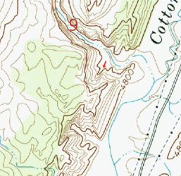
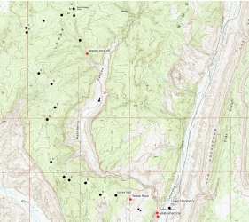
Luckily I came across Jamal's video on the Paria area. Using his trip report for inspiration, I sketched out an approximate route from Yellow Rock, across the ridge to a point W of Sam Pollock arch, then down to the arch and out the adjacent drainage to Hackberry Canyon, and finally downstream in Hackberry Canyon to the trailhead. I included an option for continuing on to Stone Donkey Canyon, but later abandoned this idea when I realized a pre-dawn start with temps in the low 20s was not so appealing.

Approximate Route
Start/end: Lower Hackberry Canyon TH
Mileage/Elevation Gain: ~13 with 2400' of gain
Screen Shot 2022-02-20 at 7.43.21 PM.png

Trip Report
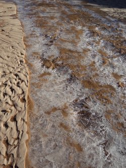
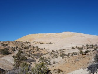
I arrived at the Lower Hackberry Canyon trailhead ~8:30am; it was in the low 20s. Cottonwood and Hackberry Creeks were almost completely iced over, so I was happy about my plan to do the loop counter-clockwise. There were a few cars when I started out, but surprisingly I had the entire Yellow Rock ascent to myself.
DSC04118.jpg DSC04120.jpg DSC04122.jpg

According to the topo, there were several ways to descend Yellow Rock in a northish direction. I took the NE option, the traversed back to true N. In retrospect, NW would have been better because after a short distance, I encountered an unexpected lightly used horse/hiker trail heading almost exactly along the rough route I had drawn in advance. I hadn't seen this trail referenced anywhere.


DSC04126.jpg DSC04133.jpg

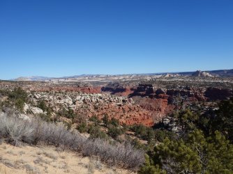
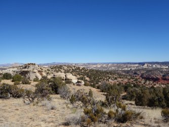
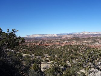
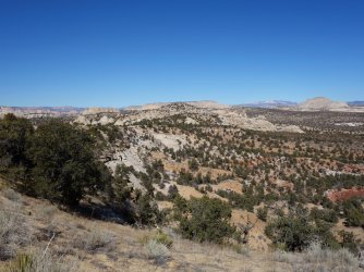
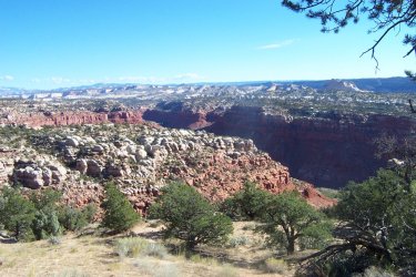
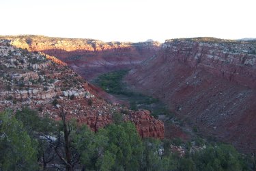
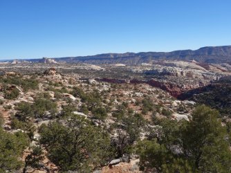
I was pleasantly surprised by the interesting terrain and breathtaking views, with Hackberry Canyon and the Cockscomb to the east and Paria River Basin to the west.

DSC04149.jpg DSC04154.jpg DSC04157.jpg

DSC04170.jpg DSC04175.jpg

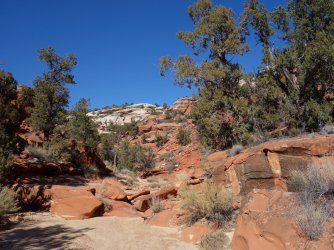
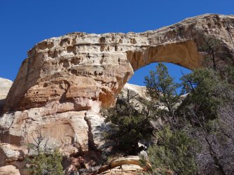
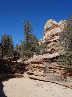
After a few hours of sandy ridge walking, it was time to leave the horse trail and find my way down to Sam Pollock Arch. I tried to stick to drainages and deer/cow trails where possible to avoid stepping on cryptobiotic soil. I finally hit the drainage adjacent to the arch and just S of where it was labeled on the map. I saw only a single set of footprints. I wasn't entirely certain where the arch was relative to the label, but it turned out to be right next to the drainage. After a few photos, I headed downcanyon and again was impressed by the beautiful topography.

DSC04189.jpg DSC04194.jpg
DSC04198.jpg

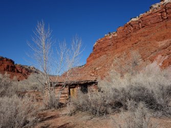
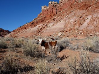
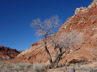
The relatively easy path ended at a tall pour-off, but an exposed path provided a bypass. Soon, I was near the end of the drainage and in lower Hackberry Canyon. Hackberry Canyon is quite wide in this section with ghostly at this time of year cottonwoods. The historic Watson Cabin appeared to have been recently restored. I heard the brush rustling, and came across a small herd of cows. While I like cows (I grew up on a small farm), it pains me to see them in a wilderness area where water is so scarce.
DSC04210.jpg DSC04204.jpg DSC04219.jpg

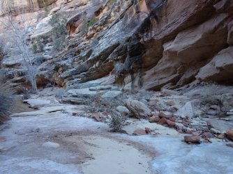
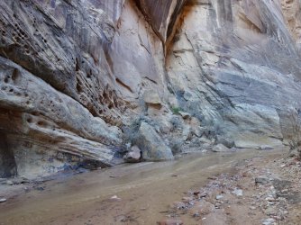
In the final ~1.25 miles from the trailhead, the canyon narrows. There were thick patches of ice that I hoped would not cave in as I cross them. Fortunately, any required water crossings were shallow and brief. I ran into the only people I saw on route, a party of two backpackers from Flagstaff heading upstream. Hopefully they had at least 15F sleeping bags.

DSC04226.jpg DSC04234.jpg DSC04237.jpg
DSC04242.jpg

Soon, I was back at the trailhead in time to try the new-to-me Cuban restaurant in Kanab. I'm looking forward to heading back to this area for a longer trip.
 

Attachments

  • DSC04181.jpg
    DSC04181.jpg
    434.1 KB · Views: 27
Love it. It’s such a great terrain with awesome views. The canyon looks like a freezer this time of the year. Thanks for sharing and we will try the Cuban restaurant the next time.
 
Nice report @fossana ! Even with the chill it looked like a nice day to get out.

I always enjoy the awareness and specifics that are part of your write ups. Details matter! :)
 
Excellent! You did the lung buster ascent to Yellow Rock? Or is your point that you found a better route (sorry, I'm dense this morning).
 
Excellent! You did the lung buster ascent to Yellow Rock? Or is your point that you found a better route (sorry, I'm dense this morning).
I overshot the turnoff to the Yellow Rock trail and scrambled up the cliffs near the mouth of Hackberry Canyon, eventually traversing the ridgeline to the saddle where the normal trail is. I didn't show that on my map, since most people would rather take the normal trail.

Screen Shot 2022-02-21 at 6.36.37 PM.png
 
That's gotta be quite the traverse then, since that lung buster has got some pretty sketchy sections with poor footing. Unless the trail is better now than it was a few years ago.
 
Great looking outing! Love your TRs. Planning on being down in that part of the world in a couple of weeks......
 
View attachment 107869
Intro
Despite the plethora of beautiful backcountry in my backyard, I was getting bored of the same terrain and starting looking for somewhere new to visit. I originally considering doing a short backpacking trip on the N Rim, but the wind forecast looked nasty starting Sunday due to an incoming winter snowstorm. Since it was a day trip, I limited my search to a 2.5h drive time (one-way). I also wanted to keep the elevation below 6500' since there was still quite a bit of snow on Canaan Mt Wilderness the weekend prior.

Luckily I came across Jamal's video on the Paria area. Using his trip report for inspiration, I sketched out an approximate route from Yellow Rock, across the ridge to a point W of Sam Pollock arch, then down to the arch and out the adjacent drainage to Hackberry Canyon, and finally downstream in Hackberry Canyon to the trailhead. I included an option for continuing on to Stone Donkey Canyon, but later abandoned this idea when I realized a pre-dawn start with temps in the low 20s was not so appealing.

Approximate Route
Start/end: Lower Hackberry Canyon TH
Mileage/Elevation Gain: ~13 with 2400' of gain

View attachment 107858

Trip Report
I arrived at the Lower Hackberry Canyon trailhead ~8:30am; it was in the low 20s. Cottonwood and Hackberry Creeks were almost completely iced over, so I was happy about my plan to do the loop counter-clockwise. There were a few cars when I started out, but surprisingly I had the entire Yellow Rock ascent to myself.
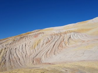
View attachment 107859 View attachment 107860 View attachment 107861

According to the topo, there were several ways to descend Yellow Rock in a northish direction. I took the NE option, the traversed back to true N. In retrospect, NW would have been better because after a short distance, I encountered an unexpected lightly used horse/hiker trail heading almost exactly along the rough route I had drawn in advance. I hadn't seen this trail referenced anywhere.
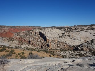
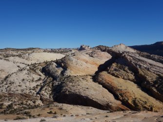
View attachment 107862 View attachment 107863

I was pleasantly surprised by the interesting terrain and breathtaking views, with Hackberry Canyon and the Cockscomb to the east and Paria River Basin to the west.
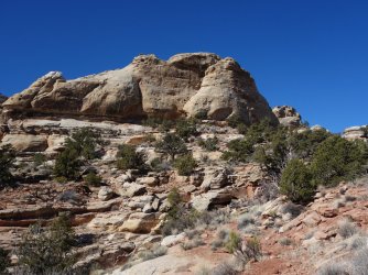
View attachment 107866 View attachment 107867 View attachment 107868

View attachment 107870 View attachment 107871

After a few hours of sandy ridge walking, it was time to leave the horse trail and find my way down to Sam Pollock Arch. I tried to stick to drainages and deer/cow trails where possible to avoid stepping on cryptobiotic soil. I finally hit the drainage adjacent to the arch and just S of where it was labeled on the map. I saw only a single set of footprints. I wasn't entirely certain where the arch was relative to the label, but it turned out to be right next to the drainage. After a few photos, I headed downcanyon and again was impressed by the beautiful topography.
View attachment 107885 View attachment 107874
View attachment 107875

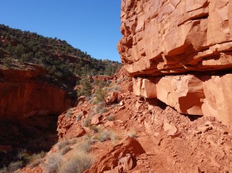
The relatively easy path ended at a tall pour-off, but an exposed path provided a bypass. Soon, I was near the end of the drainage and in lower Hackberry Canyon. Hackberry Canyon is quite wide in this section with ghostly at this time of year cottonwoods. The historic Watson Cabin appeared to have been recently restored. I heard the brush rustling, and came across a small herd of cows. While I like cows (I grew up on a small farm), it pains me to see them in a wilderness area where water is so scarce.
View attachment 107876 View attachment 107884 View attachment 107877

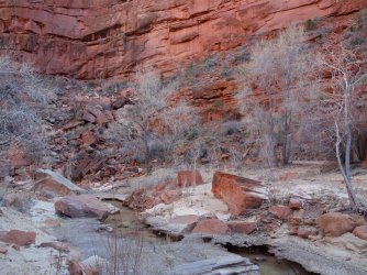
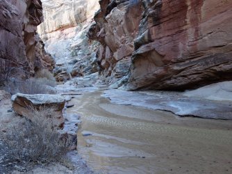
In the final ~1.25 miles from the trailhead, the canyon narrows. There were thick patches of ice that I hoped would not cave in as I cross them. Fortunately, any required water crossings were shallow and brief. I ran into the only people I saw on route, a party of two backpackers from Flagstaff heading upstream. Hopefully they had at least 15F sleeping bags.
View attachment 107878 View attachment 107879 View attachment 107880
View attachment 107881

Soon, I was back at the trailhead in time to try the new-to-me Cuban restaurant in Kanab. I'm looking forward to heading back to this area for a longer trip.
Wow! This looks like a fun trek! Thank you for sharing.
 
Hi! did you have any trouble with the decent down Sam Pollock Canyon as you avoided the pour off? I was there in april of 2023 and the trail looked very, very sketchy. Did we miss something? I know everyone's responses are different, but it appeared loose with no margin for error. Do you have any photos of it? Perhaps there was some slumping of the loose Kayenta there? thanks!
 
Hi! did you have any trouble with the decent down Sam Pollock Canyon as you avoided the pour off? I was there in april of 2023 and the trail looked very, very sketchy. Did we miss something? I know everyone's responses are different, but it appeared loose with no margin for error. Do you have any photos of it? Perhaps there was some slumping of the loose Kayenta there? thanks!
There was a "reasonable" bypass when I went, left side as you are heading downcanyon. It's possible that it may have washed out with all of the precipitation last winter/spring.

DSC04201.jpg
 
Last edited:
Similar threads
Thread starter Title Forum Replies Date
IntrepidXJ Sand Cove & Yellow Rock Hiking & Camping 16
NorthwestWanderer Tomyhoi via Yellow Aster Butte, WA Backpacking 5
NorthwestWanderer Yellow Aster Butte & Tomyhoi Lakes Basin, WA Hiking & Camping 11
Nick Yellow Knolls Hiking & Camping 1
Seldom Seen Anderson Yellow Knolls Hiking & Camping 22
TrailScot Hole-in-the-Rock Road - Escalante General Discussion 11
TrailScot Capitol Reef NP - 5 Day Backpacking Adventure from Chimney Rock to Burro Wash - October 2023 Backpacking 10
Jackson Little Rock Creek Backpacking 5
2eez4life Suggestions: Uintas Backpacking with some rock climbing routes Trip Planning 0
kwc Another Southern Adirondacks hike - Clockmill Pond and Rock Lake Hiking & Camping 0
R Pony Express Trail, Black Rock to Simpson Springs Hiking & Camping 3
XID_AZ Willow Gulch from Hole in the Rock Trip Planning 4
F Who has been here? Ruin off Hole-in-the-Rock road General Discussion 4
napatony13 UNUSUAL ROCK ART STYLES Off Road 4
scatman Beartooth Wilderness - Flat Rock Lake Lollipop Loop - July 26, 2021 Backpacking 56
C Coyote Gulch via Chimney rock trail Trip Planning 0
napatony13 BISHOP BACKROADS ROCK ART Off Road 2
napatony13 SUCCESSFUL SLEUTHING-Nevada Rock Art Off Road 6
Henk Moab rock art vandalized General Discussion 1
J Bunch O' N. San Rafael Swell summit scrambles April 10-12, 2021 (now w/rock art) Hiking & Camping 3
J Dayhiking Moab's awesome geography, couple hikes to summits and rock art April 8-9, 2021 Hiking & Camping 0
scatman Castle Rock - April 3, 2021 Hiking & Camping 13
norwegianxplorer Preikestolen, Pulpit Rock, Hiking Norways most Iconic and spectacular Landmark & views, Lysefjord, Norway Hiking & Camping 1
Stephanie B Fishing (for Trout) and Hunting (for Rock Art) In and Near Capitol Reef National Park Hiking & Camping 7
T Status of Traffic - Hole in the rock road - Escalante - September? Trip Planning 2
fossana Wire Pass fire (impacting House Rock Rd/Buckskin Gulch) Trip Planning 3
Stephanie B Searchin' for Ruins and Rock Art in San Juan County, UT Hiking & Camping 6
NorthwestWanderer Backpacking the Pasayten Wilderness : Harts Pass, PCT, Windy Pass, Buffalo Pass, Foggy Pass, Jim Pass, Hulman Pass & Rock Pass Meadows Backpacking 3
NorthwestWanderer Waterfall Hikes & the death of my legendary Chevy Cobalt...in a rock slide. Hiking & Camping 8
Stephanie B Eagle Rock Shelter (Delta County, CO) Hiking & Camping 2
Rockskipper Hiker seriously injured by rock at Fisher Towers General Discussion 12
Stephanie B Sand Island and Sand Dune Rock Art Hiking & Camping 1
b.stark Crack In Rock - Fall 2016 Backpacking 6
J Red Rock(s) Canyon Natl.Conservation Area Hikes and Scrambles Nov. 15 and 16, 2017 Hiking & Camping 0
L Red Castle Lakes / Wilson Peak OR Rock Creek Basin Trip Planning 4
LoneWolfOutdoors Eagle Rock Loop Trail in Arkansas Backpacking 6
BJett Shining Rock Wilderness Backpacking 10
Strawsome What is your favorite hike in the Escalante/Hole in the rock road area? General Discussion 6
Jimmy Hole in the Rock Car Camping Trip Planning 0
powderglut Toadstools and Hoodoos in the White Rock Valley Hiking & Camping 8
IntrepidXJ Album Hoodoos, Spires and other Rock Formations Photography 73
SKLund Spilling the Beans on Rock Art General Discussion 15
Rockskipper As ice thaws, rock avalanches on Southeast Alaska mountains are getting bigger General Discussion 0
G Hole in the Rock Hitchhiking Trip Planning 6
WasatchWill Hiking Chimney Rock & Hickman Bridge Hiking & Camping 2
Jackson Hunting for Rock Art in Tooele County Hiking & Camping 5
Dave Smith Rock State Park, Oregon Hiking & Camping 2
J Sloan Canyon & Lake Mead summits and rock art Nov 26-28, 2016 Hiking & Camping 0
J Summits and Rock Art in Nevada's Mojave Nov 8-10, 2016 Hiking & Camping 2
Jackson Rock Canyon Snowshoe Winter Sports 3

Similar threads

Back
Top