b.stark
Forever Wandering
- Joined
- Apr 8, 2015
- Messages
- 1,273
Going to throw together a report of sorts for the 2024 trip that was just completed by several forum members.
Roster was as follows:
@Bob
@scatman
@TractorDoc
@wsp_scott
@futurafree
And myself.
Most honorable mention to @Georgia Yankee who met up with us along the Thorofare creek and became part of the group for a couple days then continued on his own extended trip in the wilderness.
Day 1
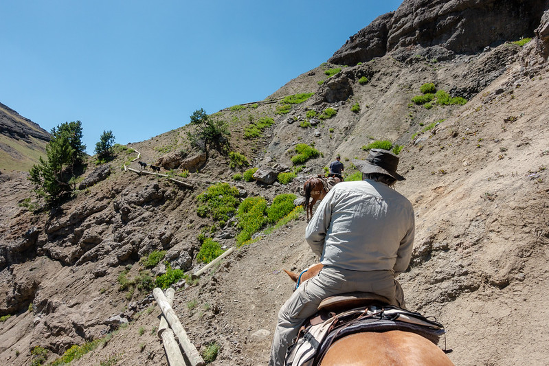
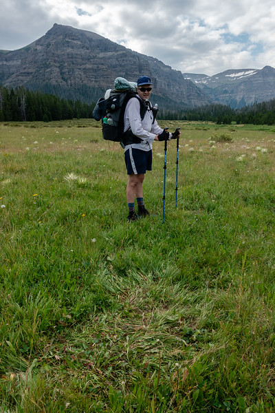
The trip started with the Deer Creek Trailhead on the South Fork of the Shoshone. Most of the group hiked up, but Bob and I took to horses and got a ride up to the top of Deer Creek Pass with an outfitter. It was an interesting experience for me. I'd rode when young, but it's been a very long time since I'd been in the saddle. The trail up to the pass was a rough re-introduction to being on horseback. There are some pretty exposed parts of the trail, especially at the top. The wrangler noted that they occasionally lose horses off the trail near the top. Some survive and some don't.
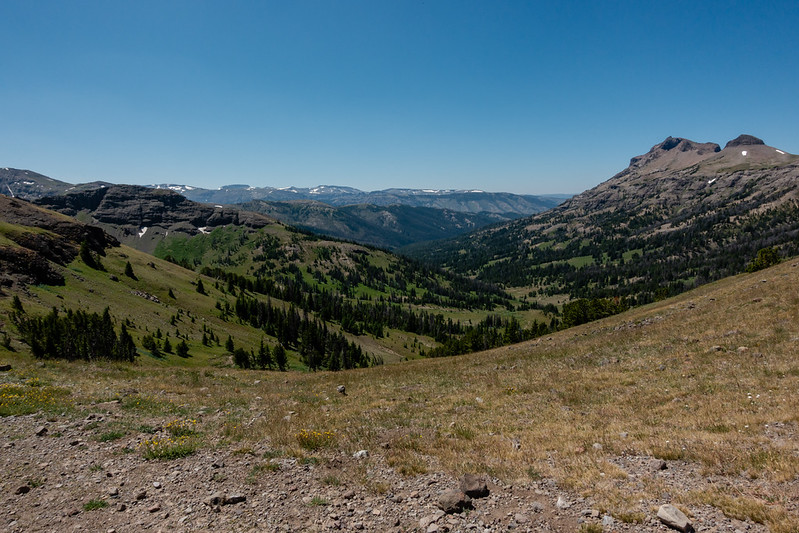
Top of the pass had some expansive views
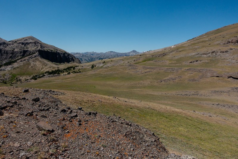
Next Bob and I went even higher along the ridge toward the North Fork of Butte Creek to make the first night's camp.
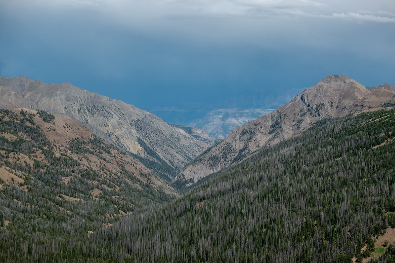
The bowl to the left contained a few elk wandering around. There were two options to get down. One was what looked from Google Earth to be a steep scree gully, the other was an old trail that the outfitter knew of and described as an "old mountain man trail." We thought the gully looked better and headed that way.
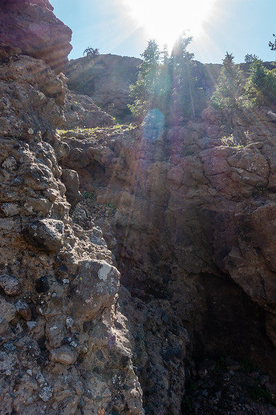
As it turns out, there is no good way down into the North Fork. The outfitter trail looked to be in very bad shape and ran on top of some cliffs that would throw you into the abyss if you slipped (and from the looks of it that was nearly a guarantee). We ended up working down toward the gully noted via internet scouting. It was pretty awful. The rock was volcanic conglomerate that was really loose and made for terrible climbing. After looking at a couple gullies we found one that looked slightly less terrible than the others and I went down. We shuttled Bob's pack down after I had gotten to the bottom of the worst of it, then continued down into the valley below.
Photo is from part way down and doesn't really do justice to how steep and loose everything was.
We came down there somewhere.
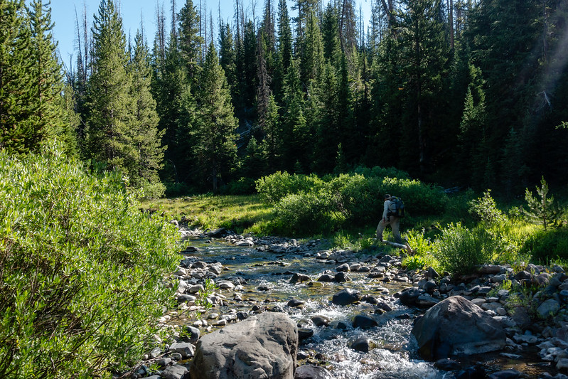
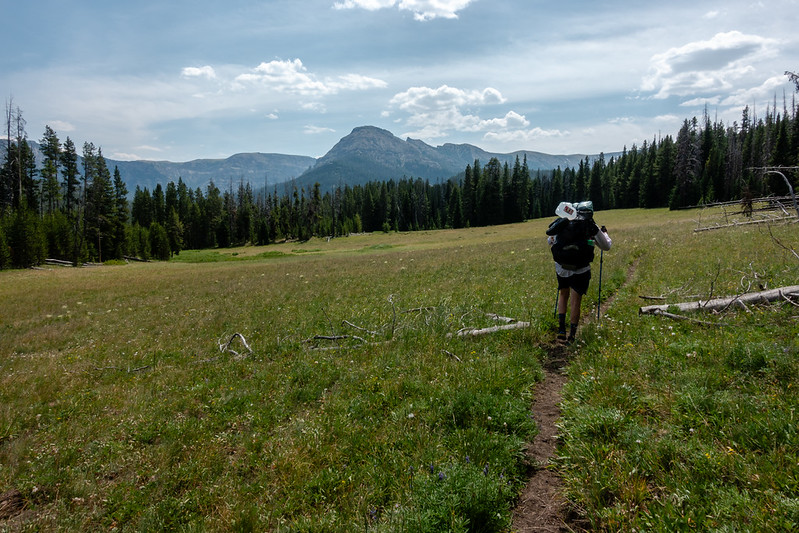
The rest of the valley involved a lot of meandering through groves of trees and trying to take advantage of meadows for easier going. There were countless small gullies of maybe 6-8 feet deep that weren't difficult but added up after a while. Lower down we ran into large patches of willows. One patch was maybe half a mile long. We did pick up a bit of a trail before going into it, but the trail ended up winding more or less along and in the creek for quite some time which made for slow and damp going. We made it to camp at maybe 6:30PM.
Day 2
The next day was much more uneventful. After Bob and I had made it to the bottom of the North Fork valley, we were already sure that at least most of the rest of the crew wouldn't appreciate that downclimb, so I messaged them via InReach to go down the trail along the South Fork. We ended up deciding to meet the group and camp at the confluence of the North and South forks.
The hike started with more willows, though less than before. The trail slowly became more established and after a while became surprisingly well maintained. It ended by going through an outfitter camp with some evidence of having fresh maintenance.
Good trail through willows
Many more crossings
Outfitter camp at the junction of north and south forks
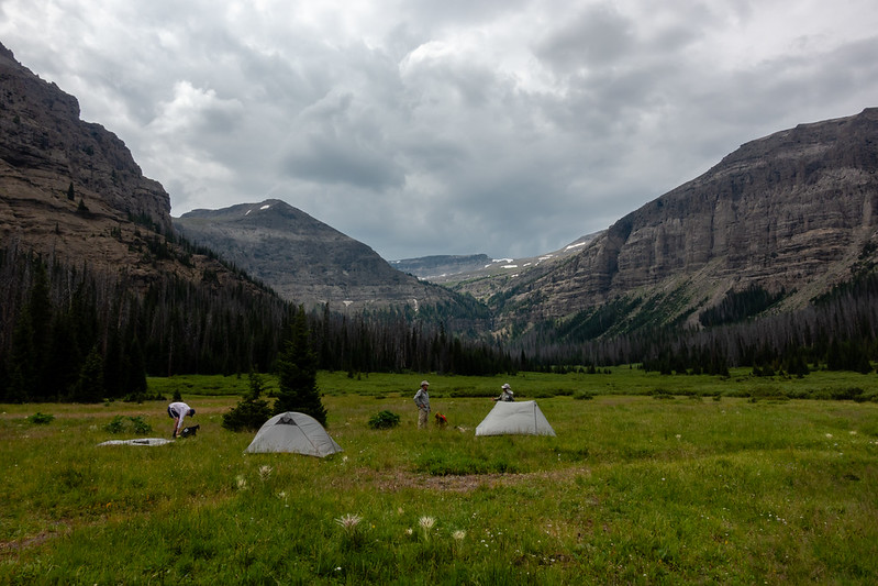
We waited for the rest and ended up making camp in a nice spot across Butte Creek. The rest of the group asked many questions about why we had them go a different way than planned, and we did our best to give a description of why.
Day 3
Now we were back on track, a bit ahead of schedule actually. Next camp was to be up in Hidden Valley.
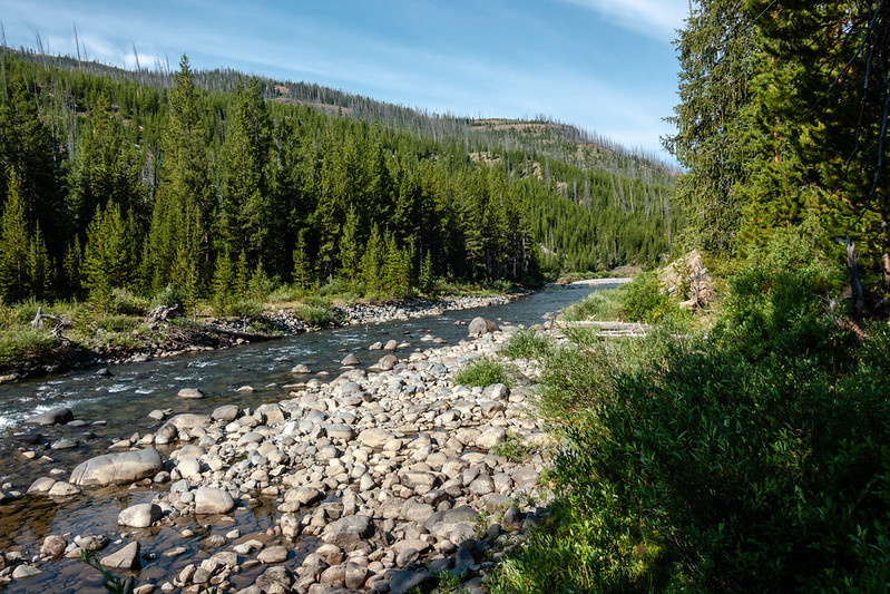
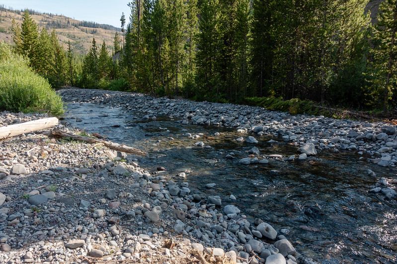
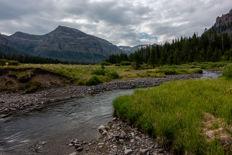
That most famous of backcountry streams, Thorofare Creek
Pass Creek
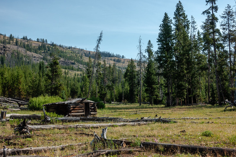
We found a backcountry cabin pointed out to us by another forum member not too far past Pass Creek. While we loitered around the cabin we saw somebody walk by and Scott must be credited with getting their attention. That turned out to be @Georgia Yankee who was out looking for us.
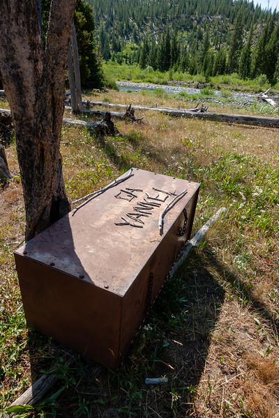
Jim left us some evidence near the crossing of Thorofare Creek in case we missed him on the trail.
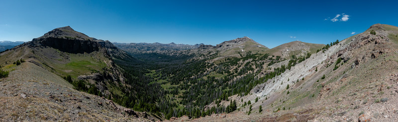
The hike up Hidden Creek valley on this day was exceedingly pleasant. Good outfitter trail and idyllic views.
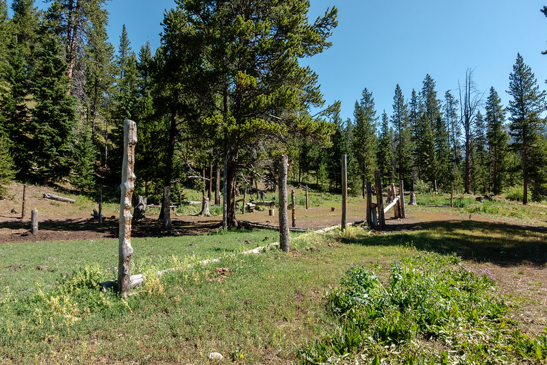
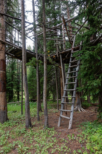
We found the outfitter camp in Hidden Creek Valley. The outfitter that took Bob and myself up to Deer Creek Pass is the very one that runs this camp. Constructions there were extensive and I spent a lot of time wandering around checking out what they had built.
Day 4
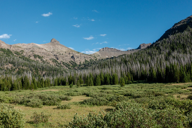
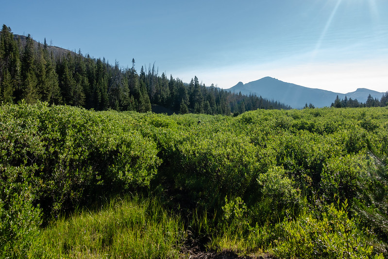
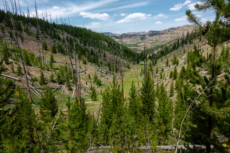
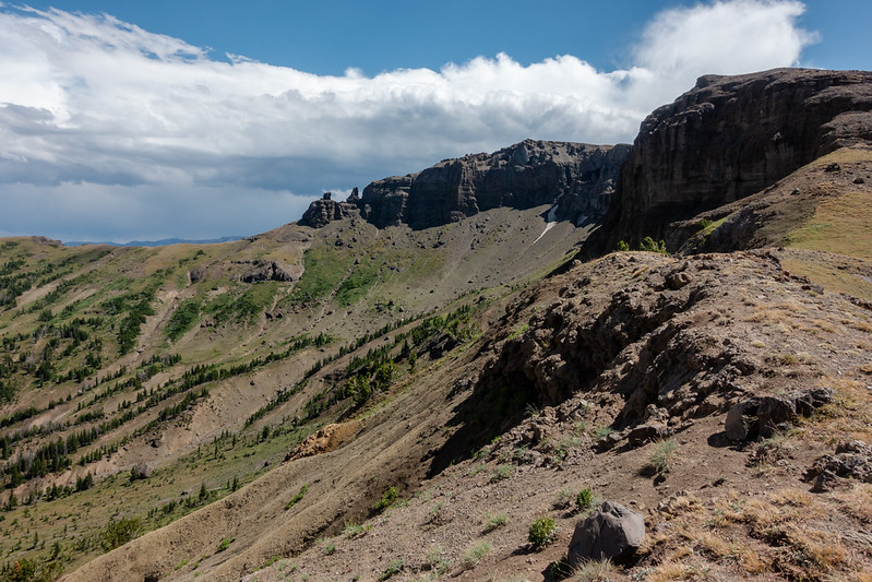
This day would be pretty simple. In theory, we wanted to get to the head of Hidden Creek Valley and get a look at potentially would be the gateway to a ridge walk that would take us maybe 3 days to complete. In practice, we didn't know if even the head of this valley would go or not, so this was real time scouting to see what was there. In any case, the upper part of Hidden Creek valley was full of great views and elk sign.
Elk beds
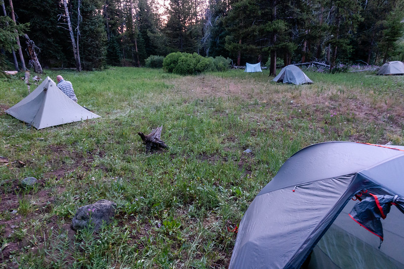
Unfortunately as soon as I set eyes on the head of the valley I knew we wouldn't be going up and out the head of it. Maybe a climber with the right skills could make it, but I didn't see anything that looked good. We made camp just before the floor of the valley turned entirely to willows and trees. Some of the guys pushed further up with scatman himself making it the furthest up the valley, but none had a positive report about our chances of exiting via the head of the valley. We had made it to camp early and it was a bit of a long afternoon, but there were great views to soak in and some tent time as some storms moved through.
Day 5
The next morning was very wet. Between the rains the previous afternoon and evening and relatively cold temps overnight, everything was wet. Tents were soaked. Grass was soaked. It was a wet hike until hitting the good outfitter trail at their camp. There is some trail in the upper part of the valley, but it becomes less visible the further up the valley you go.
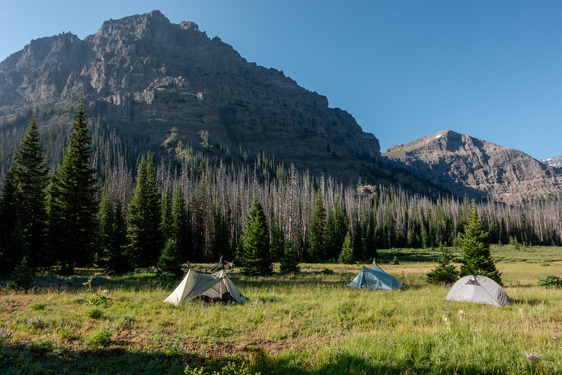
Camp was made along Thorofare Creek where the Hidden Creek trail crosses. It wasn't my favorite campsite of the trip, but it worked well enough. Some thunderstorms rolled through after dark making for a bit of excitement in the evening. Later on I got out of my tent and watched lightning on the horizon complement the stars overhead.
Day 6
On this day the group split. Bob, Hugh, and Dave would take a couple extra days to hike out. Scott, Chris, and myself would exit on day 7, making for only one more night. I took even fewer pictures on this day, having covered much of this ground before and since we also had an appreciable distance and elevation to cover. As we worked up toward Deer Creek Pass clouds were building and eventually a storm caught up with us. We sheltered in some trees about 800 feet below the pass. Not long after the storm went by I proposed and pretty much started a charge up the pass, wanting to get over fast as possible in case more storms were coming behind this one. It ended up being a non issue with no further storms that day, but at the top of the pass we did have a nice view of the storm that had ran over us across the South Fork valley miles away.
The pass, again. Didn't think I would be seeing this twice!
Stormy views across the south fork
Day 7
We camped at the same spot where the rest of the group had camped on their hike up the valley. Not an inspiring site, but good enough, if cramped. Fortunately this trail is not well used except by outfitters so we did not see anybody while camped.
The hike down was just kind of long and at times rocky. I have to say that the trail felt much more safe on my own feet instead of sitting on a horse, though my knees and quads might have suffered a bit more.
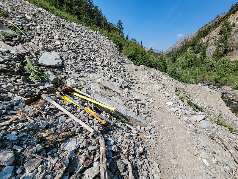
Slide area with tools staged at all times to repair the trail
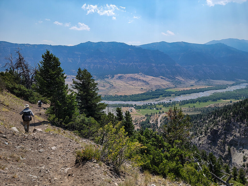
Nearing the end of the journey
We arrived at the trailhead in good time and went our separate ways. A shower sure feels good after a week in the wilderness, no matter how many times you can wash off in creeks!
Roster was as follows:
@Bob
@scatman
@TractorDoc
@wsp_scott
@futurafree
And myself.
Most honorable mention to @Georgia Yankee who met up with us along the Thorofare creek and became part of the group for a couple days then continued on his own extended trip in the wilderness.
Day 1
The trip started with the Deer Creek Trailhead on the South Fork of the Shoshone. Most of the group hiked up, but Bob and I took to horses and got a ride up to the top of Deer Creek Pass with an outfitter. It was an interesting experience for me. I'd rode when young, but it's been a very long time since I'd been in the saddle. The trail up to the pass was a rough re-introduction to being on horseback. There are some pretty exposed parts of the trail, especially at the top. The wrangler noted that they occasionally lose horses off the trail near the top. Some survive and some don't.
Top of the pass had some expansive views
Next Bob and I went even higher along the ridge toward the North Fork of Butte Creek to make the first night's camp.
The bowl to the left contained a few elk wandering around. There were two options to get down. One was what looked from Google Earth to be a steep scree gully, the other was an old trail that the outfitter knew of and described as an "old mountain man trail." We thought the gully looked better and headed that way.
As it turns out, there is no good way down into the North Fork. The outfitter trail looked to be in very bad shape and ran on top of some cliffs that would throw you into the abyss if you slipped (and from the looks of it that was nearly a guarantee). We ended up working down toward the gully noted via internet scouting. It was pretty awful. The rock was volcanic conglomerate that was really loose and made for terrible climbing. After looking at a couple gullies we found one that looked slightly less terrible than the others and I went down. We shuttled Bob's pack down after I had gotten to the bottom of the worst of it, then continued down into the valley below.
Photo is from part way down and doesn't really do justice to how steep and loose everything was.
We came down there somewhere.
The rest of the valley involved a lot of meandering through groves of trees and trying to take advantage of meadows for easier going. There were countless small gullies of maybe 6-8 feet deep that weren't difficult but added up after a while. Lower down we ran into large patches of willows. One patch was maybe half a mile long. We did pick up a bit of a trail before going into it, but the trail ended up winding more or less along and in the creek for quite some time which made for slow and damp going. We made it to camp at maybe 6:30PM.
Day 2
The next day was much more uneventful. After Bob and I had made it to the bottom of the North Fork valley, we were already sure that at least most of the rest of the crew wouldn't appreciate that downclimb, so I messaged them via InReach to go down the trail along the South Fork. We ended up deciding to meet the group and camp at the confluence of the North and South forks.
The hike started with more willows, though less than before. The trail slowly became more established and after a while became surprisingly well maintained. It ended by going through an outfitter camp with some evidence of having fresh maintenance.
Good trail through willows
Many more crossings
Outfitter camp at the junction of north and south forks
We waited for the rest and ended up making camp in a nice spot across Butte Creek. The rest of the group asked many questions about why we had them go a different way than planned, and we did our best to give a description of why.
Day 3
Now we were back on track, a bit ahead of schedule actually. Next camp was to be up in Hidden Valley.
That most famous of backcountry streams, Thorofare Creek
Pass Creek
We found a backcountry cabin pointed out to us by another forum member not too far past Pass Creek. While we loitered around the cabin we saw somebody walk by and Scott must be credited with getting their attention. That turned out to be @Georgia Yankee who was out looking for us.
Jim left us some evidence near the crossing of Thorofare Creek in case we missed him on the trail.
The hike up Hidden Creek valley on this day was exceedingly pleasant. Good outfitter trail and idyllic views.
We found the outfitter camp in Hidden Creek Valley. The outfitter that took Bob and myself up to Deer Creek Pass is the very one that runs this camp. Constructions there were extensive and I spent a lot of time wandering around checking out what they had built.
Day 4
This day would be pretty simple. In theory, we wanted to get to the head of Hidden Creek Valley and get a look at potentially would be the gateway to a ridge walk that would take us maybe 3 days to complete. In practice, we didn't know if even the head of this valley would go or not, so this was real time scouting to see what was there. In any case, the upper part of Hidden Creek valley was full of great views and elk sign.
Elk beds
Unfortunately as soon as I set eyes on the head of the valley I knew we wouldn't be going up and out the head of it. Maybe a climber with the right skills could make it, but I didn't see anything that looked good. We made camp just before the floor of the valley turned entirely to willows and trees. Some of the guys pushed further up with scatman himself making it the furthest up the valley, but none had a positive report about our chances of exiting via the head of the valley. We had made it to camp early and it was a bit of a long afternoon, but there were great views to soak in and some tent time as some storms moved through.
Day 5
The next morning was very wet. Between the rains the previous afternoon and evening and relatively cold temps overnight, everything was wet. Tents were soaked. Grass was soaked. It was a wet hike until hitting the good outfitter trail at their camp. There is some trail in the upper part of the valley, but it becomes less visible the further up the valley you go.
Camp was made along Thorofare Creek where the Hidden Creek trail crosses. It wasn't my favorite campsite of the trip, but it worked well enough. Some thunderstorms rolled through after dark making for a bit of excitement in the evening. Later on I got out of my tent and watched lightning on the horizon complement the stars overhead.
Day 6
On this day the group split. Bob, Hugh, and Dave would take a couple extra days to hike out. Scott, Chris, and myself would exit on day 7, making for only one more night. I took even fewer pictures on this day, having covered much of this ground before and since we also had an appreciable distance and elevation to cover. As we worked up toward Deer Creek Pass clouds were building and eventually a storm caught up with us. We sheltered in some trees about 800 feet below the pass. Not long after the storm went by I proposed and pretty much started a charge up the pass, wanting to get over fast as possible in case more storms were coming behind this one. It ended up being a non issue with no further storms that day, but at the top of the pass we did have a nice view of the storm that had ran over us across the South Fork valley miles away.
The pass, again. Didn't think I would be seeing this twice!
Stormy views across the south fork
Day 7
We camped at the same spot where the rest of the group had camped on their hike up the valley. Not an inspiring site, but good enough, if cramped. Fortunately this trail is not well used except by outfitters so we did not see anybody while camped.
The hike down was just kind of long and at times rocky. I have to say that the trail felt much more safe on my own feet instead of sitting on a horse, though my knees and quads might have suffered a bit more.
Slide area with tools staged at all times to repair the trail
Nearing the end of the journey
We arrived at the trailhead in good time and went our separate ways. A shower sure feels good after a week in the wilderness, no matter how many times you can wash off in creeks!

")
") )
)
 If I ever go missing, please check here first. Got a couple ideas burning a hole in my brain now, so you might find me out there as soon as September. I do so love an excuse to wander the Absarokas after all...