- Joined
- Jul 23, 2013
- Messages
- 1,665
For Day 2 along this Wind River High Route, we aim for a 2nd bucket list destination in as many days: Desolation Valley...
Saturday - July 24, 2021
Day 2: Cirque of the Towers to Desolation Valley
MILES: 11.5 | GAIN: 2,275 ft
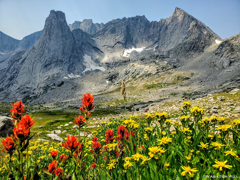
Surprisingly, it never got real cold through the first night, even with clear skies. Still cold enough to make it worth putting on the puffy jacket when we awoke, but nothing like I've experienced in mid-summer at comparable elevations in the past.
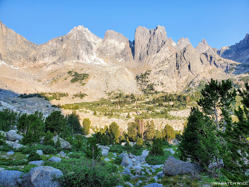
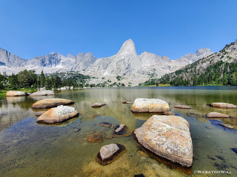
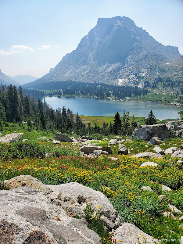
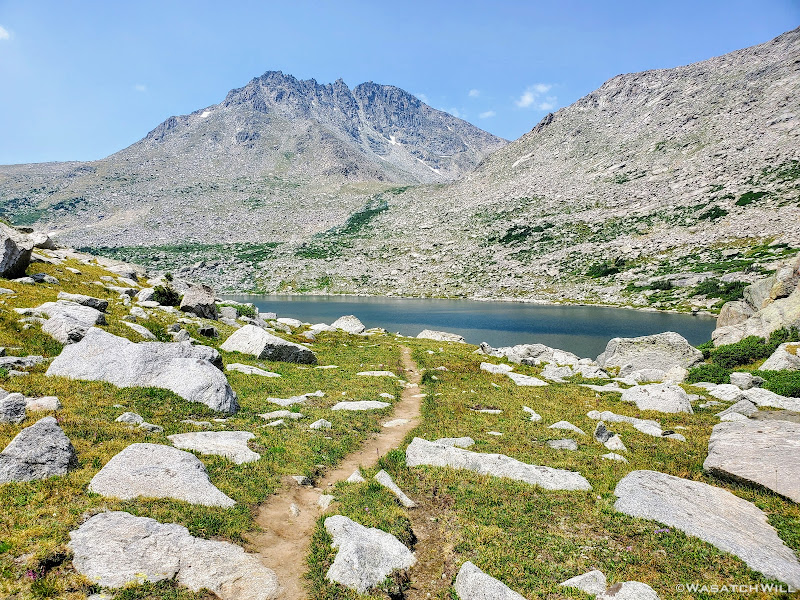
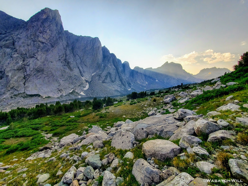
As anticipated the view out of my tent was sensational.
With the sun now shining from the east, the smoky filter that had been so visible the previous evening was no longer so prominent. The high granite towers that stood at the head of this basin were every bit as majestic and wondrous as they had appeared in pictures and videos all over the Internet. No doubt at least a few dozen folks were gearing up to climb some of the granite walls we were staring out at, if they were not already on belay. After all, the Cirque of the Towers is a world famous destination for alpine rock climbing, a factor that contributes to a chunk of its ever-growing popularity.
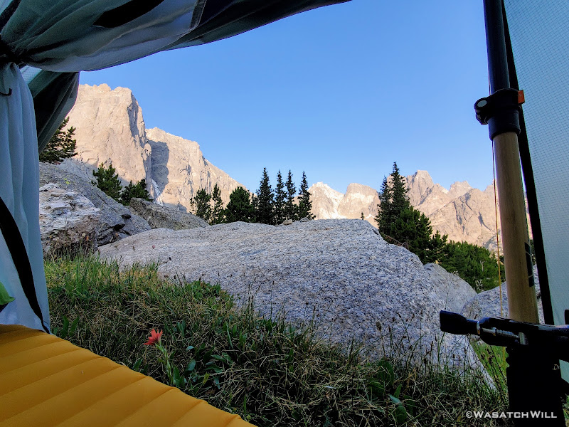
Wake-up View
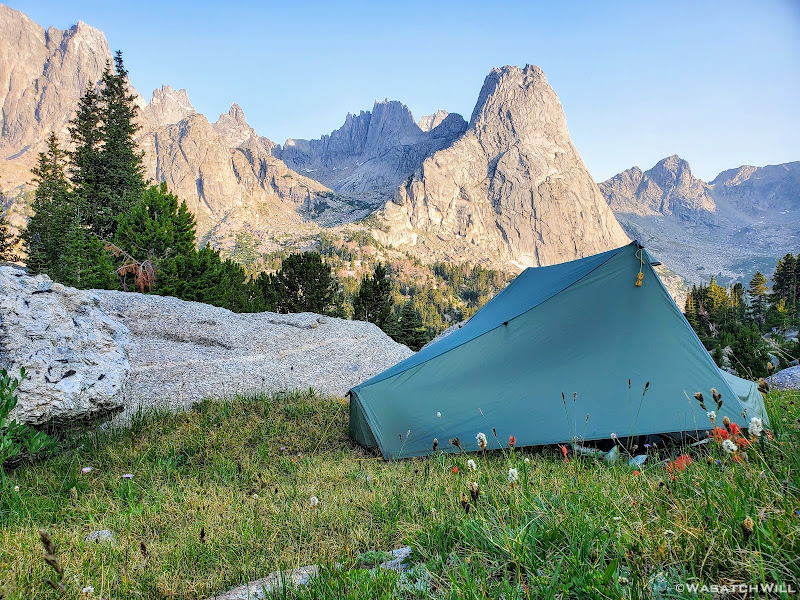
Tarptent Notch nestled high up in the Cirque of the Towers, Pingora Peak above it
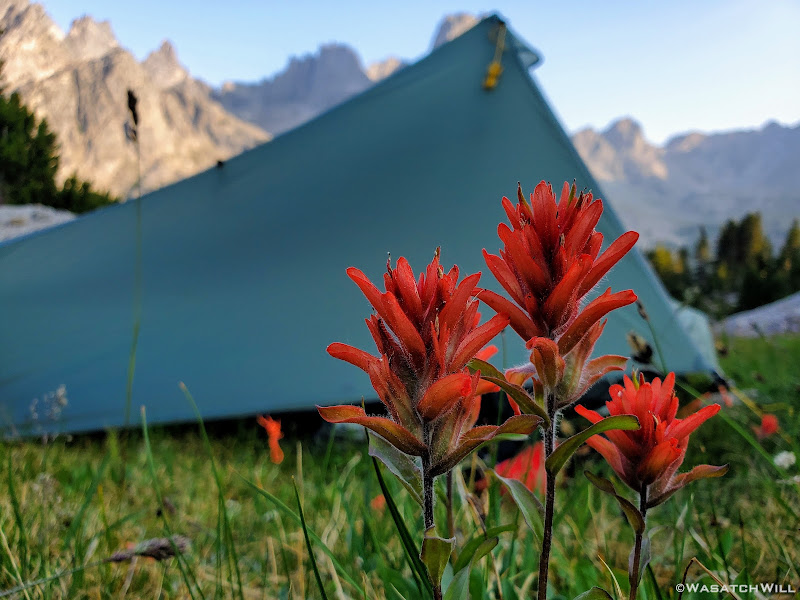
Red paintbrush flowers outside my tent
The sweeping panorama view we had from camp featured from south to north: Warbonnet Peak, Warrior Peaks, Pylon Peak, Watch Tower, Block Tower, Sharks Nose, Overhanging Tower, Wolfs Head, Pingora Peak, Camel Hump, and Lizard Head Peak.
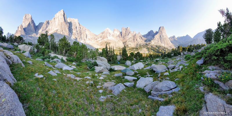
Panoramic view from camp
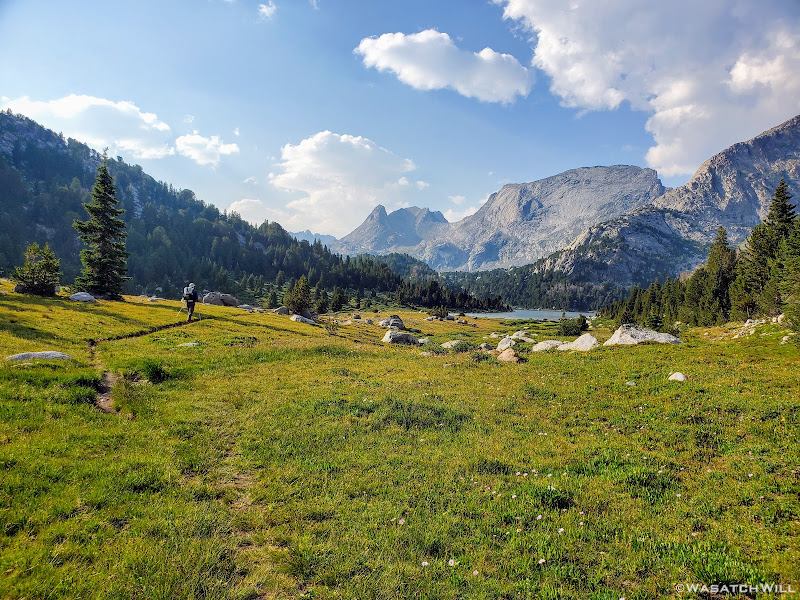
After a round of picture taking, soaking in the morning view, and eating a quick breakfast, we broke camp and set our sights toward waterfall we could hear way down in the distance.
Bonus points for whoever can spot the waterfall above!
I wasn't sure if it'd be the same waterfall that I had seen in other photos across the Internet, but it looked promising. Indeed, once we arrived, I became much more certain it was said waterfall. We had to pass close by and around a couple camps to get to it though. Such is life in the Cirque. A couple other guys came up to it for a moment after we arrived and then continued on, but that was it.
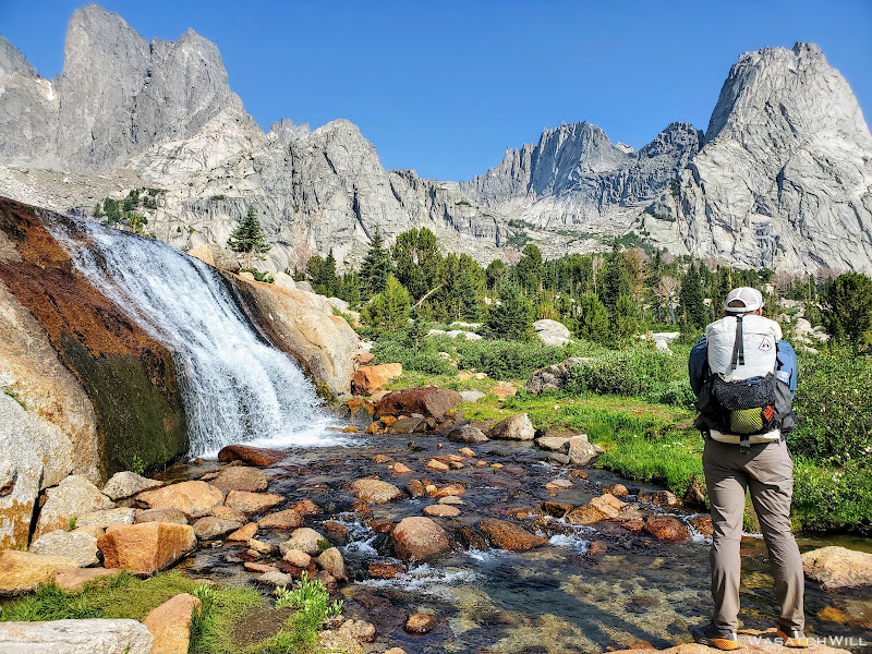
Blake spots up by the waterfall
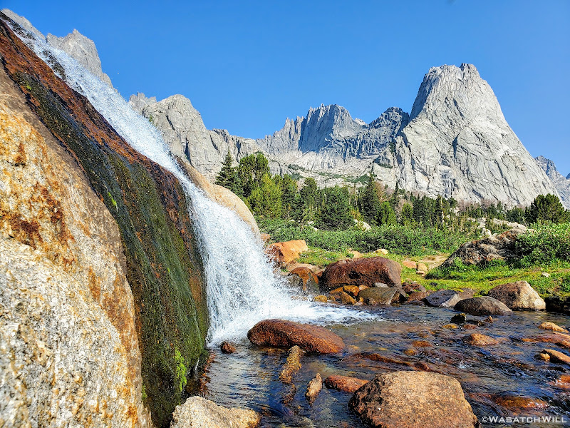
Close-up angle of waterfall with Pingora Peak in the upper right
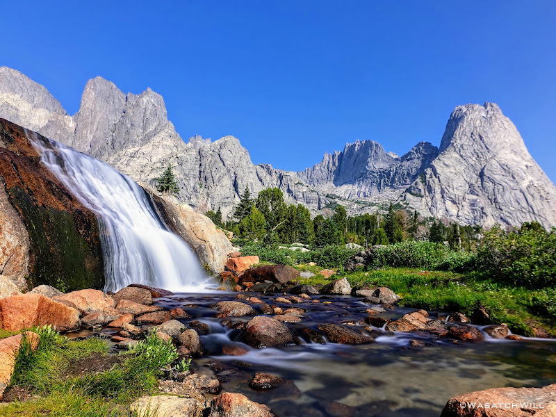
Long exposure of the waterfall
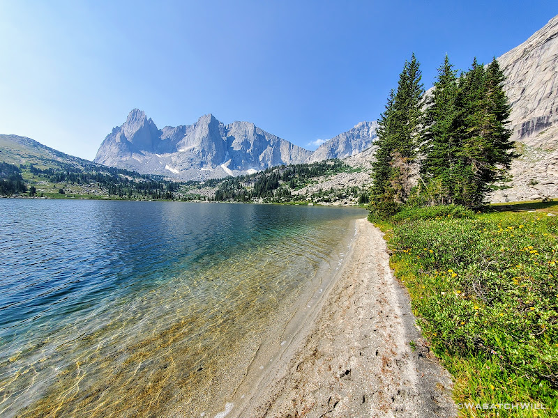
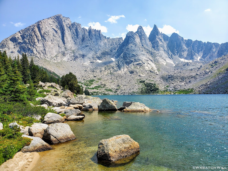
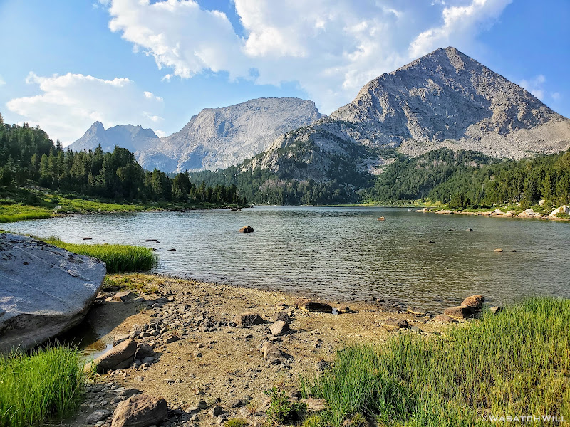
From the falls we made our way down to Lonesome Lake. Rather than take the short path along its western edge right beneath Pingora Peak, we opted to take a tour around the east side. Clear skies made for a less interesting reflection across the lake, but we were still treated to another nice view. Lonesome Lake certainly has no reason to feel Lonesome though. Granted, there are no other large lakes close by, but what it lacks in water body friends it makes up for in human body friends. For at this point, numerous other people were now out and about and several of them had stopped to take in the same view we had pulled over for.
Pingora Peak reflects across Lonesome Lake
Rounding around the other side, we lost much of the crowds we had just come through. But that would only be temporary. A parade of other backpackers would soon descend Texas Pass into the Cirque and a few more would likely follow behind us going the opposite way.
You've heard of South Beach, but this here is 'North Beach'
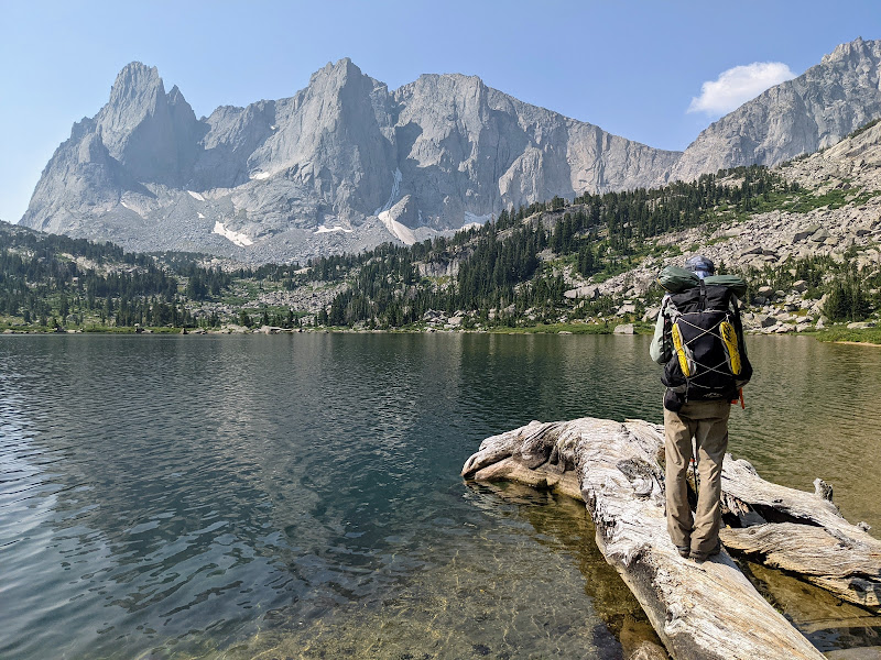
Just myself, out on a log, surveying the water for some fish (photo by Blake)
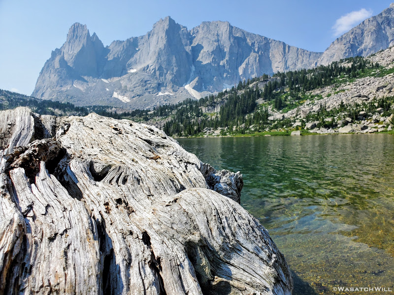
Log at the shore of Lonesome Lake, Warbonnet and Warrior Peaks above
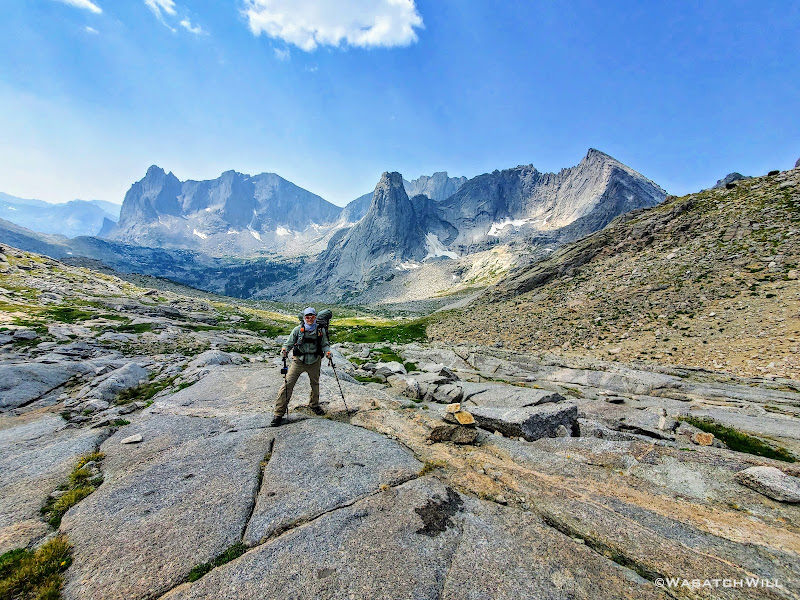
Like its namesake state, Texas Pass is big. While not as high as Anderson Pass in the Uintas of Utah, the approach up Texas Pass certainly reminded me of it. It was still pretty high up from where we started the ascent, it was long, and just like Anderson, as just mentioned, there would be a parade of people to pass by and greet along the way.
Looking back at Lonesome Lake from first rise of Texas Pass, Mitchell Peak above
Looking up toward Texas Pass (upper right)
A look back at Warbonnnet/Warrior Peaks (left), Pingora Peak (middle), and Wolfs Head (right)
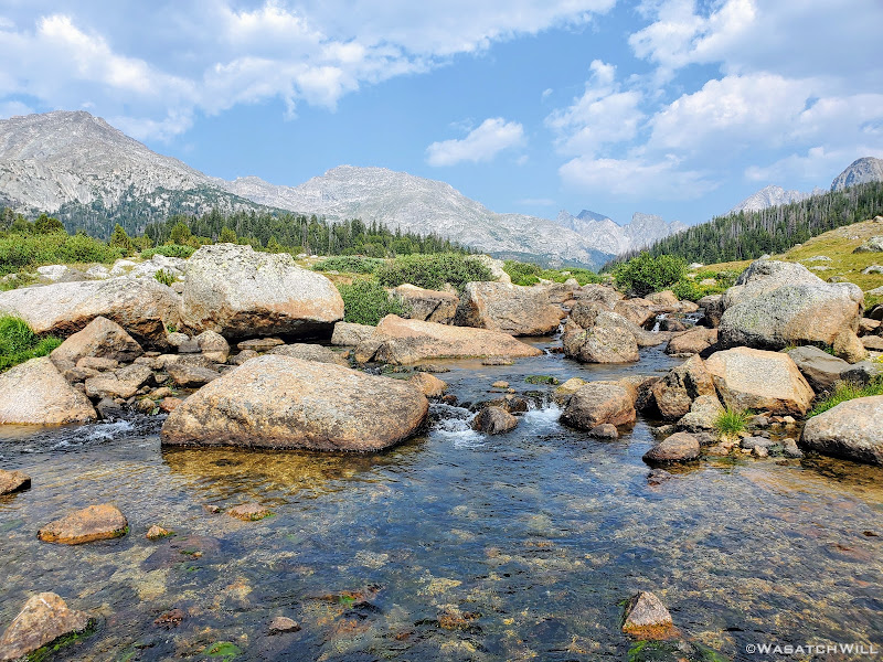
En route up the pass, we stopped somewhere along the way to filter some water streaming through a large meadow and to have a small snack.
We'd also be treated to a few patches of wild flowers that only added to the pristine mountain landscape. Whether it's the Wasatch Mountains, the Uinta Mountains, or any other high alpine mountain range in the Rockies, late July certainly seems to be the peak season for wildflowers according to my experience.
However, there's a big price you must pay for this lush green and colorful experience: MOSQUITOS. While probably having nothing to directly do with each other, I do find it ironic that when mosquitos finally start fading away, so then do most of the flowers in these mountainous settings. It's as if both the flowers and the mosquitos have been programmed and synchronized to peak and fade altogether at the same time.
Fortunately for this stretch, the mosquitos had been left behind. That certainly was not the case in the more marshy areas nor that of any area surrounding any lake, pond, or tarn.
Speaking of all the mosquitos, I'll note another fortunate thing for me with regards them. Despite all the mosquitos that would swarm us along various sections of our route, I don't remember ever being bothered enough to throw on my head net or even put on bug repellent. I was certainly prepared with both on hand, knowing it was the season for these blood-thirsty mini-demons, but I never caught more than one or two daring to proceed beyond swarming to actually take a bite over the course of the whole trip. Not sure why, but that hasn't been too uncommon for me during some of the trips I've taken. I'm not sure if it's me or them, but even of the few that are brave enough to take a bite, my skin never swells up or reacts to them. Wish I could say the same for my wife and kids on this matter, but that is not the case with them. They have nasty bad reactions that itch for days at each bite site.
But I digress. Let's move on....
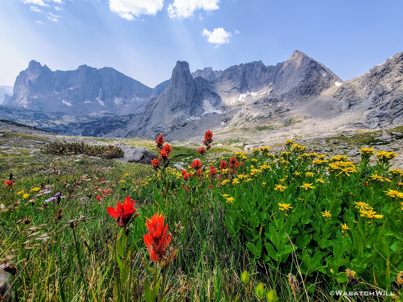
Paintbrush (red) and Arnicas (yellow) grace the grassy slopes of Texas Pass
Closer up on the flowers with Pingora Peak and Wolfs Head above
Almost to the top of Texas Pass (photo by Blake)
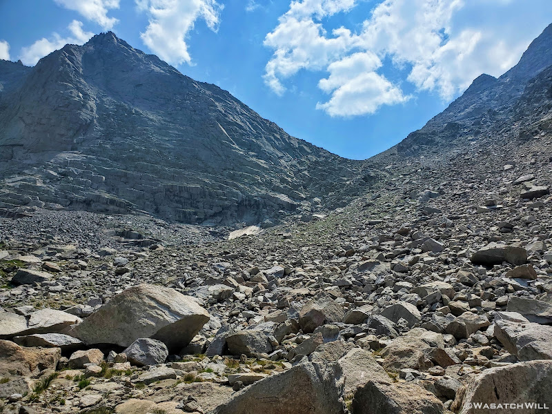
Right before cresting over the top of the pass, we had a snowfield to cross. It was soft with a gentle grade and plenty of footprints that had beaten down a track, altogether squashing any temptation to put on micro-spikes.
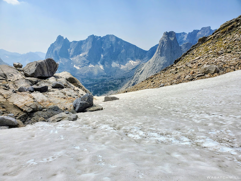
Snowfield at the top of Texas Pass
At the top of the pass we met an amazing family from Ohio, the father being an orthopedist at Ohio State University. What made this family stand out from the many other groups we'd encounter, this day or throughout the trip, is that not only was there a father and mother duo here with children in stow, it was four children ranging from mid or younger aged teens at the oldest down to around 6 or 7 years old. If I remember right, they were doing the more popular loop out of Big Sandy that circles over and around Shadow Lake, Texas Lake, and then up and over into the Cirque of the Towers. Tasty snacks and treats every so often were the consistent motivating factor that kept the younger of these amazing kids rolling along. Of course they were pacing themselves out with a lower amount of miles each day, spending something like five days doing a route that most people tend to spend three days doing.
And yet, as amazed as I was with this family, a part of me was also a little jealous. I've taken my whole family backpacking a couple of times before myself and also taken each of my kids out on some one-on-one trips over the years and tried to challenge them a little bit, even at younger ages. But none of those trips, save one overnighter with my oldest daughter up Y Mountain of the Wasatch Mountains close to my home could compare to how strenuous it would be to incorporate Texas Pass into a route with kids that young. But they had done it, and using the steeper and arguably tougher way up it, coming from Texas Lake, no less.
I then reminded myself that, beyond the beauty of their surroundings, this family was likely experiencing something even more important, more enriching, even more beautiful and fulfilling than the scenery alone. It was the time they were able to share with each other, the bonding that they no doubt experienced in successfully taking on a challenge and completing it together, and simply just being outdoors with each other surrounded by nature and away from much of the technology that drives modern society. I could now relate to this because indeed that has been the experience I've been blessed to have with my own family in our own respective trips. Having only been two days out, this encounter still made me miss my family for a bit. Ok. A LOT. It would be five more days away from them before I would return to their presence.
Blake and I then pulled over for another mid-morning snack as we watched a few other groups of people pass on by and/or pull over for their own rest, most heading down for the Cirque having come up from Texas and Shadow Lakes.
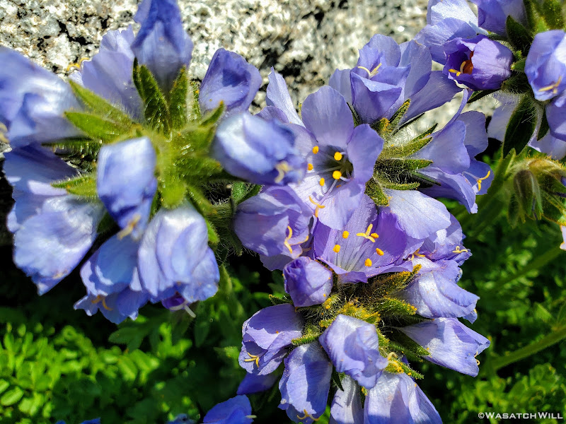
Polemonium Viscosum, aka Sky Pilot, aka Skunkweed, aka Sticky Jacobs Ladder
Once well rested from the long haul up Texas Pass, we then descended down the steeper, rockier, and somewhat less stable north side to Texas Lake down below.
Blake making the descent down to Texas Lake below
Looking back up Texas Pass from near the shore of Texas Lake
Texas Lake with Camel Hump above (upper right)
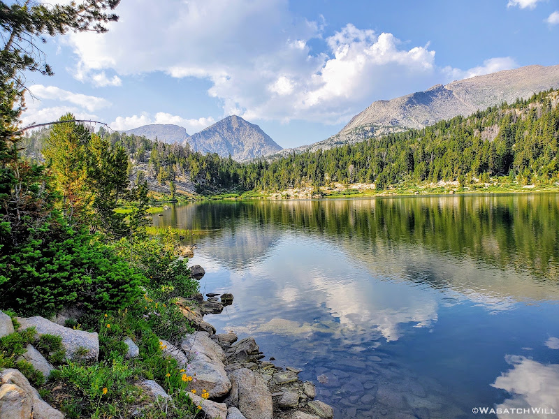
Following Texas Lake, we'd pass right by two other sizeable lakes before stopping in at Shadow Lake for lunch. Those lakes, in order, would be Barren Lake and Billy's Lake.
Blake take another look back toward Texas Lake
Approaching Barren Lake with Bair Peak above
Approaching Billys Lake (photo by Blake)
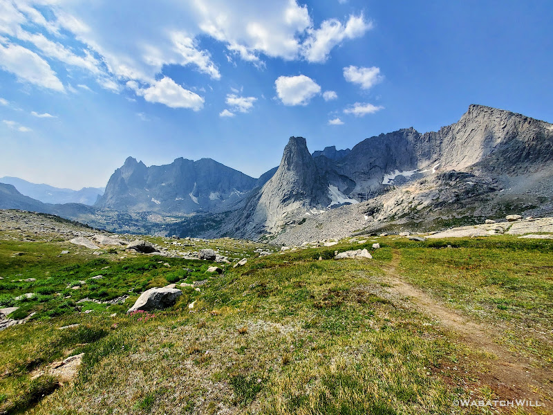
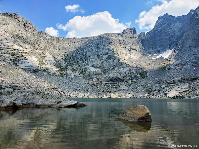
At Shadow Lake, we found ourselves a nice shady spot to pull into for some refuge from the hot sun that had now been beating down on us. Nearby a group was camped out and in another couple spots nearby some other groups moved in for the evening. Still others would pass on by. We enjoyed a nice long rest while fueling back up with some lunch all while being treated to a nice view of the back side of the Cirque of the Towers, including: Bollinger Peak, Wolfs Head, Overhead Tower, Sharks Nose, Block Tower, and Watch Tower.
Shadow Lake
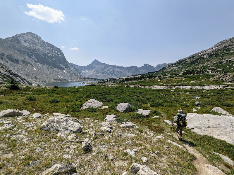
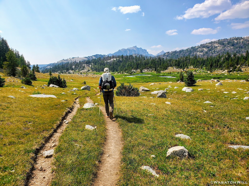
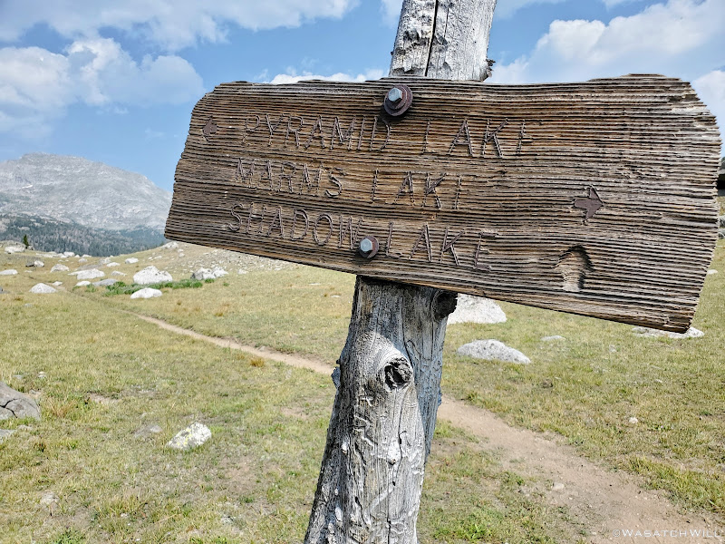
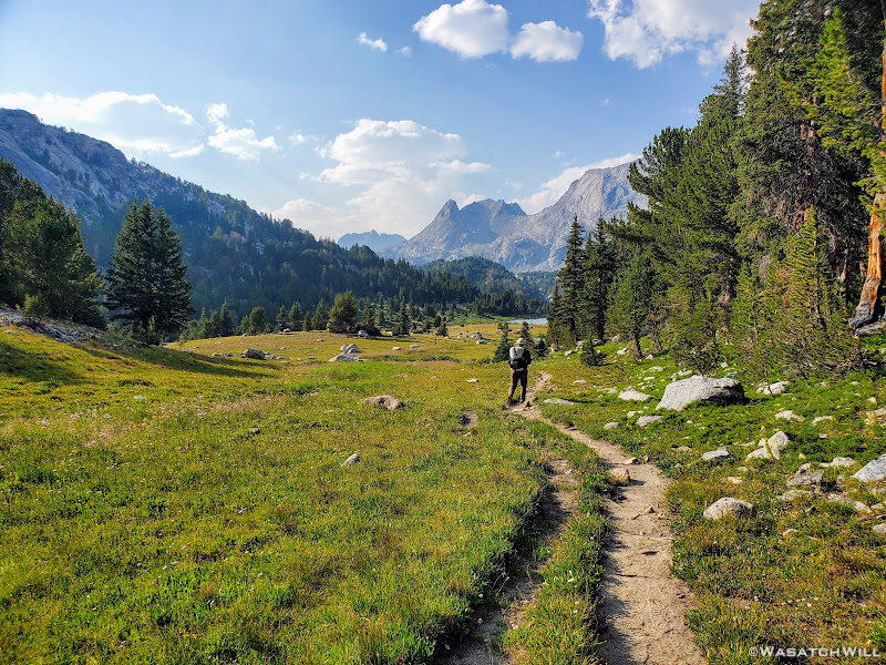
Alas, it was time to get back on trail and make haste for the destination of this day: Upper East Fork...a.k.a...Desolation Valley. It was now getting to be mid-afternoon, we had only come 4.5 miles to this point and had another 7 or so miles to go. The first couple of miles from here would lead us westward to a junction with a trail to Pyramid Lake.
Looking back at the western face of the Cirque of the Towers
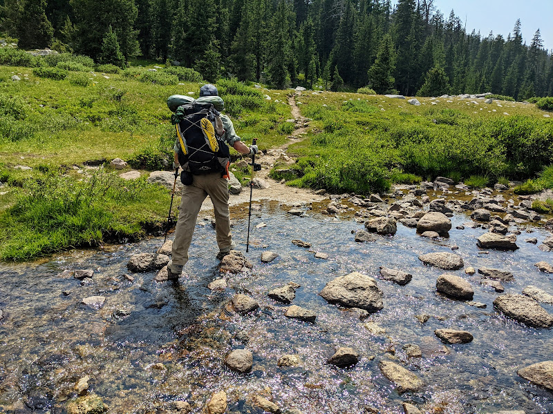
Crossing Washakie Creek
Our day's target now in view, Ambush Peak rises up in the distance
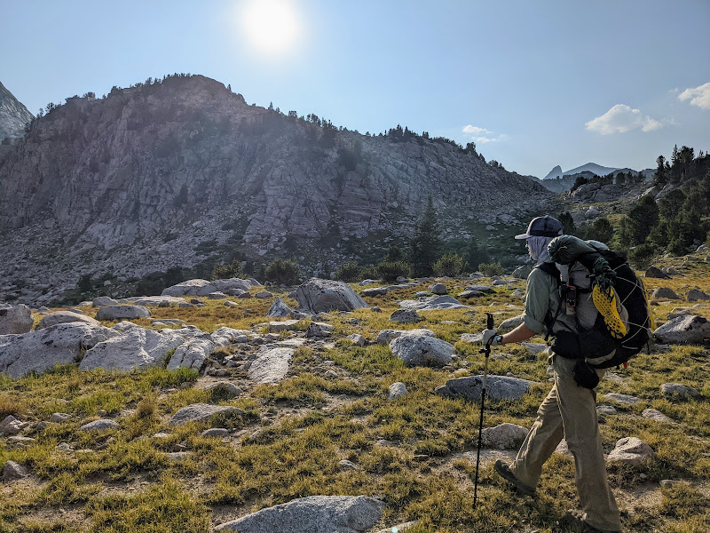
Blake blazes on ahead
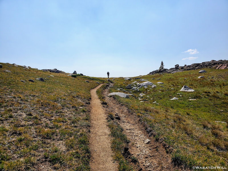
Once we reached the Pyramid Lake Trail junction, we made a 90 degree turn for the north. Indeed Pyramid Lake itself would lie in wait along the way. Prior to arriving there though, we'd cross over Washakie Creek once more and pass by Skull Lake and Mays Lake. We'd also get to gaze up ahead at Pyramid Peak, Mount Hooker, and Tower Peak out in the distance beyond for much of the way. Also, once we made the turn here, the crowds vanished. While we'd encounter another couple groups hereafter on the day, both around Skull Lake, that would be it for the remainder of the day.
Pyramid Trail junction
Washakie Creek with Mount Washakie, Bair Peak and west face of Cirque of the Towers beyond
Heading northbound with Tower Peak, Mount Hooker, and Pyramid Peak now in view
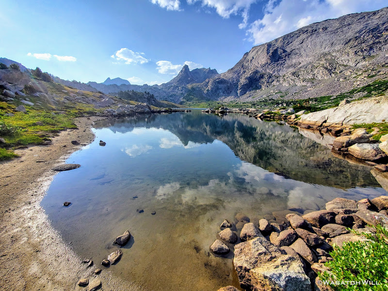
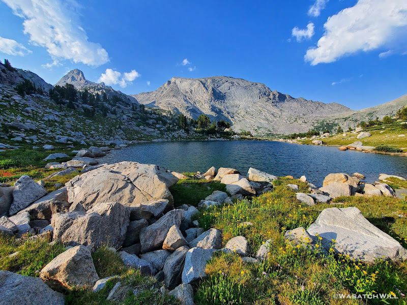
Skull Lake with Mount Hooker, Pyramid Peak, and Hailey Pass above
Blake with a peek at Mays Lake coming into view
Blake gets closer to Mays Lake, Tower Peak and Mount Hooker above
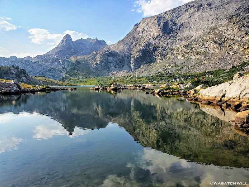
Mays Lake with Tower Peak (left), Mount Hooker (middle), Pyramid Peak (right)
Pyramid Lake beneath Tower Peak and Mount Hooker
Pyramid Lake
Last of the official trail alongside Pyramid Lake
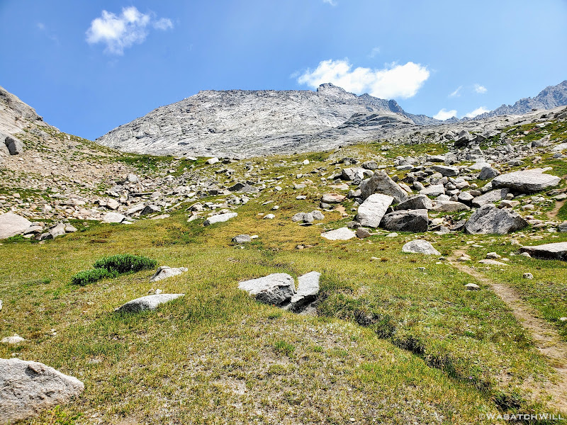
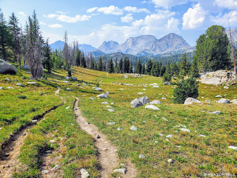
Once at Pyramid Lake we turned our attention to East Fork Park, er, Desolation Valley. We'd now be departing what had been a mostly official, well established, and well maintained trail to this point in our route since we had left the trailhead the prior day. From now until we reached Middle Fork Lake later on the morrow, we'd now be left on our own to navigate off trail making use of unofficial use trails as they appeared in spots wherever we could find them. Elsewhere we'd have wide open tundra to walk across and some long fields of rocks and larger talus to pick our way through.
Let the high route officially begin!
Now officially off trail (photo by Blake)
Looking back at Mount Hooker from across a tarn
A little while after leaving Pyramid Lake behind us, we crested over a ridge that enabled us to gaze out what would be our day's prize: A place to camp nestled along a string of picturesque lakes. Here, the sun was now leaving us as it made its way down behind Ambush Peak standing up ahead of us.
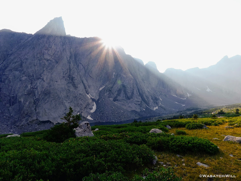
Desolation Valley comes into view as the sun sets behind Ambush Peak
Sunrays shine forth from between Ambush and Raid Peaks
After a brief descent down off the ridge, we settled into a flat little grassy area tucked up above and between two of the local lakes. Nearby stood a stand of short trees, but still plenty high and sturdy enough to hold our Ursack bear bags for the evening.
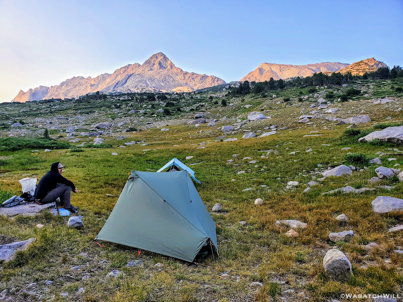
All settled in at Desolation Camp
Once our tents were up we settled down behind a rocky protrusion alongside of our camp that served as a very nice back rest. Of course, now sitting beneath the amazing Ambush Peak, it was only fitting that I pull out a prized Peak Refuel brand meal for dinner. Beef Pasta Marinara. It was hearty and delicious. Yum.
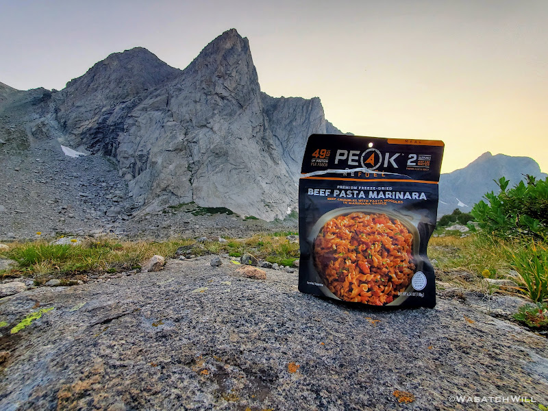
A peek at a peak and Peak
As what would become the routine every night, we'd retire to our tents soon after dinner.
While we would end up camping every night the rest of the way by numerous places that would have certainly been fun to fish, we had opted to leave our fishing gear at home for this trip. Not only did it allow us to save some space and weight (not that fishing gear needs to weigh much or take up much space), but we also knew we'd probably have precious little time if any or simply be too exhausted to actually fish at most of the locations we'd pass by and/or camp at. Also, being from out of state, visitor licenses for Wyoming, as with so many other states, are quite costly, even for just a week. Being so remote, it's highly unlikely one would be inspected for a license as might be more likely at a state managed reservoir or other body of water closer to main roads, but I still feel better doing it legally.
Now dark, I snapped up another long exposure of our camp before slipping into my tent to officially close out day two. This had been another location I was very much looking forward to camping at. As excited as I was to see the Cirque of the Towers and wake up there earlier in the morning, for some reason, I was even more excited for this spot. Needless to say, I was thrilled and overjoyed to be here on this eve and very much looked forward to seeing how the coming morning's light would make this area look.
Lights out for Blake, not yet for me
TO BE CONTINUED...
WRHR: DAY 1 - BIG SANDY TO CIRQUE OF THE TOWERS
VIDEO:
Saturday - July 24, 2021
Day 2: Cirque of the Towers to Desolation Valley
MILES: 11.5 | GAIN: 2,275 ft
Surprisingly, it never got real cold through the first night, even with clear skies. Still cold enough to make it worth putting on the puffy jacket when we awoke, but nothing like I've experienced in mid-summer at comparable elevations in the past.
As anticipated the view out of my tent was sensational.
With the sun now shining from the east, the smoky filter that had been so visible the previous evening was no longer so prominent. The high granite towers that stood at the head of this basin were every bit as majestic and wondrous as they had appeared in pictures and videos all over the Internet. No doubt at least a few dozen folks were gearing up to climb some of the granite walls we were staring out at, if they were not already on belay. After all, the Cirque of the Towers is a world famous destination for alpine rock climbing, a factor that contributes to a chunk of its ever-growing popularity.
Wake-up View
Tarptent Notch nestled high up in the Cirque of the Towers, Pingora Peak above it
Red paintbrush flowers outside my tent
The sweeping panorama view we had from camp featured from south to north: Warbonnet Peak, Warrior Peaks, Pylon Peak, Watch Tower, Block Tower, Sharks Nose, Overhanging Tower, Wolfs Head, Pingora Peak, Camel Hump, and Lizard Head Peak.
Panoramic view from camp
After a round of picture taking, soaking in the morning view, and eating a quick breakfast, we broke camp and set our sights toward waterfall we could hear way down in the distance.
Bonus points for whoever can spot the waterfall above!
I wasn't sure if it'd be the same waterfall that I had seen in other photos across the Internet, but it looked promising. Indeed, once we arrived, I became much more certain it was said waterfall. We had to pass close by and around a couple camps to get to it though. Such is life in the Cirque. A couple other guys came up to it for a moment after we arrived and then continued on, but that was it.
Blake spots up by the waterfall
Close-up angle of waterfall with Pingora Peak in the upper right
Long exposure of the waterfall
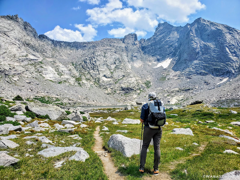
From the falls we made our way down to Lonesome Lake. Rather than take the short path along its western edge right beneath Pingora Peak, we opted to take a tour around the east side. Clear skies made for a less interesting reflection across the lake, but we were still treated to another nice view. Lonesome Lake certainly has no reason to feel Lonesome though. Granted, there are no other large lakes close by, but what it lacks in water body friends it makes up for in human body friends. For at this point, numerous other people were now out and about and several of them had stopped to take in the same view we had pulled over for.
Pingora Peak reflects across Lonesome Lake
Rounding around the other side, we lost much of the crowds we had just come through. But that would only be temporary. A parade of other backpackers would soon descend Texas Pass into the Cirque and a few more would likely follow behind us going the opposite way.
You've heard of South Beach, but this here is 'North Beach'
Just myself, out on a log, surveying the water for some fish (photo by Blake)
Log at the shore of Lonesome Lake, Warbonnet and Warrior Peaks above
Like its namesake state, Texas Pass is big. While not as high as Anderson Pass in the Uintas of Utah, the approach up Texas Pass certainly reminded me of it. It was still pretty high up from where we started the ascent, it was long, and just like Anderson, as just mentioned, there would be a parade of people to pass by and greet along the way.
Looking back at Lonesome Lake from first rise of Texas Pass, Mitchell Peak above
Looking up toward Texas Pass (upper right)
A look back at Warbonnnet/Warrior Peaks (left), Pingora Peak (middle), and Wolfs Head (right)
En route up the pass, we stopped somewhere along the way to filter some water streaming through a large meadow and to have a small snack.
We'd also be treated to a few patches of wild flowers that only added to the pristine mountain landscape. Whether it's the Wasatch Mountains, the Uinta Mountains, or any other high alpine mountain range in the Rockies, late July certainly seems to be the peak season for wildflowers according to my experience.
However, there's a big price you must pay for this lush green and colorful experience: MOSQUITOS. While probably having nothing to directly do with each other, I do find it ironic that when mosquitos finally start fading away, so then do most of the flowers in these mountainous settings. It's as if both the flowers and the mosquitos have been programmed and synchronized to peak and fade altogether at the same time.
Fortunately for this stretch, the mosquitos had been left behind. That certainly was not the case in the more marshy areas nor that of any area surrounding any lake, pond, or tarn.
Speaking of all the mosquitos, I'll note another fortunate thing for me with regards them. Despite all the mosquitos that would swarm us along various sections of our route, I don't remember ever being bothered enough to throw on my head net or even put on bug repellent. I was certainly prepared with both on hand, knowing it was the season for these blood-thirsty mini-demons, but I never caught more than one or two daring to proceed beyond swarming to actually take a bite over the course of the whole trip. Not sure why, but that hasn't been too uncommon for me during some of the trips I've taken. I'm not sure if it's me or them, but even of the few that are brave enough to take a bite, my skin never swells up or reacts to them. Wish I could say the same for my wife and kids on this matter, but that is not the case with them. They have nasty bad reactions that itch for days at each bite site.
But I digress. Let's move on....
Paintbrush (red) and Arnicas (yellow) grace the grassy slopes of Texas Pass
Closer up on the flowers with Pingora Peak and Wolfs Head above
Almost to the top of Texas Pass (photo by Blake)
Right before cresting over the top of the pass, we had a snowfield to cross. It was soft with a gentle grade and plenty of footprints that had beaten down a track, altogether squashing any temptation to put on micro-spikes.
Snowfield at the top of Texas Pass
At the top of the pass we met an amazing family from Ohio, the father being an orthopedist at Ohio State University. What made this family stand out from the many other groups we'd encounter, this day or throughout the trip, is that not only was there a father and mother duo here with children in stow, it was four children ranging from mid or younger aged teens at the oldest down to around 6 or 7 years old. If I remember right, they were doing the more popular loop out of Big Sandy that circles over and around Shadow Lake, Texas Lake, and then up and over into the Cirque of the Towers. Tasty snacks and treats every so often were the consistent motivating factor that kept the younger of these amazing kids rolling along. Of course they were pacing themselves out with a lower amount of miles each day, spending something like five days doing a route that most people tend to spend three days doing.
And yet, as amazed as I was with this family, a part of me was also a little jealous. I've taken my whole family backpacking a couple of times before myself and also taken each of my kids out on some one-on-one trips over the years and tried to challenge them a little bit, even at younger ages. But none of those trips, save one overnighter with my oldest daughter up Y Mountain of the Wasatch Mountains close to my home could compare to how strenuous it would be to incorporate Texas Pass into a route with kids that young. But they had done it, and using the steeper and arguably tougher way up it, coming from Texas Lake, no less.
I then reminded myself that, beyond the beauty of their surroundings, this family was likely experiencing something even more important, more enriching, even more beautiful and fulfilling than the scenery alone. It was the time they were able to share with each other, the bonding that they no doubt experienced in successfully taking on a challenge and completing it together, and simply just being outdoors with each other surrounded by nature and away from much of the technology that drives modern society. I could now relate to this because indeed that has been the experience I've been blessed to have with my own family in our own respective trips. Having only been two days out, this encounter still made me miss my family for a bit. Ok. A LOT. It would be five more days away from them before I would return to their presence.
Blake and I then pulled over for another mid-morning snack as we watched a few other groups of people pass on by and/or pull over for their own rest, most heading down for the Cirque having come up from Texas and Shadow Lakes.
Polemonium Viscosum, aka Sky Pilot, aka Skunkweed, aka Sticky Jacobs Ladder
Once well rested from the long haul up Texas Pass, we then descended down the steeper, rockier, and somewhat less stable north side to Texas Lake down below.
Blake making the descent down to Texas Lake below
Looking back up Texas Pass from near the shore of Texas Lake
Texas Lake with Camel Hump above (upper right)
Following Texas Lake, we'd pass right by two other sizeable lakes before stopping in at Shadow Lake for lunch. Those lakes, in order, would be Barren Lake and Billy's Lake.
Blake take another look back toward Texas Lake
Approaching Barren Lake with Bair Peak above
Approaching Billys Lake (photo by Blake)
At Shadow Lake, we found ourselves a nice shady spot to pull into for some refuge from the hot sun that had now been beating down on us. Nearby a group was camped out and in another couple spots nearby some other groups moved in for the evening. Still others would pass on by. We enjoyed a nice long rest while fueling back up with some lunch all while being treated to a nice view of the back side of the Cirque of the Towers, including: Bollinger Peak, Wolfs Head, Overhead Tower, Sharks Nose, Block Tower, and Watch Tower.
Shadow Lake
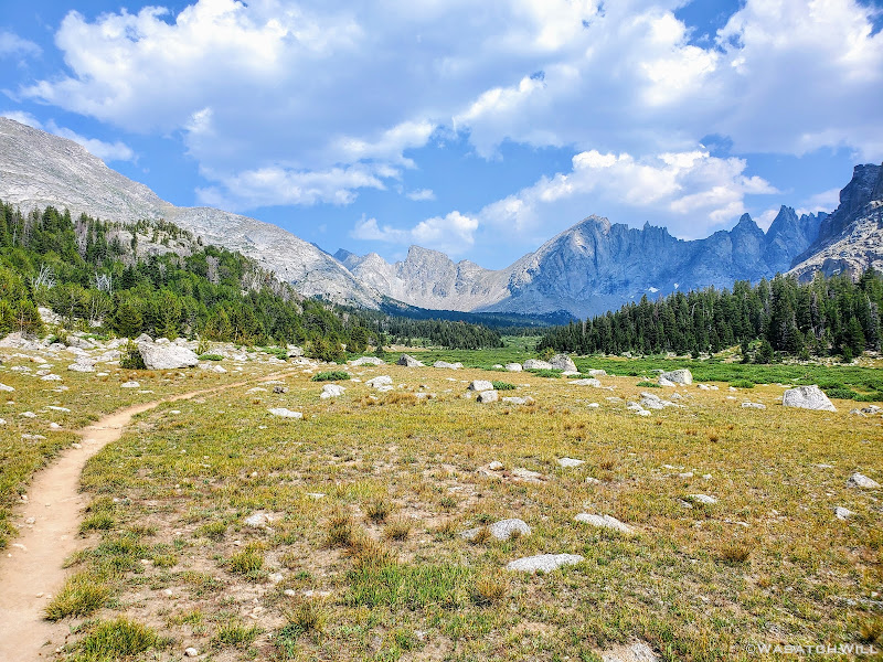
Alas, it was time to get back on trail and make haste for the destination of this day: Upper East Fork...a.k.a...Desolation Valley. It was now getting to be mid-afternoon, we had only come 4.5 miles to this point and had another 7 or so miles to go. The first couple of miles from here would lead us westward to a junction with a trail to Pyramid Lake.
Looking back at the western face of the Cirque of the Towers
Crossing Washakie Creek
Our day's target now in view, Ambush Peak rises up in the distance
Blake blazes on ahead
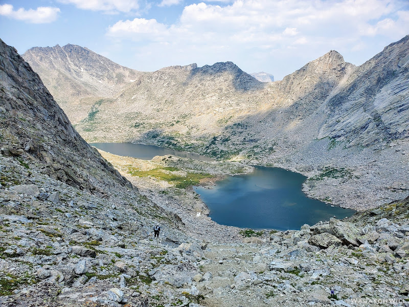
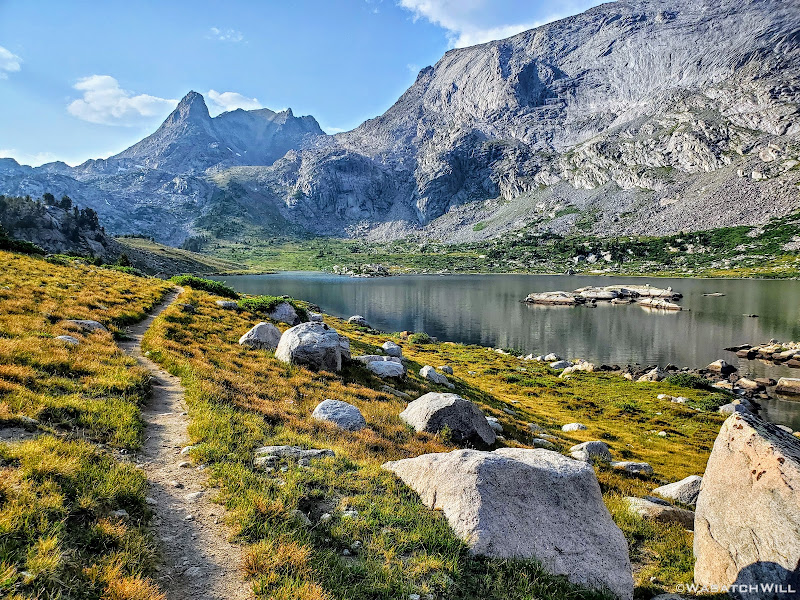
Once we reached the Pyramid Lake Trail junction, we made a 90 degree turn for the north. Indeed Pyramid Lake itself would lie in wait along the way. Prior to arriving there though, we'd cross over Washakie Creek once more and pass by Skull Lake and Mays Lake. We'd also get to gaze up ahead at Pyramid Peak, Mount Hooker, and Tower Peak out in the distance beyond for much of the way. Also, once we made the turn here, the crowds vanished. While we'd encounter another couple groups hereafter on the day, both around Skull Lake, that would be it for the remainder of the day.
Pyramid Trail junction
Washakie Creek with Mount Washakie, Bair Peak and west face of Cirque of the Towers beyond
Heading northbound with Tower Peak, Mount Hooker, and Pyramid Peak now in view
Skull Lake with Mount Hooker, Pyramid Peak, and Hailey Pass above
Blake with a peek at Mays Lake coming into view
Blake gets closer to Mays Lake, Tower Peak and Mount Hooker above
Mays Lake with Tower Peak (left), Mount Hooker (middle), Pyramid Peak (right)
Pyramid Lake beneath Tower Peak and Mount Hooker
Pyramid Lake
Last of the official trail alongside Pyramid Lake
Once at Pyramid Lake we turned our attention to East Fork Park, er, Desolation Valley. We'd now be departing what had been a mostly official, well established, and well maintained trail to this point in our route since we had left the trailhead the prior day. From now until we reached Middle Fork Lake later on the morrow, we'd now be left on our own to navigate off trail making use of unofficial use trails as they appeared in spots wherever we could find them. Elsewhere we'd have wide open tundra to walk across and some long fields of rocks and larger talus to pick our way through.
Let the high route officially begin!
Now officially off trail (photo by Blake)
Looking back at Mount Hooker from across a tarn
A little while after leaving Pyramid Lake behind us, we crested over a ridge that enabled us to gaze out what would be our day's prize: A place to camp nestled along a string of picturesque lakes. Here, the sun was now leaving us as it made its way down behind Ambush Peak standing up ahead of us.
Desolation Valley comes into view as the sun sets behind Ambush Peak
Sunrays shine forth from between Ambush and Raid Peaks
After a brief descent down off the ridge, we settled into a flat little grassy area tucked up above and between two of the local lakes. Nearby stood a stand of short trees, but still plenty high and sturdy enough to hold our Ursack bear bags for the evening.
All settled in at Desolation Camp
Once our tents were up we settled down behind a rocky protrusion alongside of our camp that served as a very nice back rest. Of course, now sitting beneath the amazing Ambush Peak, it was only fitting that I pull out a prized Peak Refuel brand meal for dinner. Beef Pasta Marinara. It was hearty and delicious. Yum.
A peek at a peak and Peak
As what would become the routine every night, we'd retire to our tents soon after dinner.
While we would end up camping every night the rest of the way by numerous places that would have certainly been fun to fish, we had opted to leave our fishing gear at home for this trip. Not only did it allow us to save some space and weight (not that fishing gear needs to weigh much or take up much space), but we also knew we'd probably have precious little time if any or simply be too exhausted to actually fish at most of the locations we'd pass by and/or camp at. Also, being from out of state, visitor licenses for Wyoming, as with so many other states, are quite costly, even for just a week. Being so remote, it's highly unlikely one would be inspected for a license as might be more likely at a state managed reservoir or other body of water closer to main roads, but I still feel better doing it legally.
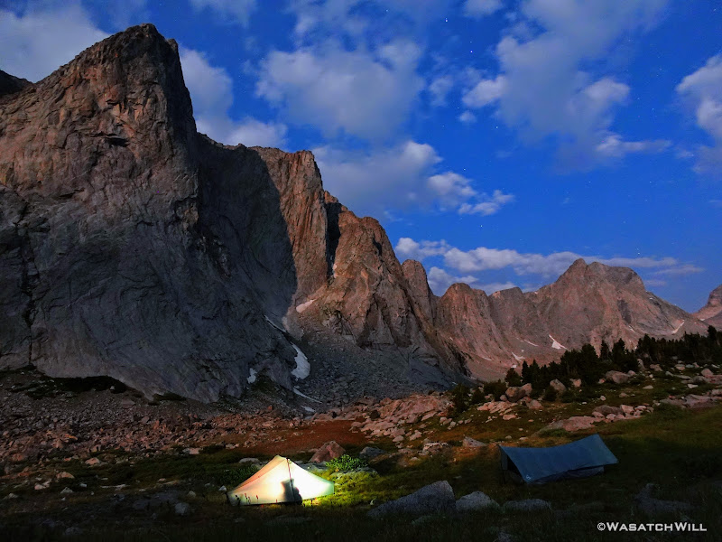
Now dark, I snapped up another long exposure of our camp before slipping into my tent to officially close out day two. This had been another location I was very much looking forward to camping at. As excited as I was to see the Cirque of the Towers and wake up there earlier in the morning, for some reason, I was even more excited for this spot. Needless to say, I was thrilled and overjoyed to be here on this eve and very much looked forward to seeing how the coming morning's light would make this area look.
Lights out for Blake, not yet for me
TO BE CONTINUED...
WRHR: DAY 1 - BIG SANDY TO CIRQUE OF THE TOWERS
VIDEO:
Last edited:
")

